IN WHICH I
  • ... Write
  • ... Explain

Merri Merri morning and thoughts about gadgetry

29/5/2022

0 Comments

 
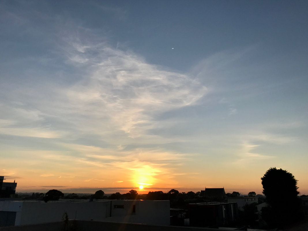
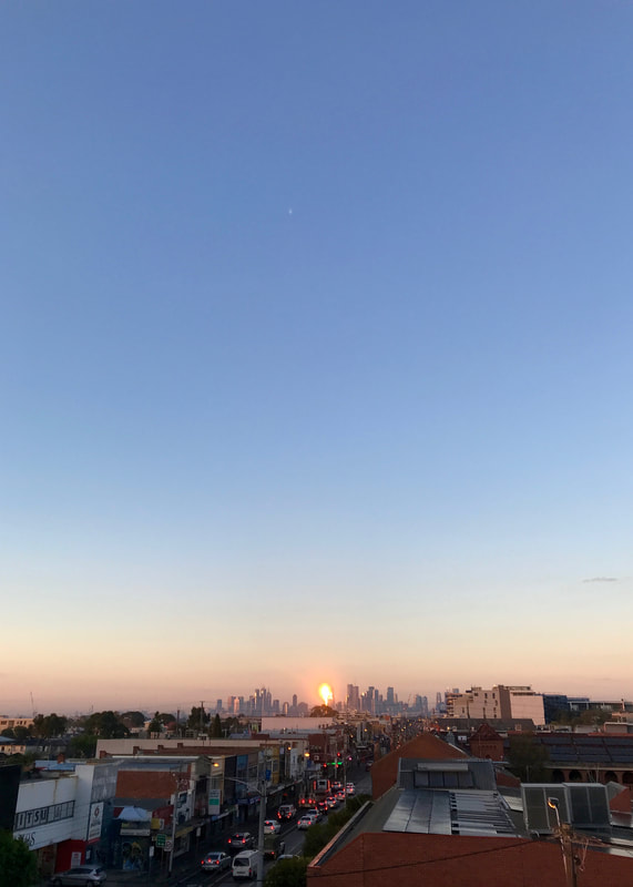
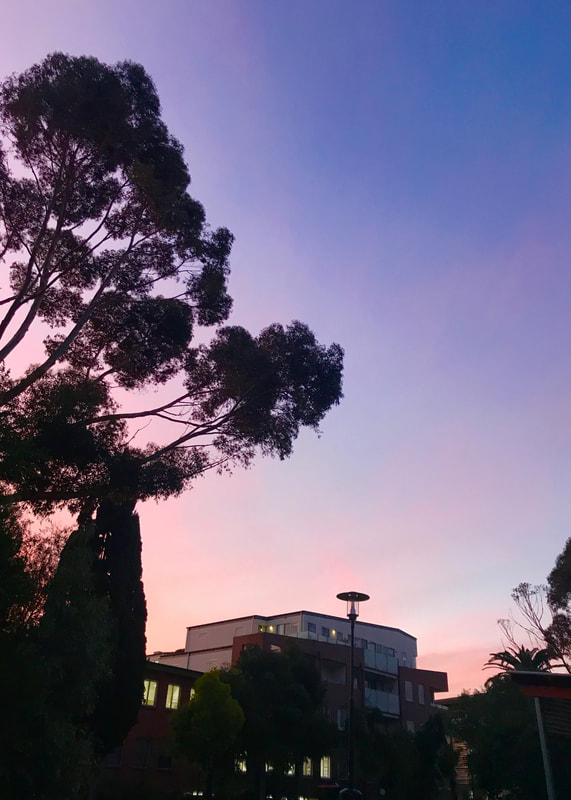
The familiar has become unfamiliar…
Outdoor velodrome with a terracotta coloured wall with BRUNSWICK in large black letters. The centre is green grass and a large pylon carries wires overhead.
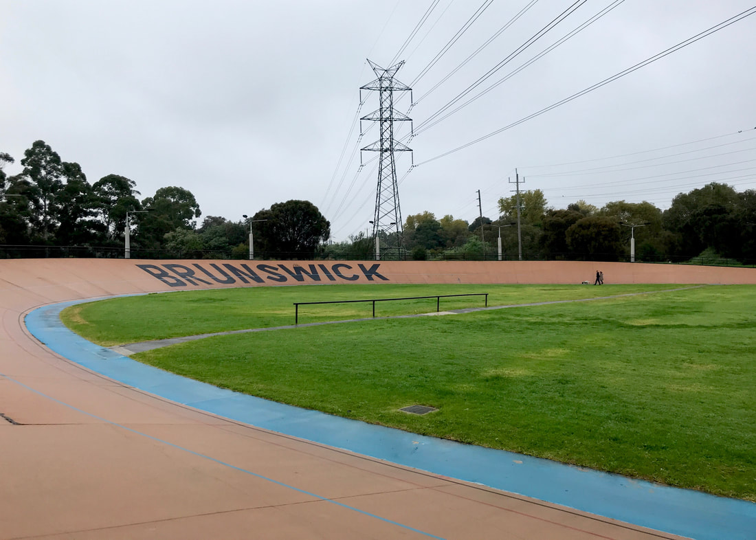
The Brunswick Velodrome. I think the last time I saw this (not IRL) was in a Courtney Barnett music video.
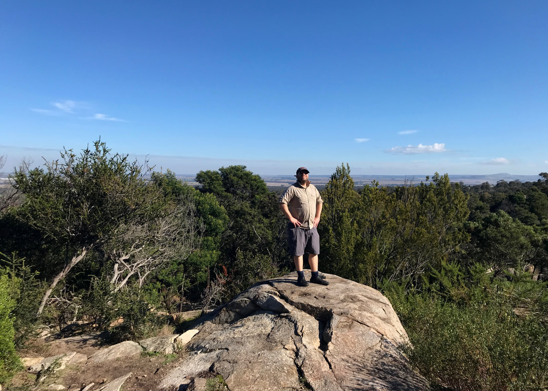
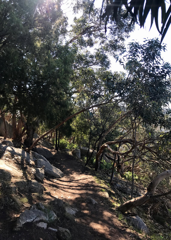
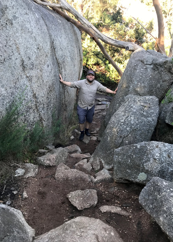
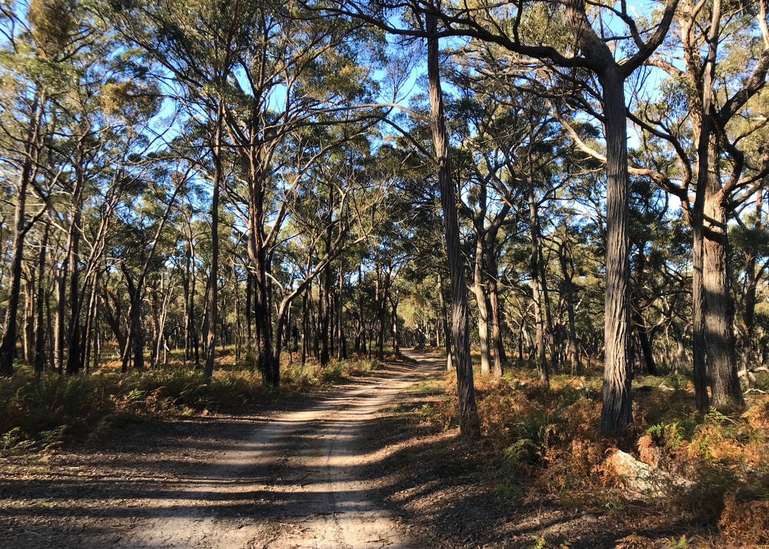
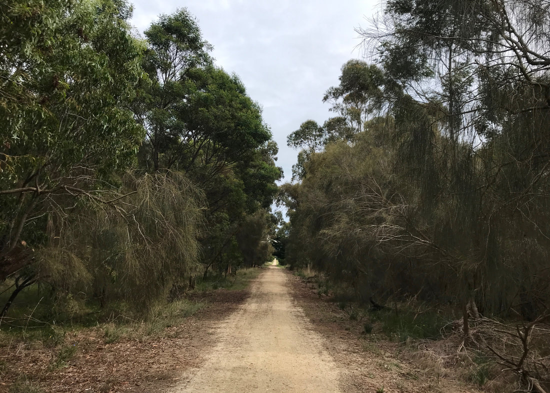
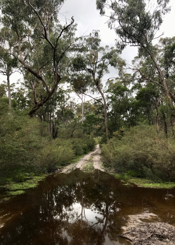
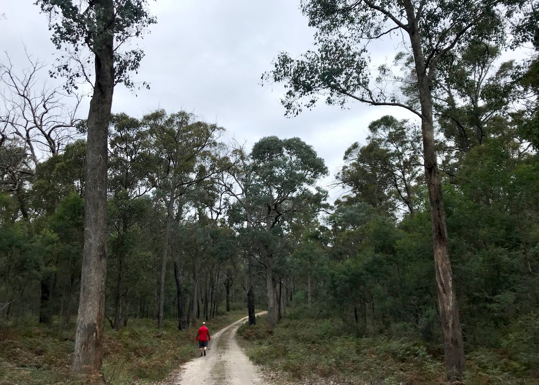
A few days after our You Yangs outing, Dan and I were due to meet a friend for morning tea at Ceres. We arrived a couple of hours early and headed north on Merri Merri (Merri Creek) in the almost-drizzle. We made it all the way up to Coburg Lake Reserve before turning around.
Picture
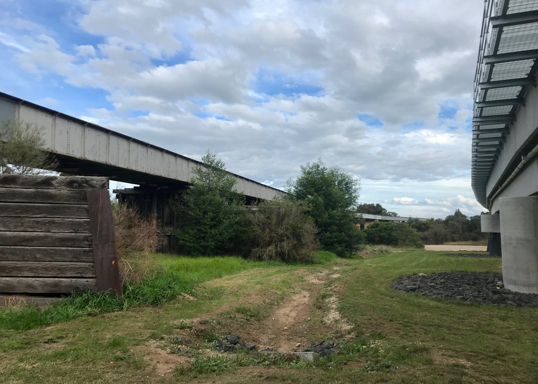
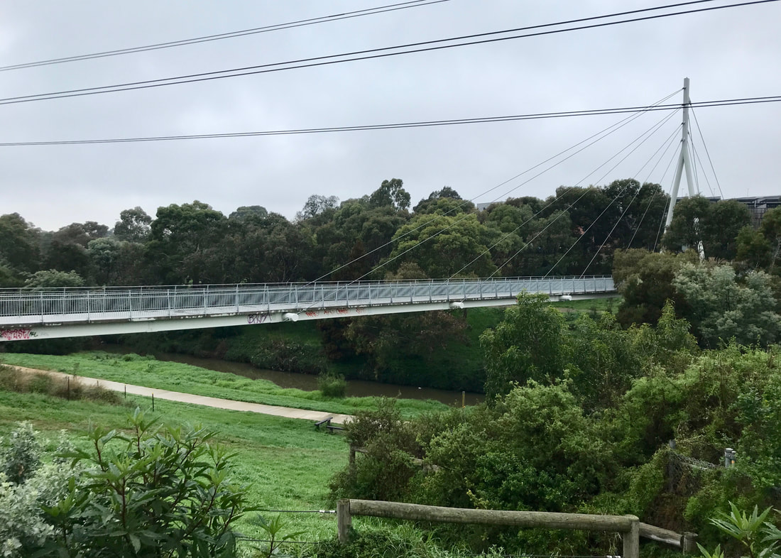
A huge new footbridge over the Merri near Ceres!
Picture
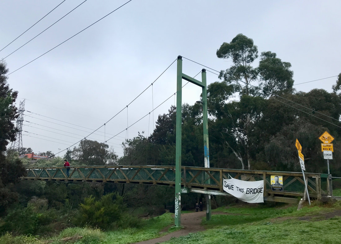
The bouncy Harding Street Bridge, probably going to be replaced.
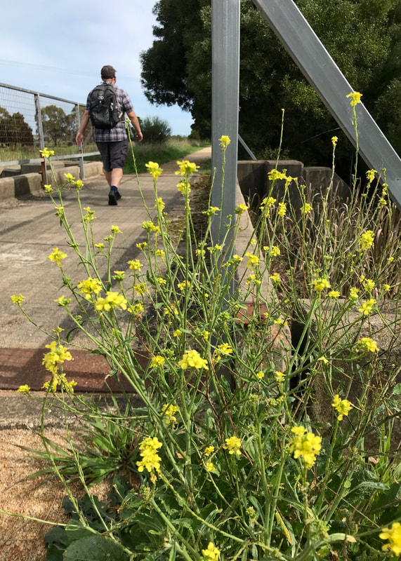
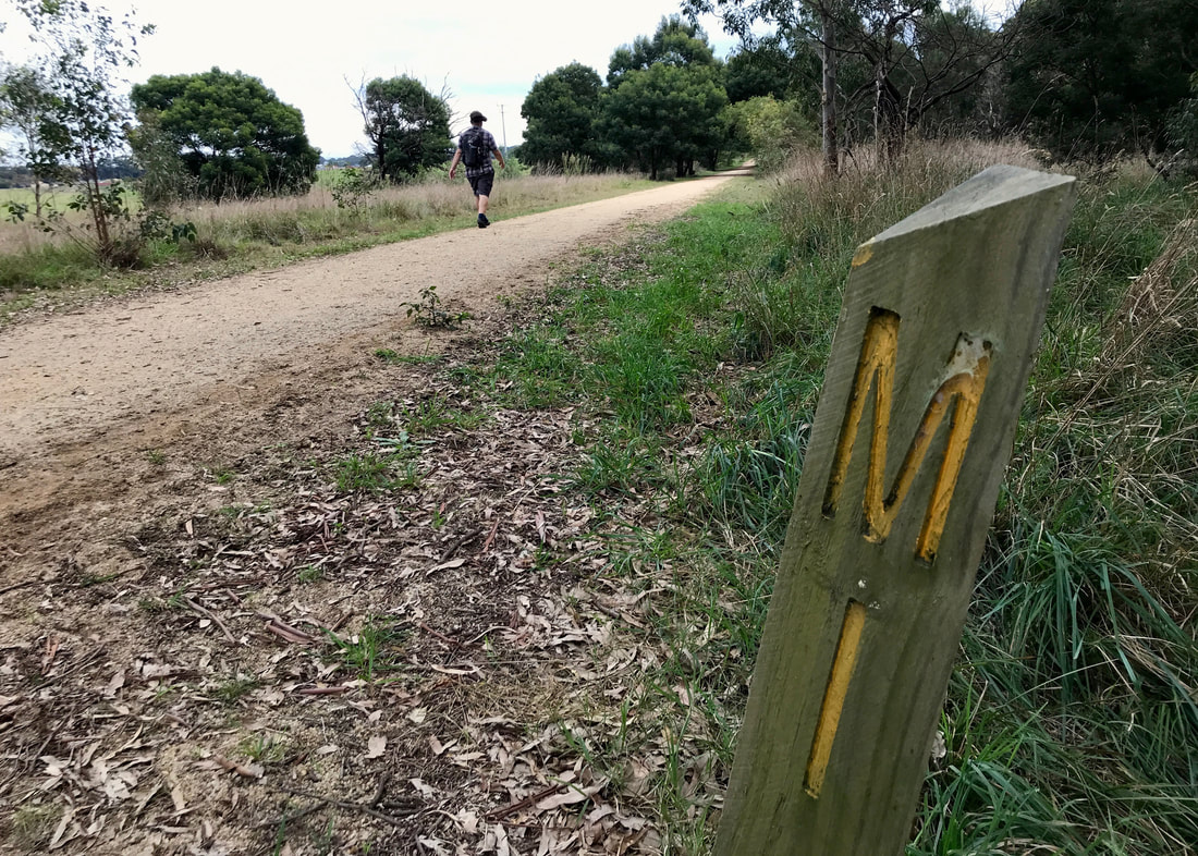
This was a path we walked many, many times when we lived near the creek in Thornbury, and it was lovely to revisit the area - even if some of the changes made us feel like strangers in our old neighbourhood! There’s a big new footbridge across the creek at Ceres, the trees and shrubs have all grown up, there’s new signage (directional and informational), the market garden at the swing bridge (which has “save our bridge” banners on it) has become quite the destination as an outpost of Ceres with its little cafe. It was a lovely walk, and I hardly took any photos, so I’m not going to dwell on it here
Picture
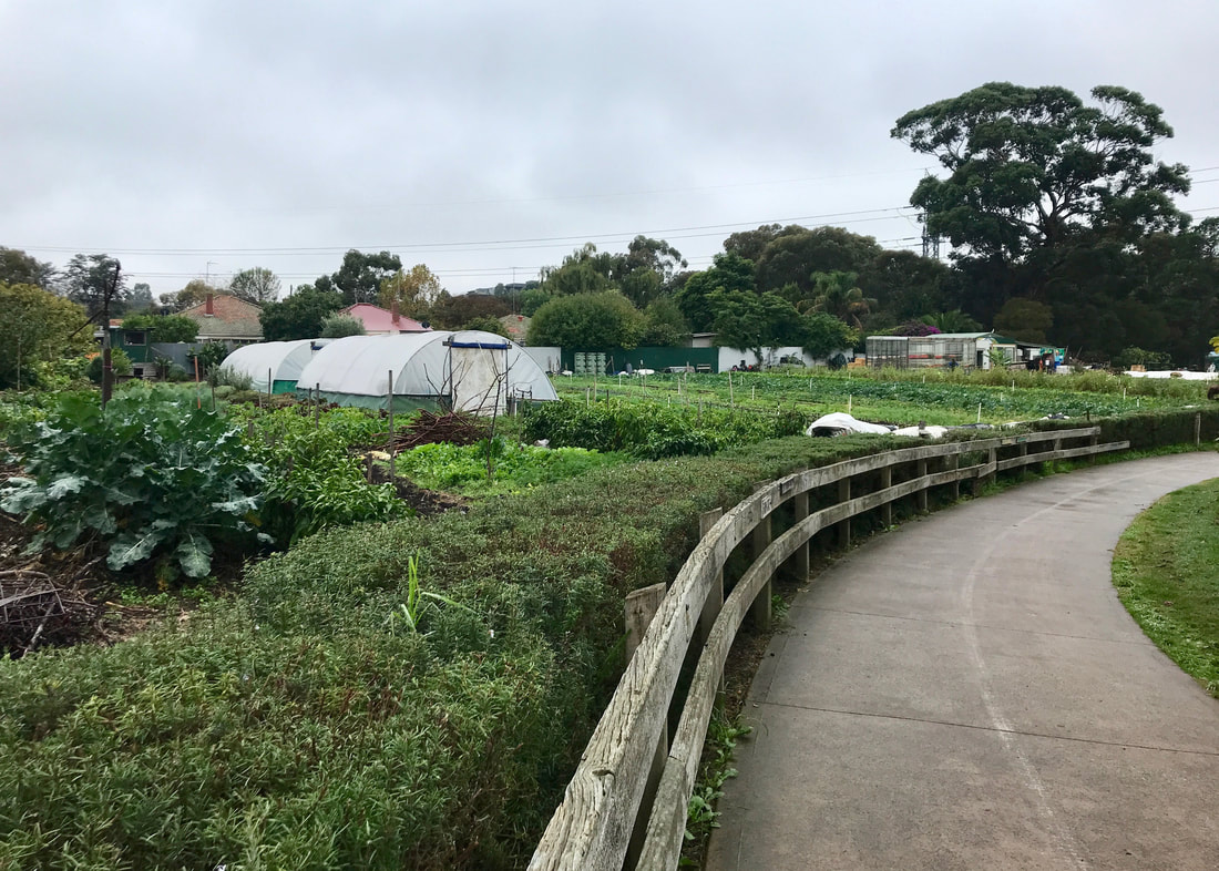
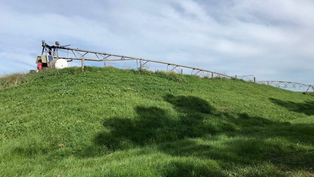
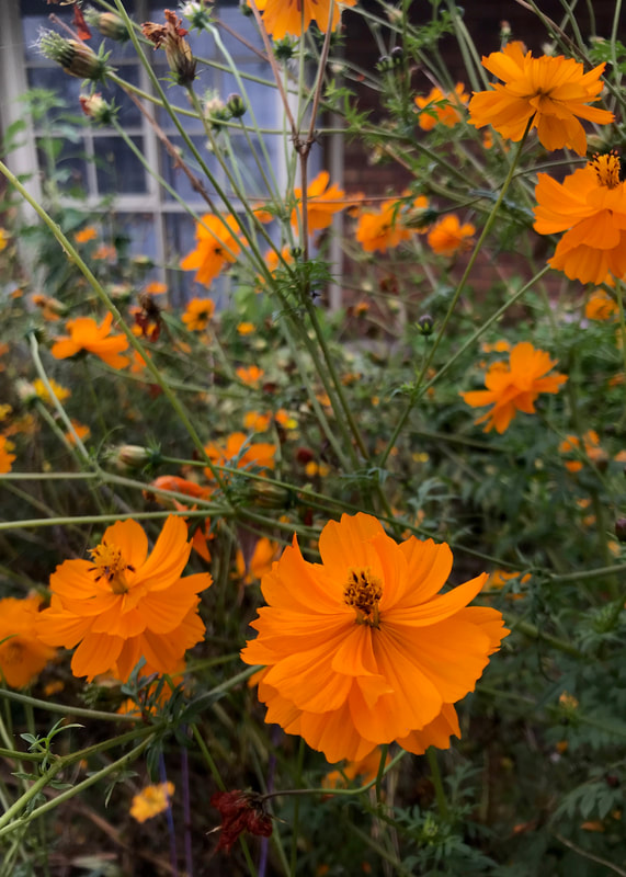
The market gardens near the Harding Street Bridge - they were buzzing with people harvesting veg and flowers.
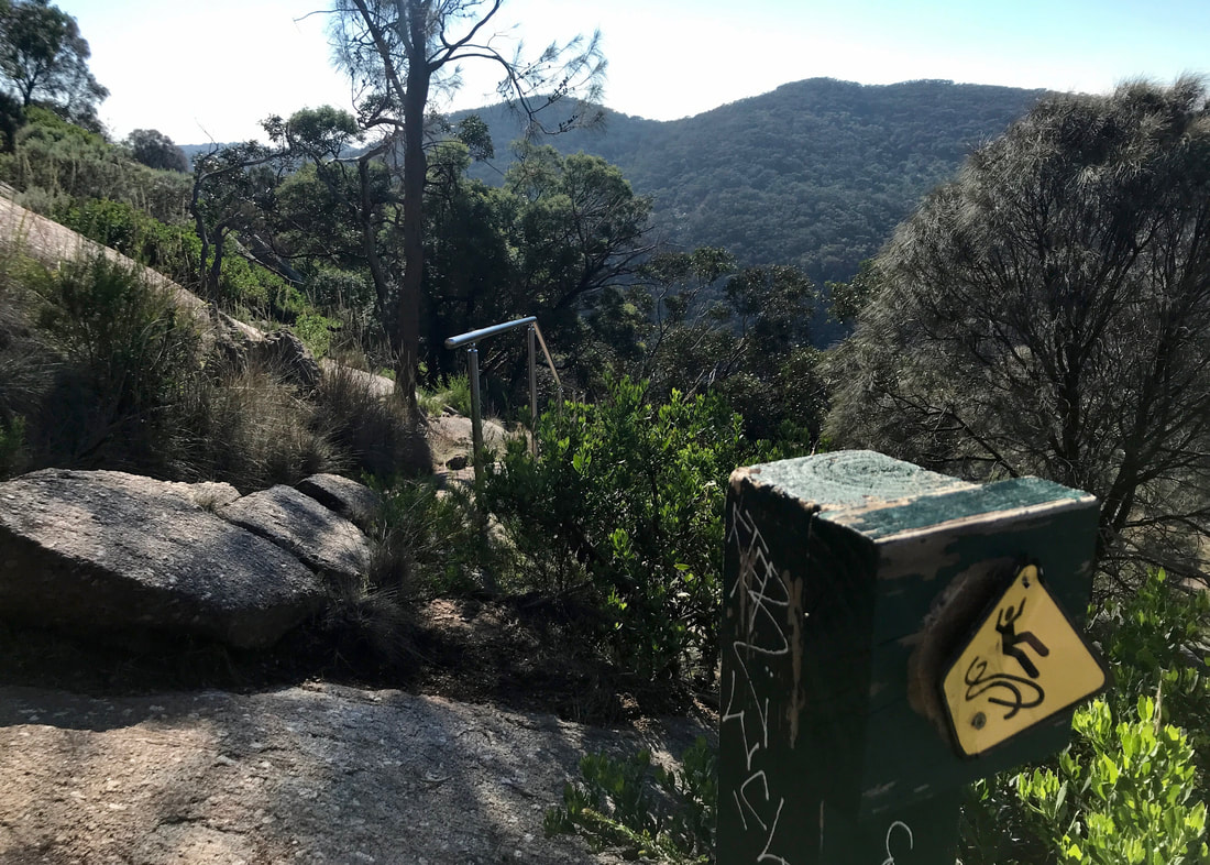
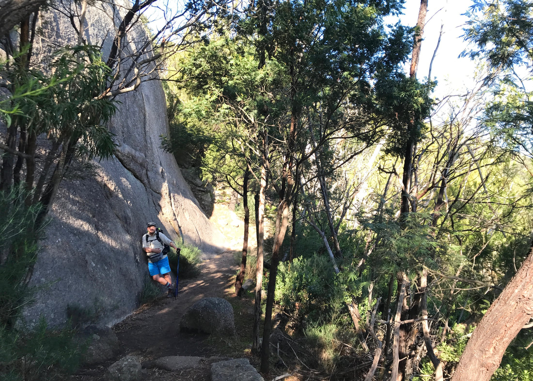
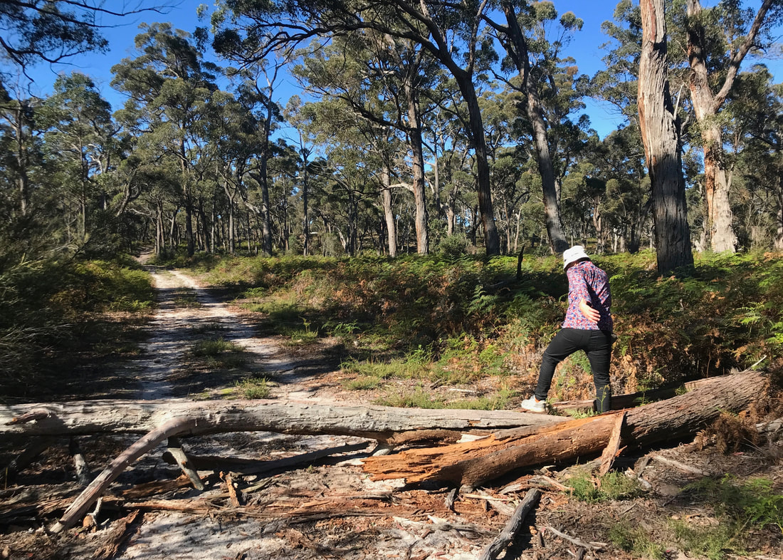
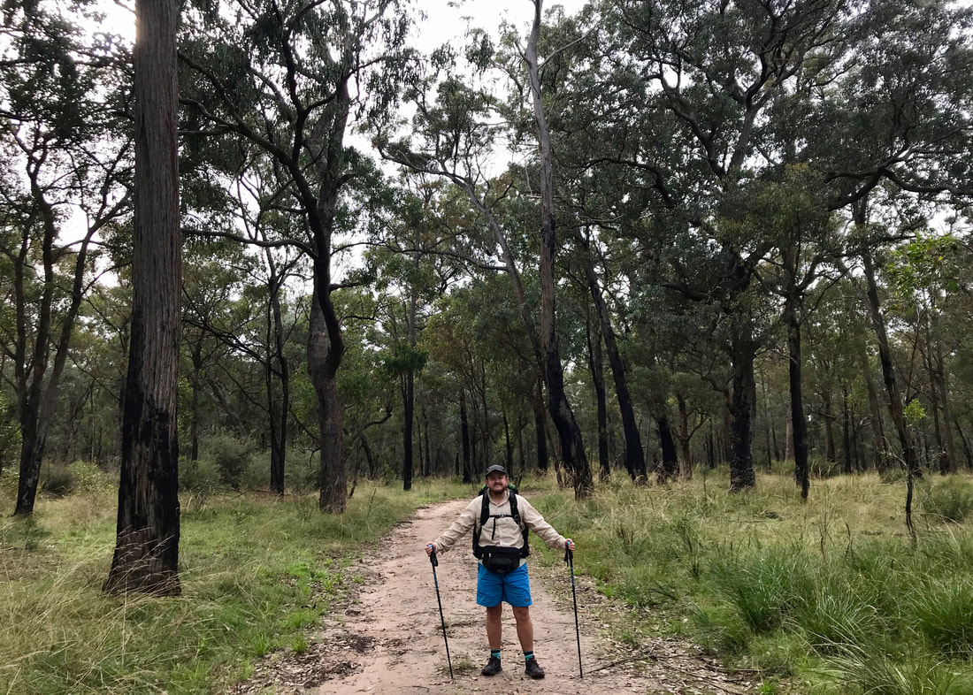
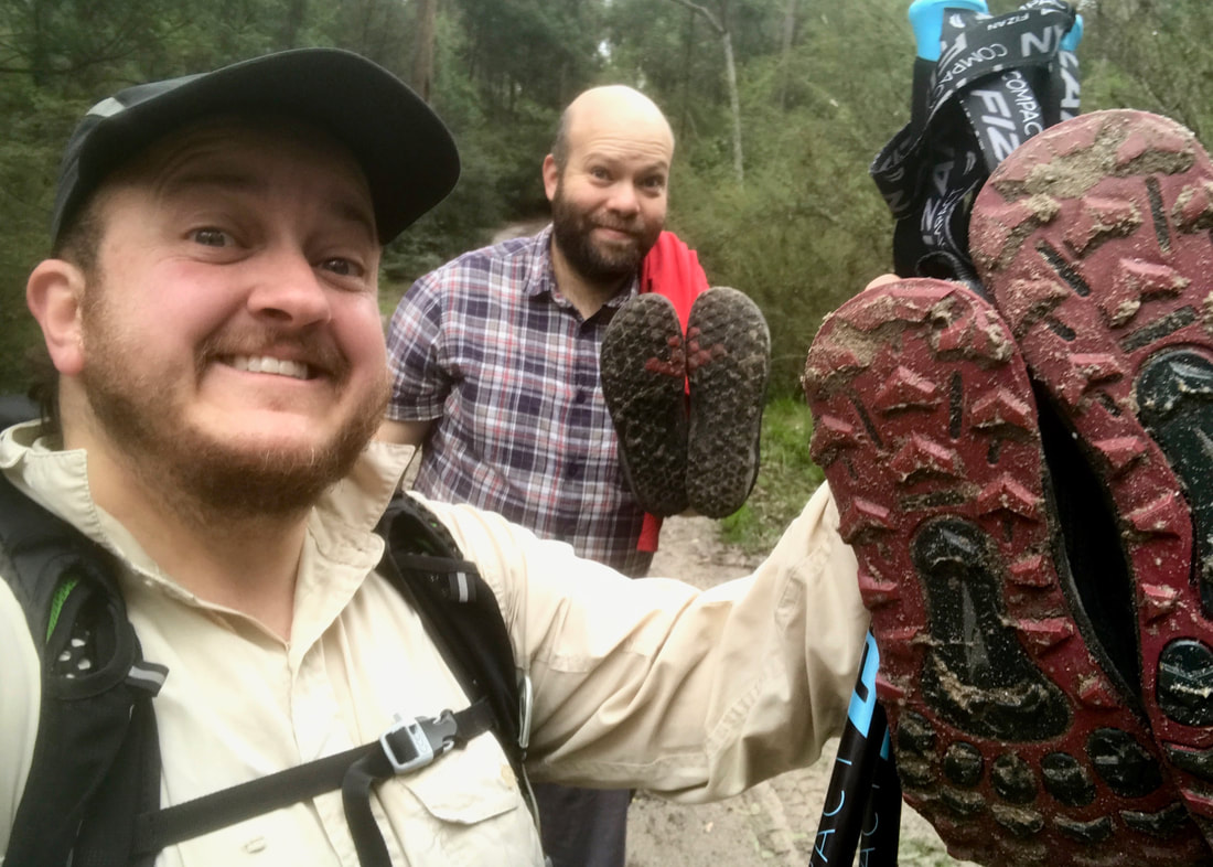
My training notes for this outing are: it helped ease my achy calves from our You Yangs walk (and so did a serious stretching session afterwards); I almost got another blister on my right toe; and thankfully I can actually walk fast - if only over flat terrain, on easy paths and without a pack (11km in 2hrs 15min).
Picture
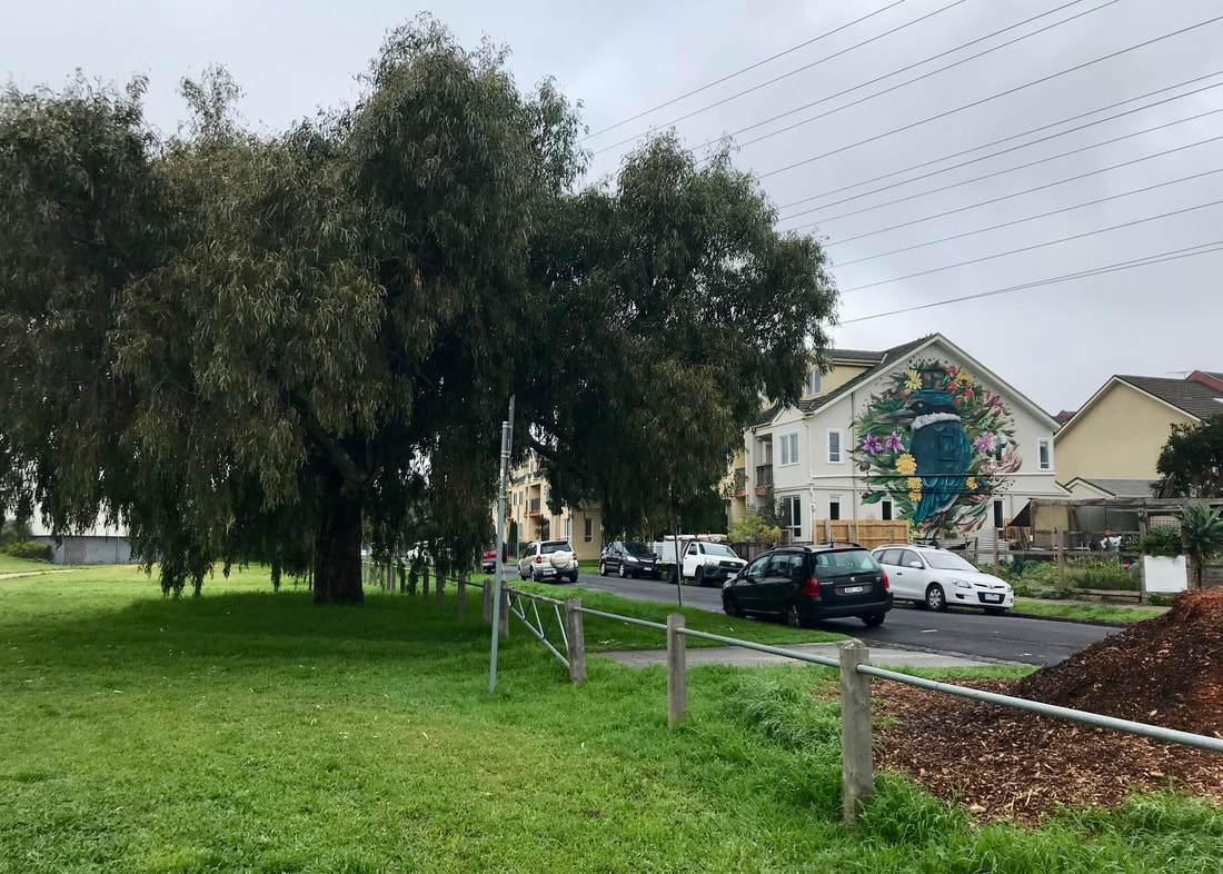
Love the kingfisher mural, brightening up a dull area of housing beside a small community garden.
Low angle shot of a concrete path where someone has written ACAB into the wet concrete
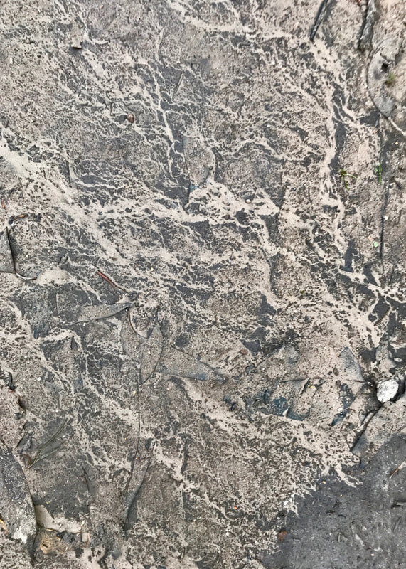
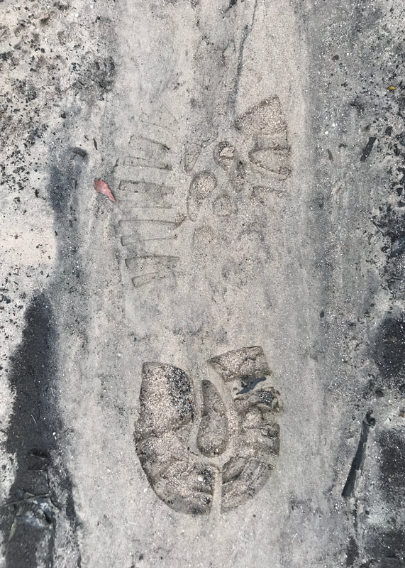
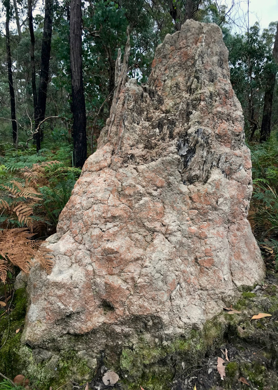
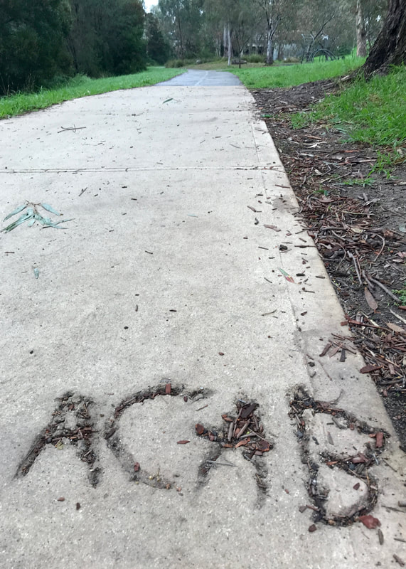
Set in stone. Well, concrete.
At an outdoor cafe, a magpie perches on the back of a seat, while on the table are dirty plates and serviettes
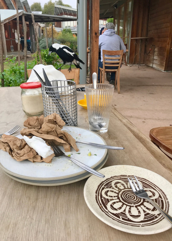
Magpie just missed out on our toasties.

Thoughts about gadgetry

I haven’t posted a lot about my Heysen Trail prep other than training walks I’ve done, but I’ve been making some decisions about what gear to take. I thought some of you might be interested. If not, feel free to close the tab now! This little ramble is about navigation, emergency beacons (PLBs) and gadgets.
One thing you need to think about when walking in remote places is safety. Let me start by saying: I already have a one-use-only emergency beacon (Personal Locator Beacon, or PLB) and a smart phone. I went back and forth on getting a Garmin Inreach or a SPOT for the Heysen. I’d pretty much ruled out the SPOT and was really researching the benefits of the Mini vs Explorer Inreach. But in the end, I decided against it. Why? Cost and weight/bulk.

The benefits of getting a Garmin, depending on the model, can include: topo maps, GPS tracking (e.g. onto a map that friends/family can check from afar), texting (even/especially when phone reception is bad), weather updates, emergency beacon and additional comms options in case of an emergency. This makes it a lot more useful than my one-use-only PLB. Also, the battery life isn’t bad and it would extend the battery of my phone (because using GPS on the phone when looking at maps uses a lot of juice).

These are all great things, so what’s holding me back? First, it’s hundreds of dollars for the device ($400+ for the Mini, $600+ for the Explorer), then you have to pay a subscription fee for $20-$100 a month (with the more basic plans, you also have to pay for tracking points and extra messaging). NB: there are cheaper ways to do it - either by buying second hand, borrowing or renting the device. So, that’s something to keep in mind if you really want to take a Garmin with you on a trip.

The other issue is I don’t want to carry more devices than I need to. My phone should be able to do a lot of what the Garmin does. I can download topo maps for offline use (e.g. Gaia premium), I can get weather updates (though only when I have internet reception, but I can check the 5 day forecast when available), I can text (when I have phone reception), I can get updates on the water tanks from other walkers (i.e. FarOut/Guthook). Paying for premium Gaia and buying FarOut for the track costs less than buying a Garmin and paying for the subscription. Plus, my phone can take photos (I have made the decision - which I may regret! - to leave my camera behind).

Of course, the phone won’t be any good in an emergency if I'm out of range and, as I said, using it for GPS tracking gobbles up the battery. It’s also possible that it will just crack the shits and stop working (Garmin is, as far as I’m aware, a much sturdier piece of equipment). So, what are my plans for that?
  • First, I already have a Personal Locator Beacon - a one-time-use emergency beacon. While this doesn’t give you the option to communicate with emergency responders (e.g. texting info about your injury or location), it is only for absolute emergencies when I don’t have phone reception - in that case, I don’t know how well I’d be able to text anyway. I don’t need to pay any extra subscription fees for the PLB.
  • Second, I will have my phone turned to aeroplane mode most of the time, which uses less battery, and I will carry a larger battery/charging pack to get me through the long stretches without power. I was planning to get a big battery pack - and I may have needed to use it for the Garmin anyway - so this isn’t such a big deal.
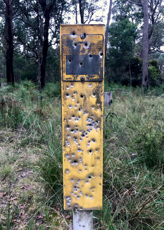
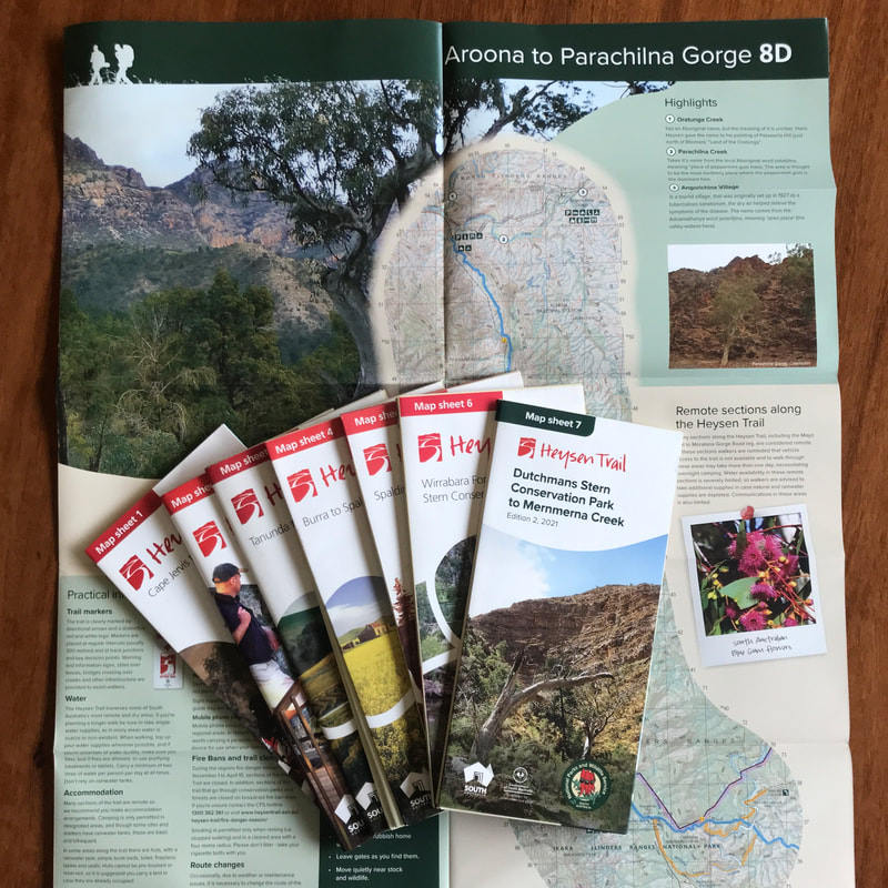
  • Third, I will carry the paper maps as a back up if my phone doesn’t work. To be honest, I’d probably carry them even if I had a Garmin because (a) you get a much better overview of the area on a spread out paper map than on a small screen and (b) paper maps don’t ever run out of batteries. Also, I do love a paper map!
I guess the main things I’ll miss (which I’d have with a Garmin) are the ability to have (e.g.) hourly “pings” onto a map so family/friends can trace my progress, and the ability to text when I have no phone reception. But the former is a nice to have rather than an essential, and the latter… well, people managed to do long walks before mobile phones were invented, so I think I’ll be OK. Maybe I’ll have to miss out on a couple of days of comms with loved ones, but that’s just part of the experience.

Merri Merri (Merri Creek) is part of the lands of the Wurrundjeri people, as is much of the wider Melbourne area. This country was never ceded and it always was, and always will be, Aboriginal land.

0 Comments

At last, the You Yangs!

27/5/2022

0 Comments

 
Granite, hills, views.
Person with blue shorts, bag and trekking poles standing on a large slab of granite that curves away to a view of hills and plains beyond
Definitely trying not to fall off this large boulder. The view behind me is to the west.
When we lived in Melbourne many years ago, Dan and I always wanted to visit the You Yangs (Wurdi Youang). The pointed hills stand out in the distant south-west, rising from the surrounding plains, clearly visible when you get anywhere with a view out in that direction. But the closest train station is 10km away, so even if we’d managed to get bikes on the train it would have taken us something like three hours to get there, leaving not very much time for a walk before it would be time to turn around and go home. It’s basically impossible to do a day trip there (and there’s no camping) unless you have a car.
Sunrise over the rooftops and trees of Brunswick
Might as well start with the Melbourne sunrise!
City skyline with a bright orange flare of light on one of the buildings
The sun setting the city on fire.
looking up a short alleyway with graffiti on the brick walls
Your typical Brunswick bluestone alley.
But now, we have a car! So, off we set from our friend’s place in Brunswick, and pulled into the park less than an hour later. I hate that this is the only option for getting there, but I’m glad we were able to. As we hopped out of the car, a bus load of early primary school kids also arrived. “We’re going on a REALLY BIG WALK!” one of them informed us. “What are you doing here?” They seemed satisfied that we were also going on a REALLY BIG WALK. Despite the commotion, a few kangaroos stuck around nearby to watch us set off. The kids still had to get through the entire class of toilet visits, so we left them to eat our dust.
Person standing hands on hips on a boulder, with treetops and a distant view behind
Lord of all he surveys, apparently.
dirt path and grass between trees and large granite boulders
This is just the path between the carparks - lovely!
Dirt path on a treed hillside
Heading up East Track.
Our plan was to do a bit of a butterfly, forming two circuits around the hills (East Track, Saddleback Track, Branding Yard Trail, Northern Range Walk and West Track, if you want to check a map). Then, if we had time at the end, we’d head up to so-called Flinders Peak (I can’t find if the individual hills have Indigenous names) and back to the car park. Spoiler: we did not have time.
Hills in the background, large granite slabs and a handrail in the middle ground and a small warning sign showing a person slipping over
Whee! I hadn't even thought about falling off the path before this sign got me anxious!
Picture
Rocks - you'll see a lot of these.
Person walking up a dirt track
Dan - not hoofing it, but leaving me in his wake!
East Track started us out with what ended up being the hardest bit of walking of the day. It was fairly steep (rising roughly 175m over 2km) but mainly what slowed us down was how the path winds through and over the amazing granite rocks and boulders that form the hillsides. There was lots of awkward stepping up and down (which I have to do carefully because of my knees), along with a bit of four-legged walking (aka scrambling) at times. I worked up quite a sweat, and could feel the burn in my calves. We pulled aside to admire the fantastic view over the plains and the bay to the east. Someone passed us, and promptly disappeared up the track. “How can they go so quickly?” I lamented. “Well, we haven’t been hoofing it,” Dan replied. I was aghast. In fact, I had been hoofing it. But then again, perhaps I felt that way because I was carrying a 10kg pack and Dan and the speedy person were not.
Picture
View to the east out to Port Phillip Bay. You might just make out the geoglyph of Bunjil in the clearing in the trees.
Hillside covered in small trees and large granite outcrops
Huh, so that's what we've been walking through. Cool!
As we twisted around East Track, we started to get views of the hillside we’d just come along, and wow! It was even more spectacular than we’d thought. There are huge granite faces, big boulders poking up through the trees, and the whole thing made me want to paint it. Having only ever seen the hills from a distance, I’d just assumed they’d be covered in trees, but no - the closer you get, the more you realise the trees are just filling in the gaps between the rocks. The granite is actually the reason this range exists - originally a mass of magma that solidified within sedimentary rocks under the sea, as the water receded and the sediments eroded, leaving behind the hills we see today. Underfoot, the soil is sandy, formed from granite eroded over time by the weather.
Picture
View with boulder and tree.
Picture
New growth on the path down on the plains.
Picture
Pigface was growing everywhere down here.
Speaking of the weather, we had chosen a perfect day. After a chilly morning, which left the grass glistening, the sun rose high in a clear blue sky. There was enough shade to keep us just on the cusp of being too hot, supplemented later in the walk by a very gentle cool breeze. Although there was a lot of haze and smoke in the distance, the air was fresh. I was glad we’d decided to come straight down on our first day in Melbourne, rather than waiting until later in the week, when it got a bit overcast and drizzly.
Dirt path leading down to trees with plains beyond
Saddleback Track on the way down.
We passed the intersection where our loops met, and spoke briefly to two fellows who told us to look out for brown snakes as there had been one on Saddleback Track yesterday. Then we dropped down off the hill along said track, passing three other people coming up, and into the trees on the plain. We were once again visited, albeit fleetingly, by a scarlet robin. I feel very honoured to have seen one on three of my last four walks. Making a very small detour, we popped out into the clearing with the geoglyph of Bunjil the wedge tailed eagle - the Wadawarrung/Wathaurong creator spirit, who made all the country of the Kulin Nation - though at 100 metres across it’s designed to be seen from above, so we’d already had a better view from East Track.
Close up of yellow wattle flowers with an out of focus walker behind
We passed a few little patches of wattle, smelling lovely in the warm sun.
Picture
Gorgeous, bright pink eucalypt flowers. Also looks like some lerps or something on the underside of the leaf to the left.
A little later, we stopped at a low bridge over a dry watercourse to take the weight off and share a Snickers. A friendly young border collie came to say hi (on a lead, as per the rules). And then it was time for the short, sharp climb back up onto the hills. A nice bench part way up gave us the chance to have a rest and watch a large family of choughs making their way through the trees around us. As well as choughs, kangaroos, the scarlet robin and some dogs out with their owners, we also saw cockies, yellow rumped thornbills, red browed finches, a small bird of prey, a large bird of prey, pigeons, magpies and wrens. We also noticed tracks that might have been from feral goats? They seemed too small for deer.
Picture
I was very taken with all the granite rocks here. I just didn't expect it!
Picture
Looking at the hills from the plains.
Person on a path between trees, the path passes between some large stones
Heading back up on the Northern Range Walk
Making our way back to close the loop, we met another couple of people walking the other way - apparently without any packs or water, which was a little alarming, but I’m sure they knew what they were doing. Right? It was quite pleasant on the Northern Range Walk, as the path was mostly in shade and had been for most of the day. We passed through a couple of lovely-smelling damp areas. We also finally realised that one of the complexes we’d been looking at to the east was Avalon Airport. Not a single plane landed or took off - at least that we noticed.
Smiling person with hands on hips on a dirt path with hills and blue skies in the background
Dan looking very pleased with himself for some reason (probably because he didn't have to carry anything!).
Person climbing down a rocky path
Down >
Person climbing down a rocky path
> the >
Person climbing down a rocky path
> path.
Lunch was taken on a large rock - Vita-weats, Emmenthal slices and some long swigs of electrolyte-laden water - before we set off along West Track to complete our walk. We decided at lunch that rather than rushing to get up the hill and back, we’d just take our time heading back to the car. If we hadn’t had a dinner date arranged with friends (dumplings in the park!), we probably would have headed up the peak at the end. But I was happy to forego the 450 steps up - and especially the 450 steps down. I’m not sure my knees would have taken it!
Picture
The view from West Track, showing the boundary of the park.
Picture
Stuck between a rock and a hard place (another rock).
Large dead tree and parklike surrounds with other trees and blue skies
The car park - pretty picturesque!
Picture
Posing beside one of the big granite walls beside the path.
On this side of the hill, the boulders felt more prominent - maybe because the west side cops more of the weather? We enjoyed views out to the Brisbane Ranges and the hills and plains to there. We spied a couple of other large complexes - one of which I guessed might be a prison, which was on the money. We met a couple of lads slipping and scrambling their way down to the path, presumably from the summit, a jogger and another dog walker. All in all, once out of the car parks, we only encountered 14 other people. Not a huge number for being out for four hours, but enough to make the place feel well used. I think most people just hike up to the summit and back, rather than exploring these other tracks. Towards the end, we could see an inviting looking big rock far below - which is, of course, imaginatively named Big Rock. A destination for our next visit. Below an official lookout, we also spotted anchor points in the granite - presumably for sport climbing and abseiling.
Landscape with a foreground of grass, rocks and small trees, looking out over plains with trees and paddocks to a distant line of water
View from the Turntable - can you see the smoke on the horizon?
Picture
A nice looking boulder.
A brown capped mushroom thrusting out of the dirt
A nice looking mushroom.
And then, after a few minutes rest on the benches at the Turntable Car Park, watching trains and boats head from Geelong to Melbourne, we toddled back to our car in Lower Car Park. The kangaroos were still there, including a few whoppers! But the primary school kids had long finished their day and headed home.
Black and white photo of a dirt path running through small trees and saplings, with strong diagonal shadows across the ground
The path down the bottom on the plains - very different to the hillsides.
Black and white landscape with a bendy tree in the foreground
View with a curving tree.
Person walking down a rocky path with a ray of sunshine above
Dan in the sunshine.

Notes

Let’s go for some bullet points.
  • A short walk, but quite hard! It took us about four hours to walk 11km. The slowness I will attribute mostly to the terrain, as described above. Picking my way around and over the granite definitely slowed us down.
  • My ankles were really feeling it at the end of the walk, and my calves were extremely tight for a few days afterwards. I took off my shoes and drew the alphabet in the air with my feet during our first break (also a good tip for long plane journeys), but I wish I’d also stretched my calves during the walk and in the evening. Overall, this was a much needed lower leg workout. I clearly need to do more walks (a) on hills/steps and (b) on uneven terrain - there will be a bunch of dry riverbed walking in the first few weeks on the Heysen Trail, so I should try and get used to it!
  • By the end of the walk, I did not feel that I could easily walk another 10-15km. But that was partly because we started late (10:30ish). I would have felt different if we’d started at 8:30… maybe!
  • I wore my second pair of anti-chafe undies, which were OK but not as good as the pink ones in terms of anti-chafe nor in terms of sheer happy-making colour. Step One > Tradies. (Unfortunately, though, Step One is bamboo, which takes ages to dry.)
  • I drank my weird salty orange flavoured electrolyte drink and I think it helped.  I also just felt better in general than the last walk.
  • I’ve been super hungry lately (cold weather?), but did fine with the rations we packed (6 crackers with cheese, half a Snickers, half a nut bar). That’s good. Still, I was very happy to stuff my face with dumplings at dinner.
Sky in shades of purple with the silhouette of a tree and some apartment buildings
Evening light in Essendon - ready for dumplings!
Play equipment, park and apartment buildings under the moon
The moon in a pink and blue sky.

The You Yangs (Wurdi Youang) are part of Wadawurrung (also transcribed as Wathaurong) Country, created by Bunjil, the wedge tailed eagle. This always was, and always will be, Aboriginal land.

0 Comments

A plod around Providence Ponds

20/5/2022

2 Comments

 
Bushland, animal tracks, fungi, birds, flowers and one very large snake.
Small orange mushrooms growing in leaf litter and grey sandy soil
Bright orange native chanterelles (I think!) growing in the sandy soil and pushing through the leaf litter. We saw lots of great fungi.
One day, Dan and Dad went off to Melbourne to pick up a whole bunch of things we’d had in storage since before we left Australia, so me and Mum decided to go for a walk. A return to Providence Ponds Flora and Fauna Reserve to explore south of the highway has been on the cards for a while, and with clear blue skies and temperatures in the low 20s, it seemed like a perfect opportunity.
Dirt track through bushland
Morning shadows over the road. It was lovely weather.
Picture
Two of the least interesting ant holes of the day.
Animal prints in grey, sandy soil
Kangaroo (or wallaby?) prints.
Gaia and Google gave different information about the tracks in this section of the reserve, and I knew from last time and from satellite imagery that there would probably be tracks not marked on either map, so we set off with an intention to explore and see what we could find, rather than to walk a set route. Things started off easily enough, and we enjoyed the quietness of the mid-morning bush. On this side of the highway the reserve is a little less diverse (north of the highway it seems to be a different ecosystem every kilometre!), but one of the cool things here was the visual of a wall of stringybarks - just a thick band of grey trunks stretching out wherever we looked.
Picture
It's hard to do justice to the wall of grey that you get in stringybark bushland like this.
Sprig of green with several small dark orange flowers with yellow edges
A pretty flower we saw a couple of times.
Picture
Wildlife highway across the road.
Picture
Banksia and the sun poking its rays in at the side.
But a lot of the interest of this walk was in the details. In the sandy soils we saw many, many animal tracks - mostly wallaby, a few kangaroo, some wombat, a dog, a dirt bike (of course), and deer. We spotted a variety of cool fungi - none of which I can identify apart from the whole swash of chanterelles (I'm pretty sure) near the end. Australian chanterelles are tiny, and although there were a lot of them, I thought that actually cleaning them of the gritty sandy soil would not have been worth the effort! We enjoyed the few remaining wildflowers and some of the cool banksias of the area. There were also looooooads of ant holes, all built up like fortresses against the incursion of rain and debris. I can’t emphasise how many there were - some sections were like cities of little ant towers. Mum started categorising them into schools of ant architecture - the volcano, the iron age fortress, the pyramid, the hummock. And of course, I took almost no pictures of these ant hills! It’s so easy to forget to photograph the things that are most common on any particular walk.
Picture
Mum stopping to watch some rosellas fly through the trees.
Small, still pond reflecting trees and blue sky
Is this the eponymous pond?
Picture
A very sand-encrusted funnel shaped fungus.
We made it to the end of Bell Track, according to the map. But the road continued through a bee hive site (under constant video surveillance - beware, honey thieves!) and to the edge of the reserve, just as I had hoped. We turned right along the paddock line, following a grassy track, picking grass seeds out of our socks every few steps, getting buzzed by mozzies and screamed at by white cockies. It was all good! Well, until we turned the corner and found a stretch of road under very stagnant water, stretching as far as we could see. We decided to pick our way around a little way to see if we could find the end, and off we set.
Picture
A large, probably marshy, area. I was pleasantly surprised that this part of the road wasn't underwater.
Picture
A tiny mushroom with a bold shadow.
Picture
A beautiful native bluebell.
“Oh, shit. Jonathan, stop!” I turned around to find Mum stepping onto an island in the middle of the road/lake. I wondered if she’d seen a big spider (she hates spiders). And then I looked where she pointed and - whoa, OK! the fattest red bellied black snake I’ve ever seen, which I must have missed by centimetres when I walked past. I also hastily hopped into the middle-of-the-road island. The snake didn’t even move - it was just curled up in a sunny patch without a care in the world. Anyway, we know that red bellies are quite nice snakes, but we decided that maybe it wasn’t worth continuing this way after all, and back we went through the mosquitoes and the grass seeds!
A few square bee hives placed in bracken, a sign on a tree trunk reads WARNING LIVE BEES - THESE HIVES ARE UNDER CONSTANT VIDEO SURVEILLANCE
WARNING! LIVE BEES! We did not hassle the bees and the bees did not hassle us.
Picture
Underside of a yellow mushroom. (They had already been knocked over.)
Picture
Top of a purple mushroom.
We had lunch in a spot of shade, as it was feeling quite warm. Rehydrated hummus (very good), Vita-Weats (my fave, as noted previously), tomato leather (good) and spinach and tomato leather (OK), all washed down with water. We had a few chocs to snack on along the way, and a nut bar, too. The break was a good opportunity to take off the shoes, pick the grass seeds out of the socks and tend to any hot spots. I wrapped a plaster around my problem toe, just in case - I’d felt a tiny twinge and didn’t want another blister. (Learnt my lesson!)
Grassy track through trees and sedges
The track by the fence. Well, if it's all like this, we'll be fine! (Spoiler: it wasn't.)
Track covered by stagnant water until it curves out of sight between trees
The water.
Picture
The snake. (Sorry for the poor pic!)
The rest of the walk was similarly pleasant, but I had been feeling sluggish all morning and did not improve after lunch. The miles were not coming easily. My pack felt heavy, my legs felt slow, my head wasn’t really in it. I realised, late as usual, that I could put my sunnies on to keep some glare out of my face. We also had a bit of a rest - which is when I spotted all those chanterelles. Despite the nice surroundings, I was a bit over it. We did a loop back to the car, skirting the Perry River (not visible) and surprising a couple of feral deer (they were very red, decent size but not huge, and they made some high-pitched, short, screams of alarm calls before they ran off - any ID based on that?!).
Picture
Strong sun, strong shadows. I liked the lines these trunks made, blackened as they were by fire.
Picture
Mum heading along one of the roads post-lunch.
Picture
Not visible here: me violently waving my arms to disperse flies.
Apart from the deer and the tracks, a few butterflies and those bloody mozzies, the main animals we saw (and heard) were birds. Lots of crimson rosellas, a few magpies and currawongs, a shrike thrush, sulphur crested cockatoos, willie wagtails and a fantail. Cool spots were a jacky winter and a scarlet robin. But my fave were the two - no, three! - no, four! - gang gangs that were eating nuts in a branch above us, and which we wouldn’t have noticed if we hadn’t stopped walking and, in the absence of footsteps, heard their quiet little creaking noises. I love gang gangs.
Trees, bracken and an old green-painted wooden signpost that has fallen over
This was one of the very few signposts we encountered, and it didn't even match our map!

Notes

We walked 17km in a bit under 5hrs - quite slow. I’m going to chalk that up to (1) a moderately heavy pack, (2) lots of stopping to look at fungi and flowers and other small things, (3) the slow going down where we met the snake and (4) me just generally not feeling good. Afterwards, I had pretty sore hips, and an achy lower back, but some gentle stretches and exercises the next day helped my fully recover, physically. My new, happily colourful anti-chafe undies were great.
Four brown mushrooms seen from above, their tops showing rings of different shades of brown
The photos I take of these never quite do the rich, warm brown shades justice.
Tiny orange mushrooms growing along ground littered with leaves and twigs
Chanterelles.
Picture
Cool yellow banksia.
A dozen or so small pale orange fungi, on deligate stems, with slightly funnel shaped tops
A little village of fungi.
I don’t know why I felt under the weather. I had a little sleep when we got home and afterwards I still felt bad - even a bit dizzy - and I developed the didn’t-wear-my-sunnies headache. I drank enough water and didn’t have a blood sugar drop, so it wasn’t that. I did wonder, however, if it might have helped to take some of the electrolyte powder that I had with me last time. Who knows! Anyway, I was pretty grateful for the chocolates - especially towards the end of the walk. I’m not the hugest fan of chocolate in everyday life, but wow, it can be nice when you’re out for a walk. A little burst of energy! Yes! (Thanks, Annie!)
Person stepping over a tree trunk which has fallen across a dirt road
Mum negotiating an epic obstacle!
I’m thinking of snacks to pack for the Heysen, especially what to put in my drop boxes. I’ll pack snacks only for the stretch from my box to the next town/shop - in most cases that’s 2-3 days, with 3 snacks per day plus a bit of extra scroggin and dark chocolate. I’ll take a wide range, so I don’t get really bored of anything, and also to take things that I might not be able to find in little general stores (I’m counting on those to have Snickers!). In my scroggin mix will be some combination of:
  • Nuts that I like (macadamias, pecans, almonds, brazil nuts)
  • Dried fruit (mango, banana chips, freeze dried strawberries, apricot bites, ginger)
  • Candy-coated chocolate (e.g. Jaffas, to avoid the melting-chocolate-getting-everywhere issue)
I’ve learnt from experience that there’s no point putting things in there that I think I “should” take for health or packweight but which I don’t like that much (seeds, sultanas, walnuts, too many M&Ms).

What do you put in your scroggin? (Also, I hope this final picture doesn't put you off said scroggin!)
POV shot of legs sitting in a car, hot pink undies poking out the bottom of the legs of blue shorts
Showing off my new undies. Even if they hadn't worked well (they worked well!), they are very joyful.

This walk is on Brayakaulung (GunaiKurnai) Country. Please note my previous post re: Providence Ponds as a possible massacre site. As will all of so-called Australia, sovereignty was never ceded and this always was, and always will be, Aboriginal land.

2 Comments

Triathlon avec frites

5/5/2022

0 Comments

 
A walk, a cycle and a swim. And chips. And potato cakes.
Person standing beside an information board and a fingerpost, holding a mountain bike and smiling
Proud owner of a new, very entry-level, bike. At the Maffra end of the Maffra-Stratford section of the Gippsland Plains Rail Trail.
We finally bought some bikes! It’s been five months since we got back to Australia, and we really meant to do it earlier. But wow, researching bikes is boring as shit, so in the end we just went for some entry-level kind of mountain bikes for noodling around on the rail trail and so on. Anyway, the bikes were in Maffra, so we decided to walk there, collect them (and helmets) and cycle home.
Picture
Hello calves and cows. You have lots of fine grass, why so skinny?
Streetscape with three large signs reading STRATFORD MOTEL and BUDGET HOTEL and MOTEL
I think there's a motel here, or possibly a hotel.
Picture
Some sort of feral brassica - possibly canola.
There’s not much to say about walking the Stratford-Maffra section of the rail trail that I haven’t already said. Once you’re on the old rail line, it’s mostly straight, it’s pretty flat, there aren’t that many standout points of interest. Unburdened by much in the way of baggage, we made good time, counting off kilometre markers in well under our standard 15 minutes. The sun was emerging and as I had foolishly forgotten to sunscreen my arms and was wearing short sleeves, I wrapped one of my new bandannas around my forearm for sun protection. It worked pretty well.
Picture
Along this stretch, we often see these extremely long irrigation systems - I usually don't notice the ends of them!
Picture
Mistletoe flowers - how pretty!
Looking down on a circular white mushroom with a few little nibbles taken out of it
I'm enjoying the season here, but wish I knew more!
I also spent a bit of time with the bandanna in my hat for extra shade. And as we walked along we found an old hat thing that someone had lost - just a visor/brim with loose fabric, which I think people wear under helmets? Anyway, it had been there for a while by the looks of it, so I took it home and put it in the wash and I’ll give it a go.
Wooden post with M5 in yellow writing and, in the background, a person walking down a gravel path
Counting down on the distance markers - 5km to Maffra!
Gravel track stretching out to the horizon, occasionally flanked by trees
Like I said - straight and flat.
thin branches with lots of small, grey, lumpy or spiky cones
Casuarina nuts/cones/seedpods - not sure of the correct term!
It’s not that the walk is bad - it’s just quite samey. So it was nice to get into Maffra and walk past houses and gardens - some interesting things to see and smell! We headed straight to the bike shop and picked up the bikes and helmets. The bike shop owner (Wayne?) was quite bemused that we’d walked from Stratford. It took very little encouragement from him for us to go and grab some chips (very good) and potato cakes (good) for lunch from the take-away shop down the road. We ate them in the park-that-is-also-an-RV-park, and then wheeled our way back to the rail trail.
Person drinking from a bottle of water while sitting on a long, low wooden bench
Rest stop! Time for a little sit down and a drink of water in the shade.
Picture
The old Powerscourt Station.
Picture
Caterpillar friend - not sure what moth this is from.
We saw a couple of black shouldered kites (which are actually quite small, more like a falcon - the book says it’s a hawk). One of them seemed to be quite young, though it didn’t have juvenile plumage, and seemed to be yelling for food? Also on our travels we saw shrike thrushes, magpies, straw necked and white/sacred ibis, an egret, many fairy wrens, many thornbills (I assume yellow-rumped, because we call them “yellow butt birds”) and many red browed finches (“red butt birds”). We even spotted a pelican flying over!
Picture
More long, flat, straight path - here bordered by casuarinas and other trees.
Picture
Dan walking along the M1, apparently.
The cycle home was a lot quicker. Quelle surprise! It took us about 50 minutes to get back to Stratford. The trail is, as I said, “pretty flat”. But that’s walkers’ flat, rather than cyclists’ flat. Fortunately, most of the elevation involves a slight descent towards the Stratford end, so we did get to coast a little bit (from a whopping 37m above sea level to 13m above!). This section of the trail improves when cycled - the views change and evolve more noticeably, and glimpses and views of the hills are very enjoyable. Of course, I barely took any photos.
Bright orange flowers in a garden
In town! New things to see!
Picture
A little honey stall on the main street - never noticed this while driving!
Picture
Coming in to Maffra under the shady trees. The white blob on the nature strip is a cat. (No pats - it ran away!)
Anyway, back to the trip. I packed my swimming top, so when we got back to Stratford I changed into that, whipped off my shorts and went for a swim in my undies. And by swim I mean dip. As in, I immersed myself twice, rinsed my head and my legs of sweat and dirt, then hightailed it out of there. The Dooyeedang (Avon River) was very refreshing and not quite as cold as the Ovens! And then we cycled home. All in all, a good outing.
Two bikes on a bike rack and, in the background, the front of a takeaway shop
Guess what's for lunch?!
Picture
Chips and potato cakes. Yum!
Person standing beside an information board and a fingerpost, holding a mountain bike and smiling
Of course, we had to get both our photos here!

Notes

The walk was easy, and we covered about 11km in about 2hr 20mins - usually I’d estimate 10km in 2hr 30mins, so that’s pretty quick for us. Maybe I’ll try a speed walk along this stretch one day! I didn’t carry a pack (just the ‘new’ bum bag carried across my body), nor did I use the sticks. My body felt pretty good - I tried to change the angle of my hips a few times (e.g. tucking in my tailbone) to help ease any issues with my lower back. No blisters or other aches from the walk.
black and white photo
The nice new path under the bridge at Stratford, cutting a pale curve through the scene.
Picture
A tree we saw - there aren't many big ones on this section.
Picture
Another tree.
However, although I took care to keep the gears nice and easy on the cycle, my knees still felt a little creaky when we got back. I will need to be extremely careful with this if going out for longer rides - especially with Dan, as he tends to fang it and I don’t like being left behind! I really don’t want to lose all the progress I’ve made with my knees since last year. Also, next time I’ll wear my cycle shorts because the old nether regions felt bruised for days!
Picture
In Stratford, the trail passes under both new and old rail bridges.
Picture
Bike resting on the riverbank under the old bridge.
person standing waist-deep in water, giving two thumbs up and grimacing theatrically
THUMBS UP THIS IS GREAT I PROMISE WHY DON'T YOU COME IN THE WATER IS BEAUTIFUL
Apart from walking, I'm also doing a lot of logistical food planning for the Heysen Trail. This includes things like counting how many days between towns, therefore how many meals I need for each section, trying to research whether I'll be able to actually buy enough food for those sections in town or if I need to pack some extras in my drop boxes, thinking about where my drop boxes will go. I'm also experimenting with different low- or no-cook recipes (I've eaten some pretty horrible chia puddings while on this journey!), dehydrating fruits and vegetables, hummus and fruit/veg leathers, making green powder, and so on. I want to leave a lot of the dehydration of actual meals until July, as a rule of thumb is they should be eaten within 3-4 months. I'm thinking of making a pasta with tomato/nut sauce, a sweet potato/lentil dahl and some sort of chilli with beans and possibly quinoa. I'll also take noodles and some extra veg and flavourings to add to whatever I find in the little general stores - be that more noodles or pasta (yum), instant mashed potato (OK, in a pinch) or cous cous (gross). What things do you pack when walking and camping?

The Gippsland Plains Rail Trail and Dooyeedang (Avon River) are part of Brayakaulung (Gunaikurnai) Country. This always was, and always will be, Aboriginal land.

0 Comments

Back to the back roads near Stockdale

1/5/2022

0 Comments

 
Let’s do this again, but make it twice as long!
Person standing on a dirt road surrounded by bush (trees and understory of grass). They are wearing blue shorts, a beige shirt, a backpack, cap and bumbag. They hold walking poles.
Modelling the huge bum bag, done up quite high on my waist to help with the issue of it tipping forward.
It had been almost three weeks since my last long walk (not counting those nice little 10km strolls, obviously!) and I really wanted to get back into the swing of things. I’d enjoyed my last walk along the bike paths and wanted to show Dan the area, so I mapped out a 20km route for us. I stuck to the roads with the hope that there’d be a bit less water to negotiate, especially given two days of rain earlier in the week.
Dirt road running through the centre of the photo, surrounded by trees and scrub
These roads were made for walking. Well, maybe not, but walk them we will.
Picture
A wattle called Prickly Moses.
Picture
Another, more standard, kind of wattle.
We set off just after breakfast, found a spot to park out of sight of the main road and started walking. I was a bit grumpy to start off, not for any particular reason, but within an hour walking had worked its magic and I was happy again. The route was pretty much all nice walking: easy to navigate and see progress, enough elevation change to keep the legs happy but not so much to be hard work. The weather was great for walking too, cool, not particularly humid, and overcast. We did have to apply the insect repellent a couple of times to keep the mozzies off, though!
Picture
Native snail - note the longer shell.
Picture
Spider egg nest in a fallen leaf.
Sign: BEE SITE
We even saw some bees in a few hives as we walked.
We saw and heard quite a few birds - kookaburras, rosellas, magpies, currawongs, choughs, a shrike thrush, wattle birds, blue wrens, thornbills, fantails, willie wagtails and pigeons (at a distance - possibly bronzewing as well as crested). We also had the joy of seeing a bright-red-breasted scarlet robin, which flew onto a nearby branch and looked at us for a while, then darted off.
Red car, crumpled and abandoned in a grassy area among trees
A nearby notice informed us that the powers that be were "aware" of this "illegally dumped litter".
Ant hole with a wombat poo on it, and a wombat has also scraped dirt up
That's one wombat that did not like those ants.
Eucalypt leaf with pink and a grean-teal colour
Pretty colours in a fallen leaf.
At some point we noticed two sets of footprints going the other way. It’s nice to know that other people come walking out here, too - not just dirt bikers, horse riders and firewooders. It was also good to know that the way we were going was going to be passable, since these walkers had come through in the last day or so, since the rain. Eventually, though, we turned down a road they had not taken… and encountered a fair bit of water over the road. Since we still had a long way to go, and since I didn’t think we’d meet too many more such obstacles, we took our shoes off and paddled across, toes sinking into the soft, fine mud at the bottom. It reminded me of the barefoot walk we did years ago. Instead of putting our shoes straight back on, we walked the next few hundred metres barefoot. The dirt was cold and hard, but I enjoyed it.
Dirt track snakes through grassy bushland
Not too far from the border with the plantation - a pine tree has escaped.
Picture
Grey fungi.
Picture
Orange fungus.
Picture
Brown fungi.
Picture
Red fungus.
We stopped for lunch at the Blues Road crossroads that tickled me last time. Part of my prep for the Heysen Trail needs to be about sorting out my food carries and making sure my rationing will work. On this walk for lunch I packed us hummus (some of which I will dehydrate and carry with me), 6 Vita-Weats (my favourite crackers, sorely missed when in the UK), a couple of little sheets of seaweed snack (I'll cut up nori sheets for the Heysen) and an apple (heavy, so I’ll probably only eat these in or just after town). Six Vita-Weats is a surprisingly decent portion. I wasn’t hungry afterwards! I also recently purchased some electrolyte powders, so I added a sachet to one of the water bottles.
Selfie POV, two people holding up their shoes
Off come the shoes! I bet you can't tell which one of us will take almost any excuse to have a paddle.
Picture
Water over road.
Picture
Dan, just finishing up with the large puddle/creek.
We crossed back over the Stockdale Road soon after. We’d been playing Twenty Questions/Who Am I?, and it was my turn. To give you an idea of our previous puzzles: I was Dan, then Dan was our friend Gemma, then I was kangaroo prints, and Dan was a blue wren. After lunch, I was the extremely ear-wormy song “Only the Lonely” by Roy Orbison. This tune plagued me through my last walk (which I've realised is because it is walking paced), and has also infected other members of the household to the point that it is like being Rickrolled. Dan cracked me up by making me guess he was the last Vita-Weat cracker he ate at lunchtime (I had 3 guesses left after guessing it was a Vitaweat he ate at lunch... but which one?!). It definitely passed the time, and Dan got stuck with my next puzzle: the Heysen Trail. Is it bigger than a house? I guess so, though maybe not at any specific point. But he got me back by being the Gelobar in Brunswick.
Anyway, at one point I did a quick detour up to touch the Briagolong-Stockdale Road (necessary to get my full 20km), and Dan waited with my pack. I carried everything for both of us for this walk and my pack and bumbag weighed over 10kg when I started, including two litres of water and all the food. It was nice to get a bit of pack-free travel in. I even broke into a little jog. It didn’t last long, obviously. I’m not a maniac.
Low angle shot of a dirt track, with lots of green moss and little plants growing along the side and in the middle
The photos of this walk seem quite grey - grey earth, grey sky - but there were some green bits!
Picture
Like a small scale aerial view of braided rivers and deltas.
Picture
The Footprint of the Other Walker.
Shortly after this, I thought I could feel a blister forming on my problem toe. Like a fool, I did not stop to check it out or put tape/a plaster on it because “there’s only a couple of kilometres to go.” I guess I have to make that mistake every now and then to remind myself why it’s good practice to stop immediately and check out the issue. When we got back to the car, it wasn’t a blister in the usual weird place at all (although that was sore), but on the side of my toe next to my big toe. I guess that I didn’t clean my feet properly after our barefoot sojourn and some grit had rubbed until the blister formed. Entirely preventable, if I wasn’t so lazy!
Pale grey track runs into the distance, surrounded by trees
You can tell the sun is shining when you get actual shadows!
Picture
Ant hill.
Picture
We saw a lot of leaves with large lumps/galls.
Still, we made it to the end in one piece and pretty good spirits. And it was only 1:45pm. So we toddled home, had a nice shower and a hot cup of tea with a couple of Tim Tams.

Notes

Now this was a training walk! 20km with pack and bum bag starting at 10kg. This original bum bag is huge, and I really stuffed it full on this walk with several snacks and all the items I might carry in it. It turns out the front pocket is just big enough for my phone, but the zip is short, which makes it a hassle to use. I just put the snacks in there instead. The next alterations I need to make are to fix up a sharp bit that cut me (end of the old zip) and change the angle where the strap connects to the bag to stop it falling forwards and leaving a big gap at the top.
Small orange fungus among leaf litter
Stunning! We saw quite a few of these, which I thought looked like mini chanterelles. The fungi ID group confirmed: Cantharellus concinnus.
Orange, coral-like fungus tufts among leaf litter
Even weirder, these ones! "Looks like a coral," I said to Dan. And yep, the ID group says it's a coral fungus - Ramaria capitata var. ochraceosalmonicolor
Physically, that blister was the worst culprit, and it wasn’t really that bad. I popped and plastered it the following day and a couple of days later it was fine. With the heavy pack, I did get quite sore hips and slightly achy knees (thank goodness for walking poles), as well as the usual sore feet. I briefly stretched out my thighs and calves in the middle of the day and when we got to the car. Post-walk and the next day, I continued to stretch my calves and get my hips moving, and I recovered pleasingly quickly. At the end of this walk I thought I could definitely have got another 5km done if needed, especially as there was so much of the afternoon left. So I guess I’m ready to start the 25km hikes!
Picture
Bit of geometrical interest in the bush. Look at all those straight tree trunks.
Yellow Telstra sign informing people to call a number before digging to avoid damaging cables
Dial before digging!
Yellow telstra sign covered in pellet holes from a shot gun
Who knows what this said before it was shot up.
Food-wise, lunch and two snacks during the day was fine. I’ll also have breakfast, dinner, a third and a bit of extra scroggin each day. Ideally I’d be getting into each town with only one emergency meal in reserve, but in reality I don’t think I’ll be able to do full resupplies at every town, so I will be carrying some items (e.g. my own dehydrated food, vegan protein powder) for a much longer time between my resupply boxes. My next step with my pack is to start figuring out exactly what I’m going to take and finding out how I’m going to get all my food in there.
Picture
Dan on the last stretch of the walk. I remember thinking, "I probably should check this blister" as I took this photo. But I didn't.
one map spread out with several other map brochures fanned across it
Maps, maps, maps!
Bright pink undies with blue and yellow spots, a hand holds up the gusset to show a panel of slippy pink material
Party undies! Hope they help with the chub rub!
My latest arrivals are the paper maps for the whole trail. I'm having fun looking through them - there's a lot more than just a map on them. Also, some extremely excellently colourful anti-chafe undies - let’s see if they work!

This walk is on the Country of the Brayakaulung (Gunaikurnai) people. Sovereignty was never ceded and this always was, and always will be, Aboriginal land.

0 Comments

    In which I

    In which I do things and write about them

    RSS Feed

    In which I tag

    All
    #30DaysWild
    Art And Architecture
    Audio And Music
    Australia
    Battle Observer
    Birmingham
    Books And Stories
    Bristol
    Buckinghamshire
    Cambridgeshire
    Cooking
    Cycling
    Devon
    East Sussex
    Eating And Drinking
    Film And Video
    Foraging
    Gardening
    Gippsland GunaiKurnai Country
    Grand Union Canal
    Hastings Independent
    Hertfordshire
    Heysen Trail Prep
    Housekeeping
    Imagining
    Interviewing
    Kent
    Lake Field
    London
    Manchester
    Marketing
    Melbourne Wurundjeri Country
    Microadventure
    National Trust
    Netherlands
    Norfolk
    Northumberland
    Paddling
    Q&A
    Reporting
    Review
    Share The Love
    Sheffield
    Snowy River
    Somerset
    South Gippsland Bunurong Country
    Suffolk
    Swimming
    Tea
    Victorian High Country Jaitmathang Country
    Victorian High Country Taungurung Country
    Wadawurrung Country
    Wales
    Walking
    West Sussex
    Wiltshire
    Year Of Sleeping Variously
    Yorkshire

    In which I archive

    July 2022
    June 2022
    May 2022
    April 2022
    March 2022
    February 2022
    January 2022
    October 2021
    September 2021
    March 2021
    December 2020
    February 2020
    January 2020
    December 2019
    November 2019
    September 2019
    August 2019
    July 2019
    April 2019
    March 2019
    December 2018
    November 2018
    October 2018
    August 2018
    July 2018
    June 2018
    May 2018
    April 2018
    March 2018
    January 2018
    December 2017
    November 2017
    October 2017
    July 2017
    June 2017
    May 2017
    March 2017
    February 2017
    January 2017
    December 2016
    November 2016
    October 2016
    September 2016
    August 2016
    July 2016
    June 2016
    May 2016
    April 2016
    March 2016
    February 2016
    January 2016
    December 2015
    November 2015
    October 2015
    September 2015
    August 2015
    July 2015
    June 2015
    May 2015
    April 2015
    March 2015
    February 2015
    January 2015
    December 2014
    November 2014
    October 2014
    September 2014

Powered by Create your own unique website with customizable templates.