Waves at Bexhill from In Which I on Vimeo.
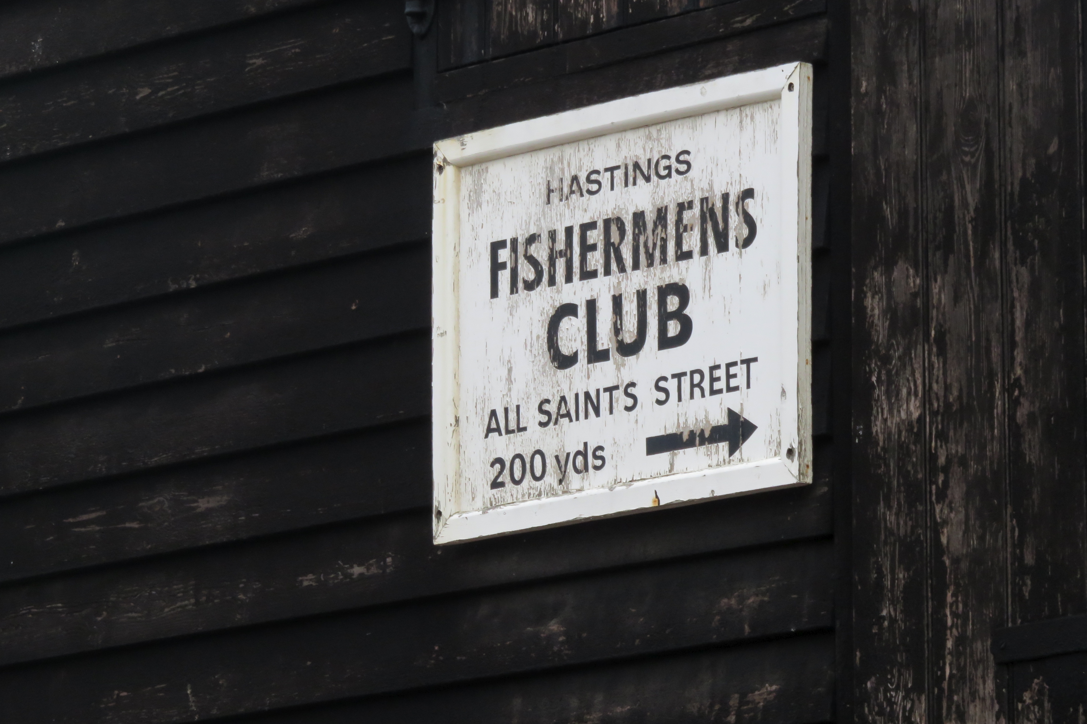
The tail of Storm Angus was still lashing the coast last Sunday, so our monthly HRRA walk was cancelled. But we were all ready to go out, so we convinced a couple of friends to brave the elements and walk with us from Hastings to Bexhill. (There's a video at the end of this post, in case you want to read along to the sound of waves on a pebbly beach!)
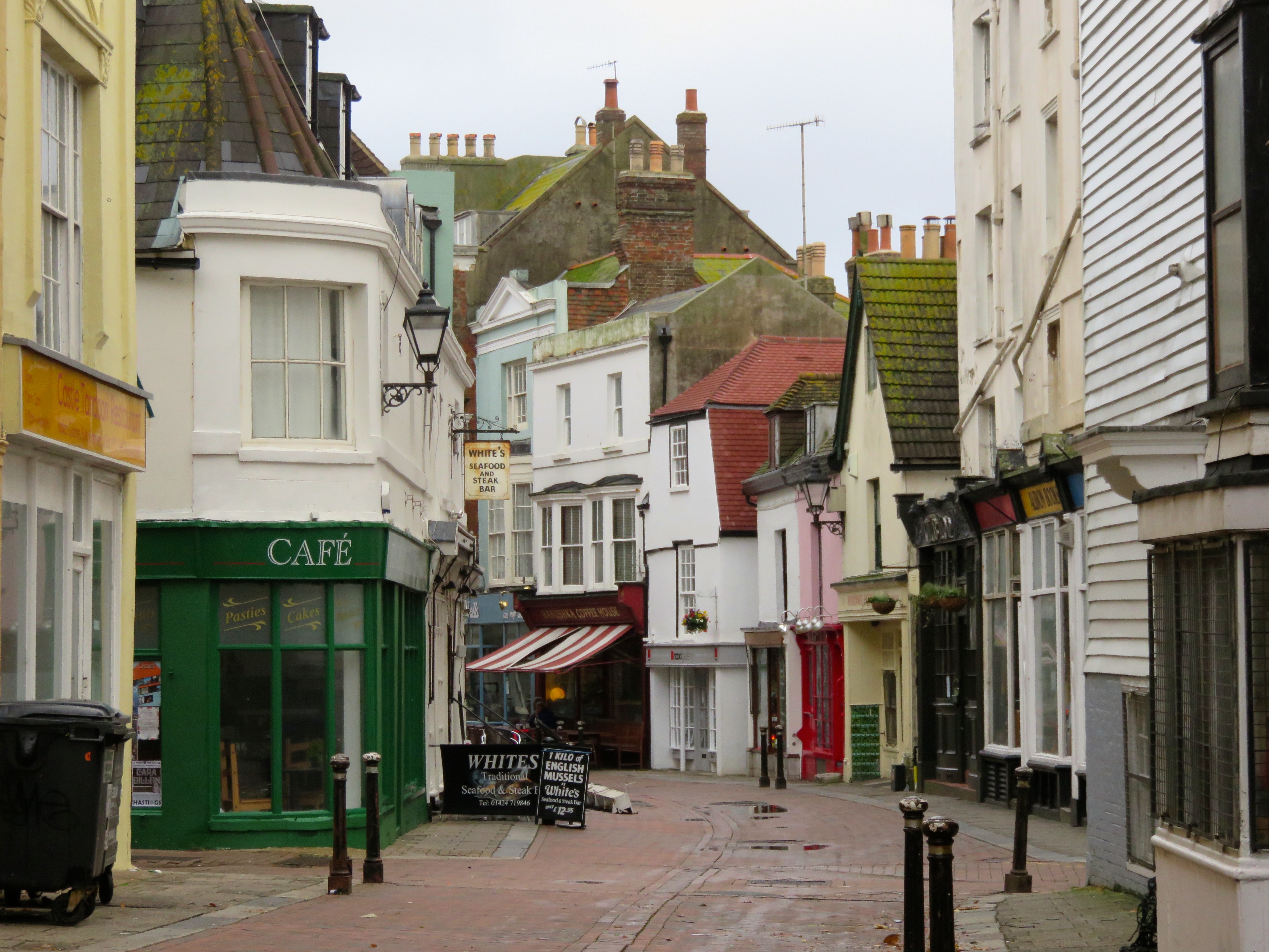
In Hastings Old Town, the wind had wreaked some minor damage - a few signs and awnings had blown over or come off the shop fronts. (You can see one in the photo above, on the ground behind the Whites signs.)
It was blustery when we met our friends by the Jerwood at the Stade. The wind was coming from the west, which meant we'd have a headwind all the way to Bexhill . . . If we made it that far.
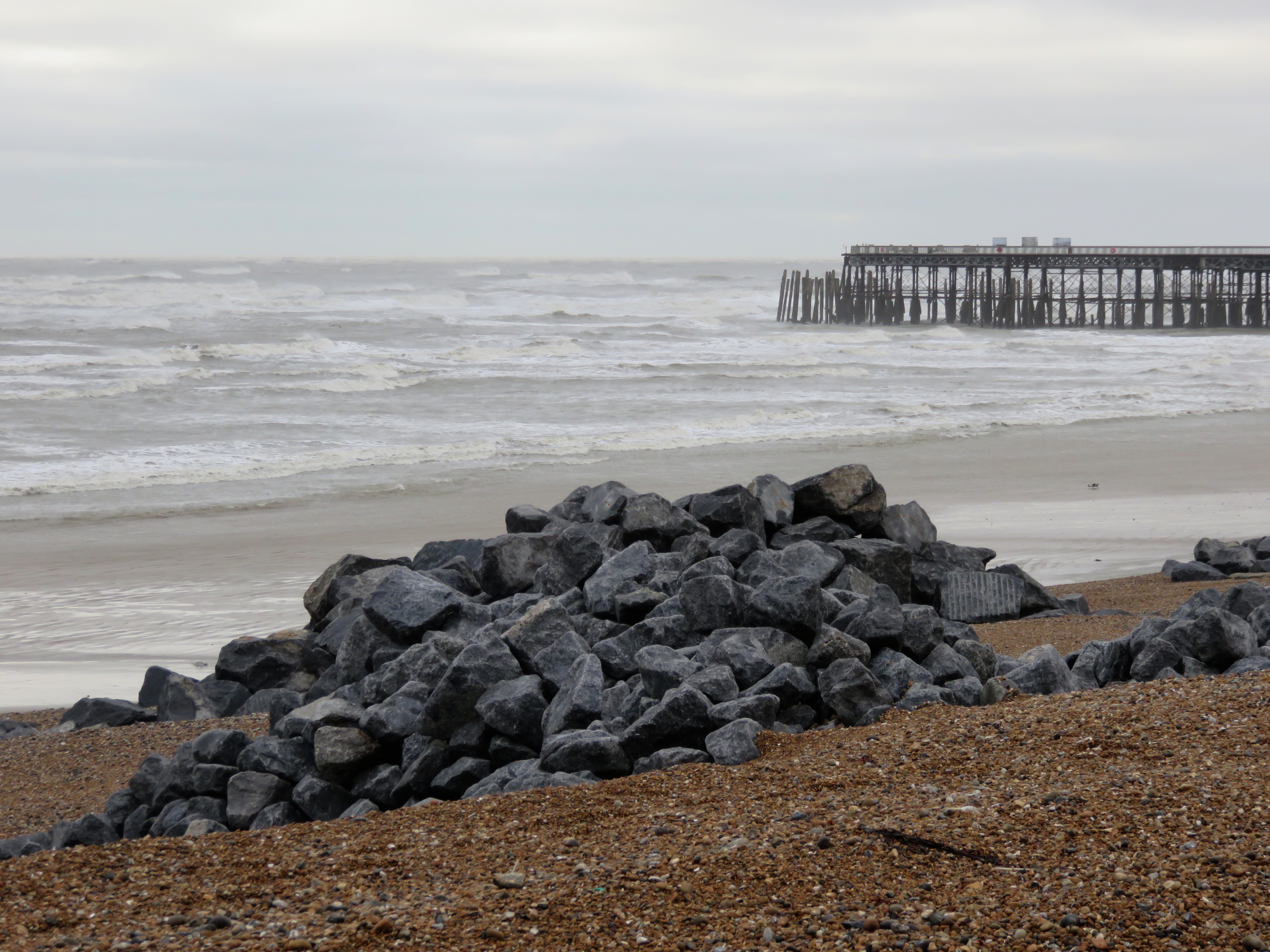
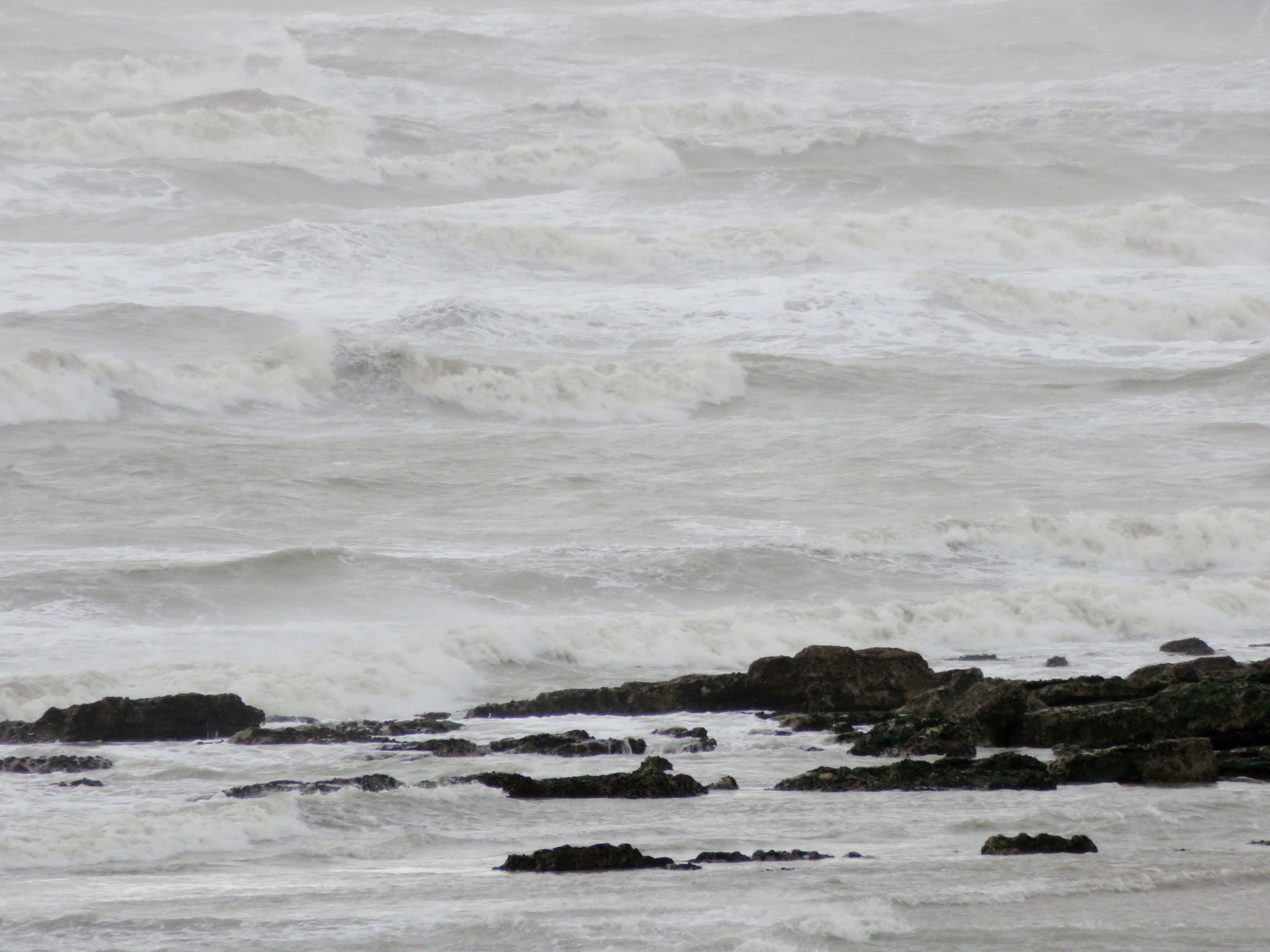
The sea was white with breakers as we pushed along the seafront towards Hastings Pier. We noticed these big rocks, new additions to the seafront, presumably placed there to help stabilise the beach.
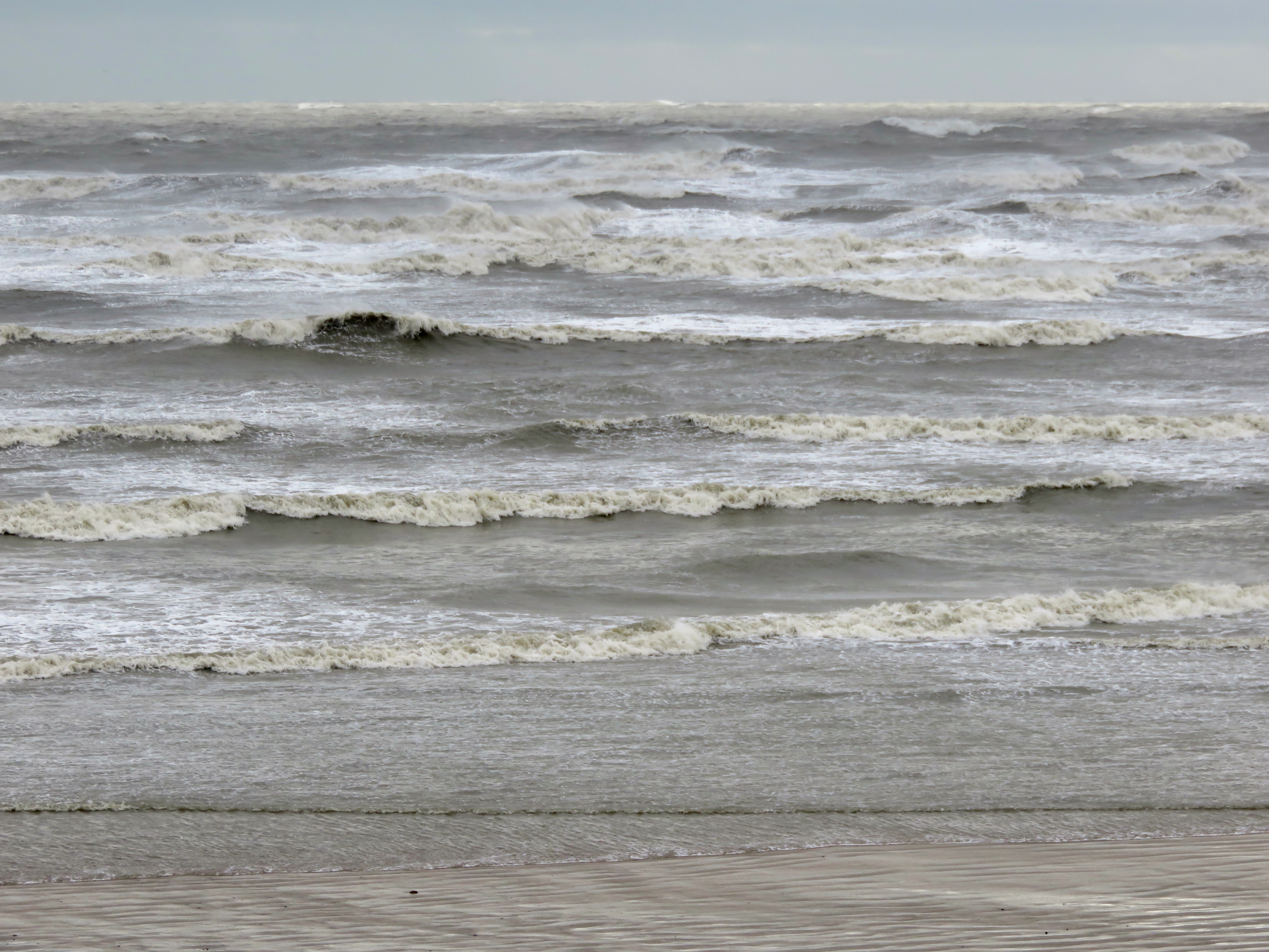
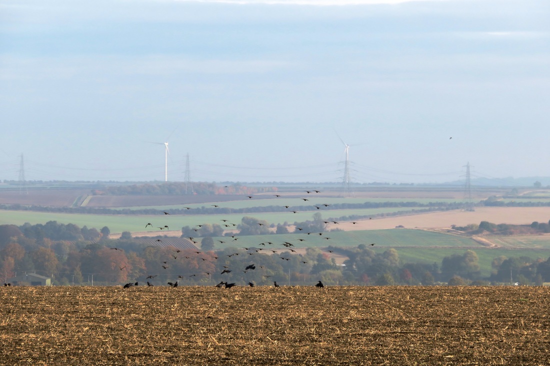
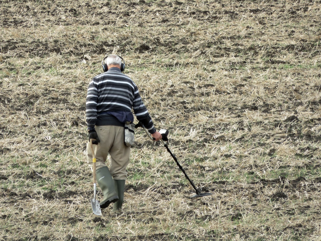
We also saw a few people out with their metal detectors. I suppose that the beach after a big storm would be a good place to find things that have either washed in from the sea or been disturbed and uncovered by the wind and waves. The the view towards Eastbourne was screened by a haze of seaspray.
I was quite close to suggesting we stop and have lunch at St Leonards instead. (That would have been a huge walk of three miles - the headwind made it feel a lot longer.) But I'd been stopping to take photos and the others were too far ahead to call off the expedition. Onwards to Bexhill!
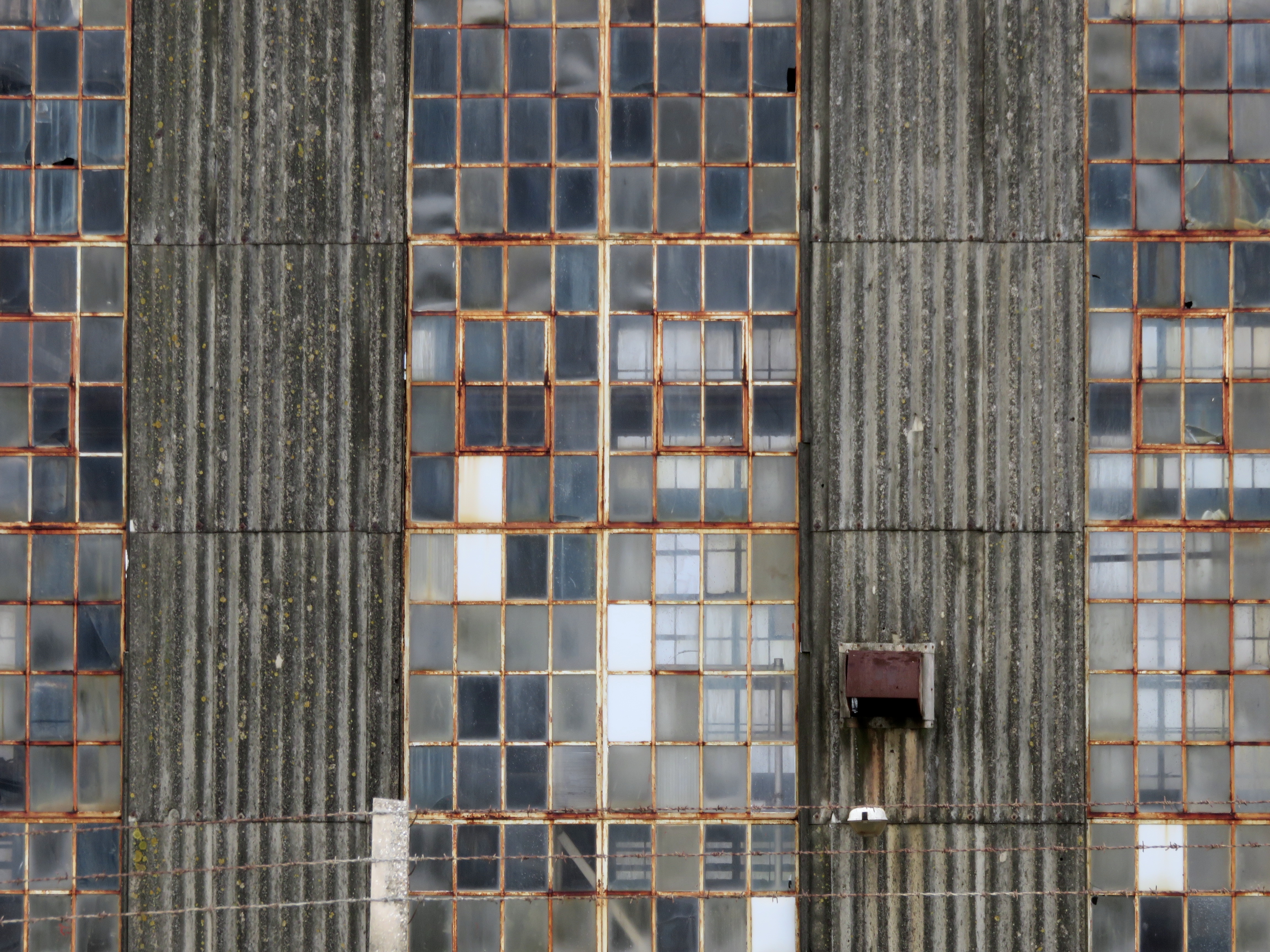
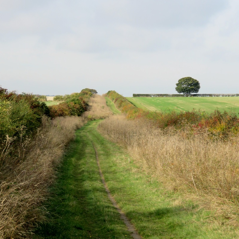
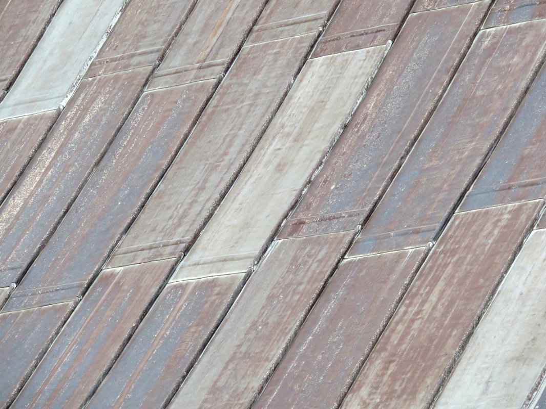
The path between Hastings and Bexhill is part of National Cycle Route 2, which hugs the south coast of England from Kent to Cornwall. It follows the railway for a while, and passes this great old industrial warehouse. I love the patterns of the windows and the rust and texture of the metal.
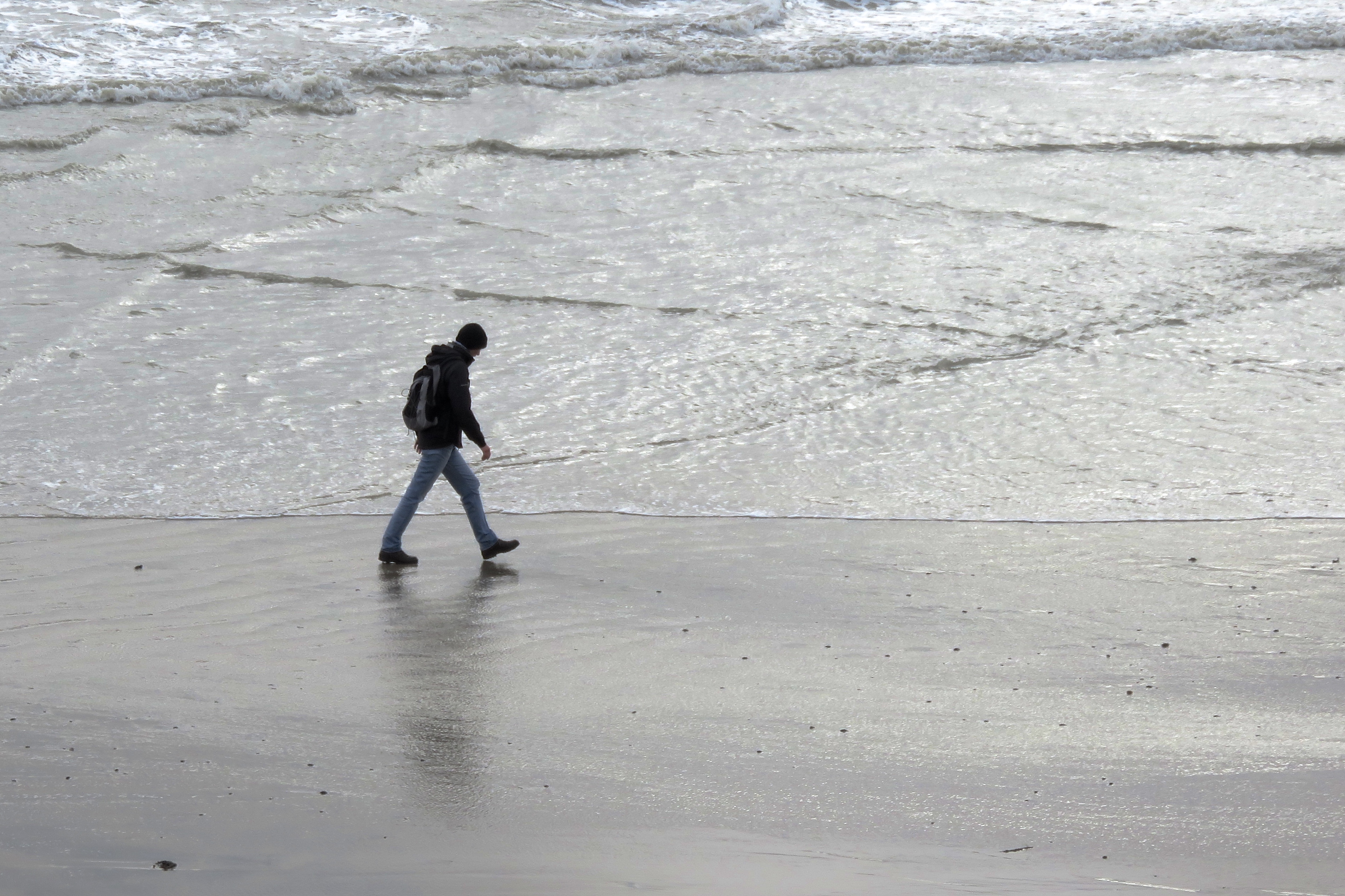
One of our walking companions went down to the water's edge, a silhouette striding against the grey and white sea.
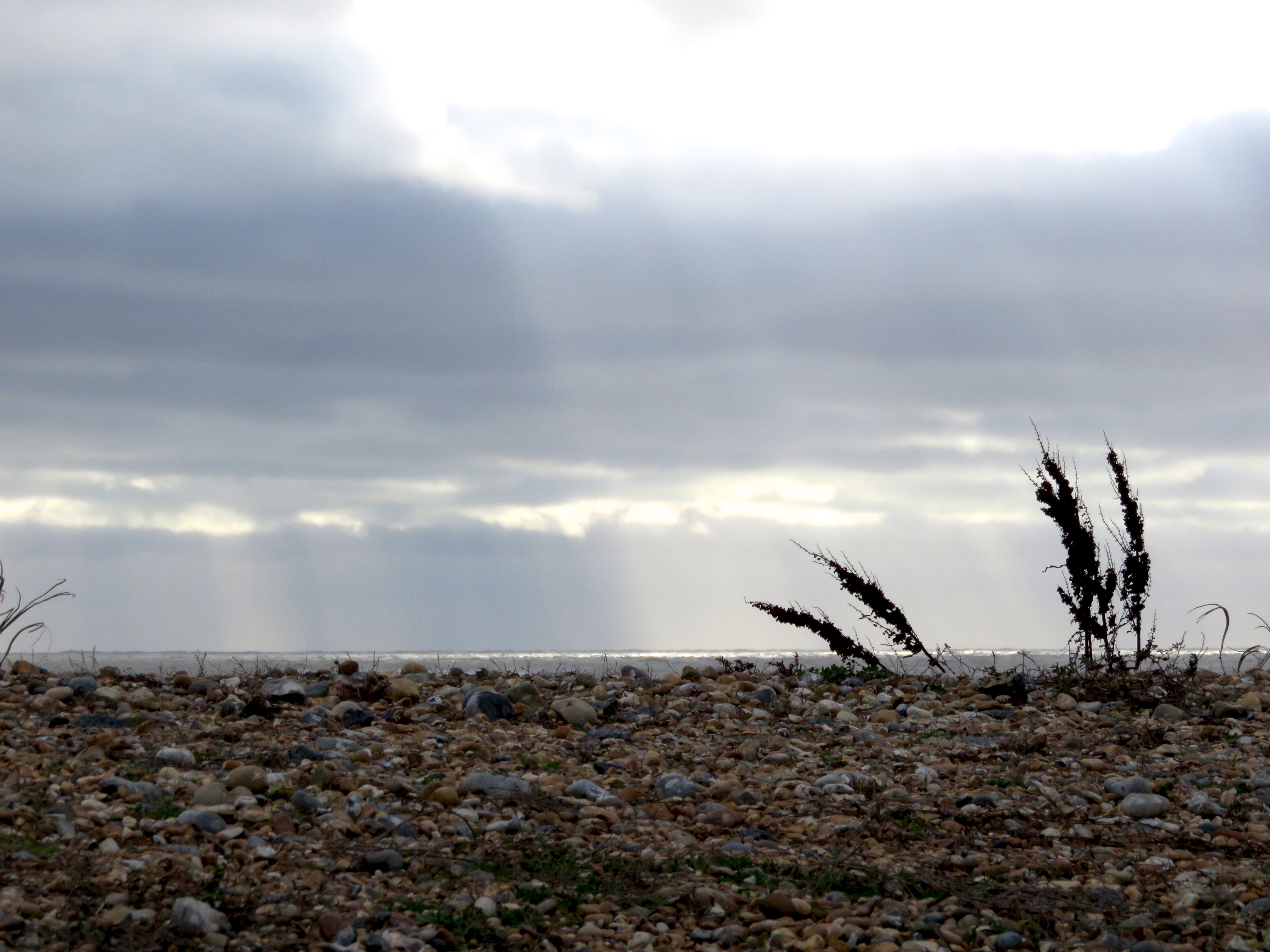
The sun began to break through as we got closer to Bexhill, creating silver stripes on the horizon. We were getting hungry and, while we found a few leaves of salty sea beet to chew on, it was a relief to climb Galley Hill, drop down into town and have a hearty lunch at Trattoria Italiana.
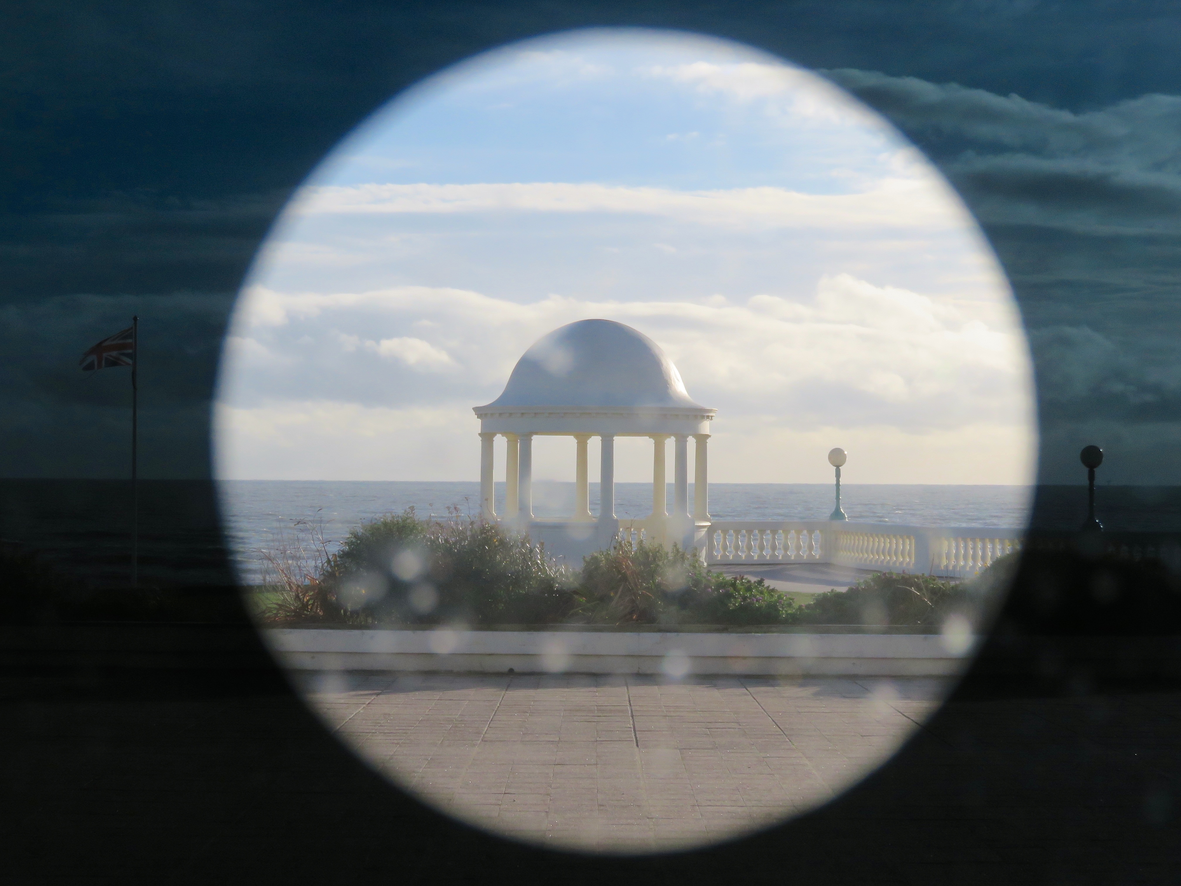
Afterwards, we popped over to the De La Warr Pavilion and spent a while mooching around Fiona Banner's exhibition. One side of the gallery is a wall of glass looking out to the sea, and Banner has covered this in an anti-UV film with several pieces cut out, the pieces being the same shape as (enormously magnified) full stops in various fonts. I loved how these shapes framed little views along the horizon and it appealed to me that the end of our walk should also be the end of a sentence.
I took a several minutes of footage of the mesmerising waves on the beach at Bexhill. Hope you enjoy them!
I've been struggling to find time and energy to get outside, let alone write about it. This often happens to me in winter. This year my motivation is to keep my walking muscles in practice for our Snowy River adventure. Do you have any other suggestions for motivation? (A good lunch is always a motivator!)
2 Comments
We’re over halfway through a very gradual process of walking from London to the Norfolk coast. We started a number of years ago, when we were living in London. Last autumn we crossed from Hertfordshire to Essex. On the last school break, we spent most of the walk in Cambridgeshire.
Cambridge was the mid-way point of the walk, so we drove up and stayed there for two nights (one before we started walking, one in the middle of the walk). This also gave us a bit of extra time to mooch around the city.
On Day 1, we caught the train back down to Great Chesterford and walked back to our accommodation (approx 30km/19mi). Our route took us up onto the hills of Cambridgeshire (I hope you enjoyed that joke) and along a Roman Road for the second half of the day. On Day 2, we walked to Ely, then caught the train back to our car (approx 27km/17mi). We followed rivers all the way, the Cam from Cambridge to its confluence with the River Great Ouse, then along the River Great Ouse to Ely. Here are a few things we saw on the way.
Day 1: Great Chesterford to Cambridge
At Great Chesterford, the grass seemed to be shining with . . . was it frost? We couldn't tell until we got closer and Dan realised the sun was shining on dew-beaded spiderwebs, strung from every blade of grass.
As we walked across the recreation ground, we noticed a rainbow gleaming in the webs. Beautiful!
It was a sunny morning, and we walked up onto the long, low hilltops. The hills aren't high, but as everything is so low, we had wonderful views over the countryside. It was fantastic to be out on such a gorgeous day. The autumn leaves were absolutely stunning. I think I said the same thing in my post last year, but I'm sure the leaves are brighter this year than they have been before!
Although the views were beautiful, it was a hazy day, so the horizon melted away into a blue smudge. We met some people walking up onto this hill as we were walking down. They told us that on a clear day you can see Ely Cathedral from up here. We couldn't see that, but we did spot wind turbines, greenhouses, pylons and an interesting looking water tower.
The autumn leaves were the stars of the show, but we also encountered bright flowers (pink roses, pink and orange spindle), blackberries, rose hips, crabapples and more.
We crossed the River Granta, a tributary of the Cam, and stopped at the church in Hildersham for morning tea. We'd just called into the local convenience store and had bought a loaf-shaped chocolate cake - the sort you might bring for a morning tea with several people. We ate half of it with a freshly brewed cup of tea. Then we ate the other half of it with another cup of tea. Yum. Inside, the church was beautifully and colourfully decorated. They also had a very new loo and running water, so we filled our water bottles again before setting off (from the tap, silly!).
From Hildersham, a short walk took us across fields being sown with potatoes to the Roman road. This trackway stretches most of the way from Cambridge to Haverhill and is used by the E2 European Long Distance Path (alternative route) and the Harcamlow Way. I always find it astonishing and humbling that I can walk a road so many centuries old and still see traces of its origins - the built up trackway, the ditches on either side. An sign informed us that the northern half of the road is a Scheduled Monument because it was built to such a high standard.
As well as the usual hedgerow shrubbery, some lengths of the Roman road had dozens of crabapple trees, with fruit flavours ranging from an unpalatable, mouth-drying tannin to a delicious crunchy sourness. We saw whitethroats (we think) and even a few butterflies in the long grasses by the roadside. We picked a few handfuls of blackberries, which were not bad considering how late in the season we were, to keep our energy up. We didn't eat any mushrooms.
Lush. That's some Brambly Hedge level business right there.
We were aiming for Wandlebury for lunch, so we were pleased to cross the A11 (incidentally, also a Roman road) and enter Gog Magog Hills territory. Wandlebury Country Park features the remains of an Iron Age hill fort - a very large, circular ditch - surrounded by beautiful woodland.
We found a nice big tree stump by the earthworks, stoked up our trusty Brukit (OK, screwed it together and pressed the ignition switch) and cooked ourselves some instant noodles. Oh, how delicious was this longed-for lunch. We had planned to walk around the fort, but decided our day was going to be long enough without adding extra distance. Instead, we decided we'd come back and visit Wandlebury on one of our trips to Norfolk. It would be an ideal location to break up the drive with a short walk. We stopped at the lookout here and in the hazy distance we decided we could just spot Ely Cathedral - the ship of the Fens.
By the time the Roman trackway met Wort's Causeway, I was flagging. A quick lie down on a handy bench helped a little, and we pressed on down the road, dodging cars. Considering this is still meant to be part of a long distance walking path, there wasn't a huge amount of room to walk on the verge. (And when there was room, there was vegetation up to our knees - which I appreciate is about wildflower conservation, but I was getting tired enough to think selfishly, "Screw the flowers, what about me!?")
We made it into Cambridge as the sun was setting. Dan's phone told us it was only another 50 minutes to walk to our Airbnb. Over an hour later, we still hadn't made it! I decided I had to eat pasta (mmm, carbs), so we ducked into a restaurant for dinner. Somewhat replenished, hobbled off into the darkness, finally making it home at about 7pm. I ran a bath and then flopped on the bed. Sensing my inability to move, one of the house cats jumped on me and went to sleep on my belly. Good call, cat.
Day 2: Cambridge to Ely
We set off around 8am, a good time to catch all the students out on the Cam practicing their rowing. There seemed to be quite a few new teams in the mix, probably because uni has only been back for a month or so. We wandered along, dodging the coaches who pedal along the path beside the river calling instructions to the cox and crew.
After leaving Cambridge, we crossed wide open fields to Fen Ditton. Wikipedia tells me, "The name was first recorded in around 950 as Dittone, meaning 'the village by the ditch', derived from the Fleam Dyke, the prehistoric ditch that passed through the village." We kicked through the leaves past the church and some play equipment (we both had fun on the flying fox) and then passed under the A14.
Baits Bite Lock is the end of the rowing stretch out of Cambridge, but we only saw a narrow boat passing through. We crossed over the river here and at the bottom of the weir, dozens of tiny fish wriggled in the water weeds.
We followed the towing path out past Waterbeach, observing the pollarded willows, a few kestrels and buzzards and lots of water fowl. I was pretty achy and half-considered jumping on the train back to Cambridge and doing the Waterbeach to Ely section another day. But after our morning tea stop at Bottisham Lock, Dan offered to carry the bag. I felt better immediately! Across the water we spotted a few deer faces poking out over the high weeds. At first we thought they might be Chinese water deer, which got us excited. However, a bit of Googling makes me think they were roe deer, which are still pretty cool - did you know they've been in Britain for over 6,000 years, were hunted to extinction in England by 1800 and then reintroduced? I didn't.
Throughout this walk, my eye was caught by the movement of machines across the scenery: a ride-on leaf sweeper, tractors in fields, ploughing, the motorway, long freight trains. I think perhaps the flatness of the landscape means these movements are elongated, stretched out like a long-held shot in a film. One thing we saw was a working party on the river, clearing vegetation from the water.
The colours on the second day were much more subdued, partly because it was overcast, partly because the vegetation was very different. We passed by some huge fields of leeks, rows and rows of gently spiked, blue-grey tops. The little curved-roof cabin across the river was painted a light sky blue, and the boat moored in front of it was blue, too. We thought about living here - it looked like it'd get a bit cold.
We saw hundreds of ladybirds on this trip. They congregated on fence posts, benches, walls, gates, trees; they whirred and swirled through the air; they landed on our backs as we walked, on every part of us when we sat still. I'm pretty sure we could have spotted every colour/spot combo there is!
After crossing the road between Wickham and Stretham, we had a late lunch: sandwiches and a freshly brewed cuppa. The fingerpost here noted we were 5 miles from Ely, so we didn't stay for too long. Soon, the small glimpses we'd had of the cathedral became longer views. It was nice, after such a flat, low walk, to have something against which we could mark our progress. At the confluence of the two rivers, we crossed over the River Great Ouse coming in from the west, watching boats pass beneath the arched footbridge. We joked that this was probably the biggest hill we climbed all day. (It wasn't a joke.)
After a rather lonesome walk, having seen barely a soul, this stretch of river buzzed with boats heading in both directions. Well, at least half a dozen boats. As we drew closer to Ely, we even exchanged greetings with few afternoon walkers. And there was someone metal detecting in a field beside the path, perhaps looking for the next Hoxne Hoard? We made it to Ely station in good time and enjoyed the smooth trip back to Cambridge, pointing out the window and saying, "We were there! We were there!". They only takes 20 minutes. Why didn't we just take the it in the first place?
Postscript: Patterns
Here, have three roofs. There must be at least one person reading who likes these patterns as much as me! Below are the multi-coloured tile roof of a big house in Fen Ditton, a corrugated shed roof from a farm outside Great Chesterford and the lead (I think?) roof of a church - possibly also in Fen Ditton.
A late addition!
When will we make it to Norfolk? When will we arrive on the Norfolk coast? Who knows! It could be years. (Actually, we'll be there in winter, but I think we'll drive up for that!)
|
In which IIn which I do things and write about them In which I tag
All
In which I archive
July 2022
|