IN WHICH I
  • ... Write
  • ... Explain

The Monthly Weeklies

30/3/2018

0 Comments

 
What are you working on? What do you want to achieve by the end of the month? And what do you need to do this week to reach those goals? I wrote about our online goal-setting group The Monthly Weeklies over at The Research Whisperer . . .
Black and white close up of stopwatch
Stopwatch (cc) William Warby
Many people are familiar with this approach to time and project management - figuring out your big goals and breaking them down into smaller steps. But sorting out what you need to do is one thing, while actually following through is quite another!

This can be especially difficult if you operate in a more solitary environment, as do many writers, artists, researchers, and people involved in projects outside of their paid job or formal study. Without the everyday structure of collaboration deadlines, team meetings, and so on it’s pretty easy to let the weeks slip by, to transfer an item from one to-do list to the next, to de-prioritise your own goals in favour of things that other people want from you. It can be hard to hold yourself accountable.

I started The Monthly Weeklies online goal-setting group with this in mind. My aim was to create a structure that would help me think seriously about short and medium term goals, a place to record those goals and my progress, and a team of people who could help keep each other focussed and celebrate each other’s successes.

The group started in September 2016 and, as the name suggests, it runs in monthly cycles with weekly check-ins. Members come and go, finding the structure useful in different ways. Benefits might include:
  • devoting time to thinking about and setting their goals, even if it’s just 5-10 minutes each week;
  • stating explicitly what they have done and what they aim to do;
  • directing time and energy into the things they want to prioritise;
  • breaking down big ideas into actionable, measurable tasks;
  • keeping focused;
  • getting a nudge to return each week instead of letting things slide;
  • having a record of what they are capable of achieving on a weekly/monthly basis;
  • the social contact element, which helps with accountability and enjoyability.
It can work for all kinds of people – we’ve had writers, researchers, librarians, bloggers, makers, teachers, artists, freelancers, and folks who simply wanted to get things done.

The fairly simple format of our group should be easy for others to replicate. If you're interested in setting up a group like this, or in learning about ours, please do pop over to The Research Whisperer to read more. . .

Thanks to Tseen Khoo for inviting me to contribute to The Research Whisperer blog - the closest I've been to an academic publication for many years!

0 Comments

Snowy River adventure: photos from the Monaro

17/3/2018

2 Comments

 
After leaving the high country and passing through the reservoirs, weirs, tunnels, pipes, pumps and dams of the hydro scheme, the Snowy loops through the Monaro High Plains. Our exploration of this stretch was very non-linear: we spent a few nights in Dalgety, canoed the river upstream, wandered down dirt roads and did some (very tame) 4WD exploring of the remote, arid pasture hills to the south. I hope this post gives a flavour of the Monaro, especially around the Snowy.

NB: This post contains photographs of a dead animals and bones.
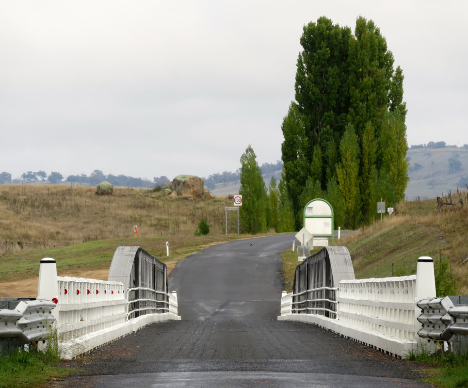
very foreshortened bridge with sealed road
Dalgety Bridge
Dalgety Bridge over the Snowy River, first erected in 1888 to replace the previous punt that crossed a little upstream. Most people who see the Snowy as it travels through the Monaro see it at Dalgety.
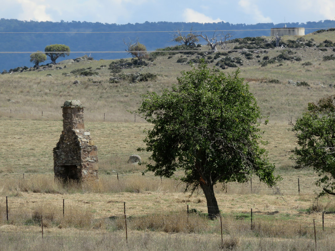
paddocks, stunted trees, ruined chimney, water tank
Near the Snowy River Way between Jindabyne and Dalgety
The Snowy emerges from the steep-sided gorges of the high country into the rolling farmland and grasslands of the Monaro. (The photo above was taken before we reached the Monaro proper, as we were hitchhiking to Dalgety - but you can see the scenery is already changing from the previous section.) “Monaro” is - or at least used to be - usually pronounced more “m’n-air-o” or “m’n-air-uh” than “mon-ar-o”, in keeping with previous spellings like “Menero” or “Miniera”. The range of spellings is a sure sign that the name was transcribed from one of Australia’s Indigenous languages, and most sources give the meaning as something like “high plain” or “plateau” or “breasts” - referring to the smooth, undulating hills. Christine Frances Hansen discusses the name in her dissertation Telling Absence (pages 26-27), which charts many possibilities, including the option that there wasn’t a language name for the collective area now known as the Monaro - rather, when asked, a local person answered “manyer” or “I don’t know.”
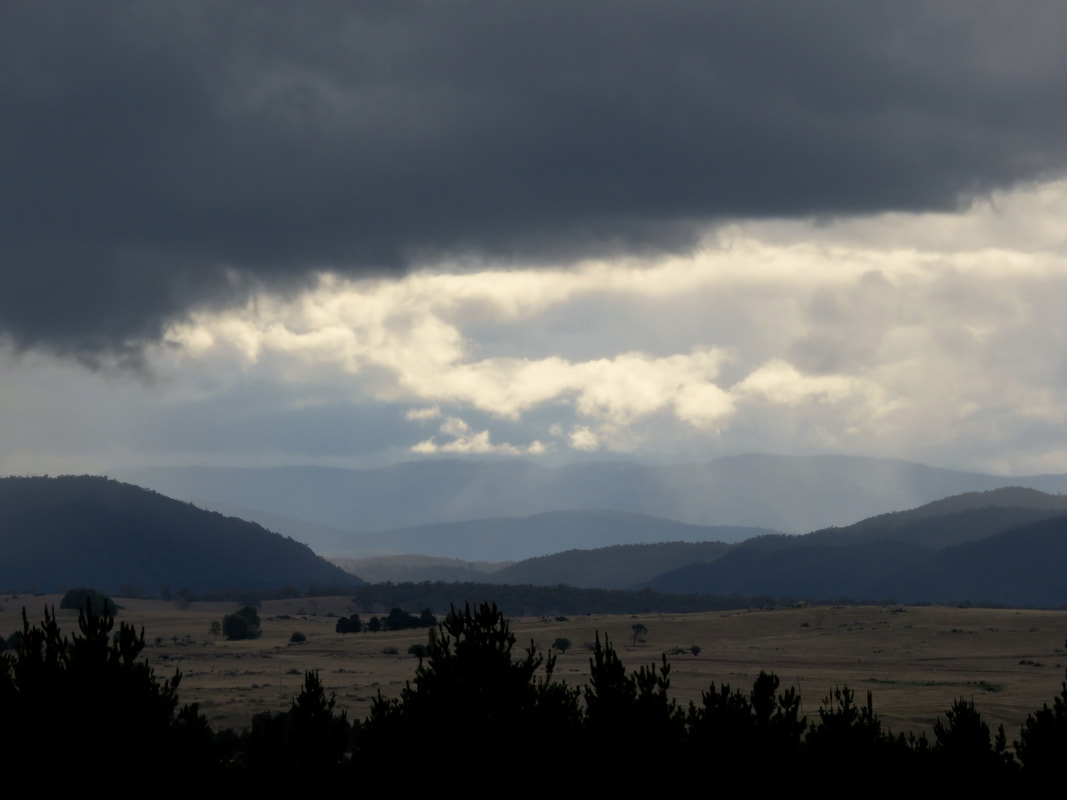
Heavy clouds over wooded hills and dry paddocks
Rain storm in the high country
Geographers usually describe the Monaro as a plateau, sitting above the eastern seaboard escarpment and below the Great Dividing Range - you can see the difference between the wooded hills of the Divide and the grasses of the Monaro in the photo above. Geologists (who apparently can never agree) generally think the Monaro High Plains are a basalt lava field formed sometime in the last 50 million years, when lava from small volcanoes flowed over the landscape, filling in the low-lying areas and valleys to create a gently undulating plateau. The rounded, Henry Moore-esque boulders which you can see scattered across the plain are granite. They are what has remained after water and naturally occurring acids have eaten away at the surrounding rock, turning it into gravel and clay which is in turn has been eroded by wind and rain.
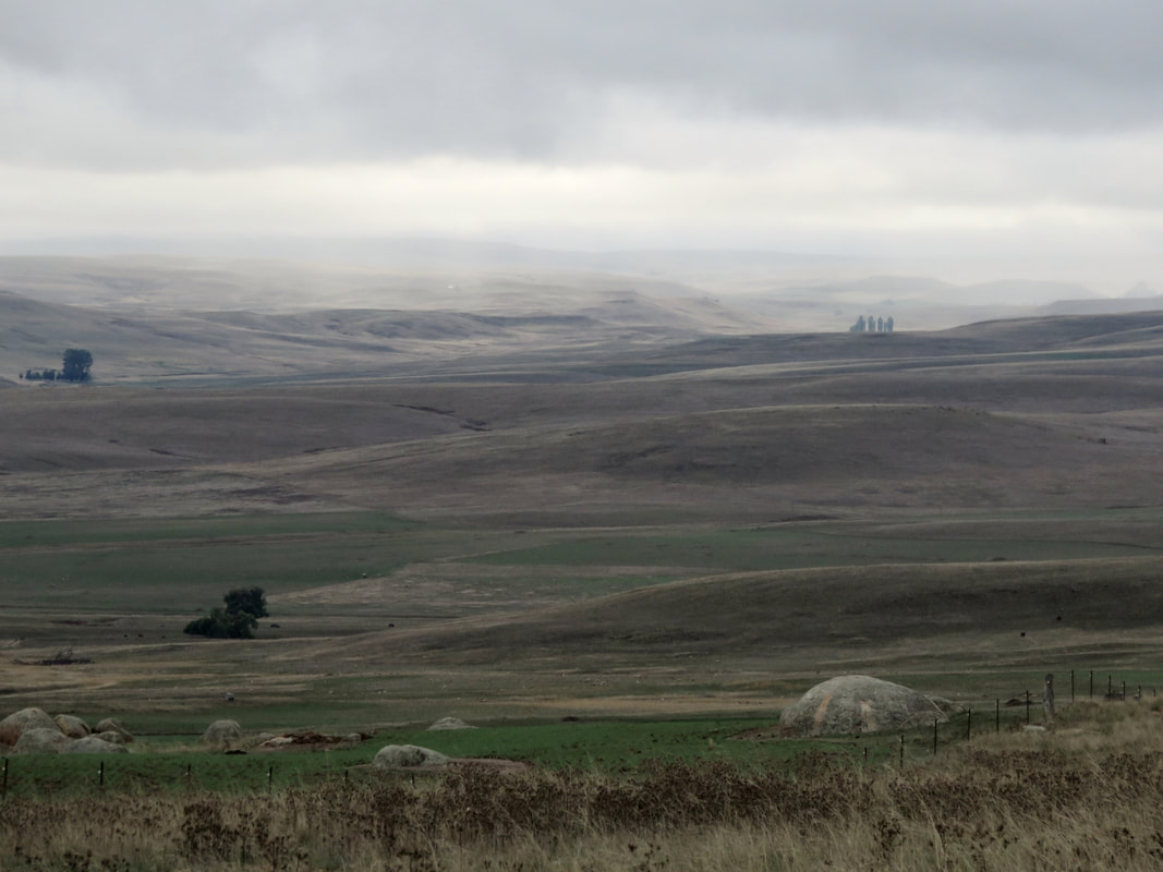
treeless, rolling hills with weathered boulders in foreground
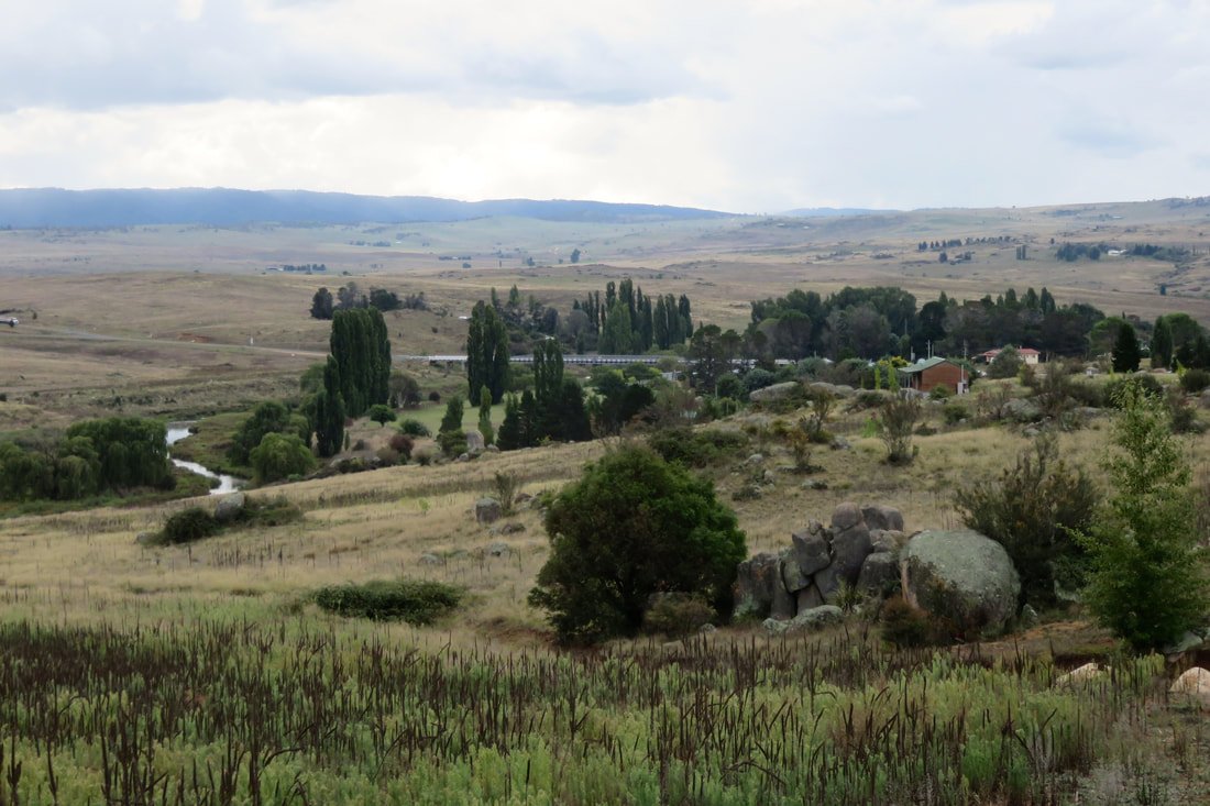
Monaro High Plains from the Snowy River Way east of Dalgety
More striking than the rolling hills and granite boulders, though, is that the Monaro is virtually treeless. The photo above, taken as we started our drive downstream, is a fairly typical example. I remember staring out of the car window on many trips between Orbost and Canberra as a kid, comparing this landscape to the tall, straight, densely packed trees of East Gippsland and thinking I might as well have travelled to the moon, it was so different. You might assume that the lack of vegetation here is a result of colonial/white settler damage as it is almost everywhere else in Australia: clearance for crops, over-grazing, logging, or a combination of all three. In fact, the Monaro was treeless when non-Indigenous people first moved through and settled here and scientists believe the phenomenon is caused by a combination of heavy basalt soil laid down by those ancient volcanoes, low rainfall (the Monaro mostly falls in the rain shadow of the Great Dividing Range) and the fact that the cold air pooling in the valleys makes it too cold for seeds to germinate (in winter, the Monaro is the coldest part of the country outside of the Alps), but the plains are not high enough for cold-resistant alpine vegetation to grow.
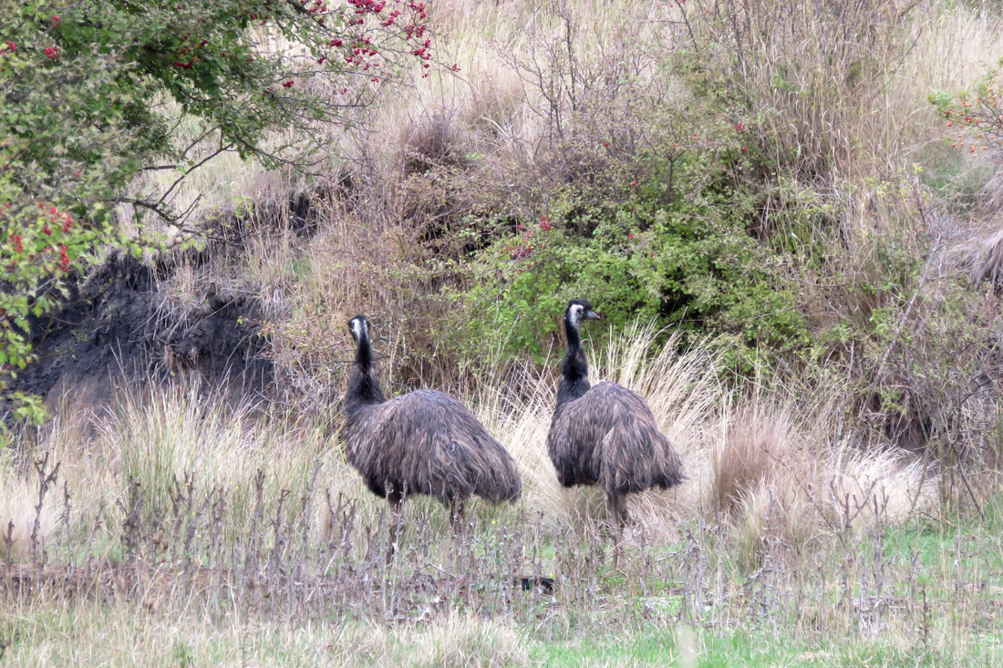
Two emus in long grass
Two emus near Beloka
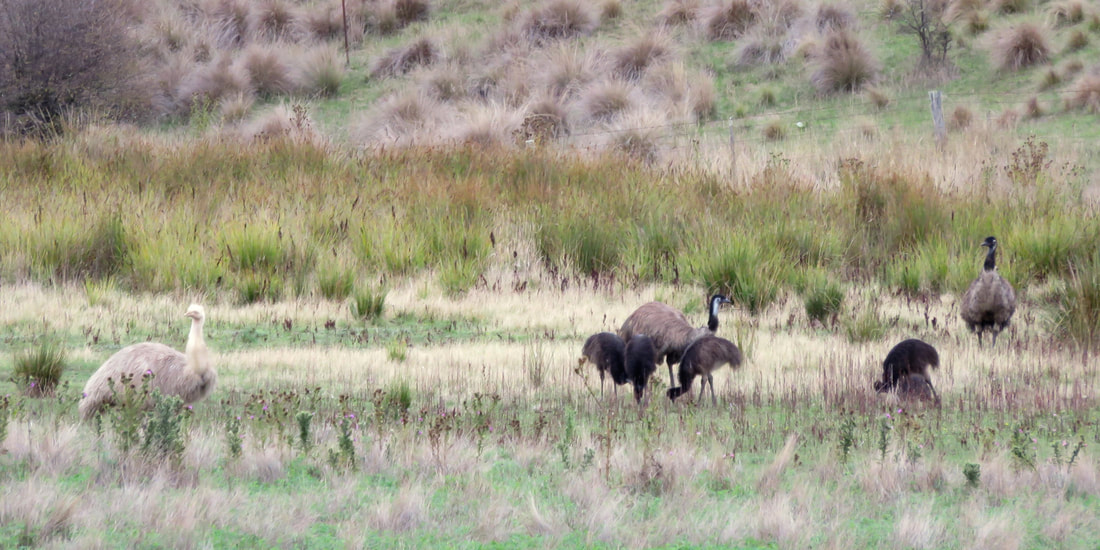
seven emus - one white, four young
Seven emus, including a white adult and four young birds
We loved seeing these emus - including some young birds and a completely white adult - near Beloka, west of Dalgety. We wondered if the white feathers are leucism (which I learnt about after seeing white-winged crows in East Sussex) or albinism, but we weren't close enough to see if it had pink eyes. The first emu photo above contains a lot of clues to the use and mis-use of the Monaro - non-native hawthorn trees and weeds all over, signs of bad erosion, and yet these emus thrive on land that seems barely able to sustain farm stock.
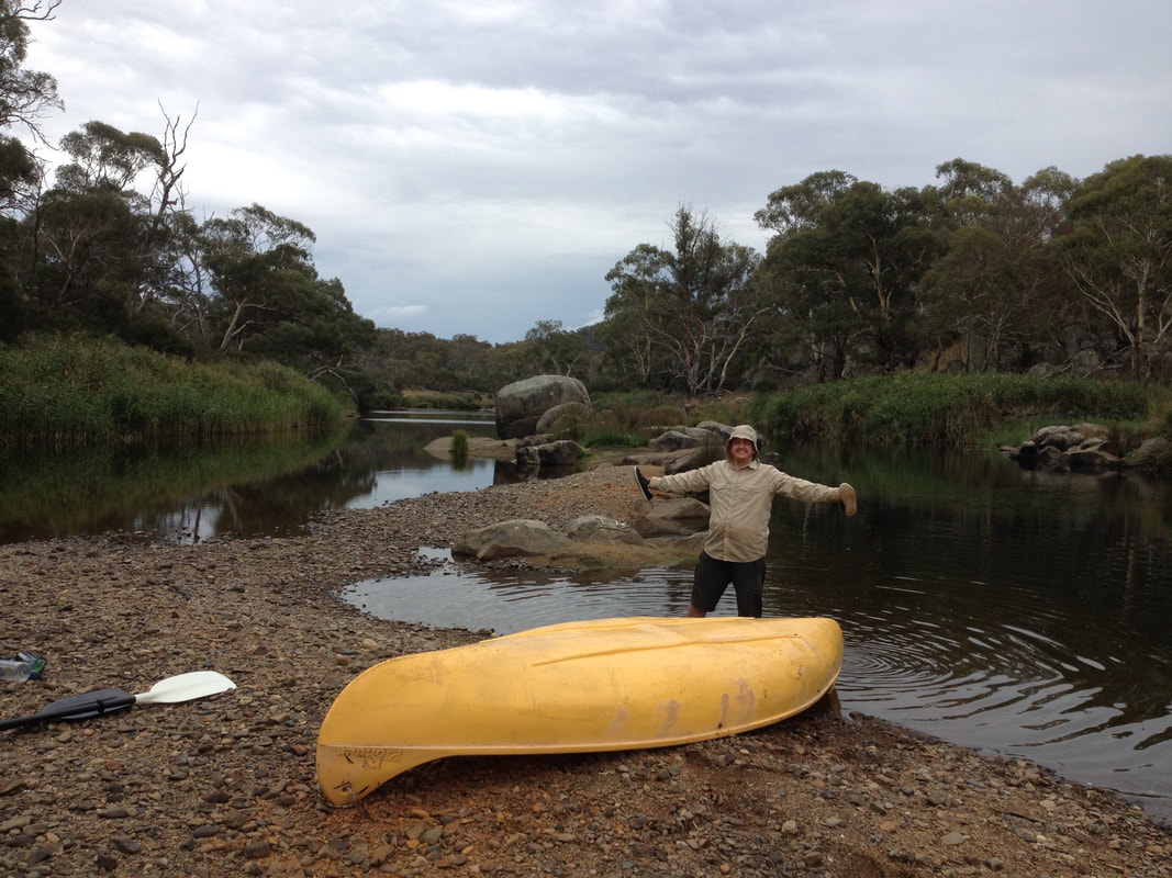
person and canoe on gravel bank in river
Taking a break from paddling on the Snowy River north of Dalgety
This would once have been underwater. Around here, the Snowy of old was a natural stock boundary for nearby stations. When the river was dammed, farmers were informed they might need to extend their fences, but the local belief was that the scheme would only ‘skim the snowmelt’ from the river, keeping anything over flood level. In reality, Jindabyne Dam stopped the river almost entirely. Photos of the river at 1% flow show that it could hardly prevent a determined sheep from straying to greener grass. The difference between the Snowy of old and the river in its dammed state was, and is, most keenly felt in this stretch. Here, joined by the rushing waters of the Thredbo and Eucumbene, the river would once have swept clean a wide path over the stones lining the riverbed. These days, that path is much narrower, the water slower, the stones often covered with a thick layer of sediment. While canoeing upstream of Dalgety, we enountered a long stretch of reed-clogged river. The water moved from side to side of the old riverbed, meaning we had to paddle back and forth, searching for a gap in the reeds. We often had to jump out of the canoe to drag it down rapids between each reed-walled pond, trying not to fall and twist our ankles, hoping we weren't annoying any snakes in the reeds!
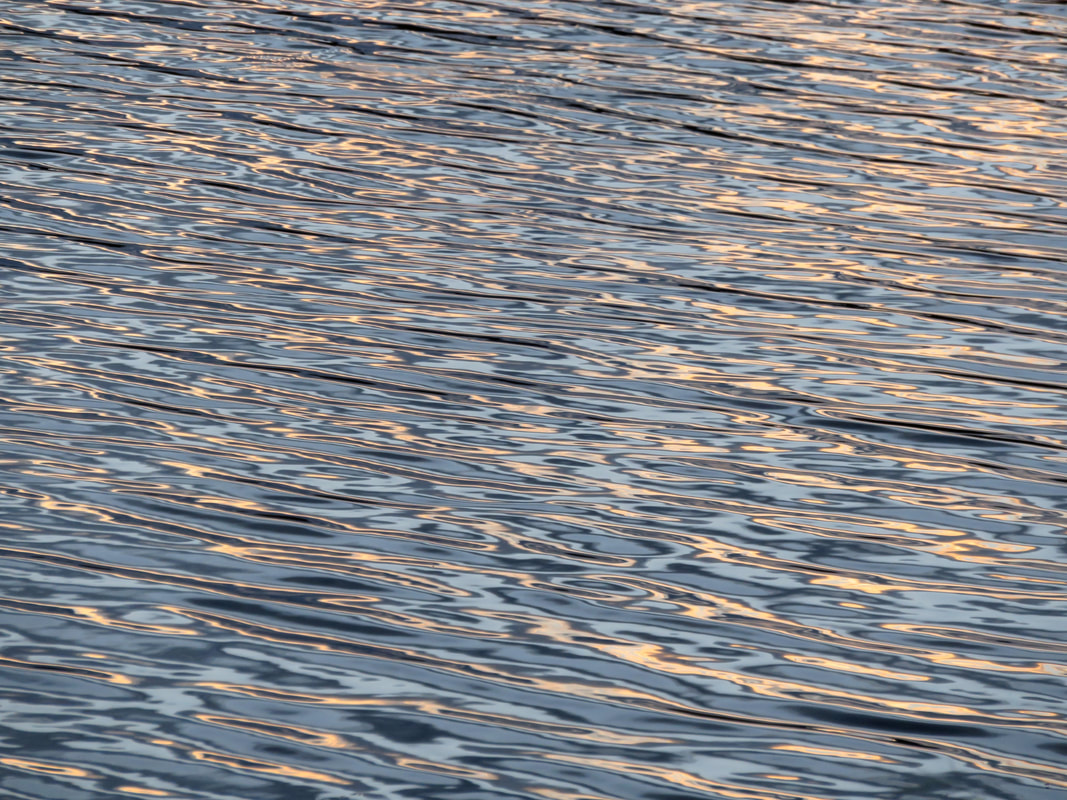
rippling water
Luscious sunset light on the river at Dalgety.
Despite the reduced flow, the Snowy River around Dalgety is meant to be a great spot to see platypus. One evening we wandered up from the campground, following the handmade signs to a riverside spot recommended for platypus sightings, and sat in a pair of plastic garden chairs provided for just such occasions. We were instructed to sit still and silent for as long as we could, as platypus are rather timid animals. I was enchanted by the delicious sunset light playing on the river (above). As we waited, a flock of galahs provided a soundtrack - screeching to roost on one tree, then swirling away behind us to another. We saw no platypus, but it was a relaxing end to the day.
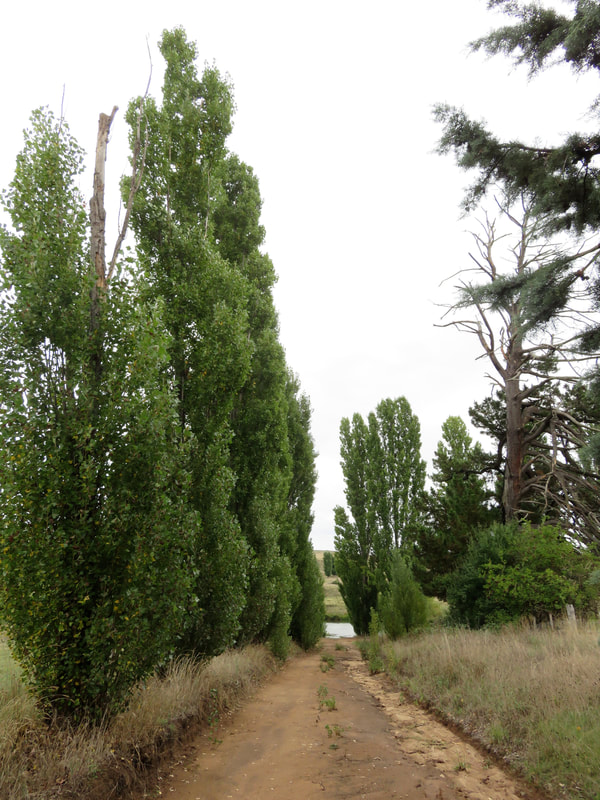
poplar trees and dirt track leading to a river
Barnes Street, Dalgety, leading to the Snowy River
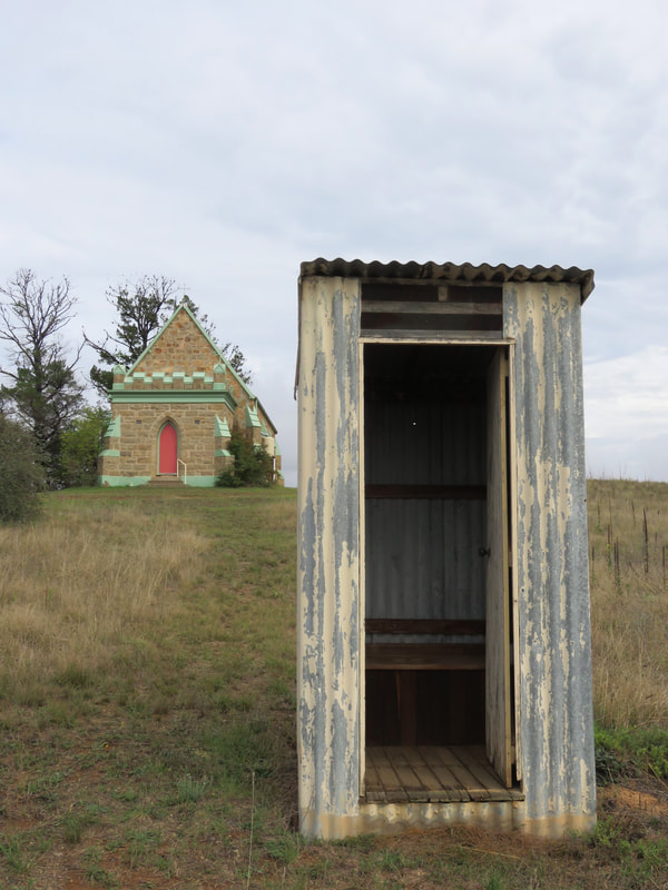
small, colourfully painted stone church, corrugated iron outdoors dunny
The sacred and the profane, Dalgety
Dalgety sits on a natural crossing place over the Snowy, which has been used for thousands of years. The first non-Indigenous settlement here was known as Buckley's Crossing, uncreatively named after a colonial settler-farmer in the area. The present day pub (built 1889) is still called Buckley’s Crossing Hotel. Buckley’s Crossing became a key point on the droving route down into Gippsland and back, being one of the easiest places to ford the Snowy. It was sometimes called Barnes’ Crossing from the mid-1800s (surprise, surprise, after another settler). The name Dalgety was not applied until the early 1870s, when the town was formally surveyed. Before the bridge was erected in 1888, there was a punt in operation - I think from the bottom of Barnes Street, pictured above left. The Catholic church, Our Lady Star of the Sea (above right) opened in 1878. I think the outdoor dunny opened more recently. (There was another outhouse a bit further away, made of stone and stuffed so full of hay or grass and other organic material that the door couldn't open properly.)
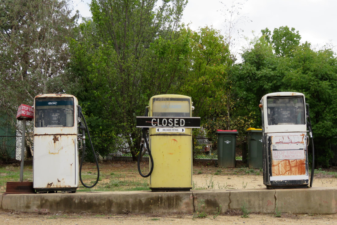
three old, disused petrol pumps
Closed, Dalgety
Did you know that, for a few years, Dalgety was set to become Australia’s capital city? Here’s a history lesson for you. After European invasion but before federation in 1901, settled Australia was not a single nation but a series of British colonies. Victoria and New South Wales were the two largest and most powerful colonies and there was a deep-seated rivalry between them, partly based on their differing trade policies. This proved to be a hurdle on the track to federation, as both colonies believed the new nation should follow their trade practices. In addition, a new nation needed a new capital city and bitter debates raged over whether that should be Sydney (the older city, in New South Wales) or Melbourne (then the larger city, in Victoria). This disagreement called for a compromise - and section 125 of the Australian Constitution states, “The seat of Government of the Commonwealth . . . shall be in the State of New South Wales, and be distant not less than one hundred miles from Sydney” but that “Parliament shall sit at Melbourne until it meet at the seat of Government.”
monaro plains with small town in river valley
View of Dalgety, Dalgety Bridge and the Snowy River from Hickeys Rd
Thus began the search for a suitable location for Australia’s new capital city. In February 1902, senators made a trip to proposed sites. Climate, soil fertility and the ability of locations to support major industries were paramount - though it seems that the majority of sites failed the first test, providing sweltering summer heat, threat of bushfire and dust storms. After those experiences, it’s no wonder that the cooler climes of Dalgety provided a smidgin of relief. There’s a famous photo of senators swimming in the Snowy at Dalgety during the tour. They’re chest-deep in smooth water, flanked by the area’s characteristic rocks and dark shrubs. At bleaker times of the year, Dalgety was buffeted by bitterly cold mountain winds, but at the time a “bracing climate” was considered an ideal environment for producing healthy, intelligent people. Two years after federation, in 1903, a Federal Royal Commission named Dalgety as the optimal site for the new capital city, and this was formalised the next year in the “Seat of Government Act 1904”.
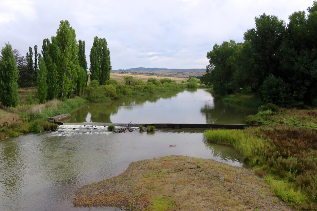
river with small weir and green trees
View of the Snowy River and small weir from Dalgety Bridge
I wonder if the Snowy’s fate might have been different if Dalgety had indeed become the capital city. Would the river have been turned into a large ornamental lake, just as in the Griffins’ winning design for Canberra? Or would it have been redirected and sculpted like the Yarra through Melbourne?  It’s likely that the Snowy and Mowamba would have both been dammed - when Dalgety was being staked out for the capital, the surveying team noted the Snowy’s potential for hydro electricity, and part of the reason for the Snowy Mountains Scheme was to provide power for Canberra. But I doubt that the Snowy and its tributaries would have been so mercilessly strangled if their damming and diversion inland for irrigation might have had a visible, tangible impact on the aesthetics and lifestyle of those in the capital city. As it stands, a small weir just upstream of the Dalgety Bridge (above) only gives an illusion of fullness.
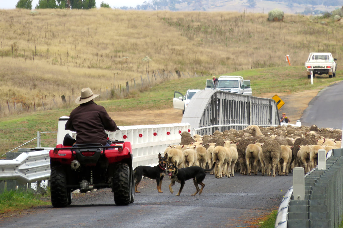
farmer on quad bike herds sheep over bridge
Moving sheep over Dalgety Bridge
For a couple of years, over a century ago, Dalgety must have felt like it was near the centre of Australian culture. But the New South Wales politicians kicked up a stink about the site - they thought Dalgety was too close to Victoria and too far away from Sydney, too cold, too dusty, too sparsely vegetated, too wild. In addition, there was concern from the powers that be that placing the capital at Dalgety would draw sea trade to the port at Eden on the south coast of NSW, which might eventually supersede the harbour at Sydney. To be fair, there were also some practical objections, such as Dalgety’s distance from the main Sydney-Melbourne railway line and how much it would cost to build a branch line to service the proposed capital. And so the search began afresh and the “Seat of Government Act 1908” named the site of present-day Canberra as the location for the new city.
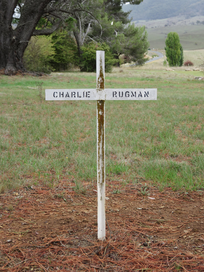
white cross labelled charlie rugman
Charlie Rugman, Boloco Cemetery, Beloka
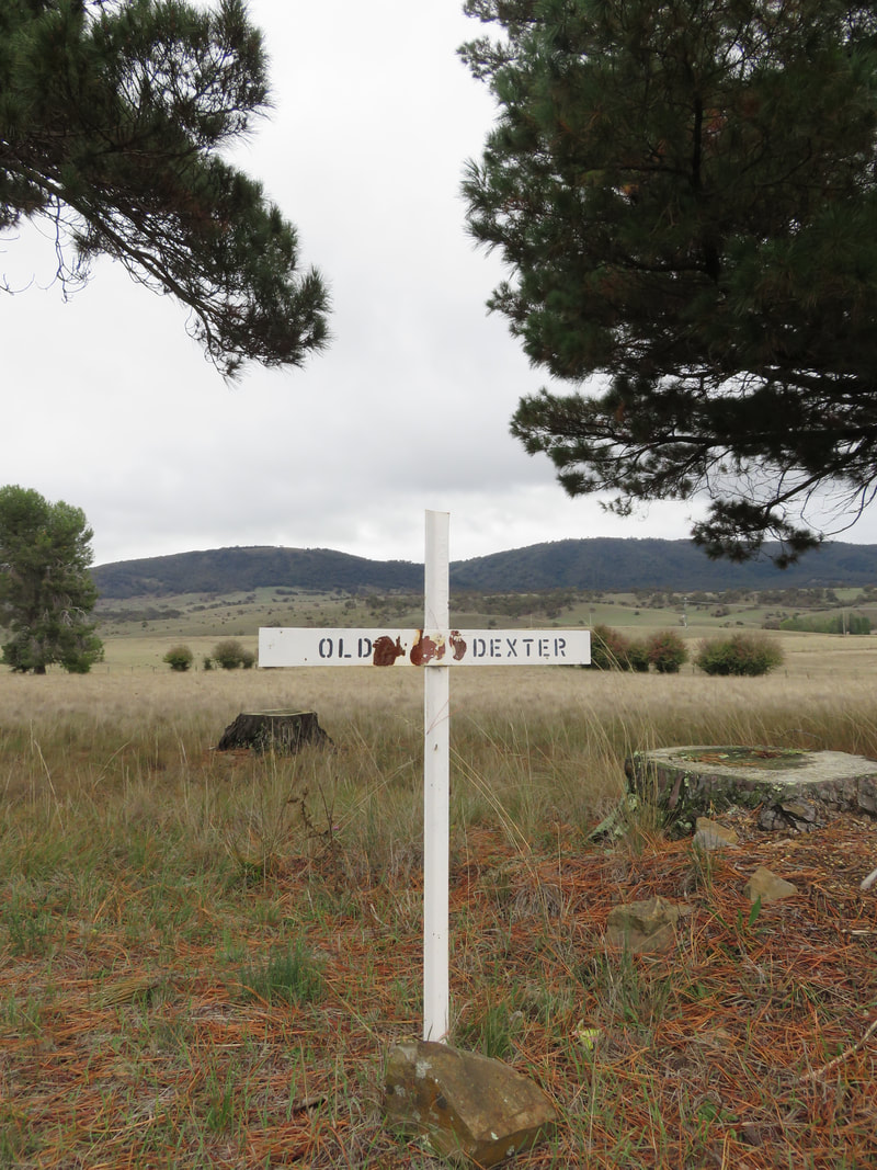
white cross for old dexter
Old Dexter, Boloco Cemetery, Beloka
So in the end, Dalgety did not become the Australian capital; it lost the race. And then, sixty years later, it lost most of its river - and thereafter much of its irrigation and tourism from fishing, its two general stores, butcher, market gardener, service station and police station. It still has a school, caravan park, hotel and small store/cafe but there are only a few dozen houses in town: it's not a lot, considering it might have been the ‘bush capital’.
river with reeds and a willow
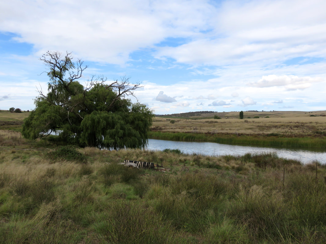
Snowy River near the end of Hickeys Rd, downstream of Dalgety
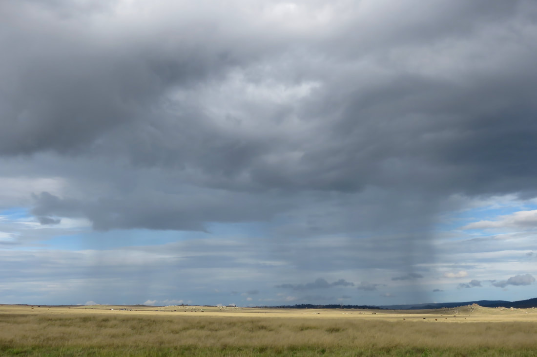
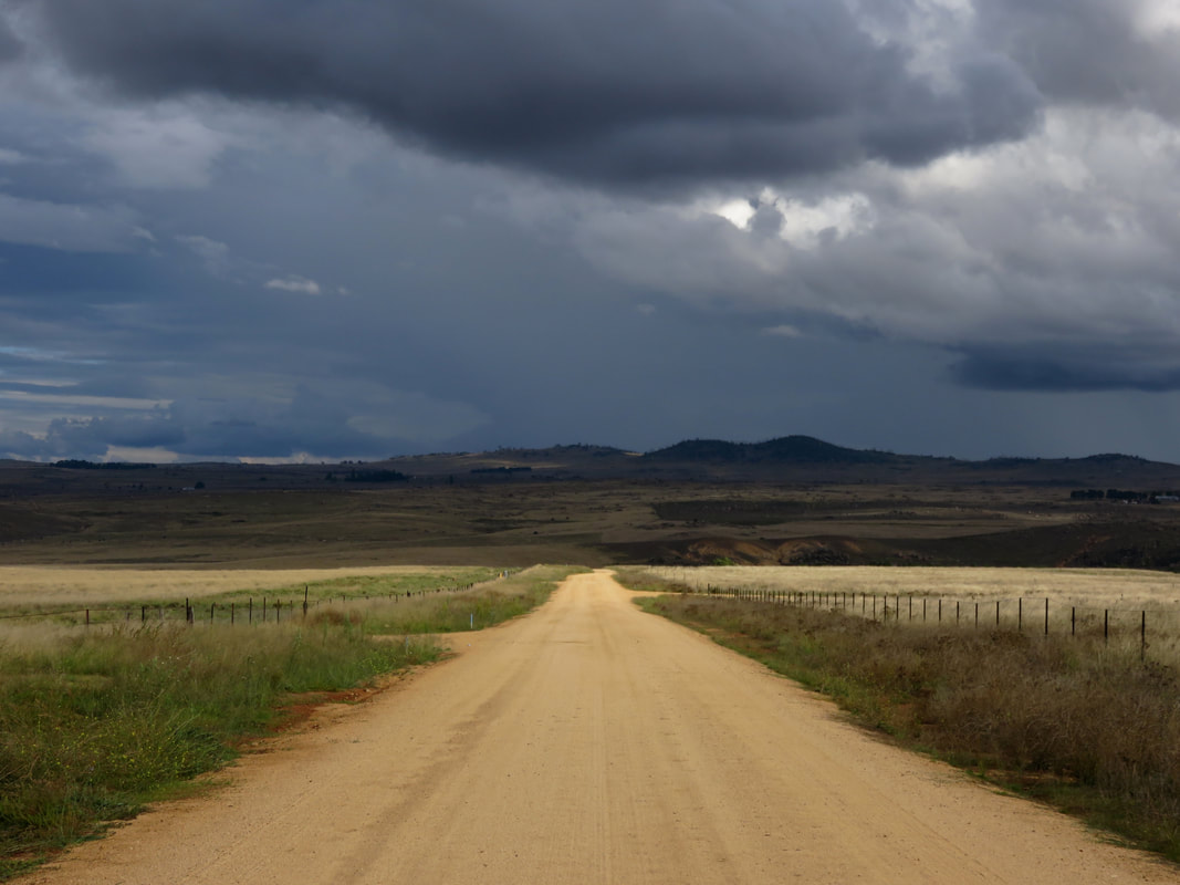
Amusingly, despite the story of the dams and the rain shadow of the Great Dividing Range, it absolutely pissed down on our first evening in Dalgety. But during our few days there, I was lucky enough to see the famed rain shadow in action. I walked out of town and headed down a long gravel road to get a glimpse of the Snowy downstream (above). I watched as a huge rainstorm billowed over the Divide, while only a few dark clouds sporting small skirts of rain made it onto the Monaro.
rain patch
Patch of rain on the Monaro near Dalgety
gravel road leading to distant hills and dark clouds
Hickeys Rd, Dalgety, looking south
Ironmungy Nature Reserve, about 20km downstream of Dalgety, conserves an area of ridge and hilltop bush in the naturally treeless surrounds. The area around Ironmungy, as across the Monaro, has a long history of Indigenous use. Artefacts have been recorded in the reserve, in similar densities as other sites around this part of the Monaro. It’s thought that these spots by the river, with their easy access to water, materials and food combined with the warmer shelter of the woodland environment, would have made good winter campsites. The name itself originates from an Indigenous language, possibly one of the local Ngarigo dialects. (If you’re interested in this kind of etymology, check out Harold Koch’s 2009 article “The methodology of reconstructing Indigenous placenames”.)
dirt track, two people, grass and trees
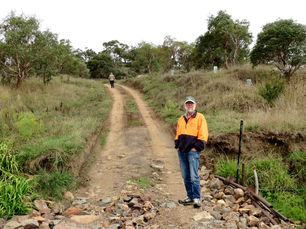
Dan and Dad at Bairds Crossing, Ironmungie Rd / Punt Hill Rd
We visited Ironmungy Nature Reserve on our 4WD day downstream with my dad. Some of the side roads were closed so we headed straight down to Bairds Crossing on the river, spotting a big wedge-tailed eagle as we went. This area was declared a Forest Reserve in 1875, and a State Forest in 1917. NSW National Parks and Wildlife Service is fighting an ongoing campaign to control serrated tussock and willow in the area, as well as blackberry and African love-grass, while rabbits have munched away at the botanical diversity of the reserve and foxes on the prowl have destroyed much native wildlife. But down near Bairds Crossing the Snowy River Rehabilitation Project has replanted the riversides with various native trees, shrubs and grasses. Bairds Crossing itself featured a crunched up, broken concrete bridge, with mangled ironwork poking out the sides. A hand painted sign on the approach, dated from earlier that month (March 2017), warned: BRIDGE COLLAPSE. NO HEAVY VEHICLES.
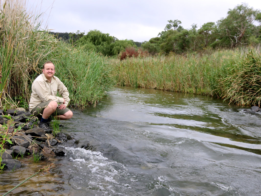
person squats beside reed-lined river
Me and the Snowy River above Bairds Crossing
You can see in the photo above how reeds and other vegetation encroach on what was once riverbed. I have to say that, while small, the river was livelier than I expected - perhaps due to the recent rainfall.
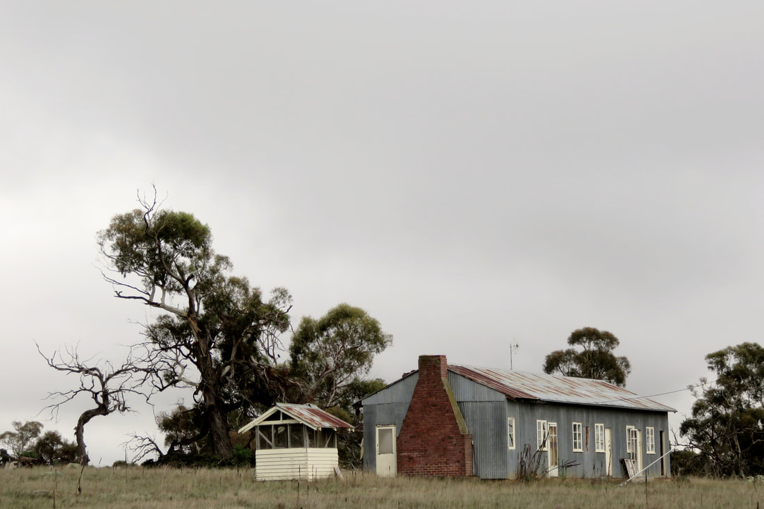
corrugated iron shed
Old shearers' quarters and meat shed, I think off Ironmungie Rd
We drove past many farms and talked with Dad about the history of sheep farming and shearing in Australia. It plays such a big part of the country's colonial (and racist) history, and as we travelled through the Monaro we could see signs of a much more prosperous past - a time when wool was a key part of the Australian economy. There was shearing at a couple of the nearby farms/stations when we were staying in Dalgety; we heard a few people at the pub talking about it. And it was pretty interesting to see this old corrugated iron-clad building a way outside of town. We presumed it was old shearers' quarters. The smaller structure looks like a meat shed - before refrigeration, this is where carcasses would have been strung up and butchered for consumption. The top half would be covered in flywire/mesh to keep the insects out and to let the cooling breeze in. 

The roads took us through grasslands choked with lamb’s ear and thistle and hoarhound, past neat, abandoned farm houses. Perhaps the successful graziers are those who have land elsewhere, somewhere the grass can catch a coastal rainstorm and cattle can put some flesh on their bones before market. Somewhere the local council hasn’t given up on spraying the worst of the weeds. Somewhere the wild dogs don’t terrorise the ewes into miscarrying, or pick off the calves with the tiredest mothers.
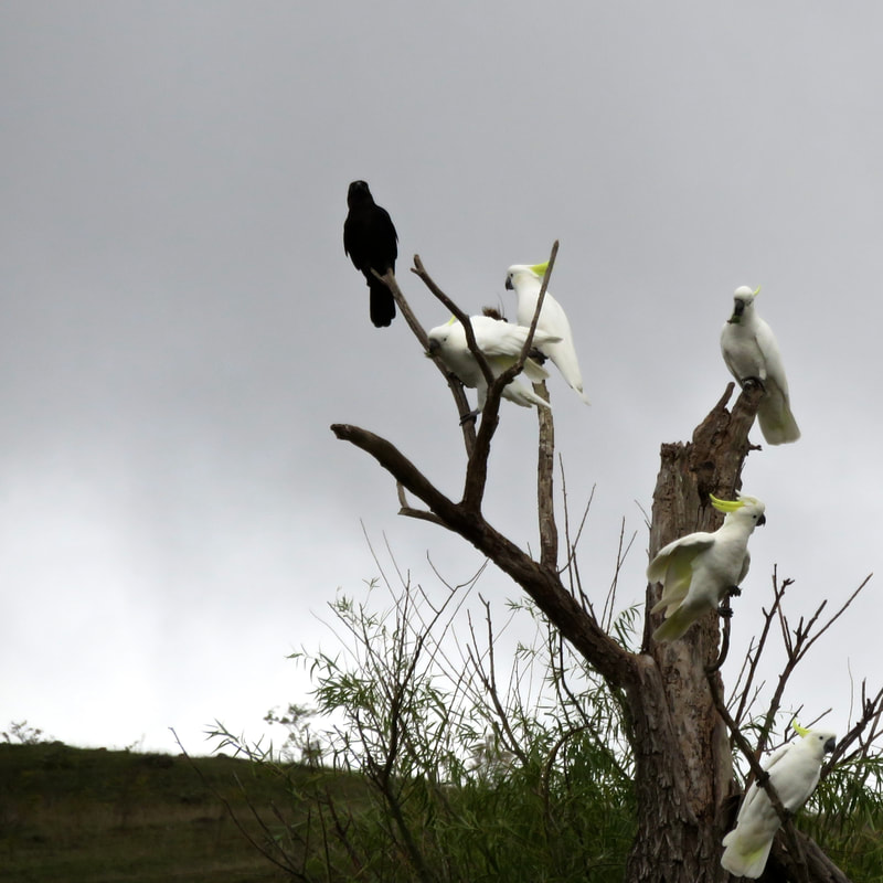
cockatoos and a crow
Crow and cockies, Ironmungie Rd
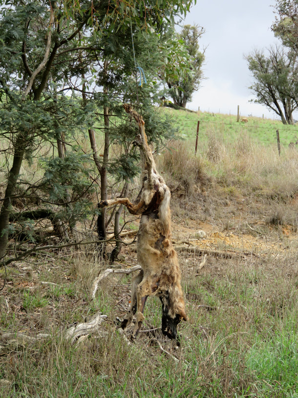
dead dog hanging from a tree
Dead dog/dingo strung from a tree, possibly on Paupong Rd
They say there’s no such thing as a pure dingo around here. Two hundred years of domesticated dogs - run off bush, abandoned, dumped, gone feral - and interbreeding has seen to that. But the dogs we saw strung up from trees and fences, despite the palimpsest of decay, had the typical yellow and cream colouration of dingoes. In the photo above, you can see a jaw that could bite the throat out of a smaller animal and the big, triangular ears that would have pointed, alert and incongruously fluffy, when it was alive.
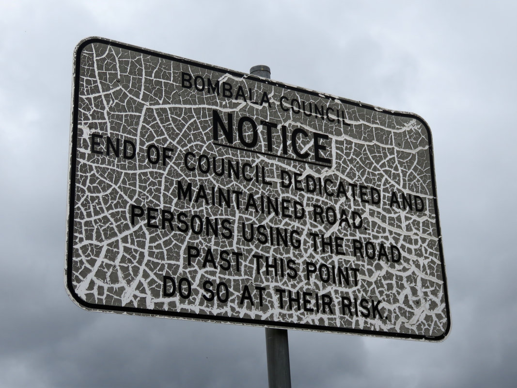
sign that has been crackled
We saw many of these unmaintained roads, often no more than farm tracks running for miles over private property
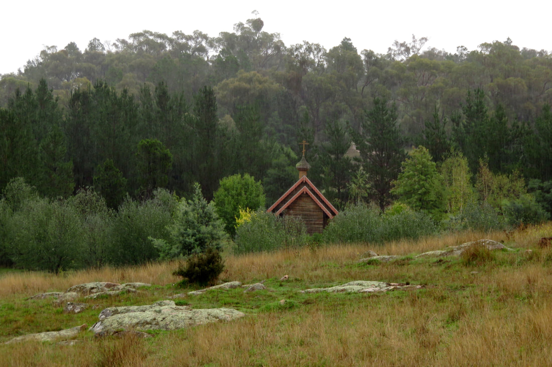
In the hills near Bungarby, tucked away down a dirt track to the river, secluded amongst the trees and granite, it’s astonishing yet strangely understandable to find a monastery. Understandable, because isn’t this precisely the half-wild, hard landscape, sitting on the edges of formal civilisation that people seeking spiritual nourishment have been inhabiting for thousands of years? Astonishing because, in an area colonised by Protestants and Catholics, this is a Russian Orthodox community for women, established in 1999. ​Finding this community, with its connections to far flung places and famous political revolutions, reminded me once again that the Snowy River’s colonial history is not homogenous. We wanted to go down to the river, but thought we'd ask permission first. I ducked out of the rain under a vine-covered verandah and spoke to the Abbess/Mother Superior through the window to the kitchen. She told me the track was pretty sketchy (well, she didn't use those exact words) after the recent downpours and that she didn't fancy having to come to our rescue if we got stuck.
small church roof in trees
Church at the Holy Convent of the Presentation of the Mother of God monastery
We'd had a bit more luck getting down to the river earlier in the day, right on the extremities of what could be described as the Monaro. The road we were following veered into a paddock beside a small, old farm house and became barely more than a smudge in the grass. I knocked on the door, but the house was empty. Halfway up a nearby hill, we could see a couple of people on a bike rounding up cattle and we waved to get their attention. A few minutes later they came down to chat to us, to let us know they were only here for a couple of hours to pick up their mob and take the cattle down to their paddocks down on the coast, a property with more rain and more grass. It was lucky we’d caught them on the right morning! They doubted our car’s chances of getting to the Maclaughlin, but suggested we could drive up and around through their property, park near an old sheep run and bushbash down to the river at the top of Stonebridge. My ears perked up at that, because I’d read about it in George Seddon’s book Searching for the Snowy and knew it's a place not many people get to see. Thanking them, we headed off, following one of the aforementioned unmaintained roads, going slowly - very slowly - over the enormous waterbars until we came to what we thought must be the place they said to park the car.
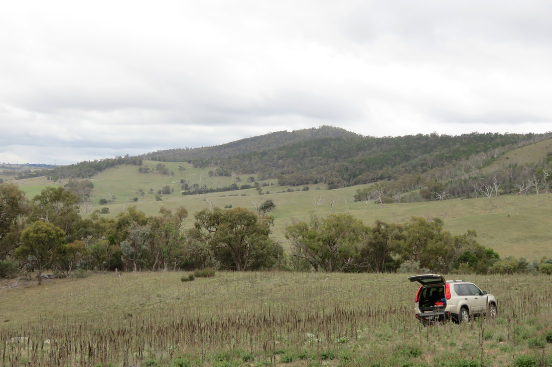
car in a paddock
Parked up in a weed-choked paddock above Stonebridge Falls
We left the car, crossed through the paddock (full of mullein and horehound) and over the ridge, then used the fence line and feral goat trails as our guide as we bush bashed down the steep hill. In the photo above, I think that the dark green trees are the native black cypress pines - quite distinct from the duller colours of eucalypts surrounding them. 
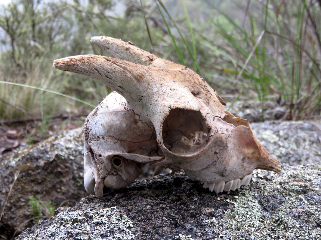
skull of small goat with horns
Goat skull
Our friendly guides had told us to look out for goats and for a big stone outcrop that they called Goat Rock, which they said always had goat poo on it. We knew we were on track when Goat Rock appeared as promised. We'd caught glimpses of the river before, but the view from the top of Goat Rock was pretty special. We scrambled down and across the rocks, made slippery by the drizzle, until we stood beside the river at Stonebridge.
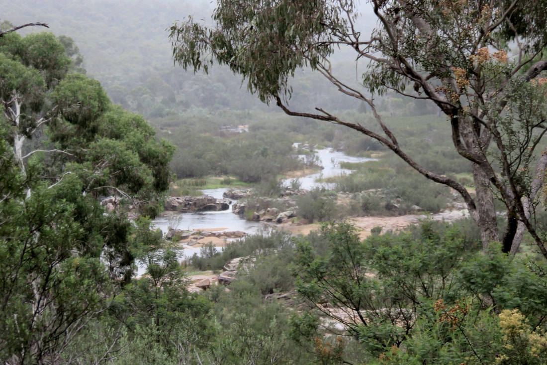
view of river through trees
The Snowy River immediately above Stonebridge Falls
George Seddon describes Stonebridge in Searching for the Snowy (1994:71) like this:
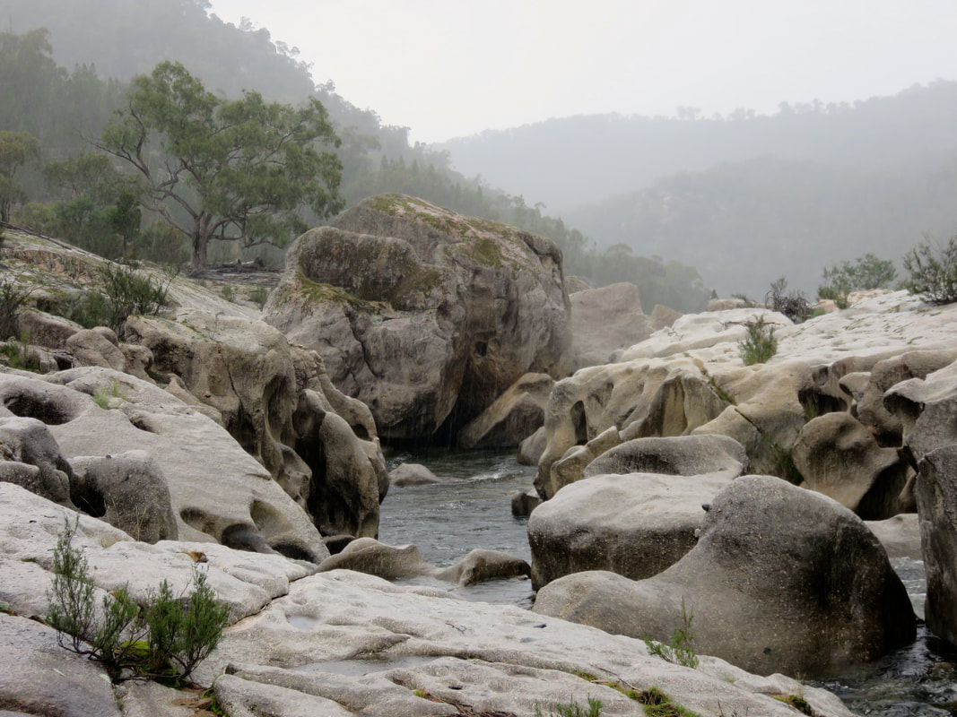
It consists of a drop of perhaps twelve metres over a distance of about 200 metres, but it is not an ordinary rapid so much as a massive and intricate piece of rock sculpture. The rock is a hard, dense and mostly fine-grained granite, with many inclusions (xenoliths) of a dark rock that had been shattered by the molten granite as it was squeezed into place below the surface of the earth. This granite has a massive jointing system, planes of weakness set at right angles, three or four metres apart. The rock has not weathered into the usual rounded boulders, but into great cubes, although the edges have been rounded and under-cut. The result is a series of almost horizontal rock pavements, almost vertical rock walls, and deep slots. At one point, the entire river disappears into one of the slots, where it can be heard and sometimes glimpsed moving with great force some four metres or so below, eventually to emerge from fissures and slots lower down. There is no real ‘bridge’, and it is quite difficult to clamber across because of the changes in level and sheer faces, but the river itself is well out of sight.
The photo below shows the river disappearing under the granite, and the sculptural dips, curves and wells created by the action of water over millennia. It felt like a very special place. I would have loved to spend a few hours or even a whole day exploring the rocks, but the rain started sheeting down and lunch was waiting for us back up the hill in the car. This was the last point we were able to access the Snowy for a good long way and, as such, it symbolises to me the river's gateway out of the Monaro High Plains. Beyond here, the river gorge becomes ever deeper, the hills larger, the roads and tracks less accessible . . . Next time, our attempts to see the Mysterious Middle Snowy!
water-sculpted granite slabs in rain
Stonebridge Falls
It's been a year since we set off on this adventure, and several months since I said I'd be "back in a couple of weeks" with this batch photos - sorry for the delay! The next bunch of pics will probably also take a month or three to appear. In the meantime, check out my overview of the trip, the photos from the high country and pics from the Snowy Mountains Scheme/Snowy Hydro.
2 Comments

    In which I

    In which I do things and write about them

    RSS Feed

    In which I tag

    All
    #30DaysWild
    Art And Architecture
    Audio And Music
    Australia
    Battle Observer
    Birmingham
    Books And Stories
    Bristol
    Buckinghamshire
    Cambridgeshire
    Cooking
    Cycling
    Devon
    East Sussex
    Eating And Drinking
    Film And Video
    Foraging
    Gardening
    Gippsland GunaiKurnai Country
    Grand Union Canal
    Hastings Independent
    Hertfordshire
    Heysen Trail Prep
    Housekeeping
    Imagining
    Interviewing
    Kent
    Lake Field
    London
    Manchester
    Marketing
    Melbourne Wurundjeri Country
    Microadventure
    National Trust
    Netherlands
    Norfolk
    Northumberland
    Paddling
    Q&A
    Reporting
    Review
    Share The Love
    Sheffield
    Snowy River
    Somerset
    South Gippsland Bunurong Country
    Suffolk
    Swimming
    Tea
    Victorian High Country Jaitmathang Country
    Victorian High Country Taungurung Country
    Wadawurrung Country
    Wales
    Walking
    West Sussex
    Wiltshire
    Year Of Sleeping Variously
    Yorkshire

    In which I archive

    July 2022
    June 2022
    May 2022
    April 2022
    March 2022
    February 2022
    January 2022
    October 2021
    September 2021
    March 2021
    December 2020
    February 2020
    January 2020
    December 2019
    November 2019
    September 2019
    August 2019
    July 2019
    April 2019
    March 2019
    December 2018
    November 2018
    October 2018
    August 2018
    July 2018
    June 2018
    May 2018
    April 2018
    March 2018
    January 2018
    December 2017
    November 2017
    October 2017
    July 2017
    June 2017
    May 2017
    March 2017
    February 2017
    January 2017
    December 2016
    November 2016
    October 2016
    September 2016
    August 2016
    July 2016
    June 2016
    May 2016
    April 2016
    March 2016
    February 2016
    January 2016
    December 2015
    November 2015
    October 2015
    September 2015
    August 2015
    July 2015
    June 2015
    May 2015
    April 2015
    March 2015
    February 2015
    January 2015
    December 2014
    November 2014
    October 2014
    September 2014

Powered by Create your own unique website with customizable templates.