IN WHICH I
  • ... Write
  • ... Explain

An early autumn walk around Sedlescombe, East Sussex

29/1/2016

0 Comments

 
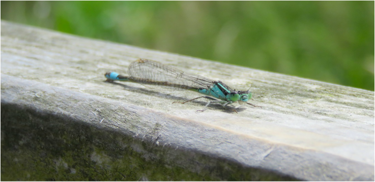
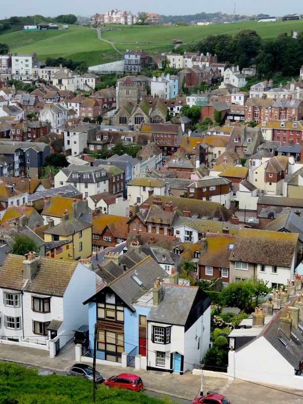
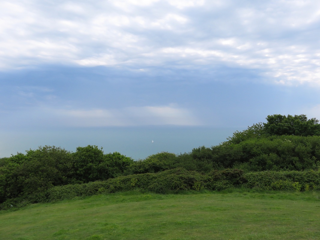
I've just realised that I never posted this walk report! It's a 8.5km (5.5mi), 2-3 hour circular walk starting in Sedlescombe, East Sussex. I hope you enjoy the memories of warmer times . . .
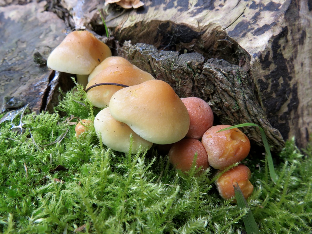
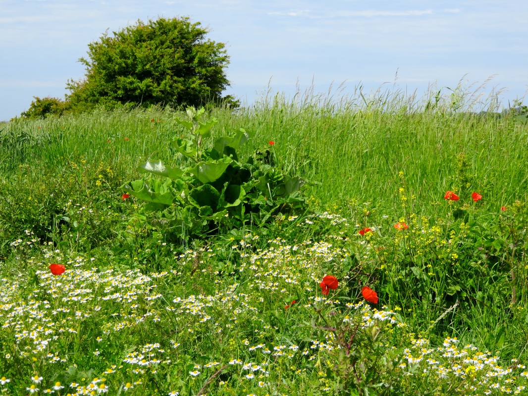
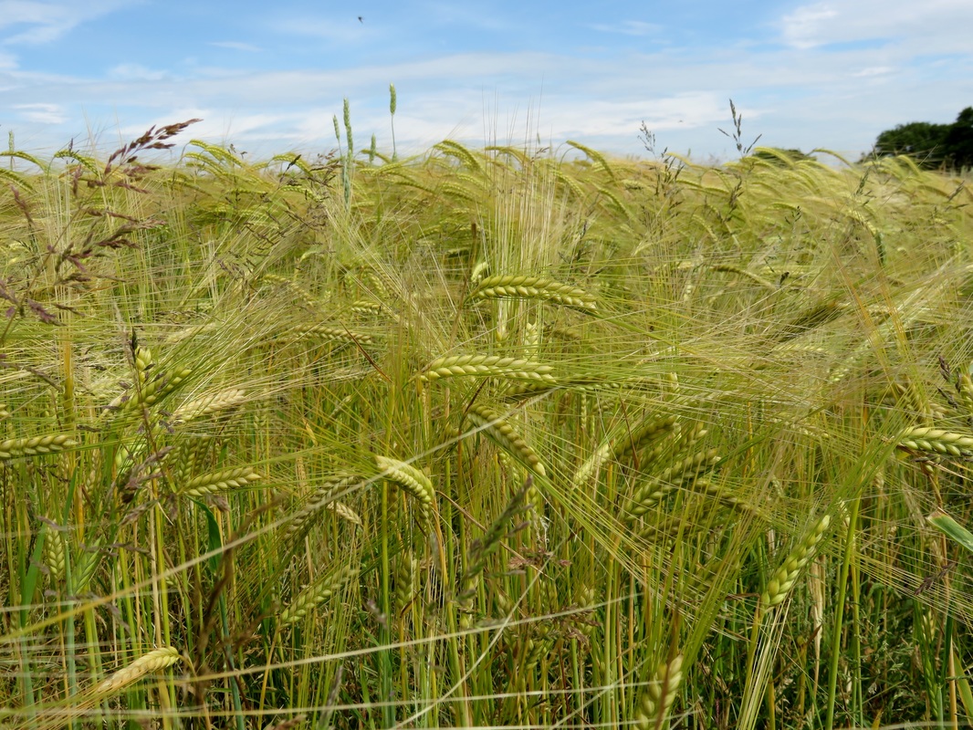
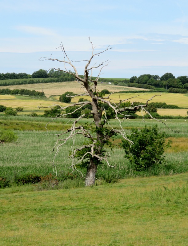
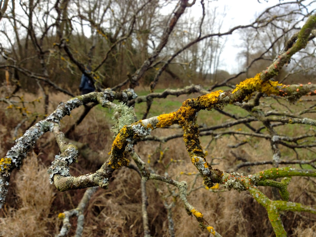
The Brede valley sparkles in the sun after a late morning shower. All around us is evidence of seasonal change: blackberries ripening, sloe bushes crammed with purple berries, and young trees peppered with cobnuts and tiny acorns. We even find some giant puffball mushrooms, big as footballs, in the grass nearby.
Picture
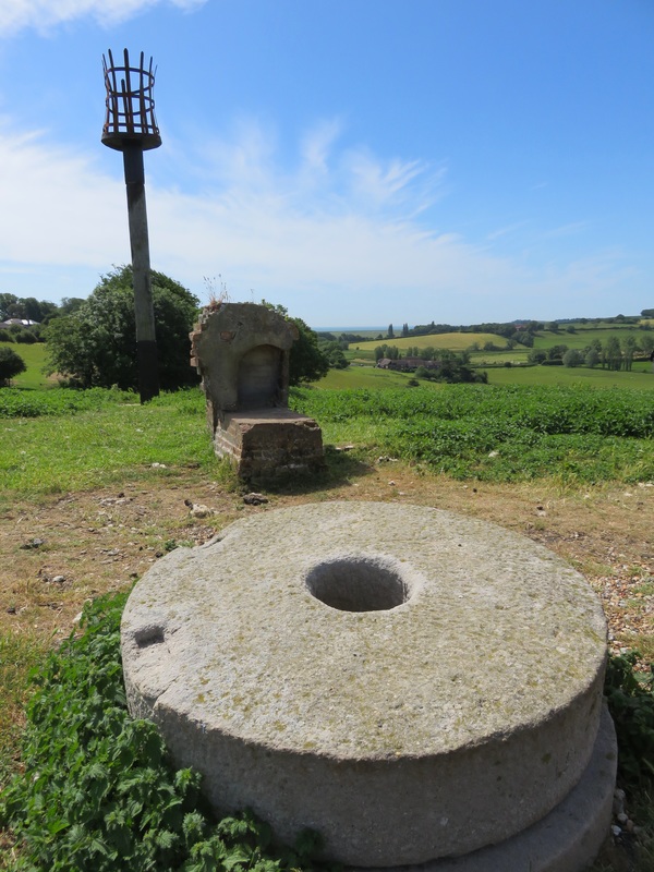
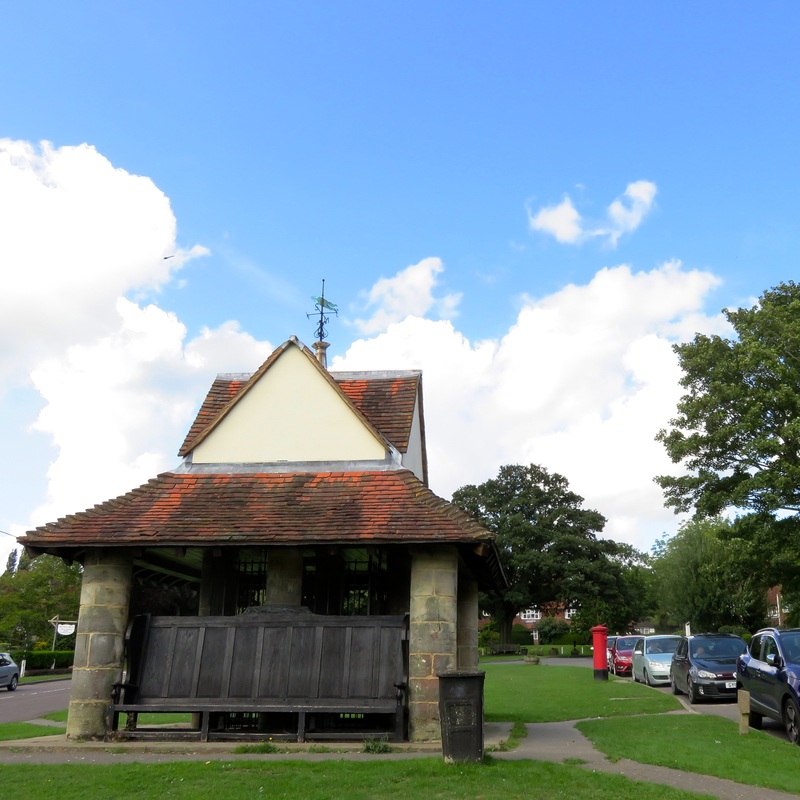
The Pump House, Sedlescombe Green.
Picture
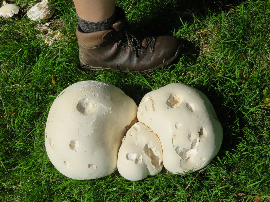
Giant Puffballs - yes, we took one home and ate it!
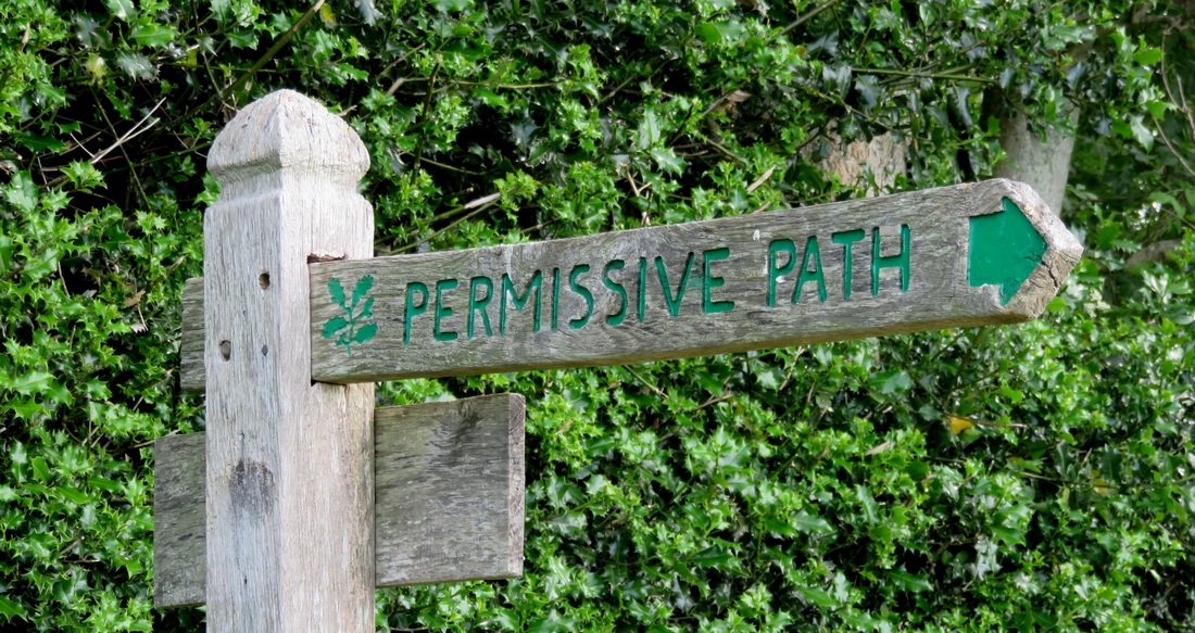
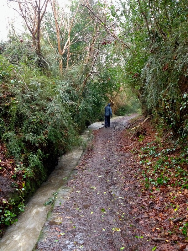
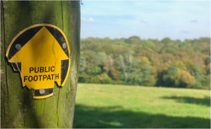
But this jumble of late summer growth has its downside for walkers. Our way is soon blocked by undergrowth that seems intent on tormenting us: tangled brambles and dog rose, waist-high stinging nettles and the sharp spikes of thistle and teasel. I whip out the phone and report these obstructions to the Ramblers.
Picture
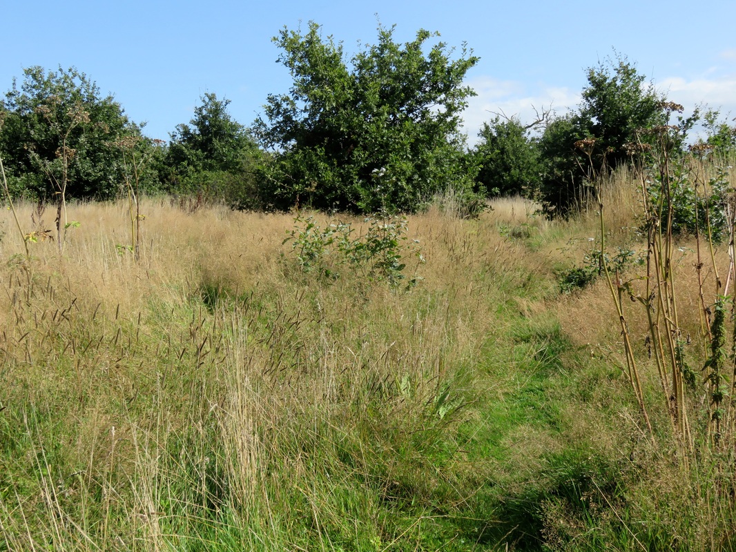
Late summer tangles.
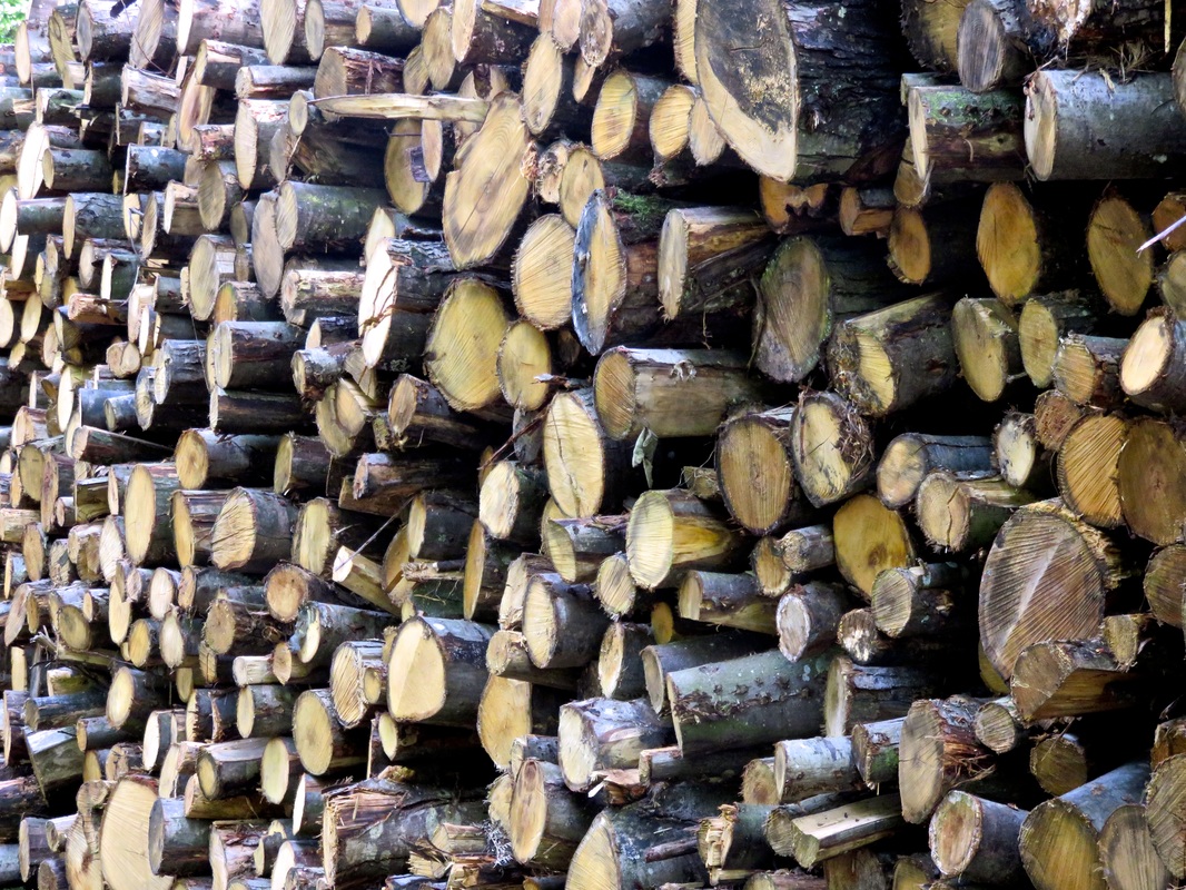
Picture
Wood pile.
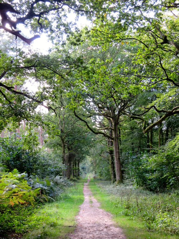
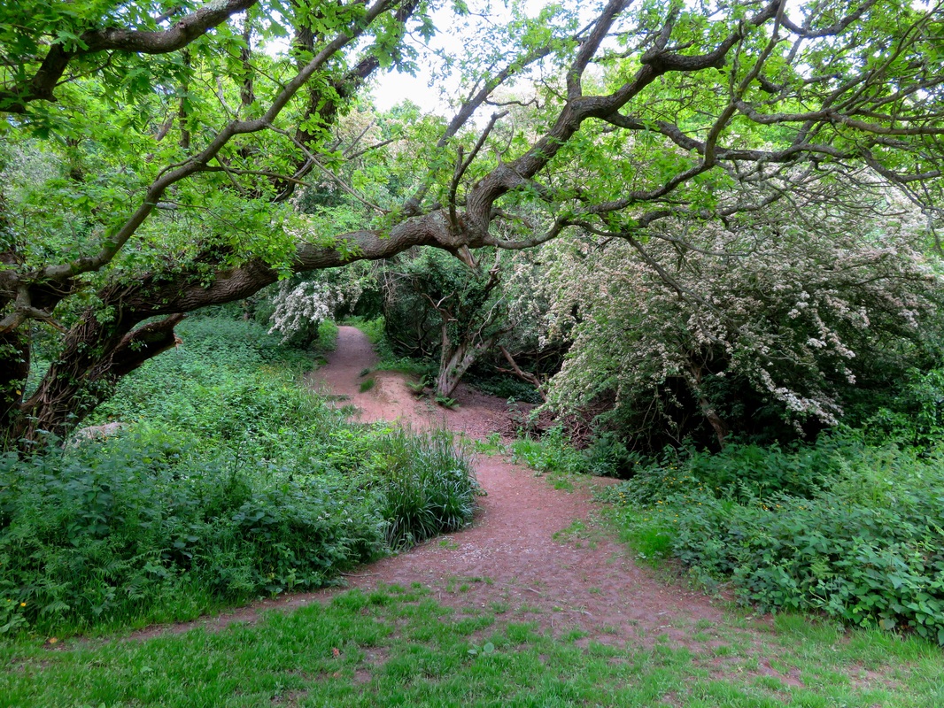
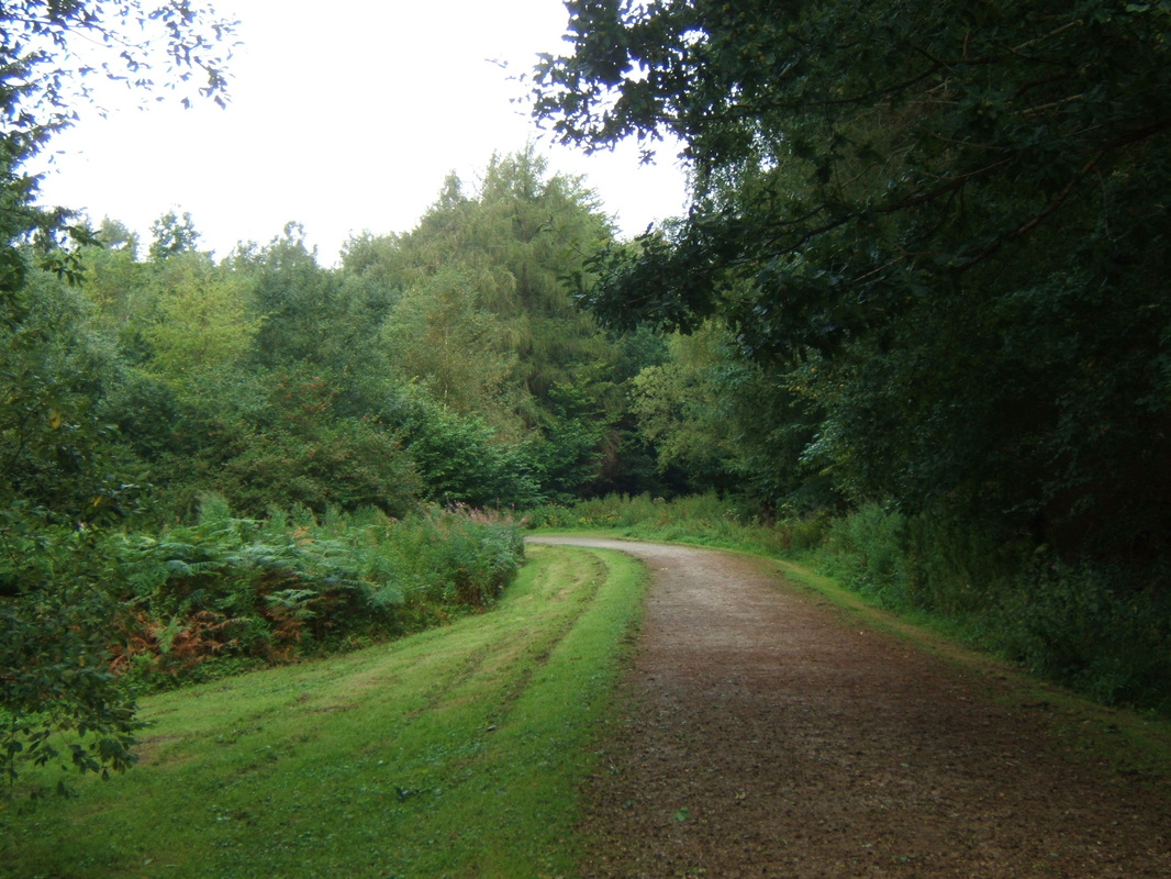
After battling the thorns, it’s a relief to find our way onto Brede Lane then to slip into the cool shade of Horn’s Wood. Dim, green light filters down (the leaves haven’t yet turned autumnal) and the fresh smell of damp wood suffuses the air. We pass a pile of timber, cross another road and continue, discovering tiny streams and catching flashes of Powdermill Reservoir through the trees.
Picture
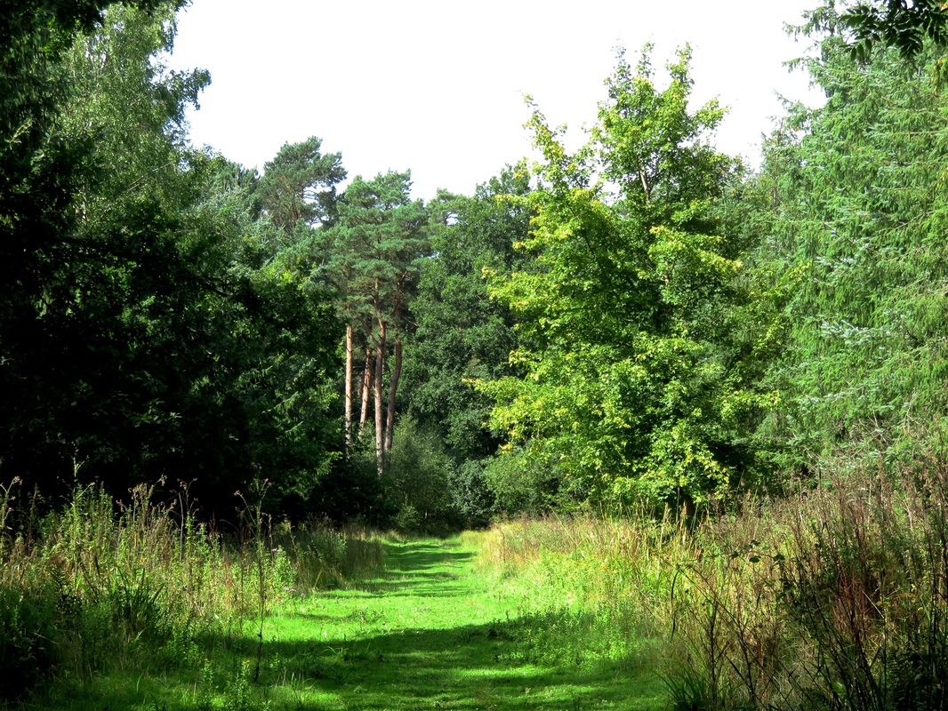
Green path in Brede High Woods.
Picture
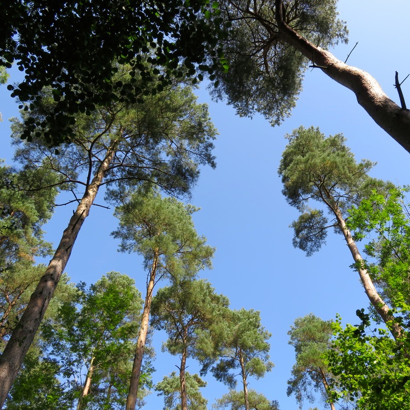
Conifers, singing in the breeze.
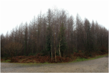
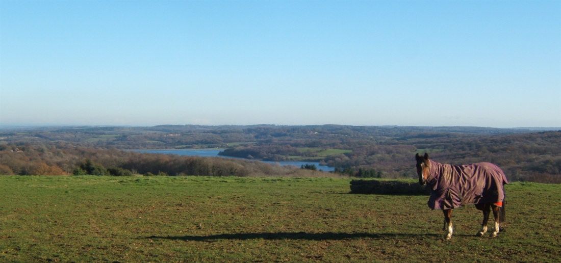
The sighing of conifers in the wind ushers us along the edge of Brede High Woods. A couple of hours wandering through here could easily turn this walk into a full afternoon’s ramble. A sign informs us that wild Konik horses are grazing here to help “maintain the wildlife-rich mosaic of habitats” of the area . . . but we don't see any!
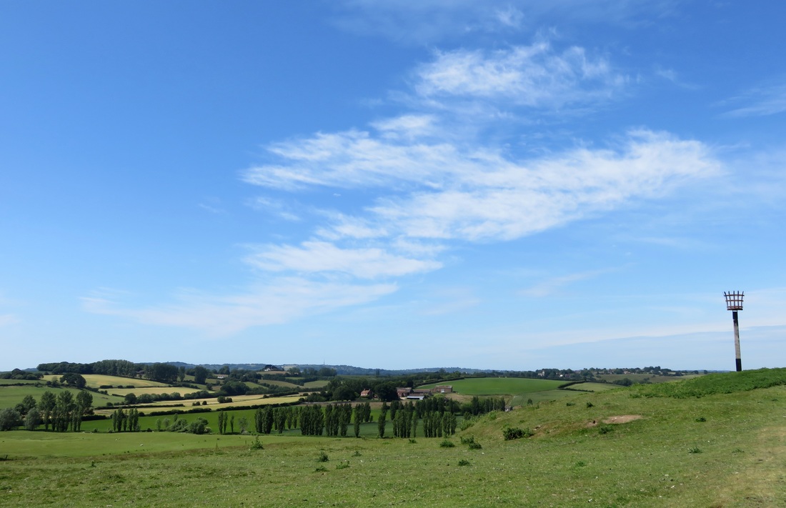
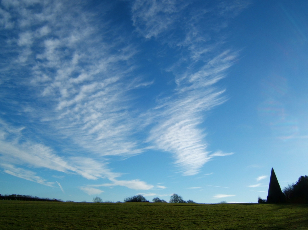
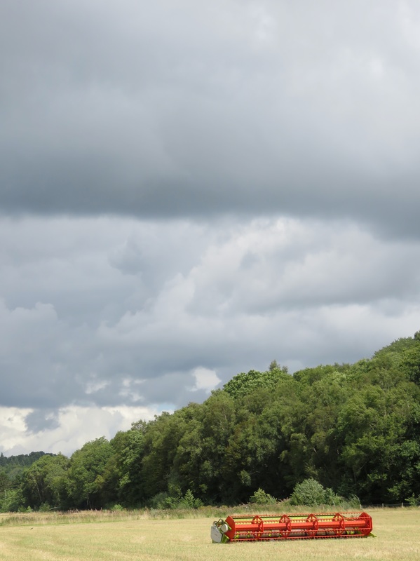
Picture
A splash of colour under a grey sky.
Picture
Tall cumulus clouds.
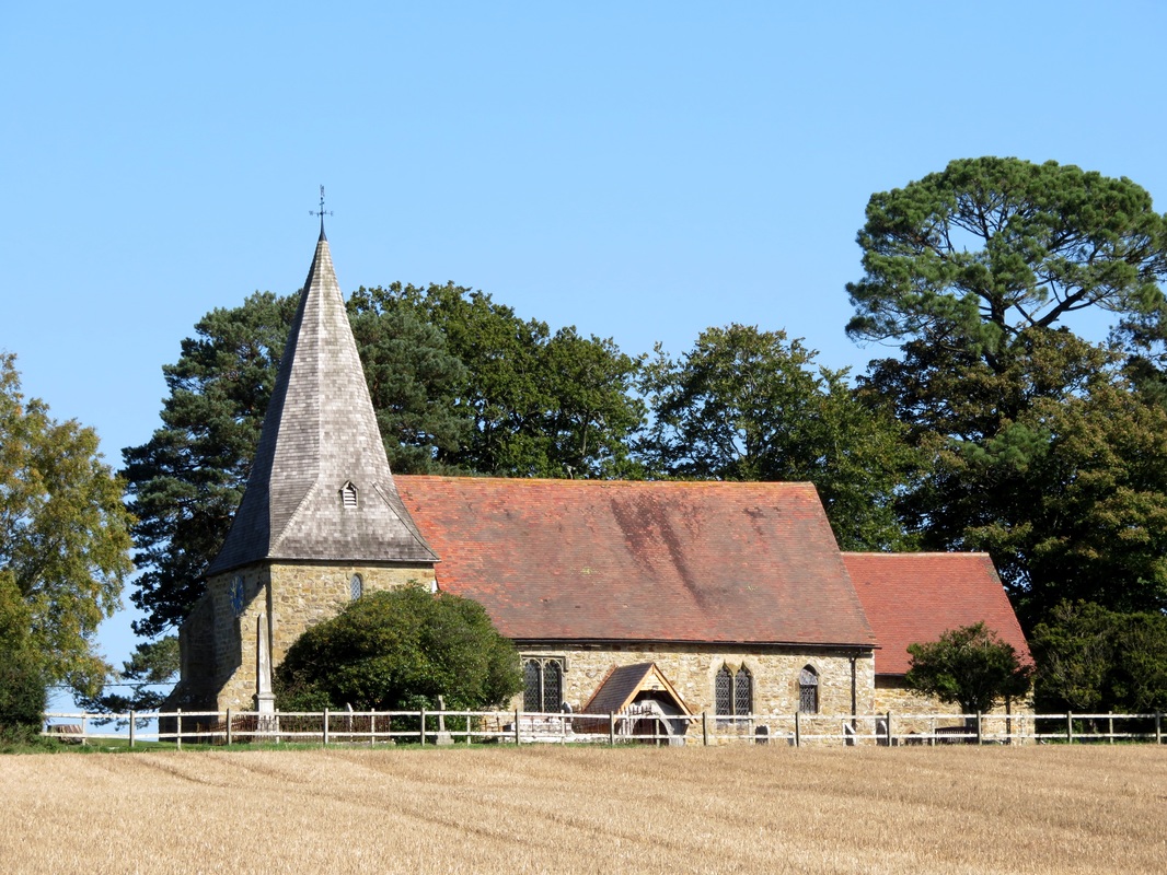
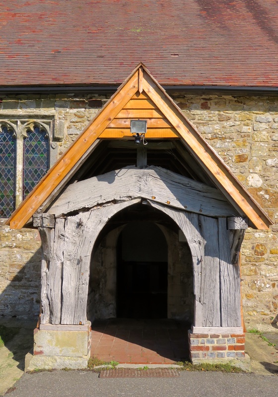
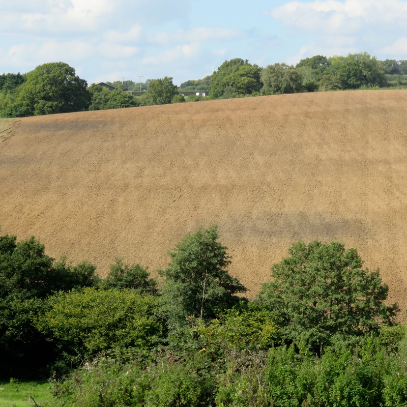
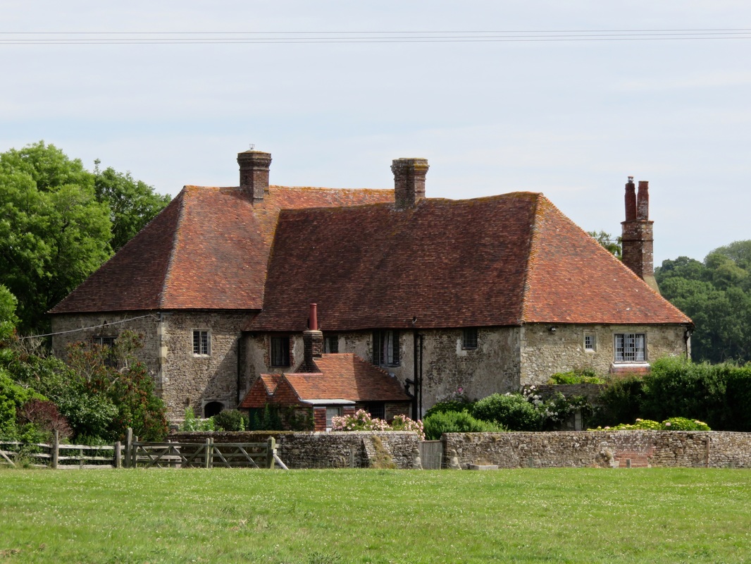
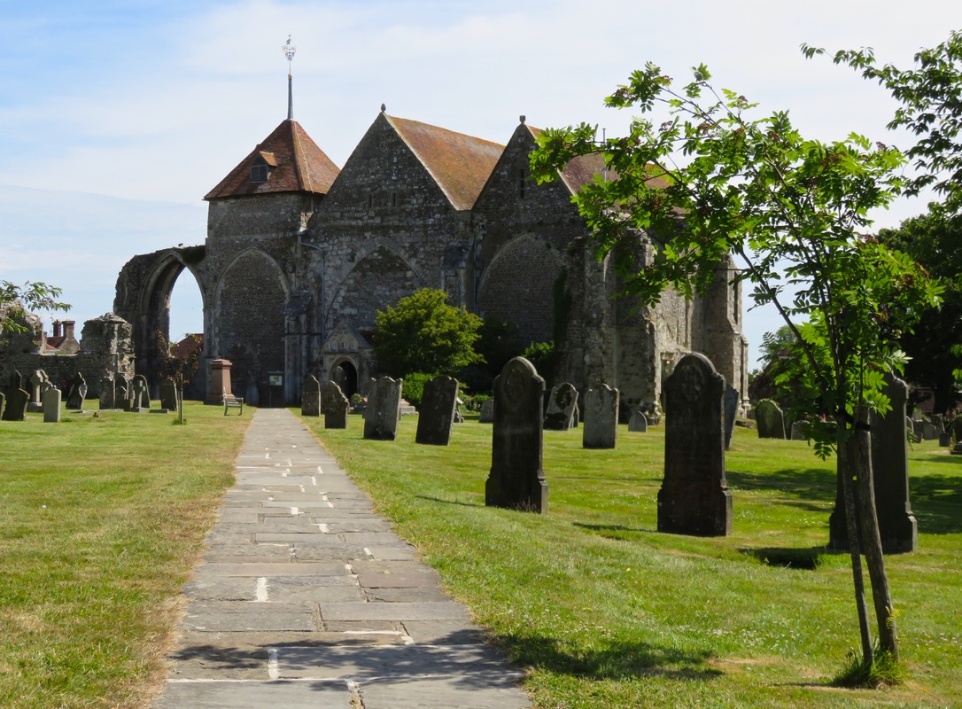
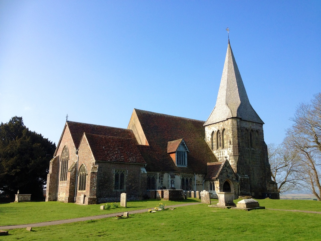
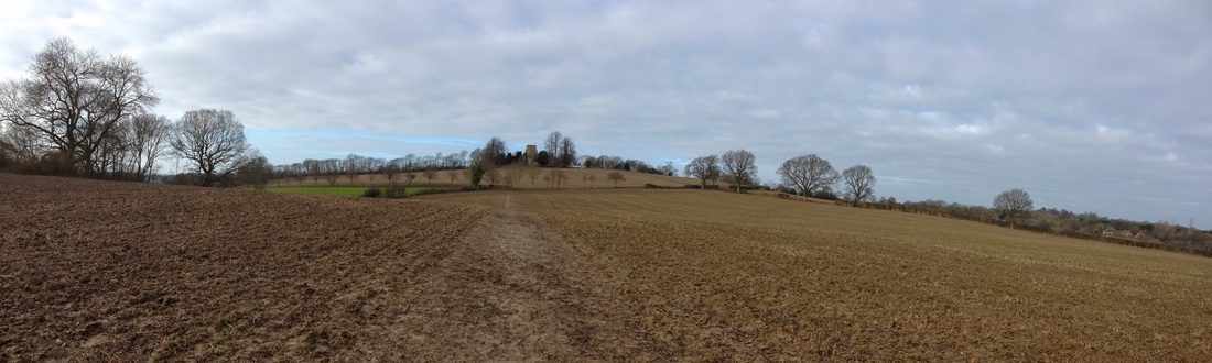
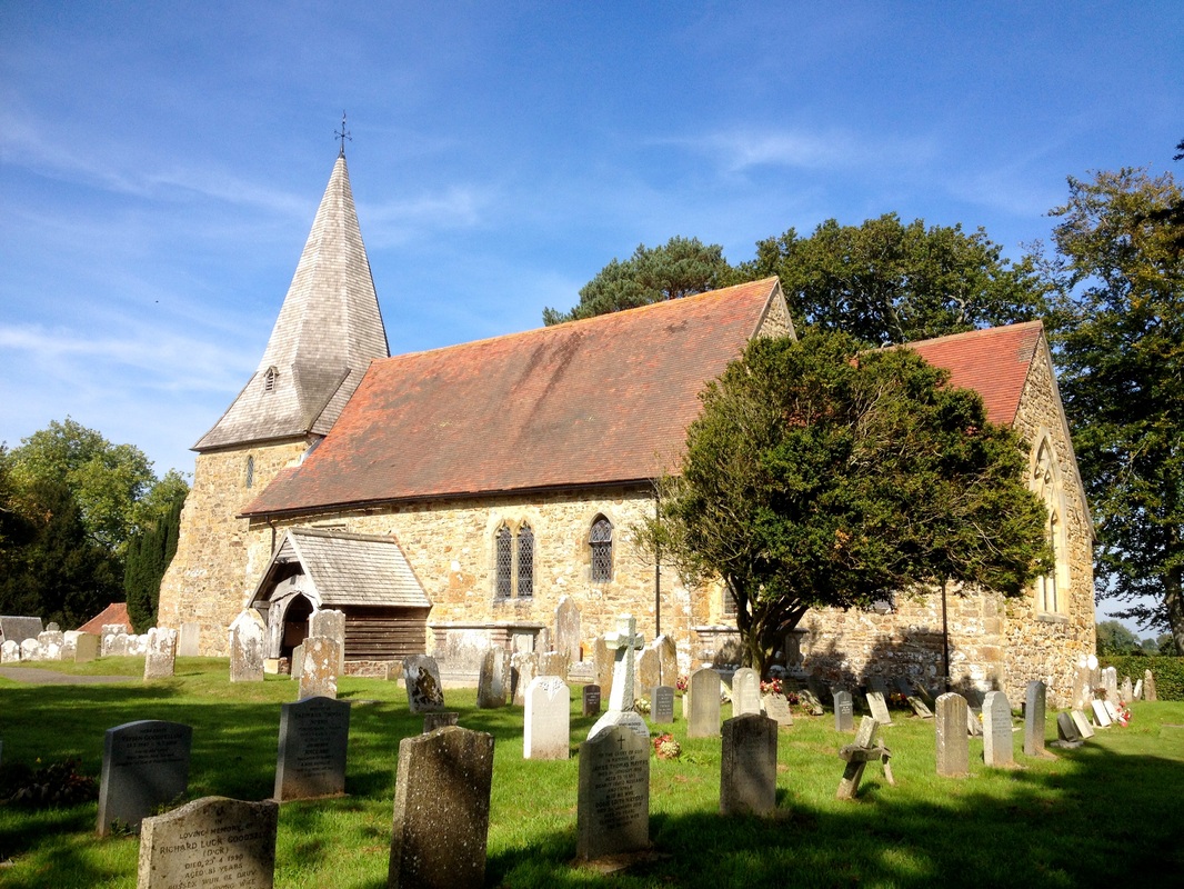
We keep an eye on the cumulus clouds blooming above us as we cross an open field and squeeze along a fence beside some attractive houses. A quick detour allows us to visit the peaceful parish church, but we don’t linger: it’s getting on for lunch and we know the chunky chips at the Queens Head are waiting. One of the problems doing a circular walk from a pub is the lure of food!
Picture
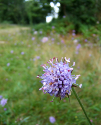
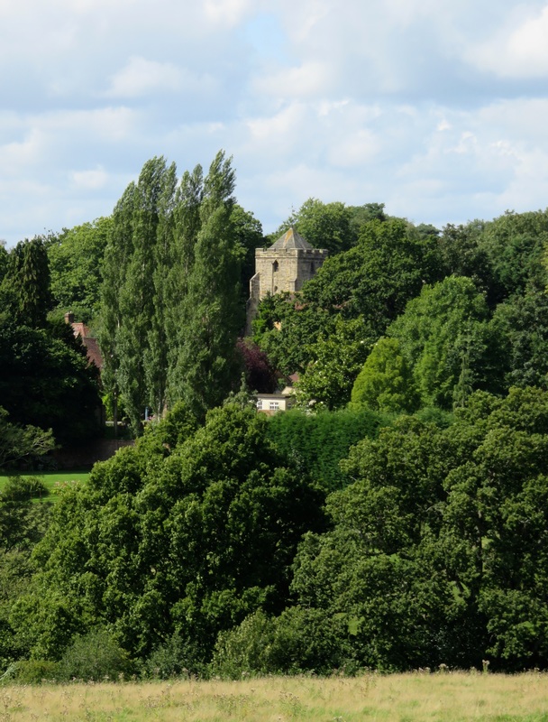
Sedlescombe Church peeking out through the trees.
Picture
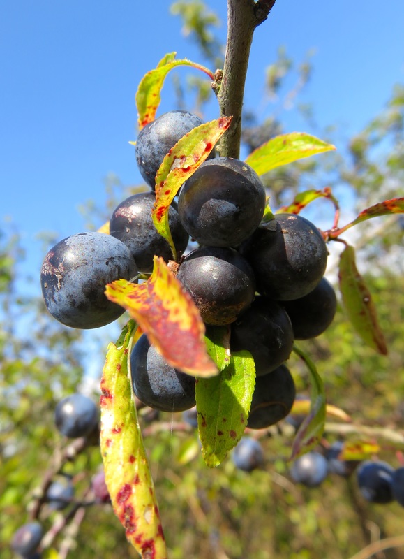
I didn't get a photo of the plums, so have some ripe sloes!
I can’t resist plucking a ripe plum from an overhanging branch as we make the easy downhill stroll back into pretty village of Sedlescombe. The scent of lavender wafts from a nearby garden and the village geese wander around the old pump house on the green. ​If this sounds rather idyllic, it is. Scratches and stings from our earlier run-ins with the local vegetation forgotten, we relax in the pub’s sunny beer garden and enjoy what might be the last of this summer’s warmth.

A version of this article first appeared in the Battle Observer (read all my articles for the Observer series here). I don't like to be a cliche of a UK-dweller, but I'm already dreaming of the long, warm, slow days of summer . . . the sound of leaves in the breeze . . . the tall grass tickling my legs as I walk . . . the sunshine soaking into the soil . . . ahhh!

0 Comments

Walk: Robertsbridge to Battle

22/11/2015

6 Comments

 
One year ago, I wrote my first walking piece for the Battle Observer: a walk from Battle to Robertsbridge. For my anniversary (and my last piece for the near future as I'm back in full-time work), I thought I'd walk the distance in reverse, on a slightly different route, and end at home.
Footpath beneath green trees, beside fields
Footpath near Robertsbridge.
There's a footpath marked on the map, but the gate is padlocked. Fortunately, a woman appears with a friendly history lesson and alternate directions. “It stops just there,” she explains. “The workers used to come this way from their cottages. An ostler lived here right up until the 1960s! You need to go through the new estate, now, instead.“
Red berries, green leaves
Hawthorn berries and rosehips in the hedgerows.
That first obstacle overcome, it’s an easy walk out of Robertsbridge, under the rail line. In the morning sunshine, we head up a long driveway to the site of the twelfth century Glottenham Castle. Robins, tits and warblers flit about, singing among the leaves. A few pheasants burst alarmingly from the long grass. Any remains of the castle have long since disappeared under the trees, but the moat is still visible - albeit through a chickenwire fence. Deep red hawthorn berries and scarlet rosehips adorn the hedgerows. A small wind turbine spins lazily in the breeze.
Church with steeple
All Saints Church, Mountfield.
Church porch
Repair work at the church.
Mountfield Lane is quiet as we follow it to All Saints Church. We stop for a thermos of tea and I pop inside to see the font (apparently one of the biggest in England). I notice that new wooden pegs have been used to repair the ancient, weatherbeaten timbers of the porch.
Small, orangeish mushrooms
Pudgy little mushrooms in the moss.
South of Mountfield, near the plume of steam that marks the gypsum processing plant, we miss the path and spend a while wandering up roads and poking our noses down the sides of gardens before rediscovering our whereabouts.
Smoke rising from trees
Distinctive: British Gypsum lives here.
Path through trees
The old coach road near Netherfield.
The path takes us through stands of beech and chestnut. Mushrooms of all kinds nestle under the fallen leaves. There are more mushrooms at a nearby farm, but they’re rather outdone by three inquisitive alpacas that follow us at a circumspect distance through their field. ​
Alpacas in green field
Two curious alpacas.
We resist the lure of the pubs at Netherfield - we have a lunch date in Battle - and instead take an old coach road downhill, through the woods. After slip-sliding our way across a muddy section churned up by forestry machinery, we emerge at a small lake. This is labelled “pond bay” on our map, so it was probably once the site of a blast furnace for extracting iron ore.
Archery targets in field
Bullseye targets at Beech Farm.
A group of archers is practicing at Beech Farm, bullseye targets lined up along the field. Their arrows ask a quiet, whistling question as they fly: phweet? The thok when they hit their targets is the answer. The archers don’t speak, and I don’t like to break their concentration. Phweet? Thok. Phweet? Thok. There are other targets in the field: statues of sheep and deer . . . and a tiny stegosaurus. If East Sussex goes all Jurassic Park on us, these archers may be our best line defence.​
Small plastic statue of dinosaur
Stegosaurus target.
Field on hill
Crosshatching on the fields.
We’re almost home - just one final hill to climb - and my belly is rumbling. It’s been a glorious morning, but now the clouds are massing overhead. We make it to Battle just in time to catch our friends at Bluebells. I'm ready for a well-earned lunch and a lazy afternoon.

This walk is about 12km/7.5mi long and is an easy-moderate grade with a few hills. You can download a GPX file of the walk on the right. This article first appeared in the Battle Observer, Friday 8 October 2015, p72.
Robertsbridge to Battle.gpx
File Size: 9 kb
File Type: gpx
Download File


6 Comments

Walk: Battle to Bexhill on the 1066 Country Walk

18/10/2015

8 Comments

 
Oh, I do like to be beside the seaside! It’s easy to jump in the car and head to the beach, but there’s a lot of satisfaction to be gained from walking there instead. This 12km (7mi) walk from Battle to Bexhill follows the Bexhill link of the 1066 Country Walk long distance path.
Picture
We set off from Battle Abbey a bit after 10am. Washed clean by yesterday’s rain, the scenery is bright with pink willowherb and cheerful yellow ragwort. Along the track past Peppering Eye Farm, a stream is running high and fast.
Picture
Despite the wetness, our way remains relatively clear until we hit mud in the RSPB nature reserve at Fore Wood. There, we watch bees, butterflies and electric blue damselflies flitting around frothy white heads of meadowsweet. A sign in a pond warns unwary visitors about the local crocodiles, insects dance in a brilliant pool of sunlight and a jay screeches overhead. Through the woods comes the muted rumble of a train passing on its way to Hastings.
Picture
Picture
We cross a field of ripe wheat, wild chamomile underfoot, and find ourselves in Crowhurst. We detour to look at the church, the neighbouring ruins and the huge old yew tree in the churchyard. There are many possible reasons for yew trees being planted in churchyards. One explanation is that while yew is good for making bows, it can be lethal to grazing animals, so planting yew trees in churchyards meant farm animals would not be poisoned.
Picture
The walk soon enters Combe Haven, where a colourful sign describes the flora and fauna we might see. Someone has keyed a gash across the map, reflecting the vandalism ahead of us, where the open wound of the Hastings-Bexhill link road cuts through the valley. The construction team can’t be faulted in its treatment of walkers: paths and signs thread us easily through the site. But it’s hard to believe anyone could approve the destruction of such a beautiful and (until the traffic arrives) peaceful place. If you’re going to do this walk, try to do it now, while it’s still possible to stop in the warm silence beside the water and hear only birdsong. Swans glide through the reeds and a heron sweeps overhead.
Picture
Up the hill and over the line of what was once a railway, we enjoy the last piece of rural quietness before entering suburban Bexhill. I feel like a bit of a Nimby, but I hope the planning application for 1,000 new houses here is not approved. The 1066 Country Walk waymarkers peter out at Bexhill Old Town and from there it’s a pleasant stroll through the pretty Manor Barn gardens and down to the seafront.
Picture
Picture
We meet up with a friend to scoff some well-earned chips for lunch. Afterwards, we bask in the sun on the beach near the De La Warr Pavilion, listening to the waves rake the pebbles. I do like to be beside the sea!
Picture

A version of this article first appeared as "A summer's country walk to the seaside" in the Battle Observer, Friday 21 August 2015, page 59.

8 Comments

Walk: Icklesham-Winchelsea circular route

8/10/2015

2 Comments

 
Going on a favourite walk is like catching up with an old friend: I look forward to it; it’s comfortable, fun and familiar. This is one of those walks. We return to it a few times each year, so anticipating and marking the seasonal changes is like sharing news or gossiping and hatching plans.
Hogg Hill windmill
Hogg Hill Mill. The house looks like a cut out in this photo, don't you think?
The scent of summer flowers follows us as we crunch the gravel out of Icklesham and into the fields. We keep an eye out for the stone circle a little way off the path. It’s been there only a few years, tricking passers-by into thinking they’ve found an ancient relic.
Stone circle
The very not-ancient stone circle.
Wildflowers
Wildflowers.
Near Hogg Hill Mill, butterflies dance in tall drifts of grass, swallows speed low across the field and baby rabbits blink at us, fearless with youth. Apparently, Sir Paul McCartney has a recording studio in the mill. We’ve never seen him, but that doesn’t mean he isn’t looking out the windows of the roundhouse enjoying the vista over Pett Level and the sea.
Permissive path fingerpost
A fingerpost points out a permissive path through a National Trust field.
Further on, we enter National Trust land. The trust owns Wickham Manor Farm, once home of William Penn, the founder of Pennsylvania. We admire New Gate, built in the 14th century as part of the ancient wall around Winchelsea, now arching over Wickham Rock Lane. A cuckoo calls nearby. 
Barley
A field of barley.
Manor house
Wickham Manor Farm.
Winchelsea is drenched in the sweet smell of roses and honeysuckle. We stop at the impressive church to watch a flock of swifts perform their daredevil flights through the tall ruined arches. Behind us, three people have made a pilgrimage to Spike Milligan’s grave. “Dúirt mé leat go raibh mé breoite” it reads - “I told you I was ill.”
Dead tree
Blasted oak, perhaps?
Winchelsea Church
Winchelsea Church.
Out of town we go, to the site of St Leonard's Windmill, repaired in 1935 and again in 1955, only to be totally destroyed by the storm in 1987. The mill stone remains to mark the spot. The wonderful view here is as close to Tuscany as you’re likely to get in East Sussex, with rolling, golden fields and a smattering of poplars. We trace the line of our walk thus far across the hills, then map the second half along the River Brede below.
Landscape and lots of sky
View from Winchelsea. Note the beacon on the right.
Down in the valley, we find poppies bobbing along the path and swans gliding between water lily pads. We cross and re-cross the train track before heading uphill to the Queens Head for a well-earned lunch.
Poppies and crop
Poppies in the Brede valley.
Winchelsea
Old mill stone and beacon at Winchelsea.
It's been a very pleasant day. As we relax in the sunny garden I think, “We mustn’t leave it so long next time.” It really is like catching up with an old friend.
Damselfly
This damselfly is unimpressed with my irregular visits and would like to make a complaint.

This article first appeared, somewhat awkwardly named, as "The good feeling of walking with memories" in the Battle Observer, Friday 10 July 2015, p76.

2 Comments

Walk mapless in Hastings Country Park

21/7/2015

2 Comments

 
When was the last time you went walking without a destination? The last time you left the map at home and found your way by following the paths that were most inviting - a cool green tunnel, a mysterious line of steps, the hint of a sea view, the promise of wildflowers?
In the hot June sun, mapless above the rooftops of Hastings Old Town, I’m faced with a decision: which way? Swallows dart overhead and the clouds bloom white and pale grey, like the sky from an old railway promo poster. I head for the top of East Hill, past the icecream truck and a small hollow filled with reeds and yellow flag irises, and find a west-facing bench to eat my lunch. Halfway through my baguette, I look up and see that Eastbourne has disappeared. By the time I’ve finished, Bexhill has vanished and a dark ribbon is moving across the sea towards me. Church bells carry on the wind, sounding an alarm. I hear the distant rumble of thunder.

I don my raincoat and set off to explore. It feels high and bleak, perhaps all the more so because it was in full sun only minutes before. The stormfront cuts across the sky, stretching out over the channel to a smudged horizon. A fat, sludgy raindrop hits me on the back of the head. I follow rabbit highways through fields towards the shelter of a young oak. The sound of the rain increases in volume and deepens in timbre from shishi-shishi-shishi on the grass to tosha-tosha-tosha as I approach the trees.

I find a bench and watch birds, unfazed by the weather, wheeling around of the cliffs on the other side of Ecclesbourne Glen. Lightning sparks. A monster crack of thunder makes the ground tremble underfoot. A boat races against the storm towards Hastings, white sails pale against the cloud. I’m glad I’m not on board.

And then, as quickly as it began, the storm abates, leaving the air fresh with petrichor - the smell of soil after rain. I head up to Rocklands Lane and further into Hastings Country Park. Here, the grass grows lumpy with dock and thistle, the latter festooned with cuckoo spit. Trails dive into the brambles, masked by nettles, buttercups and cleavers. I follow one into the scrub, ducking under an arch of blackthorn and ash, to find a hidden shelter. Another leads into a world of ferns and tiny waterfalls, submerged in shadow.

Wandering without aim, I follow a path awash with pink campions and emerge in another clifftop field. Redheaded sorrel waves in the wind and troupes of tall ribwort plantain, the seedheads in flower tutus, bend gracefully above the grass. Looking back towards Hastings, I see I’m on the other side of Ecclesbourne Glen: here are the gulls wheeling and the jackdaws flicking and diving on the wind. Beyond the safety fence, sea pinks cling to the cliff edge. I lie down for a moment to listen to the sea on the rocks far below. Half an hour later, I wake up.

I meander a little further east, but soon feel like it’s time to turn home. Cutting through the woods, I follow paths that could be human but might just as well be made by deer. At one point I find myself walking amid slow swirls of hawthorn petal confetti - May is over and her flowers are falling.

Back on East Hill, there’s a point at which it seems the grassy path could carry me straight into the sea. This is one of those invitations that can never live up to its promise, I think - a soft road onto a wide plain that shimmers green as mermaids. And yet, when it is time to leave, that is the path I take. What better way to go?
Hastings Old Town
Boat and distant rain
Path in the woods
Ribwort plantain
Sea pinks
Man and dogs

A shorter version of this article first appeared as "A mapless meander across the Firehills" in the Battle Observer, Friday 12 June 2015, page 60. I've been publishing a walk every month in the Battle Observer (and affiliate papers) since October 2014.

2 Comments

Do a day walk from Northiam in high spring

19/6/2015

0 Comments

 
A gentle springtime walk around the East Sussex/Kent border near Northiam, along the River Rother and through the hills.
Green grass, blue sky
The sun is high in the sky and it already feels like midday as we walk down through the pretty village of Northiam. We pass hawthorn hedges wearing their first blossoms and cross the River Rother at a narrow bridge, admiring the boats moored below.

Our path takes us downstream along the calm valley, through fields adrift with wildflowers - pastel blue forget-me-nots, sunny dandelion flowers and fuzzy dandelion clocks, delicate pink milkmaids (a.k.a. cuckoo flowers or lady’s smock) waving on their long stems and bold yellow wild mustard flowers echoing fields of rapeseed nearby. When we stop for lunch, we add a few foraged leaves to our sandwiches: milkmaids are a kind of peppery cress and wild mustard is also edible.

Relaxing on the sunny riverbank, the day feels long and lazy, as though the hours have slowed to a halt. The call of skylarks and the whistle of the heritage steam train on the Kent & East Sussex Railway adds to the feeling that the years have been wound back. When we finally drag ourselves away from our dozing, a herd of curious steers is gazing down at us from the track above.

But within half an hour, the sky has clouded over and a chill wind is blowing up from the marshes. At Blackwall Bridge, we re-cross the Rother and join the Sussex Border Path. Maintenance of this 150 mile long distance path has recently been taken over by the Ramblers, and new waymarkers direct us over rolling fields, down hedge-lined farm lanes and through bluebell woods.

We stop in an idyllic grove beside a reed-lined pond for our afternoon tea. Sheltered from the wind, we fall asleep, lulled by the rumble of a tractor ploughing a nearby field. We wake to a splash in the pond and a quiet rustle in the reeds - my partner says he sees a water vole, but my eyes are not so keen!

The last section takes us through Beckley and back to Northiam. We hang over a hedge to watch a delightfully furry pig at Swallowtail Hill farm, negotiate a series of increasingly treacherous stiles, admire an overgrown orchard and are followed by a friendly dog.

There are a few moments of confusion - when we miss a turning, or when the way is overgrown with rapeseed - but soon enough the path deposits us back in Northiam at journey’s end.

This article first appeared as "Words come like flowers at the call of spring" in the Battle Observer, Friday 22 May 2015, page 61. 

Download a GPX file of our route (right) or check my walking tag for more East Sussex walks.
Boating station
Wildflowers
River, rapeseed, sky
Pig!
Northiam circular GPX route
File Size: 11 kb
File Type: gpx
Download File


0 Comments

Enjoy a springtime walk around Herstmonceux

29/5/2015

0 Comments

 
Back in early April, we went on a beautiful walk around Herstmonceux, East Sussex. I wrote it up for my regular column in the Battle Observer and now it's time to share the walk with you here.
Spring has arrived! By nine o’clock, last night’s frost has melted to dew and a handful of clouds are dissolving under a vivid sun. We slip off the high street at Herstmonceux and out past the sports ground, noting the tiny purple buds in the lush grass, the scruffy young blue tits, the lime-green leaves unfurling like flowers in the hedges and a flurry of white blossoms in someone’s garden.

Out over the fields we go, where friendly cows chew the cud and let me scratch their foreheads over the gate. Even the insects are sociable: a swarm of tiny beasts congregates above a pond, a conference of flies buzzes beneath a tree, and bumblebees patrol a bank of sweet-smelling primroses.

We’re heading to the church, which lies almost two miles south of present-day Herstmonceux, marking the site of the medieval village. But we’re in no rush, so we sidetrack up pretty footpaths and charming little lanes on our way. In the churchyard, we stop for a cup of tea and soak in the wonderful view over the levels towards Hailsham and the haze-swaddled South Downs.

Back on the trail, we pass Herstmonceux Castle. Some sources claim the name ‘Herstmonceux’ arose in the 12th century, when one Idonea de Herst married an Ingelram de Monceux - their manor became known as Herste of the Monceux and, eventually, Herstmonceux. In 1441, Sir Roger Fiennes obtained a license to crenellate the existing manor house. He chose what was then an expensive and luxurious building material for his castle, red brick. (Interesting trivia: Herstmonceux village was known as Gardner Street until it adopted the name of the castle.)

A little further on, several observatory domes appear beside the path. They were built  between 1947 and 1958 to replace the observatory in Greenwich when the smoke, smog and bright lights of London made it impossible to study the skies. Where most modern domes are painted white or silver to reflect heat away, these were clad in copper sheet and encouraged to weather to green in order to help them blend in with the surrounding countryside. Whether the intended effect has been achieved is debatable, but It is now a heritage listed monument! The Royal Greenwich Observatory closed in 1990 and the buildings and their telescopes are now part of The Observatory Science Centre.

We pass through a wood carpeted in the distinctive leaves of bluebells - somewhere to return in a couple of weeks when the flowers come out - and emerge to rolling green fields and bright sunshine. We throw ourselves gleefully on the ground and spend half an hour basking in the sun, watching buzzards wheel overhead, listening to jackdaws chatter in the huge old oaks and dreaming up a summer of endless days like this.

It doesn’t take long to climb up to Windmill Hill where the eponymous windmill is missing its sails (or sweeps, as they’re known in Sussex). The windmill has recently received £80,800 from the Heritage Lottery Fund for restoration work, so perhaps they are off being restored. We take the path across the fields through Chapel Row and back to Herstmonceux. Out in the fields, we find a spot with a 360 degree view taking in the villages, the Levels and the Downs, the church spire, the big observatory dome and the windmill - a perfect recap of a perfect walk on a perfect morning.

A shorter version of this article first appeared as "Herstmonceux with a Spring in my step" in the Battle Observer, Friday 12 April 2015, page 77.

Picture
Purple flowers beside the sports ground.
Picture
Friendly cows in the fields.
Picture
Herstmonceux Church.
Picture
Herstmonceux Castle.
Picture
The Observatory Science Centre.
Picture
A big old oak tree.
0 Comments

Walk from Hastings Pier to Eastbourne Pier

10/4/2015

4 Comments

 
Beach huts
Since moving to East Sussex a few years ago, I’ve often looked out across the water from Hastings towards the distant twinkle of Eastbourne and thought, “I wonder if I could walk there in a day?”
Today, as a hazy blue sky blurs into the horizon behind Hastings Pier, I aim find out! We're going to walk as far as we can (or as far as we can be bothered), hopefully all the way to Eastbourne Pier.

It’s the kind of weather these old seaside towns are designed to be viewed in. Even the most run-down buildings with their peeling yellowed paint look happy and mediterranean. We pass the ocean liner inspired art deco Marine Court (which was the tallest block of flats in the country when it was built in 1937) and dip down onto the beach at just the right point to find Banksy’s “Tesco” stencil behind its plastic sheet. After Grosvenor Gardens, the houses give way to brightly coloured beach boxes. We weave between them, deciding which one we’d like to own.

Dog walkers are out in force, but the canine hordes haven’t deterred the birdlife: as well as the usual herring and black-headed gulls, we see dozens of busy little turnstones (more interested in turning the De La Warr’s lawn than the stones on the beach) and a small falcon riding the wind over Galley Hill. Our most unlikely sighting comes later in the day when we find a pheasant strutting up and down the beach around a ragged Martello tower at Sovereign Harbour.

At the tail end of Bexhill, we stick to the shingle. Everyone seems to ignore the various signs about this or that section being private beach. If it’s all private, I wonder where the all-England coastal path will run when it finally makes it to East Sussex?

We approach Cooden Beach, hopping over the sea-weathered wooden groynes, and notice an excavator and several trucks on the shore. This is part of our never-ending dialogue with nature: every year, the sea slowly moves tonnes of shingle and sand eastwards along the shore, and every year humans and our machines pick it up and move it back so the beach doesn’t disappear.

We follow the road for a time, curving inland through the levels around the sluice. Behind the sea defences, out of the wind, the air is still and quiet. Sheep and cows chew lazily at us over fences. It could almost be summer - it’s only wanting for ten degrees and some leaves on the trees.
Hastings Pier
Banksy
Wooden boat
Bexhill Sea Angling Club sign
On the levels
After a quick lunch at The Star Inn, we head back out to Normans Bay and the pebbly beach. It’s slow, noisy progress along the stones. My ankles start to feel like I’m being rattled by a jackhammer and it’s impossible to maintain a conversation over our crunching footsteps. We keep an eye out for Martello towers, instead. Seventy-four of these big, near-conical fortresses were built along the coast between Folkestone in Kent and Seaford in East Sussex in the 19th century (there were 140 built in Britain in total). Of these, only a third remain, with all of the 23 from Pett Level in the east to Normans Bay in the west having been demolished, destroyed or lost to the sea.

At Pevensey Bay, we pass little shingle gardens full of lobster pots and driftwood sculptures and, in contrast, a huge, gleaming, white-walled, locked-gated complex that juts arrogantly out into the beach. We disturb a bumblebee and see our first two butterflies of spring.

A long line of multi-story apartment blocks looms out of the haze. Being an out of season weekday, there’s hardly a soul to be seen in Sovereign Harbour (apart from that pheasant). The place feels eerily abandoned and the repetitive square lines and blank windows seem to hold echoes of Prora - the huge Nazi-built holiday camp. It’s not the most pleasant thought, and I take it as a sign that it’s time for afternoon tea. We laze around on a big bench at the marina, watching shags diving for food, and stay for a bit longer to see a boat coming in through the lock. There’s no rush - the sun is still out, and our destination is just around the corner.

Back on the shoreline once more, Eastbourne finally reveals itself through the thickening haze. The sunlight hangs in silver curtains, producing ever-fainter layers of rooftops, church spires, high-rises and, barely visible, the South Downs. Looking back, there’s no sign of Hastings and only the faintest of smudges to indicate Bexhill - but I know they’re there, and I now I know that yes, I could walk the bay in a day.
De La Warr
Martello tower
Picture
Eastbourne in haze
Eastbourne pier

A shorter version of this article first appeared as "How long does it take to walk from pier to pier?" in the Battle Observer, Friday 20 March 2015, p59. If you're interested, you can do this walk as part of an organised challenge event in July.

4 Comments

Walk around Bodiam Castle

17/3/2015

6 Comments

 
A pretty circular walk starting from Bodiam Castle, taking in the views from Sandhurst Cross and returning along the Sussex Border Path.
Farm track and Bodiam Castle
It’s hard to imagine what the locals must have thought of Bodiam Castle when it appeared on the scene in 1385. Even now, through modern eyes accustomed to epic feats of architectural engineering, it’s a wonderful sight: the round towers rise sheer from the surrounding moat and the stone walls glow pale gold in the sun. And it’s still a surprise to come across it, nestled amid vineyards, hops farms and white-tipped oast houses, looking out across the lush pasture of the Rother valley.

The winter sun sparkles on the frost as we head east from the castle along a farm track, crunching ice beneath our boots. It’s a glorious day under a big, blue sky, and we’re not the only ones outside enjoying it.

To the north, the square tower of St Nicholas church at Sandhurst Cross hoves into view. As the river twists away to our right, we cross Kent Ditch and head uphill, leaving East Sussex behind.

We pick our way across a muddy field and through an even muddier wood. A frantic volley of gunshots erupts close by and, realising it’s a party of duck shooters, I briefly consider turning saboteur. Instead, we push on, appreciating the open views towards Sandhurst with its clock tower and windmill.

At St Nicholas, the congregation is leaving after the Sunday morning service. We sit in the churchyard for a while, drinking in both the view and a thermos of tea, trying to keep warm in the wind.

Inside the church I read about the bells, including the John Bell, which was cast in the late 15th Century, cracked in 1961, then repaired with new technology and re-hung in 2009. We also admire a window constructed of salvaged fragments of old glass and prayer cushions decorated with everything from hovercraft and Boeing jets to badgers and biblical quotes.

From Sandhurst Cross, walkers can take the road straight back to Bodiam, but we venture on to join the Sussex Border Path.

If the first half of the walk was characterised by big things - castles, skies, views, churches - then the joy of the last section lies in the details. The first crocuses are blooming, joining snowdrops and daffodils at the side of the road. We pass a well-used badger sett. Multicoloured lichen adorns a fallen tree and a bright orange jelly-like fungus emerges from a fallen branch.

After weaving our way over the hills, we slip down a narrow path beside a vineyard to emerge back at Bodiam Castle, just in time for lunch at the the National Trust tea rooms.

A version of this article first appeared as "Crossing borders across a rich landscape" in the Battle Observer, Friday 20 February 2015, p46. 

GPX route map - Bodiam and Sandurst Cross
File Size: 9 kb
File Type: gpx
Download File


Bodiam Castle
Bodiam Castle under a clear winter sky.
Daffodils
The first daffodils of the season.
Panorama of fields and church
View towards the church at Sandhurst Cross.
Silence while bells are ringing please
Instructions in the bell tower at St Nicholas.
Lichen
Lichen on a fallen tree.
Orange jelly fungus
Bright orange fungus on a fallen branch.
6 Comments

Walk through Battle Great Wood

10/2/2015

2 Comments

 
I'd planned a winter wander through Battle Great Wood for one of my monthly columns in the Battle Observer, but things didn't go quite as I'd imagined!

A walk through the woods from Battle to Sedlescombe is a delight in every season. After a quick hop down Marley Lane, the walker dives into Battle Great Wood, wanders through coniferous and deciduous plantations, emerges at the other side with an appetite for a delicious pub meal at the Queens Head (some of the best chips I've ever had) or tea and cake at Blackbrooks, then returns through the fields and woods to Battle.

In spring, new growth turns the woods bright green and bluebells peep between the trees. In summer, bird calls ripple across the balmy afternoon, while water mint and wildflowers nod alongside the broad rides. In autumn, wind whips the leaves into a frenzy, and multitudes of colourful fungi push through the pine needles beside the meandering, unofficial paths. In winter, perhaps after a hard frost, robins, tits and finches are easily spotted flitting through bare branches.

In fact, the only weather this walk is not suited to is consistent, heavy rain.

It had been raining heavily and consistently all night and morning when we struck out for Sedlescombe, but we were swaddled in waterproofs and ready for an adventure. We were not, however, ready to wade down the gushing, knee-high river that had taken over the path down into the woods. “Never mind,” we thought as we dripped back up to town. “We’ll drive to Blackbrooks and do most of the walk in reverse.” But at that end, a deeper-than-wellies lake blocked the road. What to do?

Determined to get our woodland fix, we drove to the Battle Great Wood carpark and set out once again. Unsurprisingly, we had the woods almost entirely to ourselves. Just one dog walker passed us. “Aren’t we brave?” she said.

Ditches and ponds had burst their banks. Across the clay paths, rivulets made patterns that reminded me of aerial views of huge rivers and deltas. My shoes squelched with each step and I remembered a number of people got stuck in this mud for hours last year before being rescued - the tracks have now mostly been restored after the forestry operations.

We surprised a squirrel, which scampered away. Bright yellow specks of gorse blossom flickered at the edge of the path. The patter of rain on my hood kept time with my steps.

And then, all too soon, we were back at the car. It hadn’t quite been the pub walk we’d envisaged, but we’d had fun. And the hot cuppa awaiting us at home had never tasted better!
Path in the woods
A broad path through Battle Great Wood in summer.
Path and stream
The path into the woods, just before the stream took over.
Leafless trees
Winter trees lashed by wind and rain.
Light purple flower
Summer visitors can expect to find many wildflowers.

A version of this article first appeared as "Battle Great Wood - a river runs through it" in the Battle Observer, Friday 16 January 2015, p71. The GPX file (right) outlines the route I'd planned to take!
Battle Great Wood walk GPX
File Size: 8 kb
File Type: gpx
Download File


2 Comments

Walk around the Brightling follies

20/1/2015

2 Comments

 
One of our favourite walks to do with visitors is this loop around the Brightling follies. History, views and odd local characters all included!
View with a horse
A friendly horse and the view over Darwell Reservoir.
The follies were built by John (“Mad Jack”) Fuller, who was Squire of Brightling in the late 18th and early 19th century. As well as fostering an aura of eccentricity, Fuller was a philanthropist, member of parliament, patron of the arts and sciences, plantation owner, vocal supporter slavery and noted drunk.

After parking in Brightling, the Tower is our first stop, just a short way over the fields and between the hedges. A sweeping view opens up as we walk, with the dark green Netherfield Woods running down to the bright blue mirror of Darwell Reservoir and the Rother valley beyond. Fuller is rumoured to have built the tower to spy on Bodiam Castle, which he bought in 1828, but while I climb the wobbly ladder at the top of the tower to look out the window, I have not brought my binoculars to test this theory.

Back into the fields, it’s possible to see the next two follies: the round Temple on a low green hill and the thin triangle of the Sugarloaf, which could almost be the spire of a church on the horizon. The Temple lies at the centre of our circular walk, but after heading down past the Ox Lodge sign, over the duck ponds and up past the barn, we’re as close as we can get. Did Fuller host wild gambling parties here? Rumours abound, but we may never know for sure!

We slither our way down the fields and through the ankle-deep mud in the woodland making quite a racket, which might explain why our wildlife tally boasts only a few curious sheep and one robin.

Next stop: the Sugarloaf and a flask of tea. This folly was supposedly built when Fuller made a drunken bet that he could see the spire of the neighbouring church from his window. When this proved untrue, he quickly ordered the Sugarloaf built on this spot to win the wager. Apparently, the folly was inhabited until the 1930s, and we can see where the beams for the second floor would have been set into the walls.

After all that mud, we welcome a bit of road walking. The road runs along a long stone wall, which Fuller commissioned after the Naploeonic wars at a time of high unemployment, ensuring the livelihood of many locals. We spot the Observatory, but decide against the detour for a closer look - we subsequently also miss out on seeing the Needle. However, by all accounts the Observatory never worked particularly well, and the Needle is a fairly plain obelisk, so we don’t regret it.

Instead, we head back into the woods and pick our way along a permissive path until we emerge into a field and find ourselves above the temple on the opposite side to before. In the distance, the sea glinting in the low winter sun. Behind us is the first folly Fuller built: a gothic Summerhouse. The view is spectacular, with the Temple below us and the sea in the distance, glinting in the low winter sun.

We follow a horse ride through the woods to Fuller’s house, then step through a Secret Garden-esque door into the churchyard. Fuller’s final resting place, built 20 years before he died, is known, for reasons that soon become obvious, as the Pyramid. Two centuries later, his legacy is as remarkable and ostentatious as ever.

Unfortunately, there's no pub in Brightling, but the Netherfield Arms, only a short drive away, is a cosy and exceptionally friendly spot for lunch.
The Tower
The Temple
Silhouette of the Sugarloaf
The Sugarloaf
The Summerhouse

A shorter version of this article first appeared as "Walking around Fullers' follies in Brightling" in the Battle Observer, Friday 19 December 2014, p32.
GPX of the Brighting Follies walk
File Size: 6 kb
File Type: gpx
Download File


2 Comments

Walk from Camber to Rye

16/12/2014

2 Comments

 
Deck chairs for hire (painted wall)
A walk from Camber to Rye along a beach, over sand dunes, up a tidal river and along an old tramway.
Camber Sands evokes visions of sunny days, bright beach towels, fluorescent buckets and spades, children’s faces smeared the colour of ice lollies and adults’ shoulders stained lurid pink with sunburn. Tucked into the elbow-crook of the coastline before it reaches out to Dungeness, Camber offers the only decent stretch of sandy beach for miles, and summer crowds flock here accordingly.

But on this bleak November morning, it is almost deserted. A handpainted advertisement for deck chair hire recalls summers past; a grey wind whips in off the sea. We rug up and wander to the water over the rippled sand, weaving a pattern with our footprints. Here, at low tide, the sea recedes for hundreds of metres. As the sand dries out it’s blown inland by the prevailing wind to join the Camber dune system.

We dawdle west along the beach, looking at shells, seaweed and tidewrack from across the Channel, then clamber up into the dunes. We follow rabbit trails through microclimates of sound: here, the hiss of the sea and the wind; there, the chatter of birds on the golf course; now, a bowl of silence and deep-rooted marram grass pointing to a quiet sky. These dunes are gradually accreting, getting bigger. We make the heroic five-metre climb to the highest point and survey the landscape. 

A light mist smudges out the bulks of Dungeness nuclear power station and the cliffs at Fairlight, but Rye is clearly visible, and the harbour arm at the mouth of the River Rother juts out into the sea, black against the silvery water. These dunes were used for military training in the Second World War, and a number of fortifications are still visible on golf-course, some gazing resolutely out at the small platoon of wind turbines across the marsh, others subsiding drunkenly into the shrubs, perhaps still celebrating armistice.

This is a simple walk: turn right on the beach at Camber, then right again at the river, and it’s almost impossible to lose your way to Rye. 

A little egret - dazzling white against the tidal mud on the riverbank - picks a fight with a herring gull and wins. A line of birders gazes at a murmuration swooping and bending above Rye Harbour Nature Reserve. Undistracted by avian life, a closely-supervised toddler heaves stones into the river and cackles.

Near the Harbour Master’s office, the path joins a sealed road running on a dismantled narrow-gauge railway through the golf course. The Rye & Camber Tramway opened in 1895 to carry golfers to their sport and closed to the public in 1939. The rails are still visible at some points, and the brightly painted shack behind the Harbour Master’s office is the old station. 

At high tide, the wharf at Rye Harbour across the river has the capacity to take ships up to 90 metres long and sees imports and exports ranging from stone to talc to wheat. Today, it is quiet. We pass a pillbox stuffed to the ceiling with rubbish bags. A robin chases a chaffinch. We join National Cycle Network Route 2 for the final stretch into town.

At Rye, we linger over a delicious and well-deserved hot chocolate at Knoops (mine is infused with lavender), then find a viewpoint to look back over the walk. It’s hard to imagine, but several hundred years ago our entire route would have been underwater. Medieval maps show that Rye was originally located on a bay called the Rye Camber - from which Camber takes its name. Knowing what I do about global warming and rising sea levels, I wonder how long it will be until it is covered in water once again.
Picture
On top of the dunes
Harbour Master's office
The old station
Old rail tracks
Pillbox and track

A shorter version of this article first appeared as "Walking the railroad from Camber to Rye" in the Battle Observer, Friday 28 November 2014, p34.

2 Comments

Walk from Battle to Robertsbridge

12/11/2014

4 Comments

 
There is something magical and slightly eerie about walking in a heavy mist.
Battle Abbey in mistBattle Abbey gates in the mist.
On this early morning in autumn, the world seems small, still and hushed. Down Battle High Street, the top of the abbey gates fade into fog. The view from Whatlington Road towards Battle Great Wood is a soft, featureless glow. Instead of distant vistas, my attention settles on closer, more intimate details. Precise, silver-spun spiderwebs drape over the trees and fences, glistening with tiny beads of water. My breath stirs the mist, which swirls in a brief dance as I pass. A family of sparrows chirrups quietly in the brambles and I disturb a watching cat – he flashes me a wide-eyed glance, then slides around the corner and disappears.

This mist-bound world moves with me as I turn down a narrow farm track. The hedge melts into view when I step forward, then dissolves away behind me.

Old ambulanceThe old ambulance.
The landscape hidden by the fog is infinite. What lies beyond those trees, across the field, in the valley? The mist is keeping secrets. Maybe the High Weald has been replaced by a towering mountain range. Maybe the sea has swept in overnight, quietly but completely submerging everything around Battle Ridge. Maybe the ghost armies of 1066 are clashing silently just out of sight. Maybe I am displaced. Is this burnt-out corpse of a 1970s ambulance a figment of my imagination? Have I stepped out of time itself?

I entertain these thoughts with a little thrill, almost certain the everyday world will return soon, when the mist disperses in the sun.

The human world is waking up. I hear the ringing clangs of someone working on their home extension, and there’s an old Land Rover idling, door open, next to a field of excited Shetland ponies. I cross the rail line just in time to see the tail of the London-Hastings train. But despite these signs, I meet no one. I circumnavigate a damp field, pick my way along an overgrown path, and meander beside a stream through a beech wood. I peer into a derelict shelter that looks like a horror movie setpiece, wave to an empty train, dash across the A2100, greet some friendly horses and find myself in Mountfield.

The mist has burnt off now, and the eeriness has gone with it. I receive a hearty, “Good morning!” from a group of adults and children trailing bikes and horses, out to make the most of a beautiful sunny day. It’s so sunny that after climbing across the stubble fields to Mountfield Church, I stop to put on some sunscreen.

Mountfield Church
Mountfield Church.
It’s a lovely spot. I end up sitting in the well-kept churchyard a while, drinking tea from my thermos, nibbling a biscuit and watching buzzards wheel and spiral above. Organ music from the Sunday service drifts from the church. It mingles with the whistling cries of the buzzards, the grunt of a distant tractor and the quiet bleating of sheep to create an idyllic rural soundscape. I start to feel a certain companionship with the people who rest here more permanently – this is as good a place as any to stop.
Mountfield CourtMountfield Court.
But the path calls me onwards, up the grand sweep of road to Mountfield Court, then over the rise beyond. Fields fall gently away to a treeline starting to blush with autumn colour: yellows, oranges and browns mingle in with the lingering dark greens of late summer. The view towards Robertsbridge makes the town seem tantalisingly close. The path sinks into the valley, then twists swiftly northwards between the stream and the railway line.

I pause at a laden sloe bush and pluck a few handfuls of ripe, purple fruit to make sloe gin. As I do, I spot an odd thing: a crow with white wing tips flaps past me and begins strutting across the field. I later learn that these white feathers are a sign of leucism and they aren’t too rare an aberration. But for now, the puzzle stays with me as I head into Robertsbridge.

The train back to Battle seems to take seconds. Scenes whiz past too quickly to take in. “I walked there! And there!” I think. There’s nobody in the field where I waved to an earlier train, so I raise my hand to past-me, instead.

Waymarker
Public footpath waymarker and autumn colours near Mountfield Court.

This article first appeared as "Taking steps from Battle to Robertsbridge" in the Battle Observer, Friday 12 October 2014, p65.

4 Comments

    In which I

    In which I do things and write about them

    RSS Feed

    In which I tag

    All
    #30DaysWild
    Art And Architecture
    Audio And Music
    Australia
    Battle Observer
    Birmingham
    Books And Stories
    Bristol
    Buckinghamshire
    Cambridgeshire
    Cooking
    Cycling
    Devon
    East Sussex
    Eating And Drinking
    Film And Video
    Foraging
    Gardening
    Gippsland GunaiKurnai Country
    Grand Union Canal
    Hastings Independent
    Hertfordshire
    Heysen Trail Prep
    Housekeeping
    Imagining
    Interviewing
    Kent
    Lake Field
    London
    Manchester
    Marketing
    Melbourne Wurundjeri Country
    Microadventure
    National Trust
    Netherlands
    Norfolk
    Northumberland
    Paddling
    Q&A
    Reporting
    Review
    Share The Love
    Sheffield
    Snowy River
    Somerset
    South Gippsland Bunurong Country
    Suffolk
    Swimming
    Tea
    Victorian High Country Jaitmathang Country
    Victorian High Country Taungurung Country
    Wadawurrung Country
    Wales
    Walking
    West Sussex
    Wiltshire
    Year Of Sleeping Variously
    Yorkshire

    In which I archive

    July 2022
    June 2022
    May 2022
    April 2022
    March 2022
    February 2022
    January 2022
    October 2021
    September 2021
    March 2021
    December 2020
    February 2020
    January 2020
    December 2019
    November 2019
    September 2019
    August 2019
    July 2019
    April 2019
    March 2019
    December 2018
    November 2018
    October 2018
    August 2018
    July 2018
    June 2018
    May 2018
    April 2018
    March 2018
    January 2018
    December 2017
    November 2017
    October 2017
    July 2017
    June 2017
    May 2017
    March 2017
    February 2017
    January 2017
    December 2016
    November 2016
    October 2016
    September 2016
    August 2016
    July 2016
    June 2016
    May 2016
    April 2016
    March 2016
    February 2016
    January 2016
    December 2015
    November 2015
    October 2015
    September 2015
    August 2015
    July 2015
    June 2015
    May 2015
    April 2015
    March 2015
    February 2015
    January 2015
    December 2014
    November 2014
    October 2014
    September 2014

Powered by Create your own unique website with customizable templates.