IN WHICH I
  • ... Write
  • ... Explain

Sleep in a cemetery

30/9/2015

8 Comments

 
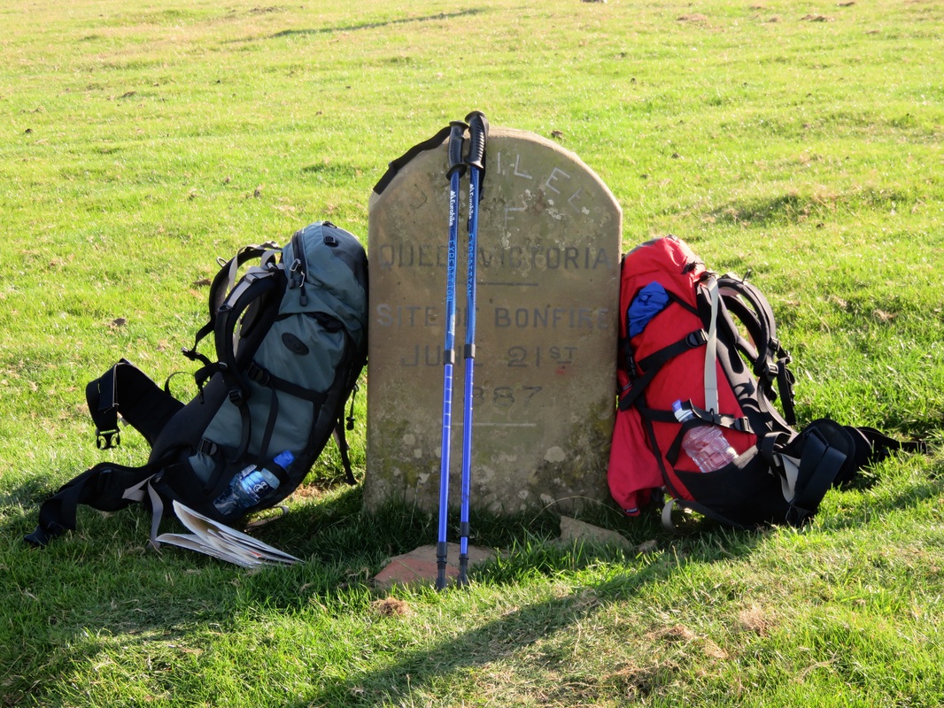
Bam! Shocked light flooded the road. A sensor-activated security system. I told myself there was nothing to worry about. We were just two people out for a late evening stroll. Along a dead-end road. Carrying large backpacks. Nothing to see here.
Morning sky
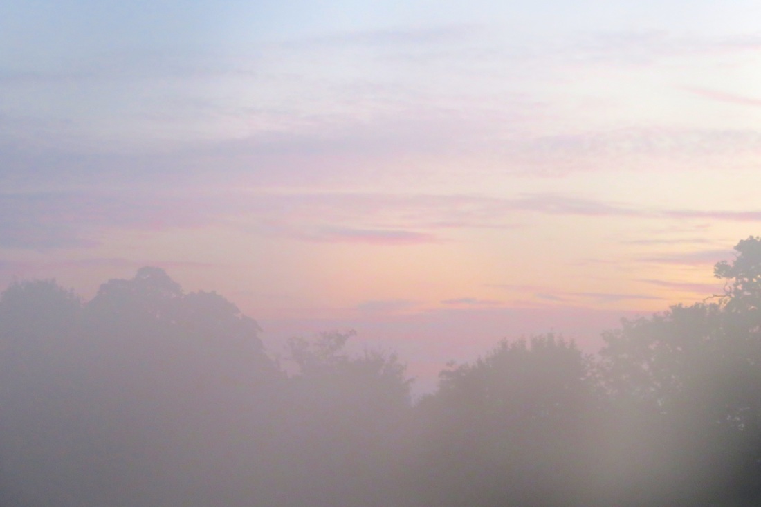
Misty morning, pastel skies.
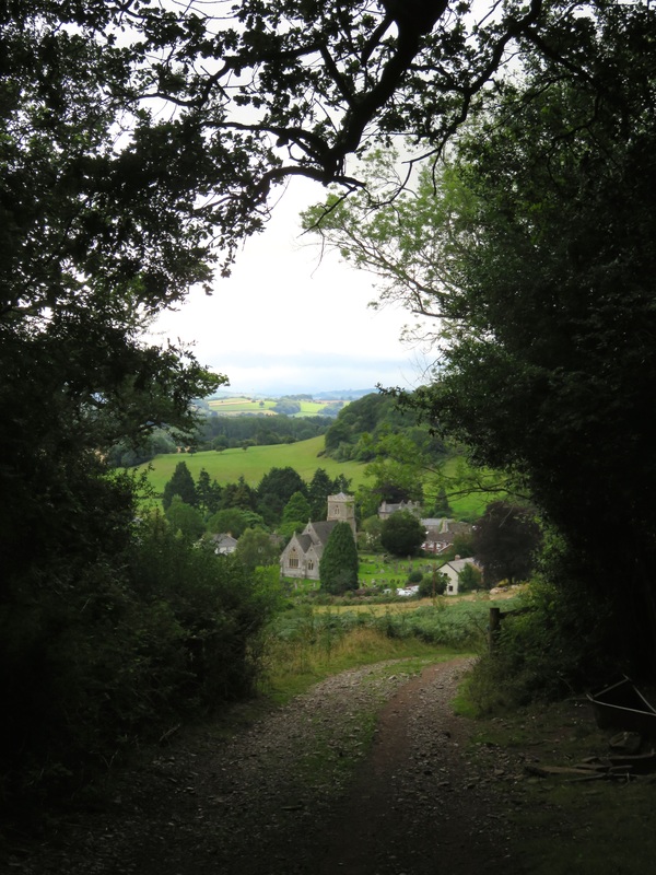
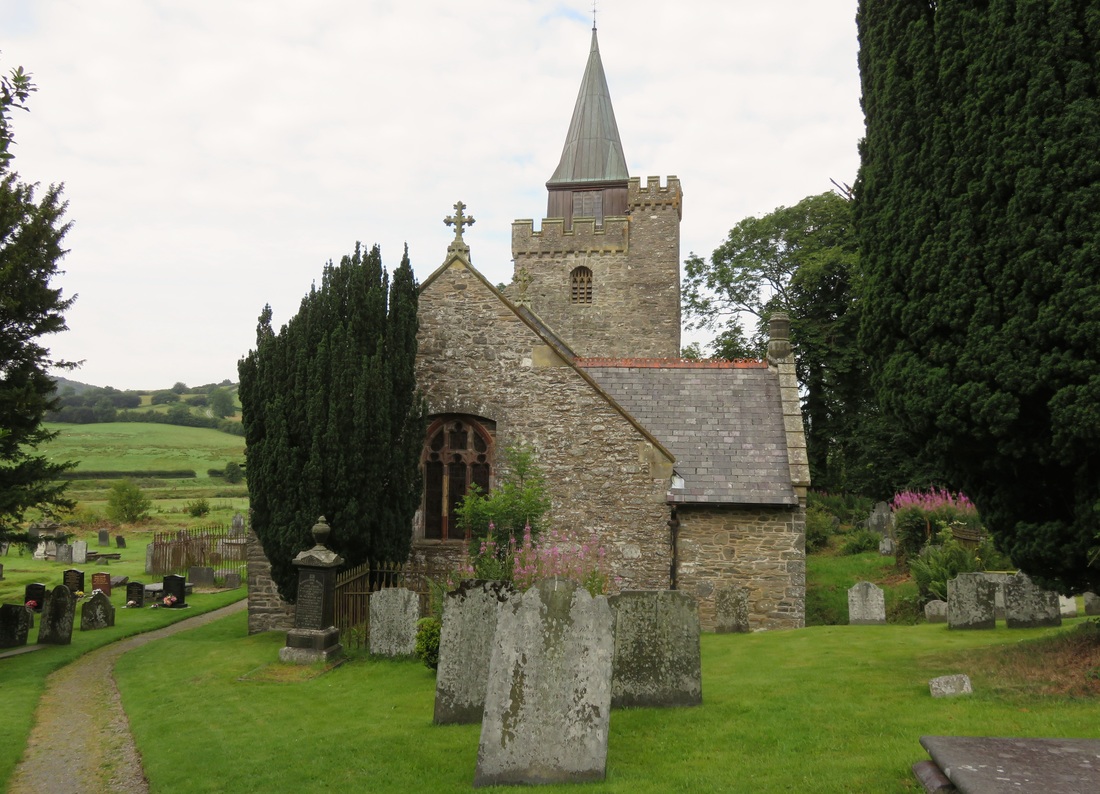
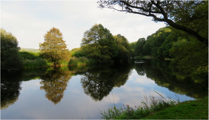
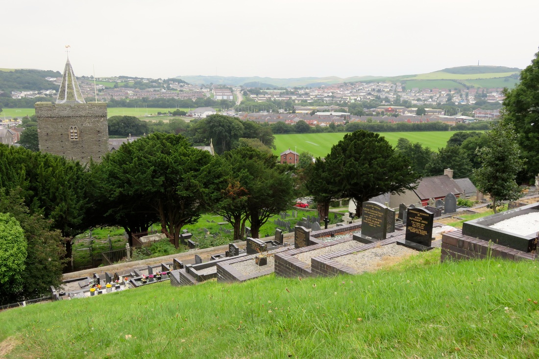
​The cemetery gates were open and we slipped through in the deepening dusk. There was a light on inside the chapel and a van by the door. We aimed our feet at the grass instead of the crunchy gravel - but halfway down the path, we froze. The chapel door opened and the beam of a torch swept through the trees. We were hidden behind a bank of shrubs, but had they heard us? I held my breath and listened with all my ears. Footsteps, probably between the door and the van. The bibip-bibip of an alarm being set and the rattle of keys. Silence. We stayed still. An animal scuffled in the trees. We waited. Surely they must have gone by now?

“Come on,” I whispered. We continued down the hill.

Vrr-rummm! The van revved to life, headlights making bright tunnels through the headstones above us. Wheels crunched along the path to the other end of the cemetery, then the headlights swung around and the van came back up. Probably a final check for sneaky people like us, I thought. And now they’ll lock the gates. No escape! We waited, but didn’t hear any other movement from above, so we padded through the night to find a spot to settle down.
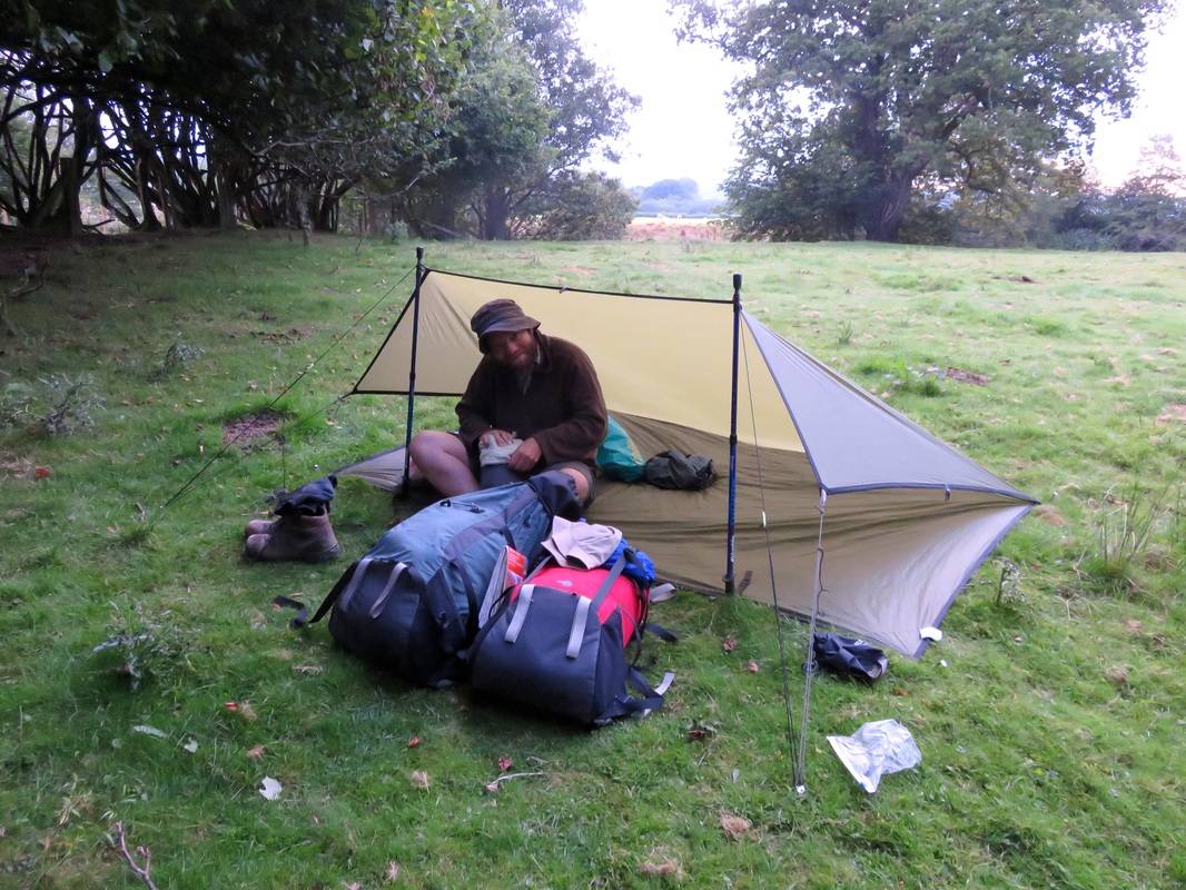
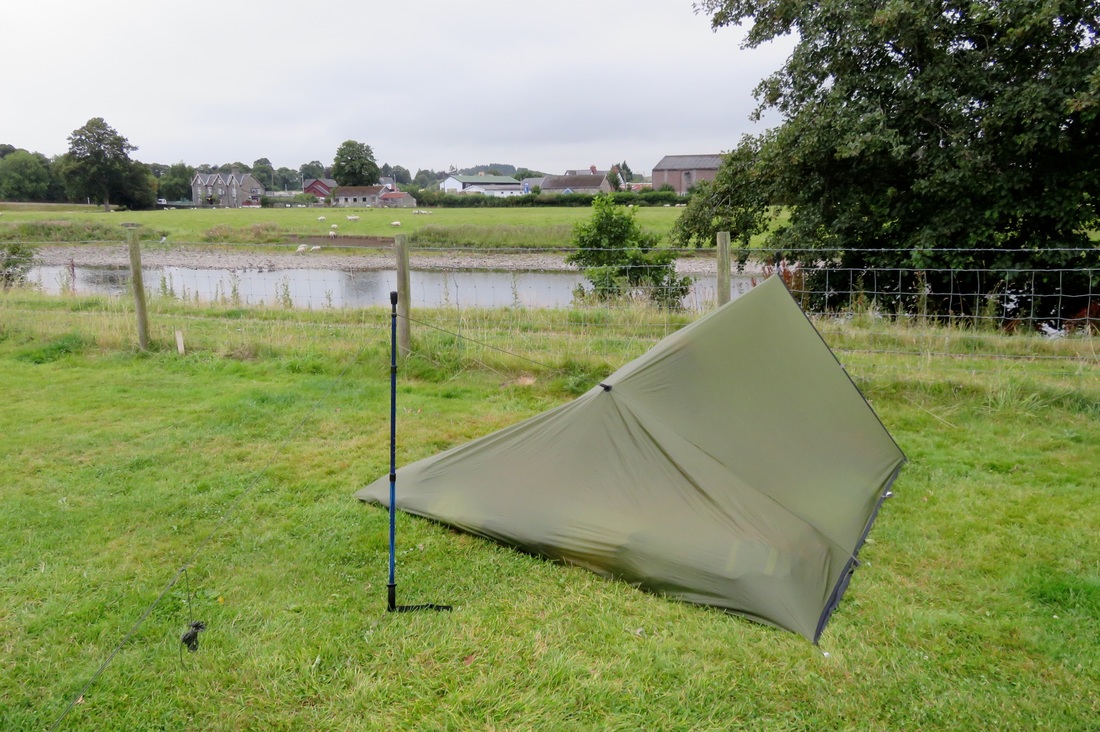
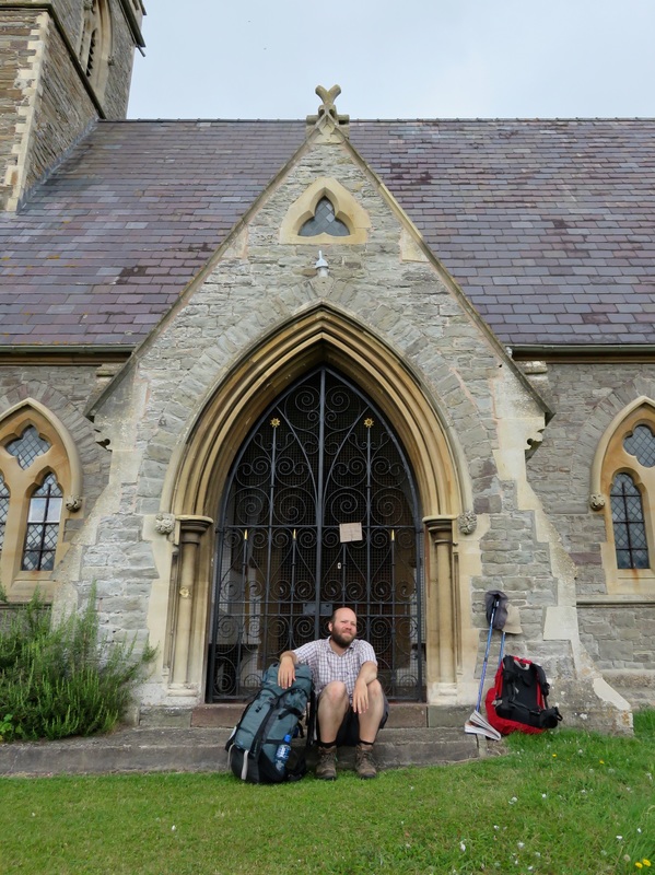
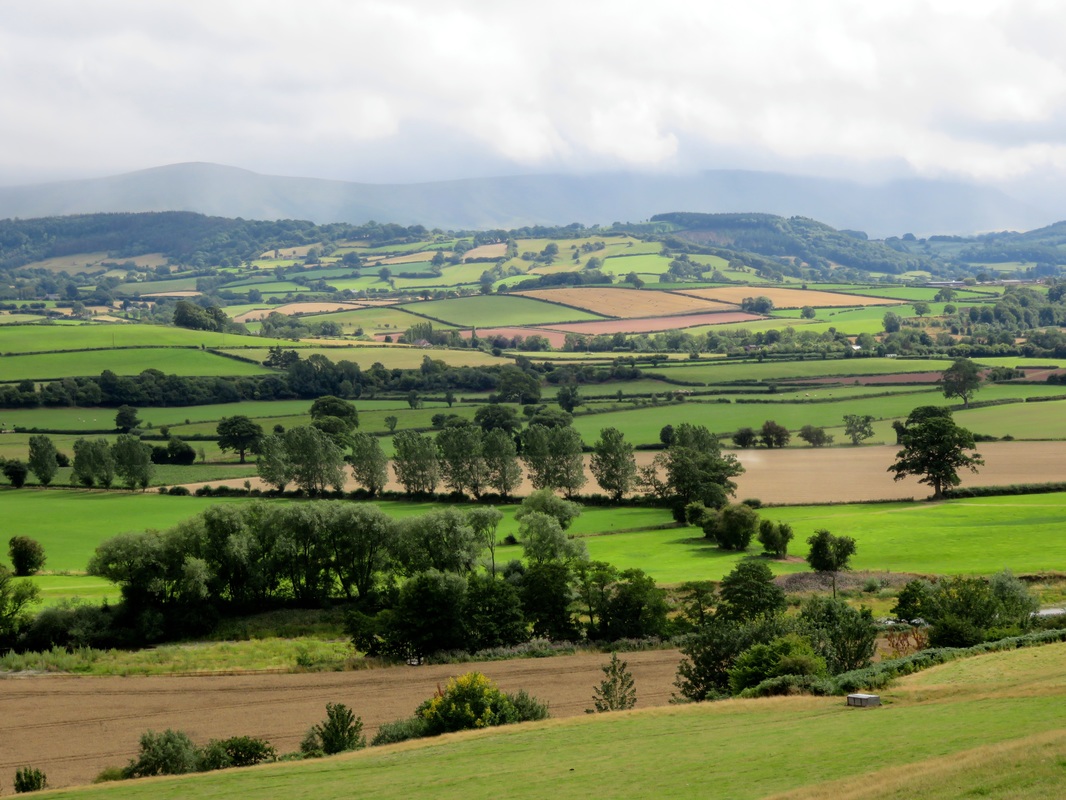
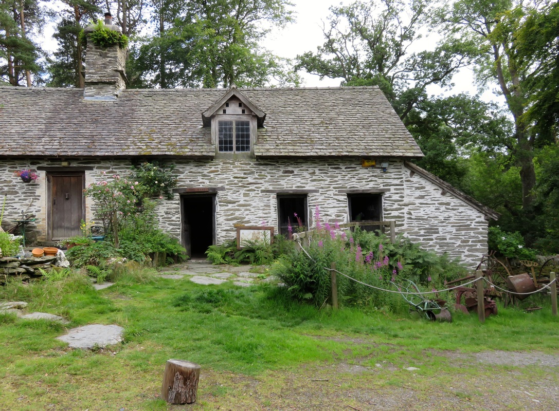
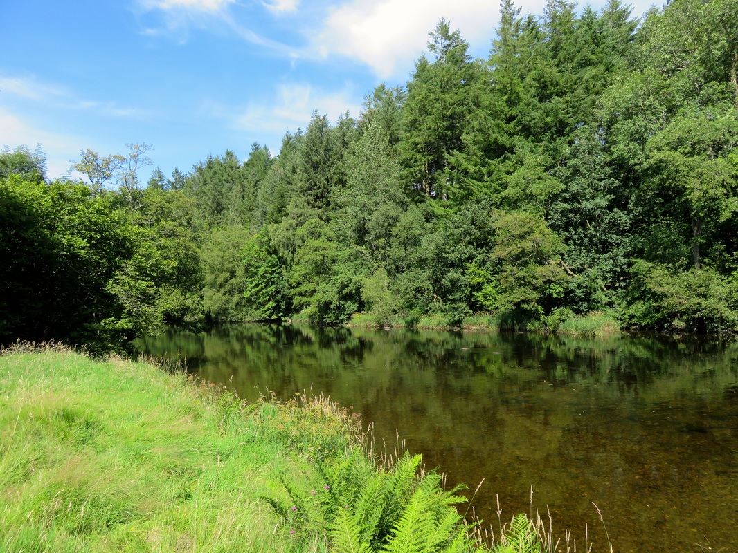
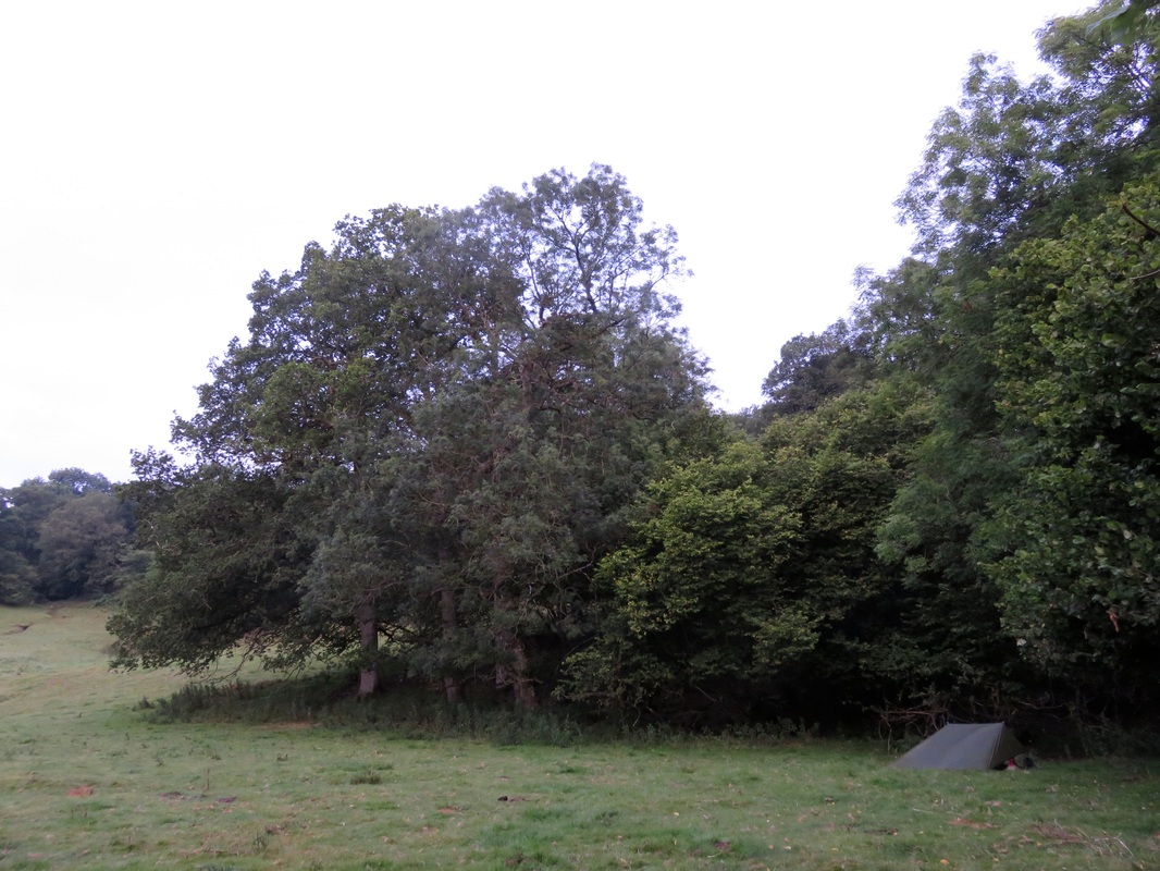
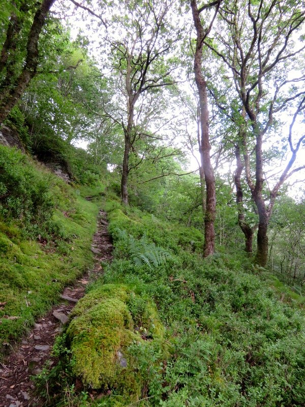
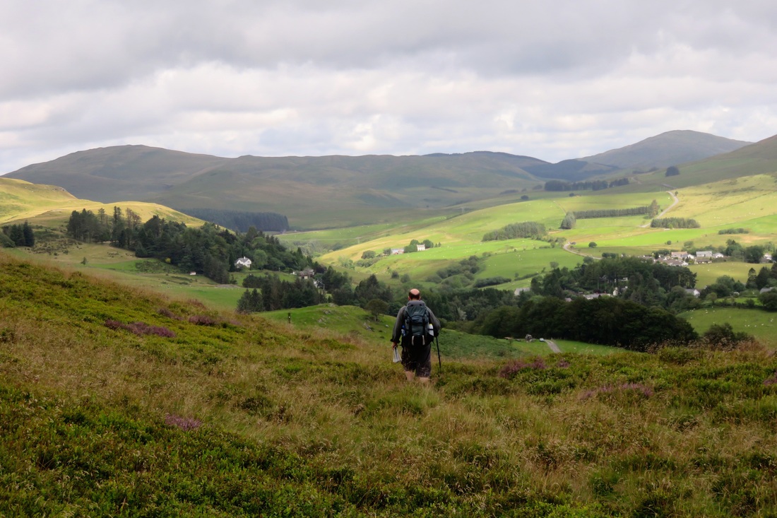
​I’d been thinking about wild camping in a churchyard or cemetery for a while. Cemeteries are usually peaceful places and, as they’re often locked after dark, they’re probably quite safe.

At least, that’s what I’d thought. But lying there swaddled in my bivvi bag, watching the very last wash of light fade through the trees, I heard a snatch of laughter. It suddenly occurred to me to wonder: what other sorts of people might want to sneak into a cemetery on a Saturday night? My heart kicked up a notch. What was that? Torches and muttering voices. But they passed by: just a couple of walkers on the footpath across the stream. I was all nerves. “We can always go home,” Dan whispered. I thought about my warm, comfortable, safe bed. But of course I didn’t really want to leave.

I didn’t think I could sleep, though. A barn owl shrieked in the distance. And, much closer, a strange, mellow, yipping sound came first from one direction, then moved towards the chapel. A fox cub? “Whatever it is, it wouldn’t be out if there were other people around,” Dan reassured me. I felt like a total wimp.

To distract myself, I listened to the cars passing on the main road and the aeroplanes curving overhead. Those noises, at least, did not belong to anyone who might come and kick us out, or tell us off, or make us take part in their secret cemetery ceremony. I concentrated, following the sounds of the motors as they grew and grew, then faded, faded, faded and were gone; grew and grew, faded, faded and were gone; grew, faded; grew, faded . . . I slept . . . ish.

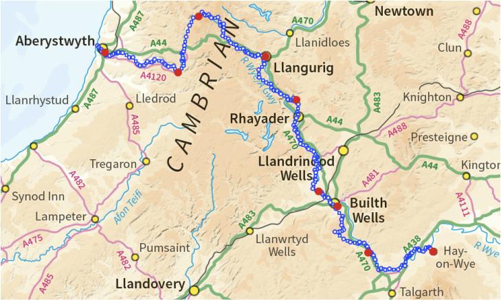
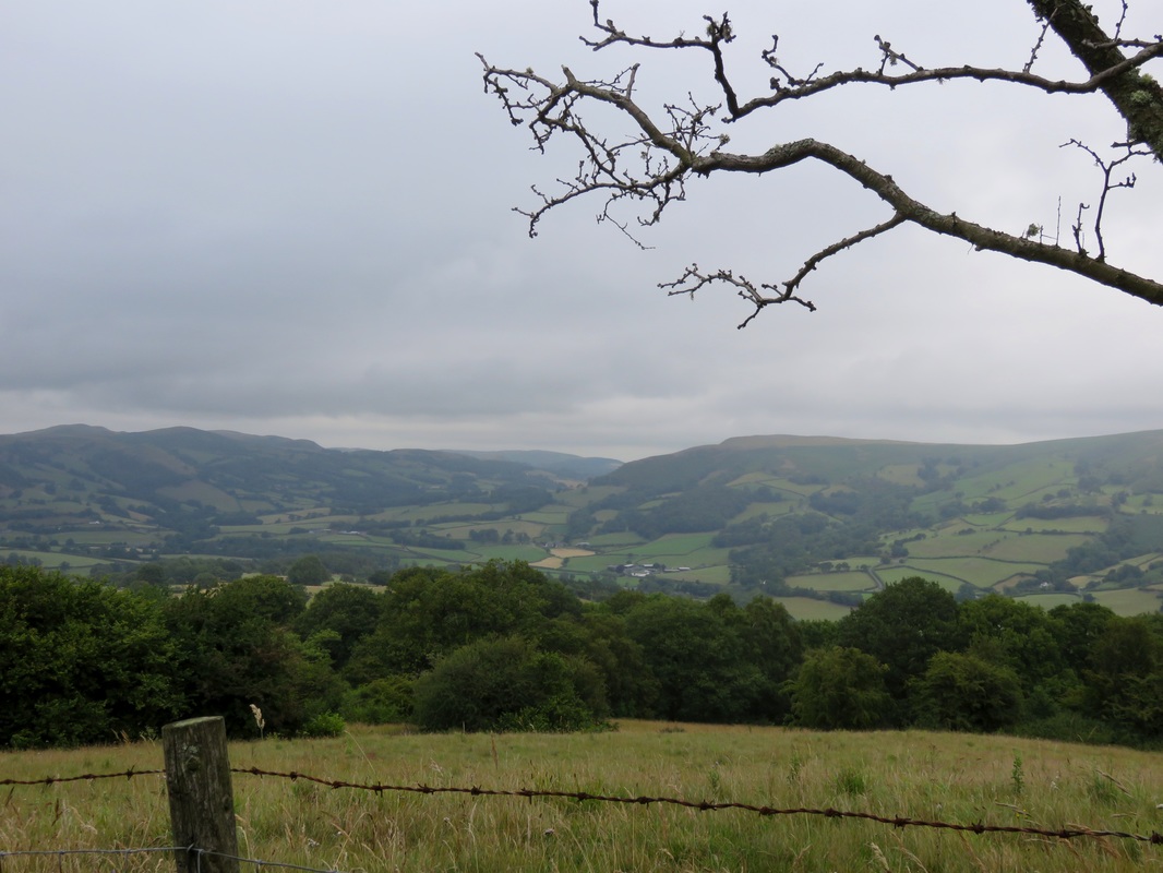
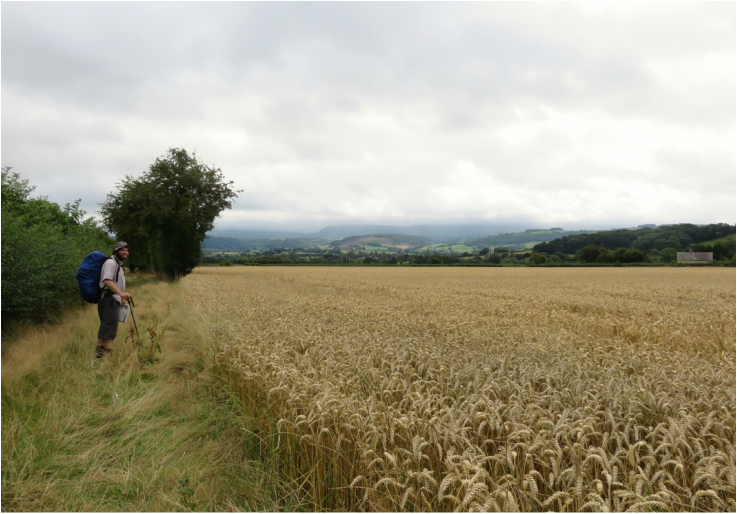
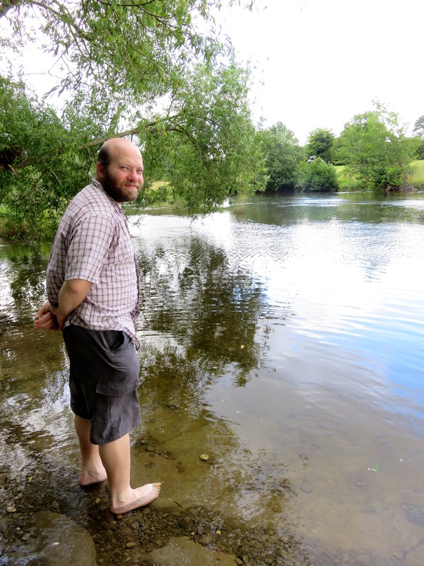
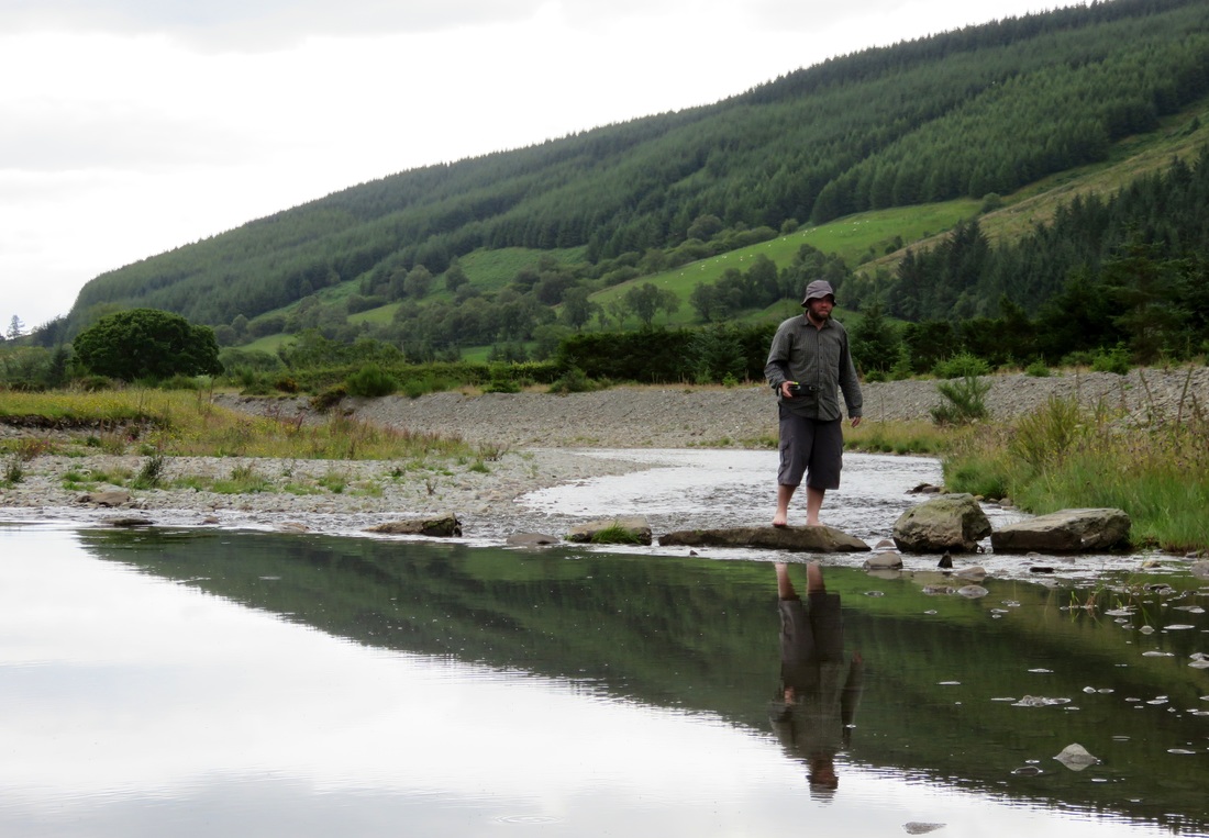
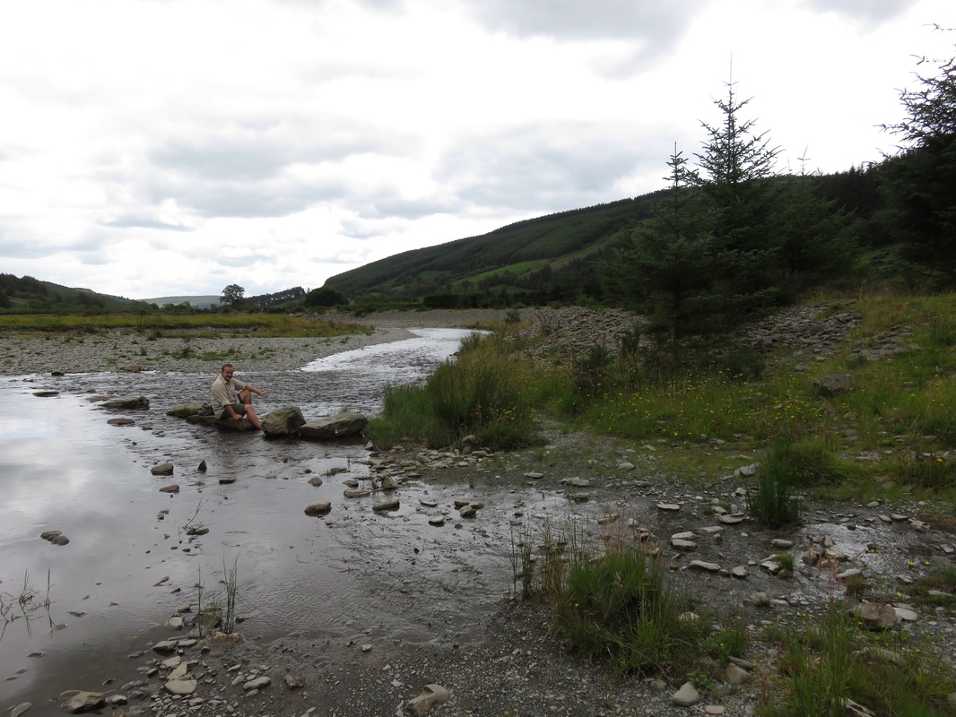
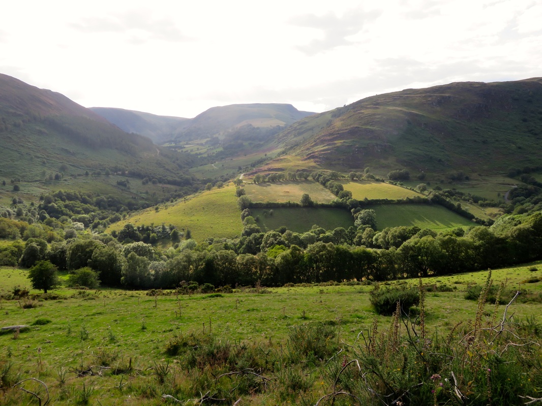
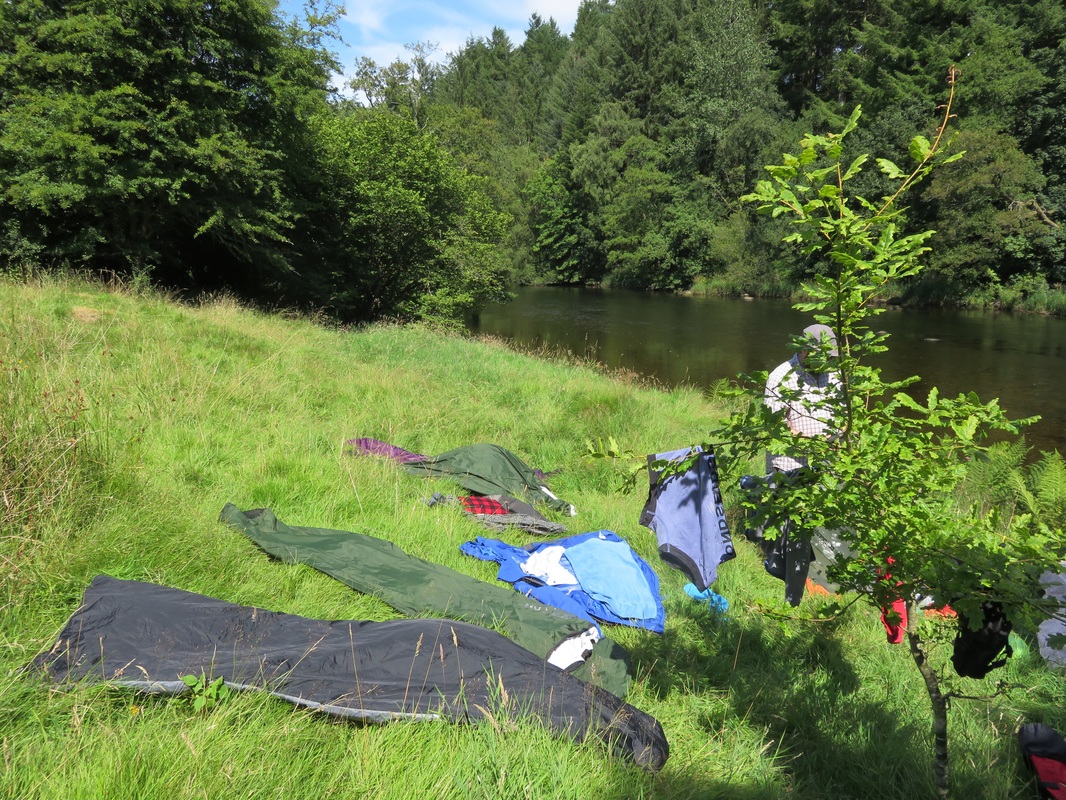
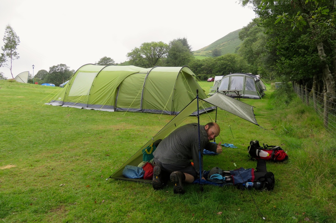
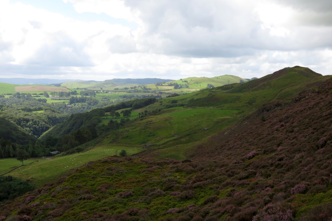
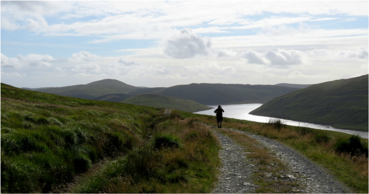
Every hour or so I woke up with a cold nose and a crick in my neck. Wild camping is definitely easier when you’ve been walking all day, I decided. The trick is to exhaust yourself to the extent that you don’t care about the awkward lumps under your mat or the way the sleeping bag liner twists around your ankles. I thought about our next walking and camping adventure. Perhaps we could finish one of the long distance paths we’ve started over the years. What would work for the October half-term? The Grand Union Canal or the Thames Path? That walk from London to Norfolk (we hadn’t quite got to Cambridge)? The Ridgeway, the Southwest Coast Path, the Wye Valley Walk, something else completely? I fell asleep again.
Morning star
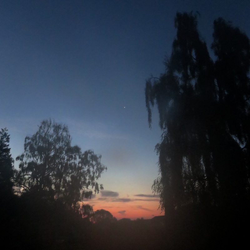
Can you see the morning star?
Picture
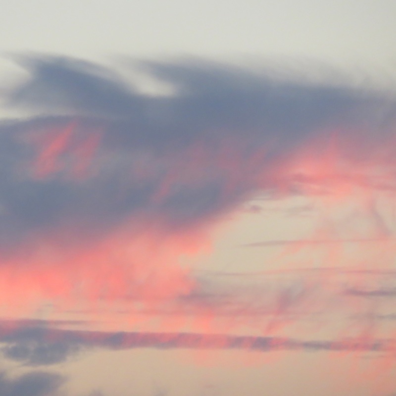
Clouds like brushstrokes.
Clouds
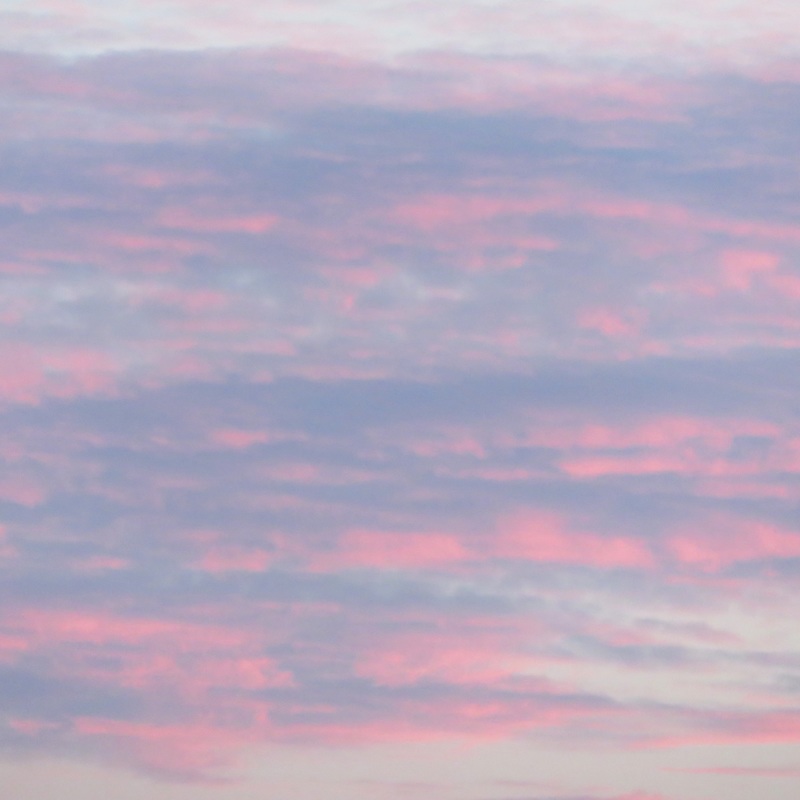
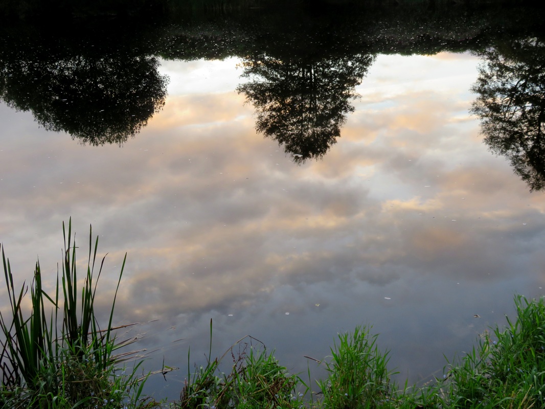
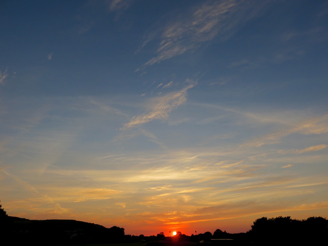
Pink and purple clouds.
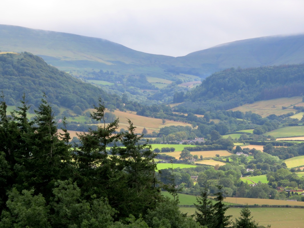
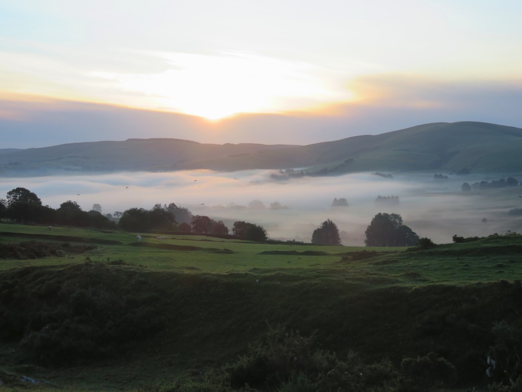
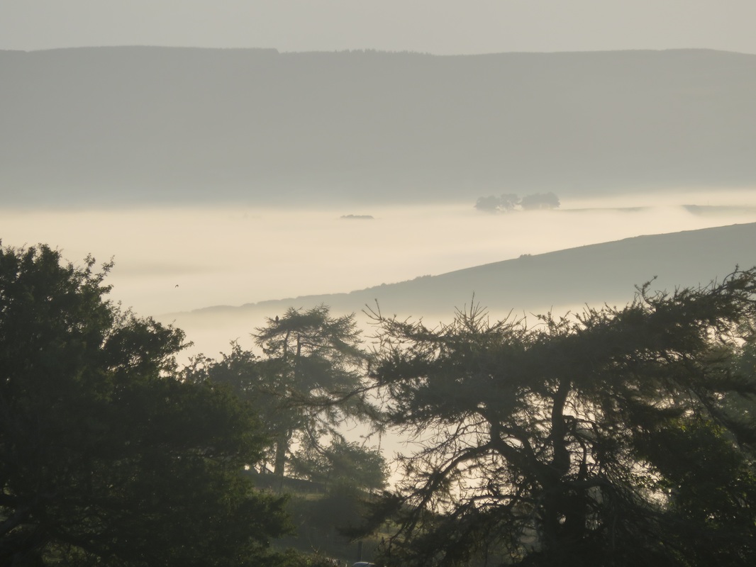
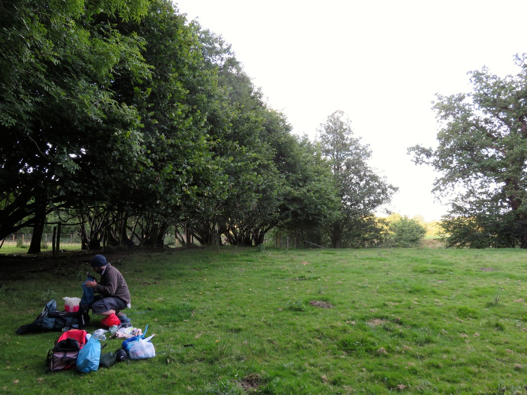
​It was half past five when I woke for good. My nerves immediately kicked in. Were we locked inside the cemetery? Would we have to climb the gates? How could we sneak out without anyone noticing that we’d snuck in? Was there some other way out of here? I clearly wasn’t going to get any more sleep. We packed our things away, then wandered back up the hill and into the dawn chorus. My spirits lifted with the birdsong and lifted again when we found the gates wide open. They hadn’t been locked after all.

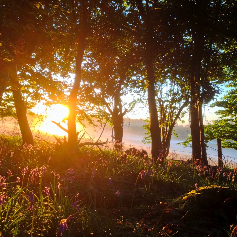
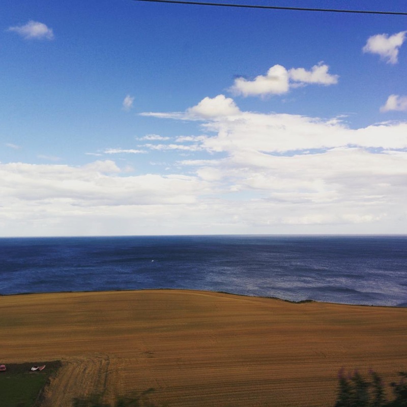
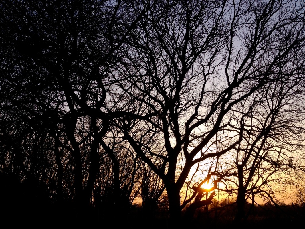
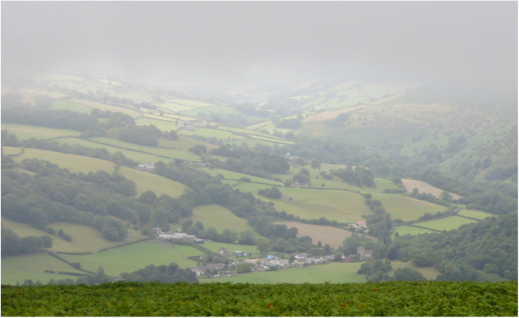
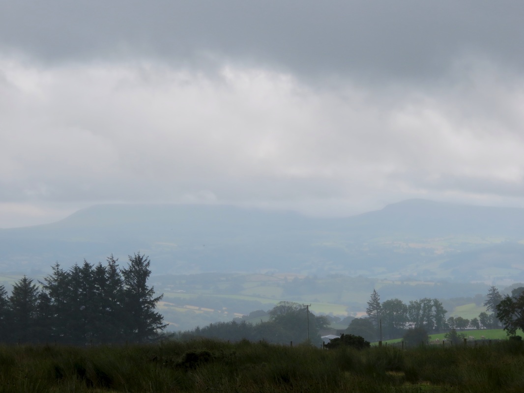
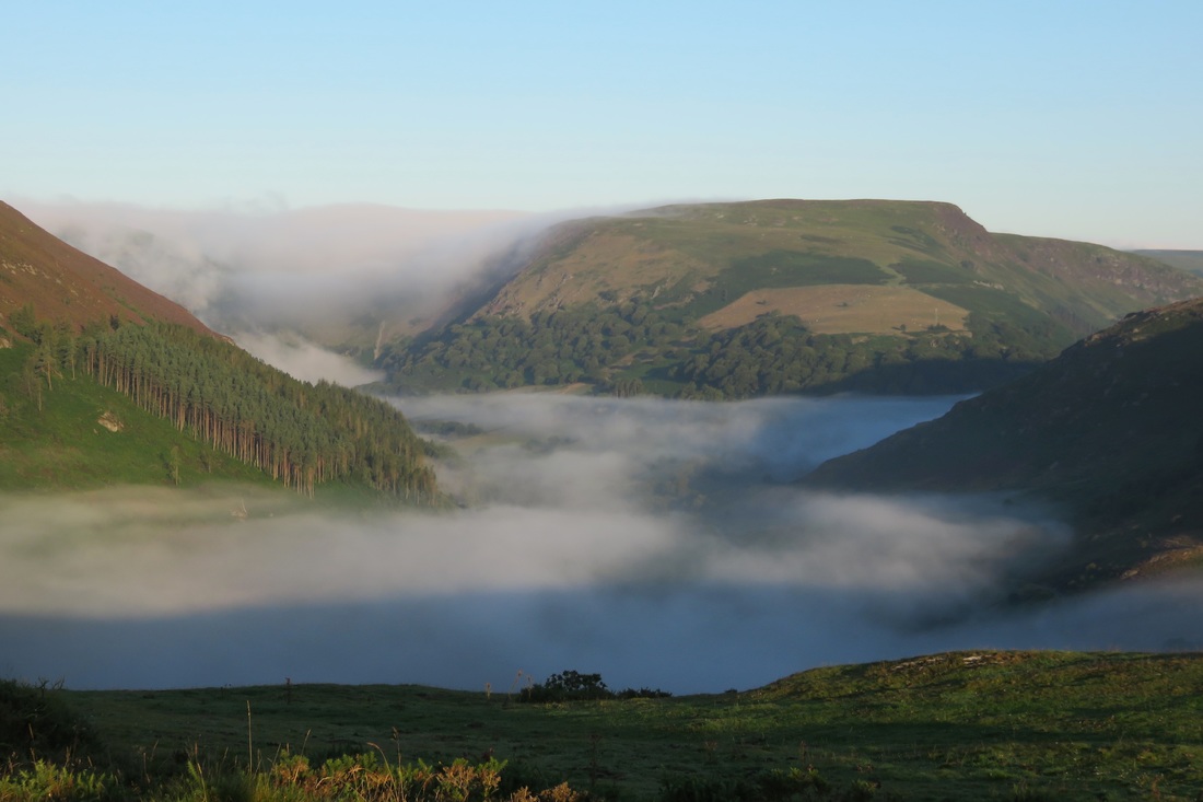
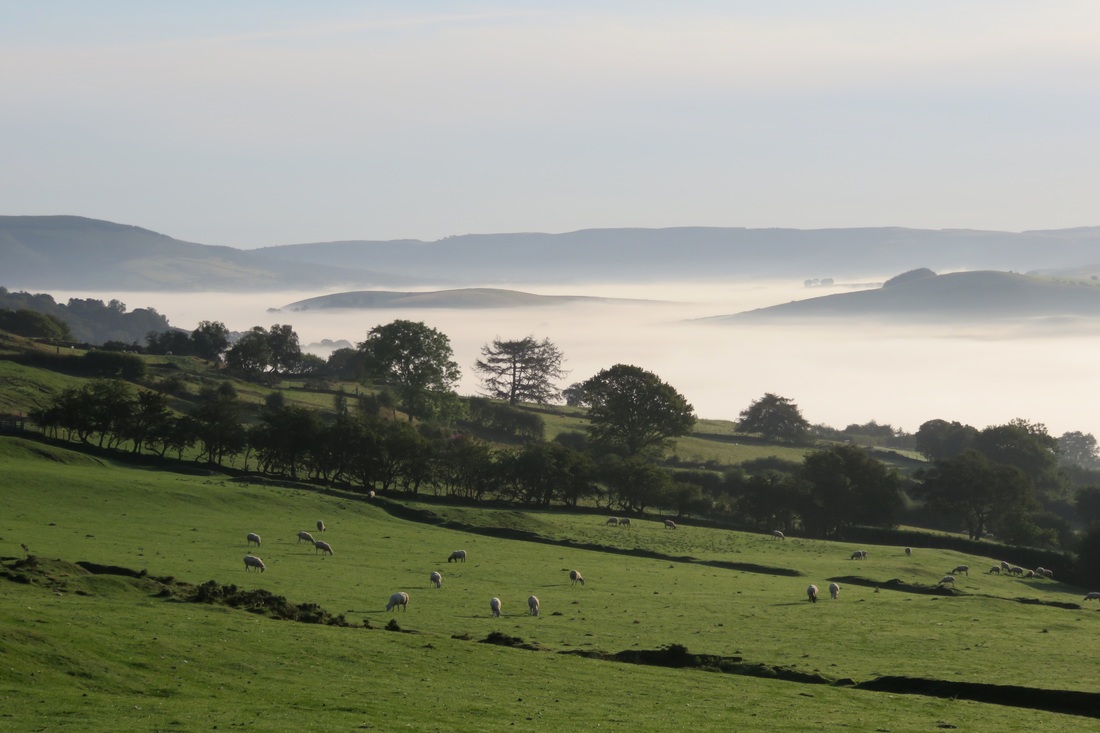
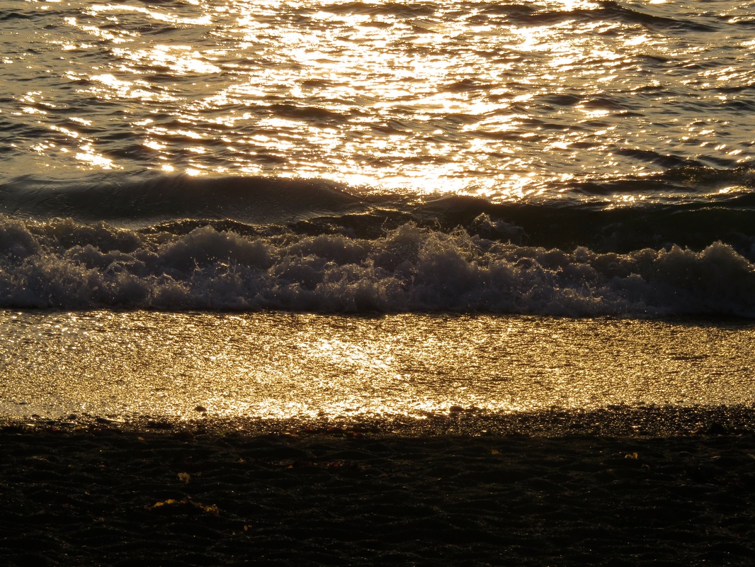
​On the way home, we spread our damp picnic rug over a wooden bench and waited for the sun to rise. The horizon turned from a dark smudge of apricot to pale green. Mist was rising from the valleys. The purple clouds were fringed with hot pink. Chattering jackdaws converged above us, coming in twos and threes and fives before heading south. A lone heron passed overhead, its loose, slow wingbeats hushing the field, the road, the houses. A rooster crowed. The sun was up. It was time to go to bed.

This sleep-out was part of Alastair Humphreys' Year of Microadventure. It also kind of fulfils our September  microadventure challenge (the theme was sunset/sunrise). It cost us a whopping £0.00.

8 Comments

Behind the scenes at In Which I

22/9/2015

0 Comments

 
It's time for some housekeeping, some pretty Creative Commons photos and some graphs.
Desk with typewriter
This is not my desk. (Photo by Ian Livesey.)
It’s been over a year since I published a Q&A post addressing burning issues in the world of tea drinking. I’d spent the previous month or so thinking about starting a blog and worrying that it was a rather old fashioned, self-indulgent thing to do. But I had a lot of time on my hands (a single typographical error at the Home Office meant my visa application was rejected and my life was completely disrupted - a story for another time) and this was one way of filling it. I looked at a few blogging platforms. I drafted a few posts. I spent a good while wondering what I should call my blog. And finally, I hit publish.

Since then, it’s been a wild ride. By monetising my content and reaching out to key influencers, I’ve grown my brand beyond my wildest dreams. Drilling down into my data, I’ve been able to build a robust picture of my audience and develop strategies to tap those target markets. I’ve engaged in some real blue-sky thinking and I’m now very excited to reveal my compelling plan for this blog moving forward . . .
Blossom and sky
This is not my blue sky thinking. (Photo by Yoichi_.)
I jest.

Aims achieved

I began In Which I with the aim of building an online portfolio/archive so potential freelance clients and employers could see that I was indeed capable of (a) stringing a sentence together, (b) writing about different subjects and (c) producing/collating content on a regular basis. I think I’ve succeeded in that. I update once a week on average, have an online record of my monthly walking column for the Battle Observer (I’m a bit behind uploading these, so expect a few more soon) and have published many of the articles I’ve written for the Hastings Independent.

I never expected to join any particular network of bloggers. I thought my subject matter would be too diverse and impersonal to appeal to any niche apart from the good old “people who know me” audience. After all, there aren’t that many people who are really into tea and wild camping and veg*n recipes and walking and local community news from Hastings, East Sussex. But in fact, it turns out the majority of my blog this year has been fairly outdoorsy and there’s a bunch of people who seem to enjoy that. Joining Alastair Humphreys’ Year of Microadventure challenge (wild camping) and coordinating my own themed monthly microadventure challenge (not just wild camping) has also meant that I’ve discovered loads of people who share similar interests. Bonus!

I'm still spying on you

Back in October last year, I kind of implied that I'd give you some updates on the analytics front. Uhhh, better late than never? Sorry!

Since I started In Which I, 57% of my visitors (‘new users’ rather than ‘sessions’ for those familiar with Google Analytics) have been from the UK, 13% from the USA and 6% from Australia. I’m surprised there’s more USAn visitors than Australian, given I have a large family/friendship group in Australia. Perhaps this is partly to do with spam referrals - I had to filter a couple of USA locations early in 2015. But while the number of Australian visitors (new users) is quite a bit lower, the number of visits (sessions) from Australia and the USA are fairly similar, demonstrating that my trusty band of Australian friends is much more likely to visit this blog repeatedly.

In terms of referrals, 31% of visits (sessions) came via Twitter and 43% via Facebook (this includes m.facebook, lm.facebook and l.facebook traffic, for those playing at home). Other major referrers were this Alastair Humphreys post and Martin Black’s microadventure round-ups.
Graph 1
Actually, Alastair Humphreys had quite a big impact on my visitor numbers. The graph above shows my overall traffic for the last year, week by week. Those two big spikes in January and February are a direct result of links from Alastair’s Facebook/Twitter. It’s even more noticeable when you look at the daily traffic.
Graph 2
The small increase in traffic around May is the result of a few things: first, a heavy influx of spam traffic; second, the photo-heavy bluebell wood microadventure; and finally, an interview with the former Hastings Children’s Library manager.

Speaking of spam referrals, I currently have something like 36 filters set up and no doubt after I publish this post I’ll get even more faux traffic. So annoying.

What you like

Given those two great stonking referral spikes from Alastair Humphreys, it probably comes as no surprise that the three posts he linked are my three most viewed posts.
  • Maps for microadventures - popular because it’s a handy resource.
  • Sleeping on a beach on the winter solstice - our first microadventure, popular because it was one of the winter microadventure winners.
  • Sleeping in a bluebell wood - probably popular because it's like a storybook.
Sunrise and bluebells
This is my bluebell wood microadventure!
The popularity of the next three comes from different sources.
  • Fifteen first lines - a short review of the Start Writing Fiction MOOC, run through FutureLearn and the Open University - popular because I used the #FLfiction hashtags to promote it and (because it was a positive review) it was shared by the course organisers.
  • Issuing the microadventure challenge - this is not that popular as a ‘landing page’ but it still has a lot of views, which means that a lot of visitors find the page as a result of internal links (from other posts on my blog).
  • How to make hedgerow jam - pleasingly, this has seen a big uptick in organic traffic over the last month because it’s seasonally relevant again and must be ranking well on Google.
Blackberries, apples, rose hips, hawthorn
This is not my hedgerow jam - but it's similar. (Photo by cloth kids.)
And here are several more posts that are fairly popular:
  • A walk from Hastings Pier to Eastbourne Pier  and exploring the River Cuckmere. These are both visited mostly by people around Sussex.
  • Walk across Wales (Part 1). It’s interesting that it’s so high up despite being a fairly recent addition to the blog - definitely something people like to read about!
  • The first tea post and our Cuckoo Trail microadventure have quite a lot of pageviews. Neither of them feature in the top 15 landing pages, so people must be clicking through from other posts on this site.
  • My Big Pathwatch article. The opposite is true of this one, as it’s one of my top 10 landing pages, but it isn’t that high in overall visits.
  • Adventures in moth trapping. I’m really just adding this as an honourable mention because I loved doing it so much! Look at those moths!
Moth that looks like a twig
This is not my buff-tip moth, but it is my photo of a moth.

What's in store

Now that I’m officially allowed to stay in the country (phew) - and now that summer is over - I’m beginning to look for a job. I’m planning to take a couple of months off from my walking column at the Battle Observer, so there might not be a November or December walk article. At the end of 2015, I will also finish the two year of microadventure challenges. But I’m not planning to stop blogging. I’m just hoping to take a step back and think about what I might want to do and write about next year.

So, is there something I’ve touched on before that you’d like me to revisit? Something you are especially interested in reading about? A new hobby you think I should take up (lacemaking, campanology, kitesurfing)? An old hobby you think I should knuckle down and do something with (music, creative writing, filmmaking, media criticism)? I can’t promise I’ll get around to it, but I promise I will consider your suggestions. Even the outlandish ones.


There is one other change afoot. Up until now, all of my post titles have been an extension of the blog name, so they can all be read as “In which I [x]” (e.g. In which I sleep in a ruin in Suffolk, In which I make room for nature with #30DaysWild, In which I forage for and cook with Alexanders). Did you notice? While it’s kind of fun, I’m growing tired of the formula. So, I hereby give myself permission to mix it up a bit, starting with this post.
Paint brushes and palette
These are not my paintbrushes. (Photo by TonalLuminosity.)

Finally, I'd like to say a big thank you to everyone who has commented on my posts, taken part in the microadventure challenges, linked here from their site and/or connected with me on social media over the last year. It's meant a lot and I've enjoyed it.

0 Comments

Walk across Wales (kit list, map and video)

16/9/2015

2 Comments

 
No self-respecting long distance walk write-up is complete without a kit list. That's a lie, but never mind: here's our kit list, route map and a video from our walk across Wales.
Backpacks leaning on a stone marker
Packs and poles.
I walked 250km (150mi) of the South West Coast Path in September 2009 carrying a 14kg bag, plus water. We stayed at a B&B every night, so that didn’t even include any sleeping gear or a shelter. At the time, I though lightweight kit was the preserve of people who drilled holes in their spoon handles and cut the pockets out of their shirts to lighten their load. If I’m honest, I derived a kind of pleasure from how heavy my bag was: I felt like a Real Walker™.

These days, while I’m not rich enough to own ultralight everything and not dedicated enough to cut my toothbrush handle off to save weight, I’ve definitely come around to the pack less, pack lighter/less weight, more fun way of thinking. I know there were reasons back in 2009 for taking a pair of jeans and a third shirt (evenings and days off), a laptop (I was obsessively committed to keeping in touch), eight pairs of undies/socks (one a day and a spare for washing day) and a huge first aid kit (just in case), but in hindsight it seems ridiculous. We still use the same packs as we did in 2009, so for our walk across Wales I was interested to see if we could take everything we needed - now including sleeping gear, a shelter and a good amount of food - while staying under our 2009 pack weight.

The morning we set off from Aberystwyth, we weighed our bags on our Airbnb hosts’ bathroom scales. My pack was 9.8kg and Dan’s was 10.4kg (both before adding water). This is hardly ultralight, but it’s an improvement. As we replace gear over the years, our pack weights may decrease further. And you never know, maybe I will become a gram weenie.

“So, what was in your packs?” I hear up to three people ask with mild curiosity. Well, wonder no more, my friends. Here follows an exhaustive kit list. Things marked (J) were carried by me, things marked (D) were carried by Dan. We carried our own set of everything else.
Person in hilly landscape
"First we go down there. Then we go all the way up there." At times like this, lightweight makes sense!

Walk across Wales kit list

  • Backpack, rain cover, plastic bags
  • Walking poles
  • Clothes - shirts x 2, jumper, leggings, shorts, underwear x 3, bed socks x 1, waterproof jacket, walking boots, thongs/flip flops, sun hat, beanie
  • Walking socks (D x 3, J x 2)
  • PJs (D full - J trousers only)
  • Merino thermal t-shirt (J)
  • Tarp, pegs and cord (J)
  • Sleeping gear - bivvi bag, sleeping bag, inflatable mat
  • Sleeping bag liner (J)
  • Pillow (D)
  • Water bottles (J x 1, D x 2)
  • Cooking gear - beer can stove and case, fuel, lighter, saucepan, cups x 2, forks x 2, knife (D)
  • Food - instant noodles, porridge, soup, tea bags, soy cream, water purification drops, cordial concentrate (D)
  • Snacks
  • Toiletries - toothpaste, toothbrushes, floss, hand sanitiser, shower gel, shampoo, conditioner, micro towel, flannel/facewasher, sunscreen, insect repellent, paw paw ointment, deodorant, toilet paper/tissues, laundry detergent (J)
  • First aid - plasters/bandaids, bandage, sterile dressings x 2, non-latex gloves, painkillers, decongestant tablets, antiseptic cream, safety pins, needle and thread, key-ring Swiss army knife with scissors, tweezers, etc. (J)
  • Phone, phone charger, camera charger (D)
  • Camera, head torch, journal, pencil and sudoku sheets, printed itinerary and emergency contacts, maps (J)
  • Trowel (D)
  • Hankies
  • Card holder - rail cards and tickets, debit cards, ID cards
  • Shoulder bag (J)
  • Piece of Material (J)
  • Zip lock bags x 70,838,491 
Tarp next to a hill
Home away from home, weighing in at 450g (plus cords, pegs and poles). Not bad.

Thoughts on our gear

What didn’t we use? I didn’t wear my beanie and we didn’t use any first aid supplies apart from plasters/bandaids (which is what you want). That’s it. There were a couple of items I could have done without - such as my thermal t-shirt, which I wore a couple of times at the end of the walk simply because it was clean, and my thermal leggings, which would have been good to wear to bed on the coldest night (when I didn’t, typically) but were too warm to wear on other nights (when I did, of course). We used the head torch and knife only once.

What did we appreciate most? The tarp was great. Pitching using walking poles was fine and we were glad we hadn’t relied solely on bivvi bags as we (and our gear) would have got very, very wet on a couple of nights. It was really nice to have a flannel for washing - a very minor luxury that made a big difference to me! The squirty cordial concentrate was a welcome flavour addition to our long days. Although the maps were heavy and bulky, I enjoyed using them and they worked nicely as groundsheets on damp grass. My Piece of Material worked its magic as usual. The Piece of Material is a sarong or small tablecloth sized piece of patterned cotton I found in a charity shop years and years ago. It’s very versatile - I can use it as a towel, scarf, sarong, sheet, curtain, picnic blanket, pillowcase, washing bag or superhero cape - and I’m always glad when I bring it on trips.

What did we miss? We probably would have appreciated an extra pair of socks/undies each, though we did OK with what we had. I would have used insect bite soothing lotion if we'd had it. I got sick of instant noodles as our only hot, savoury meal. I even - and this is unheard of for me - considered buying couscous. We figured out on the way that I preferred noodles for breakfast and porridge for dinner, and since the walk I’ve decided that instant noodles are better if you only use half the flavour sachet.

What did we not take and not miss? Trousers, scarf and gloves (it didn’t get that cold), thermos/flask (we boiled water when we wanted tea), a full first aid kit (we took a sensible amount based on my knowledge and first aid training), my phone (we had Dan’s), reading book (I bought one to read on our semi-rest day), my inflatable pillow (replaced with other bits and pieces that worked well enough), waterproof trousers (it hardly rained on us while we were walking) and another water bottle (we usually walked within a few minutes of flowing water and we had treatment drops to take the stress out of drinking it).
Inside a tarp/tent
A glimpse inside our tarp. Note the hiking boots in a plastic bag (smelly!), the Piece of Material acting as a pillow case and the map being used as a groundsheet.

All kit, all list

If you like kit lists, here are a few that might tickle your fancy: Emily Chappell’s kit for cycling around the world, an extensive list of things one might take on an Australian bushwalk from Matt Down Under, Anna McNuff’s lightweight gear list for running and adventures, Alastair Humphrey’s hypothetical kit for a mystery adventure anywhere on the planet, Sophie Radcliffe’s top ten outdoors/sports clothing items, ultralight DIY first aid kit on Section Hiker and “15 Veteran Cyclists Share Their Favourite Non-Essential Luxuries On Tour” by Tom Allen. It’s always interesting to see what people take on their adventures and notice what the differences are between countries, seasons and activities. Do you have a kit list? Feel free to link to it in the comments. I’d love to read it (really).

Route map

A hasty addition! A couple of people mentioned on Twitter that they'd like to see a map of the route we took. I don't have a GPX file of the exact walk, but here's an overview of our path, with the places we slept (approximately) marked by red dots. The route for the first two and a half days was self-designed, while the remainder of the walk stuck closely (but not exclusively) to the Wye Valley Walk long distance path. 
Map
Aberystwyth to Hay-on-Wye. Considering how close we were to main roads, it was (mostly) a very quiet walk.

And finally, a video

Congratulations! You made it to the end of the post. As a reward, here’s our short film of the walk. Instead of doing a video diary or filming every pretty view, we decided to take one long, static shot each day to give a snapshot of our time in Wales. I think the end result is enjoyable. It’s slow, but (partly because it’s slow) it’s quite relaxing. What do you think of this kind of film?

Walk Across Wales from In Which I on Vimeo.


You can find my write up of our walk across Wales here: Part 1: The coast and River Rheidol, Part 2: Cambrian Mountains and craggy hills, Part 3: The Wye valley and the border.

2 Comments

Do the August microadventure round-up cha-cha

13/9/2015

0 Comments

 
Over the last month, our microadventurers have used the “explore a border” theme to get out and see some amazing sights and have some wonderful experiences. This is particularly true for those of us in the UK, where it was summer (or, gloomier people than me might say, where it was meant to be summer).

National borders

Many people’s first response to the theme was to think of borders between countries.

Abigail and Kieran managed to time their trip to Edinburgh to fit in perfectly with the August challenge. It was surely nothing to do with the dates of the Edinburgh Fringe. Surely.

Kieran says, "Crossing the border into Scotland by train is now a more mental than physical event. No announcements, no passport checks; just get off at the other end and go on your way. This quiet transition still feels like a holiday, though. The ocean's always bluer on the other side!"

Abigail writes, "Visiting Scotland, we didn’t so much explore the border as explore across the border, in the beautiful, craggy, bustling city of Edinburgh. We caught the last few days of the Fringe, ate and drank artisan Scottish chocolate, and rummaged around reputable and dusty Edinburgh bookshops.

"But climbing up to the top of Arthur’s Seat (the main peak in Holyrood Park, at the centre of Edinburgh) we could see, in miniaturised and panoramic splendour, the buildings and hills about 800 feet below; where we couldn’t help but be reminded of borders. We picked out (or did our best to guess) the border between the district of Leith - where we were staying - and the city. We saw the crest of Edinburgh Castle amid the rambling streets, shops and peaks of houses; its history embroiled in the struggle between bordering nations. And we saw the vast lustre of the Firth of Forth, where the border of the land begins to melt into the sea.

"On our train home, we passed a sign to the north of York - Edinburgh 200 miles. It seemed surreal that we could be so far away, so soon."
Sea
Blue, Scottish sea, photo from Kieran.
Portrait and view
Kieran examines the horizon for borders, photo from Abby.
Person jumping
Q: If Abigail can fly, why take the train? #jumpstagram photo from Kieran.
Dan and I also took up the national borders idea, though our walk across Wales was more about spanning the distance between borders than about crossing them. We started on the beach at Aberystwyth, the border of land and sea, walked up over the Cambrian Mountains, then followed the River Wye to the point where it becomes the border of Wales and England, near Hay-on-Wye. Here's a short film showing some of the trip.

Walk Across Wales from In Which I on Vimeo.

As Gillian discovered, you don't have to travel far afield to enjoy the flora of different countries. A visit to Glasgow Botanic Gardens gave her the chance to venture into the glasshouses, where "geographical borders were blurred, continents bestrode", and where she "explored rainy August borders" outside. If you can't make it to Glasgow yourself, why not enjoy a virtual tour of the Kibble Palace greenhouse online?
Flowers
Skipping from continent to continent in the greenhouse, photo from Gillian.
Flowers
Soaked sundial, pretty poppy, bees and jingle bell berries, photo from Gillian.

Natural borders

One obvious border, especially to those who live on islands, is the sea. While the border between England and France might be an invisible line somewhere out in the Channel, for many people the border zone starts closer to the shore. It is always in flux. On a macro scale, sea levels change, shingle moves, cliffs crumble, the littoral zone alters. Tides move in and out, revealing more land that might be "ours", then taking it back, swelling higher and sinking lower at certain times of the year. And then on a micro level, each wave or ripple claims a strip of sand or handful of pebbles for the sea.

Allysse spent time at this liminal space and created a beautiful, meditative short film titled Moment of Zen. Allysse says, "The end of England, the border between land and sea. It wasn't quite a microadventure as there was no sleeping outside (but in a hotel room instead). I did quite a few walks along the coast, explord the antique shops in the area, ate good food, and generally lazed about on pebbles and sand dunes."

Moment of zen from Allysse Riordan on Vimeo.


County borders

Clare went on a county border crossing extravaganza on one of her very long training walks along the Stour Valley Path, from Cambridgeshire to Suffolk to Essex.  "We cross the border to Essex," Clare writes. "Essex! It takes ages to drive to Essex and I’ve just Bloody well walked here! Incredible! My mind well and truly blown. Go me!"

Dan and I also explored some borders closer to home. We went swimming in the River Rother where it marks the border between East Sussex and Kent, and went for a long evening walk along the Sussex Border Path between Hawkhurst and Flimwell. It’s interesting to think about times and places in which features like rivers and ridges and woods have acted as easy to read (and easy to enforce) borders for a non-map-using population.
Welcome to Essex
Welcome to Essex, photo from Clare.
Footpath sign
Sussex Border Path waymarking.

Border interpretation

Our monthly themes are always open to interpretation and Mags went all out with this one, including county border crossing, a cute dog and a visit to Pevensey Castle. "The original structure was a Roman Saxon shore fort built around 290AD," Mags says. "Once the Romans had left it was reoccupied by the Normans in 1066. It was abandoned again at the end of the 16th century until the ruin was acquired by the state in 1925."
Pevensey Castle
Inside Pevensey Castle, photo from Mags.

Border policing

Mags notes in her post that she spent much of the month dealing with various international bureaucracies to obtain visas for international students to come to the UK, and it isn’t possible to talk about border crossing adventures and border exploration without being aware of the ways in which borders are only open in some places, to some people. Our explorers’ abilities to cross or bump up against borders without any negative consequences mark us out as people with particular privileges, who are relatively free to move around these particular borders.

Nikki writes, "Last month in Melbourne, the government announced an initiative called Border Force, an operation that would allow authorised officers to request the visa documents of "any individual we come across".  Any person with a hint of decency could see this initiative would result in harassment of people of colour on the streets of Melbourne and a snap protest was arranged within an hour (mostly via Twitter) - I had the good fortune to be available so went along to show my support. The good news is the protest was a 100% success with first the press announcement being cancelled, and then the entire operation. It was pretty great to feel part of something that made a difference."
Protest
Protest on the steps of Flinders Street Station, photo from Nikki.
Stop racism now sign
One of the signs at the Border Force protest, photo from Nikki.

September microadventure theme: sunset/sunrise

The microadventure theme for September is sunset/sunrise (dusk/dawn), partly in honour of the equinox (spring in the southern hemisphere, autumn in the north). Perhaps you’d like to cycle along the coast and watch the sun set over the sea. Maybe you’ll get up early to watch the sunrise from a hill or a tall building, or to make breakfast on a camp stove in the woods. Perhaps you’ve been planning to go for an evening walk to spot bats or other nocturnal creatures. Or maybe you could record the dawn chorus where you live, to share with others around the world. 
Sunset through winter trees
Sunset in East Sussex, from our Cuckoo Trail microadventure.

Thanks to everyone who took part in the challenge during August. For September, broad interpretations of the theme are welcome - and don't feel you have to stick to the theme if you've got a different adventure planned. Send your images, videos, texts, links or audio my way at the end of the month and I’ll collate another round-up post. Have fun!

0 Comments

Walk across Wales (Part 3: The Wye valley and the border)

11/9/2015

4 Comments

 
Walk Across Wales: Part 1 - Part 2 - Part 3
The final section of our walk across Wales took us from a riverside field near Builth Wells to the border of England at Hay-on-Wye. This post features rain. (It had to happen, we were in Wales after all!)

Day 6: A field by the river to Builth Wells (6km)

Reflected morning clouds
Pink clouds at sunrise, reflected in the River Wye.
By now, our rhythms were attuning to those of the world around us: we went to sleep at twilight, woke with the dawn, ate lunch when the sun was high and warm. I’d started to perfect my routines for setting up and striking camp, I knew where to find things in my pack and I was beginning to understand that no matter how many times I sniffed my socks and shoes they would always make me gag. Bleugh! We ate porridge for one meal (often dinner) and noodles for another (often breakfast), snacked on chocolate and usually had a sandwich for lunch. We’d drink tea once a day (or more if we found a kettle en route), cordial from one bottle and water the rest of the time. There was something liberating about having to make so few choices - only how many squirts of cordial concentrate to add to the bottle, or whether to re-tie my bootlace, or how to set up the tarp, or what flavour of noodles to cook.
Person and bags and tarp
Just about ready to strike camp, Dan packs the last bits and pieces away.
I woke up just after 5am. The dim light brightened into a pink morning and I spent a captivating ten minutes watching bats flit by, some only inches from my head. We’d set an alarm in order to decamp before any earlybird joggers or dog walkers made their way along the path. Nobody came, of course. We sat on a bench by the Wye, soaking up the sunrise and cooking breakfast. It was noodles.
Trees reflected in river
The view at breakfast. We saw a few fish jumping in the still water - or at least heard the splashes and saw the ripples!
The other reason we’d set an alarm was to try and beat the weather to Builth Wells. There wasn’t any rain in sight as we set off through quiet fields and still, leafy woods. The swans from the day before swam past, paddling back upstream. An hour later, the sky began to cloud over, but the drizzle held off as we made our way past anglers’ lodges and fishing spots, rapids and deep pools. In fact, it wasn’t until we reached the Afon Irfon on the outskirts of Builth Wells that we felt the first smattering of rain peck at our arms.
Bridge
Reflections under the rail bridge near Builth Wells.
River
We didn't know what these planks were for. Fishing, maybe?
As we entered town, along an avenue beside the river, the clouds burst. By the time we’d found the high street, it was bucketing down. We ducked into Boots to get a few supplies, then spied a likely looking cafe, where we ordered morning tea and sheltered from the rain.
Teacup and teapot
Ahhh! A very welcome pot of tea at The Cwtch. We spent most of the day in here.
Some time later, thinking we should try to see something of Builth Wells, we made a quick dash to the castle (a scraggy lump of grass with a few wet sheep on it), the arts centre and cinema (not open until later) and the library (closed on Wednesdays). Pressed up against a doorway in a vain attempt to keep dry, we had a brilliant idea: buy a book from the charity shop and go back to The Cwtch for lunch. And that is the story of how we ended up spending four hours sitting in an extremely welcoming and hospitable tea room, eating, drinking, reading, charging our phone and tweeting. It was a complete change from our usual routine - a holiday from our holiday.
Mural on a wall
This mural in Builth Wells tells the story of the final days of Llywelyn ap Gruffydd, the last native Prince of Wales.
A mid-afternoon pause in the rain. We took our leave of the cafe and scampered off to the campsite, on a farm at the edge of town. Our pitch overlooked the river, with just a fence and a footpath in between. Knowing more rain was forecast and wanting a bit of privacy, we experimented with tarp configurations. I’m sure someone has a name for the pitch we invented/discovered. It worked so well for us that we used it again the following night. (NB: we didn’t have a groundsheet, but we found that a plastic coated OS map makes a decent alternative!)
Tarp
In case anyone's interested, there's a single walking pole at the front entrance and the back quarter of the tarp is folded under for weather protection.
I nipped out for a shower, then curled up in bed. And that was it. I concentrated on finishing Bill Bryson’s A Walk in the Woods (one of those books that’s always for sale in a charity shop), because I sure wasn’t going to lug it around in my backpack. I couldn’t be bothered cooking, so we crunched on instant noodles from the packet and listened to the rain pattering all around us. It was a delightful rest day.

Day 7: Builth Wells to Trericket Mill (18km)

Surprise! Another long distance walker had arrived at the campsite sometime after us and was getting ready to leave as we headed out. Perhaps I was a bit overenthusiastic in my greeting, but I was quite excited to speak to to another hiker. He was aiming to stop at Erwood for lunch, as were we, although he’d decided to take the valley road rather than following the Wye Valley Walk up into the hills, because he wanted to conserve energy for his long afternoon walk into Brecon.
Scenery
A view of the valley, before we got high enough to walk in the clouds.
I saw the sense in his plan as I toiled up a rough, rain-slick path, watching Dan draw ahead of me. We’d already climbed one hill out of Builth Wells, lost all our height dropping down the other side, then immediately come face to face with a slope that was five times the size. Why did the route do this? Wasn’t it meant to be a river walk? The Wye Valley Walk? I was feeling miserable. What if it was all like this and I hated these last two days of walking and it rained the whole time and it was awful? But also, why did it have to end? I didn’t want to stop walking and go back to normal life. And why was I suddenly walking so slowly? How come Dan was able to power uphill like that? Why didn’t he wait for me? Had I broken my rhythm with a single rest day? And what was the point of climbing this stupid track anyway - we knew the tops of the hills were blanketed in clouds, so it’s not like we even had any views to look forward to.
Green grassy path
The path finally reaches a less-steep bit.
What I really wanted to do was stomp my foot and yell, “It’s not fair! I don’t wanna!” Realising that made me laugh - just a little bit. I called out to Dan. We had a rest and a chat, which I remember as me asking him nicely not to speed ahead because it made me feel like the kid always coming last in PE, but which might have come out as somewhat less articulate whingeing. At any rate, I cheered up and we finally reached the point at which the path stopped climbing and kept a fairly steady height tracing contour lines around the hills.
Sheep and cloudy view
We had lots of sheepy company up on the hill. I wonder if sheep enjoy the view, too?
We wandered in and out of the clouds, noticing the very different world this weather created: misty views of valleys that wavered and disappeared, only to reappear from a minutely different angle a few steps later. During the morning, the cloud rose higher and a few shafts of sunlight broke through, illuminating patches of pasture, clusters of farm buildings and stands of trees down below. This is a scene I associate very strongly with Wales - the header of my blog is a photo taken from the slopes of Pen y Fan in the Brecon Beacons.
Picture
Sparked by Bill Bryson’s book, we fell into a lively discussion about long distance walks around the world, the people who write about them and the people who read those books. It’s interesting to see how authors make sense of new scenery and evoke it for their audience - by comparing it to another country, or by describing the geology or flora, or by giving a personal account of how their bodies engage with it. We were so deep in conversation that we didn’t realise we’d missed our turnoff until it was a kilometre behind us.
Landscape
Clouds almost obscuring the tops of Hay Bluff and Lord Hereford's Knob.
Checking the map, we were pretty sure where we were. A postal van in the distance confirmed the existence of . . . yes, it must be that road, and if we keep to the track along here we’ll come to this road and we can follow it all the way into Erwood. It’s nice to be right when it comes to navigation, so we were pleased when our strategy worked exactly as we’d planned. The sky cleared, giving us views over the beautiful rolling countryside to blue hills hidden by clouds in the distance. “It’s starting to look more like the bits of Wales we know,” I said. And we soon realised that’s because it was the Wales we knew: those hills were the Black Mountains, which we’ve visited many times.
Sign: Twmpath
I love finding signs like this, more beautiful and decorative than they have any need to be.
We headed down by Twmpath, rejoined the Wye Valley Walk, then crossed the highway and river to Erwood Station. We found our friend from the campsite rubbing Vaseline on his feet in preparation for his long afternoon walk. The line here was closed in the early 1960s - actually preceding the Beeching cuts - and the station was restored in the 1980s, with a craft centre opening on site. It’s now a gallery and cafe housed in the old buildings and some refurbished carriages. There’s a diesel engine on display and a signal box which was apparently rescued from a farm where it was being used as a chook pen. We looked at the art and craft, including some amazing kaleidoscopes, and had lunch outside. Cyclists scooted down the hill in pairs and threes and a DHL van in the carpark sprung into action providing them lunch. We couldn’t work out if it was a sponsored race, or some kind of workplace bonding thing for DHL (they were all middle aged-ish men in DHL branded clothes), or something else entirely.
Station sign and milk churns
The old station sign at Erwood. Made for Instagram.
From Erwood, our route took a quiet road through a nature reserve, following the line of the old railway. The Wye Valley Walk used to leave the road for a while to run beside the Wye, but for some reason that permissive path has been closed, so we didn’t see much of the river until we crossed it at Llanstephan Bridge. This is an early 20th century suspension bridge, which looks like a sturdy cycle bridge but which can take a car - though it’s not wide enough for a car and a walker to pass each other.
River
The River Wye viewed from Llanstephan Bridge near Trericket Mill.
Having made good time, we arrived early at Trericket Mill. We set up our tarp in the pretty little orchard, made use of the warm shower and sat under the grass-roofed shelter as the rain began. In addition to camping and a bunkhouse, Trericket Mill is a vegetarian B&B that does dinners for guests. We put on our cleanest clothes and headed over for a scrumptious meal. We could barely finish, because we were so used to eating single packets of instant noodles!
Apple
A fairytale red apple at Trericket Mill.
Wasps eating an apple
I wasn't the only one tempted by the apples!
By this stage in our walk, people were usually impressed by how far we’d come. They were also impressed at our apparent hardiness, and slightly concerned about us sleeping out in the pouring rain. One couple we met at Trericket Mill came to stay with us in Battle just last week. “I felt rather guilty, thinking of you out there in the rain while we had a warm, cosy bed inside,” said one of them. But they needn’t have worried: we were dry and surprisingly warm and cosy ourselves under our trusty tarp. Our journal says we “didn’t wash away, not even a little bit.”
Trees and benches
The campsite at Trericket Mill only has a handful of pitches. Can you spot our tarp?

Day 8: Trericket Mill to Hay-on-Wye (19km)

We woke up, stretched out, watched raindrops race down the outside of the tarp, got dressed, packed up our sleeping gear, I sniffed my shoes (bleugh!), we took the tarp down (hanking the cord, cleaning the pegs, shaking rain off) . . . But we had a change to our routine that morning - we hung the tarp up undercover to drip dry while we dashed across the mill stream and into the main building for a cooked breakfast. Yum!
Autumnal stream
The stream beside the mill. Apparently people have seen otters here. Not us, unfortunately.
It was nice to chat to the other guests again and we ended up making a late, leisurely start at around 10am. We hoisted our packs, which seemed so much lighter now, and set off along the river. There hadn’t been many crops upstream, but many of the fields along the river flats on this last day were corn, wheat, broad beans or potatoes.
Dan beside a wheat crop
Many of the riverside fields were given over to crops instead of stock.
The weather flirted with the idea of rain, so we sheltered under trees or walked in the lee of hedges for a while. Naturally, once we’d decided the rain was heavy enough to stop and put our coats on, the sky cleared. The signs of autumn we’d first noticed near Rhayader were starting to multiply, but unfortunately the blackberries were still sour. Likewise, when we found a pear tree beside a ruin and a walnut tree by the path, the fruit of both were immature.
Person ankle deep in water
Our last opportunity for a midday paddle. Dan even took his shoes and socks off. I'd converted him!
At Glasbury, I paddled in the chilly river and we shared a Snickers on the stony beach, watching a group of kayakers warm up and set off. Early last summer, we’d done the same thing, kayaking downstream from here to Hay-on-Wye. This was familiar territory.
Person on steps of church
Time for lunch.
Church and green
Looking back to Llowes from the hill path.
Whereas the day before I’d longed for a flat path beside the river, I was now pleased to follow the footpath into the wooded hillsides above the valley. I felt nostalgic for the mountains and craggy hills we’d climbed when the Wye was a stream just a few paces across. We reflected on our walk as we pushed up an overgrown path and back down towards the small village of Llowes. What would we do differently next time? (Dan: Bring an extra pair of socks!) Had we noticed any physical changes in ourselves? (Jonathan: Calves of steel!) What were our favourite parts of the walk? (Too many to name!) At the church, we admired St Maelog’s Cross and sat on the steps to eat our last odds and ends  for lunch.
Fields and hills
The beautiful Wye Valley, with the Black Mountains in the background.
The Wye Valley Walk splits at Llowes, and we chose the hilly option. We were rewarded with gorgeous vistas over the valley - Hay Bluff and Lord Hereford’s Knob covered in cloud, rain screening the Beacons, sunlight turning the river into a silver ribbon twisting through the quilted landscape. I think this is one of the most beautiful places in the world. We noticed canoeists on the Wye and tractors at work in the fields - and we held on to the view for as long as we could, until we finally descended to the river for the final stretch.
Hills
Looking towards the Gospel Pass between Hay Bluff (to the left) and Lord Hereford's Knob (to the right).
There’s a picturesque bend in the River Wye just before Hay, where a red brick house on the outer bank looks over a band of small rapids to a wide beach. We stopped to watch some canoeists shoot the rapids. Or rather, to watch one pair shoot the rapids and the other pair get stuck. These unfortunates attracted an audience of very British gawkers (i.e. lots of people on the beach who made themselves busy pretending not to look) as they rocked and pushed and eventually managed to float off downstream.
River, house, trees
A picturesque bend in the River Wye.
Dulas Brook flows between grey houses on the outskirts of Hay-on-Wye. One side of the stream is Wales, the other England. People nipping to the big supermarket to grab something for dinner are crossing into another country. Dulas Brook joins the River Wye a few hundred metres north of the bridge into town, at which point the river becomes the national border. A ten minute detour along Offa’s Dyke Path took us to a tiny, willow-lined beach on the Wye, where we took our shoes and socks off and wet our feet. From the sea at Aberystwyth to the river at Hay, we’d walked from border to border, all the way across Wales.
River
We've walked across a country!
River
A watery border, far from the beach at Aberystwyth.
The end of a long walk can often be anticlimactic, because your achievement means more to you than to anyone else. But our lovely Airbnb host was almost as excited us about our walk. She wanted to know how far we’d travelled each day, what gear we’d taken and where we’d camped. She also had a drink with us to celebrate making it across the country. I think she might be planning a similar journey herself - good luck, Joanne!
River
Saying goodbye to the River Wye from the bridge into Hay. How it's changed from those first trickles in the Cambrian Mountains!
(Side note: If you think you’d like to use Airbnb, please sign up using this link. You’ll get a discount on your first booking and we will get credit, too.)

After

We’d come by bus from Hay-on-Wye to Hereford, winding through hedge-lined lanes, over streams, past churches and farms. It would have felt like a slow journey a week and a half ago, but now things flashed by so quickly I barely had time to register their existence - glimpses and half-formed perceptions, then they were gone. It was a relief to return to walking pace and wander around the cool, lofty space of Hereford Cathedral.
Statue
Forever looking out from the walls of Hereford Cathedral.
We stood in front of the Hereford Mappa Mundi, a 13th century interpretation of the physical and spiritual world. There’s a story about this Mappa Mundi, which I’d recently read in On the Map, by Simon Garfield. When the map came to public attention in the late 1980s (the cathedral was going to sell it), nobody was really sure where it had been produced. Some early testing of the ink showed that Hereford was written on the vellum at a later date than the rest of the map. Perhaps, researchers thought, it had been made elsewhere and Hereford had been added when it came to the cathedral.
Colourful windows
Wonderfully intricate stained glass windows.
But there is another theory. As the map hung on the wall of the cathedral, thousands of people saw it and did what everyone does when they see a map: find where they are and point to it. Years and years of fingertips brushing the map wore the ink away, until somebody had to re-draw Hereford. There’s supporting evidence for this theory in the Mappa Mundi exhibition. A touchable replica, translated to English, stands against a wall. If you look for Hereford, you will find that thousands of fingertips have started to wear the word away. “This is our place in the world,” the worn patch proclaims. In a pleasing paradox, the more it disappears, the more it seems to say, “Here we are.”
Mappa mundi translation
"Here we are." How many people have pointed to this spot?

And that's what it's like to walk all the way across a (small) country. I hope you enjoyed hearing bout it! A couple of people have mentioned they'd like to see a kit list, so I'll post that along with our short video of the walk soon.

4 Comments

Walk across Wales (Part 2: Cambrian Mountains and craggy hills)

7/9/2015

12 Comments

 
Walk Across Wales: Part 1 - Part 2 - Part 3
The second instalment of our walk across Wales, featuring mountains, hills, rivers, vegan jerky, porridge and a magical night sky.

Day 3: Llyn Llygad Rheidol to Llangurig (20km)

Mountains
Looking out into the Cambrian Mountains - a remote spot indeed.
We woke to stillness and silence. The reservoir was a mirror, reflecting sky, slope and stone. Somehow, sleeping under the crags had made them more familiar, less intimidating. We packed quickly and ate a strip of vegan jerky (yes, really) while looking out at the hills.
Sky, water, hills
Reflections on Llyn Llygad Rheidol reservoir.
Climbing the mountain
Dan climbs up the virtually pathless mountainside.
A faint trail, barely more than a disturbance in the rough vegetation, straggled up the flank of the mountain. It seemed to meet a natural, wide shelf that could from a distance be taken as an overgrown road. We followed it, stopping frequently to admire the view (was that Cadair Idris in the distance?), knowing from the map that if we kept climbing we should hit a fence, which we could follow over the crest.
Stone
The stone marked on our map. We're not sure what the date or arrow signify, nor the "W.W.W." on the reverse side.
Success! We found the fence, then the marker stone, then crossed the watershed into the catchment area of the River Wye and a whole new vista. We’d climbed 200m in less than a kilometre, but there was more to do before we could stop for our second tiny breakfast. We forewent the detour to the summit of Pen Pumlumon Fawr and instead followed a gently dipping saddle to Pumlumon Arwystli.
Jonathan and stone
Another stone with the same inscriptions. I'm looking pretty happy for someone who hasn't had breakfast.
Our second challenge was to find our way down through knee-high heather, grass, reeds and potential bog to find the permissive path that forms part of the waymarked Wye Valley Walk. With no tracks marked on the map and only sheep trails on the ground, our main concern was not to head downhill at the wrong place and be cut off by tributary streams (which would be a nuisance) or fall off a crag (which could be worse than a nuisance).
Green mountain with small waterfall
The source of the River Wye. We were to follow this river (more or less) for the rest of our walk.
I was very thankful that the day was clear, making it easy to line the map up with landmarks on nearby hills: plantations, roads, wind farms. It still took us a good while to find the path, and when we did we celebrated with a Snickers and ritual cleaning out of shoes and socks. We’d pretty much climbed a mountain before breakfast! As we rested, we heard the loud reports of quarry blasts - or perhaps gunshots - in the distance, amplified by echoes in the valley below.
Slate heap and river
Abandoned slate workings. The map is peppered with shafts and other features we didn't want to fall into.
Down we went, past abandoned slate mines and along deserted roads (it was Sunday, we suddenly realised). We found a ford across the young River Wye and, despite the nearby rally car track, we thought this might be good spot to finally fill our bottles and treat some more water. A mile or two winding between the big, quiet, empty hills brought us abruptly to the A44. Cars sped along, maybe heading for Aberystwyth (was it really only two mornings ago we were there?) or Llangurig (our evening’s destination).
Reflections on river
Dan gathering water to clean the dishes after lunch. Pretty nice view from the kitchen.
A quick word with a friendly couple in a motorhome confirmed that a pub marked on the OS map nearby had long since gone. The forest, while pretty, was playing host to a dirt bike event and the constant whine of motorcycles passing nearby at speed was not conducive to a peaceful lunch. But just as we were flagging, we found a perfect place beside the river to cook up a pot of instant noodles. I sat on a stepping stone, splashing my feet in the clear water and admiring the view.
River
There's no point walking beside a river if you don't put your feet in it to cool off at lunchtime!
The afternoon passed in a blur. I remember the route was difficult to follow in places (here overgrown with nettles, there missing a waymarker) and that the path twisted up and down from the riverside, across the flats and up into the lower reaches of the hills. I was happy to be walking, but the past few days were catching up with me: I had a sting on my heel that might herald a blister, a numb patch on my toe from kicking into steep slopes all morning, an ache in my shoulder from carrying the pack and sleeping on the ground. A couple of miles out from Llangurig we checked the map to see the Wye Valley Walk detouring over a steep hill before heading to the village. It was a bit too much, so we took the less scenic, less peaceful, but much flatter route along the side of the main road to the Bluebell Inn, a welcome shower, hot dinner and bed.

Day 4: Llangurig to a hill near Rhayader (16km)

Church
The church at Llangurig. I very nearly left my walking pole behind here, which would've been a disaster for tarp pitching!
It’s amazing how comfortable a bed (any bed!) and pillow (any pillow!) can feel after only a couple of nights camping. Showered and well-fed, we’d slept like champions. After breakfast at the pub, we headed out of town with a short detour to the church and the village shop for sandwiches, chocolate and plasters. (Side note: it turns out Llangurig is not at all like the frontier town described in Jasper Fforde’s The Eye of Zoltar!)
Hills, grass, sheep
Heading up the first hill of the day, observed by sheep.
Almost immediately, the path took to the hills, past an interesting building at Clochfaen, up through green fields, down through green fields and up through more green fields into heathery moorland. As we strode out above the world, we met four hikers who’d been in the pub the night before. They were up from Llanelli, if I recall correctly, doing the Wye Valley Walk in day hikes, a week or two every summer. We all marvelled at how few walkers we’d seen, especially as it was a sunny spell during the school holidays. “Can I have your autograph?” one of them joked.
Hills and views
It's funny how the first hill always seems so tiny from the top of the second hill.
Down a steep track into the Dernol valley we went, past a man who’d got his chainsaw blade jammed in a tree and was trying to unstick it. We joined the asphalt road and slipped between the rough hillsides. On the road, a gate - and on the gate, a sign: PLEASE CLOSE GATE / TO STOP SHEEP MIXING / THANK YOU. We saw a lot of sheep on this walk. There were black sheep with white faces, white sheep with black faces, white sheep with black bellies, skinny-legged goatish sheep, sheep with woolly faces, sheep with big butts obviously bred for eating, curly-horned sheep, sheep with floppy ears, sheep with ridiculous pointy rabbit ears, sheep, sheep, sheep. Just after lunch beside the river, the road beside a farm was being used to pen sheep (possibly for shearing). We went quietly through and received a friendly wave from the farmers.
Walker on road, greenery
The road along the Dernol valley. Note the socks hanging off Dan's bag to dry!
Along the valley, hills and bluffs rose up in succession. It’s hard to describe, or even capture on camera, the rich and subtle colours of those slopes: emerald green grass in the valley speckled with yellow flowers, the purple heather or dark green and brown bracken higher up, the grey and grey-blue outcrops jutting above, and brilliant patches of blue sky between the clouds. Twittering birds flitted beside us and we saw kestrels hovering in their distinctive style, looking for snacks.
Jonathan in landscape
Honestly, what a disgusting place. Horrible, horrible, horrible, yuck. Why would anyone go walking here? Avoid at all costs.
We entered a delightful wood, which felt almost like an orchard with stretches of grassy ground beneath shady boughs. The Wye swept happily along beyond the trees and we dawdled happily along between them. As we rested on a handy bench, a couple walking their three tiny dogs stopped for a chat. They were from Porthmadog, but often visited this area in their motorhome. Soon, we crossed the Wye on a footbridge and snuck down to the water for a paddle and some chocolate. By now it was a proper sized river, running swiftly over rapids and around huge boulders scattered along the bed.
River
Boulders in the Wye and the footbridge across the river.
It’s a wrench to leave such picturesque spots, but fortunately a quick dash across the A470 took us into Gilfach Nature Reserve, which was equally pretty. Along the valley, plantations are being replaced with the kind of broadleaf forest that stood here in ancient times. We crossed the derelict railway and continued through the meadows. The River Marteg, with its little waterfalls, reminded me how quickly the Wye had grown. From a hide near the visitor centre, we spotted a dipper in the stream, preening and bobbing. Cute!
Stone building
The Byre at Gilfach, the most welcome (and welcoming!) visitor centre I've had the pleasure to visit.
Suddenly we realised that it was almost 5 o’clock. We legged it up the drive to find the visitor centre closed. Or was it? On closer inspection, the doors to the Byre stood ajar. Inside, we found a wealth of information and interpretation boards, bird guides, history pamphlets, maps and (best of all) tea-making facilities and biscuits with an honesty box for donations! We had our own teabags and soy milk, but the idea of boiling water at the flick of a switch was too good to resist. We had a cup of tea, then another. We bought some biscuits and made more tea.
Hills, valleys, trees
The view across Gilfach from the steep hill.
Thus refreshed, the hill behind the farm didn’t look nearly so worrisome and indeed we powered up it with ease. Flinging our bags down, we sat on a grassy hummock amongst the low gorse and drank in the views, golden sunlight washing over us. The forecast was for a clear night, so we decided against pitching the tarp. As the sun set, a pair of ravens flew croaking across the valley. We wriggled into our bivvi bags. Cows and sheep called to each other, then politely settled down for the night. Dan spotted one star and I spotted another. A plane blinked through the dusk.
Dan on a hill
Enjoying the afternoon sun before going to bed. No dinner that night - we were full of tea!
An hour or two later, I opened my eyes to the most astonishing vision. I let out an involuntary, “Wow!” and heard Dan chuckle. “It’s pretty incredible,” he agreed. There was no moon and not a wisp of cloud. Above us, the Milky Way stretched in a bright smudge behind the stars. The stars themselves were diamond clear and so abundant that it seemed as though someone had taken fistfuls and thrown them like confetti into the sky. Although I couldn’t name them, the patterns of constellations were obvious in a way I’ve not seen since moving to the Northern Hemisphere. Shooting stars flashed and died - the Perseid meteor shower - and satellites traced lines across the night. It was mesmerising and, along with the coldness, quite distracting. Every time I woke, I stared up into space and was newly amazed at how fortunate I was, despite my freezing feet, to be alive and present in this place, at this time, on this world, with this view.

Day 5: A hill near Rhayader to a field by the river (27km)

Scenery
Sunrise, and cloud fills the valleys below us.
Dawn. Below us, the valleys were filled with cloud: golden and orange in the east, cool and silver where the sun had yet to reach. We pulled condensation-soggy sleeping bags out of our bivvies and wrung out our newly dew-wet washing, barely registering annoyance. 
Scenery
Silvery light, hills becoming islands in the sea of cloud.
I felt that I was slipping in and out of a trance, blindsided by the beauty of the place, unable to take in the excess magic of it. We were the only people seeing this: all the houses were hidden below the clouds, all the roads, all the farms. It was just us, the birds, the sheep and the cows.
Landscape
Cloud in the valleys, and another bank spilling over the hills in the distance.
By the time we got to Rhayader, the sun had burnt the cloud away. It was quite a pleasant pre-breakfast stroll along country roads, apart from an aggressive farm dog that barked and snarled at us until we’d left its territory. Dogs like this are my least favourite part about walking in the UK - far scarier than cattle, in my opinion.
Fields, clouds, trees, hills
I took a lot of photos of these cloud-lakes, but I'm not sure if any of them truly capture the magical feeling of that morning!
Rhayader is a pretty town and the livestock market meant there were lots of people around. We stopped at Ty Morgans for breakfast (good mushrooms!), then got some freshly made rolls from Wild Swan deli for lunch. Across the river, we took an unplanned detour into the church, dedicated to St Bride, or Bridget - quite a Celtic choice. But soon we found the route down past the quaint old Triangle Inn and out of town.
River, rocks, pretty town
The River Wye at Rhayader - note the interesting rock formations and the church in the background.
It was easy walking along lanes and bridleways in the warm sun, red kites circling above us, to the point where the River Elan joins the Wye. We crossed the Elan on a bouncy suspension bridge, then took a quiet road around the valley towards Llanwrthwl. As we left the confluence, a light breeze sent a smattering of yellow swirling down from the trees: our first autumn leaves of the year.
Hill and sky
The hills were getting smaller, but the purple heather and rocky outcrops remained.
There was a PC marked on our map at Llanwrthwl. PC stands for public convenience, also known as a public toilet to those of us not living in the 1930s. Inevitably, the PC was boarded up and locked - not particularly public or convenient. There was, however a very welcoming church, advertising tea-making facilities for hikers on the Wye Valley Walk or the local pilgrimage route. As at Gilfach, this felt like unbridled luxury. We drank our fill of tea, signed the visitor book, made a donation, admired the pre-Christian stone outside the church door, then set off to find a not-too-public, convenient bush.
Gravel road and shady trees
The old coach road between Llanwrthwl and Newbridge-on-Wye.
The sealed road surface petered out a mile or two later, giving way to an old coach road. National Cycle Network signs warned cyclists that this stretch could be rough and muddy, but we found it to be perfect walking, with shady trees along the gravel track and some gorgeous views across the valley. The miles disappeared beneath our boots, and we left the last craggy hills behind us. A new view was opening up ahead, of a gently swelling landscape and wide farming valley.
Green landscape
View of Doldowlod, home of inventor and engineer James Watt. The watt, a unit of power, is named after him.
Just as we were getting hungry, the map showed one of those happy quirks - a bridleway that led down to the river, along the bank and then . . . nowhere. Perhaps it was once a fording place, but now the right of way was a dead end. We pushed through some trees to find a most idyllic lunch spot: a flat, grassy patch right beside the water, hidden from houses and roads. We spread our damp things on the grass in the hot afternoon sun. They were dry in minutes - as was I, after stripping off and jumping in the river for a brisk rub down. Even Dan went for a paddle. He was starting to come around to my shoes-off-socks-off-feet-in-the-water lunchtime rule.
Grassy riverbank
Drying out our things in the hot afternoon sunshine. Classic undies-on-a-branch shot.
It was tempting to stay all afternoon. We had no particular destination in mind and only a short walk to Builth Wells the following day. But both of us wanted to see more while the weather held, so we packed up and headed towards Newbridge-on-Wye. Two other walkers (a rare sight!) preceded us over the eponymous bridge into town.
River and trees
Perfect for skinny dipping. If you're into that kind of thing, I guess.
We ate icecreams and debated our next move. We toyed with the idea of pushing on to Builth Wells, or finding somewhere on the way, or heading back to our lunch spot to camp. It was after 4pm, but we felt good and the sun was still warm, so we struck out. Somehow, we lost the route in the hills across the river. Taking the opportunity to rest by the Jubilee Stone (commemorating Queen Victoria’s jubilee in 1887), we watched RAF planes do noisy laps around the vale. I shook my fist at them. “You kids get off my sky! And stop wasting my taxpayer money!”
Backpacks, walking poles, map and Jubilee Stone
The Jubilee Stone. Is this the hiking equivalent of #baaw?
Somewhere around here I’d thought we might find a spot to sleep, but in reality the hills were too steep and exposed at the top, too brackeny and out of reach at the bottom. Perhaps we really should make for Builth Wells and have a rest day tomorrow, we decided. But nobody was answering the phone at our next campsite and there was no 3G reception so we couldn’t check other accommodation options in town. The shadows lengthened. The path took us through a farmyard where two waggy-tailed sheep dogs greeted us warmly, then turned and proceeded to snap and nip the air beside my legs. Ugh, dogs. There was nowhere to camp.
River and reflections
The River Wye, peaceful in the evening light.
The path rose and fell along the valley wall, through conifers coloured in uncharacteristically warm hues by the evening sun. It was a beautiful area, but I was getting tired. Eventually, we crossed a stream and found a field that, while not ideal, would be OK to camp in. But perhaps we should press on to town? A pair of serene, smug looking swans kept pace alongside us. At some point I realised I was too exhausted to make a decision about where to stop, so Dan called it: let’s set up in one of these fields. The worst that could happen? Someone might find us and tell us to leave. And the likelihood of that was remote, as we hadn’t seen anyone since leaving the road outside Newbridge. This stress was a stark contrast to our nights in the mountains and hills: in the last few days we’d walked from virtual isolation into a much more populous, more cultivated landscape.
Field and bags
Not very secluded: the Wye Valley Walk crosses the far edge of the grass.
Tucked away in a field corner, we cooked a comforting dinner of instant porridge. We left pitching the tarp until the last minute, then snuggled down into our warm, dry beds in the comfortable, soft grass. Despite the rustling of animals in the woods nearby and my worries about grumpy farmers and snarling dogs, I fell asleep almost instantly and didn’t wake until morning.
Tarp, field, woods
In fact, while we weren't invisible, our tarp was fairly unobtrusive in the corner of our field.

I hope you enjoyed this! You can also read Part 1: The coast and River Rheidol and Part 3: The Wye Valley and the border.

12 Comments

Walk across Wales (Part 1: The coast and River Rheidol)

1/9/2015

17 Comments

 
Walk Across Wales: Part 1 - Part 2 - Part 3
We made it! We walked all the way across a country: eight days, 145km (90mi), two rivers, who knows how many packets of instant noodles and a whole lot of fun. Here's the first instalment.

Before

View from Constitution Hill
View of Aberystwyth from Constitution Hill. You can see the Wellington Monument on the hill opposite.
We’d come by train almost all the way across two countries, from London in England’s east to Aberystwyth on the west coast of Wales. The sky was clear, the sun hot, and from the top of Constitution Hill that afternoon we’d been able to trace landmarks right around Cardigan Bay: from the lump of Bardsey Island off Llŷn Peninsula in the north around to Pembrokshire in the south. Below us, the keen kids of the surf lifesaving club paddled out to sea in a training exercise. We’d also spotted Snowdon. We knew this because the information boards said we’d be able to see the mountain on a clear day, though in all honesty we weren’t sure which pointy peak it actually was.
Aberystwyth beach
A sunny afternoon at the beach, Aberystwyth. Note the funicular railway up Constitution Hill. We walked up. Fools.
After a stroll around the ruins of Aberystwyth Castle and dinner at veg*n cafe Crimson Rhino, we headed back to the promenade, watching the sun glint on the sea as it charted a course to the horizon directly in front of us. Earlier in the day we’d joined a small, happy crowd of people on the beach, paddling in the fresh, clear wavelets and feeling the coarse sand between our toes. Now we sat on the jetty, listening to the gentle slap of the swell on the piles beneath us. Before us, water stretched glittering out to the horizon: this truly was the edge of the country. The sunbathing, sand-fort making, paddling crowd had mostly given way to evening drinkers pressed up against the wall beneath the promenade. I hauled a kid out of the water onto the jetty - “It’s my last jump of the day!” - and was half tempted to join him.
Sun on the sea
Late afternoon sun on the sea.
We walked along the River Rheidol out of town as the sky turned fiery orange and gold. (Side note: our Airbnb hosts were very accommodating and even picked us up from the station when we arrived. If you want to try Airbnb, please sign up using this referral link and you and I will both get Airbnb credit!)
Sunset sky
Sunset over Aberystwyth. OK, you can't really see Aberystwyth, but it's there.
Since I’d organised most of the walk, Dan had the task of taking me on a mystery tour around Aberystwyth the next day. After getting slightly lost in a tiny strip of woods by the river, we headed up to the Wellington Monument - a tall plinth topped with nothing (apparently it was originally intended to hold a chap-on-a-horse sculpture) that sits on a round hill on the southern outskirts of Aberystwyth. We spread out our OS map in the wind and located various landmarks, the majority of them wind farms in the hills to the east. We watched someone wade across the River Ystwyth below us, then climbed down through stretches of burnt gorse and shady tunnels of green to look at the river close up.
Wellington Monument and heather
Heather on the hill.
Wellington Monument
The Wellington Monument, no Wellington in sight.
Before going for lunch at the organic, veg*n friendly Treehouse, we popped in to have a look at Ceredigion Museum. Wow! The museum is housed in a restored Edwardian theatre, with different themed collections in the stalls and various adjoining rooms. There’s a huge number of objects and photographs, many of them of national interest, which gives it the feeling of being quite an important collection. Some of the displays - such as the dairy industry section near the main entrance - have a great sense of narrative, too. But this is no slick, contemporary museum. In fact, it feels like a tiny local museum with type-written case notes in some displays, an agricultural room featuring more bill hooks, sickles and scythes than you can shake a stick at and a couple of rather terrifying stone-age people mannequins in the geology room. The museum was also hosting an exhibition titled EuroVisions: Wales Through the Eyes of European Visitors, 1750–2010, which seemed apt.
Colourful houses in Aberystwyth
Colourful houses and a few of the many flags along the seafront at Aberystwyth.
In the afternoon, we scurried up yet another hill into a nature reserve where we enjoyed some trees and a wall and a well. I was finding all these hills a little tiring - and I wasn’t even wearing my pack yet! I had a little lie down on a bench before we eventually found our way out to the National Library of Wales. With Dan being a librarian, this was always on the cards for our trip to Aberystwyth and it didn’t disappoint. The building is reminiscent of the grand public buildings of the 19th century, although it was only begun in 1911. Inside, the feeling of grandeur continues with red carpets and beautiful high ceilings. We saw a number of exhibitions there, including Philip Jones Griffiths: A Welsh Focus on War and Peace. It was great to find the library acting as such a thriving cultural centre. We had a cup of tea in the cafe and failed dismally to use our beginners’ Welsh with the assistant at the library shop. Spoiler alert: this was to set the tone for the whole trip. I don’t think we spoke Welsh with another person even once.
Trees
One of the many beautiful trees we found in the nature reserve. Some had carved graffiti dating back to the 1950s.
The final mystery tour stop of the day was the Aberystwyth Arts Centre at the university, which we visited for a small photography exhibition To Build a Home - Amanda Jackson’s portraits of the community of Lammas Tir Y Gafel Eco Village in Pembrokeshire. Once there, we found they also had a Robert Mapplethorpe exhibition, so we took a turn around that, too. Phew, that was a lot of photography in one day. On the way back home, we found ourselves in the extremely steep Llanbadarn Cemetery. We escaped from the drizzle inside the church and considered coming back to watch the bell ringing later, but by then we were tucked up in bed.
Llanbadarn Cemetery
Llanbadarn Cemetery - so steep the graves are terraced.

Day 1: Aberystwyth to Devil’s Bridge (20km)

It was still drizzling when we said goodbye to our hosts and headed to the petrol station to buy ourselves a sandwich for lunch. On the bright side, wearing our coats meant not having to stuff them in our how-did-they-get-that-heavy packs. I’d already jettisoned my inflatable pillow, waterproof trousers and extra water bottle (it had sprung a leak), so what was weighing me down? (Don’t worry - I’ll save the kit list for a future post if anyone’s remotely interested!)
Bridge across the Rheidol
Crossing the river on a cycle bridge on the first day of our walk. Nice pose.
Crossing the river, we headed out of town through an industrial estate, following a National Cycle Network route along quiet country lanes. Although we’d planned to head up into the hills on footpaths, the low cloud hiding the tops would’ve stifled any views, so we stuck to the valley floor. Despite a few damp spells, it wasn’t cold. In the end the coats were making us wetter with perspiration than we would be with precipitation, so they came off.
Misty vista
A misty vista - the Rheidol valley with hilltops in the cloud.
We passed a smattering of houses and farms and watched red kites circling overhead. We even saw some of these magnificent birds perched on nearby fence posts - although of course they’d taken off by the time I got my camera out! Along with a couple of buzzards and the osprey I’d spotted from the train window near Machynlleth on the way over, I was pretty stoked with our birds of prey spotting thus far.
Walking by the reservoir
Enjoying the reflections on Cwn Rheidol Reservoir.
There was hardly anyone else about. Just a post office van, a couple of farm vehicles and a few horsey types at the riding school. At one point, alerted by the mournful hoots drawing near, we waited in a meadow to watch the Rheilffordd Cwm Rheidol tourist steam train chuff along below us. The view of the valley was on the other side, so none of the passengers noticed us.
Pretty green track
A pretty green track through trees, ferns and moss.
Leaving the road, we skirted Cwm Rheidol Reservoir, crossing little streams and waterfalls, discovering some interesting relics of the mining industry along the way. After squelching through a particularly muddy field, we were eager to stop for lunch at a picnic table overlooking the Rheidol Falls. Although it’s not very high, the water gushes through the geometric slabs of rock with enormous power. I think it was at the Rheidol Falls that I finally realised that we were going to be following the Rheidol for the first two days of the walk, right up to its source. I’ve since learned that it’s the steepest river in Britain - which I can definitely believe!
Rheidol Falls
Rheidol Falls - not a bad spot to stop for lunch!
The hills closed in around the river, flanked with plantations, steep sides disappearing into smudges of cloud. As we made our way over the lower reaches of the hills, we commented that the views seemed almost Swiss or Canadian (only, you know, several times smaller in scale). 
View of pines, hills and tiny house
Steep hills, forests (plantations) and little houses tucked away in handkerchief clearings.
Eventually the path skyrocketed, taking us from near water’s edge right up out of the valley in one long, steep climb. We passed through a pine forest, admiring the vertical stripes and purple and orange tinge of the tree trunks. As we emerged from the tops of the trees, the steam train chuffed by above us. This time we were on the viewing side and enjoyed a few seconds of fame, waving to the passengers. Later we stopped at the station cafe (called Two Hoots - oh so punny), where we chatted to a couple who had seen us from the train.
Steam train
The Rheilffordd Cwm Rheidol steam engine at Devil's Bridge - the end of the line.
There’s no point going to Devil’s Bridge and not checking out the main attraction, so we paid our £1 each to do the short walk - a few flights of stairs down to view the bridge(s) and the Devil’s Punchbowl waterfall. The nice man at the ticket office even looked after our backpacks so we didn’t have to schlep them up and down the path. The bridges are pretty cool: three structures stacked one on top of the other, the lowest and oldest built sometime between 1075 and 1200, the middle built in 1753 and the most recent at the top built in 1901. The River Mynach flows beneath them at the bottom of a dizzyingly deep and narrow slit in the rock: the Devil’s Punchbowl. Over the ages, the water has moulded the rocks into weird sculptural shapes, which curve and recurve under dripping ferns at the bottom of the gorge, almost far enough down to escape daylight.
Devil's Bridge
The three bridges above the gorge - oldest at the bottom.
Devil's Bridge
The short walk at Devil's Bridge - this view is worth £1.
We’d booked a pitch at nearby Woodlands for the night. This is a well-appointed, friendly camping and caravanning site, with separate areas for each type of accommodation. It feels smaller and quieter than it is because it’s thoughtfully laid out. We pitched our tarp near the far corner of the camping field and amused ourselves comparing our accommodation to the huge, multi-roomed tents nearby. That evening, after dining on the first of many packs of instant noodles, we fell asleep to the gentle trickle of a small stream a few feet away and the soft patter of drizzle on our tarp. The sound of water - waterfalls, streams, trickles, rivers, rapids and (sometimes) rain - provided a constant background to our walk, becoming so familiar by the end that it was only really noticeable in its absence.
Our tarp and the other tents
Tarp's up? Thumbs up! We earned a few admirers among our neighbours for our lightweight camping ways.

Day 2: Devil’s Bridge to Llyn Llygad Rheidol under Plynlimon (19km)

By the time we woke, the rain had blown over. We even had a few moments of sunshine as we cooked and ate our instant porridge on a picnic table by the washing up kitchen.
Path to Parson's Bridge
The path to Parson's Bridge. The picture doesn't do the gradient justice!
Waterfall
Tens of metres below, the Rheidol continues to carve up the rocks.
A shortish walk along the busy road took us past feral raspberries and alongside some distinctive hill profiles to an unmarked footpath. This in turn lead through a field, across a stream (the footbridge was fine but getting to it required some detective work and a detour around a bog) and back to the River Rheidol. Disconcertingly, what appeared to be the valley floor was in fact riven by a narrow, wooded gorge - so what we thought might be an easy walk to the hills opposite actually required a steep descent to Parsons Bridge (a footbridge) and an even steeper ascent back out the other side. It certainly got the blood pumping!
View of hills and gorge
The view from (near) the top. Note the steep wooded V of the gorge to the left of the photo.
Once out and up on the heathery hillside, we were rewarded with beautiful views and a glut of tiny blueberry-looking fruit. Vaguely recalling a photo of bilberries (possibly in Alys Fowler’s The Thrifty Forager?), I decided these small fruits must be them. A cautious taste confirmed their blueberry-ness and I proceeded to throw caution to the wind, stuffing handfuls of sweet, tart fruit into my mouth and staining my fingers purple. I later found out they were indeed bilberries, known locally as wimberries. Their season is only a few weeks a year, and we happened to be there at just the right time.
Wimberries
Wimberries. Don't try to tell me you wouldn't gobble these by the handful!
My foraging, combined with paths that wandered off into sheep tracks and some rather approximate waymarking (it took us a while to realise that the precise directional marking we’re used to in East Sussex doesn’t feature very heavily on the mid-Wales rights of way network) meant that we rocked up in Ponterwyd closer to lunch time than planned. We grabbed a couple of sandwiches from the petrol station and ate one on the old bridge in the village before heading out on the quiet road towards Nant-y-Moch Reservoir.
Walking in the hills
Descending towards Ponterwyd, one of the helpful way markers is visible just to the left and in front of Dan.
It was easy walking in the brisk breeze and the midday sun. The incline was barely noticeable, spreading 150m ascent over 6km (3.75mi), with views slowly revealing themselves. It was quite meditative. We passed a few farms, were passed by half a dozen cars, met some hairy coos and of saw birds of prey soar across the valley. 
Road to Nant-y-Moch
The road to Nant-y-Moch. Although easy, 6km on tarmac isn't the best for tired feet!
We spotted a house by the river which didn’t seem to have any driveway - we had to consult the map to find out how it was accessed (it’s marked as Aber-Peithnant on the OS map if you’re interested). A conical hill appeared at the end of the valley, and the striking dam wall came into sight.
Nant-y-Moch dam wall
The dam wall at Nant-y-Moch, the River Rheidol a small trickle at its base. We will lunch just to the right of the wall, where the red car is parked.
Dan was feeling tired and achy after the long road slog, so we made the detour down to the dam wall for a rest. We perched up at the foot of a monument (commemorating Owain Glyndŵr’s victory at Hyddgen in 1401) to eat second lunch - sandwich, Snickers and a brew - and spread a few damp things out to dry in the sun.
Lunch time
Boiling water for a cup of tea (on one of our drink can stoves) and trying to dry off our socks, towels and undies in the sun.
After lunch, we followed the sealed road around the east side of Nant-y-Moch and met our first walkers of the trip. They’d been out for the day on a 10 mile hike of “the Lumons” (there’s Pumlumon Fach, Pen Pumlumon Fawr, Pen Pumlumon Arwystli and Plynlimon/Pumlumon Fawr) and they looked exhausted. “There are no paths, and it’s all boggy,” said one. This didn’t bode well for our plans tomorrow morning - to climb the apparently pathless mountainside out of our campsite and cross the watershed to find the source of the River Wye. But when we mentioned where we hoped to stay the night, the news was more positive. “Perfect spot. There’s even a bit of wood there for a fire if you want.” (We didn't want, but that's beside the point.)
Walking along the track
It really feels like we're in the hills now. Nant-y-moch Reservoir is gleaming silver behind us.
It took us the better part of an hour to follow the track around the north-western spur of what is essentially an elongated horseshoe of a valley, with the small reservoir of Llyn Llygad Rheidol nestled tarn-ishly at the end. We found a nice flat place to pitch our tarp just metres from the water and agreed that it was an idyllic spot. I admit I had a minor hissy fit when our pegs kept hitting rock, forcing us to re-pitch the tarp in the wind quite a few times! But then we were set up, our camp cradled in the slightly intimidating, craggy arms of the Cambrian Mountains. We found ourselves talking in whispers, despite our isolation. There’s something about these big, almost architectural spaces that creates a sense of reverence.
The valley and crags
That'll be our home tonight: beside the water, beneath the crags, under the stars.
But not too much reverence. I scampered off stark naked for a quick wash, ignoring the big yellow warning sign. Dan, being more sensible, read the sign and passed on the news that there was blue green algae in the reservoir. Well. We had water treatment drops with us, but we decided not to tempt fate. Luckily we’d filled up from a mountain stream on the way to camp, so we had a spare bottle of water to get us up the hill the next morning, but it did mean there'd be no tea or porridge for breakfast. Uh oh.
Tarp
A beautiful spot to spend the night. (Damp socks and undies might become a recurring feature of our photos. They were a recurring feature of our walk.)
In the night, the wind, which had been threatening to flatten our tarp from behind, turned around and began to blow straight into our shelter. I woke several times to the bright stars and sound of the tarp snapping like the sails of a boat. I dreamt I was anchored off Aberystwyth, on a ship in a storm.

Are you enjoying the virtual tour of our walk so far? I hope so! You can find the second instalment here.

17 Comments

    In which I

    In which I do things and write about them

    RSS Feed

    In which I tag

    All
    #30DaysWild
    Art And Architecture
    Audio And Music
    Australia
    Battle Observer
    Birmingham
    Books And Stories
    Bristol
    Buckinghamshire
    Cambridgeshire
    Cooking
    Cycling
    Devon
    East Sussex
    Eating And Drinking
    Film And Video
    Foraging
    Gardening
    Gippsland GunaiKurnai Country
    Grand Union Canal
    Hastings Independent
    Hertfordshire
    Heysen Trail Prep
    Housekeeping
    Imagining
    Interviewing
    Kent
    Lake Field
    London
    Manchester
    Marketing
    Melbourne Wurundjeri Country
    Microadventure
    National Trust
    Netherlands
    Norfolk
    Northumberland
    Paddling
    Q&A
    Reporting
    Review
    Share The Love
    Sheffield
    Snowy River
    Somerset
    South Gippsland Bunurong Country
    Suffolk
    Swimming
    Tea
    Victorian High Country Jaitmathang Country
    Victorian High Country Taungurung Country
    Wadawurrung Country
    Wales
    Walking
    West Sussex
    Wiltshire
    Year Of Sleeping Variously
    Yorkshire

    In which I archive

    June 2022
    May 2022
    April 2022
    March 2022
    February 2022
    January 2022
    October 2021
    September 2021
    March 2021
    December 2020
    February 2020
    January 2020
    December 2019
    November 2019
    September 2019
    August 2019
    July 2019
    April 2019
    March 2019
    December 2018
    November 2018
    October 2018
    August 2018
    July 2018
    June 2018
    May 2018
    April 2018
    March 2018
    January 2018
    December 2017
    November 2017
    October 2017
    July 2017
    June 2017
    May 2017
    March 2017
    February 2017
    January 2017
    December 2016
    November 2016
    October 2016
    September 2016
    August 2016
    July 2016
    June 2016
    May 2016
    April 2016
    March 2016
    February 2016
    January 2016
    December 2015
    November 2015
    October 2015
    September 2015
    August 2015
    July 2015
    June 2015
    May 2015
    April 2015
    March 2015
    February 2015
    January 2015
    December 2014
    November 2014
    October 2014
    September 2014

Powered by Create your own unique website with customizable templates.