IN WHICH I
  • ... Write
  • ... Explain

Snowy River adventure: photos from the Monaro

17/3/2018

2 Comments

 
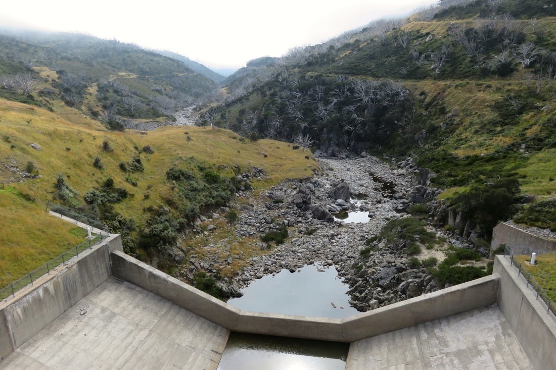
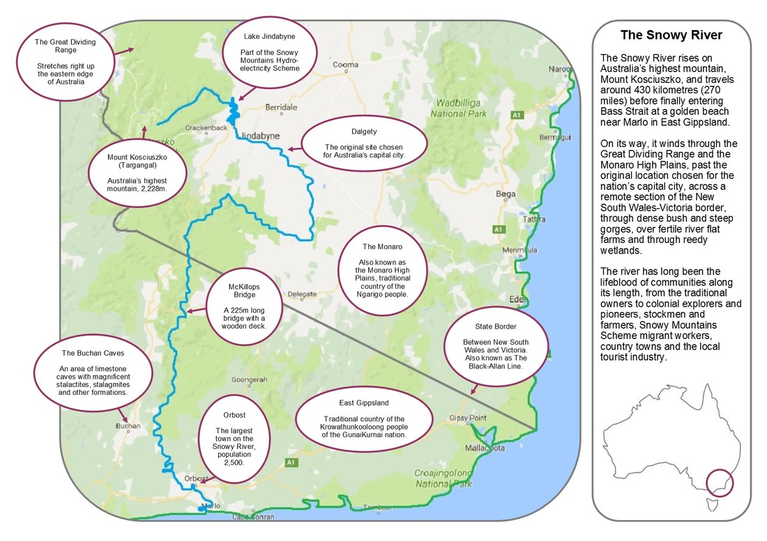
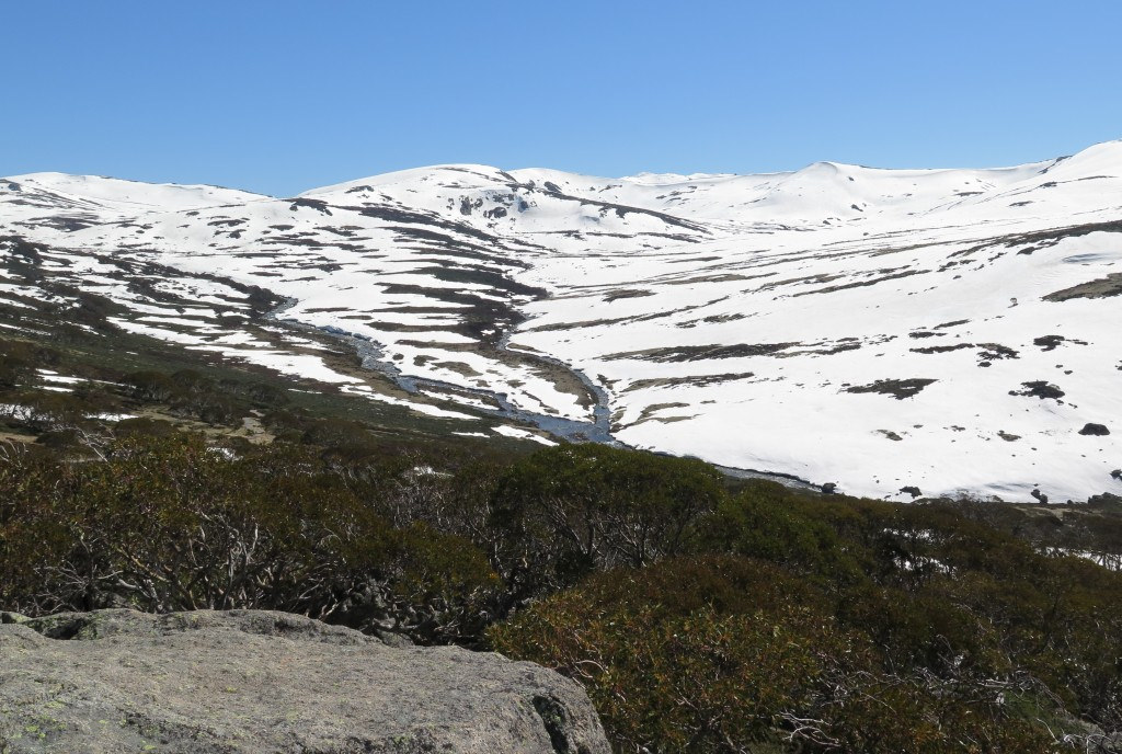
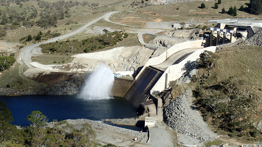
After leaving the high country and passing through the reservoirs, weirs, tunnels, pipes, pumps and dams of the hydro scheme, the Snowy loops through the Monaro High Plains. Our exploration of this stretch was very non-linear: we spent a few nights in Dalgety, canoed the river upstream, wandered down dirt roads and did some (very tame) 4WD exploring of the remote, arid pasture hills to the south. I hope this post gives a flavour of the Monaro, especially around the Snowy.

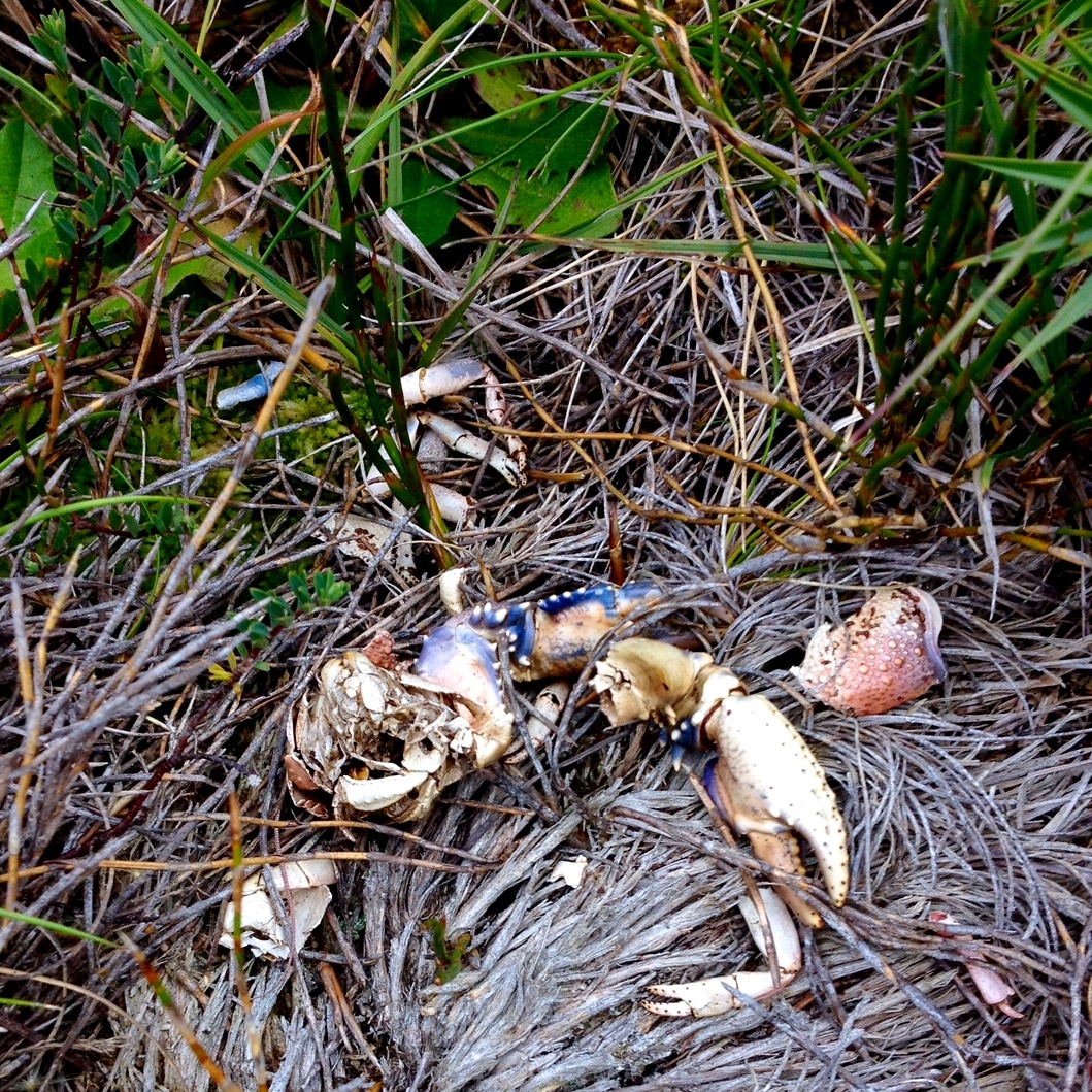
NB: This post contains photographs of a dead animals and bones.
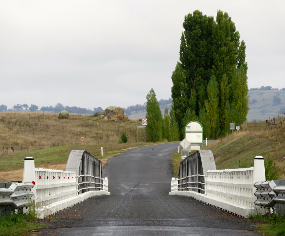
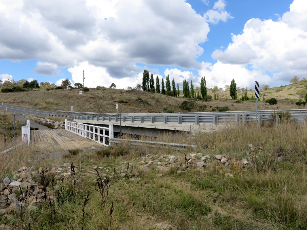
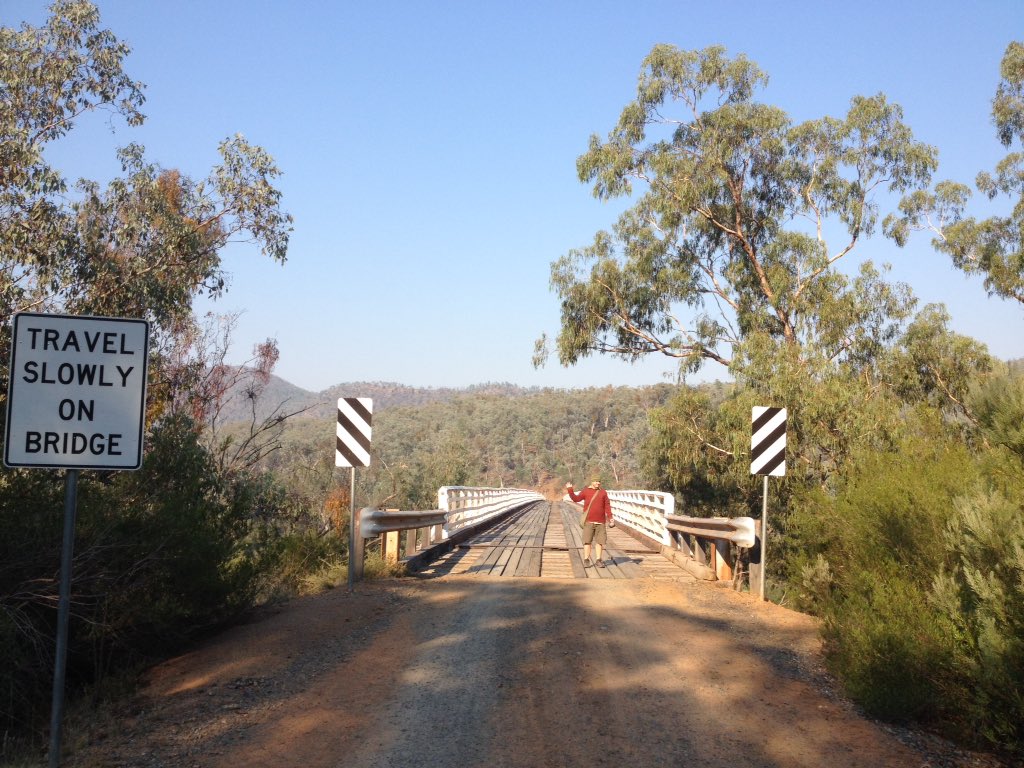
very foreshortened bridge with sealed road
Dalgety Bridge
Dalgety Bridge over the Snowy River, first erected in 1888 to replace the previous punt that crossed a little upstream. Most people who see the Snowy as it travels through the Monaro see it at Dalgety.
paddocks, stunted trees, ruined chimney, water tank
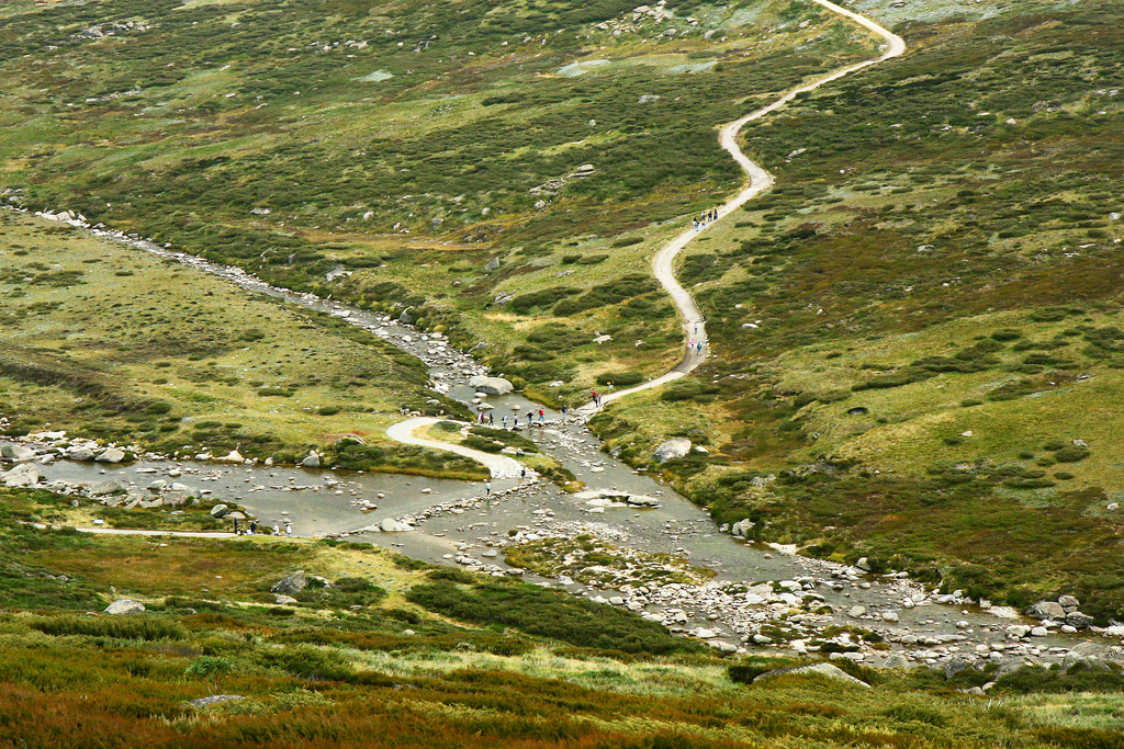
Near the Snowy River Way between Jindabyne and Dalgety
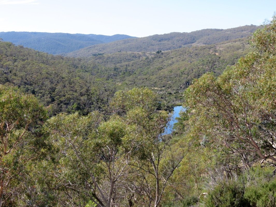
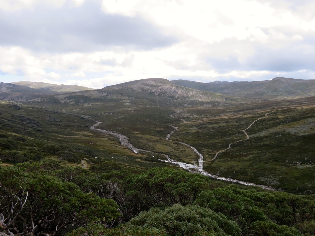
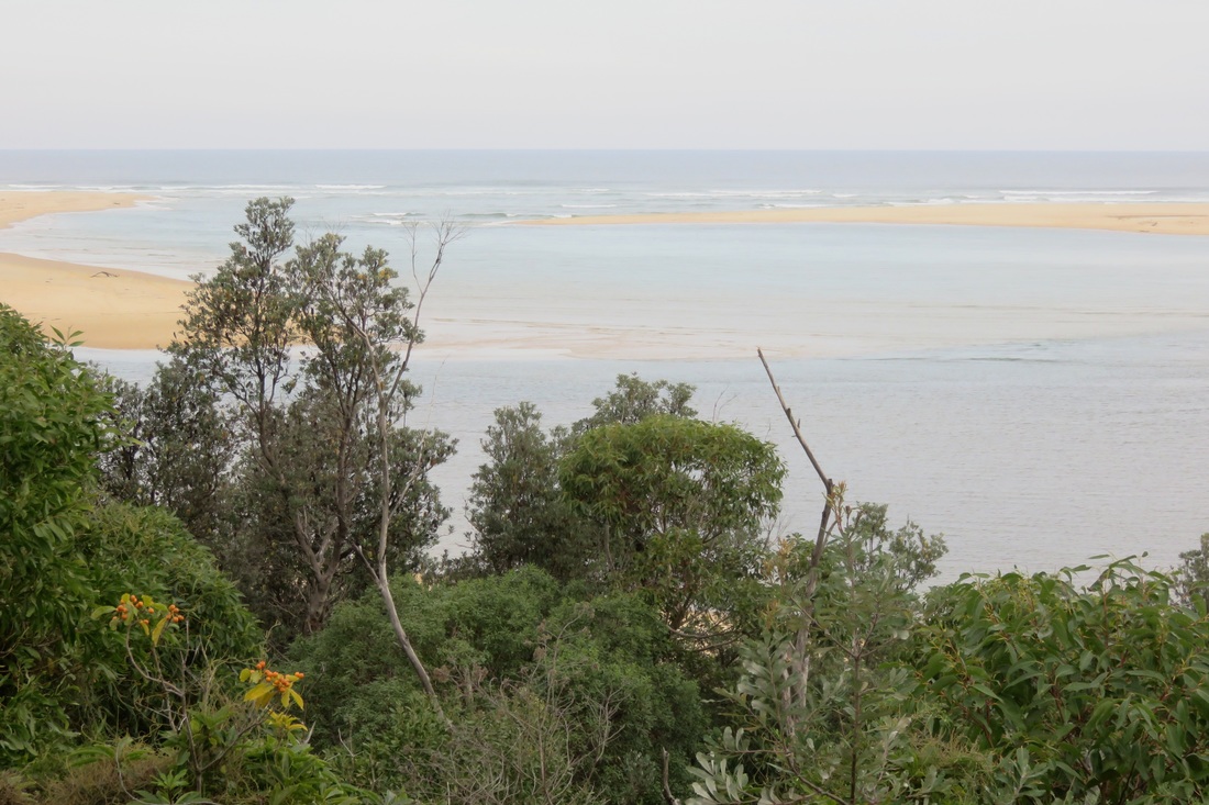
The Snowy emerges from the steep-sided gorges of the high country into the rolling farmland and grasslands of the Monaro. (The photo above was taken before we reached the Monaro proper, as we were hitchhiking to Dalgety - but you can see the scenery is already changing from the previous section.) “Monaro” is - or at least used to be - usually pronounced more “m’n-air-o” or “m’n-air-uh” than “mon-ar-o”, in keeping with previous spellings like “Menero” or “Miniera”. The range of spellings is a sure sign that the name was transcribed from one of Australia’s Indigenous languages, and most sources give the meaning as something like “high plain” or “plateau” or “breasts” - referring to the smooth, undulating hills. Christine Frances Hansen discusses the name in her dissertation Telling Absence (pages 26-27), which charts many possibilities, including the option that there wasn’t a language name for the collective area now known as the Monaro - rather, when asked, a local person answered “manyer” or “I don’t know.”
Heavy clouds over wooded hills and dry paddocks
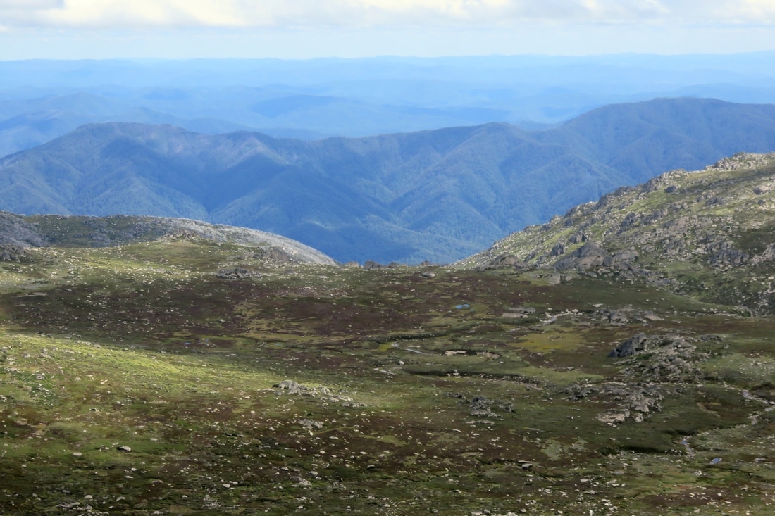
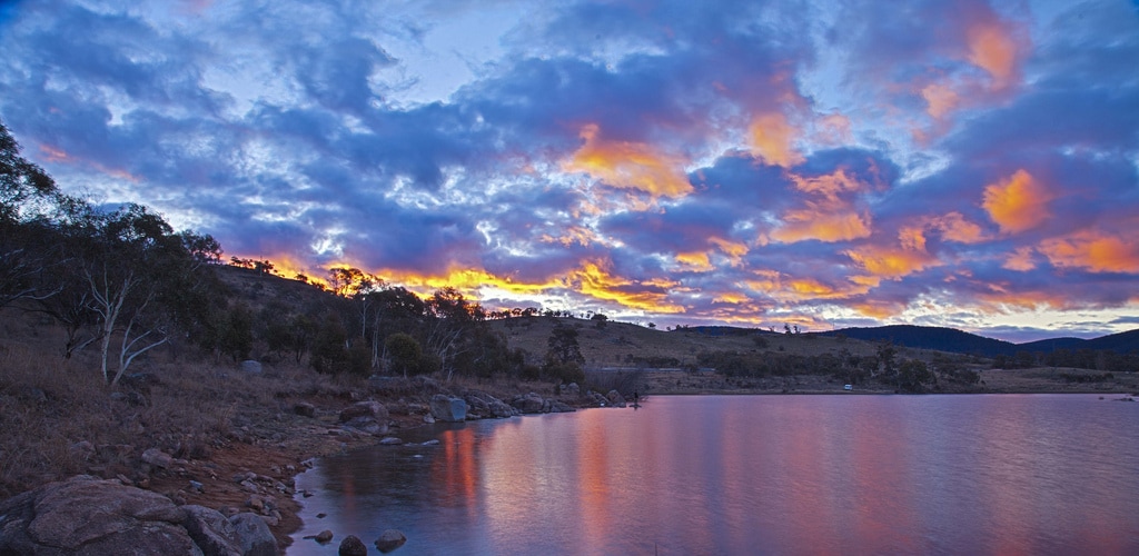
Rain storm in the high country
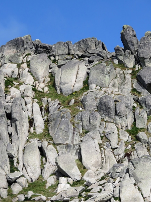
Geographers usually describe the Monaro as a plateau, sitting above the eastern seaboard escarpment and below the Great Dividing Range - you can see the difference between the wooded hills of the Divide and the grasses of the Monaro in the photo above. Geologists (who apparently can never agree) generally think the Monaro High Plains are a basalt lava field formed sometime in the last 50 million years, when lava from small volcanoes flowed over the landscape, filling in the low-lying areas and valleys to create a gently undulating plateau. The rounded, Henry Moore-esque boulders which you can see scattered across the plain are granite. They are what has remained after water and naturally occurring acids have eaten away at the surrounding rock, turning it into gravel and clay which is in turn has been eroded by wind and rain.
treeless, rolling hills with weathered boulders in foreground
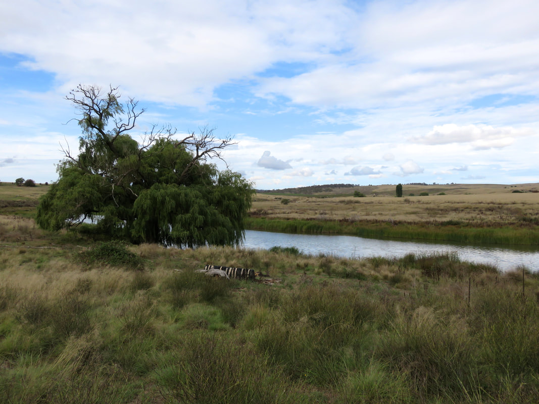
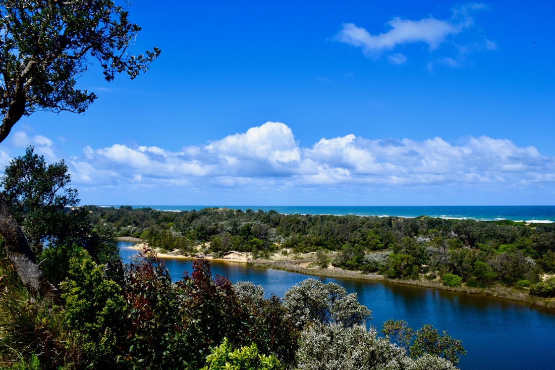
Monaro High Plains from the Snowy River Way east of Dalgety
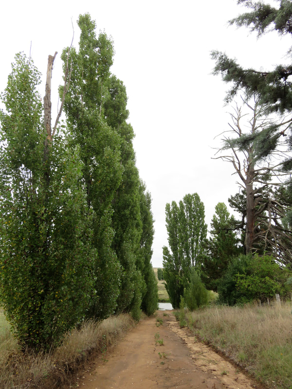
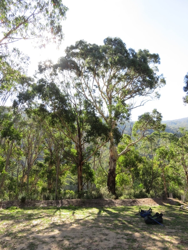
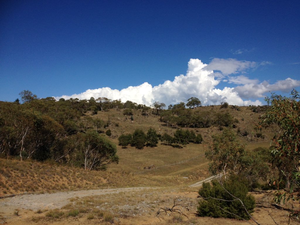
More striking than the rolling hills and granite boulders, though, is that the Monaro is virtually treeless. The photo above, taken as we started our drive downstream, is a fairly typical example. I remember staring out of the car window on many trips between Orbost and Canberra as a kid, comparing this landscape to the tall, straight, densely packed trees of East Gippsland and thinking I might as well have travelled to the moon, it was so different. You might assume that the lack of vegetation here is a result of colonial/white settler damage as it is almost everywhere else in Australia: clearance for crops, over-grazing, logging, or a combination of all three. In fact, the Monaro was treeless when non-Indigenous people first moved through and settled here and scientists believe the phenomenon is caused by a combination of heavy basalt soil laid down by those ancient volcanoes, low rainfall (the Monaro mostly falls in the rain shadow of the Great Dividing Range) and the fact that the cold air pooling in the valleys makes it too cold for seeds to germinate (in winter, the Monaro is the coldest part of the country outside of the Alps), but the plains are not high enough for cold-resistant alpine vegetation to grow.
Two emus in long grass
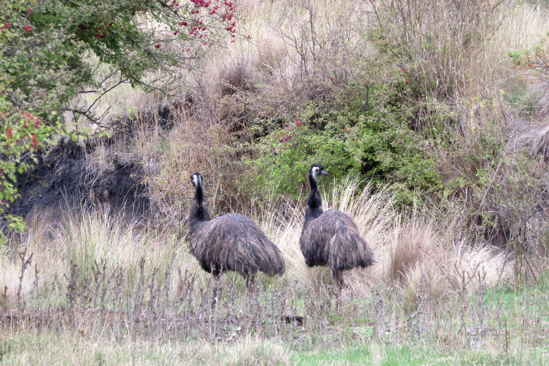
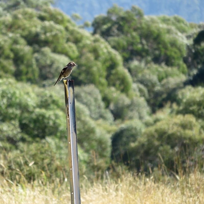
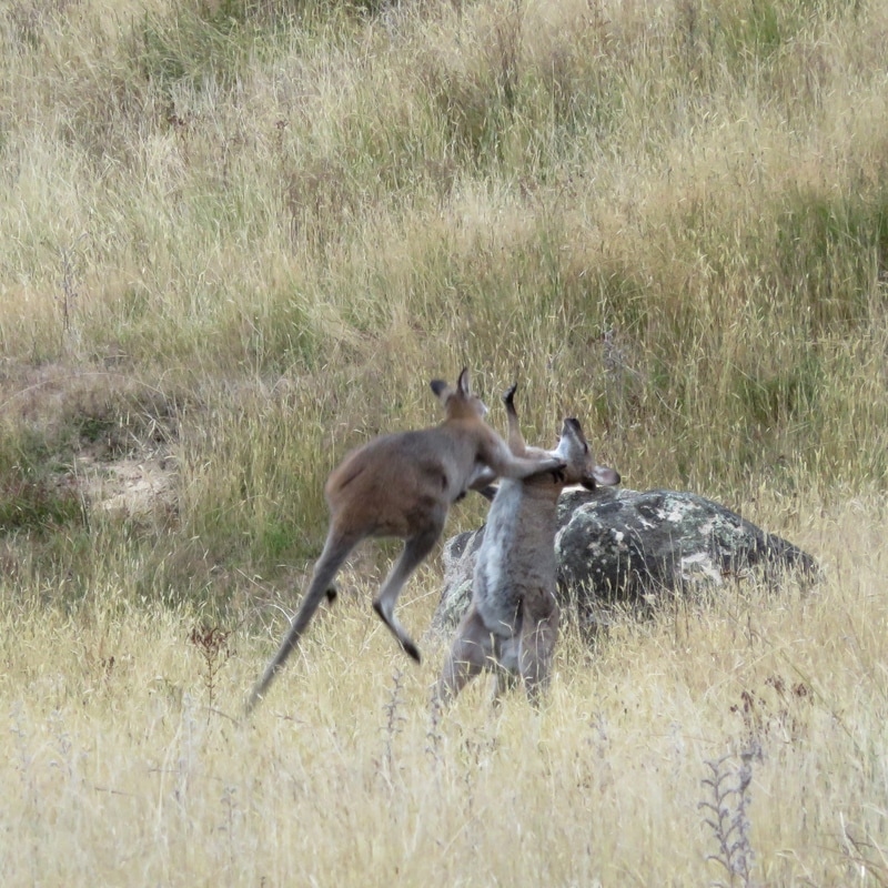
Two emus near Beloka
seven emus - one white, four young
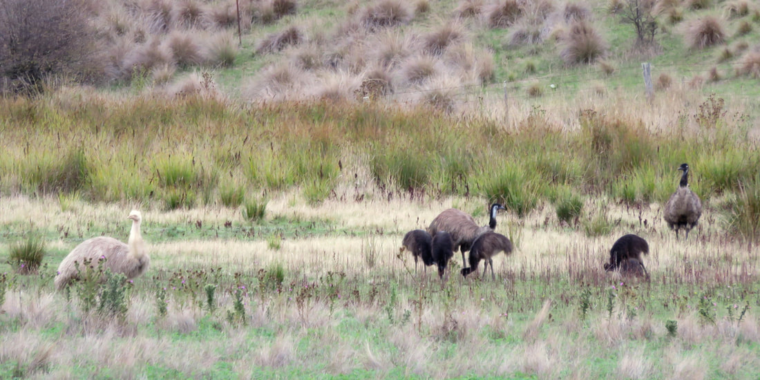
Seven emus, including a white adult and four young birds
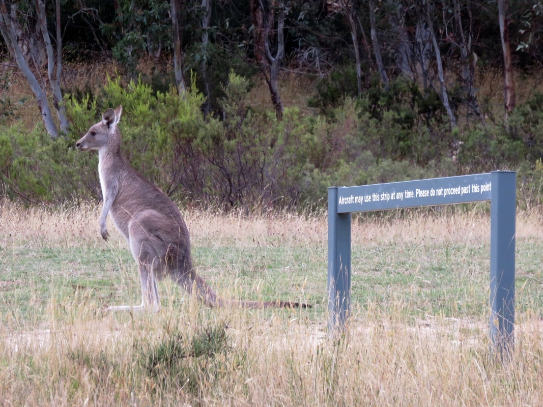
We loved seeing these emus - including some young birds and a completely white adult - near Beloka, west of Dalgety. We wondered if the white feathers are leucism (which I learnt about after seeing white-winged crows in East Sussex) or albinism, but we weren't close enough to see if it had pink eyes. The first emu photo above contains a lot of clues to the use and mis-use of the Monaro - non-native hawthorn trees and weeds all over, signs of bad erosion, and yet these emus thrive on land that seems barely able to sustain farm stock.
person and canoe on gravel bank in river
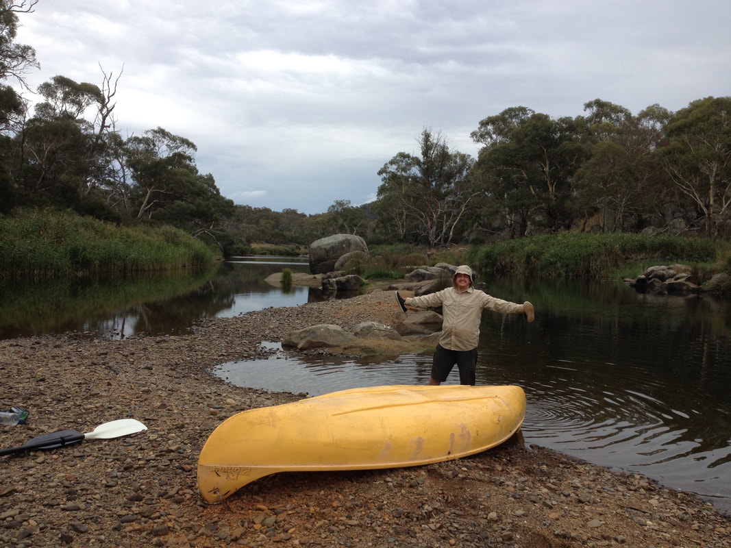
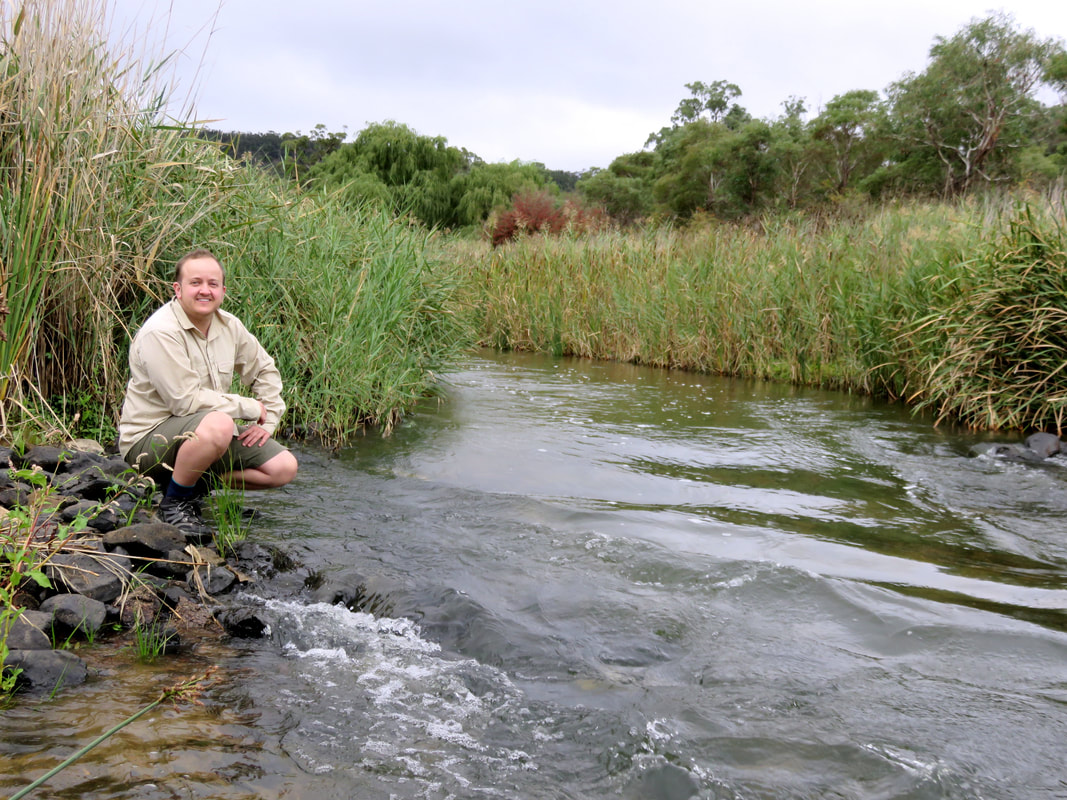
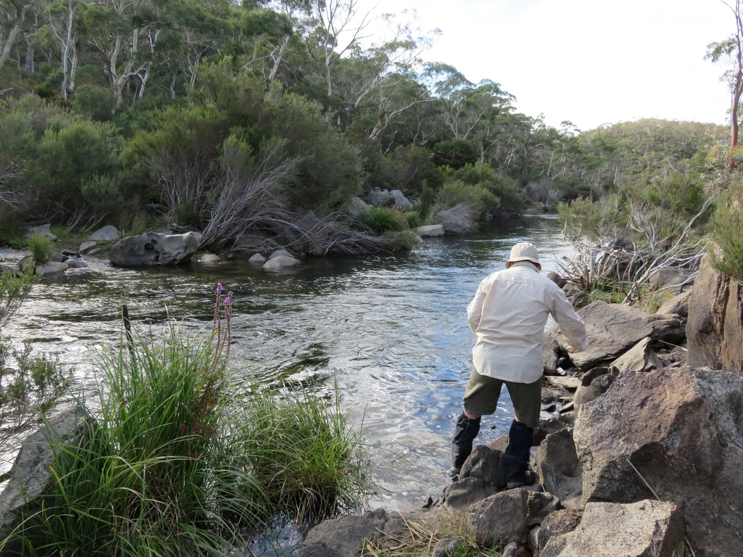
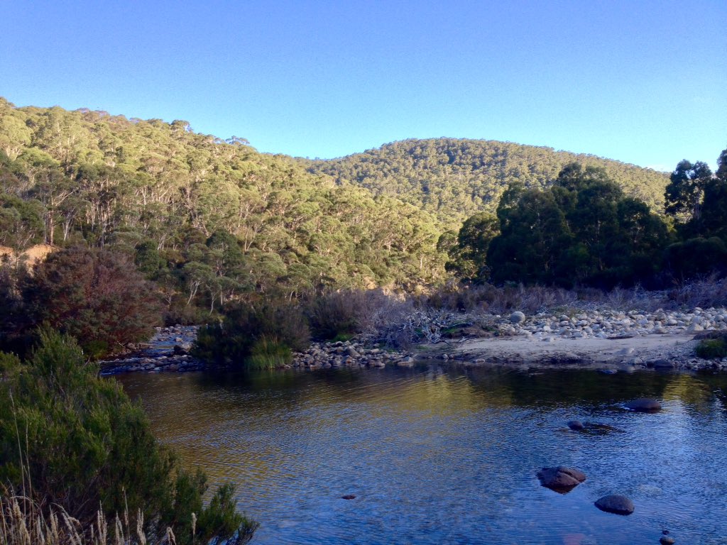
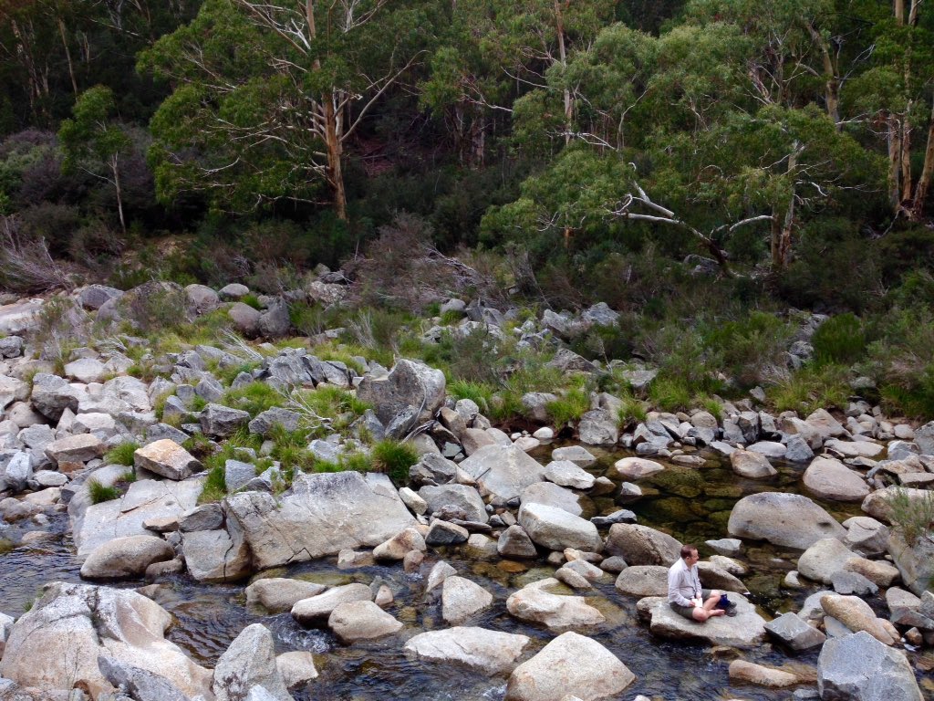
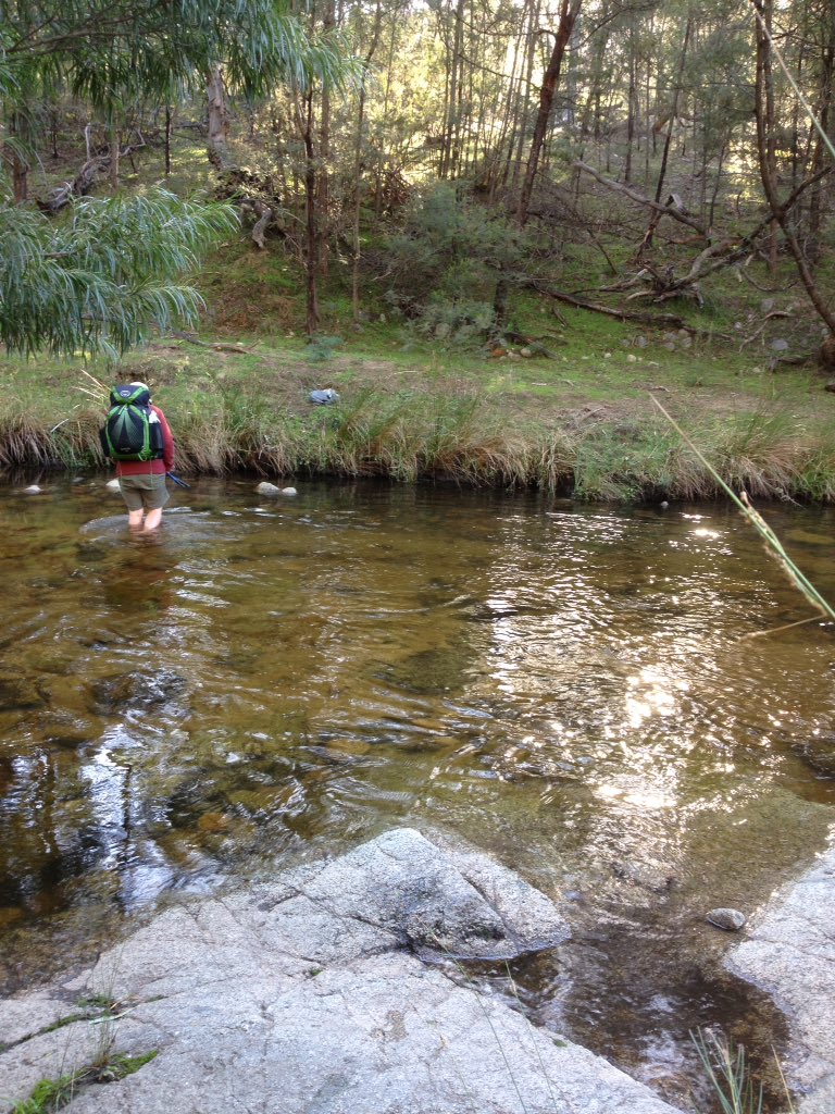
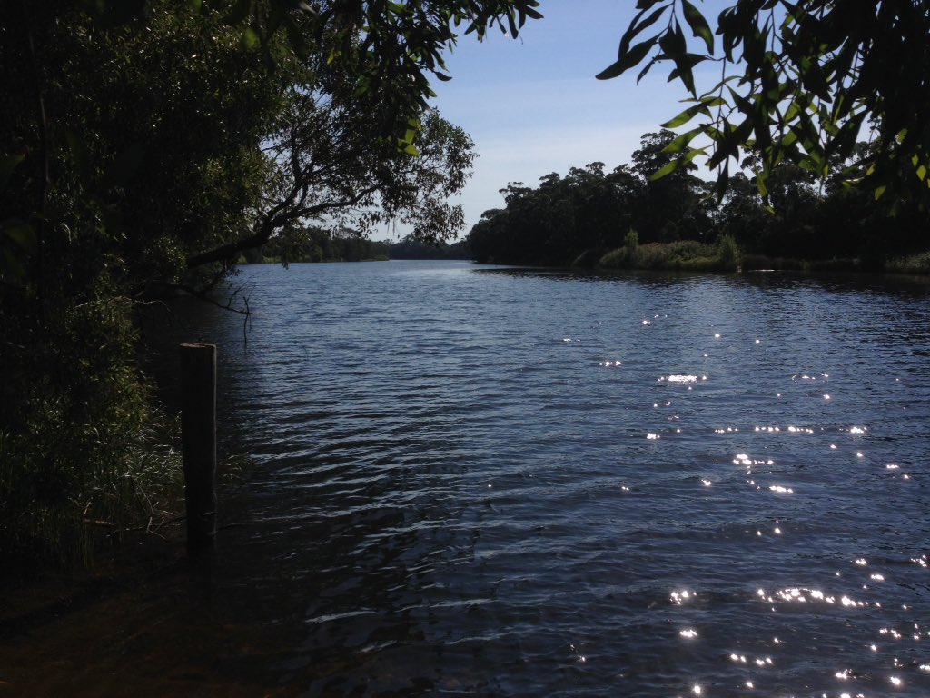
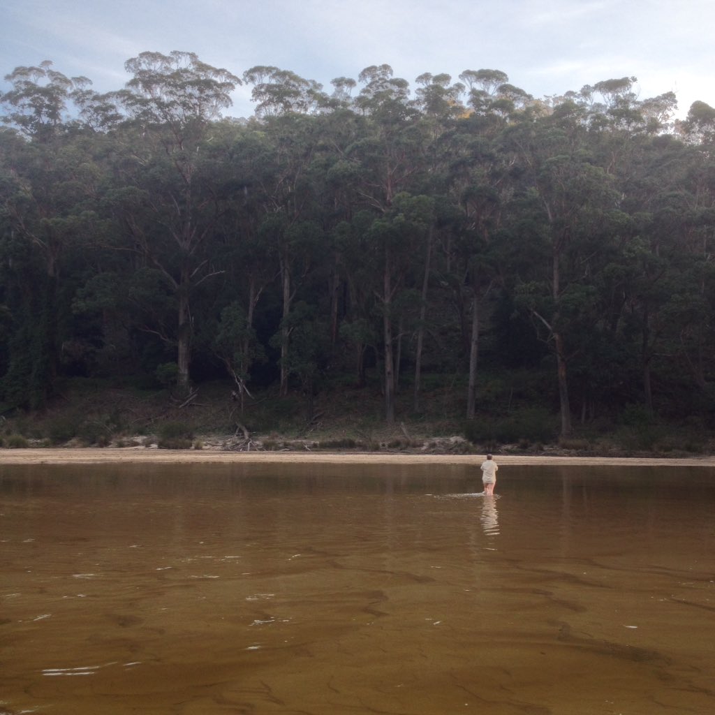
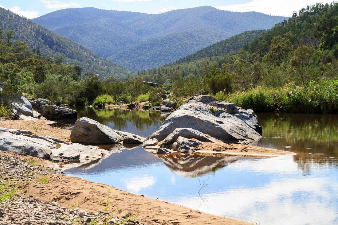
Taking a break from paddling on the Snowy River north of Dalgety
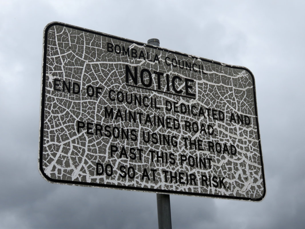
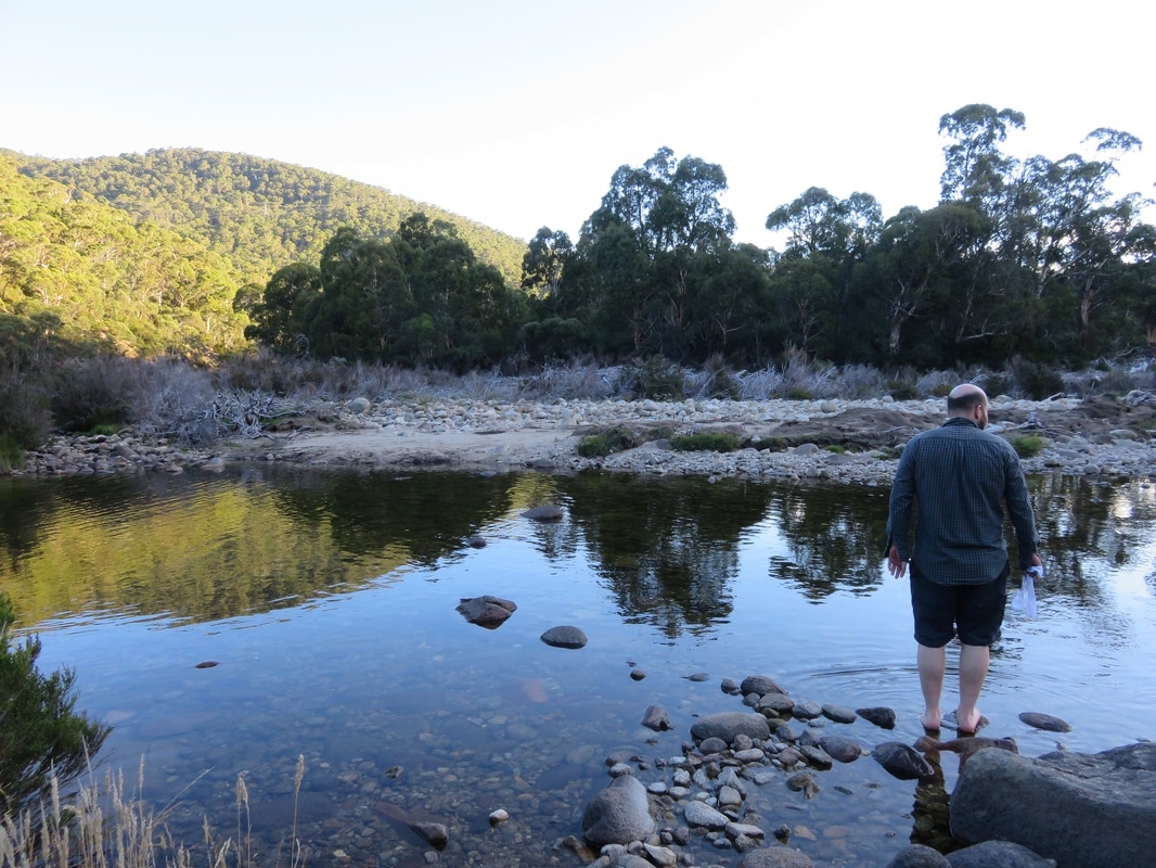
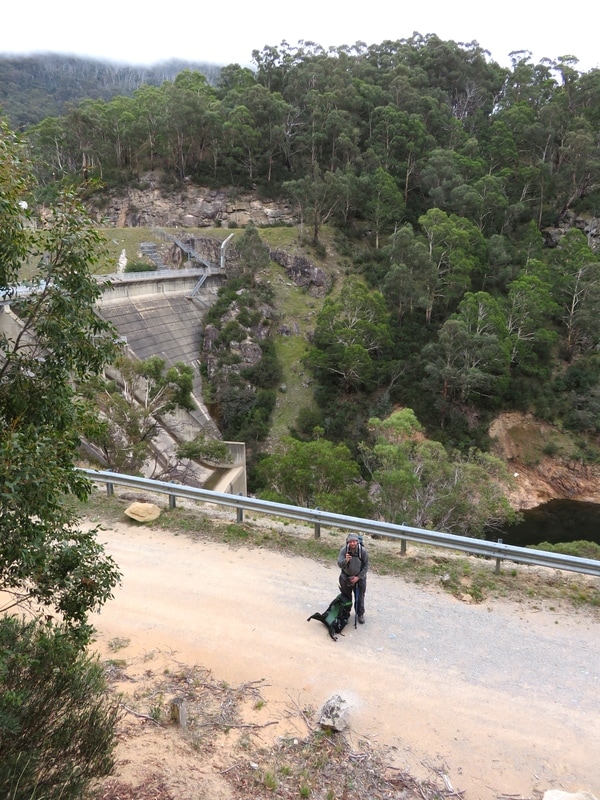
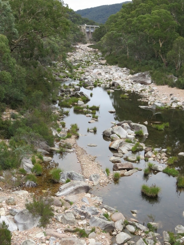
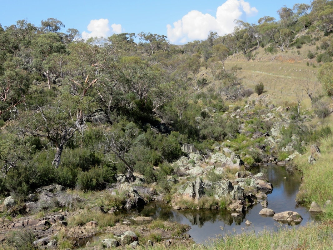
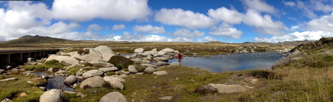
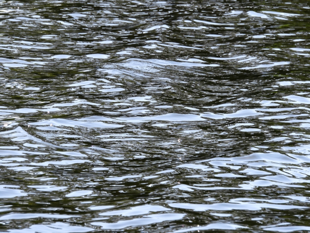
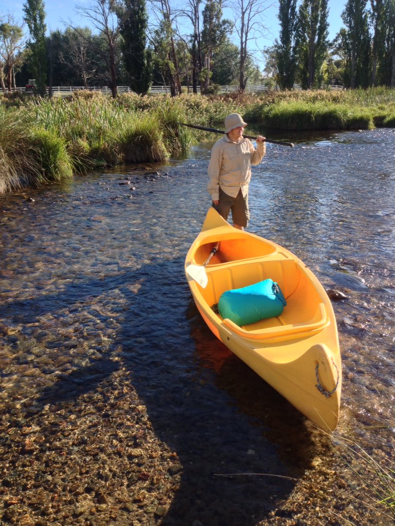
This would once have been underwater. Around here, the Snowy of old was a natural stock boundary for nearby stations. When the river was dammed, farmers were informed they might need to extend their fences, but the local belief was that the scheme would only ‘skim the snowmelt’ from the river, keeping anything over flood level. In reality, Jindabyne Dam stopped the river almost entirely. Photos of the river at 1% flow show that it could hardly prevent a determined sheep from straying to greener grass. The difference between the Snowy of old and the river in its dammed state was, and is, most keenly felt in this stretch. Here, joined by the rushing waters of the Thredbo and Eucumbene, the river would once have swept clean a wide path over the stones lining the riverbed. These days, that path is much narrower, the water slower, the stones often covered with a thick layer of sediment. While canoeing upstream of Dalgety, we enountered a long stretch of reed-clogged river. The water moved from side to side of the old riverbed, meaning we had to paddle back and forth, searching for a gap in the reeds. We often had to jump out of the canoe to drag it down rapids between each reed-walled pond, trying not to fall and twist our ankles, hoping we weren't annoying any snakes in the reeds!
rippling water
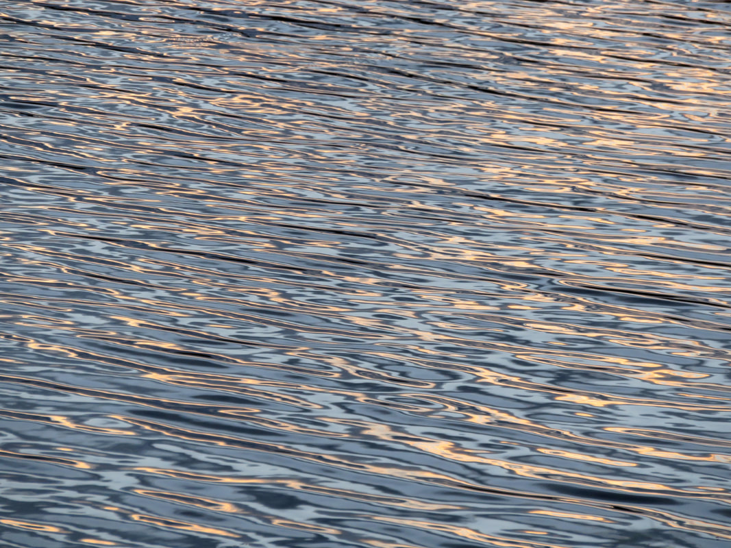
Luscious sunset light on the river at Dalgety.
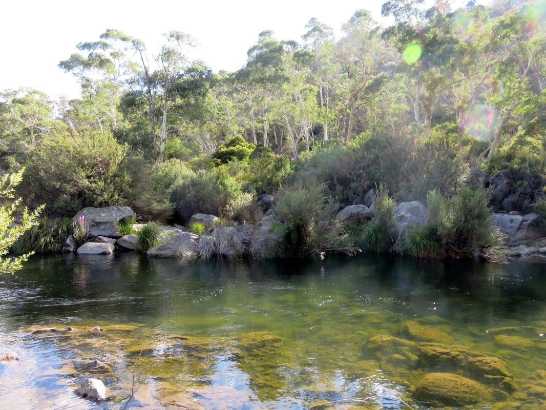
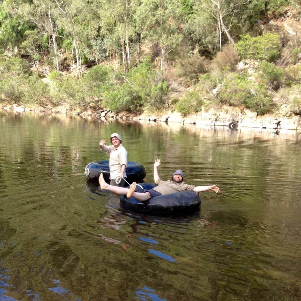
Despite the reduced flow, the Snowy River around Dalgety is meant to be a great spot to see platypus. One evening we wandered up from the campground, following the handmade signs to a riverside spot recommended for platypus sightings, and sat in a pair of plastic garden chairs provided for just such occasions. We were instructed to sit still and silent for as long as we could, as platypus are rather timid animals. I was enchanted by the delicious sunset light playing on the river (above). As we waited, a flock of galahs provided a soundtrack - screeching to roost on one tree, then swirling away behind us to another. We saw no platypus, but it was a relaxing end to the day.
poplar trees and dirt track leading to a river
Barnes Street, Dalgety, leading to the Snowy River
small, colourfully painted stone church, corrugated iron outdoors dunny
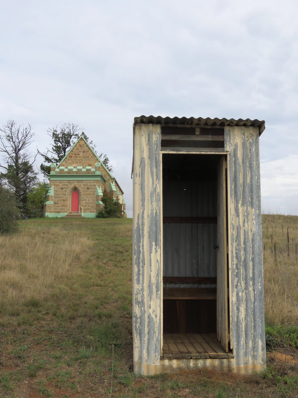
The sacred and the profane, Dalgety
Dalgety sits on a natural crossing place over the Snowy, which has been used for thousands of years. The first non-Indigenous settlement here was known as Buckley's Crossing, uncreatively named after a colonial settler-farmer in the area. The present day pub (built 1889) is still called Buckley’s Crossing Hotel. Buckley’s Crossing became a key point on the droving route down into Gippsland and back, being one of the easiest places to ford the Snowy. It was sometimes called Barnes’ Crossing from the mid-1800s (surprise, surprise, after another settler). The name Dalgety was not applied until the early 1870s, when the town was formally surveyed. Before the bridge was erected in 1888, there was a punt in operation - I think from the bottom of Barnes Street, pictured above left. The Catholic church, Our Lady Star of the Sea (above right) opened in 1878. I think the outdoor dunny opened more recently. (There was another outhouse a bit further away, made of stone and stuffed so full of hay or grass and other organic material that the door couldn't open properly.)
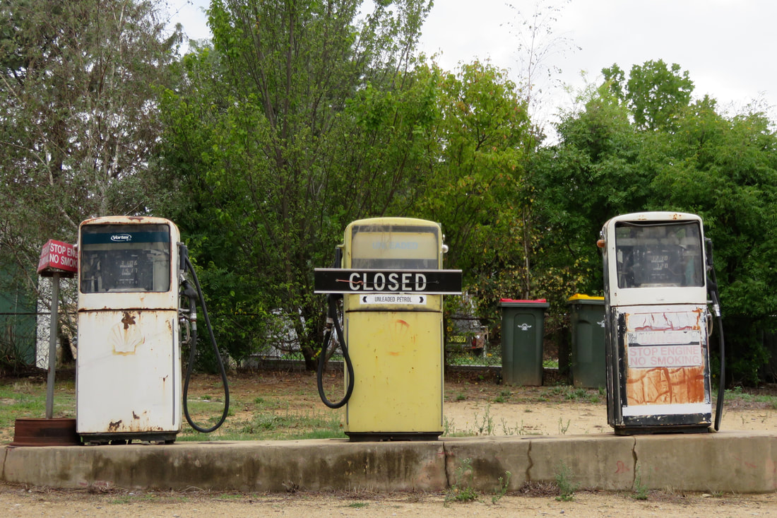
three old, disused petrol pumps
Closed, Dalgety
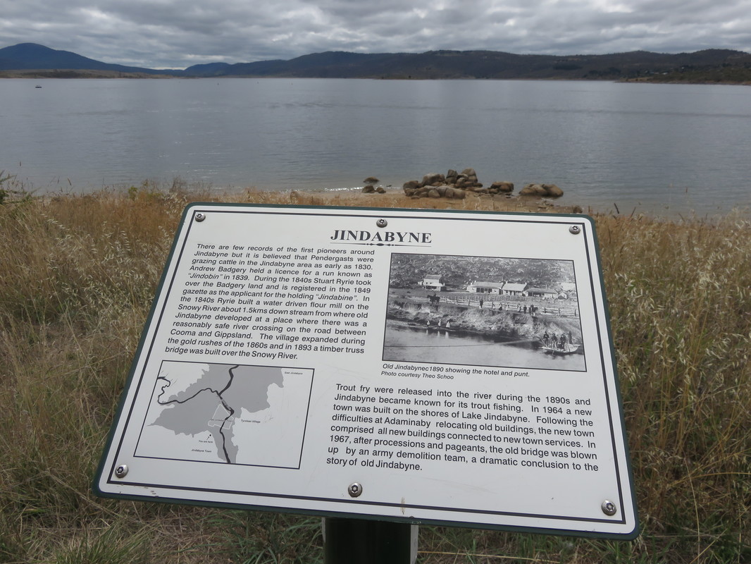
Did you know that, for a few years, Dalgety was set to become Australia’s capital city? Here’s a history lesson for you. After European invasion but before federation in 1901, settled Australia was not a single nation but a series of British colonies. Victoria and New South Wales were the two largest and most powerful colonies and there was a deep-seated rivalry between them, partly based on their differing trade policies. This proved to be a hurdle on the track to federation, as both colonies believed the new nation should follow their trade practices. In addition, a new nation needed a new capital city and bitter debates raged over whether that should be Sydney (the older city, in New South Wales) or Melbourne (then the larger city, in Victoria). This disagreement called for a compromise - and section 125 of the Australian Constitution states, “The seat of Government of the Commonwealth . . . shall be in the State of New South Wales, and be distant not less than one hundred miles from Sydney” but that “Parliament shall sit at Melbourne until it meet at the seat of Government.”
monaro plains with small town in river valley
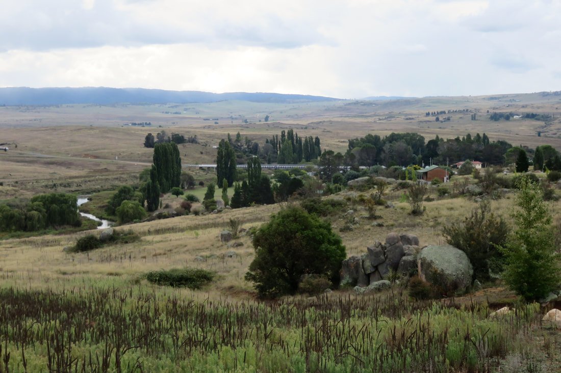
View of Dalgety, Dalgety Bridge and the Snowy River from Hickeys Rd
Thus began the search for a suitable location for Australia’s new capital city. In February 1902, senators made a trip to proposed sites. Climate, soil fertility and the ability of locations to support major industries were paramount - though it seems that the majority of sites failed the first test, providing sweltering summer heat, threat of bushfire and dust storms. After those experiences, it’s no wonder that the cooler climes of Dalgety provided a smidgin of relief. There’s a famous photo of senators swimming in the Snowy at Dalgety during the tour. They’re chest-deep in smooth water, flanked by the area’s characteristic rocks and dark shrubs. At bleaker times of the year, Dalgety was buffeted by bitterly cold mountain winds, but at the time a “bracing climate” was considered an ideal environment for producing healthy, intelligent people. Two years after federation, in 1903, a Federal Royal Commission named Dalgety as the optimal site for the new capital city, and this was formalised the next year in the “Seat of Government Act 1904”.
river with small weir and green trees
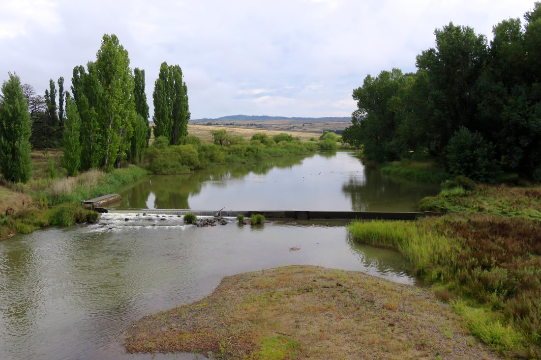
View of the Snowy River and small weir from Dalgety Bridge
I wonder if the Snowy’s fate might have been different if Dalgety had indeed become the capital city. Would the river have been turned into a large ornamental lake, just as in the Griffins’ winning design for Canberra? Or would it have been redirected and sculpted like the Yarra through Melbourne?  It’s likely that the Snowy and Mowamba would have both been dammed - when Dalgety was being staked out for the capital, the surveying team noted the Snowy’s potential for hydro electricity, and part of the reason for the Snowy Mountains Scheme was to provide power for Canberra. But I doubt that the Snowy and its tributaries would have been so mercilessly strangled if their damming and diversion inland for irrigation might have had a visible, tangible impact on the aesthetics and lifestyle of those in the capital city. As it stands, a small weir just upstream of the Dalgety Bridge (above) only gives an illusion of fullness.
farmer on quad bike herds sheep over bridge
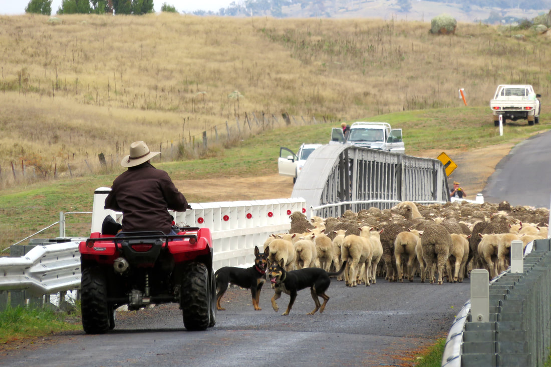
Moving sheep over Dalgety Bridge
For a couple of years, over a century ago, Dalgety must have felt like it was near the centre of Australian culture. But the New South Wales politicians kicked up a stink about the site - they thought Dalgety was too close to Victoria and too far away from Sydney, too cold, too dusty, too sparsely vegetated, too wild. In addition, there was concern from the powers that be that placing the capital at Dalgety would draw sea trade to the port at Eden on the south coast of NSW, which might eventually supersede the harbour at Sydney. To be fair, there were also some practical objections, such as Dalgety’s distance from the main Sydney-Melbourne railway line and how much it would cost to build a branch line to service the proposed capital. And so the search began afresh and the “Seat of Government Act 1908” named the site of present-day Canberra as the location for the new city.
white cross labelled charlie rugman
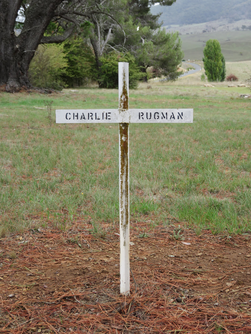
Charlie Rugman, Boloco Cemetery, Beloka
white cross for old dexter
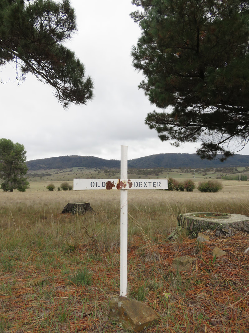
Old Dexter, Boloco Cemetery, Beloka
So in the end, Dalgety did not become the Australian capital; it lost the race. And then, sixty years later, it lost most of its river - and thereafter much of its irrigation and tourism from fishing, its two general stores, butcher, market gardener, service station and police station. It still has a school, caravan park, hotel and small store/cafe but there are only a few dozen houses in town: it's not a lot, considering it might have been the ‘bush capital’.
river with reeds and a willow
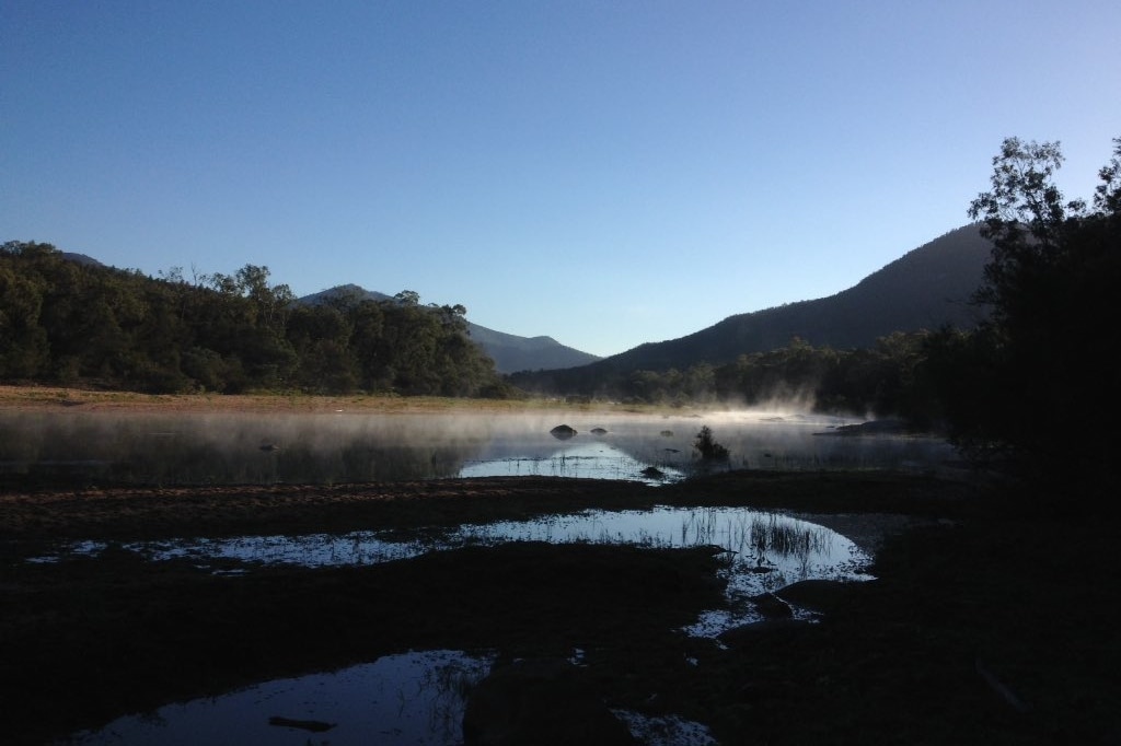
Snowy River near the end of Hickeys Rd, downstream of Dalgety
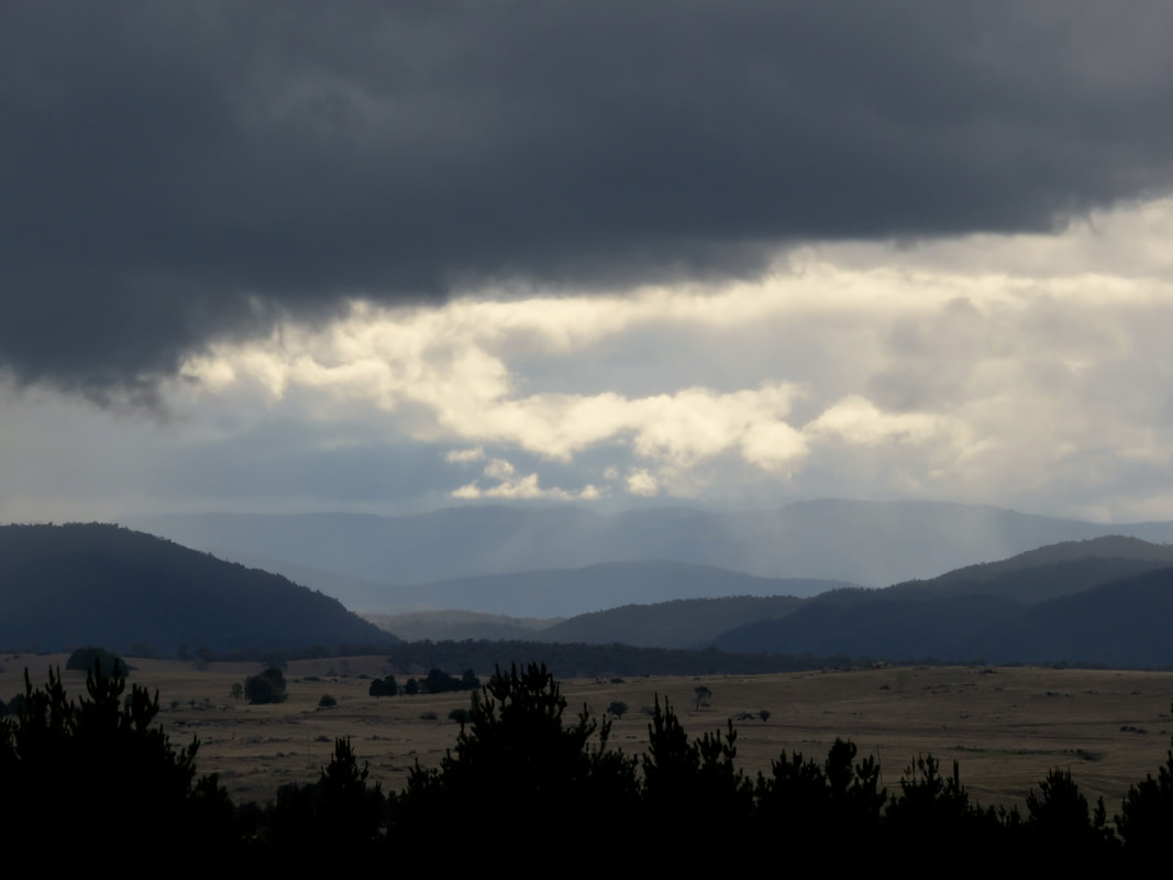
Amusingly, despite the story of the dams and the rain shadow of the Great Dividing Range, it absolutely pissed down on our first evening in Dalgety. But during our few days there, I was lucky enough to see the famed rain shadow in action. I walked out of town and headed down a long gravel road to get a glimpse of the Snowy downstream (above). I watched as a huge rainstorm billowed over the Divide, while only a few dark clouds sporting small skirts of rain made it onto the Monaro.
rain patch
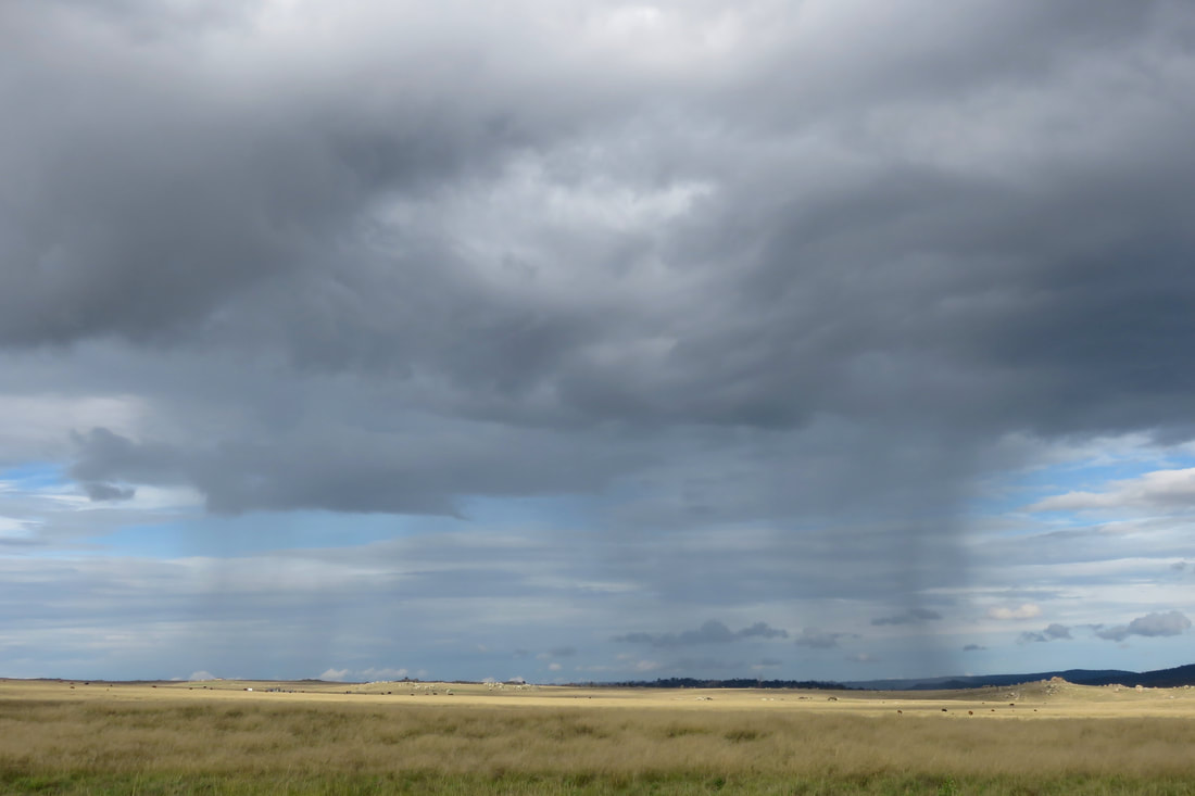
Patch of rain on the Monaro near Dalgety
gravel road leading to distant hills and dark clouds
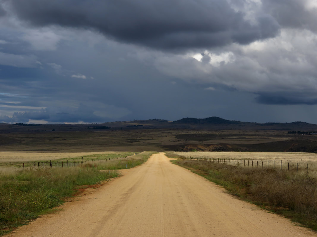
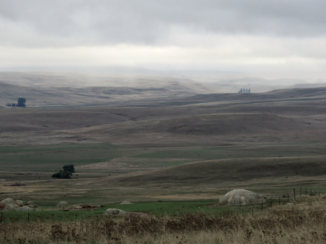
Hickeys Rd, Dalgety, looking south
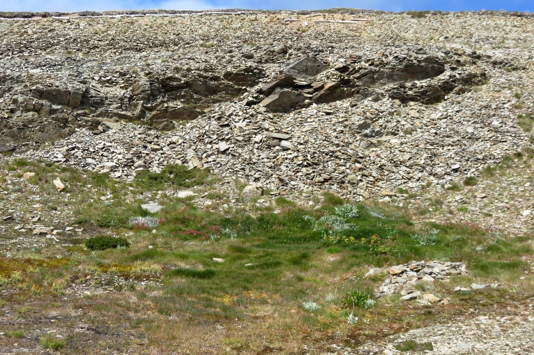
Ironmungy Nature Reserve, about 20km downstream of Dalgety, conserves an area of ridge and hilltop bush in the naturally treeless surrounds. The area around Ironmungy, as across the Monaro, has a long history of Indigenous use. Artefacts have been recorded in the reserve, in similar densities as other sites around this part of the Monaro. It’s thought that these spots by the river, with their easy access to water, materials and food combined with the warmer shelter of the woodland environment, would have made good winter campsites. The name itself originates from an Indigenous language, possibly one of the local Ngarigo dialects. (If you’re interested in this kind of etymology, check out Harold Koch’s 2009 article “The methodology of reconstructing Indigenous placenames”.)
dirt track, two people, grass and trees
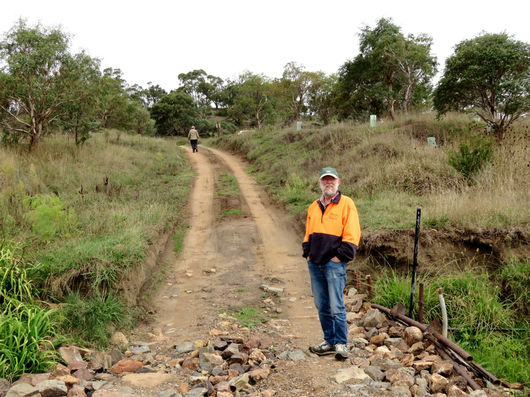
Dan and Dad at Bairds Crossing, Ironmungie Rd / Punt Hill Rd
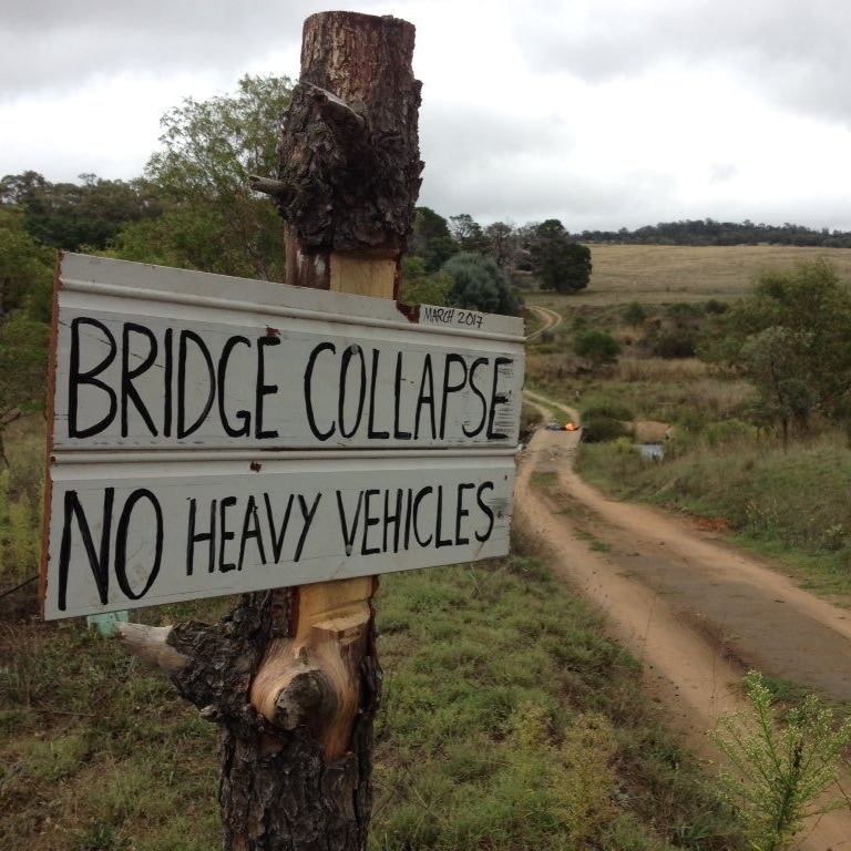
We visited Ironmungy Nature Reserve on our 4WD day downstream with my dad. Some of the side roads were closed so we headed straight down to Bairds Crossing on the river, spotting a big wedge-tailed eagle as we went. This area was declared a Forest Reserve in 1875, and a State Forest in 1917. NSW National Parks and Wildlife Service is fighting an ongoing campaign to control serrated tussock and willow in the area, as well as blackberry and African love-grass, while rabbits have munched away at the botanical diversity of the reserve and foxes on the prowl have destroyed much native wildlife. But down near Bairds Crossing the Snowy River Rehabilitation Project has replanted the riversides with various native trees, shrubs and grasses. Bairds Crossing itself featured a crunched up, broken concrete bridge, with mangled ironwork poking out the sides. A hand painted sign on the approach, dated from earlier that month (March 2017), warned: BRIDGE COLLAPSE. NO HEAVY VEHICLES.
person squats beside reed-lined river
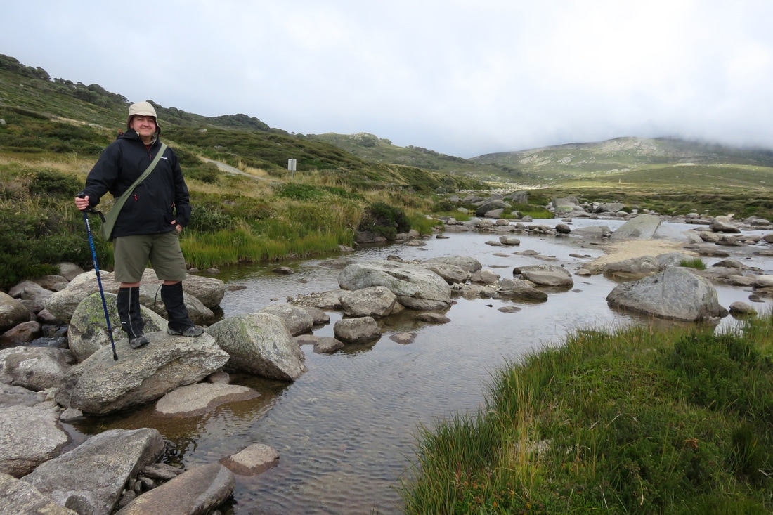
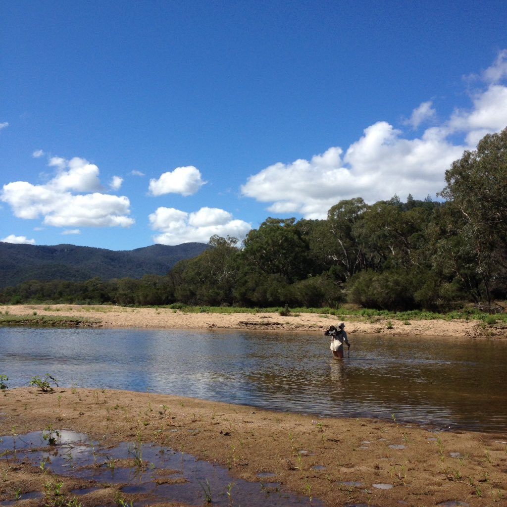
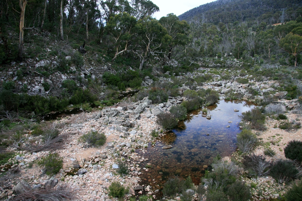
Me and the Snowy River above Bairds Crossing
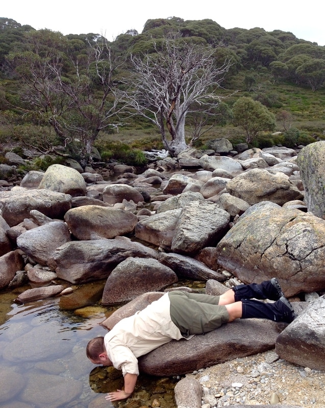
You can see in the photo above how reeds and other vegetation encroach on what was once riverbed. I have to say that, while small, the river was livelier than I expected - perhaps due to the recent rainfall.
corrugated iron shed
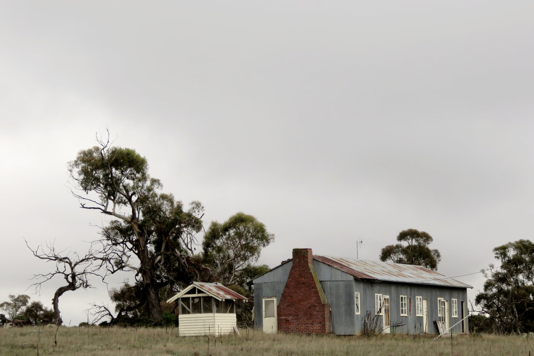
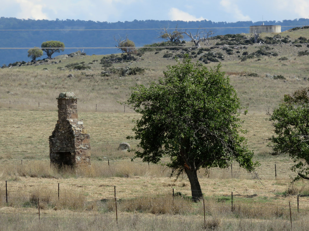
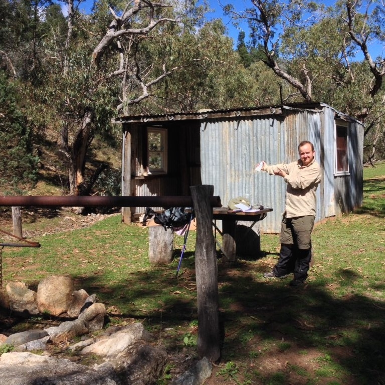
Old shearers' quarters and meat shed, I think off Ironmungie Rd
We drove past many farms and talked with Dad about the history of sheep farming and shearing in Australia. It plays such a big part of the country's colonial (and racist) history, and as we travelled through the Monaro we could see signs of a much more prosperous past - a time when wool was a key part of the Australian economy. There was shearing at a couple of the nearby farms/stations when we were staying in Dalgety; we heard a few people at the pub talking about it. And it was pretty interesting to see this old corrugated iron-clad building a way outside of town. We presumed it was old shearers' quarters. The smaller structure looks like a meat shed - before refrigeration, this is where carcasses would have been strung up and butchered for consumption. The top half would be covered in flywire/mesh to keep the insects out and to let the cooling breeze in. 

The roads took us through grasslands choked with lamb’s ear and thistle and hoarhound, past neat, abandoned farm houses. Perhaps the successful graziers are those who have land elsewhere, somewhere the grass can catch a coastal rainstorm and cattle can put some flesh on their bones before market. Somewhere the local council hasn’t given up on spraying the worst of the weeds. Somewhere the wild dogs don’t terrorise the ewes into miscarrying, or pick off the calves with the tiredest mothers.
cockatoos and a crow
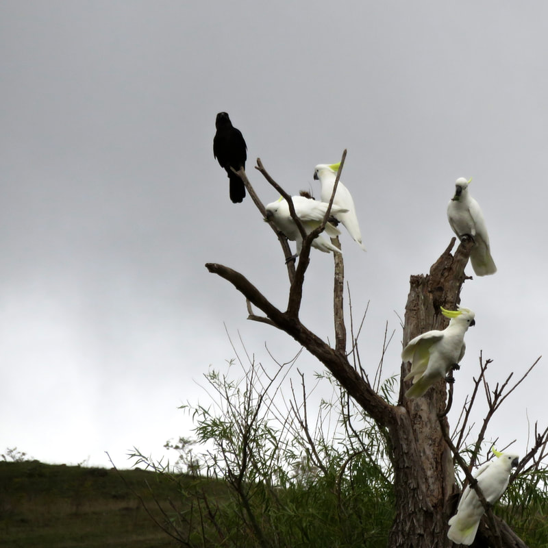
Crow and cockies, Ironmungie Rd
dead dog hanging from a tree
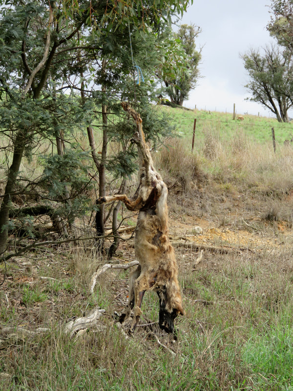
Dead dog/dingo strung from a tree, possibly on Paupong Rd
They say there’s no such thing as a pure dingo around here. Two hundred years of domesticated dogs - run off bush, abandoned, dumped, gone feral - and interbreeding has seen to that. But the dogs we saw strung up from trees and fences, despite the palimpsest of decay, had the typical yellow and cream colouration of dingoes. In the photo above, you can see a jaw that could bite the throat out of a smaller animal and the big, triangular ears that would have pointed, alert and incongruously fluffy, when it was alive.
sign that has been crackled
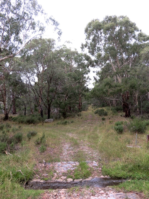
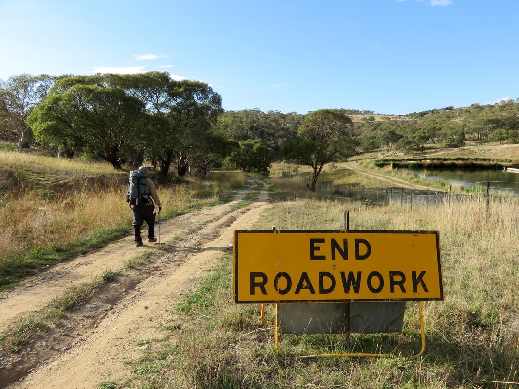
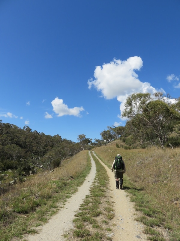
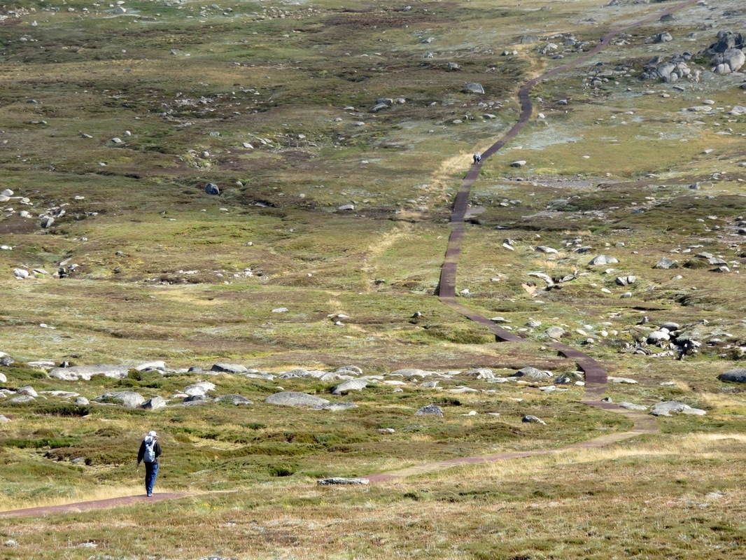
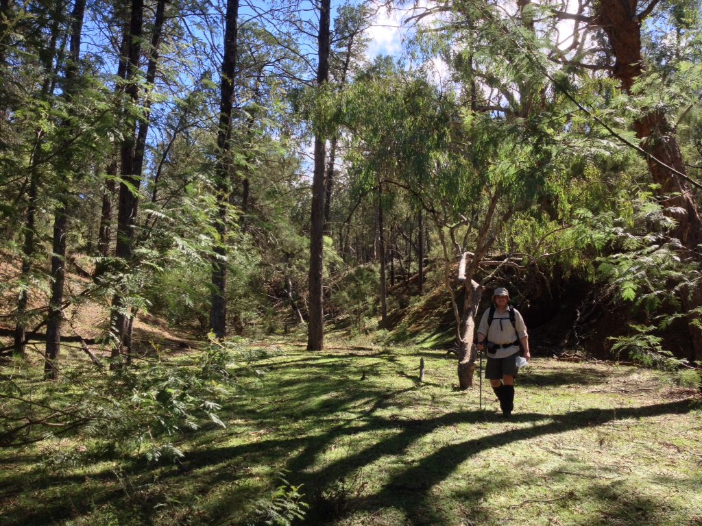
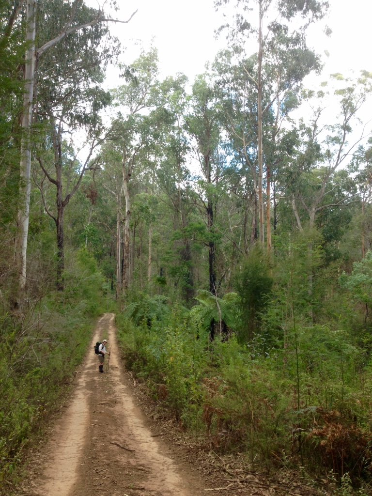
We saw many of these unmaintained roads, often no more than farm tracks running for miles over private property
In the hills near Bungarby, tucked away down a dirt track to the river, secluded amongst the trees and granite, it’s astonishing yet strangely understandable to find a monastery. Understandable, because isn’t this precisely the half-wild, hard landscape, sitting on the edges of formal civilisation that people seeking spiritual nourishment have been inhabiting for thousands of years? Astonishing because, in an area colonised by Protestants and Catholics, this is a Russian Orthodox community for women, established in 1999. ​Finding this community, with its connections to far flung places and famous political revolutions, reminded me once again that the Snowy River’s colonial history is not homogenous. We wanted to go down to the river, but thought we'd ask permission first. I ducked out of the rain under a vine-covered verandah and spoke to the Abbess/Mother Superior through the window to the kitchen. She told me the track was pretty sketchy (well, she didn't use those exact words) after the recent downpours and that she didn't fancy having to come to our rescue if we got stuck.
small church roof in trees
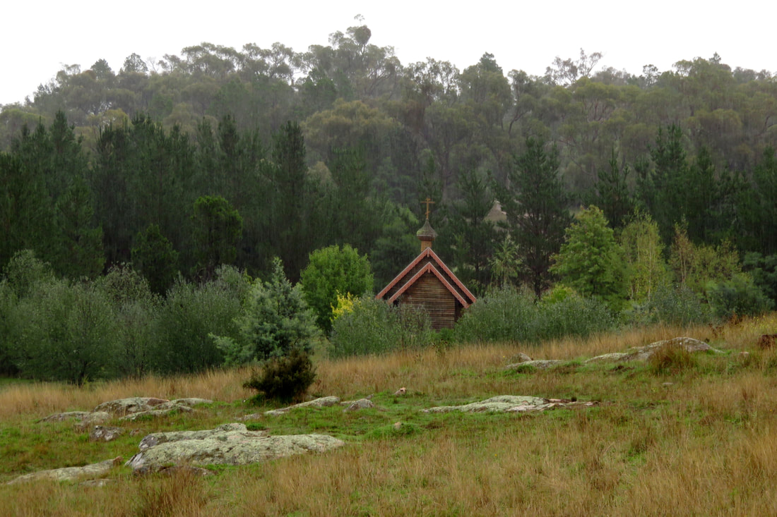
Church at the Holy Convent of the Presentation of the Mother of God monastery
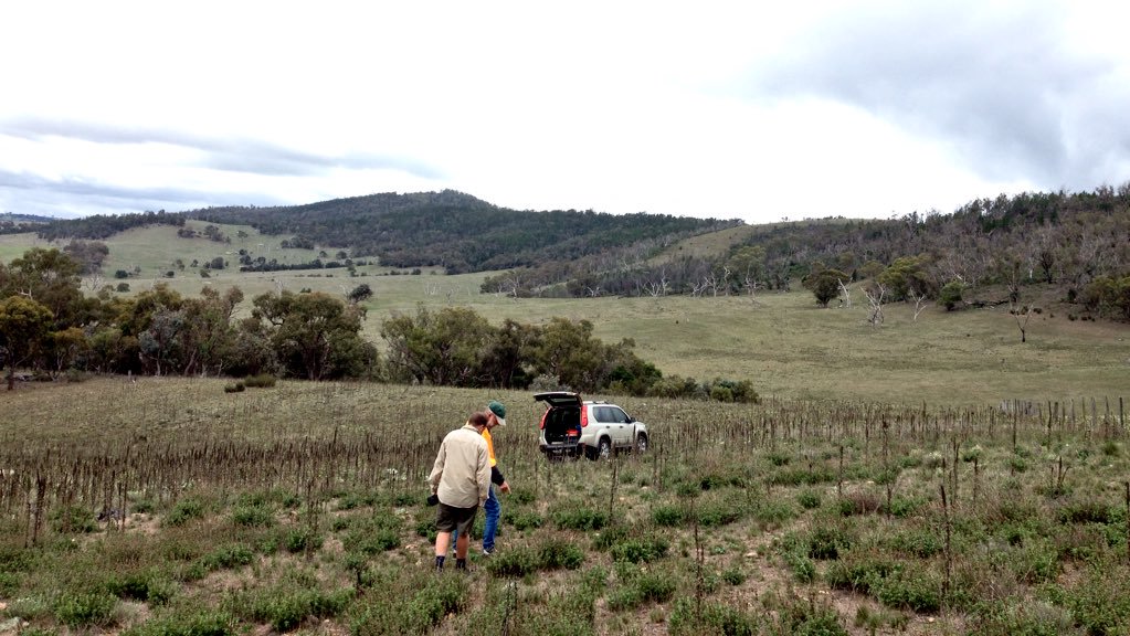
We'd had a bit more luck getting down to the river earlier in the day, right on the extremities of what could be described as the Monaro. The road we were following veered into a paddock beside a small, old farm house and became barely more than a smudge in the grass. I knocked on the door, but the house was empty. Halfway up a nearby hill, we could see a couple of people on a bike rounding up cattle and we waved to get their attention. A few minutes later they came down to chat to us, to let us know they were only here for a couple of hours to pick up their mob and take the cattle down to their paddocks down on the coast, a property with more rain and more grass. It was lucky we’d caught them on the right morning! They doubted our car’s chances of getting to the Maclaughlin, but suggested we could drive up and around through their property, park near an old sheep run and bushbash down to the river at the top of Stonebridge. My ears perked up at that, because I’d read about it in George Seddon’s book Searching for the Snowy and knew it's a place not many people get to see. Thanking them, we headed off, following one of the aforementioned unmaintained roads, going slowly - very slowly - over the enormous waterbars until we came to what we thought must be the place they said to park the car.
car in a paddock
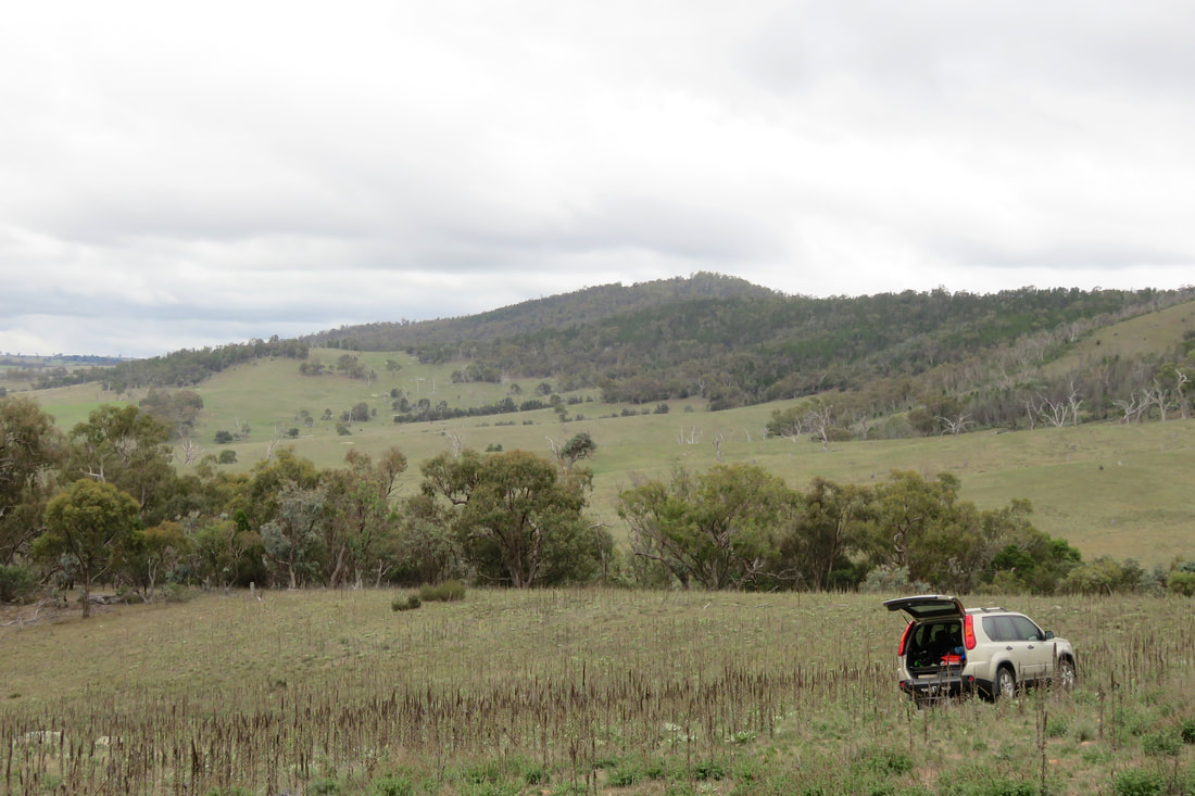
Parked up in a weed-choked paddock above Stonebridge Falls
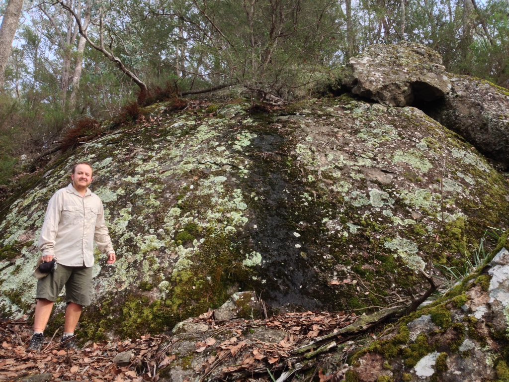
We left the car, crossed through the paddock (full of mullein and horehound) and over the ridge, then used the fence line and feral goat trails as our guide as we bush bashed down the steep hill. In the photo above, I think that the dark green trees are the native black cypress pines - quite distinct from the duller colours of eucalypts surrounding them. 
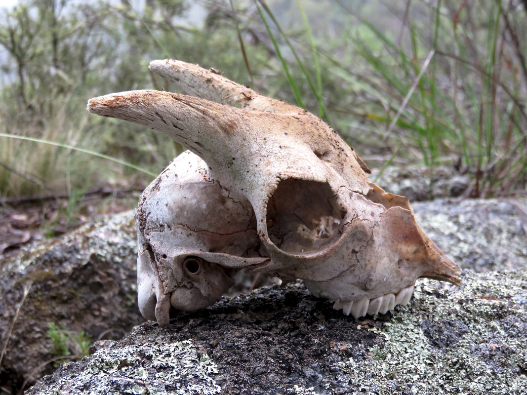
skull of small goat with horns
Goat skull
Our friendly guides had told us to look out for goats and for a big stone outcrop that they called Goat Rock, which they said always had goat poo on it. We knew we were on track when Goat Rock appeared as promised. We'd caught glimpses of the river before, but the view from the top of Goat Rock was pretty special. We scrambled down and across the rocks, made slippery by the drizzle, until we stood beside the river at Stonebridge.
view of river through trees
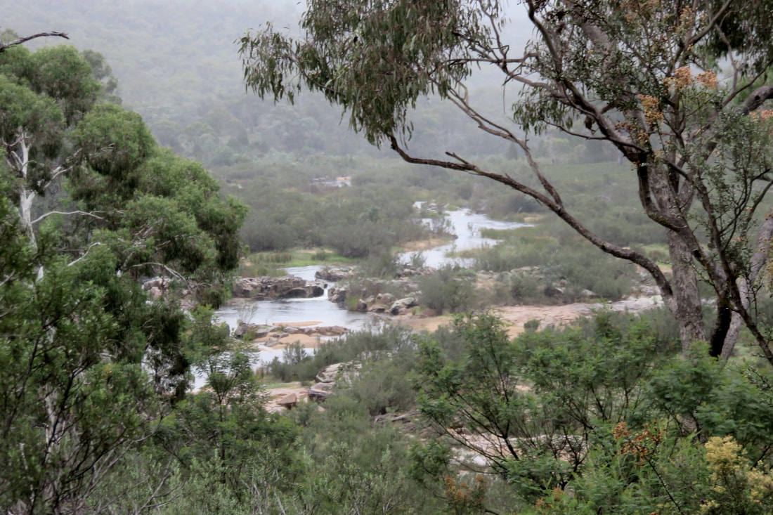
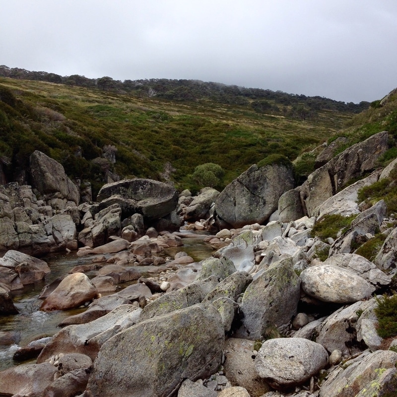
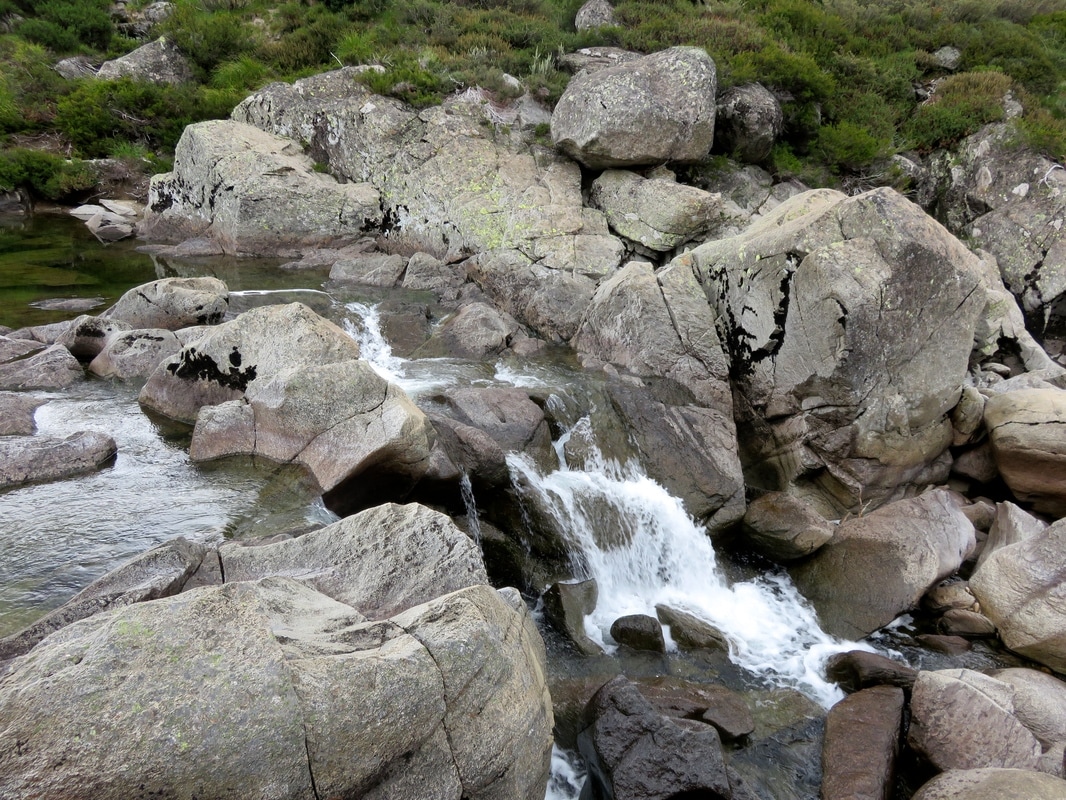
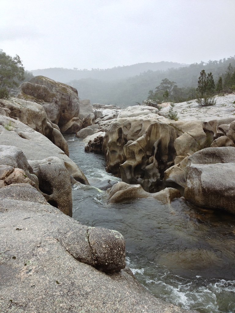
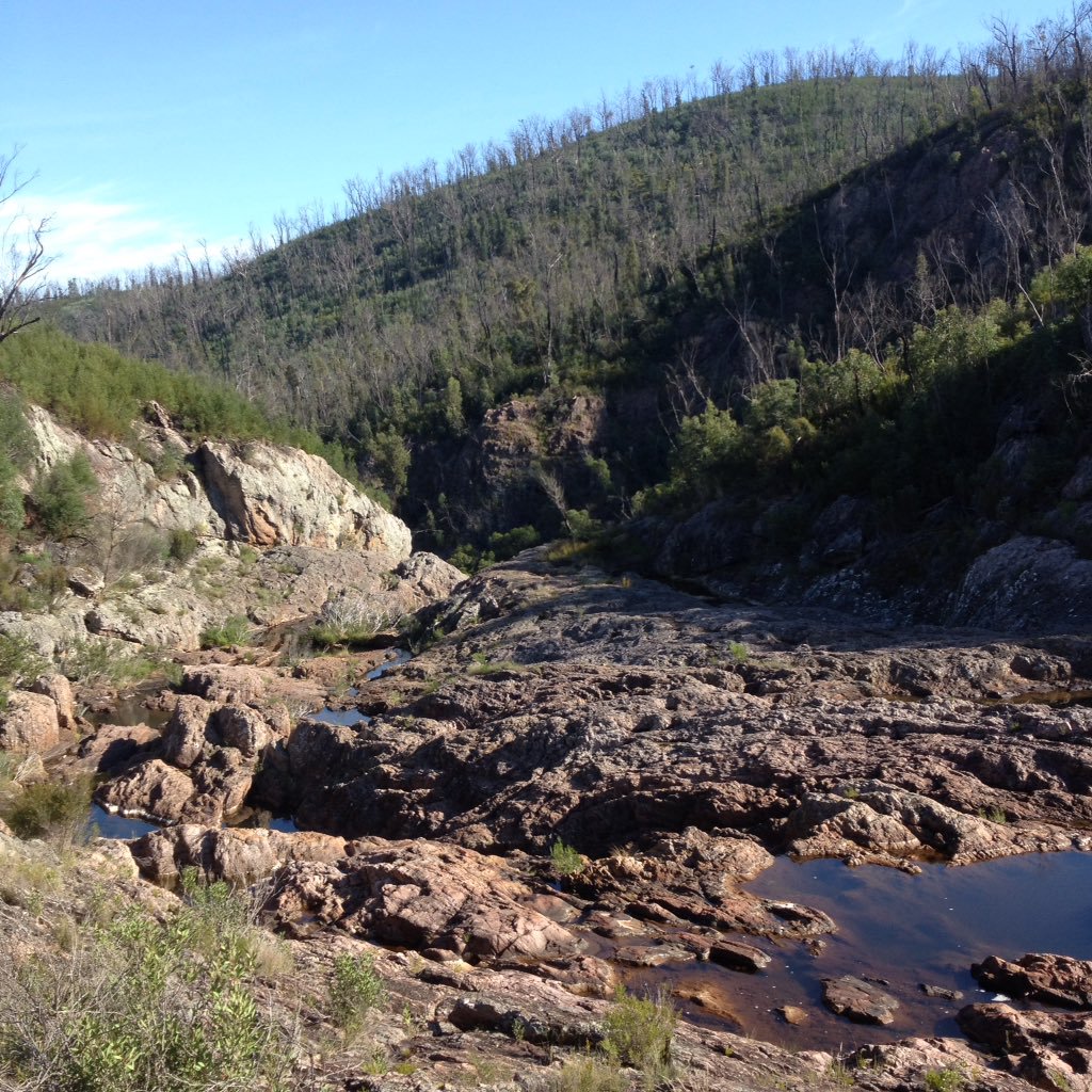
The Snowy River immediately above Stonebridge Falls
George Seddon describes Stonebridge in Searching for the Snowy (1994:71) like this:
It consists of a drop of perhaps twelve metres over a distance of about 200 metres, but it is not an ordinary rapid so much as a massive and intricate piece of rock sculpture. The rock is a hard, dense and mostly fine-grained granite, with many inclusions (xenoliths) of a dark rock that had been shattered by the molten granite as it was squeezed into place below the surface of the earth. This granite has a massive jointing system, planes of weakness set at right angles, three or four metres apart. The rock has not weathered into the usual rounded boulders, but into great cubes, although the edges have been rounded and under-cut. The result is a series of almost horizontal rock pavements, almost vertical rock walls, and deep slots. At one point, the entire river disappears into one of the slots, where it can be heard and sometimes glimpsed moving with great force some four metres or so below, eventually to emerge from fissures and slots lower down. There is no real ‘bridge’, and it is quite difficult to clamber across because of the changes in level and sheer faces, but the river itself is well out of sight.
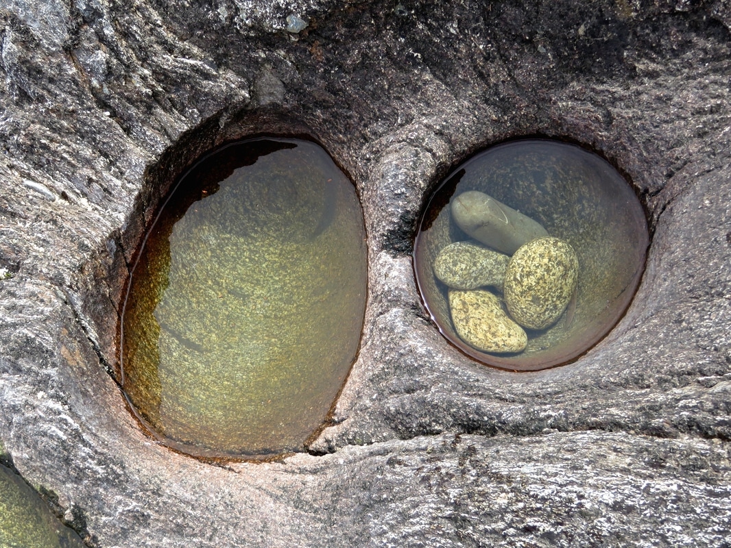
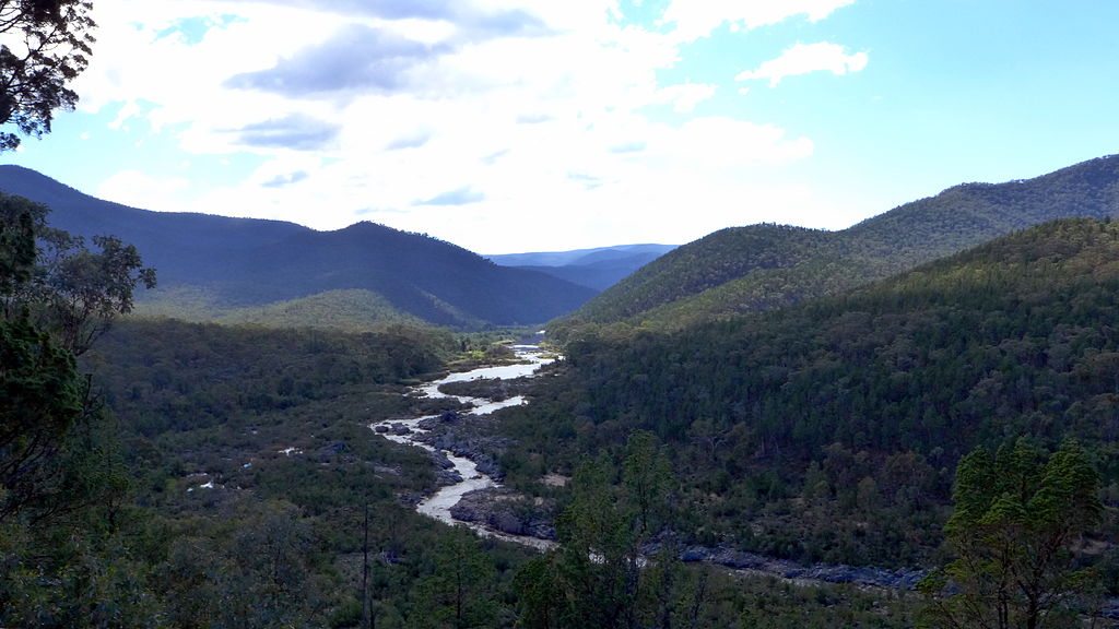
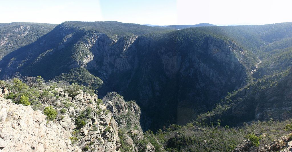
The photo below shows the river disappearing under the granite, and the sculptural dips, curves and wells created by the action of water over millennia. It felt like a very special place. I would have loved to spend a few hours or even a whole day exploring the rocks, but the rain started sheeting down and lunch was waiting for us back up the hill in the car. This was the last point we were able to access the Snowy for a good long way and, as such, it symbolises to me the river's gateway out of the Monaro High Plains. Beyond here, the river gorge becomes ever deeper, the hills larger, the roads and tracks less accessible . . . Next time, our attempts to see the Mysterious Middle Snowy!
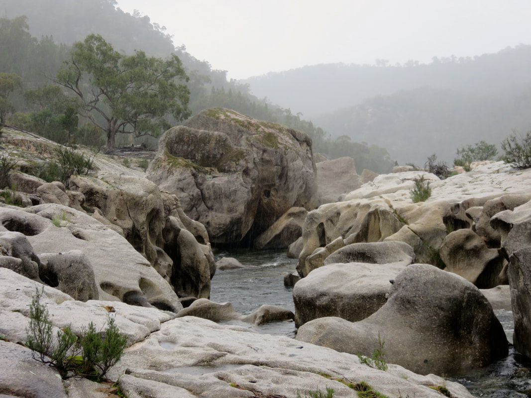
water-sculpted granite slabs in rain
Stonebridge Falls
It's been a year since we set off on this adventure, and several months since I said I'd be "back in a couple of weeks" with this batch photos - sorry for the delay! The next bunch of pics will probably also take a month or three to appear. In the meantime, check out my overview of the trip, the photos from the high country and pics from the Snowy Mountains Scheme/Snowy Hydro.
2 Comments

Snowy River adventure: photos from the hydro scheme

30/6/2017

2 Comments

 
The Snowy River is interrupted on its journey to the sea by three dams: Guthega, Island Bend and Jindabyne. Following our days in the high country, exploring this section of the river took us from the mountains to the fringes of the Monaro High Plains. (Content note: there are a couple of pics of snakes in this post!)
Dam wall
The biggest dam across the Snowy is at Jindabyne, and this is the first dam we saw as we drove up to the start of our journey. The photo above was taken from a point downstream several days later, but before we get to that, let's go back in tiiiime . . . 
Silvery still water between hills
Construction on the Snowy Mountains Hydro-electricity Scheme started in 1949. It was completed 25 years later. Something like 70,000-100,000 people came to Australia to work on the scheme, and many stayed. Since then there have been a few upgrades and additions and there are now 16 dams, 7 power stations and a combined 225 km (140 miles) of tunnels, pipelines and aqueducts. It’s still considered to be one of the most complex hydroelectric schemes in the world - and it's huge, spreading over 5,000 square kilometres, although only 2% of the construction is visible above ground. Guthega Pondage (above), is the impounded reservoir formed by Guthega Dam. It's the first (or last, depending on your direction) dam across the Snowy River, and the first dam completed as part of the Snowy Mountains Hydroelectric Scheme in 1955. We first encountered it at the end of the infamous Day Two.
Looking down a dry river from a dam wall
This is what the Snowy River looks like downstream of Guthega Dam: a rocky river bed, dotted with a few stagnant pools of water. The water from the reservoir is, as far as I could tell from the information signs and the shape of the landscape, pumped out through a level tunnel along the sides and tops of the hills, then released down long pipes to work the turbines at Munyang/Guthega Power Station several kilometres downstream (below right). You can see the layout in this arial shot on Wikipedia.
Still blue water between hills
White pipes going down a hill
At the start of our third day, the clouds burnt away and Guthega Pondage turned blue beneath the clear sky (above left). But conditions up here are, of course, not always this idyllic! When researching her book The Snowy: The People Behind the Power, Siobhan McHugh spoke to some of the 450 Norwegians who came to work on the scheme at Guthega. They were apparently pretty unimpressed with their accommodation (uninsulated fibro huts) and food (they were given margarine, they wanted butter) and at one point they went on strike until they were able to have hot showers. To me, it seems more than fair that they should’ve had a few basic amenities, especially as they were risking their lives on a daily basis. In fact, Guthega was the location of the first Snowy Mountain Scheme fatality: a Norwegian miner killed by a rock fall. In total, 121 people died working on the scheme (unofficially, there may have been more), 53 of them in underground accidents.
Gate with asbestos warning sign
Towards the end of the day, we made it to Island Bend, a campground on the site a temporary township established for Snowy Mountains Scheme workers and their families in 1952. These days, there are only a few hints of the township that once was - flat pieces of ground where houses and halls and schoolrooms once stood, a grassy airstrip, the odd feral flower escaped from a garden and signs warning about the lingering presence of asbestos. It’s hard to imagine the area as a bustling small township. While researching this trip I came across a few scanned copies of the village newsletter, Around the Bend. Uploaded by Bruce Mitchell, one of “the Snowy kids” from the scheme’s townships, these typewritten publications give some insight into life in the township. A February 1967 edition notes that the barber shop is closed, there are updates on the darts team and archery club performances and an announcement about the weekly film programme: a Sunday matinee (Oliver Twist with John Mills and Alec Guinness), films on Sunday and Wednesday evenings, a Friday film group and a note that “Free Documentaries will be screened as usual on Thursday evening”.
Small bird sitting on metal post
Trees and camping spot
We camped the night at Island Bend, in the section tucked in the eponymous bend of the Snowy River. You can see our spot in the photo (above right) before we put our tent up - note the trees, much taller than on the mountains. We didn't have time to explore the site in full, as it's quite spread out. I'd recommend this spot - though hopefully you won't get a bunch of people arriving from Sydney at midnight and setting up noisily in the pitch next to you!
Person standing in river late afternoon
We didn't manage to get a spot right next to the river, but that didn't stop us heading down to the water to watch the sun set. There's a bit more flow here than below Guthega or even at Munyang. I guess a lot of it must come from the small creeks and tributaries trickling off the mountains.
Kangaroo and airstrip sign
Kangaroos fighting
Kangaroos don't have to obey human signs. (In case you can't read it, the sign reads, "Aircraft may use this strip at any time. Please do not proceed past this point.") We also saw kangaroos fighting - a first for me! They'd have a bit of biffo, then stop to nibble on the grass for a while, until one of them bopped the other on the head and away they'd go again. A bit like cats, really!
Yellow sign
Concrete survey mark
The mountains are riddled with signs (literal and figurative) of the scheme and its history. Yellow markers pointed up rough tracks off many of the roads and after a while we decided that they were pointing to pylons. This particular sign (above left) indicates the access point for pylons 5-15 - or so we believe! If you know differently, please do leave a comment. We also found survey marks (above right), fragments of walls, random pipes sticking out of the ground, bolts on roads and in gutters, chunks of wire-threaded concrete on the riverbed and many more remainders of recent industrial history.
Reflections in dam water
Person standing on road near dam wall
Looking upstream to distant dam
From Island Bend campsite we took the roads down to Island Bend Dam. We couldn't get access to the dam wall, but we spotted a few interesting things anyway. I climbed up a random bit of stone and concrete wall to get a better view (the top photo of the reflections and the bottom left photo of Dan on the road are taken from up there). A little way downstream we detoured back down to a bridge across the river, giving us a glimpse back up to the dam wall. Catching glimpses of all these enormous structures in the middle of the mountains reminded me of moments in The Lord of the Rings when the travellers come across huge structures like the Argonath and other physical remnants of times past.
Snake - full length shot
Snake - close head shot
We encountered this snake on a bush track, lying between us and where we wanted to go. Apparently alpine copperheads are the only snakes that hang out in the mountains, so presumably this is one. We'd seen two the day before, making their way down the roadside gutters. One hadn't noticed us and had slithered slowly on its way. The other saw us, got the fright of its life, and practically flew over a bush to get away from us. This one didn't move. We stamped and clapped and shouted to let it know we were there. We threw a couple of little twigs at it from afar to try to get it to move on. It didn't move on. We couldn't see even the slightest twitch, tremor, or tongue flick. We started wondering if it was dead. I walked slowly forward until I was only a couple of metres away. It didn't look dead, but it still wasn't moving. I figured I was so close that if it was going to bite there wasn't much I could do, so I walked on past, stopping to snap a couple of close ups - after all, it's not every day you get this close to a lovely snake!
Entrance to tunnel with 'safety counts' sign
Tunnel entrance at the confluence of the Snowy and Gungarlin. The sign reads, "Saftety counts. Target for this tunnel repair: zero accidents." We laughed a bit and wondered (a) is there ever a target of 1-or-more accidents? and (b) this is just the target, what was the actual outcome? One of the worst and most dangerous jobs during the original construction of the scheme was working on concrete tunnel lining. While researching her book, Siobhan McHugh heard stories - from friends of friends of friends - about people being concreted into the lining between the forms and the rock face. She also read the evidence from an inquest following precisely this kind of accident in a shaft near Island Bend, on the last shift before Christmas 1963. The inquest decided that what had probably happened was a rock about the same diameter as the concrete pipe had lodged in the pipe and blocked the flow of concrete into the shaft. The workers noticed that no concrete was coming through and someone poked at the pipe just in case there was a blockage. What they didn’t know was that about nine tonnes of concrete had built up behind the rock. The concrete poured out in a catastrophic rush, dislodging the pipes and knocking the workers off the scaffolding to the bottom of the shaft.
Two men were killed instantly. One man was buried up to his hips in liquid setting concrete. He was pinned by debris and they could not get him out. They had two hours before the concrete set. He was alive and he was screaming. They tried pouring sugar in the concrete to stop it setting. They found out afterwards there would have been no hope because the man’s legs had been virtually severed in the accident and the only reason he wasn’t dead was that the blood wasn’t able to escape because of the concrete around him. (Source)
There might be other people buried beneath the concrete, says McHugh, and we will probably never know. The Snowy Mountains Authority kept meticulous records, but the contractors did not. There are many stories about family members shift-swapping, about people using assumed names to escape wartime incidents or child maintenance payments. With the identity of any given worker being such a slippery thing, it’s probably impossible to ever say for certain how many people died on the job.

If you're interested, Mikelangelo and the Black Sea Gentlemen have a recent album inspired by the stories of the migrant workers on the scheme. The song "The Sun Will Shine In" particularly reminds me of this place: I wake up in darkness, I work all day in darkness, I go to sleep in darkness . . .

'The Sun Will Shine In' by Mikelangelo and the Black Sea Gentlemen from Mic Gruchy on Vimeo.

Track through bush
Cylindrical concrete tower
The big, somewhat phallic construction is the surge tank or tower at the Snowy Valley Lookout on Kosciuszko Road. I am still unclear on its function. The information sign had this to say (weird non/capitalisation from original): "Jindabyne Pumping Station [at the bottom of the valley below the surge tower] pumps water during off peak periods from lake Jindabyne through the Jindabyne-Island bend Tunnel to the Snowy Geehi Tunnel at Island Bend for diversion to Geehi Reservoir. Additional flexibility is achieved during periods of high flow in the Geehi River by diverting water in a reverse direction through the Snowy-Geehi and Jindabyne-Island Bend Tunnels to lake Jindabyne. The large concrete tower Structure at the Snowy Valley lookout is the Surge Tank for the Jindabyne Pressure Pipelines. The surge tank has an underground spillway which releases water via the dissipator chute at Jindabyne Pumping Station." I hope that makes it all clear. (This blog post made more sense to me: "The tank itself is basically a spring; the cylinder is air tight, so when the water stops flowing along the tunnel, it has nowhere to go except into the tank where it compresses the air, which then starts resisting the flow, bringing it to a gentle halt. Then the water level will drop as the pressures equalise.")
Sign sunk in water
The Snowy Mountains Scheme was conceived and begun in a time before it was considered important to do any kind of research into the environmental impact of large scale engineering works. The ongoing effects of damming the Snowy are obvious downstream of Jindabyne, but there are traces of construction all around the mountains. This sign was taking a rest in a pool of water just off Kosciusko Road, near the intersection with Guthega Road, where we hitched a lift into Jindabyne after two days walking.
Scale model of valley
What? There's a model of the Jindabyne area in the visitor centre in town. It shows the valley as it was and is - the light blue shows the old path of the Snowy, the dark blue shows the waterline of Lake Jindabyne, the black lines are submerged roads, the red lines are roads used in the present. Douglas Stewart’s poem “Farewell to Jindabyne" documents the fate of the old town, lying beneath the lake.

Let us lament for Jindabyne, it is going to be drowned,
Let us shed tears, as many as the occasion warrants;
The Snowy, the Thredbo and the Eucumbene engulf it
Combining their copious torrents.


Over almost thirty stanzas, Stewart lists “all Jindabyne has to offer” in less than complimentary tones, concluding half-way through the poem that “Nothing, except the hotel, was built for permanence”, and:

Many a time thus viewing the total township
And thinking how soon it was all to be buried in water
Like drowned Atlantis and never be heard of again
I have thought: the sooner the better


Worrying the issue over, Stewart name-checks the people and their properties soon to be submerged (note the European names): Hans at the Kookaburra Cafe, Rankin’s and Jindabyne Motors, Leo A. Hore at the pub, E. Kluger and “his famous salami sausages”. But soon enough, he remembers that all these people will be re-homed in New Jindabyne.

What the poem leaves out - as does much of the writing about the scheme - is the loss of older sites, places important to the Ngarigo and other Aboriginal groups. Stewart’s view of Indigenous people is of:

The shy dark shadowy aboriginal race
Always like creatures in water, who left one word
And vanished without a trace . . .


It’s a summary that suggests the disappearance of Aboriginal people is complete (it isn't) and that such a disappearance is a sad inevitability (rather than a concerted regime of violence by colonisers). Stewart doesn't talk about Aboriginal cultures, stories and places lost beneath the water. There were no surveys of such sites done before construction, but had there been the surveyors might have listed places similar to those found elsewhere throughout the high country, the Monaro and the Snowy valley: camp, shelter, ceremonial and stone tool manufacture sites, middens, scarred trees (either carved to mark the burial places of important people, or scarred in the removal of bark to make shelters, canoes, shields, baskets), or other things not so bounded by a specific physical location - a landscape or a particular view, part of a songline, specific geological features, plants or animals. Stewart contends that Aboriginal people left behind only a single word - presumably the word “Jindabyne”? - so whereas he and his implied audience are able to get a bit nostalgic for the homes and cultural hubs of ‘modern’ Australia (houses, pubs, shops, churches), the Indigenous equivalents (art, artefacts, sacred sites, names and stories) remain unlamented.
Large lizard face
Small lizard face
We saw many lizard friends on our travels in Australia. I'd forgotten how ubiquitous they are, and how much I miss seeing them in the UK. These photos were taken a few days apart, in very different locations - one high on the hillside, one down in the riverbed - which you wouldn't necessarily think, given the rock is the same speckled granite. It must be good for basking! Anyway, on the left is (we think) a Cunningham's skink, probably about a foot long, and the one on the right is something else, much smaller and smoother . . . sorry, I'm not a lizard expert. Again, if anyone can provide a better ID than that, please leave a comment!
Person walking on road and 'end roadwork' sign
Off we go, to try and get to the river below Jindabyne Dam. You can see how the landscape is changing. We've moved from the alpine vegetation above Guthega Pondage, down through the montane forests and taller trees in the valley around Island Bend and Gungarlin River. We're now into the grasslands that, while they still sit on the escarpment of the Great Divide, can probably be counted as the fringes of the Monaro High Plains (to be featured in my next post!).
Person stepping towards river
River and sunlight
Back on the Snowy, below Jindabyne Dam. In the 1990s, 99% of the Snowy River's natural flow was held by the scheme, much of it ending up being diverted into the River Murray. After a huge, grassroots campaign and a lot of political lobbying, the four governments involved in the scheme (Victoria, New South Wales, South Australia and the Federal Government) finally agreed to return a bit more of the Snowy's water to the Snowy. The figure I remember the campaign asking for was 28%. This has, as far as I'm aware, never been achieved - and nor has the promised 21% eventuated. However, a good deal more than 1% now comes out of the dam, which was altered to enable enormous "flushing" flows, designed to mimic snowmelt floods. Having seen photos of the Snowy at its worst below Jindabyne Dam, I wasn't sure what to expect. I was pleasantly surprised to find a swift-flowing stream here. Obviously, it was a lot smaller than it must once have been - the valley floor is the old river bed and the river is only the size of a big creek - but it isn't completely stagnant. Finally getting to see this bit of the river, making it down to the water below the dam wall, felt like a milestone.
Person walking on dirt road
Concrete spillway
But, as noted in a previous post, we couldn't make it much further along the river itself. We climbed back up the valley and set off along the aqueduct track that links Lake Jindabyne (on the Snowy) and Mowamba Weir (on the Mowamba - a tributary of the Snowy). It was hot, so we stopped whenever we could find a smidgen of shade and looked back at the view of the dam. Check out that spillway! It would surely make an epic water slide!
Bush, hills and glimpse of blue water
One of our final glimpses of the Snowy River as it heads away down Jindabyne Gorge. I'd love to come back and see a bit more of this section one day. There are 4WD tracks and private roads that go down to the river in this stretch, so it's not impossible to access . . . Or perhaps I could go kayaking on one of the big environmental releases, like this:

The Snowy River: Jindabyne Gorge from Linden Brown on Vimeo.

Gate across dirt track
The aqueduct track turns away from the Snowy above the Mowamba junction, and heads back out towards the Snowy River Way (one of two ways to drive between Jindabyne and Dalgety). The Mowamba River (or Moonbah, below left) has its own story in the Snowy Scheme saga. Rising on the slopes of Mount Terrible, the Mowamba travels on its merry way until it is diverted via a weir and aqueduct into Lake Jindabyne. For a little while, back when environmental flows were first returned to the Snowy, the Mowamba was allowed to overtop the weir. As it isn't dammed upstream, it became, for a while, a surrogate snowmelt headwater for the Snowy. However, once the big alterations had been made to Jindabyne Dam, the aqueduct was switched on once again and now only a trickle makes its way out from the base of the Mowamba Weir (below right).
Creek in valley
Trickle of water from base of concrete structure
Two bridges - old and new
Old bridge, new bridge. On the left is the older wooden bridge over the Mowamba. Now the Snowy River Way crosses a more substantial, double lane concrete bridge. I noticed quite a few places on our journey where old bridges has been left beside the new as formally listed and/or informal heritage structures: here, Bete Bolong Creek, Murrindal River, Ambyne on the Deddick River.  After visiting the Mowamba Weir, we hitchhiked to Dalgety - and that is where my next post will pick up!
Moon in blue sky
Here's the story of the creation of the Snowy River, told by Rod Mason (then Kosciuszko Indigenous Liaison Officer), cited in Claire Miller's book Snowy River Story: The Grassroots Campaign to Save a National Icon (2002). I thought of it every time I looked up and saw the moon on this trip.
The moon took the water from the ocean, and travelled to the mountains to the north. The platypus followed, and busted the moon’s waterbags when the moon fell asleep in the mountains. The water gushed out and made the Snowy River and all its children..

Thanks for reading - remember to let me know if you can identify those lizards! I'll be back in a couple of weeks with a photo post about the Monaro High Plains. In the meantime, you can check out my overview of the trip or my photos from the high country.

2 Comments

Snowy River adventure: photos from the high country

11/6/2017

2 Comments

 
You might have already seen a few photos from our trip in my overview blog post, but I have hundreds more. Want to come over for a slide show? (I'm only half joking.) Over the coming weeks, I'll share photos of the Snowy River and surrounds from source to sea. This one spans the first few days - there are more from the foothills of the mountains, but they'll be in the next post about the Snowy Mountains Scheme.

Ascent

Two walkers on path
Photo by Emily.
The walk up the mountain was very pleasant, especially as the clouds started to clear. In this photo, Dan and I are (I think) approaching the crest of the Ramshead Range, with Ramshead North on the left. Read more about our walk up the mountain.
small stream
Photo by Dan or Emily.
This is the Snowy River, a photo taken from the first (or last) bridge across it - a steel mesh footbridge on the walk from the top of the Thredbo chairlift to Rawson Pass. We saw tiny fish here, mountain galaxias, speckled and wiggling in the shallows.
Granite tors
little white and yellow flowers
The extremes of this landscape: huge, ancient granite boulders, exposed to the sky and weathered into a rounded jumble by thousands of years of rain and snow and wind; tiny flowers and delicate mosses of the ephemeral bogs. Beautiful.
View with mountain lake
The sign at Cootapatamba Lookout notes, "This waterhole was named Kau-oola-patamba, the place where the eagle drank, from an Aboriginal storyline from the north." Lake Cootapatamba (as it's generally written) is the highest lake in Australia. It’s one of only a handful of cirque lakes, or post-glacial tarns, found on the mainland, formed in the bowl-shaped hollow that occurs at the upper end of a valley where a glacier has scoured out the rock. Lake Cootapatamba is cupped in a shallow plain, and as we climb we see the landscape descends in steps down the mountain. You can't see it in this photo, but just over the ridge behind the lake there’s a tiny, bright red hut, a survival beacon designed to catch lost skiers and hikers who come the wrong way off the mountain in bad weather. 
Pile of stones
There was a cairn, like an OS trig point, at the top of the mountain. Several paces away, across the rocky top, someone had built their own cairn. Further downstream, in the middle of nowhere on a fire trail that is only accessible by management vehicles and people on foot, we found another stone tower.
View with mountains
Here a small stream meanders over a high plateau before disappearing into a steep-sided valley. This was one of the few views that made me feel that I really was physically at the top of the world. This landscape is beautifully described in Alan Gould's wonderful poem "Flying Over the Australian Alps", which I reproduce in part here entirely without permission. Please read the full piece at the link.
​
                        Under you     Australia
is a broad unmade bed     hills pleating     folding
as if around an entanglement of limbs     forests
cushion the yellow light greenly     or vanish
into reservoirs of cobalt shadow     a valley
ignites along the filament of its creek     dams
perhaps a dozen     take dazzle-fire like insect wings
 
You are travelling     the earth is travelling
in a slow enchantment   from a time toward a time.

Descent

slate pile and wildflowers
Granite, granite, granite. And then, suddenly, an entire hillside of slate. This reminded me of the abandoned slate quarries of Wales though as far as I'm aware this has never been used as such? The spot in the photo caught my eye because of the tiny microclimate in the hollow, where a huge range of wildflowers and alpine herbs were growing.
person sitting on mountainside
Stone hut with red roof
Thick stone walls clutch green-framed windows, protecting the glass from the weather. A chimney straggles from a dark red roof, secured with wire to the ridgeline. This is Seaman's Hut, named after W. Laurie Seaman who, along with his companion Evan Hayes, was one of Australia’s first skiing fatalities. On 14 August 1928, Seaman and Hayes were on Mount Kosciuszko when a blizzard closed in around them. A search party following the pair’s tracks deduced that they’d been separated. Seaman had followed the pole line back down towards Rawson Pass. He was blown off course by the strong winds and retraced his tracks, but missed the pole line of Summit Road in the blizzard. His body was found near the current hut site almost four weeks later, where he had presumably waited for Hayes to join him. Hayes’ body was not found until 1930, over two kilometres away above Lake Cootapatamba. Seaman’s Hut was built by the NSW Tourist Bureau using money donated by Seaman's parents with the idea that anyone who might need emergency shelter on Kosciusko would be able to find it. It's maintained by the Kosciuszko Huts Association.
panorama of person paddling in stream
Photo by Dan.
The second (or second last) bridge across the Snowy River, on the gravel road from Rawson Pass down to Charlotte Pass. It sees a lot of foot and bicycle traffic. In fact, until 40 years ago, the road from Charlotte Pass was open to vehicle traffic, too. A 1930s pamphlet The Motor Road to Kosciusko declares, “Every motorist should aspire to driving his car to the very Summit of Mount Kosciusko” - and many motorists (including the women drivers ignored by the pamphlet) did so. It wasn’t until the UNESCO Biosphere Reserve designation kicked in during 1977 that the road was closed to public vehicles. We stopped at this bridge for a while and I stood still in the clear water until the curious galaxias grew confident enough to come and nibble my legs. It tickled!
Plant with small green florets of leaves
Small warm yellow flowers
Alpine mint (left) and some kind of pea flower (right). The mint has a very Australian smell - not much like the mint you might grow in your garden. I kept meaning to make myself a mint tea, but didn't get around to it. At any rate, it's probably illegal to pick it in a national park.
Tree with bark that wrinkles like skin
Snow gums. How amazing are they? White Sallee is their other common name. As we came down the mountain, their presence indicated that we were dropping out of the alpine region. The snow gums don’t grow very big up here, due to the low temperatures, the snow and ice, the wind and frosts - as you descend, they get taller and straighter. The bark folds like skin in the bends of the trunk, making the trees seem part-animal. The bark is silvery grey, dripped and streaked with pale coffee cream, the pink of new skin and red, orange and pea-soup green. The colours flicker in ribbons around bending, curling limbs and flow across the gnarled base of older trees.

Scramble

Two tributaries and a path converging in a valley
Facing upstream from the lookout at Charlotte Pass. The left hand fork is the Snowy, the right is Club Creek coming down from Club Lake. The track that crosses them both at the confluence is the Main Range Walking Track - the long way from here to Mount Kosciuszko! We started our second day by taking the track down to the river, then turning right and following the river bed downstream.
Person standing on rock in shallow river
Photo by Dan.
Here I am, at the start of Day Two. Look how happy I seem. That is the face of someone who really has no idea what they're in for! The going was easy here - it got much harder later on. Behind me you can see the path coming down from Charlotte Pass and to the right of the image you might just be able to make out a chimney - all that remains of Foreman's Hut.
Stream in small rocky gorge
Photo by Dan.
Person lying on rock to drink from stream
Photo by Dan.
The river began as a fairly shallow, wide stream. We could walk along the side, hopping from rock to rock when needed. Around the corner, though, the Snowy sank into a small gorge, the water became swift, the rocks became a little harder to negotiate. It got more difficult to climb out of the river onto the hillside and, once out, the slopes were often covered with dense alpine shrubs, almost impossible to walk through. I worked up quite a sweat, despite the cool, overcast day, and it was nice to be able to stick my head in the river, wash myself off a bit, and grab a drink while I was at it!
Basins in granite boulders filled with water and stones
The rock formations here - and throughout our trip - were wonderful. This photo shows two basins that have, over thousands of years, been hollowed out of a granite boulder by the grinding motion of smaller stones moved by flowing water. I wonder how long the stones in the right hand basin have been there?
Small waterfall
As the day wore on, we found ourselves clambering down more small waterfalls, over bigger boulders, through deeper water. This is the last photo I took while on the river - there's a gap of almost two hours before the next one. I'd already hit the wall by this stage, but over the next couple of hours Dan also got the wobbles, we realised that we'd not come nearly as far as we'd thought and we scrambled ourselves to a point where the river was too deep to wade safely any more. Eventually, we climbed up a small waterfall onto the hillside, where we found the vegetation was thinning out. We walked cross country, avoiding bogs where possible, until we found a footpad heading down to Illawong Suspension Bridge, Illawong Hut and the footpath out to Guthega. Adventurous!
Crustacean claw in grass
Metal seat and chain contraption
The photo on the left was taken on the walk to Illawong Hut. Yes, it's the remains of a crustacean - a yabby. Probably. (I've just Googled yabbies and discovered their scientific name is Cherax destructor. How cool is that?) This explained the holes we'd seen the day before up near the source of the Snowy - they were probably yabby holes.

On the right is a cool contraption that was once used for crossing a creek between Illawong Hut and Guthega. It's a heritage monument now, and the plaque calls it a flying fox. Presumably you sit on the metal seat and pull it along one chain link at a time - in the photo you can see that the links on the far side of the seat are bunched up while the ones on the near side are extended.

Out of the mountains

Road, burnt trees and reflectors on a stick
This is the road out from the ski village of Guthega, high on the slopes above the Snowy River (which is in the valley to the right of this photo). We kept thinking how few people we saw - no walkers off the main trails, and only a couple of cars every hour. If this was in a small, densely populated country like the UK, it would be crawling! The tall red poles are road markers for visibility when everything's under snow. The epic number of reflectors on this one caught my eye. Someone's been busy.
Hillside roads twisting through burnt trees
The intersection of Guthega Rd (sealed) and Link Rd. Link Rd is a summer-only track that leads over the mountains to Smiggin Holes ski village on Kosciuszko Rd. But the main feature of this photo is obviously the bushfire-deadened snow gums on every hill. In 2003, a complex of fires killed several people, injured hundreds and caused huge damage to the outskirts of Canberra, while another raged through almost two thirds of Kosciuszko National Park. In 2006-7, when the longest continuously burning bushfire complex in Australia's history burnt through Gippsland and the Victorian Alps, Kosciuszko National Park again experienced serious damage. These are the scars. All across the ridges and slopes, the bony hands of burnt gums thrust up from the stony ground, fingers fanned out brittle and bare. The pattern is repeated over and over, crosshatched monochrome etchings on the slopes where there should be a flurry of leaves. With distance, the burnt trees blur together, giving the impression of dark cloud or smoke, as though the slopes themselves are the remains of a still-smouldering fire.
People reflected in round mirror on tree
By this stage, the end of the third day, we had dropped out of the subalpine region and into the montane eucalyptus forest. Whereas snow gums are pretty much the only tree in the subalpine altitudes, there are several species of tree in this photo (in the reflection and behind the mirror in the river valley). You can also see how the tree behind the mirror is growing much straighter and taller than the snow gums in previous shots.
Fiery sunset over hills
Goodnight, mountains! This is taken on Kosciuszko Rd, looking towards Sponar's Chalet (you might just be able to make it out at the bottom middle of the photo). It has to count among some of the most spectacular sunset skies I've seen. Emily stopped the car and we all spent a good while gawking as the clouds moved from yellow to fiery orange and bruised purple.

I'll post more pics in a couple of weeks. In the meantime, if you can read a trip overview (if you haven't already) and/or a more detailed account of climbing Mt Kosciuszko. 

2 Comments

Highest - Mountain Monday guest post

20/5/2017

0 Comments

 
Kate invited me to contribute to her Mountain Monday series of guest posts last week. Here's an excerpt from my piece, all about our walk up Mount Kosciuszko/Targangal at the beginning of our Snowy River adventure.
ski lift
On the lift up from Thredbo.
Directly beneath the chairlift, the Australian Alps Walking Track struggles up the steep hillside. I wonder if people who hike the full 655km of the trail from Walhalla in Victoria to the outskirts of Canberra sneer at those of us dangling our legs from the metal benches above. Perhaps someone is watching us even now, puffing their way up from Thredbo village, shaking their head at our laziness. I doubt it. We didn’t see anyone heading up the fog-dampened track this morning, only those who - like us - finished their snacks, pulled their beanies low over their ears, wrapped their scarves across their faces, hefted their backpacks, handed over their tickets and jumped on the ski lift.

A chilly wind twists around my legs and the cloud draws close, silently reducing our view to the ground immediately below - a few straggly trees, boulders, yellow grass - and the next chair in front of us, swinging from the lift rope. Beyond the hum of the drive at the bottom, the chairlift itself is quiet. For a moment, between one breath and the next, we’re in a small, eerie world of grey, accompanied only by the clunks and whirs of wind and metal on metal.

Then Emily burps, we laugh, the cloud swirls back and the view of the valley unfurls behind us. There are slashes of treelessness under the chairlifts and in long downhill strips which in snow season would be ski runs. The morning sun catches a ridgeline; silver skeletons of snow gums mark the huge bushfires that burnt through here a few years ago.
silver grass, rocks, blue sky
Alpine herb fields.

Please do head over to The Adventures of Kate to continue reading!

0 Comments

Plan M (in which we fail to walk down the Snowy River)

7/5/2017

8 Comments

 
Almost two months ago, we flew to Australia to try to walk down the Snowy River. Spoilers: we couldn’t do it. But we had a lot of fun trying!
Close up of water surface
The Snowy River at Lochend, between Orbost and Marlo.
Here’s what we got up to and how our plans changed. (Many of these pics are from the phone camera and a lot of them were taken by Dan. I’ll be blogging more photos from the camera as I get around to editing them.)

Plan A

Plan A was to walk the river. We flew into Melbourne, stayed with our friends for a night, then Emily picked us up and drove us to my parents’ place near Orbost. The next day, we hopped back in the car and zoomed up to Jindabyne. Emily stayed with us in Jindabyne for most of the next week, ferrying us around, cooking dinner, finding out interesting things and generally being a superstar. Day 1 was an easy day walk up Australia’s highest mountain and back down. It started with a ski lift up the steepest bit, followed by hot chocolate in Australia’s highest cafe, then a walk to the source of the Snowy (pretty much). Emily went back down to the car and Dan and I went up to the summit, visiting Australia's highest toilets on the way. We then headed down the other side to Charlottes Pass, stopping for me to paddle in the river while little galaxias nibbled my legs.
Path over heathy, rocky landscape
See the little indentations in the landscape running left to right under the path? That's the baby Snowy River!
Person sitting on a small sign reading
The second crossing of the Snowy River, on the way down from the summit to Charlottes Pass. Of course I went in the water after this!
​Day 2 was probably the hardest day of walking - or rather, scrambling - I have ever done. The river began as a fairly open bed, with lots of little rocks to use to walk along the side, but which soon became a swift stream rushing down through a gorge, over multiple rapids and small falls. Out of the river, the hills were covered with dense alpine shrubs, almost impossible to walk through. I hit the wall early on, and spent most of the day shaking with the effects and aftereffects of multiple adrenaline dumps. “It wasn’t meant to be like this on Day 2!” I wailed at one point. It took us several hours to make our way down the river to a point where Dan also hit the wall and we couldn’t get any further. We climbed out up a waterfall and trudged across the hillside, finally catching a glimpse of the hut where we’d planned to have morning tea (it was now about 3pm). We found a footpath leading to a suspension bridge, made it to the hut, ate the last of our chocolate and followed a path out to the road at Guthega where Emily picked us up - several kilometres short of our planned end-point for the day. We were physically tired, but mentally and emotionally we were absolutely drained. What had we got ourselves into?
Mountain landscape with converging streams and a path
The Snowy near Charlottes Pass (it's the left-hand stream before they converge) and the Main Range walking track.
A small waterfall and granite boulders
Just one of the many obstacles on Day 2. The problem with most of our photos of the day is they give no sense of scale.
Two excited people
Before: the adventurers set off on Day 2! (Photo by Emily.)
Two exhausted people
After: "It wasn't meant to be this hard!" (Photo by Emily.)

Plan B

The next couple of days were clear road-walking along the river. Mornings were cool and the valleys often stuffed with cloud, but it burnt away quickly leaving hot blue skies. We encountered three copperhead snakes, saw dozens of kangaroos (some fighting!), a few wallabies, the cutest little red-bellied birds (flame robins), a wombat and many other denizens of the bush. We found a beautiful campsite overnight at Island Bend, once the site of a Snowy Mountains Hydroelectric Scheme township. Plan B came into effect on Day 4, when (due to the slow progress on Day 2) we ran out of time. A track we thought might take us through alongside the river was signposted, “This trail is now closed to all unauthorised use at Jindabyne Pump Station. Due to safety concerns it is no longer possible for mountain bike riders and walkers to continue along the trail past the pump station and they must return to this point.” We didn’t fancy walking 10km along the track only to have to turn around and walk 10km back - plus the rest to get us out to somewhere with phone reception or passing traffic. Instead we walked a few hours out to Kosciusko Road and hitchhiked into Jindabyne. The only previous hitchhiking we’d done together was a couple of miles in Norfolk when we’d gone for a walk and ended up running late for Dan’s grandmother’s 90th birthday. This was a bit more exciting!
Blue still water and hills
Guthega Pondage looking blue in the sunshine. Note the burnt skeletons of snow gums on the slopes.
River in afternoon shadow
The river at Island Bend, sun just starting to set behind the hills.
person in rocky river
Sitting on a rock in the Snowy River near the Gungarlin junction, taking notes.

Plan C

On our day off in Jindabyne, we strolled around town, wandered along the lake shore and went to the fantastic Birchwood cafe for more than one meal. We spent a bit of time in the visitor centre, looking at the tiny corroboree frogs, learning more about Kosciuszko National Park and admiring the model of the area, showing Old Jindabyne and the route of the Snowy River before both were drowned beneath the lake. 
Lake Jindabyne and sign
Somewhere out there under the water of Lake Jindabyne are the remains of Old Jindabyne.
We moved to Plan C the next day, when Emily waved us off and drove back to Melbourne. We made our way down to the river below Jindabyne Dam and started pushing our way through the scrub along the river bank into the gorge. Twenty minutes later, we’d come about 200 metres. At this rate, we would run out of food before we could make it to Dalgety. We traipsed back up the hill in the baking heat and followed a dirt track around the top of the gorge and up the Mowamba River to the road. We mulled a few options over as we had lunch and investigated Mowamba Weir. A bus goes between Jindabyne and Dalgety three times a week, but we weren’t sure it would stop for us. A chat to a couple of blokes fixing a car in a nearby back yard confirmed it wouldn’t, so we decided to hitchhike to Dalgety. “I’ve never picked up hitchhikers before, but you two look pretty harmless,” a woman told us. I think she meant we looked pathetic, huddled out of the blazing sun in the one patch of shade we could find! We made a pact from now on to pick up hitchhikers when we can - it’s such a relief when someone finally stops. In Dalgety, a dry town in a dry place, we pitched our tent minutes before an epic rain, wind and hail storm settled in and washed away half the caravan park’s new roads. I was certain our tent would be a goner, but it survived - as did we, which I’m not sure would have been the case had we been stuck in a gorge with a rising river.
dry hills and clouds in the distance
Along the track above the Snowy and Mowamba Rivers. In retrospect those clouds should have been a clue to the evening's weather!

Plans D and E

Our time in Dalgety included Plans D and E. We paddled a section of the Snowy upstream of Dalgety on a canoe borrowed from Sue and Colin at the caravan site. We spent as much time in the water as out of it. The dazzling, clear skies of the morning turned to storm clouds and lightning by mid afternoon and we thought it might be a good idea to get off the river. We pulled into a random garden and shouted, “Hello! Is anyone home!” Anyone was home - two anyones, in fact - and they were very nice to us. We sat on the verandah as it bucketed down, drinking tea and telling tales until Colin came to our rescue.
Person with yellow canoe
About to set off in an unsteady canoe!
Green tent in rain
Our tent, having survived a few downpours, in Dalgety.
​We got the maps out while we were in Dalgety and realised that, while it might be possible to walk the length of the river, we would probably move downstream at a rate of about 6-10km per day rather than the 15km per day that we’d originally planned. The going was much slower than we’d anticipated, what with having to rockhop, wade, bushbash, ford the river and creeks, and detour up the sides of the valleys. Our options were to attempt to walk a long section of the river in its entirety, or to do several shorter sections along the whole length of the river but not see the stuff in between. We opted for the latter and roped my dad into driving up to Dalgety to do a bit of car-based exploring. Gosh, we had a fantastic day or two. We travelled through some amazing landscapes, saw some intriguing places, met some interesting people and generally had a fun time. It rained.
River, granite boulders and rain
Stonebridge. Amazing.
Hand painted sign
Bairds Crossing, Ironmungie.
Two people and car in paddock
Paddocks around the Monaro are choked with invasive weeds: great mullein and horehound seem particularly pervasive.

Plan F

We retreated down to my parents’ place on the lower Snowy near Orbost, skipping ahead to spend a few days exploring that area. Perhaps this could all be encompassed within Plan F. We went bushwalking at Raymond Creek (a tributary of the Snowy), inner tubing several kilometres down the river from Wood Point (seeing many Snowy River crocs), wandering along the road and riverfront at Jarrahmond (visiting the gauging station) and walking from Marlo to Frenches Narrows (a salty lagoon at the end of the Snowy). We also paid a visit to Mount Raymond fire tower, where we enjoyed fantastic views over the Orbost flats, the hills beyond and out over the coast.
red rock creek
Raymond Creek, below the falls. Note signs of recent bushfire.
two people on inner tubes
Heading down the Snowy on inner tubes! (Photo by a parent!)
person on boardwalk
Exploring at Frenches Narrows.
person in bus stop
My old bus stop. It was Saturday, so no bus for me.

Plans G and H

We spent a night in Buchan with my parents before my dad then drove us back up to NSW. We planned to have a few days walking and exploring before meeting my aunt and uncle at Jacobs River - as arranged months before. We tossed up driving all the way around to Paupong via Dalgety, which we’d visited the week before (Plan G), but in the end went for the more sensible (or easier, if you want to be cynical) option. Dad dropped at Jacobs River (Plan H) and we walked upstream from there.
Two people beside swimming pool
The famously cold pool at Buchan - the water flows from the caves. (Photo by Elisabeth.)
Person wading across small river
Crossing Jacobs River - off on an adventure!
​We followed old tracks and animal trails a day upstream, left most of our stuff in our tent at the bottom of Byadbo Fire Trail, did an epically steep return day walk along fire trails to Slaughterhouse Hut (an old cattleman’s hut maintained by the KHA), camped another night, then headed back to Jacobs. This was a fantastic three day trip, which I’d recommend to anyone interested. As well as lots of native animals and birds, we saw many wild/feral horses, deer and what I believe were dingo/wild dog hybrids. (Despite my fear of dogs, our two encounters with them at the end of the Byadbo Fire Trail were some of the quietest and most amusing animal encounters of the trip - especially the time when three dogs coming down to the hill towards the river were surprised to find a person having a shit in a hole. The person coughed, ahem, the dogs stopped, assessed the situation, then melted back into the bush. Spoiler: the person having a shit was me.)
person in bush with green grass
A rare green spot in the bush - a dry creek bed, I think.
person wading over river
Fording the Snowy on the way up to Byadbo Fire Trail.
person and corrugated iron hut
At Slaughterhouse Hut, gesturing with sunscreen.
mist rising from river in morning light
Morning on the Snowy, mist rising from the warmer water and catching the morning light.

Plan I

With my aunt and uncle, we did a day of supported walking down the Barry Way almost to the border of NSW and Victoria, enjoying the beautiful views along the valley, the easy walking, the sunshine and flowering gums. We didn’t have to carry our packs and we rocked up to shady picnic tables adorned with wraps, dips, salads, croissants and wine! After this, instead of walking to McKillops Bridge along the river, we drove around with them (Plan I). This proved to be a pretty epic adventure in itself. Their 2WD stationwagon was packed to the rafters and we had about two inches of clearance as we made our way down the narrow, winding gravel road. Fortunately, we didn’t meet any other cars on the way down as there is minimal space for passing between the huge sidecuts on one side and the steep ravines on the other. There are some pretty epic views, though! We spent a couple of nights at McKillops Bridge, exploring under it, swimming in the river, going for walks and poking around the rapids.
shaking hands at border stone
Interstate cooperation - Victoria (me) and NSW (Dan). (Photo by Barry or Caroline.)
person with croissant and wine bottle
This is the life! Croissants and wine for lunch!
person on bridge
About to head over McKillops Bridge - a quarter of a kilometre across.

Plans J and K

Understandably, my aunt and uncle weren’t keen to drive back out the same way, which put paid to Plan J (walking down by Campbells Knob, crossing the river, heading overnight on the Deddick Track and following Moonkan Track back to Jacksons Crossing, then walking out from Jackons Crossing to Balley Hooley). The only other road crossing of the river in Victoria is at Orbost, so we headed back down to my folks’ place the other way, via Goongerah. This coincided with my mum’s birthday, which was pretty nice!
​
Everyone we spoke to had weather news: a big stormfront was on its way. We hastily arranged Plan K. My aunt and uncle dropped us off north of Buchan and we walked in to Jacksons Crossing. The 4WDers we met at the top of Basin Creek Road were keen to tell us how steep the track was. They weren’t wrong. It was a hard walk, but the bush, the rainforest, the farmland, the bluffs and the river were gorgeous. The next day we couldn’t find the bridle track we wanted to walk out on (bushfires? overgrowth?) and after an hour messing around in the bush we had to hoof it back up the 4WD road, putting in a bit of hard work to make it to our arranged pickup point with my dad. We made it back to my parents’ house minutes before guests arrived for my mum’s birthday lunch.
road and tall trees
The walk to Jacksons Crossing.
sunrise sky and silhouetted trees
Sunrise from my parents' house.

Plan L

Because we had accommodation booked in Buchan and because we had friends coming to meet us there from Bendigo, we couldn’t really rearrange the timing of our stay there. We had a lovely stay at the Buchan Motel, watching kangaroos through the morning mist from our balcony, exploring the area and going on a cave tour with our friends. We also got the chance to explore some of the less-travelled parts of the Buchan Caves Reserve - waterfalls, mossy boulders, little creeks, old walking tracks and tall eucalypt forests. After a couple of nights, it was back to Orbost via a short walk and picnic at Balley Hooley at the confluence of the Buchan and Snowy Rivers, this time with another uncle and aunt (Plan L).
person beside big boulder
Exploring around the lesser-travelled parts of the Buchan Caves Reserve. I was lichen this rock.

Plan M

The last section of the adventure was always the vaguest in terms of plans, as I am familiar with the area, we knew we’d have somewhere to stay and there are lots of options for exploring the river. So I think this section can all come under the heading of Plan M. We walked around Orbost with my sister, reading all the interpretation signs, paddling in the river under the bridge, finding huge Wanderer/Monarch butterflies and their caterpillars and pupae in the sensory garden. We picked our way up the rainforest on my parents place, along the creek bed from the river to the driveway, again with my sister. We hired bikes in Orbost and cycled 50km - down to Lochend, the Devil’s Backbone and Lake Wat Wat, back up along the hilltops to Newmerella, out to Simpsons Creek on the East Gippsland Rail Trail, down the hills onto the flats at Bete Bolong (visiting my uncle, who gave us some much-appreciated lemonade) and back over the river into Orbost just as the sun was setting. We went boating with my dad from the Brodribb around to Marlo in a tinny borrowed from my parents’ friend.
River in sunshine
The Snowy River at Lochend, glinting in the midday sun.
two people in rainforest
The rainforest in Pipeclay Creek.
person and boat
Dan and the boat at the end of our row.

Plan A

Plan A had us finishing the walk on Tuesday 18 April, heading out across Frenches Narrows, over the dunes and along the beach to the mouth of the Snowy. And that’s exactly what we did. My parents came with us and we picnicked in the sun, watching pelicans, terns, gulls and other birds wheel above, bob on the waves, sit on the sand, pick over the seaweed or stalk through the estuary water. We waded back across the estuary and wandered back to the car along the boardwalk. The next evening, after another day at the beach, Dan and I went down to the river at the bottom of my parents’ place. I crossed the river one last time and collected a bottleful of sand.
person in blue green water
Thumbs up! At the mouth of the Snowy River.
person in river
A final crossing of the Snowy.

The best laid plans

I’m still sorting through all my feelings about the journey.

Sometimes I think: We had an amazing time, we encountered so many places, animals, people and things, we had some fantastic adventures with friends and family and we’ve seen more of the river than most people ever will. We had a few close calls and a lot of fun. We are so fortunate to have had the chance to do this - to take time off work, to travel and to have these experiences. It was brilliant!

Sometimes I think: Two years of dreaming and planning, countless hours of research, a huge amount of effort organising logistics, all that support from other people, all the money spent on gear and food and transport - and we failed. We didn’t see as much of the river as I hoped, didn’t do as much walking or camping or swimming as I wanted. We took the easy option too many times. Can we really call it an adventure?

Sometimes I think: If there wasn’t a real possibility of failure, perhaps it wouldn’t have really been an adventure. Perhaps failing is an integral part of adventure.
Mist off water
Mist rising from the Snowy River near the end of Byadbo Fire Trail.
Sometimes I think: How amazing is it that we managed to do as much as we did? How good is it that we could adapt when things started going awry?

If we hadn’t changed our plans, we would have been on such a tight schedule that we would have missed a lot of what made the journey so delightful. I wouldn’t have stood still on an empty road in the Monaro, watching a huge storm blow across the mountains. We wouldn’t have hitchhiked. We wouldn’t have canoed down the shallow, sparkling river upstream of Dalgety, falling in and swimming after our dry-bagged gear. We wouldn’t have seen an albino emu or spent a day hypothesising the geological and cultural histories of landscapes as we went 4WDing with my dad. We wouldn’t have seen the feral goats near Stonebridge. We wouldn’t have had the chance to revisit special places we found - to swim, to ford the river or simply sit and wonder. We might not have had time to watch the kingfishers at Jacobs River or linger beside the river as the steam or mist danced above the water in the still, cool morning at Willis. We wouldn’t have been able to spend hours cooking up delicious meals over a campfire with my aunt and uncle. We might not have been able to float quietly on our inner tubes past Snowy River crocs on the rocks and birds on the fallen trees. We wouldn’t have explored so many tributaries - the warm trickle of the Mowamba River downstream of the weir, the swift, refreshing water of Jacobs River, the deceptively picturesque Deddick River winding through dry scrubby hills and weed-choked paddocks, the big rock slabs and terraces of Raymond Creek, the Buchan River rising after heavy rain, the temperate rainforest of Pipeclay Creek, the reed-lined Brodribb River. We wouldn’t have been able to poke around underneath McKillops Bridge. We might have been too rushed to ship oars and drift downstream on an outrunning tide, the water lapping at the aluminium hull of our little boat, watching the world go slowly past, snacking on Fererro Rochers. We wouldn’t have spent so long leaning over the railing on the footbridge with my mum, watching hundreds of different fish dart and flash through the estuary water. We mightn’t have met people when we pulled a canoe up into their garden during a storm, when we sheltered from the rain in a camp kitchen, when we hitchhiked, when they gave us permission to drive or walk through their property, when they told us stories about the river. Some of my favourite memories are of the slow, quiet moments when we didn’t have to hurry.

reflections
Reflections on the Snowy at Wood Point, before we jumped in with our inner tubes.
Sometimes I think: I’m glad we got to spend so much extra time at my childhood home and in the river there. While we were in Australia, my parents unexpectedly sold up. They will be moving away in August, so this was my last chance to spend time there and to say goodbye. I think this is probably why we ended up back home as often as we did. In the end, despite having seen the river in so many guises during this journey - skipping down mountains, flowing through the Monaro, disappearing under the granite at the spectacular Stonebridge, sweeping between the huge dry hills around the border, mingling with saltwater in the smooth tidal reaches near Marlo - the few hundred metres at the bottom of a hill near Pipeclay Creek will always be the first place I go to in my heart and mind when I think of the Snowy River.
mouth of the snowy
Dan and me at the mouth of the Snowy River at Marlo. A gorgeous day and a wonderful conclusion to our adventure.

I'll be posting more photos from the trip over the coming weeks (or, more likely, months), so stay tuned! Thanks to everyone who helped us out on this journey: Emily, Kate, Elisabeth and Jerry, Nathan, Jesse, Christie, Sue and Colin, Sian and John, Rosemary and Mason, the Presentation of the Mother of God convent, Caroline and Barry, Alex and Julie, Bridget and family, David and Jane and Mimo, John and Chris, Esther and Gabe, Pete, Cynthia, Glenn, Mary and Ben, Margot and Aaron and the fire tower network. If I've forgotten anyone, I'm sorry. 

8 Comments

Snowy River adventure: the final countdown

9/3/2017

10 Comments

 
The countdown to adventure is almost over! It's been a month or so since I first made a silly online counter and started counting down the days on our whiteboard at work . . . and this weekend we're off to Australia to attempt to get down the Snowy River (mainly) on foot.
Blue sky, blue sea, blue estuary, green trees
The Snowy River near Marlo. "Snowy River Estuary" (cc) Dan.
I'm ready to go. We've been preparing for a while now (see this and this and this). We've bought all our bits and pieces over here, we've practiced pitching the tent (sorry for being so bossy, Dan!), done a few walks ("We'll get fit on the trail," we keep telling ourselves) and I've pored over the maps to commit emergency exits to memory.
Maps and computer
Comparing our maps to Google Earth.
person looking out of tent
Practice pitch of our tent - it started snowing!
We couldn't have got this far without a bunch of support from people in Australia. Kate has made us a selection of home-made dehydrated meals and Emily has bought a stash of noodles and porridge and boxed it all up into various food drops. I bet you nerds would like to see a satisfying, 26 second time-lapse video of the packing process, wouldn't you?! Here's one Emily made while talking to me on Skype!

Packing food for an adventure from In Which I on Vimeo.

We don't really know how we're going to fit all the food in our bags, but I'm sure we'll manage somehow! My parents have bought and registered a PLB and I've uploaded our itinerary to the PLB website. I've printed out all my notes. I had a leg massage earlier this week. I still don't know if it will be possible for the two of us to do this thing - but there's only one way for us to find out: try.
bags of stuff
Batteries, notebooks, water treatment drops . . .
freezer bags of food
Goodies by Kate. I love her notes/comments: "Yum!"
Tub of food packets
Shop-bought food, purchased in Australia by our wonderful friend Emily. Not shown: the other 278499 packets of noodles.
I'm looking forward to hearing magpies and kookaburras calling in the day, seeing the Southern Cross and the Milky Way tilt across the night sky, spending time among trees and hills and rocks, watching the landscape change as we move downstream, learning the smells and rhythms of the river, hanging out with Dan all day every day (hopefully we both feel the same about this after a few weeks on the go!), seeing wildlife, hearing birds, walking hard, getting dirty and exhausted, swimming myself clean, having some time away from the work desk, being super excited about fresh food and company when we meet people for our food drops, exploring the places I've read so much about, learning more about the river I grew up beside, about its ecosystems, about its natural and cultural histories.
water and clouds with bright sunset colours
Sunset over Lake Jindabyne. "Lake Jindabyne" (cc) matt brand.
I probably won't update this blog while we're away. We don't have a spot tracker, so you can't follow us online. We don't have any sponsors or funders, so there's nobody we're obliged to report to. I might tweet occasionally (here and/or here) - more so in the first and last week - but for the most part I doubt we'll have much mobile signal and we'll be conserving phone battery for necessities and emergencies. But don't worry: I am sure I'll have plenty to write about when we get back! I've got notebooks and my camera and a digital recorder, so you might even get some delightful film or audio pieces at some point.
maps
A few people have asked if we're taking collections for a charity (or for ourselves). We're not - although we are very grateful for the assistance of friends and family with transport, accommodation and other logistics. If you are inspired by our journey to give a donation to an organisation of your choice, please do. I would like you to give to an organisation that not only offers support to but preferably campaigns/advocates for and is run by Indigenous/First Nations people, asylum seekers/refugees, trans/queer people or other marginalised groups. Dan would like you to support libraries, literacy and education. If you can combine elements of the two, brilliant! Feel free to share links to the organisations you support in the comments.

It's the final countdown!

See ya later . . .

Oh, by the way, did you see my interview over on The Urban Wanderer? I talk about long distance walking, adventure plans . . . and tea, of course. Go and check out Sarah's blog - she's got some lovely stuff on there.

10 Comments

Snowy River adventure update

21/1/2017

5 Comments

 
Oh my gosh! In less than two months we will be in Australia, setting off the most exciting (and physically challenging) adventure we’ve ever attempted. Eep!
snowy mountain and clear water in foreground
View of Mount Kosciuszko and the Etheridge Range from the headwaters of the Snowy River - Trevar Alan Chilver.
I posted about our Snowy River adventure plans back in July and again in October. So, I reckon it's about time for another update.

Logistics

We’ve organised most of the transport and food drops that are essential to completing the journey. I’m really grateful to all the friends and family members who have offered to help (or allowed themselves to be roped into it). From our perspective, it’s not only about getting a bit of food and a pair of clean socks: I think sharing our trip with other people, even if it’s just for an afternoon or an evening, is going to be a real highlight. We’ve also booked accommodation at the three spots other than my parents’ house where we’ll have the opportunity to sleep in actual beds (Jindabyne, Dalgety and Buchan). Luxury! It remains to be seen if we actually make it to said accommodation on the booked nights. Who knows what might happen?
pool in dry riverbed
Snowy River below Island Bend - Mick Stanic.

Food

Now that transport, food drops and accommodation are pretty much sorted, we’ve given Kate, our dehydrated-meal-producing-kitchen-wizard, a proper breakdown of how many meals we need. These homemade delights will be supplemented by a steady stream of instant noodles, sachets of porridge (not as fancy as Elizabeth's!), scroggin and chocolate bars. I have a spreadsheet. (Of course I have a spreadsheet!) Emily, who is as big a planning nerd as me, is going to do the supermarket shopping side of things and divide everything up into food drop tubs in advance of our arrival. I admit that I’m a bit envious that she gets to do this, but she’s promised to Skype me for a “boxing” video and to take a few photos. I will no doubt share them here or on Twitter.
spreadsheet
Sorting out the shopping list and food drops.
spreadsheet
Sorting out what we'll eat around Jindabyne and Dalgety.

Maps

Thanks to family in Australia, we have a full set of paper maps for the river - nine of them, in fact. I’m in the process of comparing them to satellite images, photos and other sources to make sure they’re accurate where it counts (e.g. emergency access, fire trails) and to see if there have been any major changes since they were printed (e.g. new developments and roads). It might also give us an idea of which side of the river we might like to be on - for example, to avoid cliffs, bluffs and flowing creeks, or to take advantage of wide sandbanks and flatter areas for pitching our tent. Of course, satellite images aren’t necessarily up-to-date and it is the nature of rivers to reshape their immediate surroundings, but this should give us a good overview.
maps
Maps, maps, maps!
satellite view of river
The Snowy between Buchan and Orbost. What.

Access

Having decided to try getting from McKillops Bridge to the Buchan River on foot, I’ve been turning my attention to another problem stretch in terms of access. From the dam wall at Jindabyne to where the river runs back into the Kosciuszko National Park, we’ll be travelling through the Monaro. We’ve been asking around and most people have suggested it’s not possible to walk this section either. I’m not sure if that’s because (a) it’s legally dubious (in Victoria, the river is bordered by a strip of Crown Land which is technically, if not practically, OK to walk along - in New South Wales, only the water itself is public access), (b) it’s not physically possible to walk or (c) it’s not possible from their points of view, although it might be from ours. Other options include wide detours away from the river (probably on bikes, considering the distance) or paddling. We shall see.
boots on sand
New shoes! So far I'm really impressed with these Merrell Grassbow boots. They're very light and very waterproof.

Gear

Back in October, I wrote that we were a falling behind in our gear acquisition. This really started to stress me out, but I think we’re back on track. We have sleeping bags (two Pipedream 400s from Alpkit) and new shoes (originally I got Merrell Moabs, but I had to return them as they didn’t work for me, so I am now the proud owner of a pair of vegan-friendly Merrel Grassbows which are amazingly light; Dan got Meindl Responds). I gave Dan the job of sorting out our electrics - he’s bought spare camera batteries, a nifty little USB/international charger, memory cards and whatnot. My parents got a PLB from KTI - which we’ll borrow for the trip (working out the international registration and transport was just too difficult). Excitingly, our tent has arrived! We ended up going with the Alpkit Ordos 3, which feels huge for its weight. We had fun last weekend setting it up in our friend’s garden. There are a few other bits to get, too: gaiters (to help fend off snakes), a decent digital dictaphone/recorder for note-taking, gas (has to be bought in Australia), toiletries, first aid kit top ups, a map case and so on.
tent
New tent! We bought the footprint/groundsheet, but probably won't use it with the inner as the two layers are very slippery together.

Personal preparation

We really have done bugger all physical training. We’ve gone on some short walks and are planning a few middle-distance day walks over the next month. It’s just so cold and wintery. Bleh! I’ve pledged to carry my bag (with some stuff in it) for all our walks from now until we leave. Speaking of bags, we need to do a trial pack at some point to make sure we can carry everything. No doubt we’ll end up jettisoning a few bits and pieces. I’d also like to set the tent up again - and sleep in it at least once! - before we leave.

Mentally and emotionally, I’m still not really sure how to prepare for this trip. It’s been a long time coming, but I’ve never done anything like this before, never set off on a trek without knowing it was possible. Last week, I realised a lot of my anxiety stemmed from uncertainty - not only about what we’ll come across, but how we will deal with it. So I turned all managerial and decided to write down what I wanted to get out of the journey - a kind of aims and objectives, if you will. What a dork. I came up with six main goals:
  1. To see as much of the river as we can
  2. To learn more about the river
  3. To have fun
  4. To overcome challenges
  5. To stay safe
  6. To document our journey in writing, photos and other media
Dan and I jotted down a few ideas as to how we might achieve these things, too. It’s a sort of contract with myself and it’s made me feel a bit more grounded in the face of the unknown.
Map and notes
I made this map (traced over Google Maps, obvs!) to explain where we're going. Geared towards a high school audience as Dan will probably use it at school.

So, that’s where we’re at. I’ll try to write another update before we leave (maybe about food!). I hope you’ve found it at least mildly interesting to see all of the things that go on behind the scenes in planning a big trip like this. Let me know if you have any questions . . .

5 Comments

Update: Snowy River adventure plans

24/10/2016

6 Comments

 
Our adventure down the Snowy River in Australia is still on! In my last post about it, I mentioned that I wanted to talk about the planning process, to be honest about the logistics and all the work that goes into the trip before we head off in March. So, here goes. (This post got a bit out of hand with the videos!)
Lanscape, river with rocks
Snowy River (cc) John. Ahh, looks relaxing.
Back in July, several people said they were interested in helping out with food drops and maybe joining us on the river. Some mentioned camping with their families or joining us for a rest day in town, others liked the idea of walking with us through the high country, some even suggested bringing their ponies or bikes and heading off ahead down the road to meet us at the next campsite. Understandably, as we start following up on these expressions of interest, some folks won’t actually be able to come - the dates won’t suit, they’ll have made other plans for their holidays, or it’s simply too far to drive.

​I’ve pared our list of things we need people to help us with down to nine essential transport and food related tasks, a few “it’ll make everything so much easier” things and a couple of nice-to-haves. Most of these fall into five or six clusters (e.g. three tasks in one cluster might be: bringing a food drop to Buchan, picking us up from the river and driving us into town, maybe checking out the caves with us, then driving us back to the river a day or two later). Hopefully we will get most of this organised over the next month or so.
Timelapse footage of the Snowy River near Charlottes Pass, Summer 2015.
Food: Speaking of food, Kate has been concocting tasty morsels for us - a dehydrated dhal seems to have worked well (and lasted OK for six weeks before rehydrating!) and we’ve been chatting about salty tomato fruit leathers and the pros and cons of Deb (instant mashed potato) and pasta. Semolina is going to act as a base for a couple of meals (sweet and savoury). Maybe I will have to overcome my intense dislike of cous cous, as it is such a useful travel food.

​Gear: We are a bit behind with getting our gear together, mainly because we spent all our money on fun things like canoeing and Champing. We visited the Alpkit warehouse/showroom a couple of months back and it was fantastic! We’d been thinking of getting an Ordos 2 tent for this adventure, but the Ordos 3 is so much more spacious and almost free standing, with only a slightly bigger footprint and an extra 300g of weight. Decisions, decisions! Now we just have to save more money . . . We did get a Brukit (and then, several weeks later, some gas) which works a dream for cups of tea and instant noodles; soon we’ll try it with something more substantial. Also, we have bought travel insurance, woohoo! (I know, it’s not exciting, but it’s one of those things you just have to do.) As we often have before, we used World Nomads.

Adventure time: My dad has sourced us a couple of tractor tyre inner tubes for the downstream sections. Who doesn’t love the idea of inner tubing down a river?! Adventures don’t have to be Serious Business At All Times. I’ve also done some more in-depth route planning, which means I have a list of maps to buy, and also the following conundrum to work out . . .

Tulloch Ard? More like Tulloch Hard!

So, north of McKillops Bridge, the Snowy looks a bit like this.
Landscape, hills, bush with a river in the middle
The Snowy River as seen from the Barry Way, north of the Victoria/New South Wales border.
The river, which hasn’t really had full flow down it since the dam at Jindabyne was completed in 1967, cuts a smaller channel down the wide, flat river bed. There might be crevasses between the rocks, there might be a lot of tough underbrush growing in the old river bed, we might need to wade across the river sometimes to find a path - but I think that we will be able to walk or scramble our way along it. We’ll at least give it a bloody good try!
Byadbo wilderness, Snowy River, Kosciuszko National Park. from Stephen Curtain on Vimeo.
But south of McKillops Bridge, there are sections where the river looks more like this. The river enters gorge country, where the riverbed is much narrower. Very steep hills or cliffs slice right down to the water. There are a couple of points where the bottom of the valley is impassable on foot. I couldn’t find any Creative Commons photos of the gorge from the river, but you can see images here and here. Likewise, I can’t see any Creative Commons images from the Tulloch Ard Gorge lookout, so instead here's a picture of Little River Gorge, just before Little River enters the Snowy, to give you an idea of nearby terrain.
Landscape with large rocky cliff gorge
Little River Gorge (cc) Wikimedia. The Snowy gorges aren't quite so deep and sheer!
Most people I'd spoken to were saying we’d have to paddle some of the gorge sections downstream of McKillops Bridge. These people happened to be kayakers rather than walkers, so I wasn’t entirely convinced - but in the absence of other knowledge, I looked into paddling options. ​The easiest put-in and put-out points for a kayak or sports raft are at McKillops Bridge upstream and the confluence with the Buchan River downstream, at Balley Hooley campsite. This is probably the most popular section of the Snowy to paddle, so there is plenty of info about it. I started listing ideas.
1. Paddle - bring our own craft and gear. You can read the blog of someone who did a trip like this from Kosciuszko to the Coast. They missed out the upper section of the Snowy, instead taking the overland/shorter route south from Mt Kosciuszko/Targangal and meeting the Snowy River at Pinch River, above McKillops Bridge. As you can see if you read that blog post, there are only a few short sections where walking/scrambling probably isn’t possible, but because the river is deep, narrow and full of rapids, I don’t like the idea of trying to swim or wade them.

​The benefit of having our own packraft/s is that we wouldn’t have to rely on many other people - in fact, we could use the boats all the way down the river, whenever we wanted. Also, they’re apparently pretty comfortable to sleep on! The downside to this is that it’s expensive to buy decent packrafts, paddles, floatation vests and possibly helmets - and it’s pretty heavy to lug around all that stuff if you’re not using it. Also, we’re more interested in walking and scrambling than paddling; having packrafts with us would really change the timbre of our adventure. Also, if you’re paddling whitewater without a qualified guide, insurance companies start charging massive premiums - or simply won’t cover you. (You might see why when you watch the following video! This is not usually what the river is like - this was filmed during one of the big environmental water releases.)
The Snowy River: Bungarby Gorge from Linden Brown on Vimeo.
2. Paddling tour - get a group together and go on a guided tour. A few companies do guided tours down this part of the Snowy and this would be pretty lush, as they organise transport for all the rafts/kayaks and gear and some of them also cook all your food for you! You get the benefit of an experienced guide 24/7 which makes the whole thing a lot safer and, if your guide’s any good, you get to hear a lot more about the areas you’re passing through. But where a guided tour would make things easy in theory, in practice there’s a major hurdle: you need a minimum of 4-6 people for most tours, and it costs about $1000 per person for the four day trip. While we are OK to fork out the money as part of our adventure, we had a grand total of no people express real interest in joining us for this. Another downside to the guided tour thing is that, once again, it would change the feel of our journey.
Kayaking from McKillops Bridge to Buchan River with a tour group.
3. Paddle hire - hire a sports raft and paddle by ourselves. We could hire the craft, paddles, safety gear and waterproof barrels/bags for the four days between McKillops Bridge and Buchan, arrange transport for the gear to/from the river, and off we go. It’s the least expensive option and also fairly in keeping with our DIY adventuring style. We’ve recently done more paddling and discovered that we like shooting rapids, though when I looked for videos and images of the rapids on the Snowy River, they usually showed the biggest ones - the whitest water, the largest rocks, the narrowest chutes. In the gorge, rapids range up to Class IV which, if you read Wikipedia, is somewhat beyond our level of paddling prowess: “Risk of injury to swimmers is moderate to high, and water conditions may make self-rescue difficult. Group assistance for rescue is often essential but requires practiced skills.” Eek! However, further investigation (checking online maps, poring over photos and videos, reading blog posts and talking to our man on the river) revealed that there are good maps with the major rapids marked on them and that we could portage around them when needed.

Unfortunately, while I'd convinced myself and Dan that this was going to be our best option, convincing a company to hire the equipment to us, especially when the water levels might be quite low after summer, was another matter. I can’t say I blame them for their reluctance (I know we’re safety conscious and won’t be stupid; they don’t). After a couple of failed email threads and awkward early morning international phone conversations, I started to get pretty anxious and considered ditching the section entirely. There was only one other option . . . ​
4. Walking - scrambling up and over the hills when necessary. Back to square one. Walking. As it happened, my parents were catching up with someone who used to live near Orbost and who is a keen bushwalker. He and a few friends had walked the Snowy in sections downstream from Jindabyne in the late 1980s. I got in touch with him by email to get some hints and tips. “I went on foot the whole way, including the gorge stretch,” he told me. “It was a bit of a challenge but really not all that difficult to go up along some of the ridges beside the river. There are lots of animal tracks to follow - so it is possible.”
​
After tying myself in knots trying to organise the paddling malarky, it turned out that perhaps we could get along most of the section on foot after all. And where it’s not feasible to stay right beside the river, we could engage in a bit of cross country bushbashing. I went back to my timeline and maps, made some measurements, checked for tracks and access roads and eventually decided that we could probably still get to the Buchan River on the day we originally intended. Yes, there would be a few long, hard days of walking, but by that point in the trip we should be fitter than we have been for years (if not ever!), so hopefully it wouldn’t be too bad. We might also choose to walk the last long day along tracks and roads instead of along the Snowy itself, but I’m not going to stress about it - after all, it’s not meant to be a scientific survey of every metre of the river!
Landscape, blue river entering blue sea
Where the Snowy Meets the Sea (cc) Jules Hawk.

So that’s the state of our planning at the moment. I expect I'll update you again in another couple of months - hopefully when we've made some more decisions, bought some more equipment and organised some more people to help out.

6 Comments

Big plans

12/7/2016

2 Comments

 
I love a plan. I love planning. The problem solving, the anticipation, the promise. Starting a project at work? We need a plan. Writing an article? Draw up a plan. Going on holidays? Plan, plan, plan.
It’s something to do with the anticipation, with being able to clarify goals, of thinking about how this thing will fit into and perhaps shape my everyday life. It’s something to do with the research, with discovering possibilities, with imagining potential futures. I like how planning an adventure brings it closer to reality, into the present, how planning out each step of a large project makes it feel less overwhelming and more achievable. I relish those moments when different aspects come together, or when a whole new idea suddenly opens up.

Ben Saunders - Living on Ice from Ben Saunders on Vimeo. (This film is almost entirely an ode to the planning of an adventure.)

Not everyone loves to plan. Sometimes it seems like social media is fixated on the notion that the best adventures are unplanned, spontaneous, unexpected - the kind of adventures that happen when you stop on the way to somewhere else to watch a sunset, when you deviate from your SatNav route, when you miss your train and end up sleeping under the stars, when you allow yourself the luxury of no destination, when you follow your instinct, when you break free. I think it’s true that often the unexpected elements are what make a place or time particularly special.

​I’m not so keen on the inspirational quotes, though - the soundbites that once might have meant something, but now spend all their time plastered across over-exposed, over-filtered photographs of lakes or mountains or dirt roads or railway lines, or those twee pastel photos of young, long-haired, white women wearing oversized woollen jumpers and cradling enamel cups of steaming coffee while gazing into the middle distance. Those inspirational quotes never seem to mention getting lost in thick cloud at the top of a cliff when your GPS battery dies and you haven’t bothered to bring a paper map; or your car breaking down in the outback when you haven’t told anyone where you’re going, there’s no phone signal and you’re running out of water; or zipping open your tent to find a beast going through the food you failed to pack away properly, and wondering in that split second whether this particular creature prefers chocolate bars and peanut butter or human flesh. I rather think the best adventures do not include being dead. 

(Here’s a fun flowchart: Did You Have A Good Adventure? Though I think my idea of "hard" might be quite a lot gentler than other people’s! Also, here's an amusing "lessons learnt" blog post about cycling in a Californian winter.)
Sunset, plane landing, text
What nonsense! How are you going to get on that plane, magic? (As far as I know, the image is connected to this video.)
On the other hand, there is a danger in micromanaging journeys to the point that all the joy is squeezed out. Some things are better left as an approximate sketch or vague outline rather than a detailed diagram. I know I have a tendency towards over-planning myself, though I’m past the stage where my trips have a Contiki-tour-slash-nursing-home style itinerary: 6:47am wake up, 7:05am take photo of sunrise, 7:10am eat breakfast (insert menu here), walk 4.5km, drink 280mL water, dig hole 20cm deep, excrete 129g fecal matter, etc.

I suppose it's about balancing the two extremes: learning to plan with an appropriate degree of rigor for different travels and adventures - and to suit my capabilities. Last summer, I headed out for long daywalks without a map, food, or raincoat (my plans involved checking the forecast and walking in East Sussex, where a pub is never too far away). Likewise, wild camping at least once a month last year made packing for microadventures almost second nature - it felt more like slinging bread and tea in the sack a la John Muir than an exercise in major event coordination. Moving up a notch, planning a five day walk this summer, I’ve mapped out a general route and booked accommodation along the way - soon I’ll have a look at places where we can buy lunch, and I’ll stock up on chocolate bars. And last summer, when we were heading off on our walk across Wales, I spent longer thinking about kit, looking at maps and making sure I knew where we were headed: we’d been stuck up a Welsh hill in less than ideal circumstances before - not something I wanted to repeat.

But then, next year, we’re going on an adventure more stereotypically adventurous than anything I’ve ever done before - more remote, more challenging, more, “I don’t even know if this is possible.” And in response, I am reverting to type: plan, plan, plan!
Notebook, pen and phone
"Plan. Write. Remember." (cc) Jorge Quinteros.

Writing about planning

Let’s back up a bit. First, an admission. While I love planning, I rarely write about my plans before they’re finalised.

Why? Not to put too fine a point on it, I’m afraid.

My big worry is that I’ll look like a fool if the plan doesn’t come to fruition. How will I feel in a few months or a year if I have to come back and admit to the people who read this that we’re not going on that big, remote, challenging adventure at all? I’ll feel like a failure, that’s what.

(A lesser fear - one that’s more likely to happen, but easier to put aside - is that I’ll get a lacklustre response. Nobody will be enthused. Nobody will be encouraging. Nobody will comment. Nobody will give it a star or a thumbs up or a heart or a smiley face. I have to remind myself, that’s OK - I’m doing it for me, not for the lurking internet hordes, and naturally it's going to be more exciting to me than to anyone else. Besides, I've talked about this plan with people outside of the internets and they seem to think it's interesting!)
A couple of weeks ago I was reading the blog of the most enthusiastic ball of energy that is the adventurer Anna McNuff, specifically her post "To scoot or not to scoot, that is the question". ​In it, she talks about her plan to travel the length of South America by giant scooter, about testing out said giant scooters with a friend in the Welsh hills, about having a fantastic time . . . but realising this was not going to be the best mode of transport for a trip that involved going up a lot of hills. Anyway, Anna’s post is great and the video makes me want to go scooting, but she opens with something of a rallying cry - to talk a bit more about the planning of adventures before they begin:
. . . all-too-often we only get to hear about adventure plans when they are unveiled / announced / launched / released, and above all . . . final. The reasons for that are valid - you don’t want to look like a prize banana after all - shooting your mouth off and then not doing what you said you would. But it always seems a shame that the journey to the start line of an adventure should appear so effortless.
So, that got me thinking, and now I'm all psyched up and wanting to talk a bit about this adventure we’re planning for next year . . .

An adventure down the Snowy River

Snowy slops with small river
View of the Snowy River, looking up towards Mt Kosciuszko/Targangal (cc) eyeweed.
The Snowy River is one of Australia’s most iconic rivers - at least, it is within Australia. Mostly, ask an Australian if they’ve heard of the Snowy River and they’ll recite a line or two from Banjo Paterson’s 1895 bush poem "The Man from Snowy River", mention the 1982 film of the same name starring Sigrid Thornton (or the terrible sequel), talk about the Snowy Mountains Scheme or, if they’re environmentally inclined, about the campaign to restore water from said scheme to the river. But from my extremely anecdotal and unscientific research, it doesn’t seem like many people outside Australia have heard of the Snowy River. So, in case you don’t know: the Snowy River rises in southern New South Wales on Mt Kosciuszko/Targangal, Australia’s highest mountain; it then flows in a question-mark-ish line for about 400km south before entering Bass Strait at Marlo in eastern Victoria. In between, it’s dammed three times, trickles through the Monaro High Plains, gushes over rapids and through gorges in remote areas of national park and loops through farmland, past remnant rainforest and coastal lakes. There aren’t many towns on the Snowy: Jindabyne (population <1750) at the main dam, Dalgety (population <100) in the Monaro and then nothing much until Orbost (population <2500) and Marlo (population <400) on the coast.

And next year, we’re going to try and follow the Snowy the whole way from source to sea, walking, paddling, wading, scrambling, swimming . . . however we can.
Walking trail over river
Crossing the Snowy River on the Charlottes Pass to Blue Lake trail (cc) Andrea Schaffer.
I first conjured up the idea of following the Snowy on dreary day in February last year. I was unenthused and uninspired and I needed to feel that an escape was possible. What could be a better escape than an adventure down a river, following the water downstream, sleeping on its sandy beaches, meeting people along the way, boiling river water for tea, swimming every day and finally arriving at the wide open ocean? And why not the Snowy River? I grew up beside the Snowy, but I’ve barely seen any of it. It would be a chance to go on a terrific journey, with lots of walking, scrambling, paddling, maybe some bushbashing - and in the process, I could learn a bit more about the natural environments, human cultures, history and geography of the river.
Large engineering works
The dam at Jindabyne, releasing a little more water back into the Snowy (cc) sydneydawg2006.
So, the idea has been on the cards for a while, quietly bubbling away, with research about the river taking up lots of my spare time. I hinted at our plans in my "Why follow a river?" post back in February. But it wasn’t until last month when our weeks off work were confirmed and our plane tickets booked that the enormity of the whole thing really started to sink in.
Bridge high over river
McKillops Bridge, one of only two bridges across the Snowy in Victoria, and the furthest upstream I've ever been (cc) Colin Adland.
If all goes well we will be in Australia for almost six weeks in 2017 and on the river for about five of those. I have a draft itinerary, although in reality I have no idea how far we’ll be able to travel in a day, because there are no footpaths or tracks along the majority of the river. I’ve done a lot of Google Maps-based exploration. I’ve contacted various government departments and tourist information centres about the legalities of access to the river. I'm looking for more information about whose country we'll be on. I’m talking to expedition companies about boat hire and guided tours for the sections of river that I’ve been told are categorically unwalkable. We might end up paddling more than we expected. Dan and I are looking at our kit and trying to figure out what we need to discard, change, upgrade and acquire to make sure we’re safe (enough), comfortable (enough) and lightweight (enough) to make the journey enjoyable (enough). We're going to the Alpkit warehouse in August to check their gear out in person. We’ve pencilled in several overnight walks from now until then to keep our level of fitness from falling through the floor, but I think it will be a case of the trip being its own training. I’ve got an Australian first aid book to refresh my knowledge of how to bandage snake bites. I'm trying not to freak myself out with the idea of being chased by packs of feral dogs (or indeed domestic dogs). I’ve haunted forum debates about the pros and cons of PLBs and satellite messengers - particularly concerned about coverage in remote areas of Australia. We're trying to save some money. Kate of the Katechen, based in Melbourne, is going to devise some homemade dehydrated vegetarian meals for us (there's no point trying to take food into Australia, it'll probably be confiscated by customs). I’m hoping that a few friends and family who we’ve chatted to about our plans might be able to join us for a day or two here and there or at least help us arrange food drops and clean socks and undies at strategic points. Someone might even be able to give us a lift to beginning of the walk (a 7+ hour drive, minimum) - because actually getting there would be a good start!
River, tall trees, small person
Me, having crossed the Snowy River in a feat of intrepid exploration earlier this year.
There’s so much that’s still up in the air, still so many unknowns. And the nature of such an adventure means that some of it will remain unknowable until we do it, or fail while trying. In the meantime, there’s a lot to organise.

Luckily, I love planning.
River mouth, grey sky
The mouth of the Snowy River at Marlo in East Gippsland.

So, there you have it. The cat's out of the bag, or among the pigeons, or on a hot tin roof. I have a plan, which is now on the internet, so it must be official!

2 Comments

    In which I

    In which I do things and write about them

    RSS Feed

    In which I tag

    All
    #30DaysWild
    Art And Architecture
    Audio And Music
    Australia
    Battle Observer
    Birmingham
    Books And Stories
    Bristol
    Buckinghamshire
    Cambridgeshire
    Cooking
    Cycling
    Devon
    East Sussex
    Eating And Drinking
    Film And Video
    Foraging
    Gardening
    Gippsland GunaiKurnai Country
    Grand Union Canal
    Hastings Independent
    Hertfordshire
    Heysen Trail Prep
    Housekeeping
    Imagining
    Interviewing
    Kent
    Lake Field
    London
    Manchester
    Marketing
    Melbourne Wurundjeri Country
    Microadventure
    National Trust
    Netherlands
    Norfolk
    Northumberland
    Paddling
    Q&A
    Reporting
    Review
    Share The Love
    Sheffield
    Snowy River
    Somerset
    South Gippsland Bunurong Country
    Suffolk
    Swimming
    Tea
    Victorian High Country Jaitmathang Country
    Victorian High Country Taungurung Country
    Wadawurrung Country
    Wales
    Walking
    West Sussex
    Wiltshire
    Year Of Sleeping Variously
    Yorkshire

    In which I archive

    July 2022
    June 2022
    May 2022
    April 2022
    March 2022
    February 2022
    January 2022
    October 2021
    September 2021
    March 2021
    December 2020
    February 2020
    January 2020
    December 2019
    November 2019
    September 2019
    August 2019
    July 2019
    April 2019
    March 2019
    December 2018
    November 2018
    October 2018
    August 2018
    July 2018
    June 2018
    May 2018
    April 2018
    March 2018
    January 2018
    December 2017
    November 2017
    October 2017
    July 2017
    June 2017
    May 2017
    March 2017
    February 2017
    January 2017
    December 2016
    November 2016
    October 2016
    September 2016
    August 2016
    July 2016
    June 2016
    May 2016
    April 2016
    March 2016
    February 2016
    January 2016
    December 2015
    November 2015
    October 2015
    September 2015
    August 2015
    July 2015
    June 2015
    May 2015
    April 2015
    March 2015
    February 2015
    January 2015
    December 2014
    November 2014
    October 2014
    September 2014

Powered by Create your own unique website with customizable templates.