The Snowy River is interrupted on its journey to the sea by three dams: Guthega, Island Bend and Jindabyne. Following our days in the high country, exploring this section of the river took us from the mountains to the fringes of the Monaro High Plains. (Content note: there are a couple of pics of snakes in this post!)
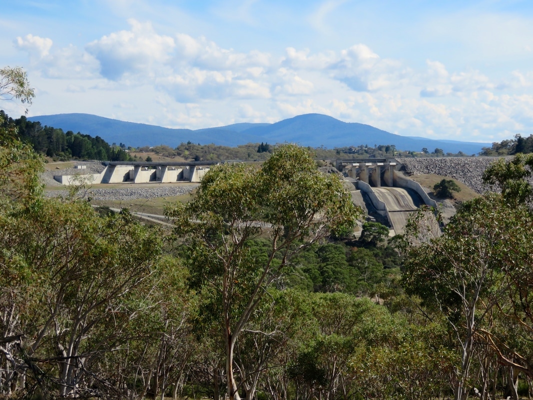
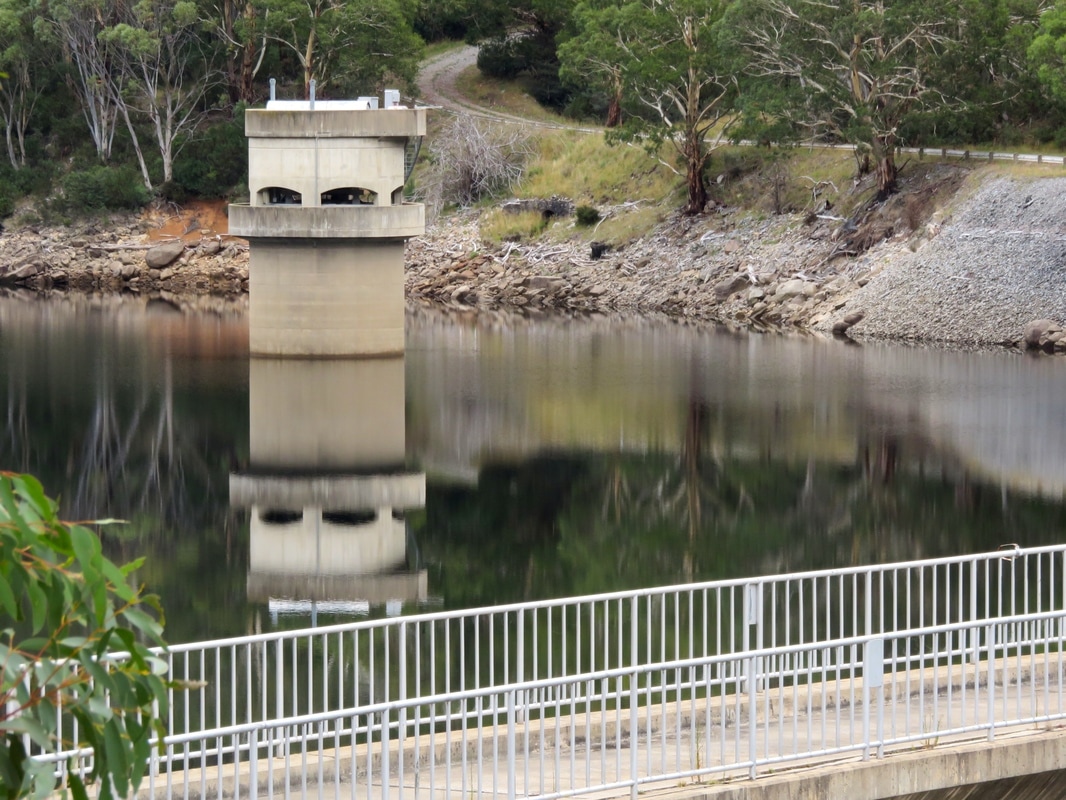
The biggest dam across the Snowy is at Jindabyne, and this is the first dam we saw as we drove up to the start of our journey. The photo above was taken from a point downstream several days later, but before we get to that, let's go back in tiiiime . . .
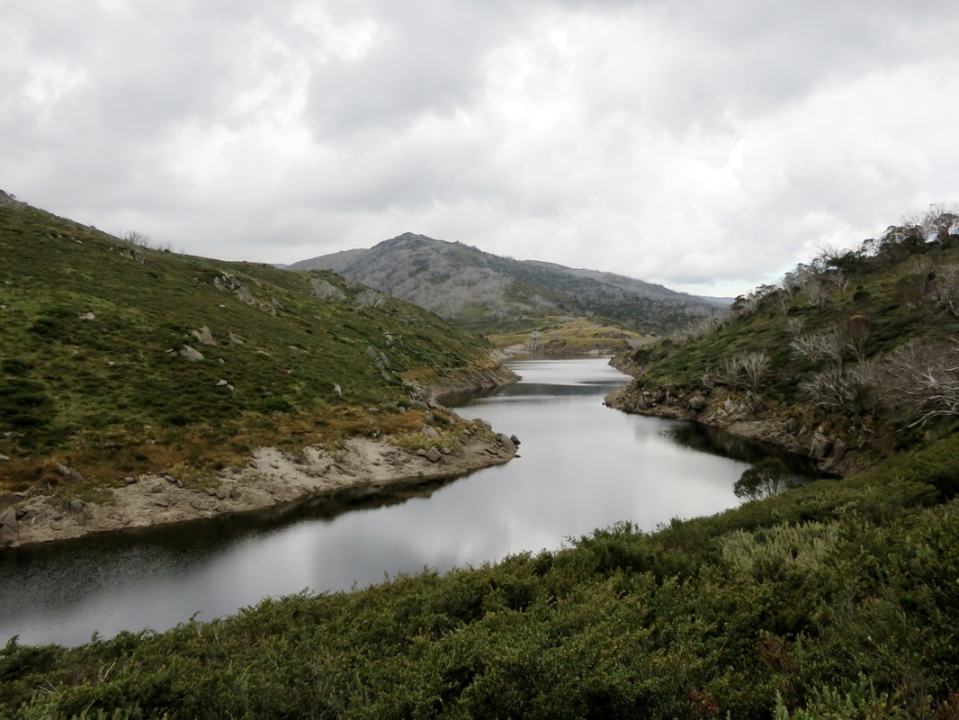
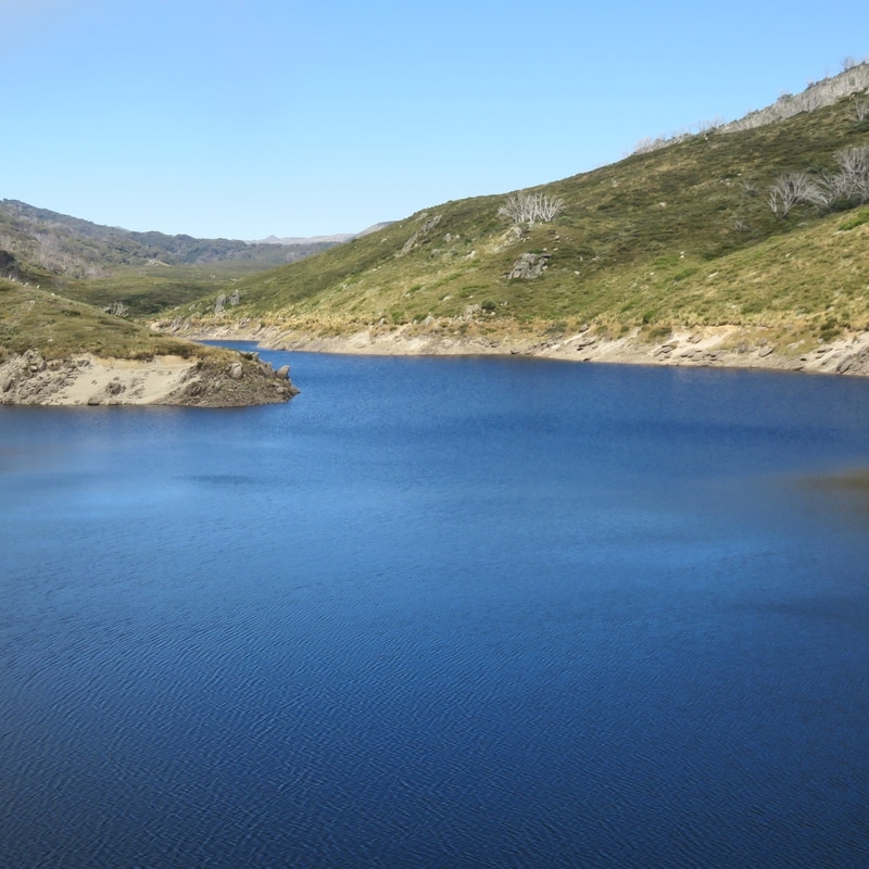
Construction on the Snowy Mountains Hydro-electricity Scheme started in 1949. It was completed 25 years later. Something like 70,000-100,000 people came to Australia to work on the scheme, and many stayed. Since then there have been a few upgrades and additions and there are now 16 dams, 7 power stations and a combined 225 km (140 miles) of tunnels, pipelines and aqueducts. It’s still considered to be one of the most complex hydroelectric schemes in the world - and it's huge, spreading over 5,000 square kilometres, although only 2% of the construction is visible above ground. Guthega Pondage (above), is the impounded reservoir formed by Guthega Dam. It's the first (or last, depending on your direction) dam across the Snowy River, and the first dam completed as part of the Snowy Mountains Hydroelectric Scheme in 1955. We first encountered it at the end of the infamous Day Two.
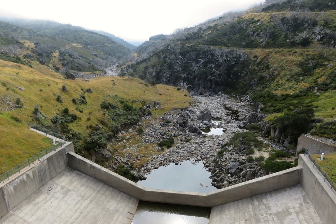
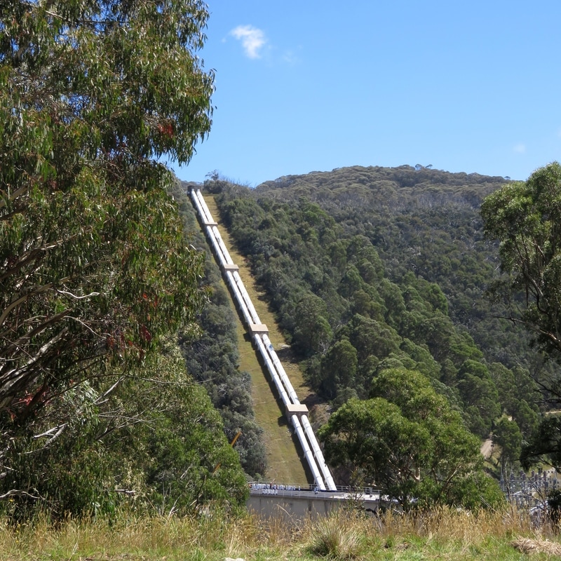
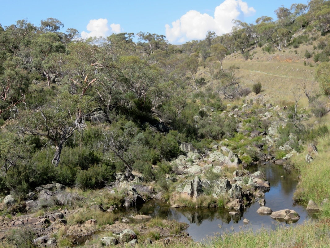
This is what the Snowy River looks like downstream of Guthega Dam: a rocky river bed, dotted with a few stagnant pools of water. The water from the reservoir is, as far as I could tell from the information signs and the shape of the landscape, pumped out through a level tunnel along the sides and tops of the hills, then released down long pipes to work the turbines at Munyang/Guthega Power Station several kilometres downstream (below right). You can see the layout in this arial shot on Wikipedia.
|
|
At the start of our third day, the clouds burnt away and Guthega Pondage turned blue beneath the clear sky (above left). But conditions up here are, of course, not always this idyllic! When researching her book The Snowy: The People Behind the Power, Siobhan McHugh spoke to some of the 450 Norwegians who came to work on the scheme at Guthega. They were apparently pretty unimpressed with their accommodation (uninsulated fibro huts) and food (they were given margarine, they wanted butter) and at one point they went on strike until they were able to have hot showers. To me, it seems more than fair that they should’ve had a few basic amenities, especially as they were risking their lives on a daily basis. In fact, Guthega was the location of the first Snowy Mountain Scheme fatality: a Norwegian miner killed by a rock fall. In total, 121 people died working on the scheme (unofficially, there may have been more), 53 of them in underground accidents.
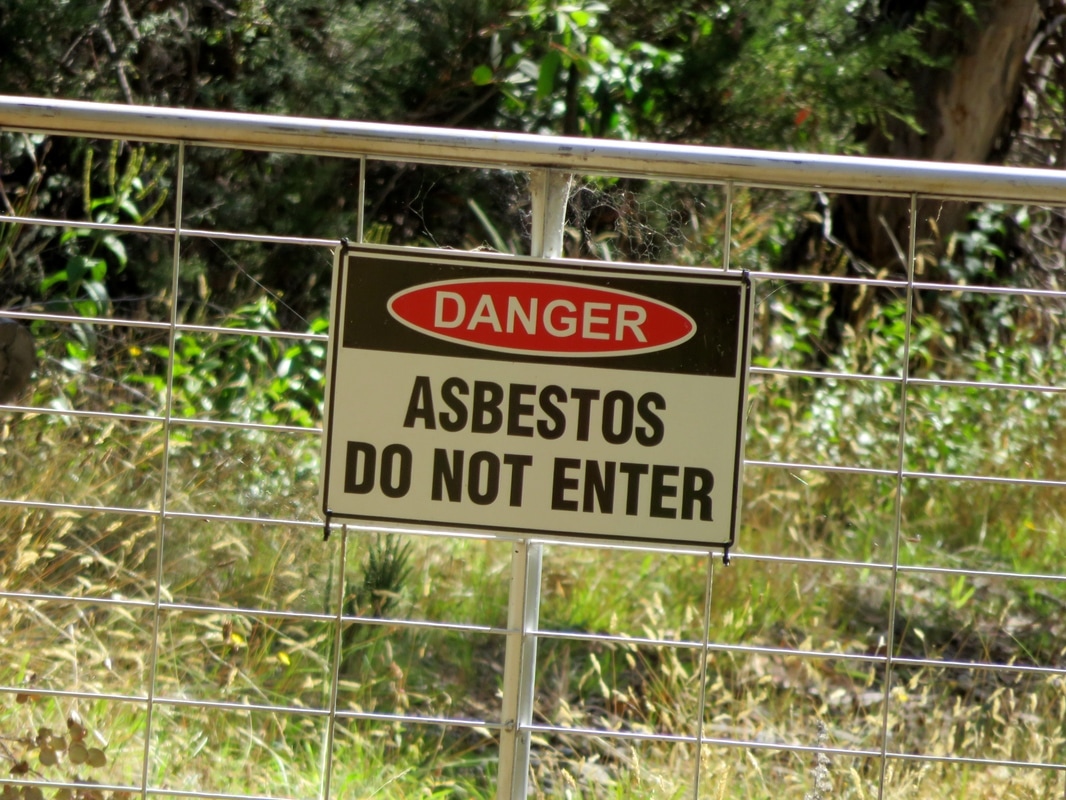
Towards the end of the day, we made it to Island Bend, a campground on the site a temporary township established for Snowy Mountains Scheme workers and their families in 1952. These days, there are only a few hints of the township that once was - flat pieces of ground where houses and halls and schoolrooms once stood, a grassy airstrip, the odd feral flower escaped from a garden and signs warning about the lingering presence of asbestos. It’s hard to imagine the area as a bustling small township. While researching this trip I came across a few scanned copies of the village newsletter, Around the Bend. Uploaded by Bruce Mitchell, one of “the Snowy kids” from the scheme’s townships, these typewritten publications give some insight into life in the township. A February 1967 edition notes that the barber shop is closed, there are updates on the darts team and archery club performances and an announcement about the weekly film programme: a Sunday matinee (Oliver Twist with John Mills and Alec Guinness), films on Sunday and Wednesday evenings, a Friday film group and a note that “Free Documentaries will be screened as usual on Thursday evening”.
|
|
We camped the night at Island Bend, in the section tucked in the eponymous bend of the Snowy River. You can see our spot in the photo (above right) before we put our tent up - note the trees, much taller than on the mountains. We didn't have time to explore the site in full, as it's quite spread out. I'd recommend this spot - though hopefully you won't get a bunch of people arriving from Sydney at midnight and setting up noisily in the pitch next to you!
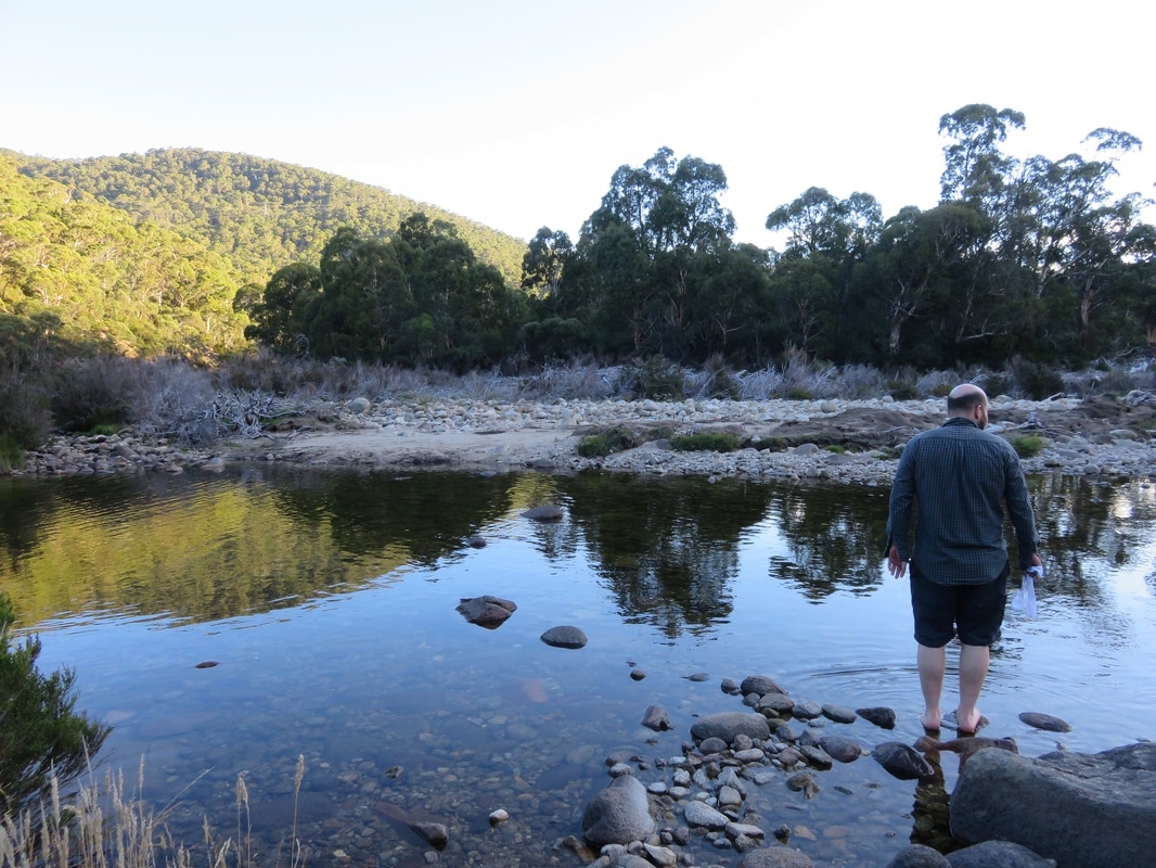
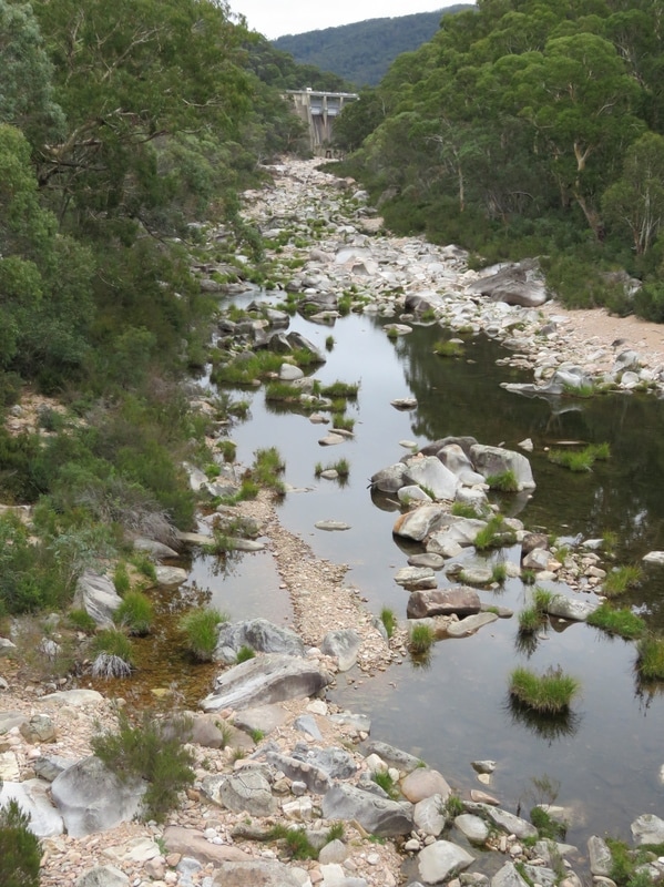
We didn't manage to get a spot right next to the river, but that didn't stop us heading down to the water to watch the sun set. There's a bit more flow here than below Guthega or even at Munyang. I guess a lot of it must come from the small creeks and tributaries trickling off the mountains.
|
|
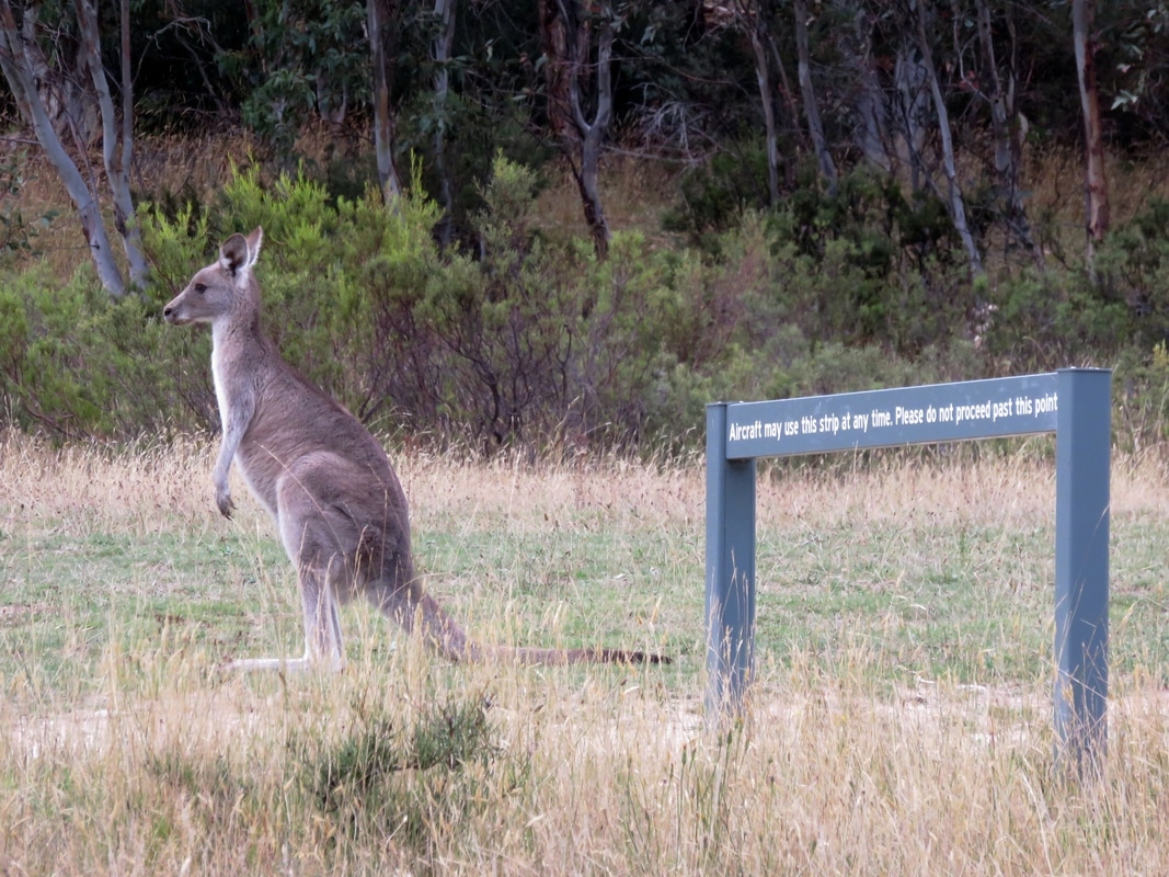
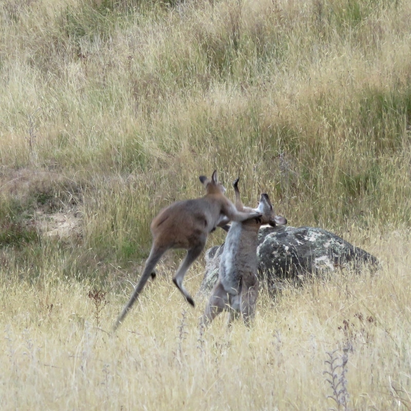
Kangaroos don't have to obey human signs. (In case you can't read it, the sign reads, "Aircraft may use this strip at any time. Please do not proceed past this point.") We also saw kangaroos fighting - a first for me! They'd have a bit of biffo, then stop to nibble on the grass for a while, until one of them bopped the other on the head and away they'd go again. A bit like cats, really!
|
|
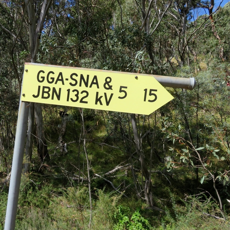
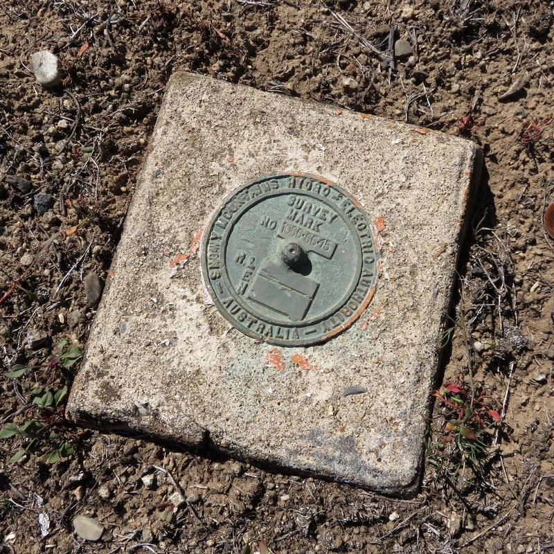
The mountains are riddled with signs (literal and figurative) of the scheme and its history. Yellow markers pointed up rough tracks off many of the roads and after a while we decided that they were pointing to pylons. This particular sign (above left) indicates the access point for pylons 5-15 - or so we believe! If you know differently, please do leave a comment. We also found survey marks (above right), fragments of walls, random pipes sticking out of the ground, bolts on roads and in gutters, chunks of wire-threaded concrete on the riverbed and many more remainders of recent industrial history.
|
|
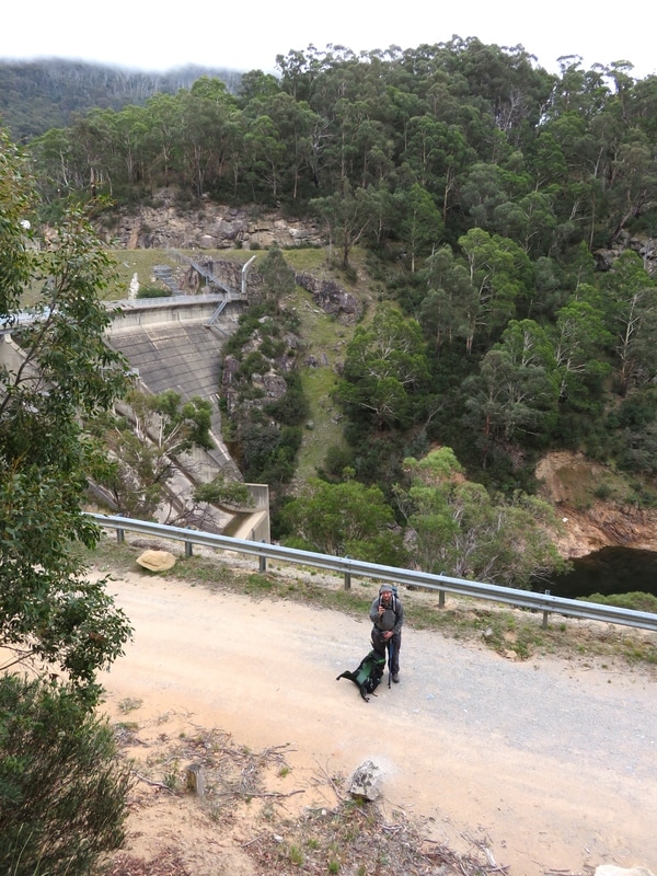
From Island Bend campsite we took the roads down to Island Bend Dam. We couldn't get access to the dam wall, but we spotted a few interesting things anyway. I climbed up a random bit of stone and concrete wall to get a better view (the top photo of the reflections and the bottom left photo of Dan on the road are taken from up there). A little way downstream we detoured back down to a bridge across the river, giving us a glimpse back up to the dam wall. Catching glimpses of all these enormous structures in the middle of the mountains reminded me of moments in The Lord of the Rings when the travellers come across huge structures like the Argonath and other physical remnants of times past.
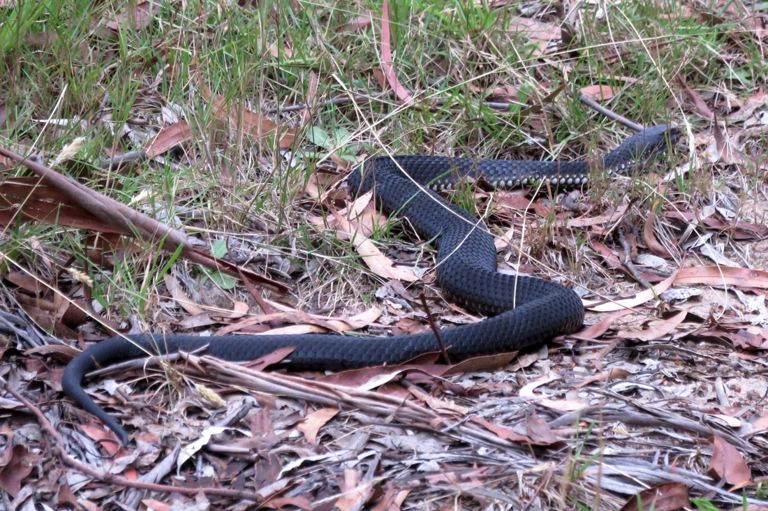
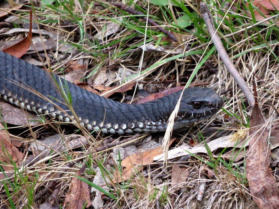
We encountered this snake on a bush track, lying between us and where we wanted to go. Apparently alpine copperheads are the only snakes that hang out in the mountains, so presumably this is one. We'd seen two the day before, making their way down the roadside gutters. One hadn't noticed us and had slithered slowly on its way. The other saw us, got the fright of its life, and practically flew over a bush to get away from us. This one didn't move. We stamped and clapped and shouted to let it know we were there. We threw a couple of little twigs at it from afar to try to get it to move on. It didn't move on. We couldn't see even the slightest twitch, tremor, or tongue flick. We started wondering if it was dead. I walked slowly forward until I was only a couple of metres away. It didn't look dead, but it still wasn't moving. I figured I was so close that if it was going to bite there wasn't much I could do, so I walked on past, stopping to snap a couple of close ups - after all, it's not every day you get this close to a lovely snake!
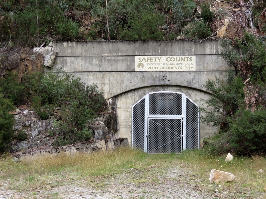
Tunnel entrance at the confluence of the Snowy and Gungarlin. The sign reads, "Saftety counts. Target for this tunnel repair: zero accidents." We laughed a bit and wondered (a) is there ever a target of 1-or-more accidents? and (b) this is just the target, what was the actual outcome? One of the worst and most dangerous jobs during the original construction of the scheme was working on concrete tunnel lining. While researching her book, Siobhan McHugh heard stories - from friends of friends of friends - about people being concreted into the lining between the forms and the rock face. She also read the evidence from an inquest following precisely this kind of accident in a shaft near Island Bend, on the last shift before Christmas 1963. The inquest decided that what had probably happened was a rock about the same diameter as the concrete pipe had lodged in the pipe and blocked the flow of concrete into the shaft. The workers noticed that no concrete was coming through and someone poked at the pipe just in case there was a blockage. What they didn’t know was that about nine tonnes of concrete had built up behind the rock. The concrete poured out in a catastrophic rush, dislodging the pipes and knocking the workers off the scaffolding to the bottom of the shaft.
Two men were killed instantly. One man was buried up to his hips in liquid setting concrete. He was pinned by debris and they could not get him out. They had two hours before the concrete set. He was alive and he was screaming. They tried pouring sugar in the concrete to stop it setting. They found out afterwards there would have been no hope because the man’s legs had been virtually severed in the accident and the only reason he wasn’t dead was that the blood wasn’t able to escape because of the concrete around him. (Source)
There might be other people buried beneath the concrete, says McHugh, and we will probably never know. The Snowy Mountains Authority kept meticulous records, but the contractors did not. There are many stories about family members shift-swapping, about people using assumed names to escape wartime incidents or child maintenance payments. With the identity of any given worker being such a slippery thing, it’s probably impossible to ever say for certain how many people died on the job.
If you're interested, Mikelangelo and the Black Sea Gentlemen have a recent album inspired by the stories of the migrant workers on the scheme. The song "The Sun Will Shine In" particularly reminds me of this place: I wake up in darkness, I work all day in darkness, I go to sleep in darkness . . .
If you're interested, Mikelangelo and the Black Sea Gentlemen have a recent album inspired by the stories of the migrant workers on the scheme. The song "The Sun Will Shine In" particularly reminds me of this place: I wake up in darkness, I work all day in darkness, I go to sleep in darkness . . .
|
|
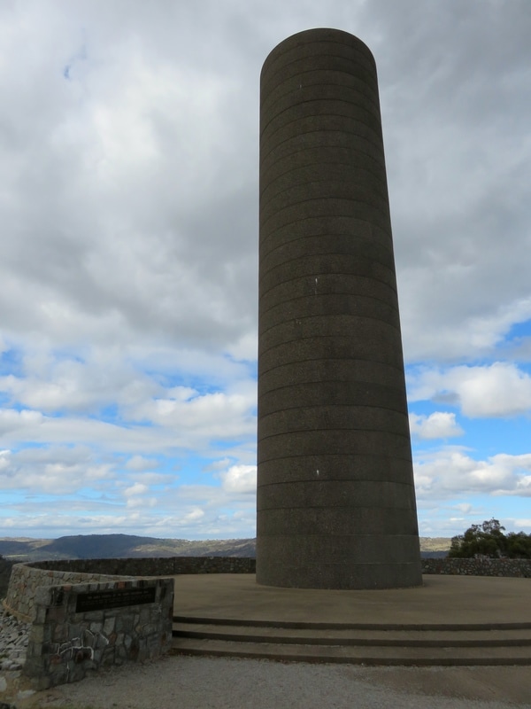
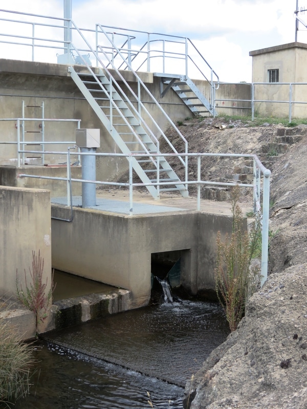
The big, somewhat phallic construction is the surge tank or tower at the Snowy Valley Lookout on Kosciuszko Road. I am still unclear on its function. The information sign had this to say (weird non/capitalisation from original): "Jindabyne Pumping Station [at the bottom of the valley below the surge tower] pumps water during off peak periods from lake Jindabyne through the Jindabyne-Island bend Tunnel to the Snowy Geehi Tunnel at Island Bend for diversion to Geehi Reservoir. Additional flexibility is achieved during periods of high flow in the Geehi River by diverting water in a reverse direction through the Snowy-Geehi and Jindabyne-Island Bend Tunnels to lake Jindabyne. The large concrete tower Structure at the Snowy Valley lookout is the Surge Tank for the Jindabyne Pressure Pipelines. The surge tank has an underground spillway which releases water via the dissipator chute at Jindabyne Pumping Station." I hope that makes it all clear. (This blog post made more sense to me: "The tank itself is basically a spring; the cylinder is air tight, so when the water stops flowing along the tunnel, it has nowhere to go except into the tank where it compresses the air, which then starts resisting the flow, bringing it to a gentle halt. Then the water level will drop as the pressures equalise.")
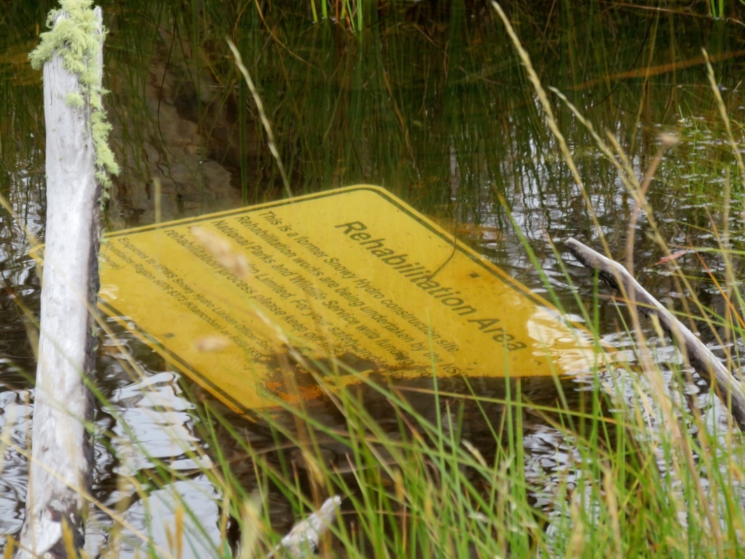
The Snowy Mountains Scheme was conceived and begun in a time before it was considered important to do any kind of research into the environmental impact of large scale engineering works. The ongoing effects of damming the Snowy are obvious downstream of Jindabyne, but there are traces of construction all around the mountains. This sign was taking a rest in a pool of water just off Kosciusko Road, near the intersection with Guthega Road, where we hitched a lift into Jindabyne after two days walking.
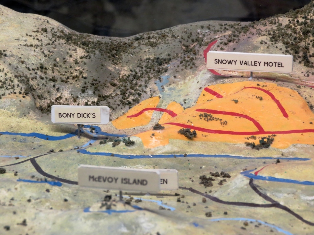
What? There's a model of the Jindabyne area in the visitor centre in town. It shows the valley as it was and is - the light blue shows the old path of the Snowy, the dark blue shows the waterline of Lake Jindabyne, the black lines are submerged roads, the red lines are roads used in the present. Douglas Stewart’s poem “Farewell to Jindabyne" documents the fate of the old town, lying beneath the lake.
Let us lament for Jindabyne, it is going to be drowned,
Let us shed tears, as many as the occasion warrants;
The Snowy, the Thredbo and the Eucumbene engulf it
Combining their copious torrents.
Over almost thirty stanzas, Stewart lists “all Jindabyne has to offer” in less than complimentary tones, concluding half-way through the poem that “Nothing, except the hotel, was built for permanence”, and:
Many a time thus viewing the total township
And thinking how soon it was all to be buried in water
Like drowned Atlantis and never be heard of again
I have thought: the sooner the better
Worrying the issue over, Stewart name-checks the people and their properties soon to be submerged (note the European names): Hans at the Kookaburra Cafe, Rankin’s and Jindabyne Motors, Leo A. Hore at the pub, E. Kluger and “his famous salami sausages”. But soon enough, he remembers that all these people will be re-homed in New Jindabyne.
What the poem leaves out - as does much of the writing about the scheme - is the loss of older sites, places important to the Ngarigo and other Aboriginal groups. Stewart’s view of Indigenous people is of:
The shy dark shadowy aboriginal race
Always like creatures in water, who left one word
And vanished without a trace . . .
It’s a summary that suggests the disappearance of Aboriginal people is complete (it isn't) and that such a disappearance is a sad inevitability (rather than a concerted regime of violence by colonisers). Stewart doesn't talk about Aboriginal cultures, stories and places lost beneath the water. There were no surveys of such sites done before construction, but had there been the surveyors might have listed places similar to those found elsewhere throughout the high country, the Monaro and the Snowy valley: camp, shelter, ceremonial and stone tool manufacture sites, middens, scarred trees (either carved to mark the burial places of important people, or scarred in the removal of bark to make shelters, canoes, shields, baskets), or other things not so bounded by a specific physical location - a landscape or a particular view, part of a songline, specific geological features, plants or animals. Stewart contends that Aboriginal people left behind only a single word - presumably the word “Jindabyne”? - so whereas he and his implied audience are able to get a bit nostalgic for the homes and cultural hubs of ‘modern’ Australia (houses, pubs, shops, churches), the Indigenous equivalents (art, artefacts, sacred sites, names and stories) remain unlamented.
|
|
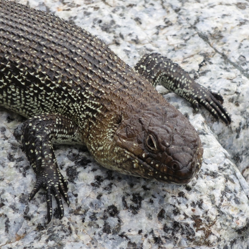
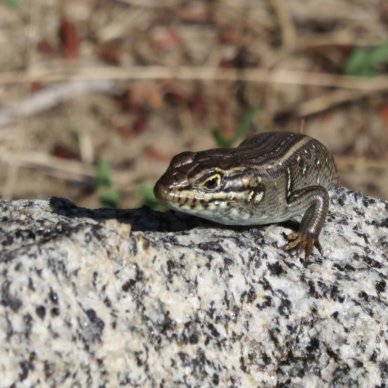
We saw many lizard friends on our travels in Australia. I'd forgotten how ubiquitous they are, and how much I miss seeing them in the UK. These photos were taken a few days apart, in very different locations - one high on the hillside, one down in the riverbed - which you wouldn't necessarily think, given the rock is the same speckled granite. It must be good for basking! Anyway, on the left is (we think) a Cunningham's skink, probably about a foot long, and the one on the right is something else, much smaller and smoother . . . sorry, I'm not a lizard expert. Again, if anyone can provide a better ID than that, please leave a comment!
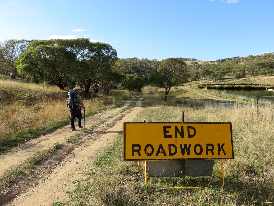
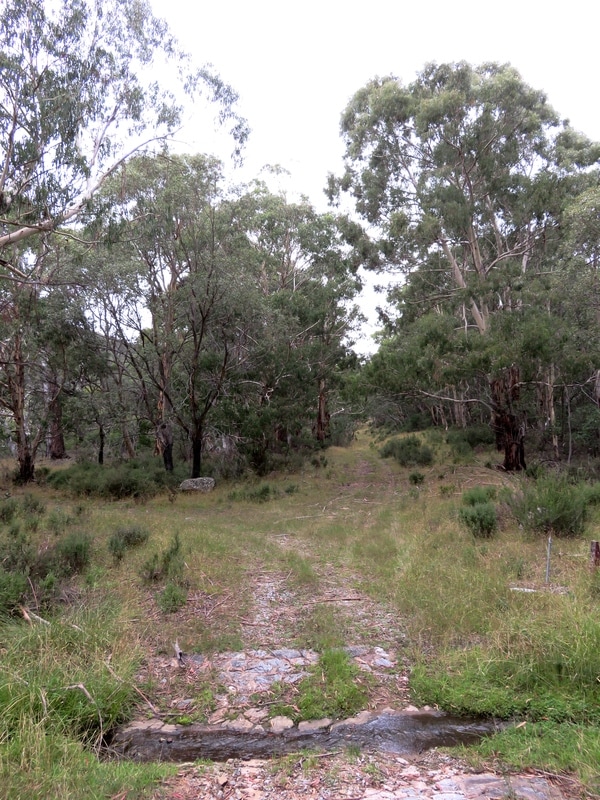
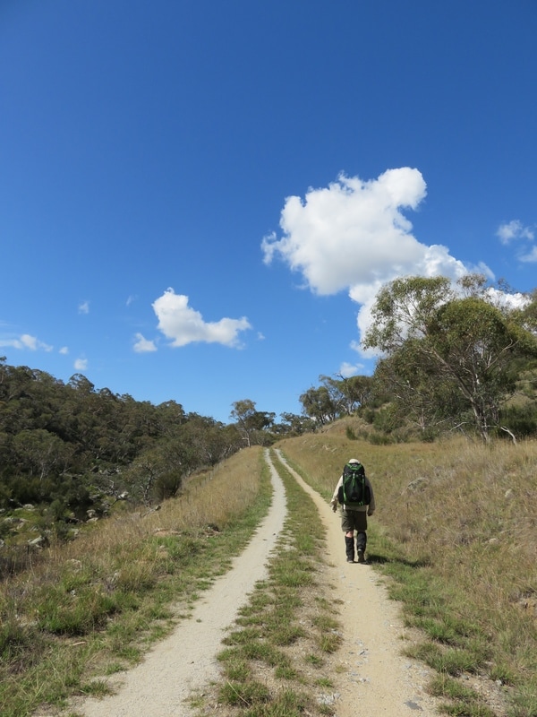
Off we go, to try and get to the river below Jindabyne Dam. You can see how the landscape is changing. We've moved from the alpine vegetation above Guthega Pondage, down through the montane forests and taller trees in the valley around Island Bend and Gungarlin River. We're now into the grasslands that, while they still sit on the escarpment of the Great Divide, can probably be counted as the fringes of the Monaro High Plains (to be featured in my next post!).
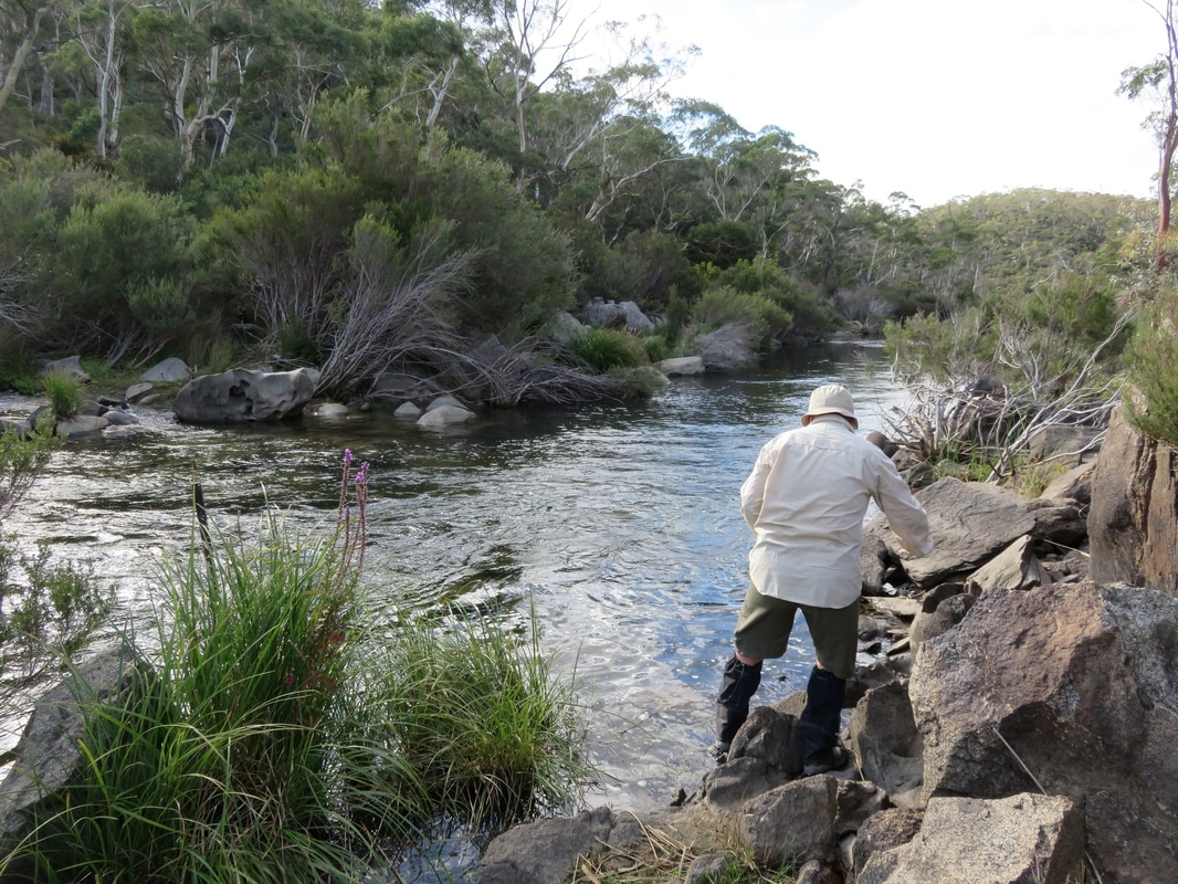
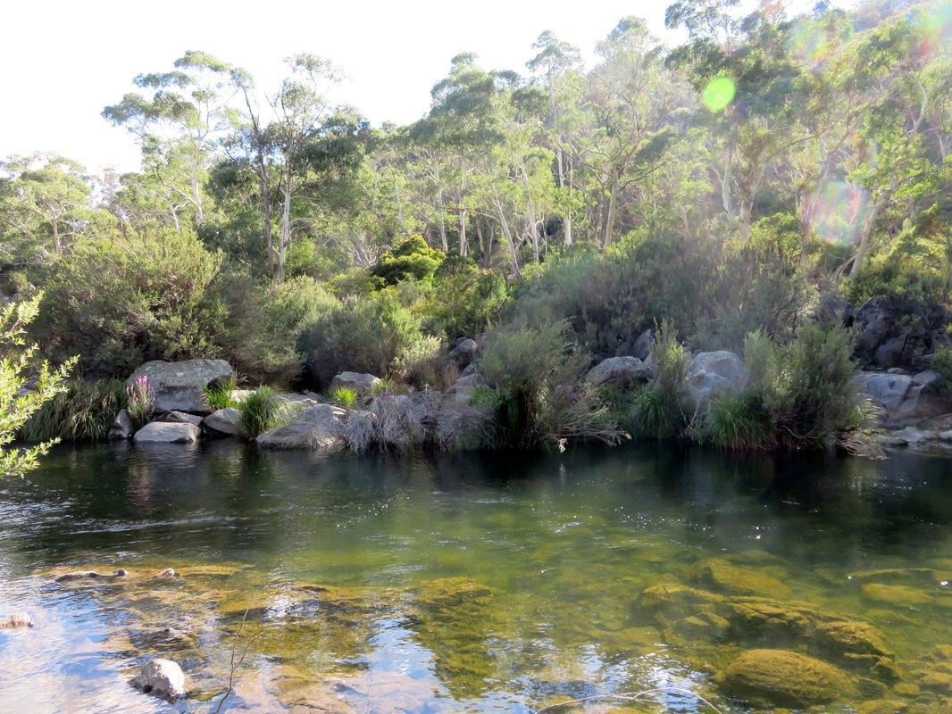
Back on the Snowy, below Jindabyne Dam. In the 1990s, 99% of the Snowy River's natural flow was held by the scheme, much of it ending up being diverted into the River Murray. After a huge, grassroots campaign and a lot of political lobbying, the four governments involved in the scheme (Victoria, New South Wales, South Australia and the Federal Government) finally agreed to return a bit more of the Snowy's water to the Snowy. The figure I remember the campaign asking for was 28%. This has, as far as I'm aware, never been achieved - and nor has the promised 21% eventuated. However, a good deal more than 1% now comes out of the dam, which was altered to enable enormous "flushing" flows, designed to mimic snowmelt floods. Having seen photos of the Snowy at its worst below Jindabyne Dam, I wasn't sure what to expect. I was pleasantly surprised to find a swift-flowing stream here. Obviously, it was a lot smaller than it must once have been - the valley floor is the old river bed and the river is only the size of a big creek - but it isn't completely stagnant. Finally getting to see this bit of the river, making it down to the water below the dam wall, felt like a milestone.
|
|
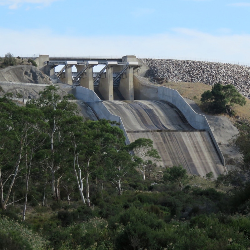
But, as noted in a previous post, we couldn't make it much further along the river itself. We climbed back up the valley and set off along the aqueduct track that links Lake Jindabyne (on the Snowy) and Mowamba Weir (on the Mowamba - a tributary of the Snowy). It was hot, so we stopped whenever we could find a smidgen of shade and looked back at the view of the dam. Check out that spillway! It would surely make an epic water slide!
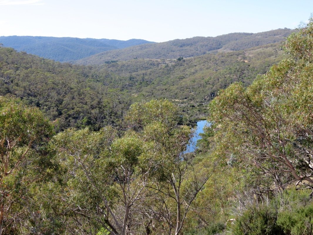
One of our final glimpses of the Snowy River as it heads away down Jindabyne Gorge. I'd love to come back and see a bit more of this section one day. There are 4WD tracks and private roads that go down to the river in this stretch, so it's not impossible to access . . . Or perhaps I could go kayaking on one of the big environmental releases, like this:
The aqueduct track turns away from the Snowy above the Mowamba junction, and heads back out towards the Snowy River Way (one of two ways to drive between Jindabyne and Dalgety). The Mowamba River (or Moonbah, below left) has its own story in the Snowy Scheme saga. Rising on the slopes of Mount Terrible, the Mowamba travels on its merry way until it is diverted via a weir and aqueduct into Lake Jindabyne. For a little while, back when environmental flows were first returned to the Snowy, the Mowamba was allowed to overtop the weir. As it isn't dammed upstream, it became, for a while, a surrogate snowmelt headwater for the Snowy. However, once the big alterations had been made to Jindabyne Dam, the aqueduct was switched on once again and now only a trickle makes its way out from the base of the Mowamba Weir (below right).
|
|
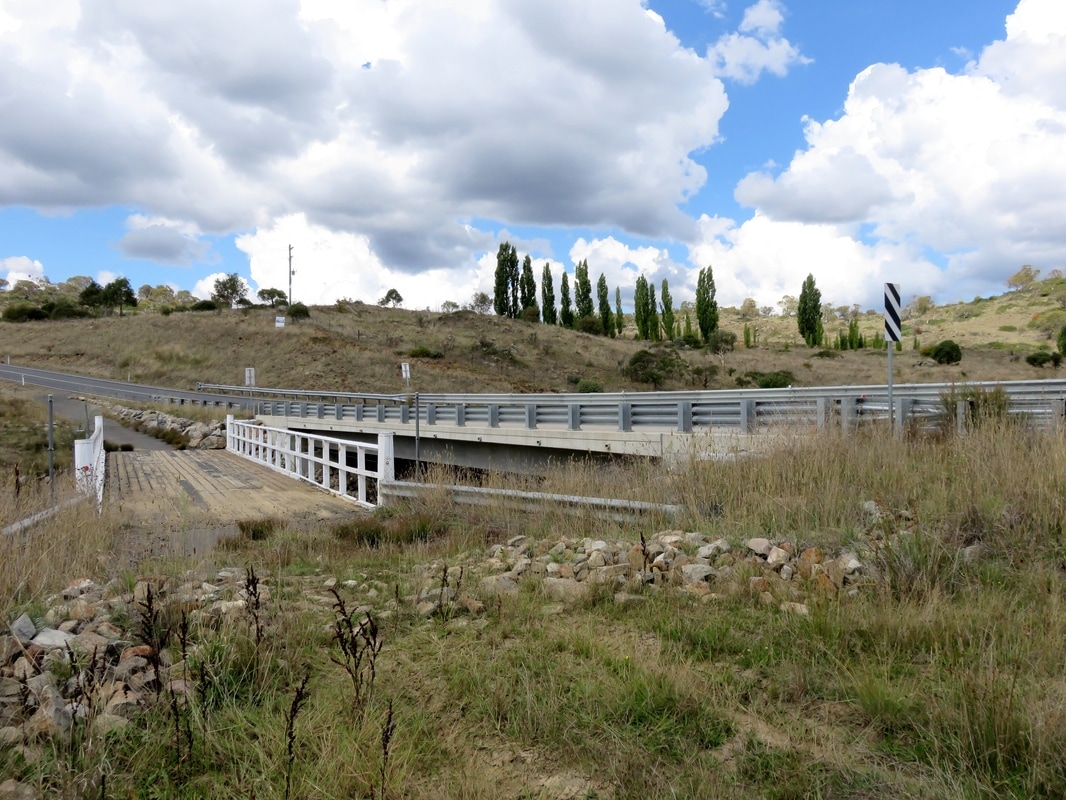
Old bridge, new bridge. On the left is the older wooden bridge over the Mowamba. Now the Snowy River Way crosses a more substantial, double lane concrete bridge. I noticed quite a few places on our journey where old bridges has been left beside the new as formally listed and/or informal heritage structures: here, Bete Bolong Creek, Murrindal River, Ambyne on the Deddick River. After visiting the Mowamba Weir, we hitchhiked to Dalgety - and that is where my next post will pick up!
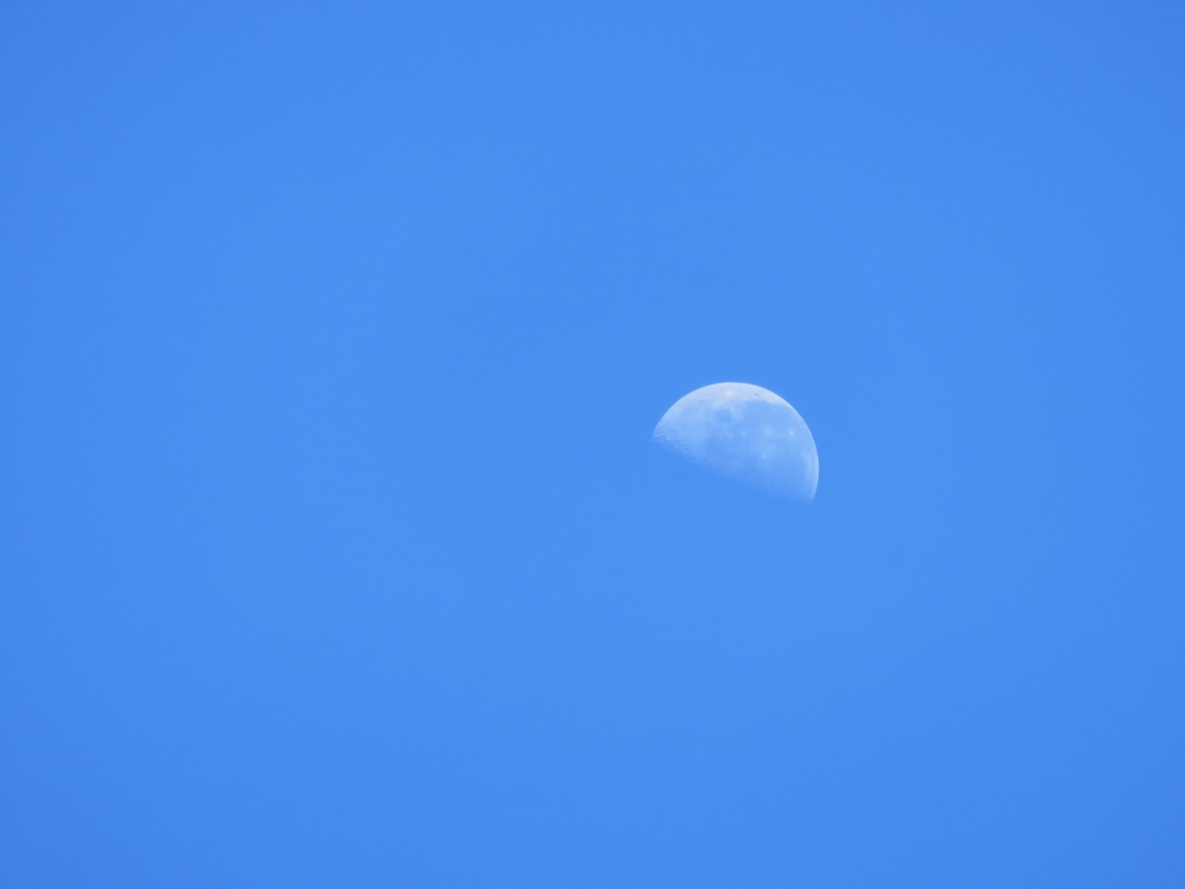
Here's the story of the creation of the Snowy River, told by Rod Mason (then Kosciuszko Indigenous Liaison Officer), cited in Claire Miller's book Snowy River Story: The Grassroots Campaign to Save a National Icon (2002). I thought of it every time I looked up and saw the moon on this trip.
The moon took the water from the ocean, and travelled to the mountains to the north. The platypus followed, and busted the moon’s waterbags when the moon fell asleep in the mountains. The water gushed out and made the Snowy River and all its children..
Thanks for reading - remember to let me know if you can identify those lizards! I'll be back in a couple of weeks with a photo post about the Monaro High Plains. In the meantime, you can check out my overview of the trip or my photos from the high country.
 RSS Feed
