Almost two months ago, we flew to Australia to try to walk down the Snowy River. Spoilers: we couldn’t do it. But we had a lot of fun trying!
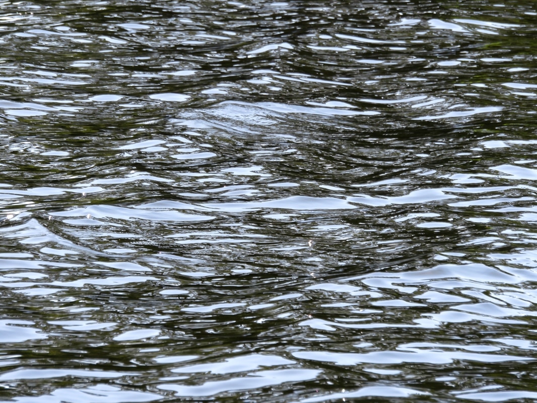
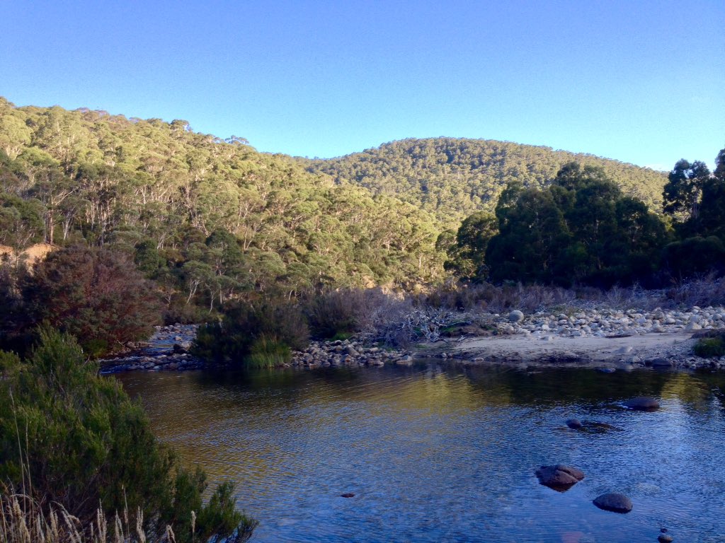
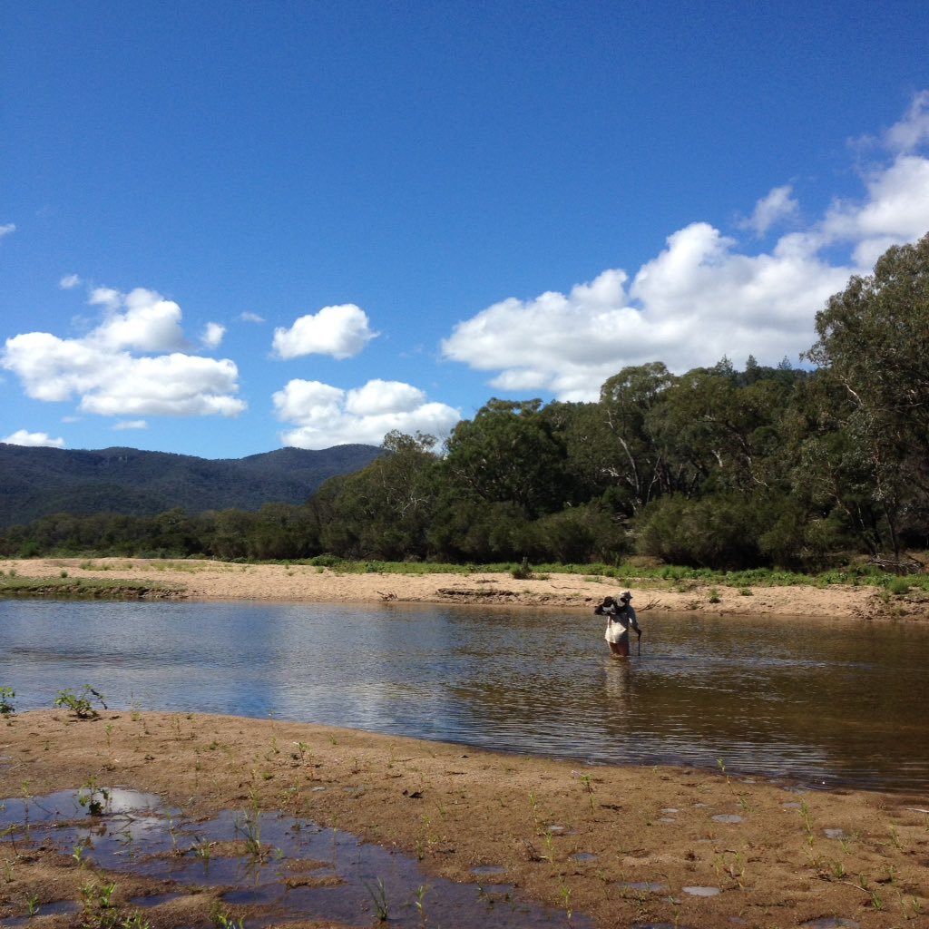
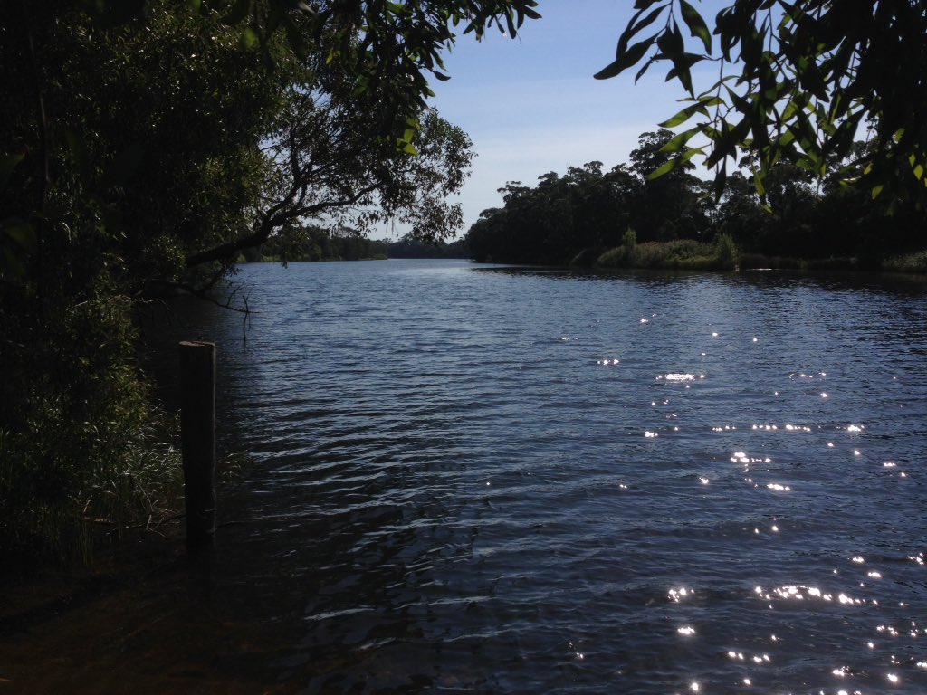
The Snowy River at Lochend, between Orbost and Marlo.
Here’s what we got up to and how our plans changed. (Many of these pics are from the phone camera and a lot of them were taken by Dan. I’ll be blogging more photos from the camera as I get around to editing them.)
Plan A
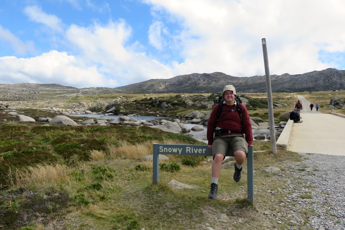
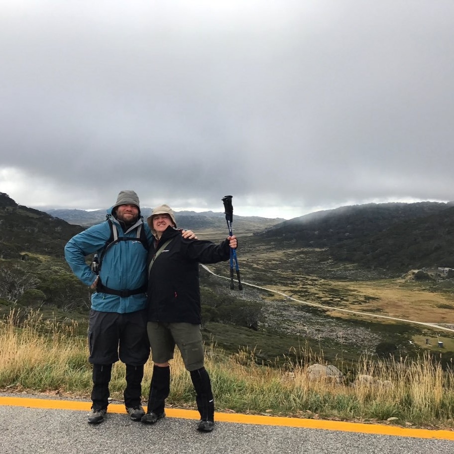
Plan A was to walk the river. We flew into Melbourne, stayed with our friends for a night, then Emily picked us up and drove us to my parents’ place near Orbost. The next day, we hopped back in the car and zoomed up to Jindabyne. Emily stayed with us in Jindabyne for most of the next week, ferrying us around, cooking dinner, finding out interesting things and generally being a superstar. Day 1 was an easy day walk up Australia’s highest mountain and back down. It started with a ski lift up the steepest bit, followed by hot chocolate in Australia’s highest cafe, then a walk to the source of the Snowy (pretty much). Emily went back down to the car and Dan and I went up to the summit, visiting Australia's highest toilets on the way. We then headed down the other side to Charlottes Pass, stopping for me to paddle in the river while little galaxias nibbled my legs.
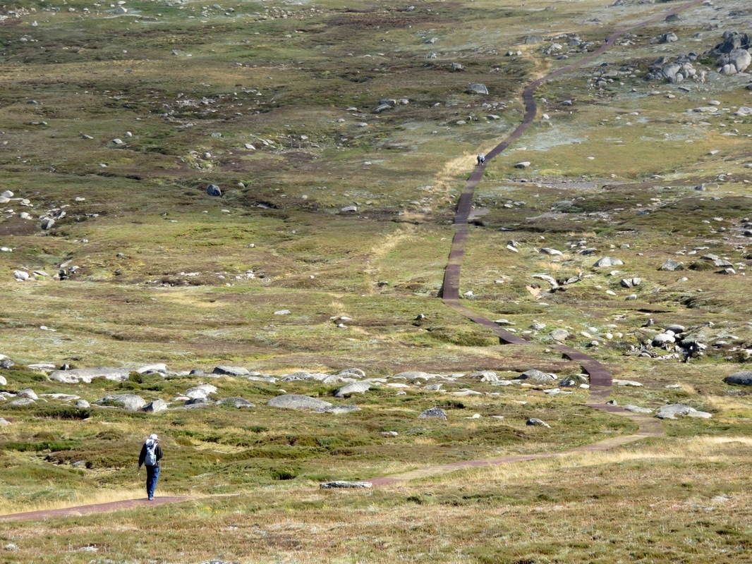
See the little indentations in the landscape running left to right under the path? That's the baby Snowy River!
The second crossing of the Snowy River, on the way down from the summit to Charlottes Pass. Of course I went in the water after this!
Day 2 was probably the hardest day of walking - or rather, scrambling - I have ever done. The river began as a fairly open bed, with lots of little rocks to use to walk along the side, but which soon became a swift stream rushing down through a gorge, over multiple rapids and small falls. Out of the river, the hills were covered with dense alpine shrubs, almost impossible to walk through. I hit the wall early on, and spent most of the day shaking with the effects and aftereffects of multiple adrenaline dumps. “It wasn’t meant to be like this on Day 2!” I wailed at one point. It took us several hours to make our way down the river to a point where Dan also hit the wall and we couldn’t get any further. We climbed out up a waterfall and trudged across the hillside, finally catching a glimpse of the hut where we’d planned to have morning tea (it was now about 3pm). We found a footpath leading to a suspension bridge, made it to the hut, ate the last of our chocolate and followed a path out to the road at Guthega where Emily picked us up - several kilometres short of our planned end-point for the day. We were physically tired, but mentally and emotionally we were absolutely drained. What had we got ourselves into?
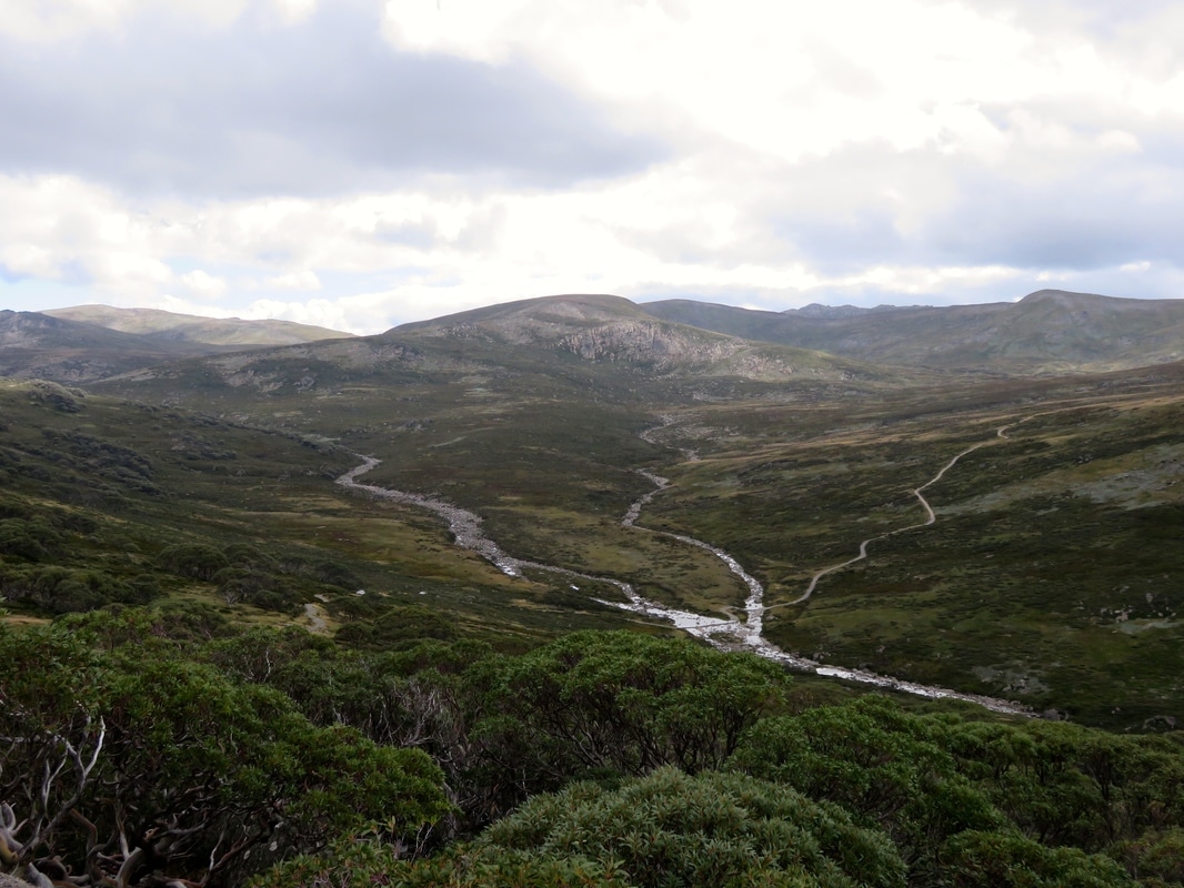
The Snowy near Charlottes Pass (it's the left-hand stream before they converge) and the Main Range walking track.
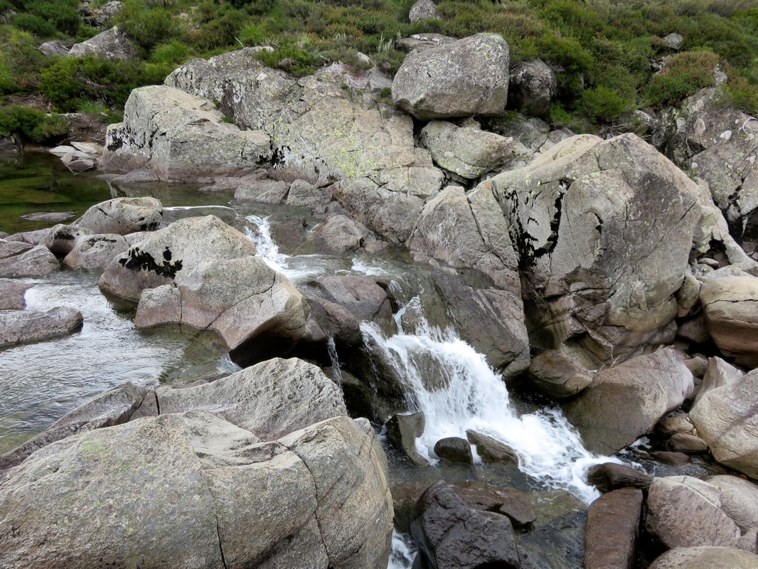
Just one of the many obstacles on Day 2. The problem with most of our photos of the day is they give no sense of scale.
 Before: the adventurers set off on Day 2! (Photo by Emily.) | 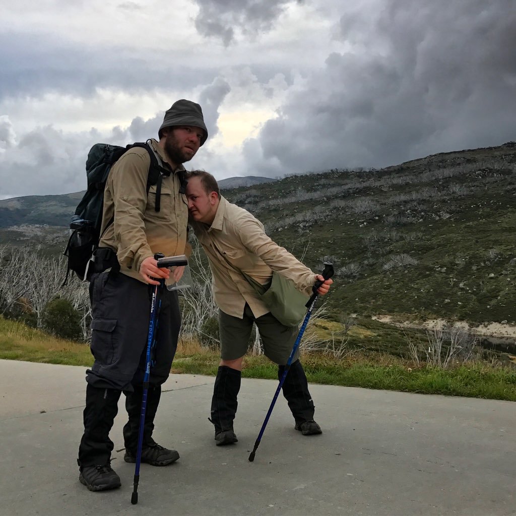 After: "It wasn't meant to be this hard!" (Photo by Emily.) |
Plan B
The next couple of days were clear road-walking along the river. Mornings were cool and the valleys often stuffed with cloud, but it burnt away quickly leaving hot blue skies. We encountered three copperhead snakes, saw dozens of kangaroos (some fighting!), a few wallabies, the cutest little red-bellied birds (flame robins), a wombat and many other denizens of the bush. We found a beautiful campsite overnight at Island Bend, once the site of a Snowy Mountains Hydroelectric Scheme township. Plan B came into effect on Day 4, when (due to the slow progress on Day 2) we ran out of time. A track we thought might take us through alongside the river was signposted, “This trail is now closed to all unauthorised use at Jindabyne Pump Station. Due to safety concerns it is no longer possible for mountain bike riders and walkers to continue along the trail past the pump station and they must return to this point.” We didn’t fancy walking 10km along the track only to have to turn around and walk 10km back - plus the rest to get us out to somewhere with phone reception or passing traffic. Instead we walked a few hours out to Kosciusko Road and hitchhiked into Jindabyne. The only previous hitchhiking we’d done together was a couple of miles in Norfolk when we’d gone for a walk and ended up running late for Dan’s grandmother’s 90th birthday. This was a bit more exciting!
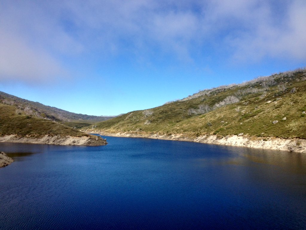
Guthega Pondage looking blue in the sunshine. Note the burnt skeletons of snow gums on the slopes.
The river at Island Bend, sun just starting to set behind the hills.
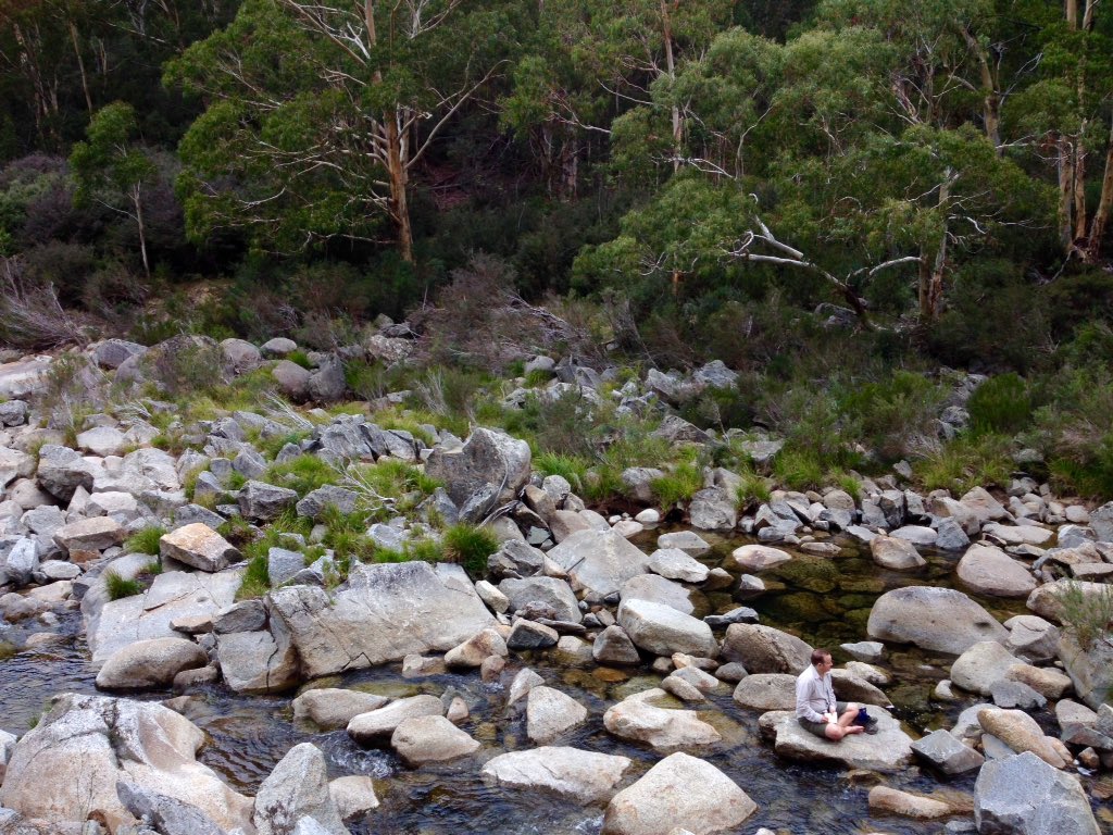
Sitting on a rock in the Snowy River near the Gungarlin junction, taking notes.
Plan C
On our day off in Jindabyne, we strolled around town, wandered along the lake shore and went to the fantastic Birchwood cafe for more than one meal. We spent a bit of time in the visitor centre, looking at the tiny corroboree frogs, learning more about Kosciuszko National Park and admiring the model of the area, showing Old Jindabyne and the route of the Snowy River before both were drowned beneath the lake.
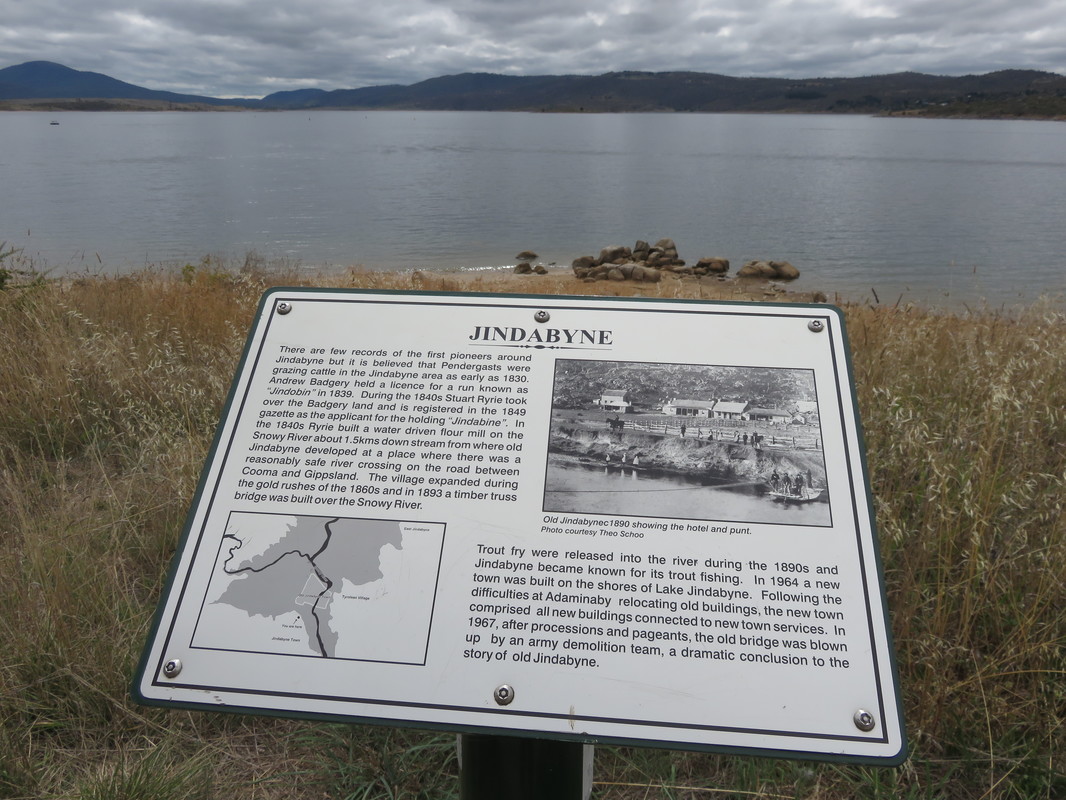
Somewhere out there under the water of Lake Jindabyne are the remains of Old Jindabyne.
We moved to Plan C the next day, when Emily waved us off and drove back to Melbourne. We made our way down to the river below Jindabyne Dam and started pushing our way through the scrub along the river bank into the gorge. Twenty minutes later, we’d come about 200 metres. At this rate, we would run out of food before we could make it to Dalgety. We traipsed back up the hill in the baking heat and followed a dirt track around the top of the gorge and up the Mowamba River to the road. We mulled a few options over as we had lunch and investigated Mowamba Weir. A bus goes between Jindabyne and Dalgety three times a week, but we weren’t sure it would stop for us. A chat to a couple of blokes fixing a car in a nearby back yard confirmed it wouldn’t, so we decided to hitchhike to Dalgety. “I’ve never picked up hitchhikers before, but you two look pretty harmless,” a woman told us. I think she meant we looked pathetic, huddled out of the blazing sun in the one patch of shade we could find! We made a pact from now on to pick up hitchhikers when we can - it’s such a relief when someone finally stops. In Dalgety, a dry town in a dry place, we pitched our tent minutes before an epic rain, wind and hail storm settled in and washed away half the caravan park’s new roads. I was certain our tent would be a goner, but it survived - as did we, which I’m not sure would have been the case had we been stuck in a gorge with a rising river.
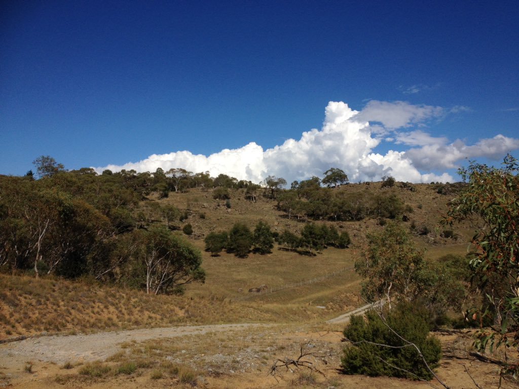
Along the track above the Snowy and Mowamba Rivers. In retrospect those clouds should have been a clue to the evening's weather!
Plans D and E
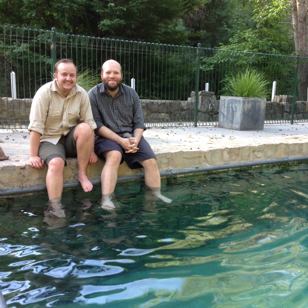
Our time in Dalgety included Plans D and E. We paddled a section of the Snowy upstream of Dalgety on a canoe borrowed from Sue and Colin at the caravan site. We spent as much time in the water as out of it. The dazzling, clear skies of the morning turned to storm clouds and lightning by mid afternoon and we thought it might be a good idea to get off the river. We pulled into a random garden and shouted, “Hello! Is anyone home!” Anyone was home - two anyones, in fact - and they were very nice to us. We sat on the verandah as it bucketed down, drinking tea and telling tales until Colin came to our rescue.
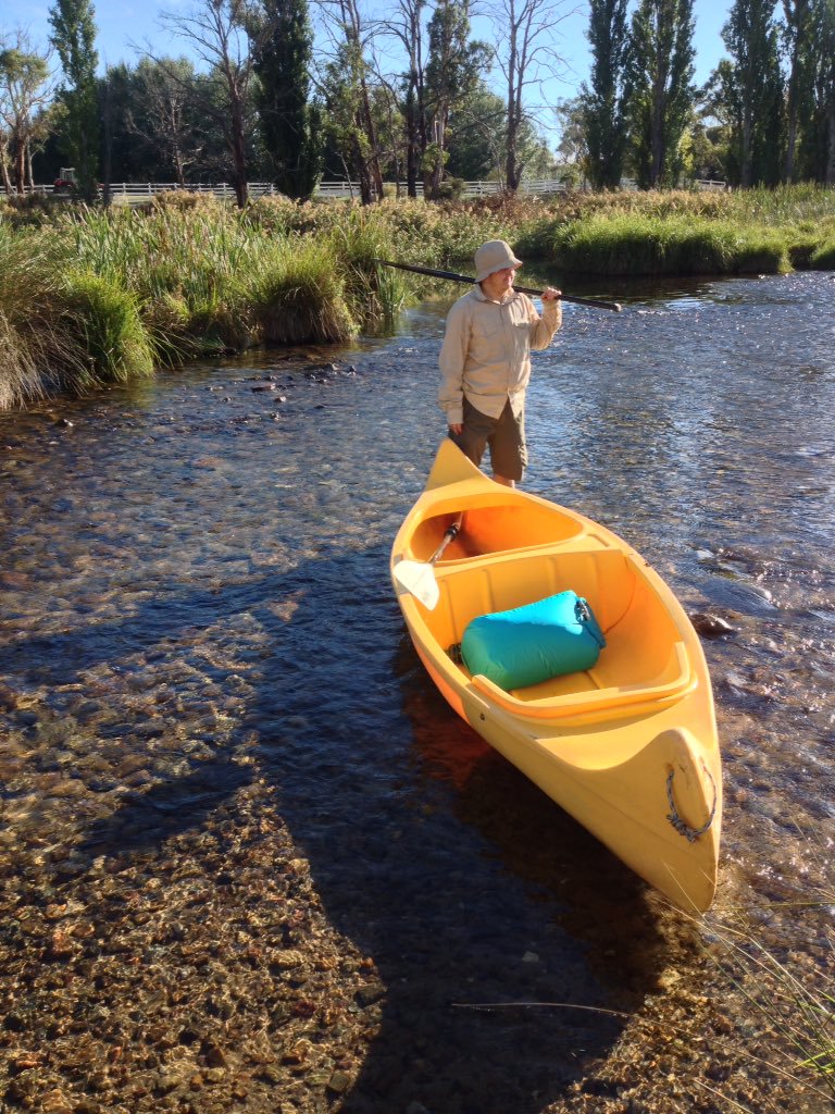 About to set off in an unsteady canoe! | 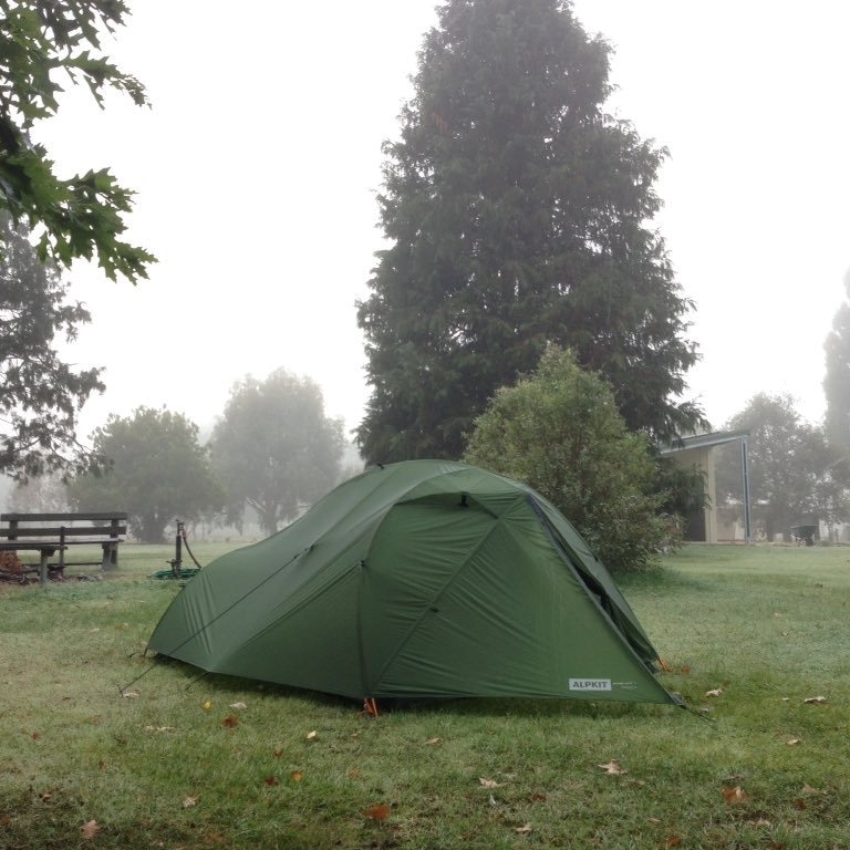 Our tent, having survived a few downpours, in Dalgety. |
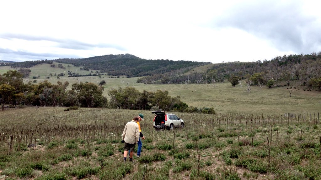
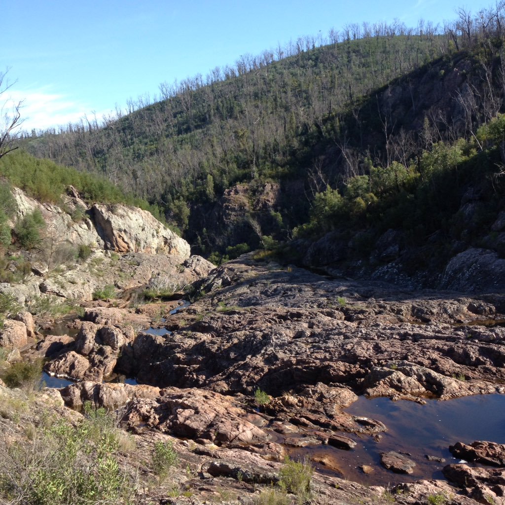
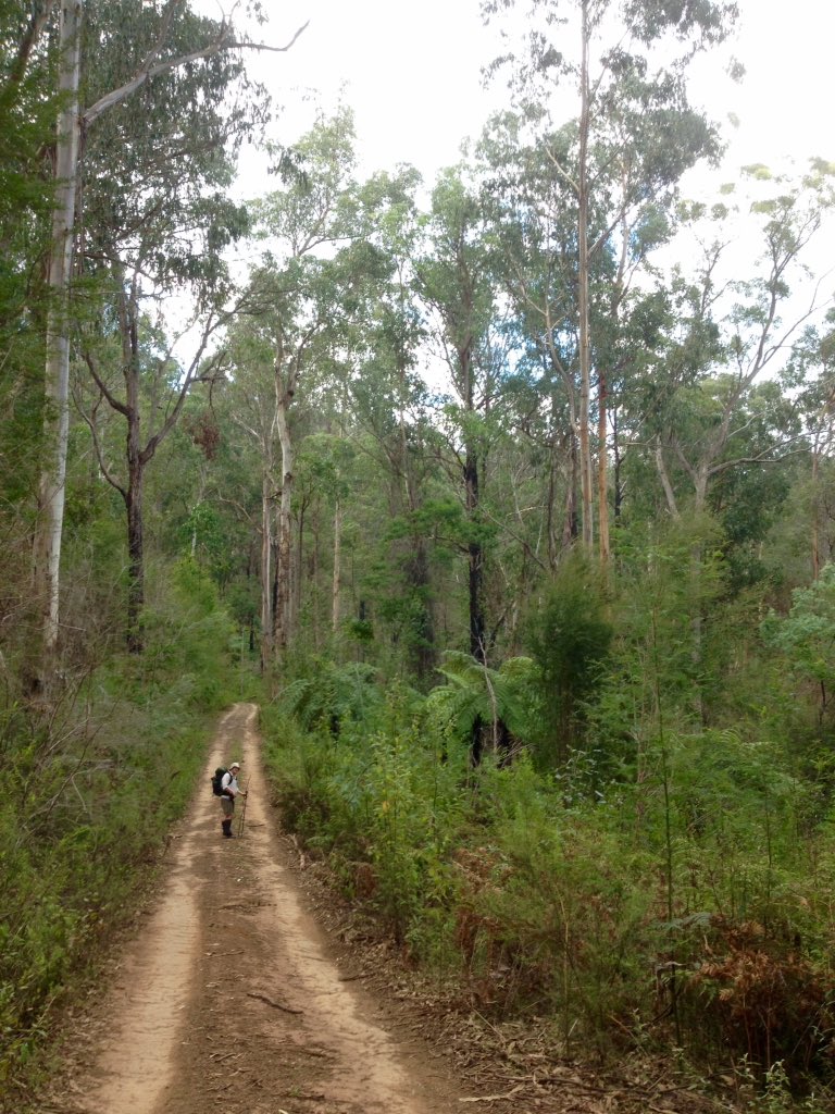
We got the maps out while we were in Dalgety and realised that, while it might be possible to walk the length of the river, we would probably move downstream at a rate of about 6-10km per day rather than the 15km per day that we’d originally planned. The going was much slower than we’d anticipated, what with having to rockhop, wade, bushbash, ford the river and creeks, and detour up the sides of the valleys. Our options were to attempt to walk a long section of the river in its entirety, or to do several shorter sections along the whole length of the river but not see the stuff in between. We opted for the latter and roped my dad into driving up to Dalgety to do a bit of car-based exploring. Gosh, we had a fantastic day or two. We travelled through some amazing landscapes, saw some intriguing places, met some interesting people and generally had a fun time. It rained.
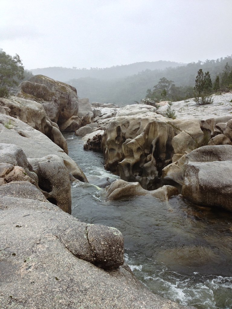 Stonebridge. Amazing. |  Bairds Crossing, Ironmungie. |
Paddocks around the Monaro are choked with invasive weeds: great mullein and horehound seem particularly pervasive.
Plan F
We retreated down to my parents’ place on the lower Snowy near Orbost, skipping ahead to spend a few days exploring that area. Perhaps this could all be encompassed within Plan F. We went bushwalking at Raymond Creek (a tributary of the Snowy), inner tubing several kilometres down the river from Wood Point (seeing many Snowy River crocs), wandering along the road and riverfront at Jarrahmond (visiting the gauging station) and walking from Marlo to Frenches Narrows (a salty lagoon at the end of the Snowy). We also paid a visit to Mount Raymond fire tower, where we enjoyed fantastic views over the Orbost flats, the hills beyond and out over the coast.
 Raymond Creek, below the falls. Note signs of recent bushfire. | 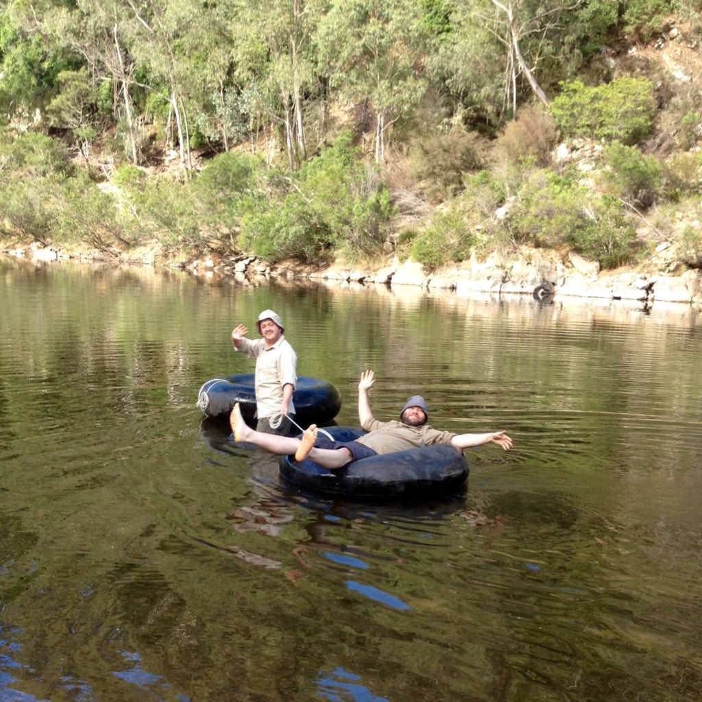 Heading down the Snowy on inner tubes! (Photo by a parent!) |
 Exploring at Frenches Narrows. | 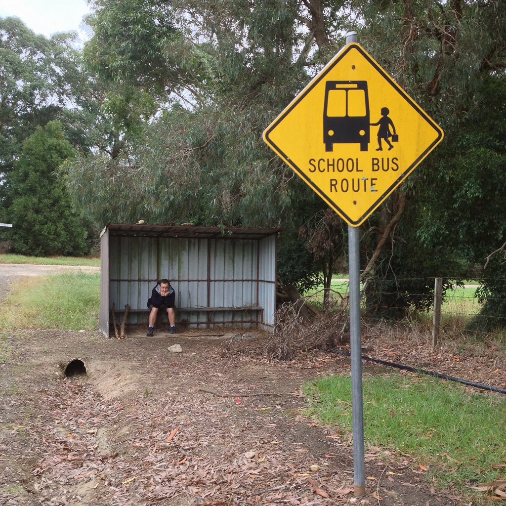 My old bus stop. It was Saturday, so no bus for me. |
Plans G and H
We spent a night in Buchan with my parents before my dad then drove us back up to NSW. We planned to have a few days walking and exploring before meeting my aunt and uncle at Jacobs River - as arranged months before. We tossed up driving all the way around to Paupong via Dalgety, which we’d visited the week before (Plan G), but in the end went for the more sensible (or easier, if you want to be cynical) option. Dad dropped at Jacobs River (Plan H) and we walked upstream from there.
 The famously cold pool at Buchan - the water flows from the caves. (Photo by Elisabeth.) | 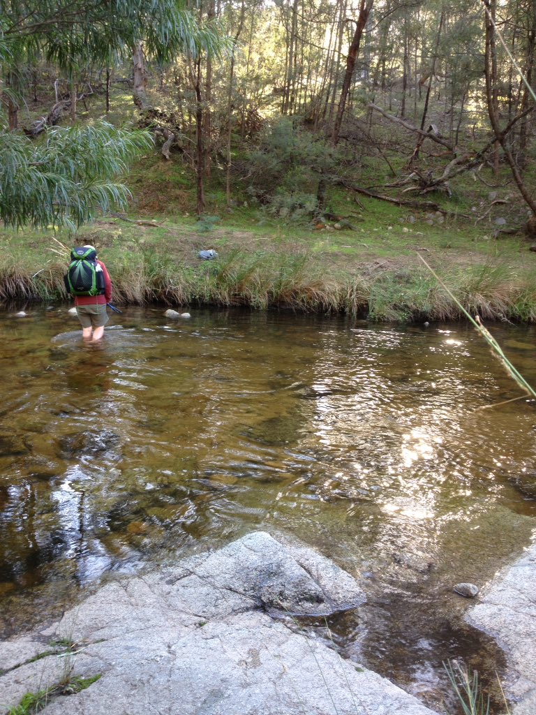 Crossing Jacobs River - off on an adventure! |
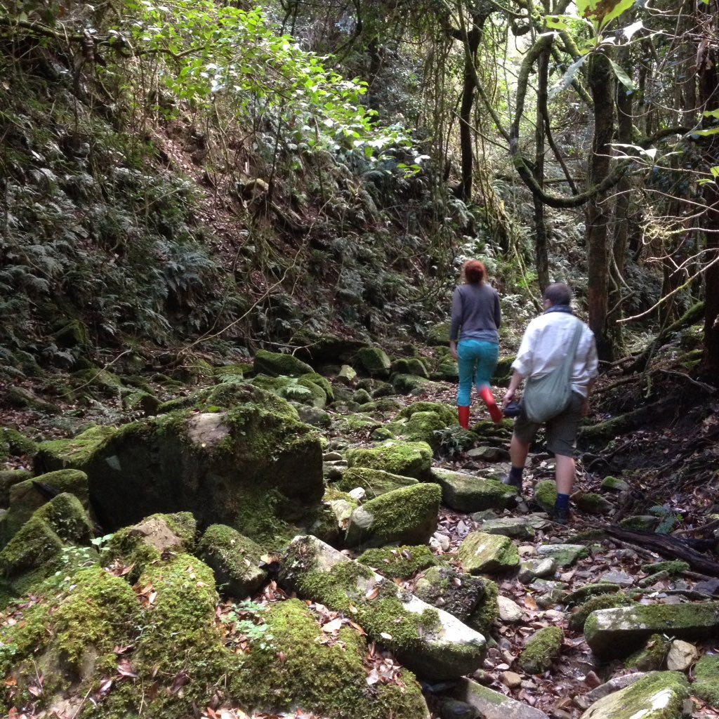
We followed old tracks and animal trails a day upstream, left most of our stuff in our tent at the bottom of Byadbo Fire Trail, did an epically steep return day walk along fire trails to Slaughterhouse Hut (an old cattleman’s hut maintained by the KHA), camped another night, then headed back to Jacobs. This was a fantastic three day trip, which I’d recommend to anyone interested. As well as lots of native animals and birds, we saw many wild/feral horses, deer and what I believe were dingo/wild dog hybrids. (Despite my fear of dogs, our two encounters with them at the end of the Byadbo Fire Trail were some of the quietest and most amusing animal encounters of the trip - especially the time when three dogs coming down to the hill towards the river were surprised to find a person having a shit in a hole. The person coughed, ahem, the dogs stopped, assessed the situation, then melted back into the bush. Spoiler: the person having a shit was me.)
A rare green spot in the bush - a dry creek bed, I think.
 Fording the Snowy on the way up to Byadbo Fire Trail. | 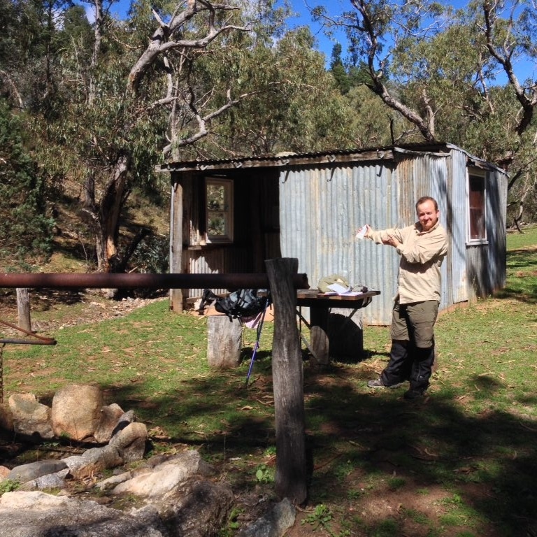 At Slaughterhouse Hut, gesturing with sunscreen. |
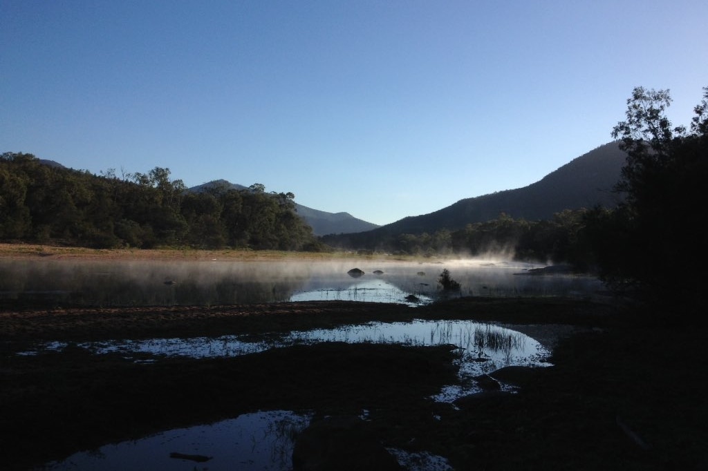
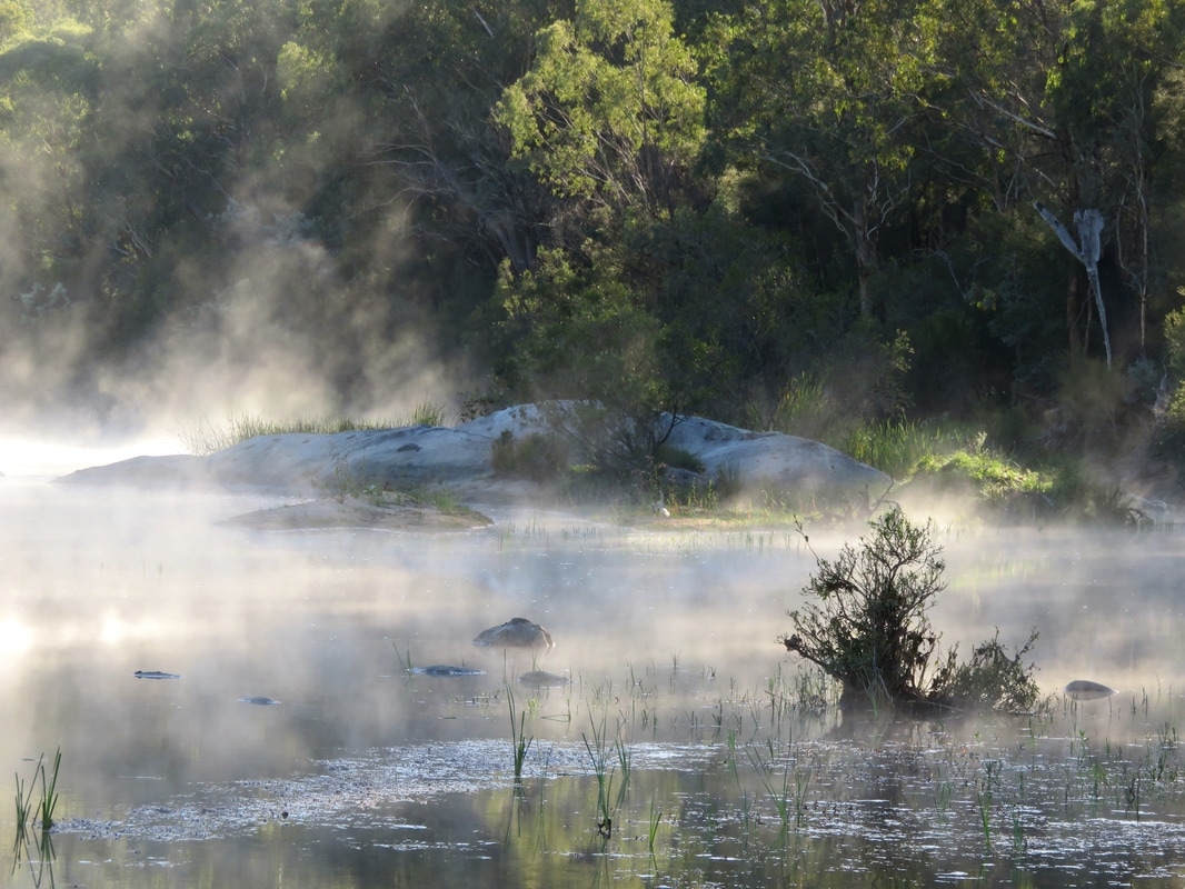
Morning on the Snowy, mist rising from the warmer water and catching the morning light.
Plan I
With my aunt and uncle, we did a day of supported walking down the Barry Way almost to the border of NSW and Victoria, enjoying the beautiful views along the valley, the easy walking, the sunshine and flowering gums. We didn’t have to carry our packs and we rocked up to shady picnic tables adorned with wraps, dips, salads, croissants and wine! After this, instead of walking to McKillops Bridge along the river, we drove around with them (Plan I). This proved to be a pretty epic adventure in itself. Their 2WD stationwagon was packed to the rafters and we had about two inches of clearance as we made our way down the narrow, winding gravel road. Fortunately, we didn’t meet any other cars on the way down as there is minimal space for passing between the huge sidecuts on one side and the steep ravines on the other. There are some pretty epic views, though! We spent a couple of nights at McKillops Bridge, exploring under it, swimming in the river, going for walks and poking around the rapids.
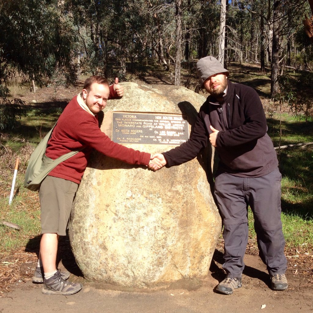 Interstate cooperation - Victoria (me) and NSW (Dan). (Photo by Barry or Caroline.) | 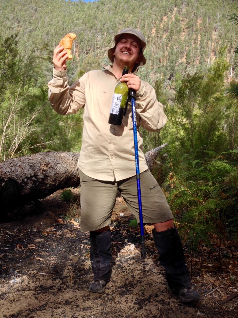 This is the life! Croissants and wine for lunch! |
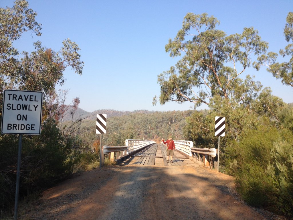
About to head over McKillops Bridge - a quarter of a kilometre across.
Plans J and K
Understandably, my aunt and uncle weren’t keen to drive back out the same way, which put paid to Plan J (walking down by Campbells Knob, crossing the river, heading overnight on the Deddick Track and following Moonkan Track back to Jacksons Crossing, then walking out from Jackons Crossing to Balley Hooley). The only other road crossing of the river in Victoria is at Orbost, so we headed back down to my folks’ place the other way, via Goongerah. This coincided with my mum’s birthday, which was pretty nice!
Everyone we spoke to had weather news: a big stormfront was on its way. We hastily arranged Plan K. My aunt and uncle dropped us off north of Buchan and we walked in to Jacksons Crossing. The 4WDers we met at the top of Basin Creek Road were keen to tell us how steep the track was. They weren’t wrong. It was a hard walk, but the bush, the rainforest, the farmland, the bluffs and the river were gorgeous. The next day we couldn’t find the bridle track we wanted to walk out on (bushfires? overgrowth?) and after an hour messing around in the bush we had to hoof it back up the 4WD road, putting in a bit of hard work to make it to our arranged pickup point with my dad. We made it back to my parents’ house minutes before guests arrived for my mum’s birthday lunch.
Everyone we spoke to had weather news: a big stormfront was on its way. We hastily arranged Plan K. My aunt and uncle dropped us off north of Buchan and we walked in to Jacksons Crossing. The 4WDers we met at the top of Basin Creek Road were keen to tell us how steep the track was. They weren’t wrong. It was a hard walk, but the bush, the rainforest, the farmland, the bluffs and the river were gorgeous. The next day we couldn’t find the bridle track we wanted to walk out on (bushfires? overgrowth?) and after an hour messing around in the bush we had to hoof it back up the 4WD road, putting in a bit of hard work to make it to our arranged pickup point with my dad. We made it back to my parents’ house minutes before guests arrived for my mum’s birthday lunch.
 The walk to Jacksons Crossing. |  Sunrise from my parents' house. |
Plan L
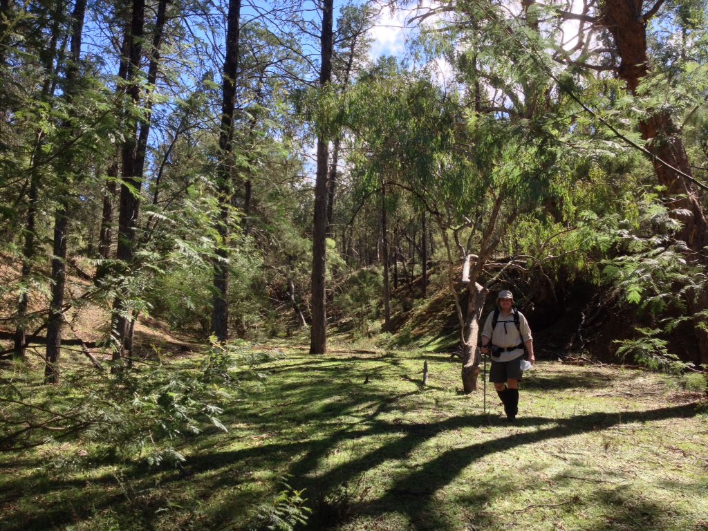
Because we had accommodation booked in Buchan and because we had friends coming to meet us there from Bendigo, we couldn’t really rearrange the timing of our stay there. We had a lovely stay at the Buchan Motel, watching kangaroos through the morning mist from our balcony, exploring the area and going on a cave tour with our friends. We also got the chance to explore some of the less-travelled parts of the Buchan Caves Reserve - waterfalls, mossy boulders, little creeks, old walking tracks and tall eucalypt forests. After a couple of nights, it was back to Orbost via a short walk and picnic at Balley Hooley at the confluence of the Buchan and Snowy Rivers, this time with another uncle and aunt (Plan L).
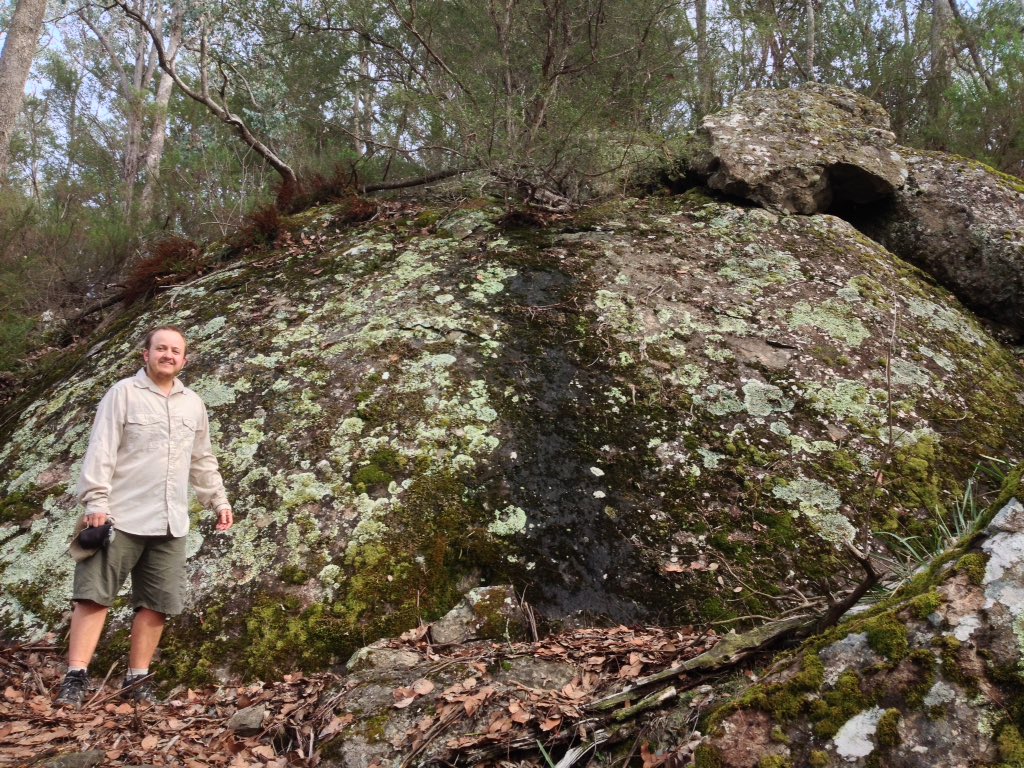
Exploring around the lesser-travelled parts of the Buchan Caves Reserve. I was lichen this rock.
Plan M
The last section of the adventure was always the vaguest in terms of plans, as I am familiar with the area, we knew we’d have somewhere to stay and there are lots of options for exploring the river. So I think this section can all come under the heading of Plan M. We walked around Orbost with my sister, reading all the interpretation signs, paddling in the river under the bridge, finding huge Wanderer/Monarch butterflies and their caterpillars and pupae in the sensory garden. We picked our way up the rainforest on my parents place, along the creek bed from the river to the driveway, again with my sister. We hired bikes in Orbost and cycled 50km - down to Lochend, the Devil’s Backbone and Lake Wat Wat, back up along the hilltops to Newmerella, out to Simpsons Creek on the East Gippsland Rail Trail, down the hills onto the flats at Bete Bolong (visiting my uncle, who gave us some much-appreciated lemonade) and back over the river into Orbost just as the sun was setting. We went boating with my dad from the Brodribb around to Marlo in a tinny borrowed from my parents’ friend.
The Snowy River at Lochend, glinting in the midday sun.
 The rainforest in Pipeclay Creek. | 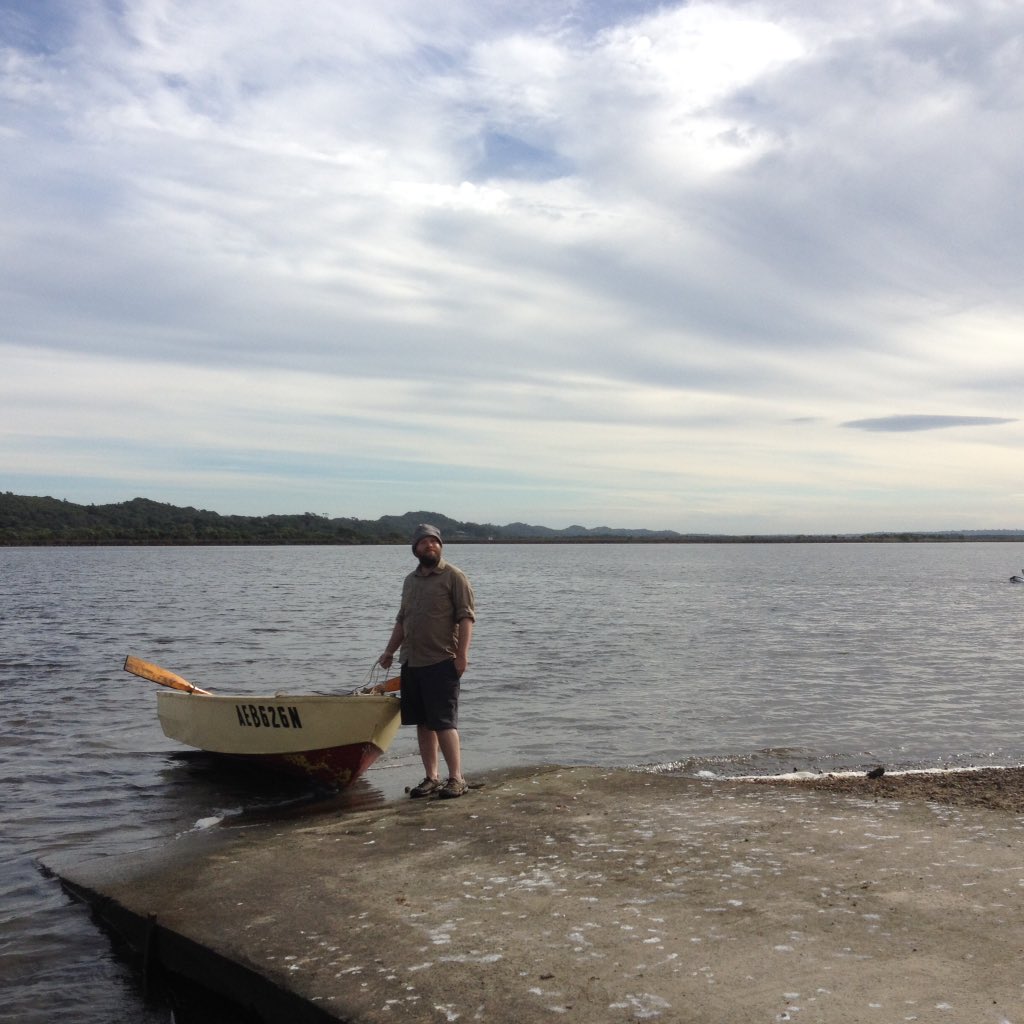 Dan and the boat at the end of our row. |
Plan A
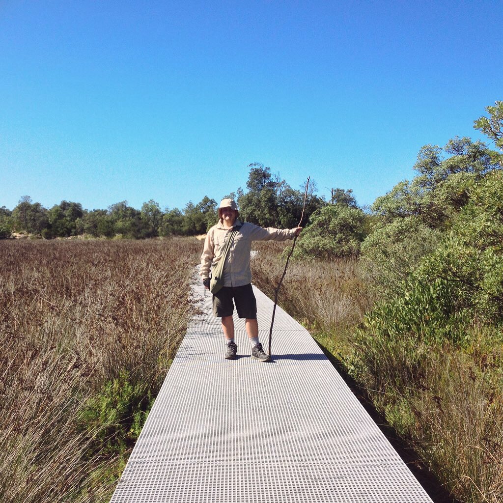
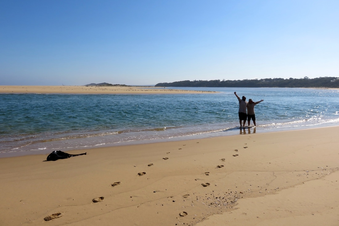
Plan A had us finishing the walk on Tuesday 18 April, heading out across Frenches Narrows, over the dunes and along the beach to the mouth of the Snowy. And that’s exactly what we did. My parents came with us and we picnicked in the sun, watching pelicans, terns, gulls and other birds wheel above, bob on the waves, sit on the sand, pick over the seaweed or stalk through the estuary water. We waded back across the estuary and wandered back to the car along the boardwalk. The next evening, after another day at the beach, Dan and I went down to the river at the bottom of my parents’ place. I crossed the river one last time and collected a bottleful of sand.
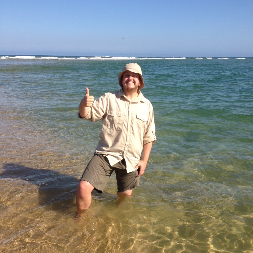 Thumbs up! At the mouth of the Snowy River. | 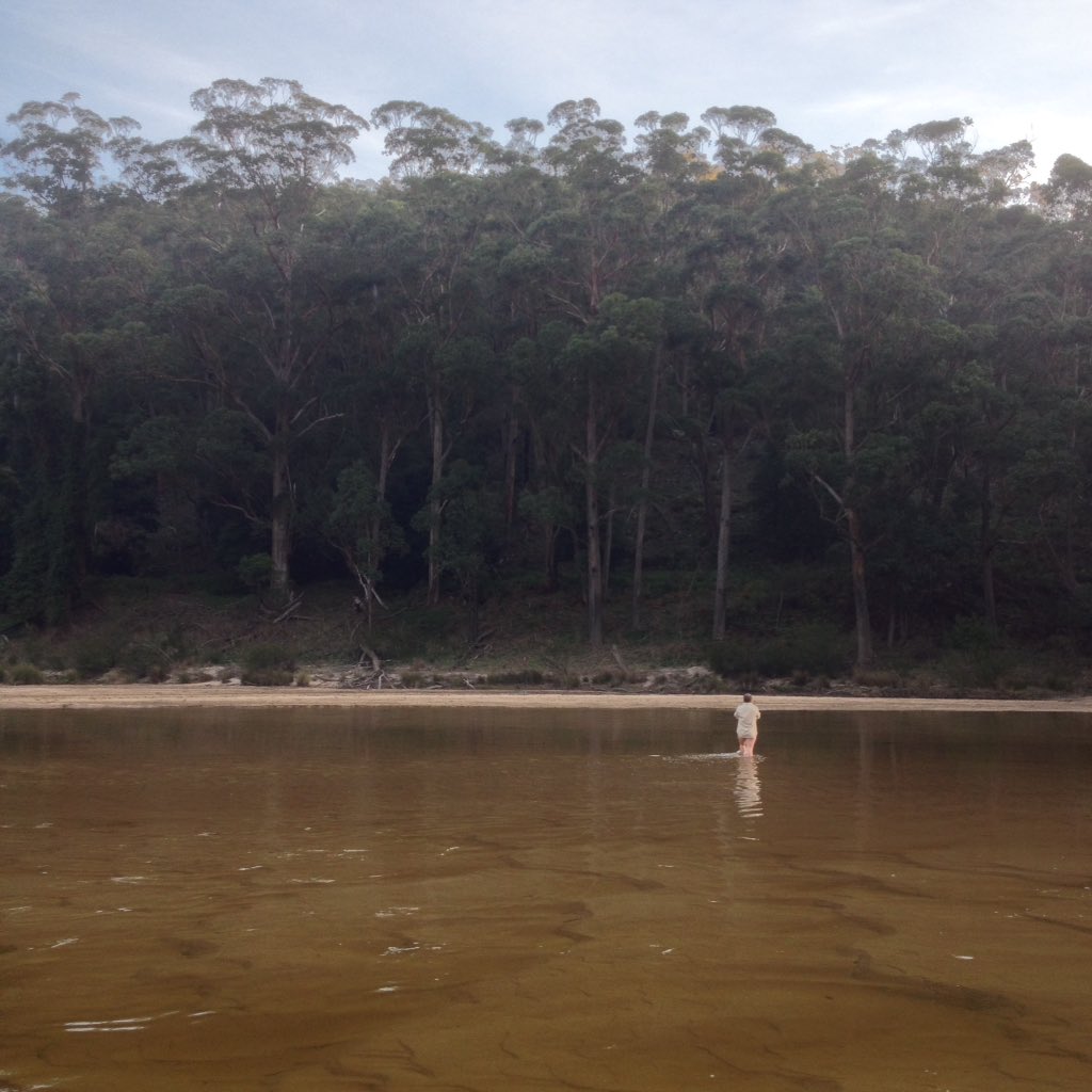 A final crossing of the Snowy. |
The best laid plans
I’m still sorting through all my feelings about the journey.
Sometimes I think: We had an amazing time, we encountered so many places, animals, people and things, we had some fantastic adventures with friends and family and we’ve seen more of the river than most people ever will. We had a few close calls and a lot of fun. We are so fortunate to have had the chance to do this - to take time off work, to travel and to have these experiences. It was brilliant!
Sometimes I think: Two years of dreaming and planning, countless hours of research, a huge amount of effort organising logistics, all that support from other people, all the money spent on gear and food and transport - and we failed. We didn’t see as much of the river as I hoped, didn’t do as much walking or camping or swimming as I wanted. We took the easy option too many times. Can we really call it an adventure?
Sometimes I think: If there wasn’t a real possibility of failure, perhaps it wouldn’t have really been an adventure. Perhaps failing is an integral part of adventure.
Mist rising from the Snowy River near the end of Byadbo Fire Trail.
Sometimes I think: How amazing is it that we managed to do as much as we did? How good is it that we could adapt when things started going awry?
If we hadn’t changed our plans, we would have been on such a tight schedule that we would have missed a lot of what made the journey so delightful. I wouldn’t have stood still on an empty road in the Monaro, watching a huge storm blow across the mountains. We wouldn’t have hitchhiked. We wouldn’t have canoed down the shallow, sparkling river upstream of Dalgety, falling in and swimming after our dry-bagged gear. We wouldn’t have seen an albino emu or spent a day hypothesising the geological and cultural histories of landscapes as we went 4WDing with my dad. We wouldn’t have seen the feral goats near Stonebridge. We wouldn’t have had the chance to revisit special places we found - to swim, to ford the river or simply sit and wonder. We might not have had time to watch the kingfishers at Jacobs River or linger beside the river as the steam or mist danced above the water in the still, cool morning at Willis. We wouldn’t have been able to spend hours cooking up delicious meals over a campfire with my aunt and uncle. We might not have been able to float quietly on our inner tubes past Snowy River crocs on the rocks and birds on the fallen trees. We wouldn’t have explored so many tributaries - the warm trickle of the Mowamba River downstream of the weir, the swift, refreshing water of Jacobs River, the deceptively picturesque Deddick River winding through dry scrubby hills and weed-choked paddocks, the big rock slabs and terraces of Raymond Creek, the Buchan River rising after heavy rain, the temperate rainforest of Pipeclay Creek, the reed-lined Brodribb River. We wouldn’t have been able to poke around underneath McKillops Bridge. We might have been too rushed to ship oars and drift downstream on an outrunning tide, the water lapping at the aluminium hull of our little boat, watching the world go slowly past, snacking on Fererro Rochers. We wouldn’t have spent so long leaning over the railing on the footbridge with my mum, watching hundreds of different fish dart and flash through the estuary water. We mightn’t have met people when we pulled a canoe up into their garden during a storm, when we sheltered from the rain in a camp kitchen, when we hitchhiked, when they gave us permission to drive or walk through their property, when they told us stories about the river. Some of my favourite memories are of the slow, quiet moments when we didn’t have to hurry.
If we hadn’t changed our plans, we would have been on such a tight schedule that we would have missed a lot of what made the journey so delightful. I wouldn’t have stood still on an empty road in the Monaro, watching a huge storm blow across the mountains. We wouldn’t have hitchhiked. We wouldn’t have canoed down the shallow, sparkling river upstream of Dalgety, falling in and swimming after our dry-bagged gear. We wouldn’t have seen an albino emu or spent a day hypothesising the geological and cultural histories of landscapes as we went 4WDing with my dad. We wouldn’t have seen the feral goats near Stonebridge. We wouldn’t have had the chance to revisit special places we found - to swim, to ford the river or simply sit and wonder. We might not have had time to watch the kingfishers at Jacobs River or linger beside the river as the steam or mist danced above the water in the still, cool morning at Willis. We wouldn’t have been able to spend hours cooking up delicious meals over a campfire with my aunt and uncle. We might not have been able to float quietly on our inner tubes past Snowy River crocs on the rocks and birds on the fallen trees. We wouldn’t have explored so many tributaries - the warm trickle of the Mowamba River downstream of the weir, the swift, refreshing water of Jacobs River, the deceptively picturesque Deddick River winding through dry scrubby hills and weed-choked paddocks, the big rock slabs and terraces of Raymond Creek, the Buchan River rising after heavy rain, the temperate rainforest of Pipeclay Creek, the reed-lined Brodribb River. We wouldn’t have been able to poke around underneath McKillops Bridge. We might have been too rushed to ship oars and drift downstream on an outrunning tide, the water lapping at the aluminium hull of our little boat, watching the world go slowly past, snacking on Fererro Rochers. We wouldn’t have spent so long leaning over the railing on the footbridge with my mum, watching hundreds of different fish dart and flash through the estuary water. We mightn’t have met people when we pulled a canoe up into their garden during a storm, when we sheltered from the rain in a camp kitchen, when we hitchhiked, when they gave us permission to drive or walk through their property, when they told us stories about the river. Some of my favourite memories are of the slow, quiet moments when we didn’t have to hurry.
Reflections on the Snowy at Wood Point, before we jumped in with our inner tubes.
Sometimes I think: I’m glad we got to spend so much extra time at my childhood home and in the river there. While we were in Australia, my parents unexpectedly sold up. They will be moving away in August, so this was my last chance to spend time there and to say goodbye. I think this is probably why we ended up back home as often as we did. In the end, despite having seen the river in so many guises during this journey - skipping down mountains, flowing through the Monaro, disappearing under the granite at the spectacular Stonebridge, sweeping between the huge dry hills around the border, mingling with saltwater in the smooth tidal reaches near Marlo - the few hundred metres at the bottom of a hill near Pipeclay Creek will always be the first place I go to in my heart and mind when I think of the Snowy River.
Dan and me at the mouth of the Snowy River at Marlo. A gorgeous day and a wonderful conclusion to our adventure.
I'll be posting more photos from the trip over the coming weeks (or, more likely, months), so stay tuned! Thanks to everyone who helped us out on this journey: Emily, Kate, Elisabeth and Jerry, Nathan, Jesse, Christie, Sue and Colin, Sian and John, Rosemary and Mason, the Presentation of the Mother of God convent, Caroline and Barry, Alex and Julie, Bridget and family, David and Jane and Mimo, John and Chris, Esther and Gabe, Pete, Cynthia, Glenn, Mary and Ben, Margot and Aaron and the fire tower network. If I've forgotten anyone, I'm sorry.
 RSS Feed
