We made it! We walked all the way across a country: eight days, 145km (90mi), two rivers, who knows how many packets of instant noodles and a whole lot of fun. Here's the first instalment.
Before
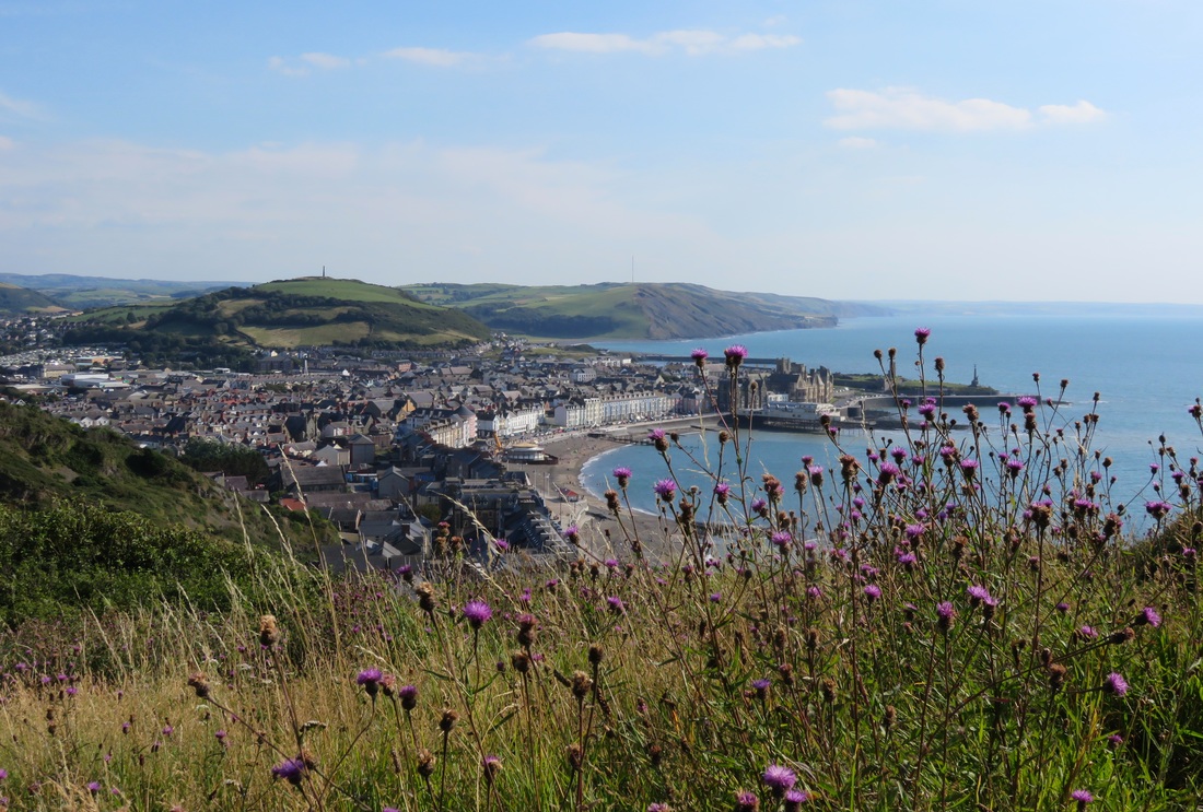
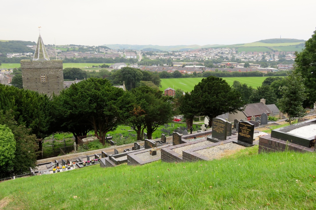
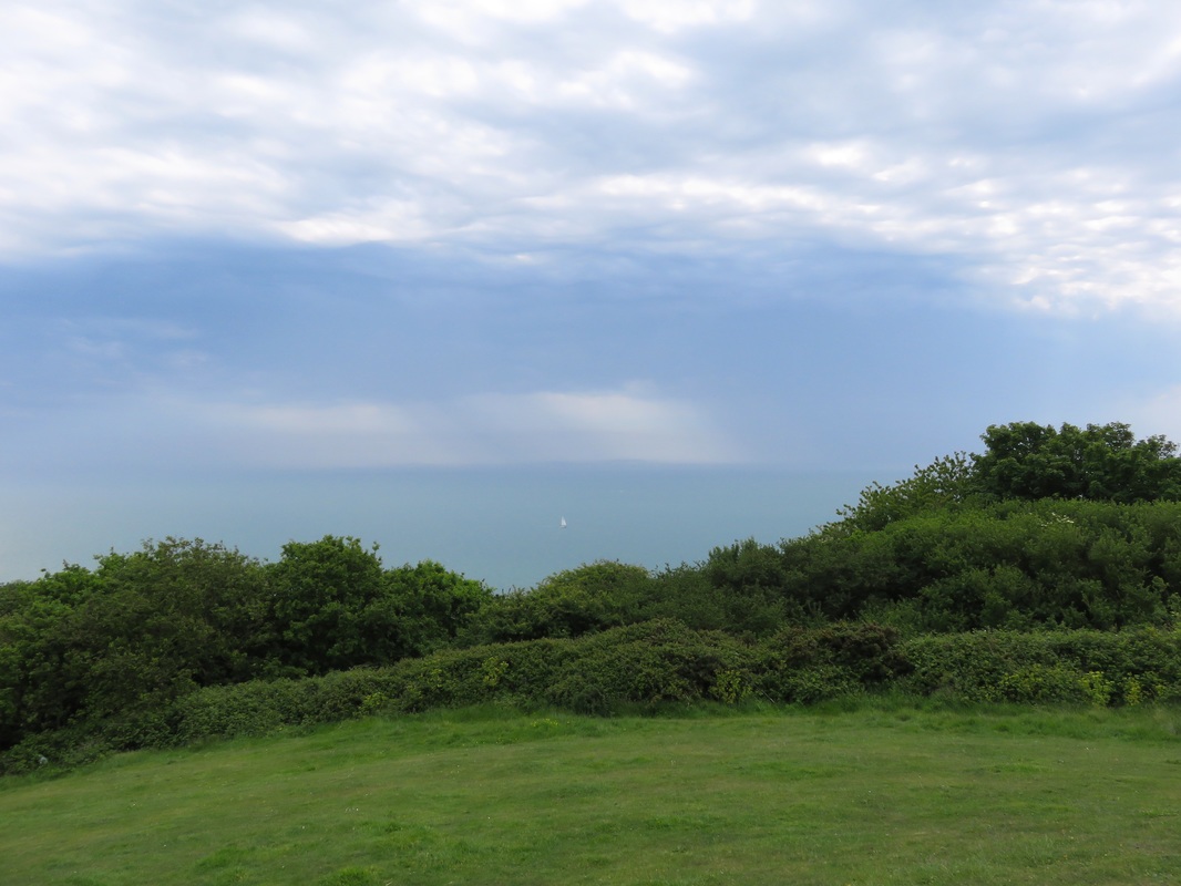
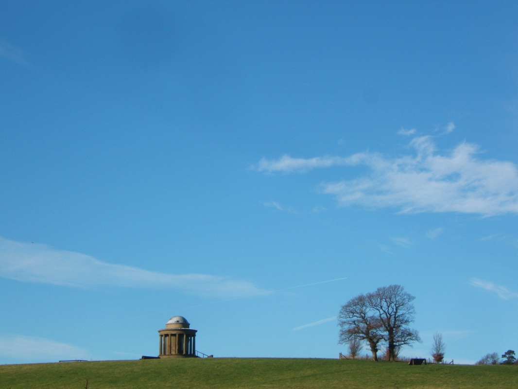
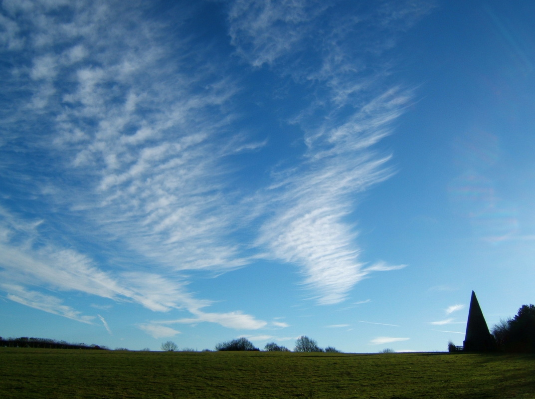
View of Aberystwyth from Constitution Hill. You can see the Wellington Monument on the hill opposite.
We’d come by train almost all the way across two countries, from London in England’s east to Aberystwyth on the west coast of Wales. The sky was clear, the sun hot, and from the top of Constitution Hill that afternoon we’d been able to trace landmarks right around Cardigan Bay: from the lump of Bardsey Island off Llŷn Peninsula in the north around to Pembrokshire in the south. Below us, the keen kids of the surf lifesaving club paddled out to sea in a training exercise. We’d also spotted Snowdon. We knew this because the information boards said we’d be able to see the mountain on a clear day, though in all honesty we weren’t sure which pointy peak it actually was.
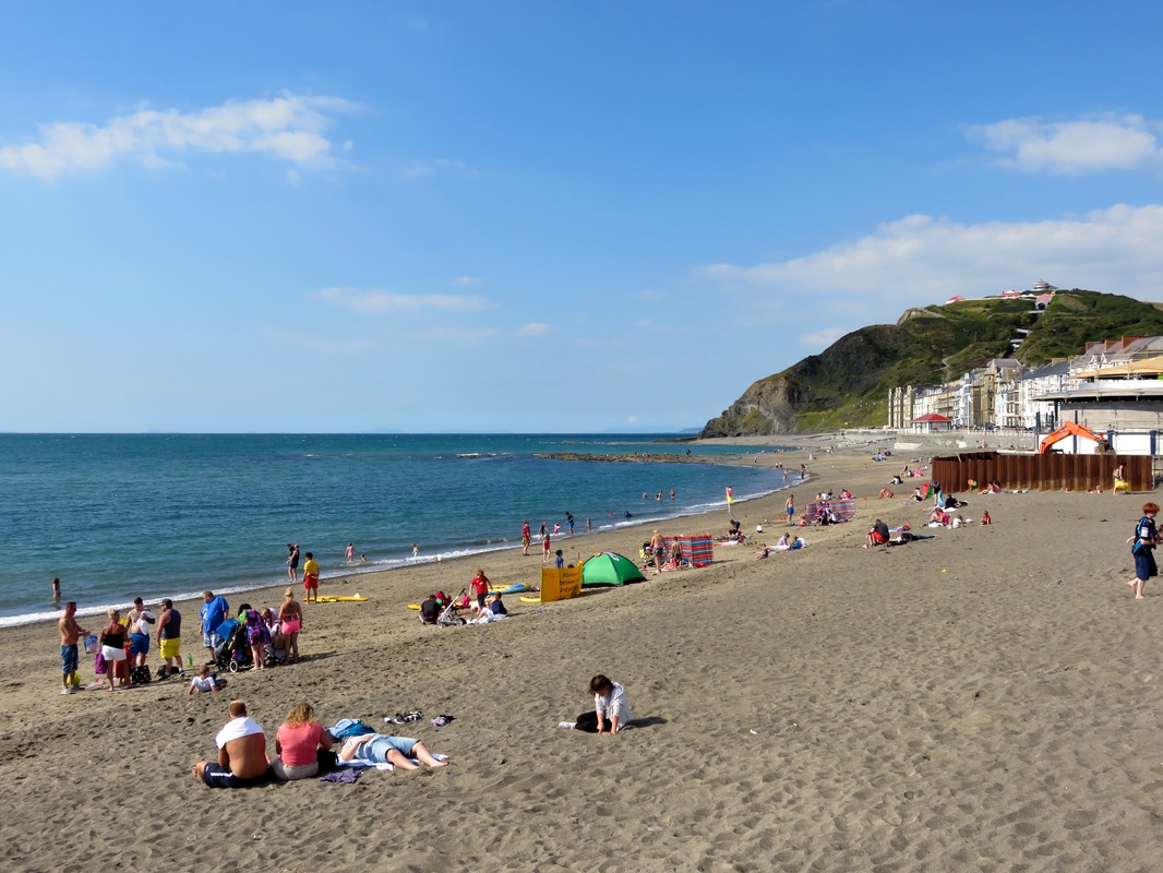
A sunny afternoon at the beach, Aberystwyth. Note the funicular railway up Constitution Hill. We walked up. Fools.
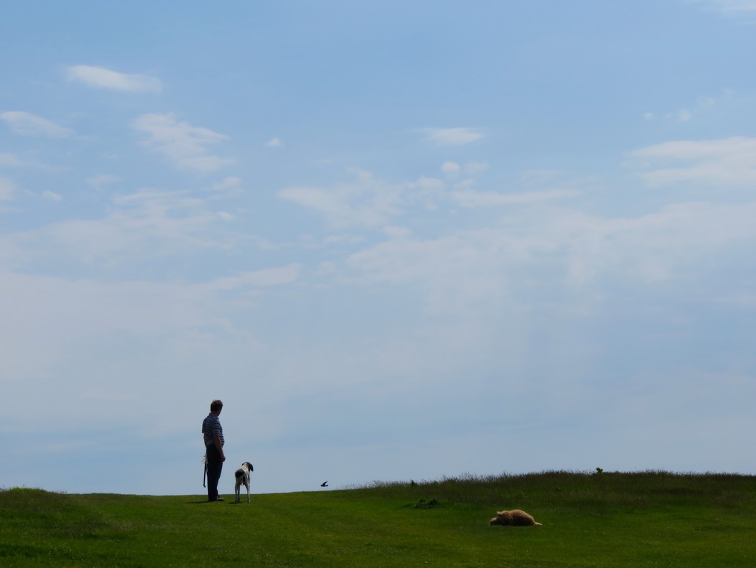
After a stroll around the ruins of Aberystwyth Castle and dinner at veg*n cafe Crimson Rhino, we headed back to the promenade, watching the sun glint on the sea as it charted a course to the horizon directly in front of us. Earlier in the day we’d joined a small, happy crowd of people on the beach, paddling in the fresh, clear wavelets and feeling the coarse sand between our toes. Now we sat on the jetty, listening to the gentle slap of the swell on the piles beneath us. Before us, water stretched glittering out to the horizon: this truly was the edge of the country. The sunbathing, sand-fort making, paddling crowd had mostly given way to evening drinkers pressed up against the wall beneath the promenade. I hauled a kid out of the water onto the jetty - “It’s my last jump of the day!” - and was half tempted to join him.
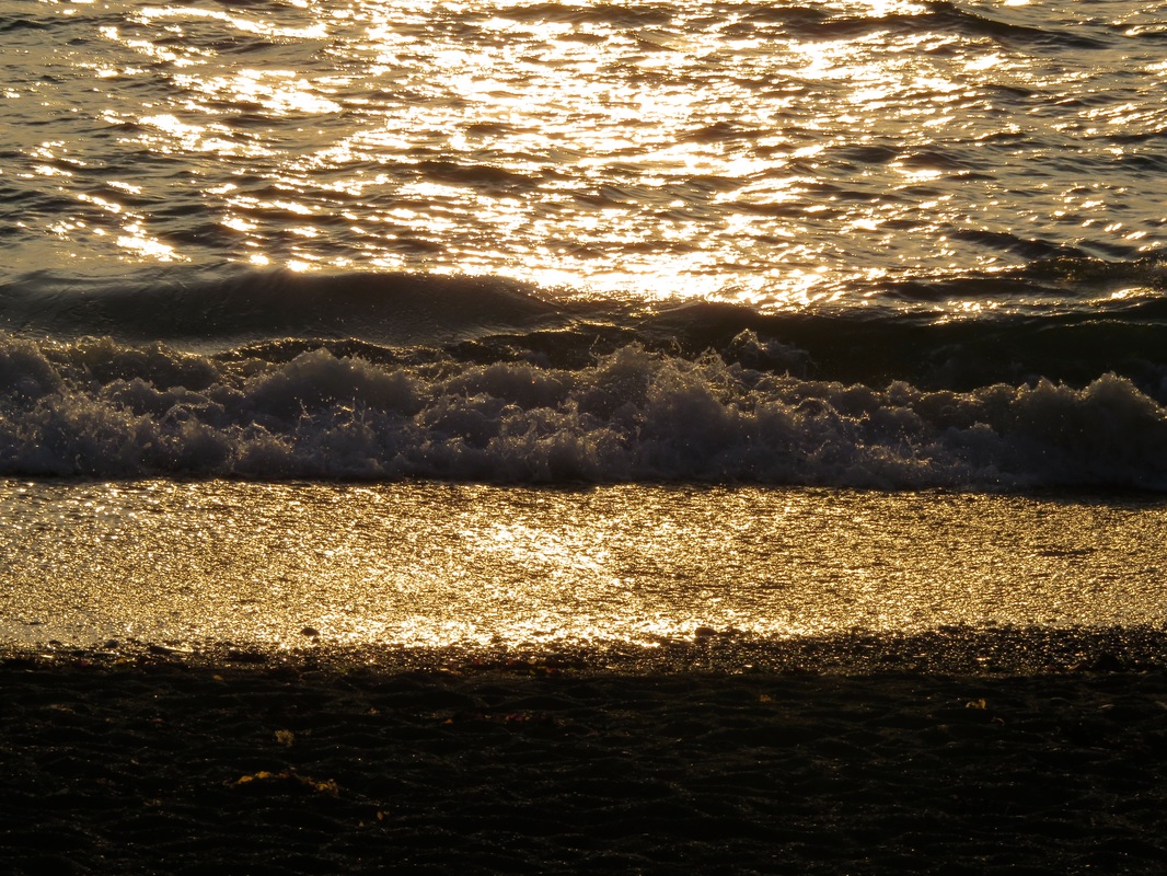
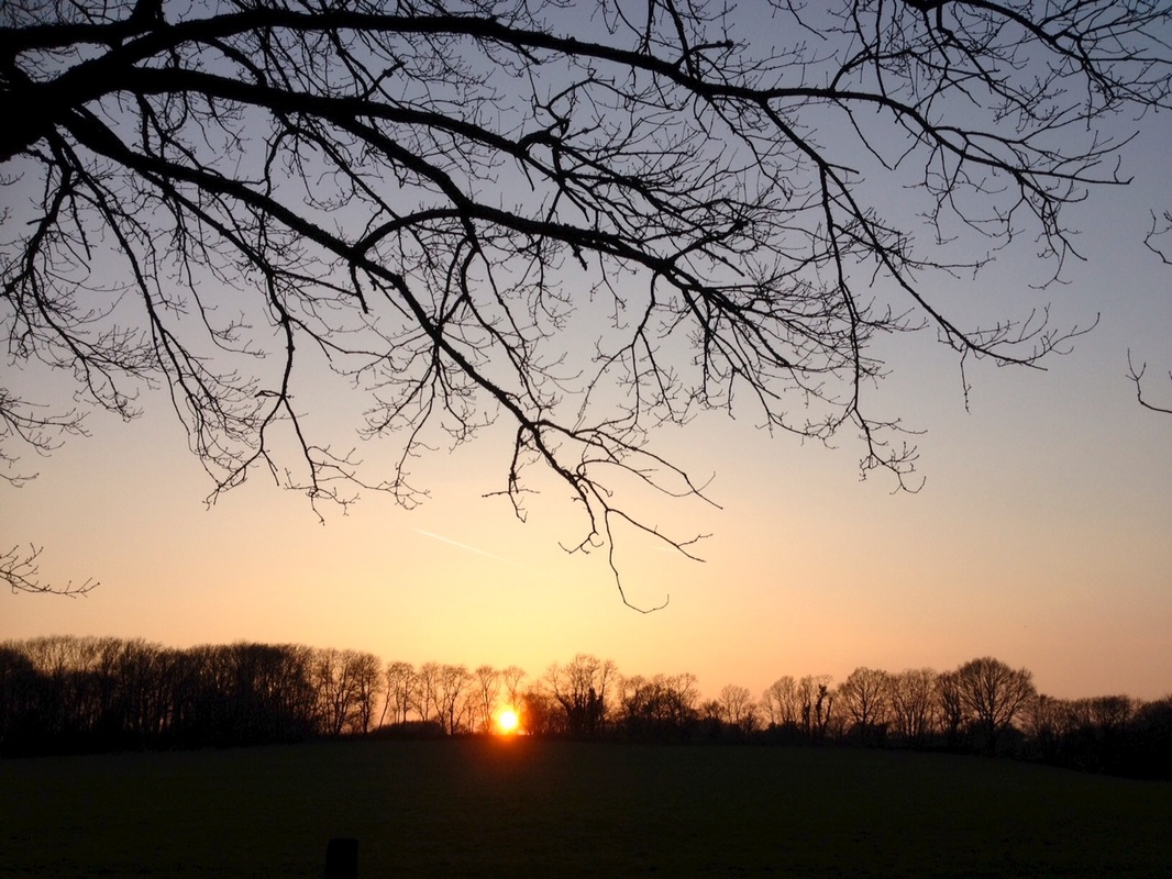
Late afternoon sun on the sea.
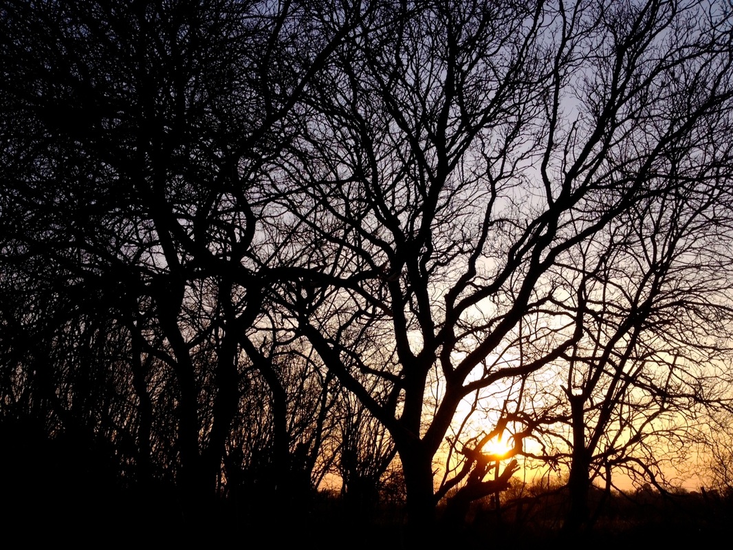
We walked along the River Rheidol out of town as the sky turned fiery orange and gold. (Side note: our Airbnb hosts were very accommodating and even picked us up from the station when we arrived. If you want to try Airbnb, please sign up using this referral link and you and I will both get Airbnb credit!)
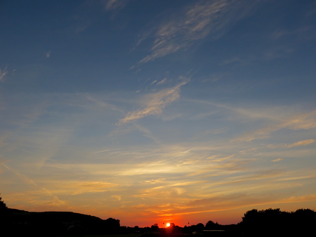
Sunset over Aberystwyth. OK, you can't really see Aberystwyth, but it's there.
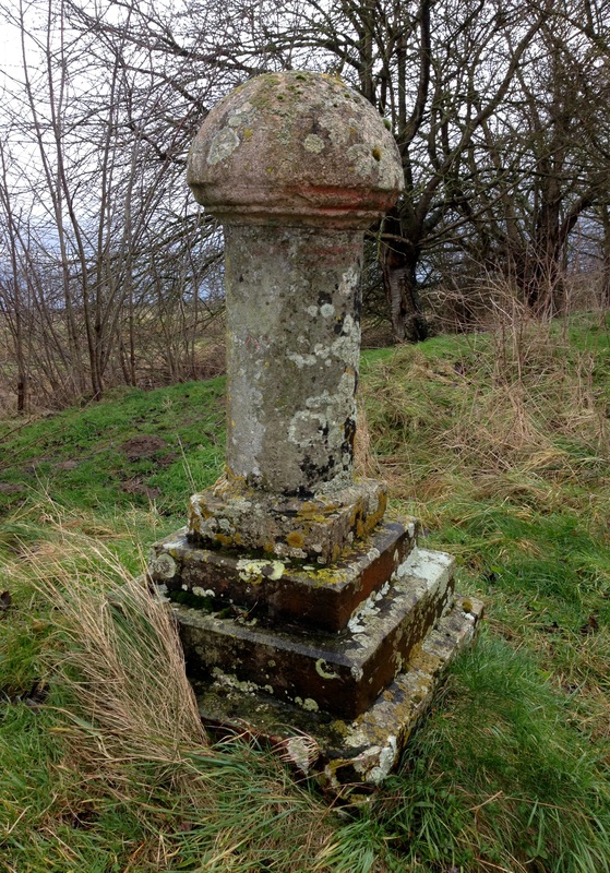
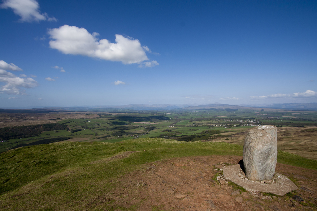
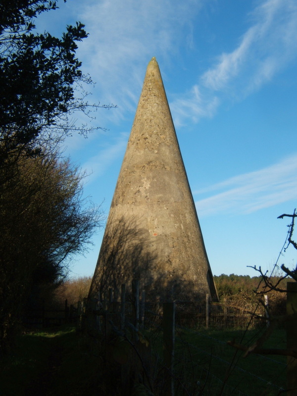
Since I’d organised most of the walk, Dan had the task of taking me on a mystery tour around Aberystwyth the next day. After getting slightly lost in a tiny strip of woods by the river, we headed up to the Wellington Monument - a tall plinth topped with nothing (apparently it was originally intended to hold a chap-on-a-horse sculpture) that sits on a round hill on the southern outskirts of Aberystwyth. We spread out our OS map in the wind and located various landmarks, the majority of them wind farms in the hills to the east. We watched someone wade across the River Ystwyth below us, then climbed down through stretches of burnt gorse and shady tunnels of green to look at the river close up.
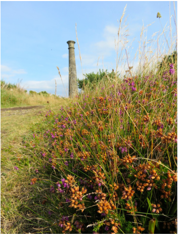 Heather on the hill. | 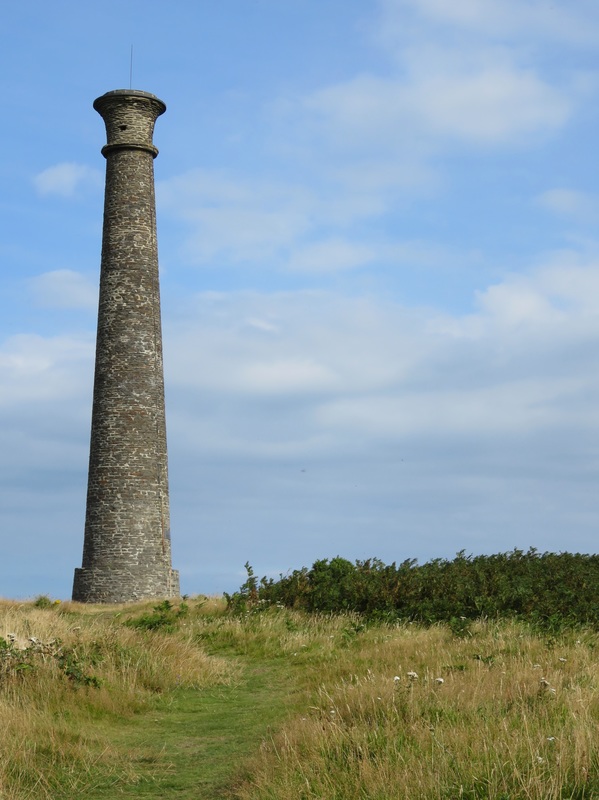 The Wellington Monument, no Wellington in sight. |
Before going for lunch at the organic, veg*n friendly Treehouse, we popped in to have a look at Ceredigion Museum. Wow! The museum is housed in a restored Edwardian theatre, with different themed collections in the stalls and various adjoining rooms. There’s a huge number of objects and photographs, many of them of national interest, which gives it the feeling of being quite an important collection. Some of the displays - such as the dairy industry section near the main entrance - have a great sense of narrative, too. But this is no slick, contemporary museum. In fact, it feels like a tiny local museum with type-written case notes in some displays, an agricultural room featuring more bill hooks, sickles and scythes than you can shake a stick at and a couple of rather terrifying stone-age people mannequins in the geology room. The museum was also hosting an exhibition titled EuroVisions: Wales Through the Eyes of European Visitors, 1750–2010, which seemed apt.
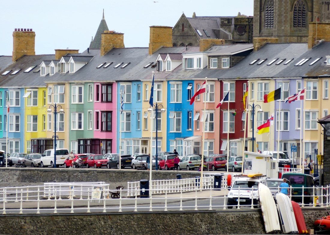
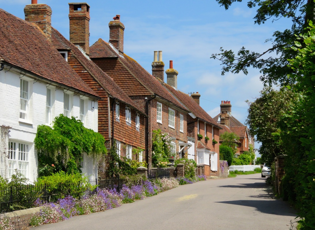
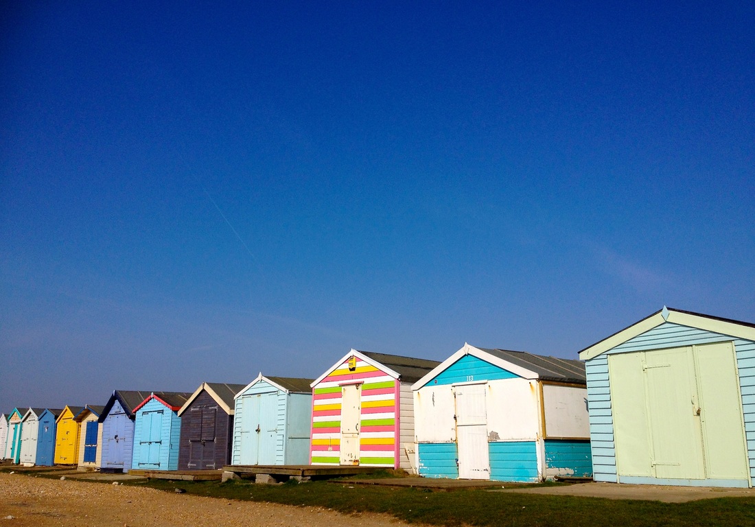
Colourful houses and a few of the many flags along the seafront at Aberystwyth.
In the afternoon, we scurried up yet another hill into a nature reserve where we enjoyed some trees and a wall and a well. I was finding all these hills a little tiring - and I wasn’t even wearing my pack yet! I had a little lie down on a bench before we eventually found our way out to the National Library of Wales. With Dan being a librarian, this was always on the cards for our trip to Aberystwyth and it didn’t disappoint. The building is reminiscent of the grand public buildings of the 19th century, although it was only begun in 1911. Inside, the feeling of grandeur continues with red carpets and beautiful high ceilings. We saw a number of exhibitions there, including Philip Jones Griffiths: A Welsh Focus on War and Peace. It was great to find the library acting as such a thriving cultural centre. We had a cup of tea in the cafe and failed dismally to use our beginners’ Welsh with the assistant at the library shop. Spoiler alert: this was to set the tone for the whole trip. I don’t think we spoke Welsh with another person even once.
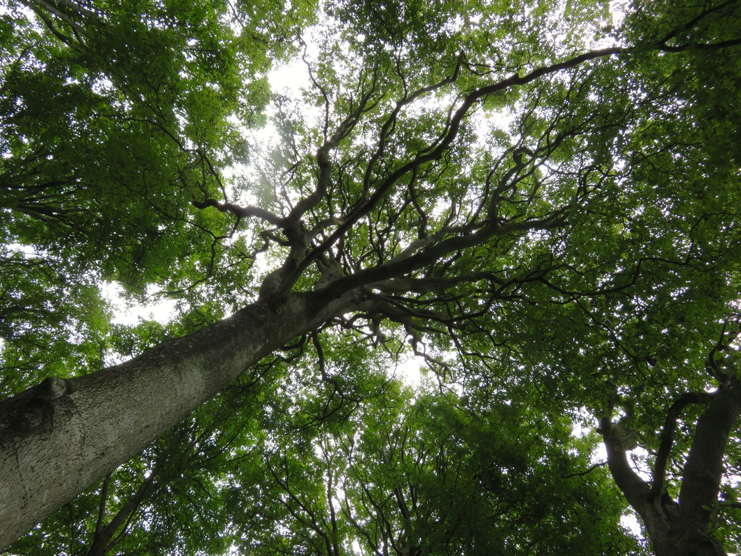
One of the many beautiful trees we found in the nature reserve. Some had carved graffiti dating back to the 1950s.
The final mystery tour stop of the day was the Aberystwyth Arts Centre at the university, which we visited for a small photography exhibition To Build a Home - Amanda Jackson’s portraits of the community of Lammas Tir Y Gafel Eco Village in Pembrokeshire. Once there, we found they also had a Robert Mapplethorpe exhibition, so we took a turn around that, too. Phew, that was a lot of photography in one day. On the way back home, we found ourselves in the extremely steep Llanbadarn Cemetery. We escaped from the drizzle inside the church and considered coming back to watch the bell ringing later, but by then we were tucked up in bed.
Llanbadarn Cemetery - so steep the graves are terraced.
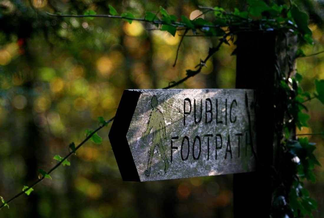
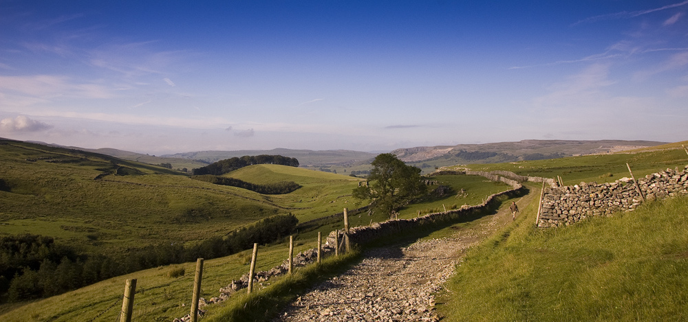
Day 1: Aberystwyth to Devil’s Bridge (20km)
It was still drizzling when we said goodbye to our hosts and headed to the petrol station to buy ourselves a sandwich for lunch. On the bright side, wearing our coats meant not having to stuff them in our how-did-they-get-that-heavy packs. I’d already jettisoned my inflatable pillow, waterproof trousers and extra water bottle (it had sprung a leak), so what was weighing me down? (Don’t worry - I’ll save the kit list for a future post if anyone’s remotely interested!)
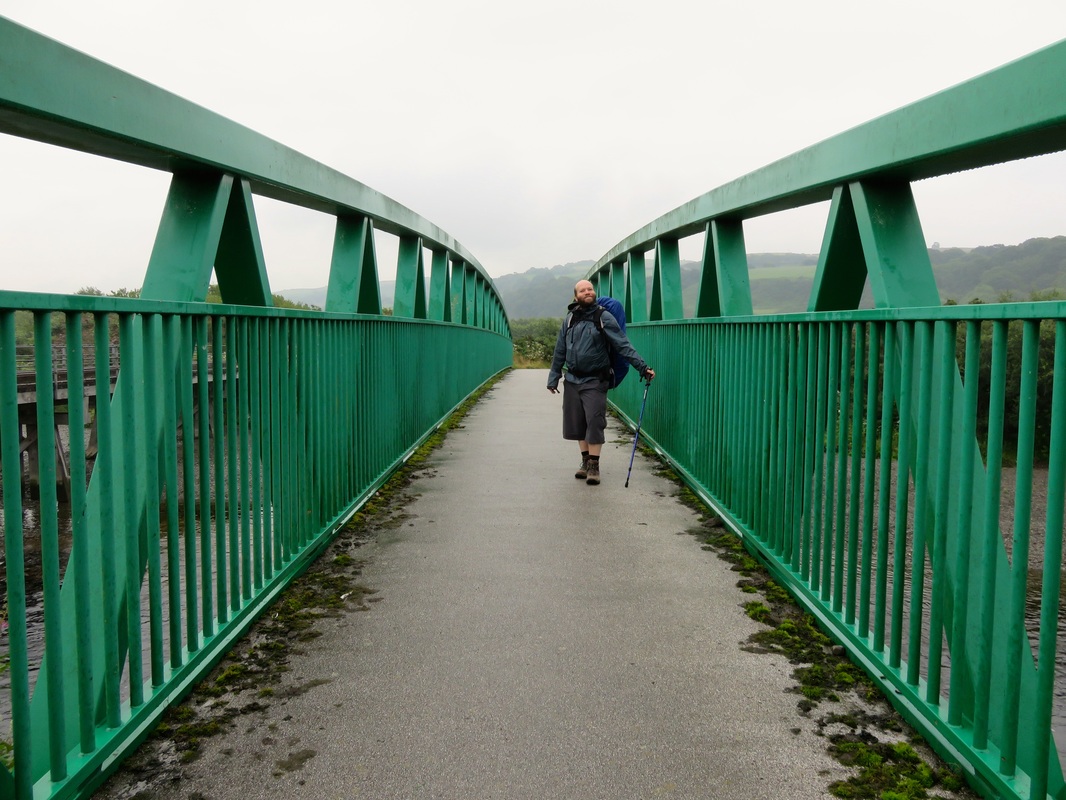
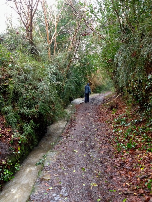
Crossing the river on a cycle bridge on the first day of our walk. Nice pose.
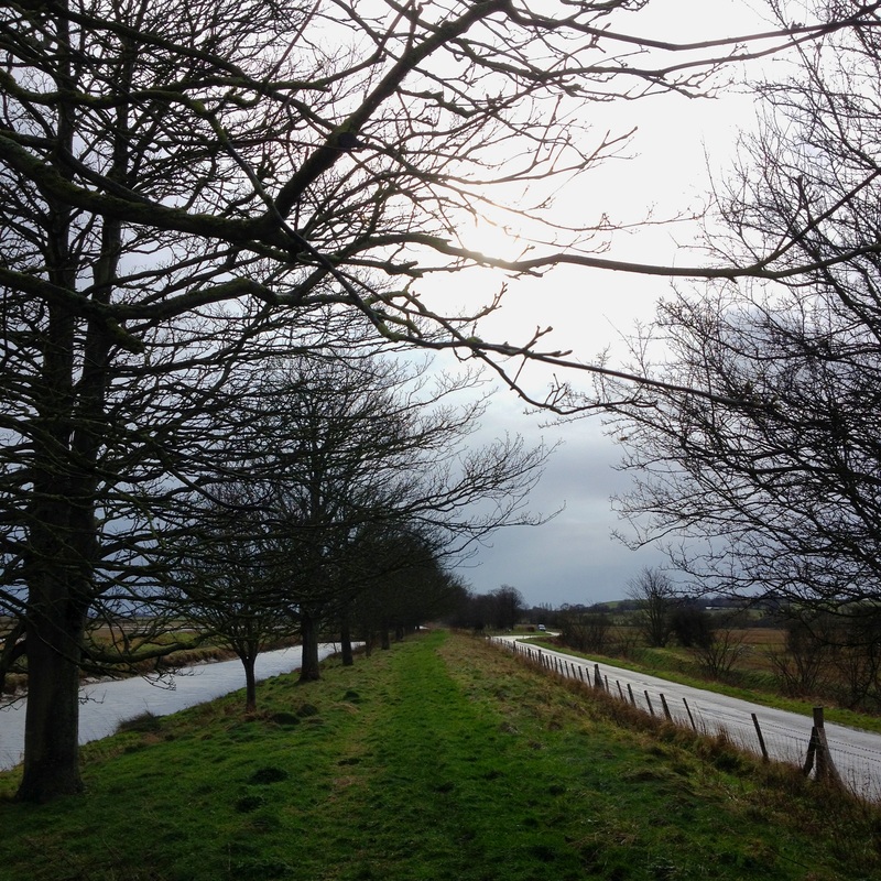
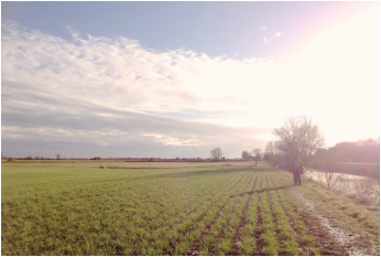
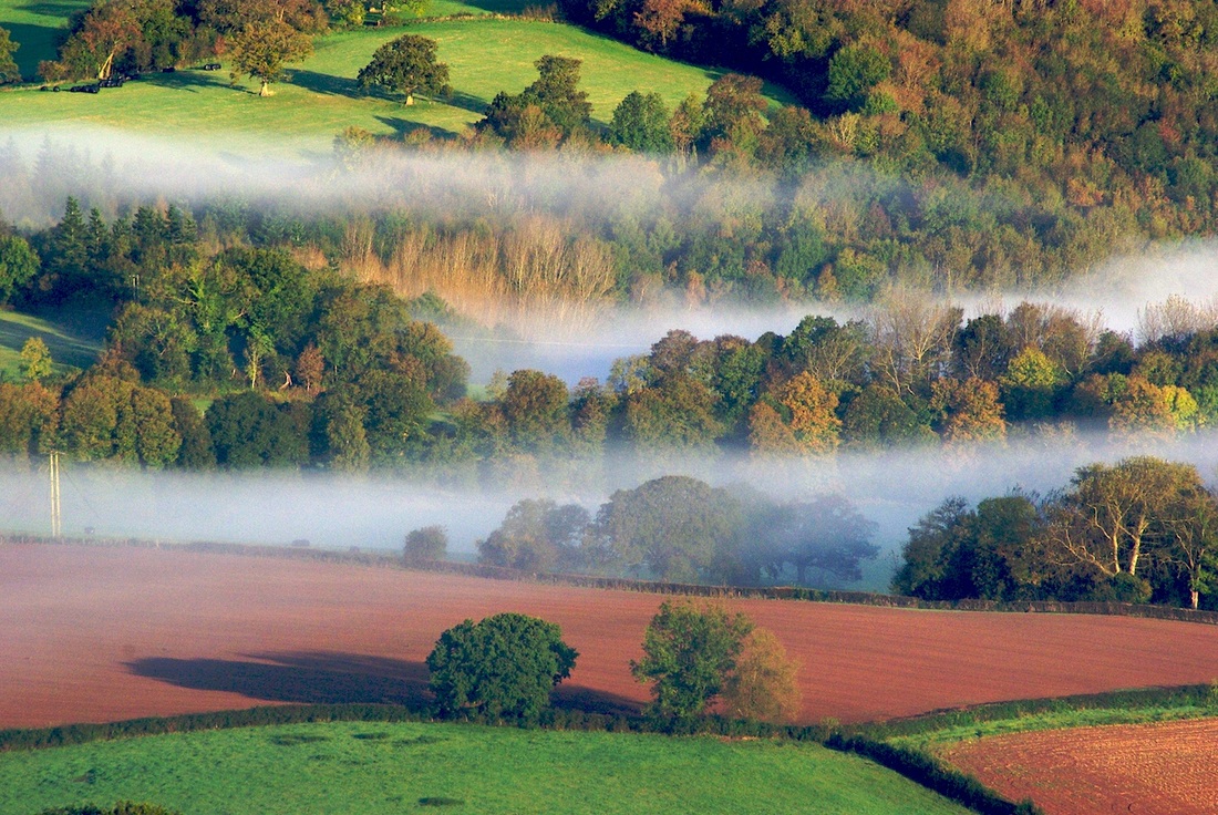
Crossing the river, we headed out of town through an industrial estate, following a National Cycle Network route along quiet country lanes. Although we’d planned to head up into the hills on footpaths, the low cloud hiding the tops would’ve stifled any views, so we stuck to the valley floor. Despite a few damp spells, it wasn’t cold. In the end the coats were making us wetter with perspiration than we would be with precipitation, so they came off.
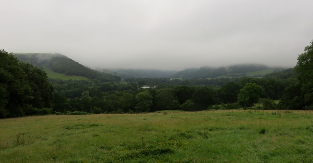
A misty vista - the Rheidol valley with hilltops in the cloud.
We passed a smattering of houses and farms and watched red kites circling overhead. We even saw some of these magnificent birds perched on nearby fence posts - although of course they’d taken off by the time I got my camera out! Along with a couple of buzzards and the osprey I’d spotted from the train window near Machynlleth on the way over, I was pretty stoked with our birds of prey spotting thus far.
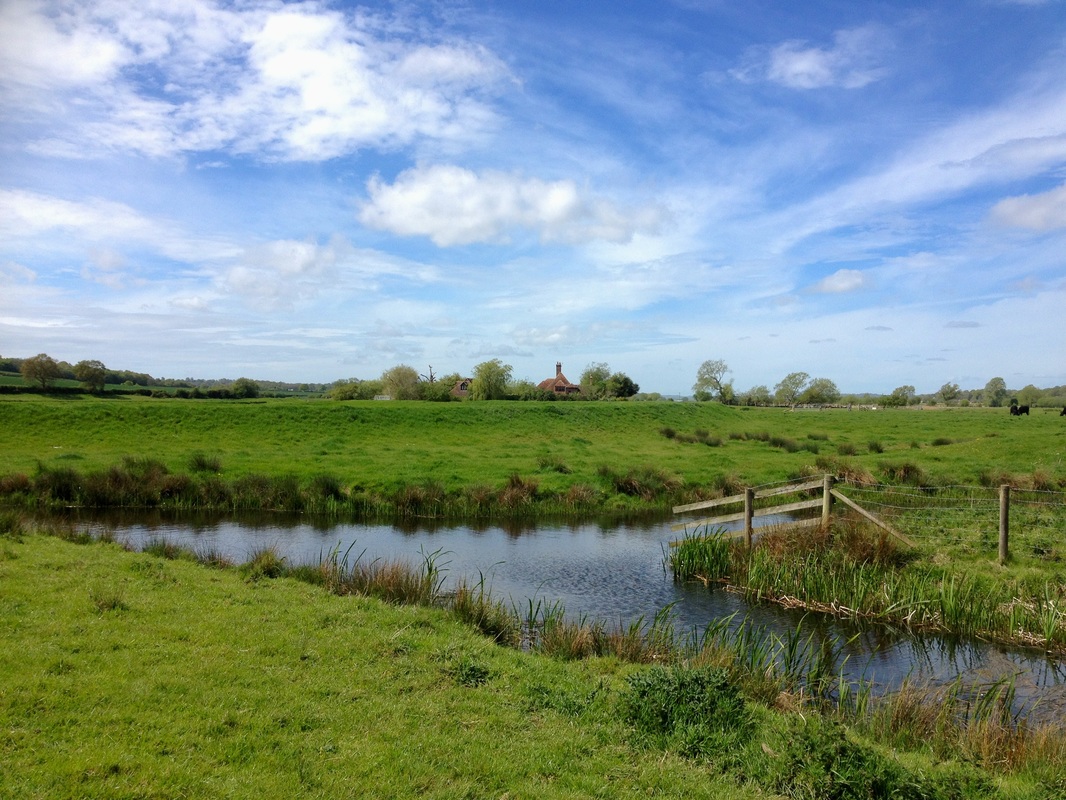
Enjoying the reflections on Cwn Rheidol Reservoir.
There was hardly anyone else about. Just a post office van, a couple of farm vehicles and a few horsey types at the riding school. At one point, alerted by the mournful hoots drawing near, we waited in a meadow to watch the Rheilffordd Cwm Rheidol tourist steam train chuff along below us. The view of the valley was on the other side, so none of the passengers noticed us.
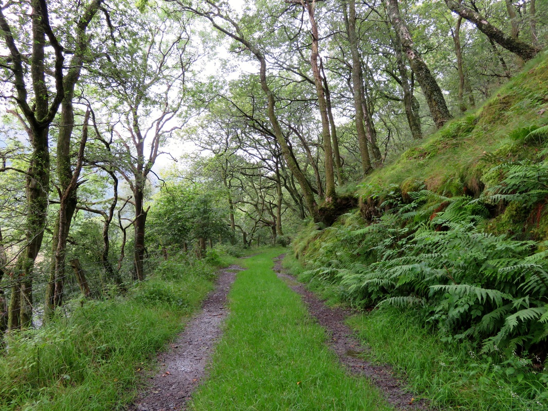
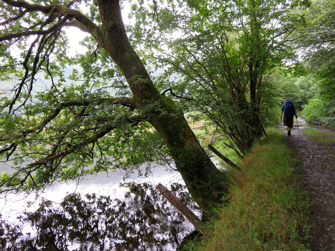
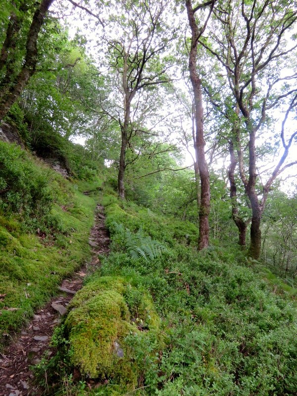
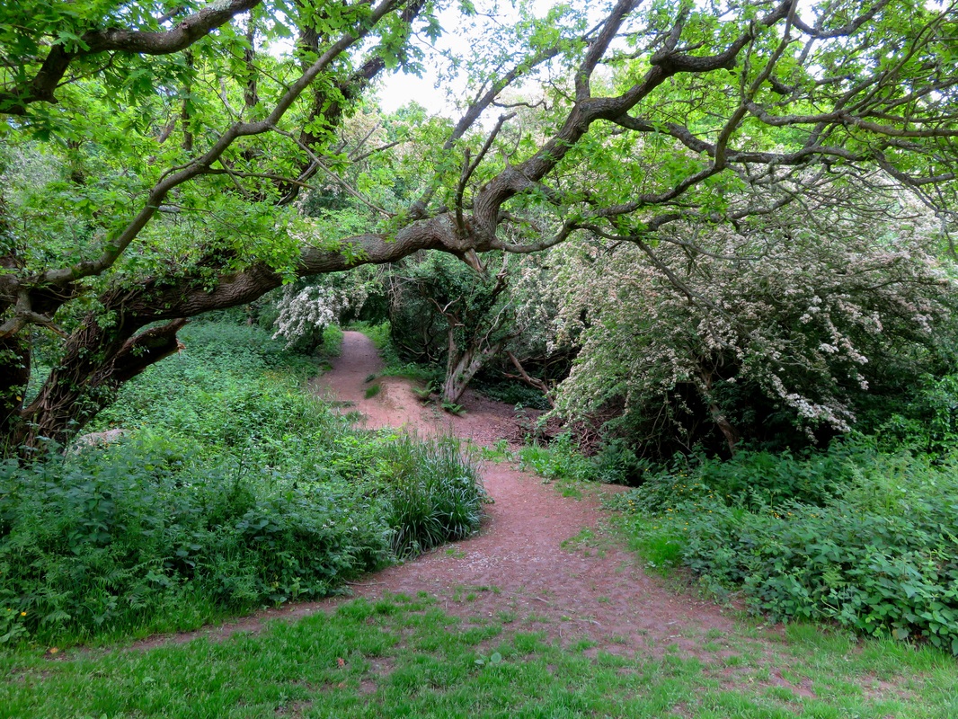
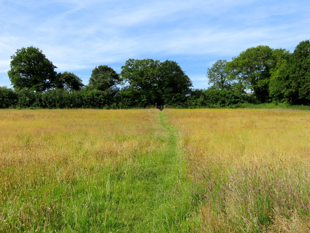
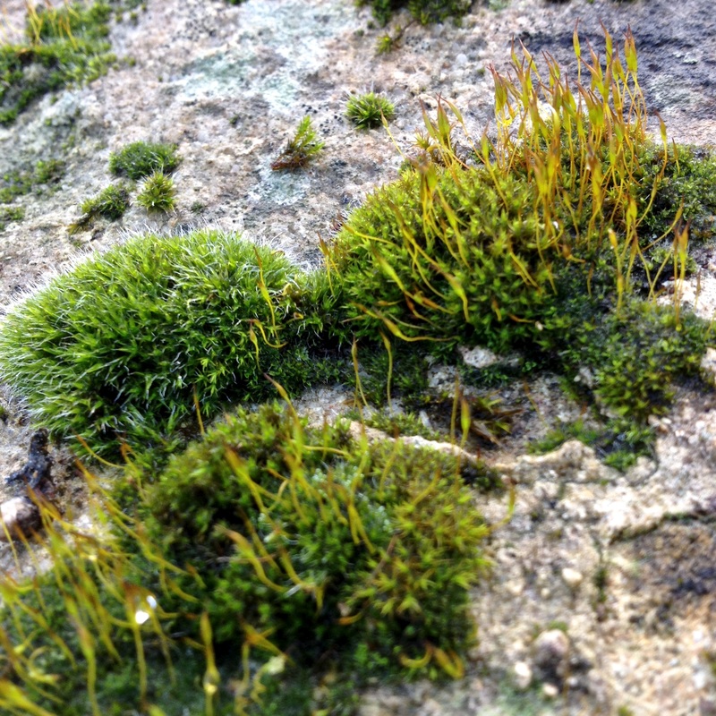
A pretty green track through trees, ferns and moss.
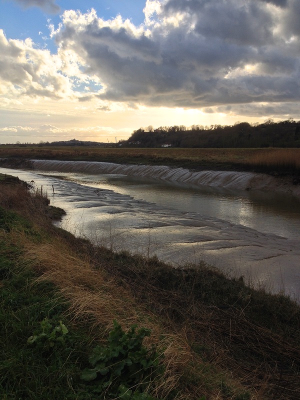
Leaving the road, we skirted Cwm Rheidol Reservoir, crossing little streams and waterfalls, discovering some interesting relics of the mining industry along the way. After squelching through a particularly muddy field, we were eager to stop for lunch at a picnic table overlooking the Rheidol Falls. Although it’s not very high, the water gushes through the geometric slabs of rock with enormous power. I think it was at the Rheidol Falls that I finally realised that we were going to be following the Rheidol for the first two days of the walk, right up to its source. I’ve since learned that it’s the steepest river in Britain - which I can definitely believe!
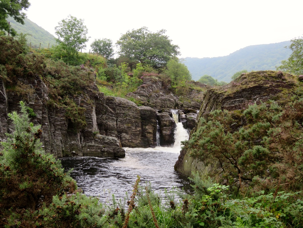
Rheidol Falls - not a bad spot to stop for lunch!
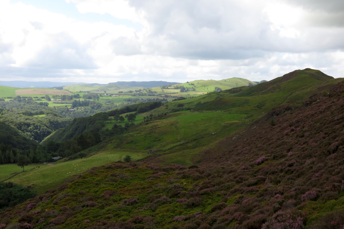
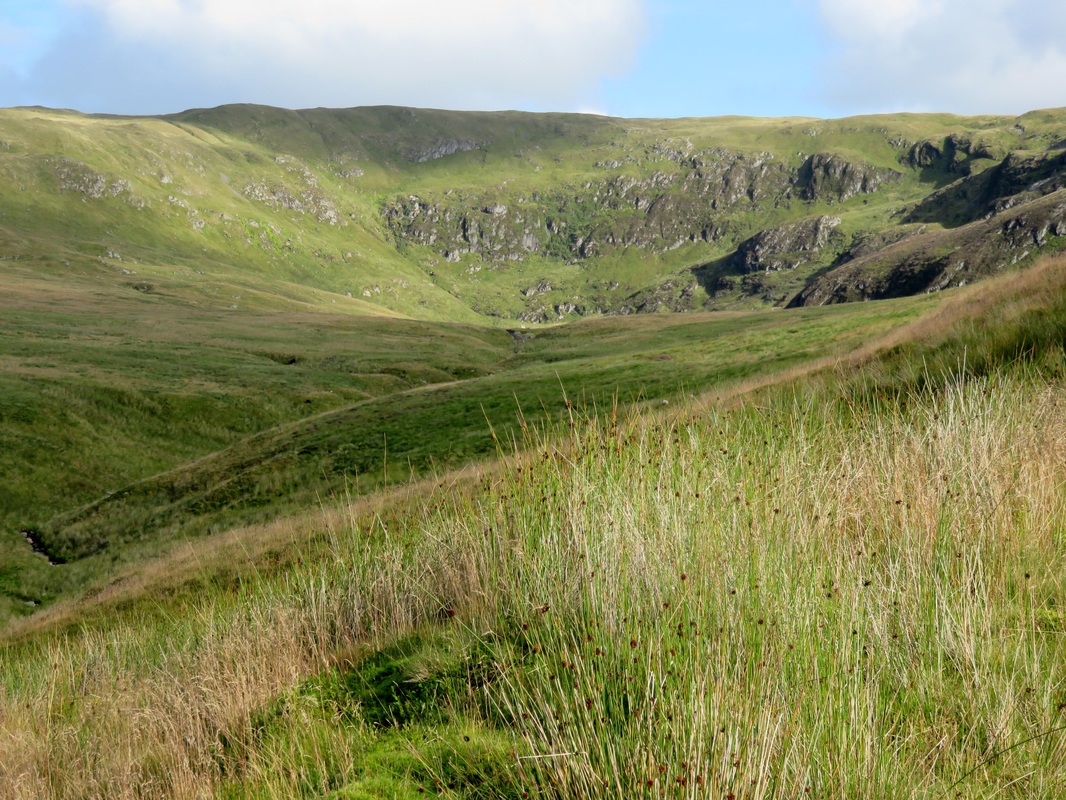
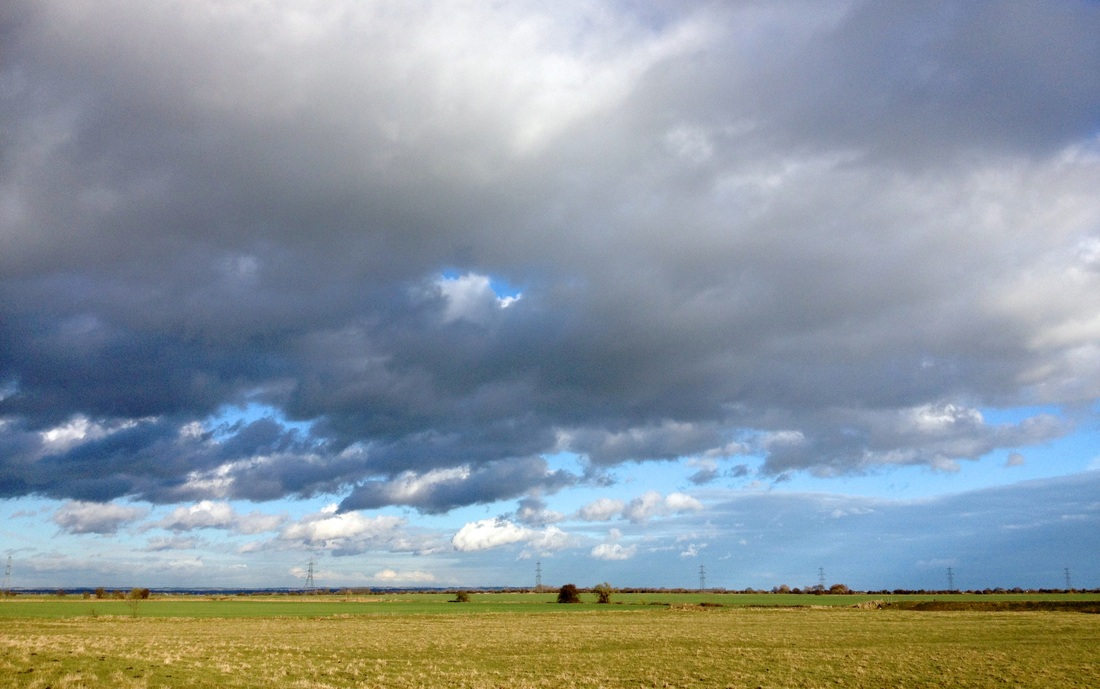
The hills closed in around the river, flanked with plantations, steep sides disappearing into smudges of cloud. As we made our way over the lower reaches of the hills, we commented that the views seemed almost Swiss or Canadian (only, you know, several times smaller in scale).
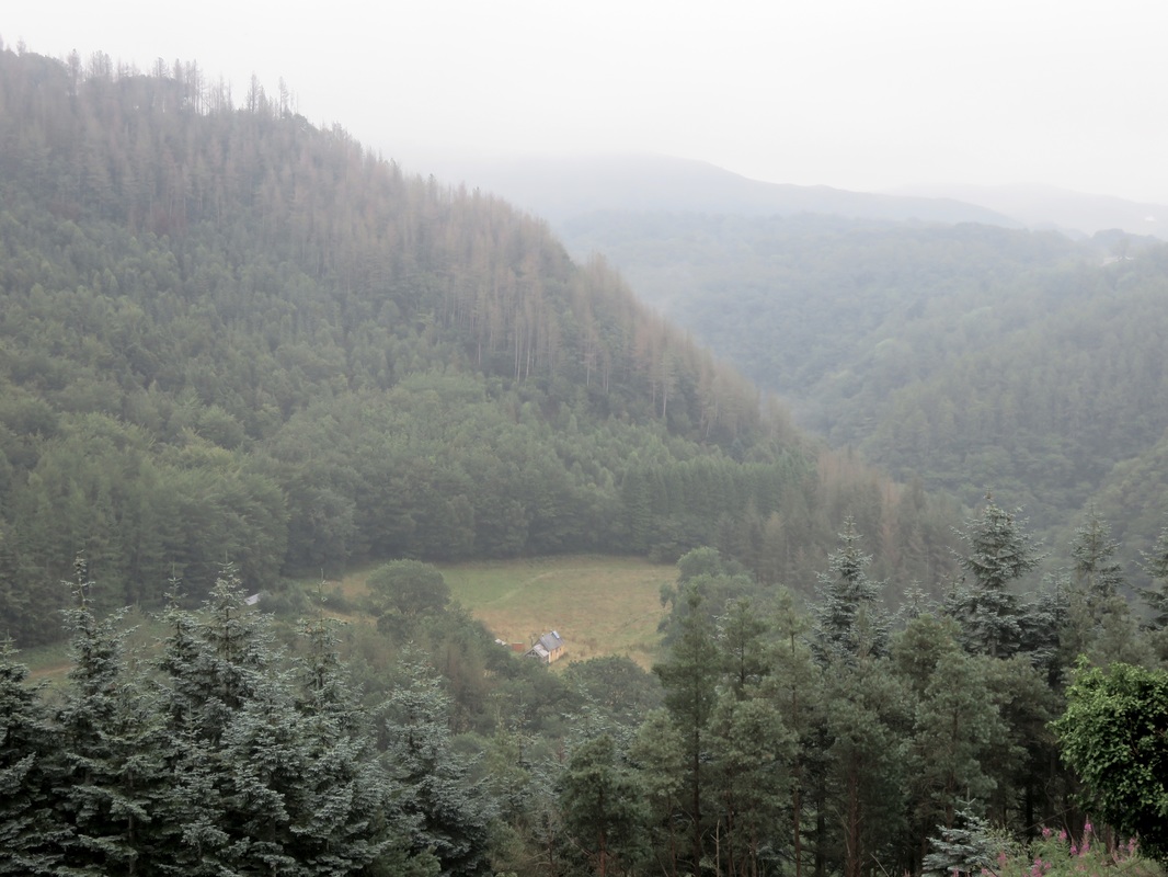
Steep hills, forests (plantations) and little houses tucked away in handkerchief clearings.
Eventually the path skyrocketed, taking us from near water’s edge right up out of the valley in one long, steep climb. We passed through a pine forest, admiring the vertical stripes and purple and orange tinge of the tree trunks. As we emerged from the tops of the trees, the steam train chuffed by above us. This time we were on the viewing side and enjoyed a few seconds of fame, waving to the passengers. Later we stopped at the station cafe (called Two Hoots - oh so punny), where we chatted to a couple who had seen us from the train.
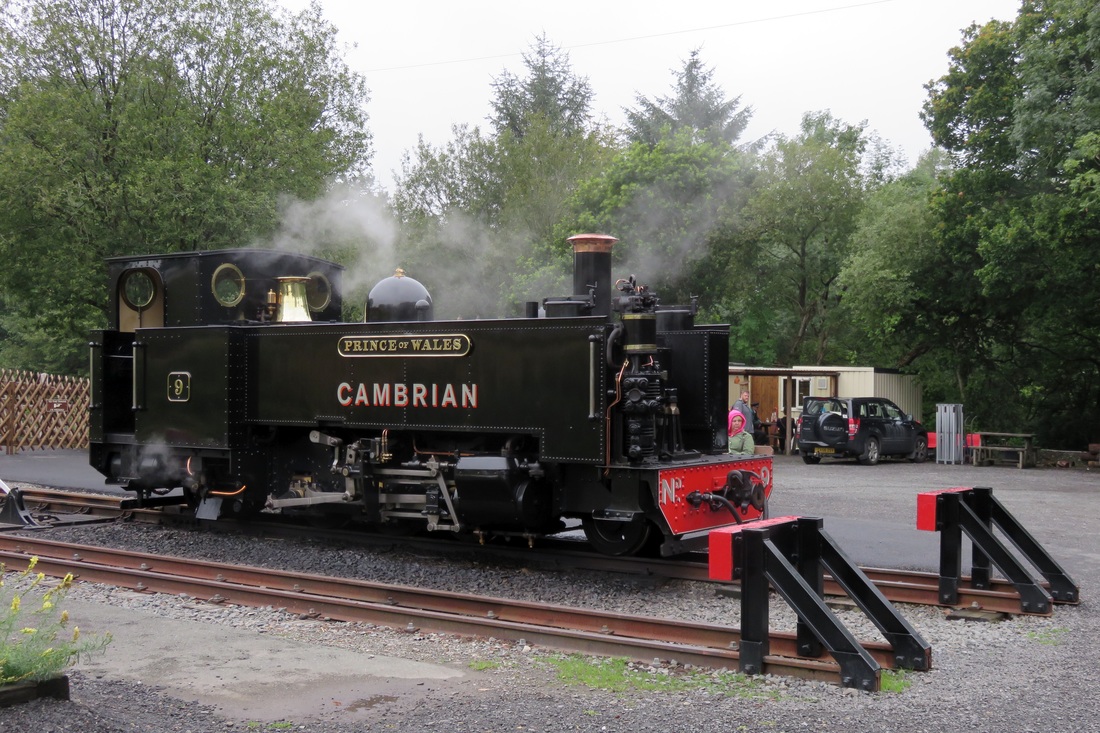
The Rheilffordd Cwm Rheidol steam engine at Devil's Bridge - the end of the line.
There’s no point going to Devil’s Bridge and not checking out the main attraction, so we paid our £1 each to do the short walk - a few flights of stairs down to view the bridge(s) and the Devil’s Punchbowl waterfall. The nice man at the ticket office even looked after our backpacks so we didn’t have to schlep them up and down the path. The bridges are pretty cool: three structures stacked one on top of the other, the lowest and oldest built sometime between 1075 and 1200, the middle built in 1753 and the most recent at the top built in 1901. The River Mynach flows beneath them at the bottom of a dizzyingly deep and narrow slit in the rock: the Devil’s Punchbowl. Over the ages, the water has moulded the rocks into weird sculptural shapes, which curve and recurve under dripping ferns at the bottom of the gorge, almost far enough down to escape daylight.
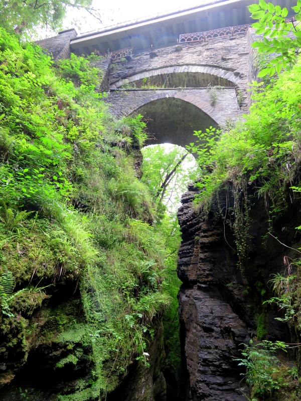 The three bridges above the gorge - oldest at the bottom. | 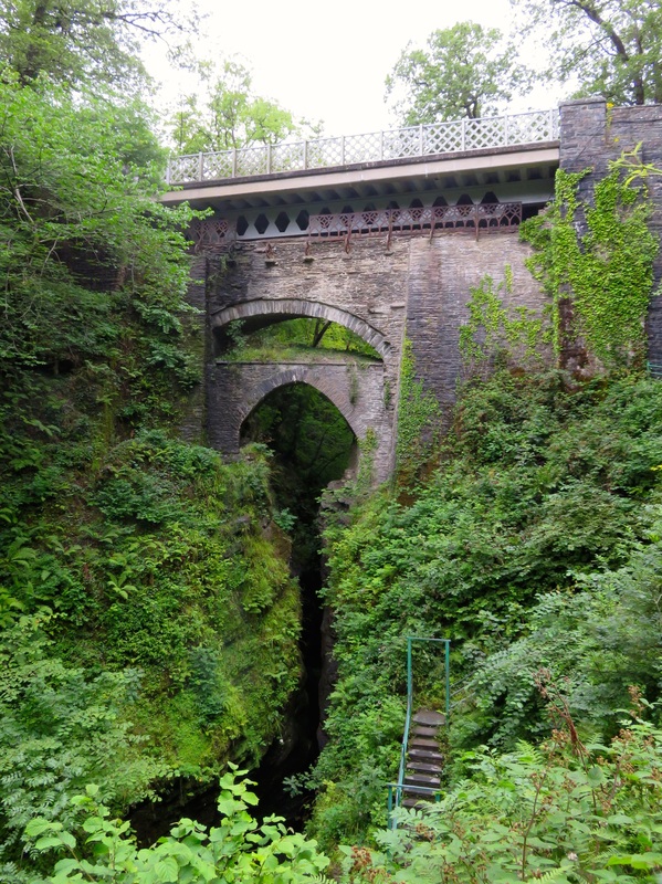 The short walk at Devil's Bridge - this view is worth £1. |
We’d booked a pitch at nearby Woodlands for the night. This is a well-appointed, friendly camping and caravanning site, with separate areas for each type of accommodation. It feels smaller and quieter than it is because it’s thoughtfully laid out. We pitched our tarp near the far corner of the camping field and amused ourselves comparing our accommodation to the huge, multi-roomed tents nearby. That evening, after dining on the first of many packs of instant noodles, we fell asleep to the gentle trickle of a small stream a few feet away and the soft patter of drizzle on our tarp. The sound of water - waterfalls, streams, trickles, rivers, rapids and (sometimes) rain - provided a constant background to our walk, becoming so familiar by the end that it was only really noticeable in its absence.
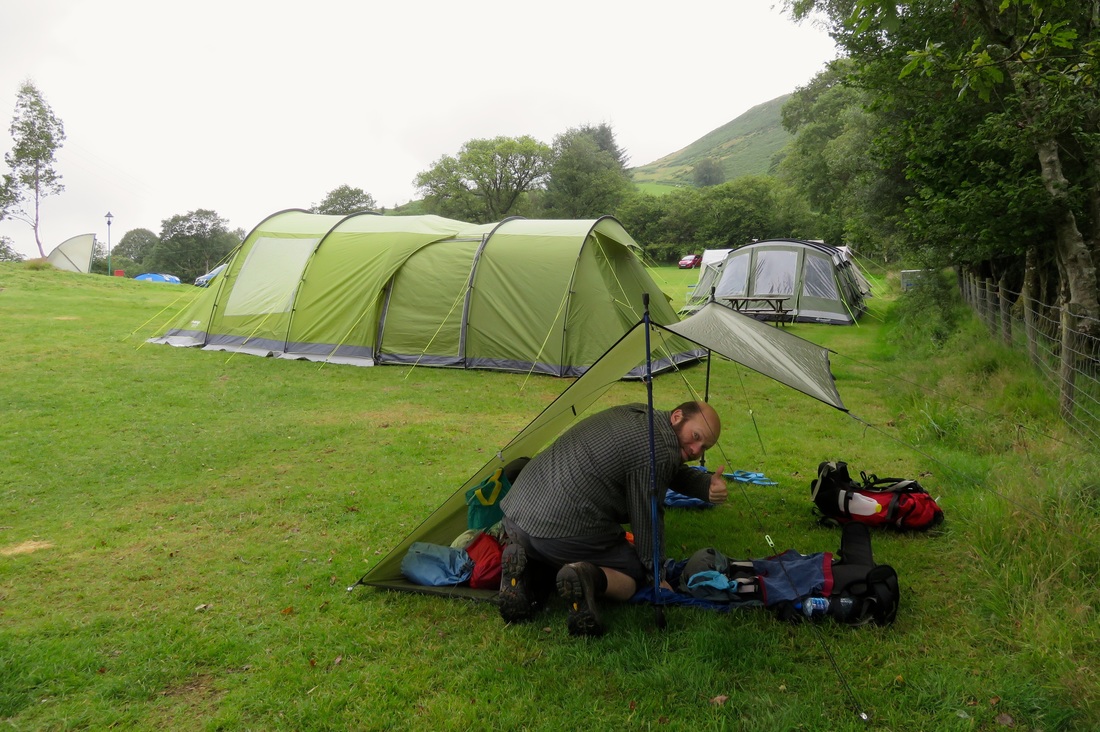
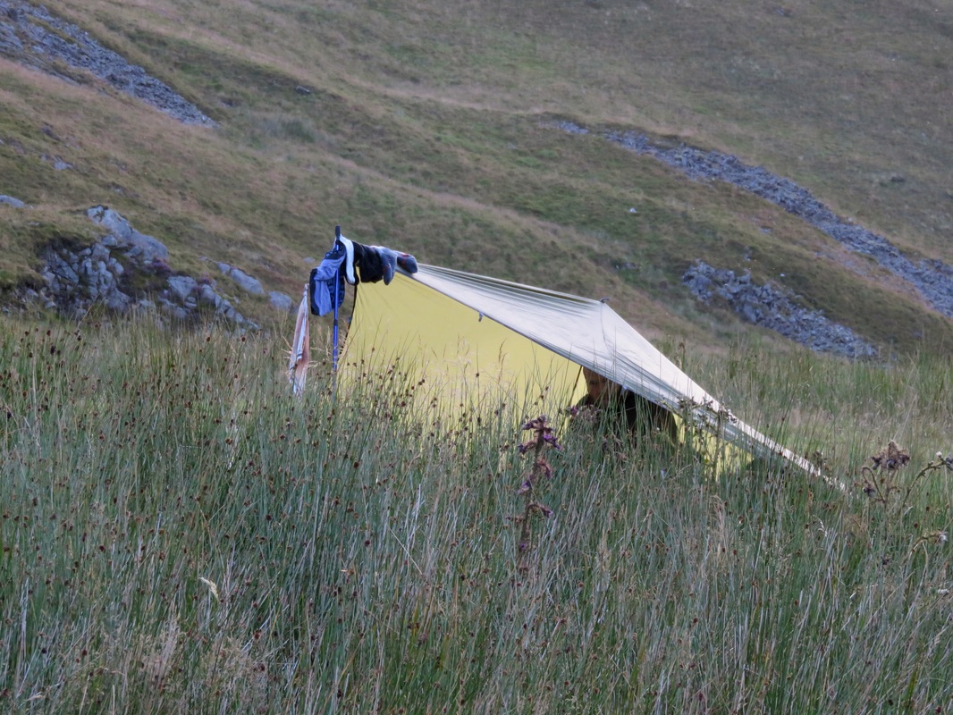
Tarp's up? Thumbs up! We earned a few admirers among our neighbours for our lightweight camping ways.
Day 2: Devil’s Bridge to Llyn Llygad Rheidol under Plynlimon (19km)
By the time we woke, the rain had blown over. We even had a few moments of sunshine as we cooked and ate our instant porridge on a picnic table by the washing up kitchen.
 The path to Parson's Bridge. The picture doesn't do the gradient justice! | 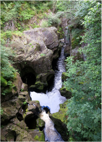 Tens of metres below, the Rheidol continues to carve up the rocks. |
A shortish walk along the busy road took us past feral raspberries and alongside some distinctive hill profiles to an unmarked footpath. This in turn lead through a field, across a stream (the footbridge was fine but getting to it required some detective work and a detour around a bog) and back to the River Rheidol. Disconcertingly, what appeared to be the valley floor was in fact riven by a narrow, wooded gorge - so what we thought might be an easy walk to the hills opposite actually required a steep descent to Parsons Bridge (a footbridge) and an even steeper ascent back out the other side. It certainly got the blood pumping!
The view from (near) the top. Note the steep wooded V of the gorge to the left of the photo.
Once out and up on the heathery hillside, we were rewarded with beautiful views and a glut of tiny blueberry-looking fruit. Vaguely recalling a photo of bilberries (possibly in Alys Fowler’s The Thrifty Forager?), I decided these small fruits must be them. A cautious taste confirmed their blueberry-ness and I proceeded to throw caution to the wind, stuffing handfuls of sweet, tart fruit into my mouth and staining my fingers purple. I later found out they were indeed bilberries, known locally as wimberries. Their season is only a few weeks a year, and we happened to be there at just the right time.
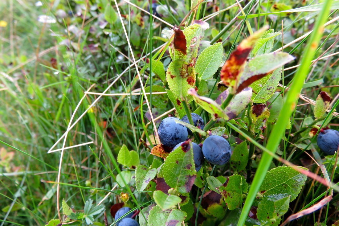
Wimberries. Don't try to tell me you wouldn't gobble these by the handful!
My foraging, combined with paths that wandered off into sheep tracks and some rather approximate waymarking (it took us a while to realise that the precise directional marking we’re used to in East Sussex doesn’t feature very heavily on the mid-Wales rights of way network) meant that we rocked up in Ponterwyd closer to lunch time than planned. We grabbed a couple of sandwiches from the petrol station and ate one on the old bridge in the village before heading out on the quiet road towards Nant-y-Moch Reservoir.
Descending towards Ponterwyd, one of the helpful way markers is visible just to the left and in front of Dan.
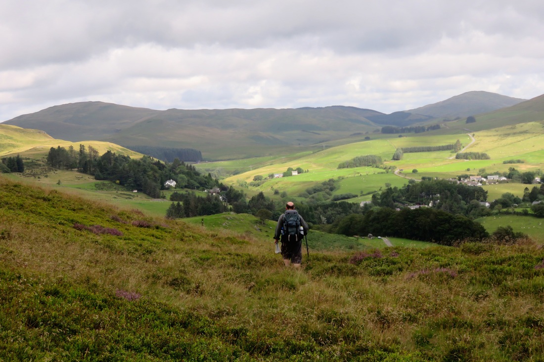
It was easy walking in the brisk breeze and the midday sun. The incline was barely noticeable, spreading 150m ascent over 6km (3.75mi), with views slowly revealing themselves. It was quite meditative. We passed a few farms, were passed by half a dozen cars, met some hairy coos and of saw birds of prey soar across the valley.
The road to Nant-y-Moch. Although easy, 6km on tarmac isn't the best for tired feet!
We spotted a house by the river which didn’t seem to have any driveway - we had to consult the map to find out how it was accessed (it’s marked as Aber-Peithnant on the OS map if you’re interested). A conical hill appeared at the end of the valley, and the striking dam wall came into sight.
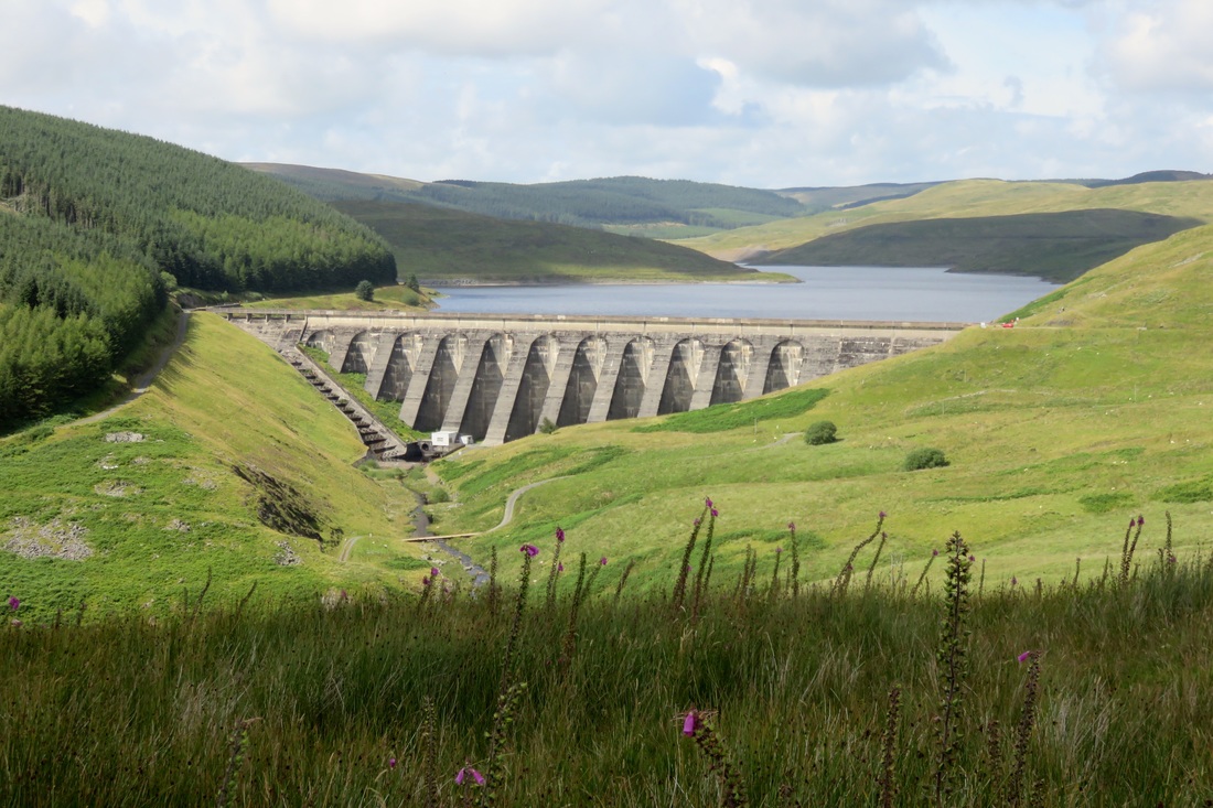
The dam wall at Nant-y-Moch, the River Rheidol a small trickle at its base. We will lunch just to the right of the wall, where the red car is parked.
Dan was feeling tired and achy after the long road slog, so we made the detour down to the dam wall for a rest. We perched up at the foot of a monument (commemorating Owain Glyndŵr’s victory at Hyddgen in 1401) to eat second lunch - sandwich, Snickers and a brew - and spread a few damp things out to dry in the sun.
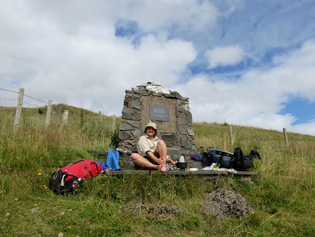
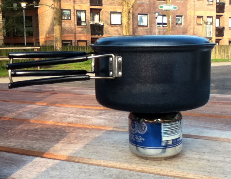
Boiling water for a cup of tea (on one of our drink can stoves) and trying to dry off our socks, towels and undies in the sun.
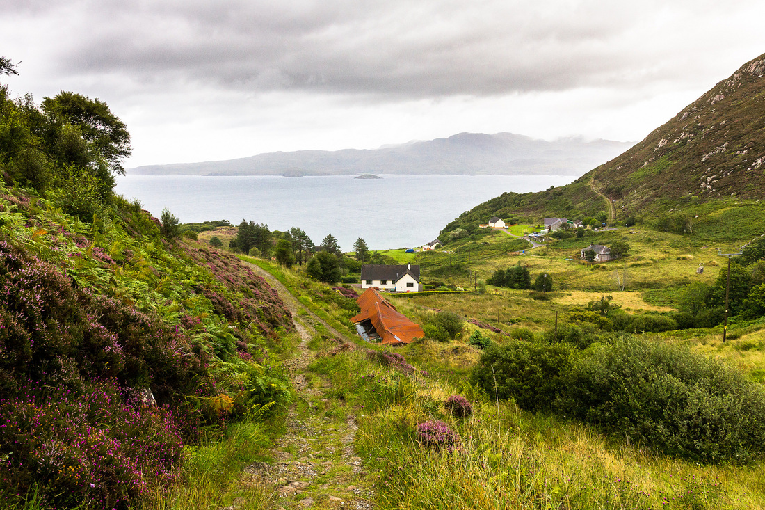
After lunch, we followed the sealed road around the east side of Nant-y-Moch and met our first walkers of the trip. They’d been out for the day on a 10 mile hike of “the Lumons” (there’s Pumlumon Fach, Pen Pumlumon Fawr, Pen Pumlumon Arwystli and Plynlimon/Pumlumon Fawr) and they looked exhausted. “There are no paths, and it’s all boggy,” said one. This didn’t bode well for our plans tomorrow morning - to climb the apparently pathless mountainside out of our campsite and cross the watershed to find the source of the River Wye. But when we mentioned where we hoped to stay the night, the news was more positive. “Perfect spot. There’s even a bit of wood there for a fire if you want.” (We didn't want, but that's beside the point.)
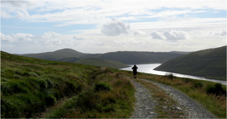
It really feels like we're in the hills now. Nant-y-moch Reservoir is gleaming silver behind us.
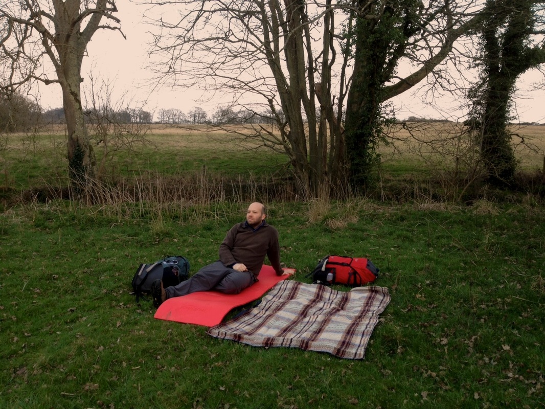
It took us the better part of an hour to follow the track around the north-western spur of what is essentially an elongated horseshoe of a valley, with the small reservoir of Llyn Llygad Rheidol nestled tarn-ishly at the end. We found a nice flat place to pitch our tarp just metres from the water and agreed that it was an idyllic spot. I admit I had a minor hissy fit when our pegs kept hitting rock, forcing us to re-pitch the tarp in the wind quite a few times! But then we were set up, our camp cradled in the slightly intimidating, craggy arms of the Cambrian Mountains. We found ourselves talking in whispers, despite our isolation. There’s something about these big, almost architectural spaces that creates a sense of reverence.
That'll be our home tonight: beside the water, beneath the crags, under the stars.
But not too much reverence. I scampered off stark naked for a quick wash, ignoring the big yellow warning sign. Dan, being more sensible, read the sign and passed on the news that there was blue green algae in the reservoir. Well. We had water treatment drops with us, but we decided not to tempt fate. Luckily we’d filled up from a mountain stream on the way to camp, so we had a spare bottle of water to get us up the hill the next morning, but it did mean there'd be no tea or porridge for breakfast. Uh oh.
A beautiful spot to spend the night. (Damp socks and undies might become a recurring feature of our photos. They were a recurring feature of our walk.)
In the night, the wind, which had been threatening to flatten our tarp from behind, turned around and began to blow straight into our shelter. I woke several times to the bright stars and sound of the tarp snapping like the sails of a boat. I dreamt I was anchored off Aberystwyth, on a ship in a storm.
Are you enjoying the virtual tour of our walk so far? I hope so! You can find the second instalment here.


 RSS Feed
