The final section of our walk across Wales took us from a riverside field near Builth Wells to the border of England at Hay-on-Wye. This post features rain. (It had to happen, we were in Wales after all!)
Day 6: A field by the river to Builth Wells (6km)
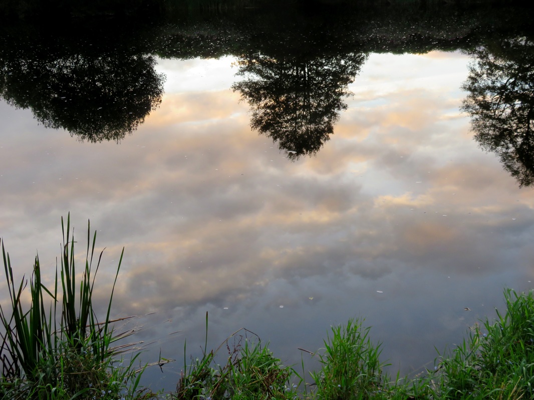
Pink clouds at sunrise, reflected in the River Wye.
By now, our rhythms were attuning to those of the world around us: we went to sleep at twilight, woke with the dawn, ate lunch when the sun was high and warm. I’d started to perfect my routines for setting up and striking camp, I knew where to find things in my pack and I was beginning to understand that no matter how many times I sniffed my socks and shoes they would always make me gag. Bleugh! We ate porridge for one meal (often dinner) and noodles for another (often breakfast), snacked on chocolate and usually had a sandwich for lunch. We’d drink tea once a day (or more if we found a kettle en route), cordial from one bottle and water the rest of the time. There was something liberating about having to make so few choices - only how many squirts of cordial concentrate to add to the bottle, or whether to re-tie my bootlace, or how to set up the tarp, or what flavour of noodles to cook.
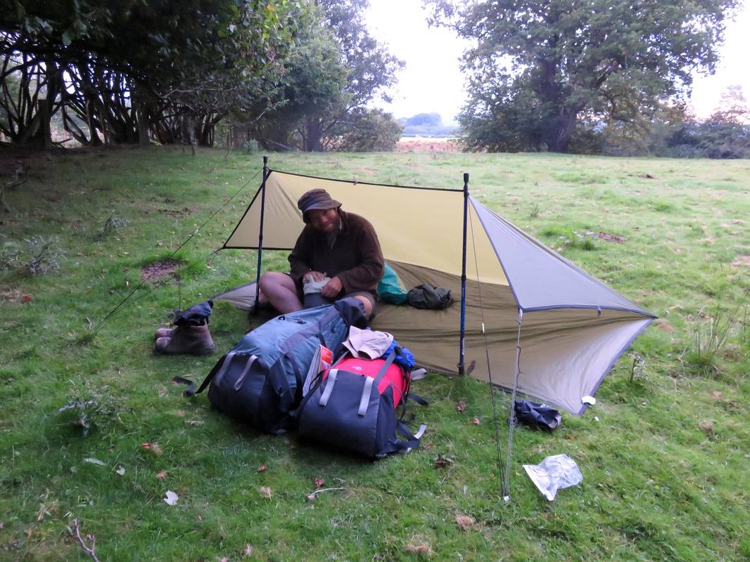
Just about ready to strike camp, Dan packs the last bits and pieces away.
I woke up just after 5am. The dim light brightened into a pink morning and I spent a captivating ten minutes watching bats flit by, some only inches from my head. We’d set an alarm in order to decamp before any earlybird joggers or dog walkers made their way along the path. Nobody came, of course. We sat on a bench by the Wye, soaking up the sunrise and cooking breakfast. It was noodles.
The view at breakfast. We saw a few fish jumping in the still water - or at least heard the splashes and saw the ripples!
The other reason we’d set an alarm was to try and beat the weather to Builth Wells. There wasn’t any rain in sight as we set off through quiet fields and still, leafy woods. The swans from the day before swam past, paddling back upstream. An hour later, the sky began to cloud over, but the drizzle held off as we made our way past anglers’ lodges and fishing spots, rapids and deep pools. In fact, it wasn’t until we reached the Afon Irfon on the outskirts of Builth Wells that we felt the first smattering of rain peck at our arms.
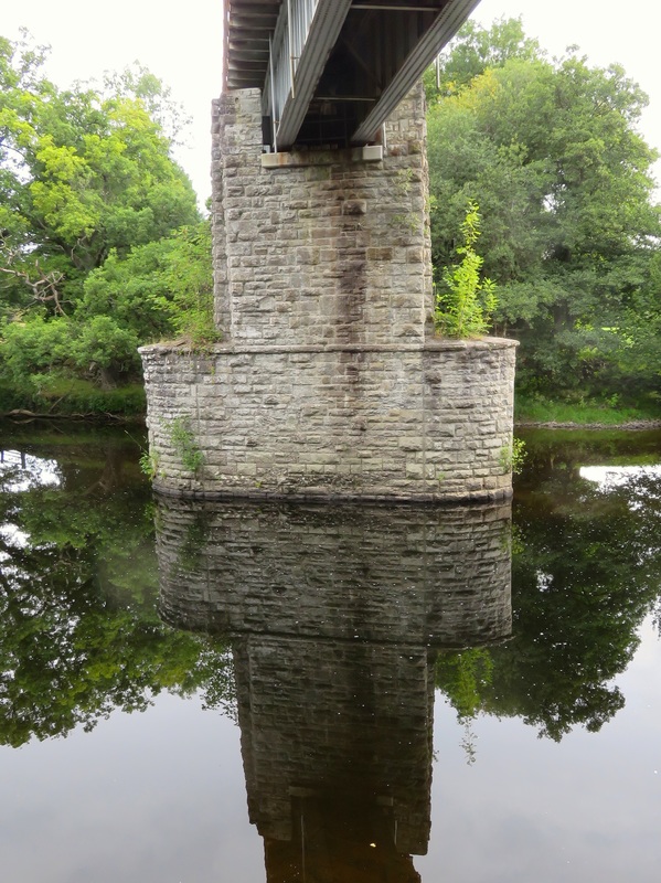 Reflections under the rail bridge near Builth Wells. | 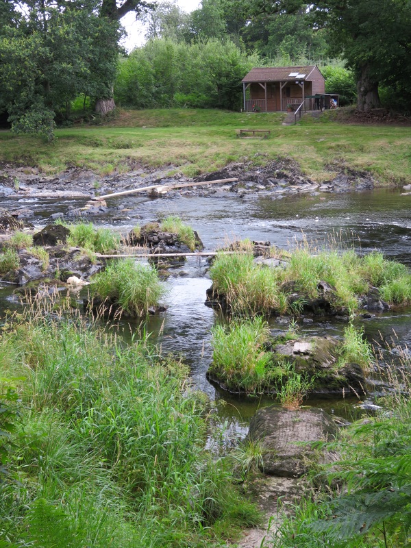 We didn't know what these planks were for. Fishing, maybe? |
As we entered town, along an avenue beside the river, the clouds burst. By the time we’d found the high street, it was bucketing down. We ducked into Boots to get a few supplies, then spied a likely looking cafe, where we ordered morning tea and sheltered from the rain.
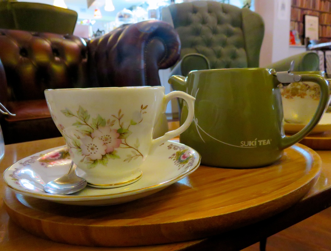
Ahhh! A very welcome pot of tea at The Cwtch. We spent most of the day in here.
Some time later, thinking we should try to see something of Builth Wells, we made a quick dash to the castle (a scraggy lump of grass with a few wet sheep on it), the arts centre and cinema (not open until later) and the library (closed on Wednesdays). Pressed up against a doorway in a vain attempt to keep dry, we had a brilliant idea: buy a book from the charity shop and go back to The Cwtch for lunch. And that is the story of how we ended up spending four hours sitting in an extremely welcoming and hospitable tea room, eating, drinking, reading, charging our phone and tweeting. It was a complete change from our usual routine - a holiday from our holiday.
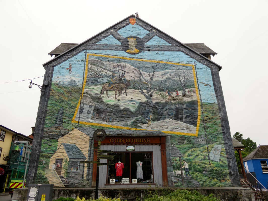
This mural in Builth Wells tells the story of the final days of Llywelyn ap Gruffydd, the last native Prince of Wales.
A mid-afternoon pause in the rain. We took our leave of the cafe and scampered off to the campsite, on a farm at the edge of town. Our pitch overlooked the river, with just a fence and a footpath in between. Knowing more rain was forecast and wanting a bit of privacy, we experimented with tarp configurations. I’m sure someone has a name for the pitch we invented/discovered. It worked so well for us that we used it again the following night. (NB: we didn’t have a groundsheet, but we found that a plastic coated OS map makes a decent alternative!)
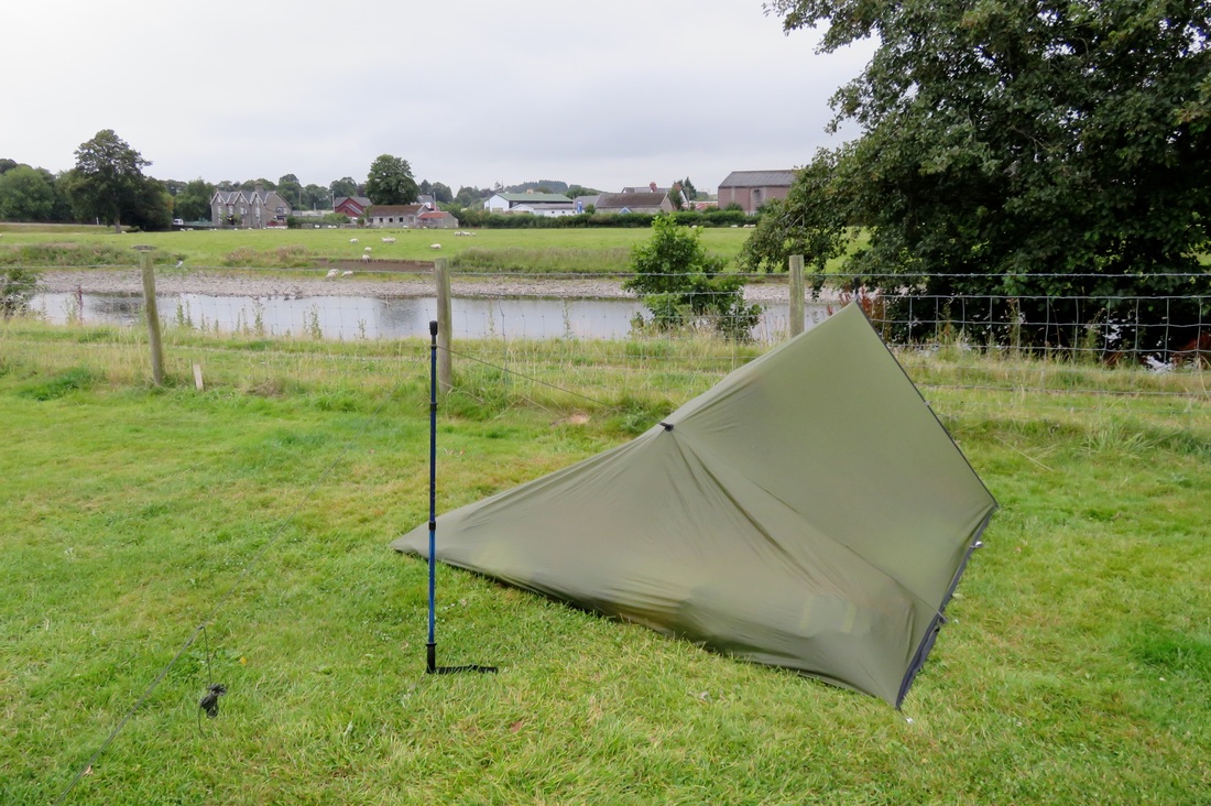
In case anyone's interested, there's a single walking pole at the front entrance and the back quarter of the tarp is folded under for weather protection.
I nipped out for a shower, then curled up in bed. And that was it. I concentrated on finishing Bill Bryson’s A Walk in the Woods (one of those books that’s always for sale in a charity shop), because I sure wasn’t going to lug it around in my backpack. I couldn’t be bothered cooking, so we crunched on instant noodles from the packet and listened to the rain pattering all around us. It was a delightful rest day.
Day 7: Builth Wells to Trericket Mill (18km)
Surprise! Another long distance walker had arrived at the campsite sometime after us and was getting ready to leave as we headed out. Perhaps I was a bit overenthusiastic in my greeting, but I was quite excited to speak to to another hiker. He was aiming to stop at Erwood for lunch, as were we, although he’d decided to take the valley road rather than following the Wye Valley Walk up into the hills, because he wanted to conserve energy for his long afternoon walk into Brecon.
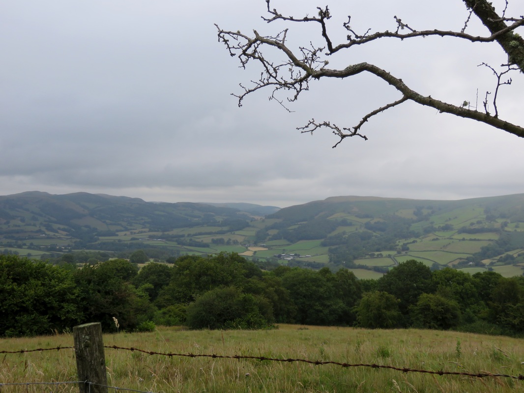
A view of the valley, before we got high enough to walk in the clouds.
I saw the sense in his plan as I toiled up a rough, rain-slick path, watching Dan draw ahead of me. We’d already climbed one hill out of Builth Wells, lost all our height dropping down the other side, then immediately come face to face with a slope that was five times the size. Why did the route do this? Wasn’t it meant to be a river walk? The Wye Valley Walk? I was feeling miserable. What if it was all like this and I hated these last two days of walking and it rained the whole time and it was awful? But also, why did it have to end? I didn’t want to stop walking and go back to normal life. And why was I suddenly walking so slowly? How come Dan was able to power uphill like that? Why didn’t he wait for me? Had I broken my rhythm with a single rest day? And what was the point of climbing this stupid track anyway - we knew the tops of the hills were blanketed in clouds, so it’s not like we even had any views to look forward to.
The path finally reaches a less-steep bit.
What I really wanted to do was stomp my foot and yell, “It’s not fair! I don’t wanna!” Realising that made me laugh - just a little bit. I called out to Dan. We had a rest and a chat, which I remember as me asking him nicely not to speed ahead because it made me feel like the kid always coming last in PE, but which might have come out as somewhat less articulate whingeing. At any rate, I cheered up and we finally reached the point at which the path stopped climbing and kept a fairly steady height tracing contour lines around the hills.
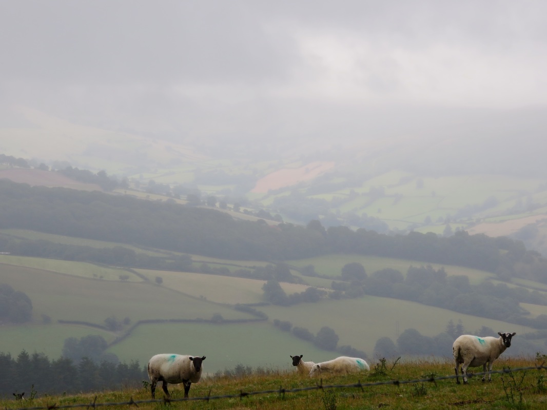
We had lots of sheepy company up on the hill. I wonder if sheep enjoy the view, too?
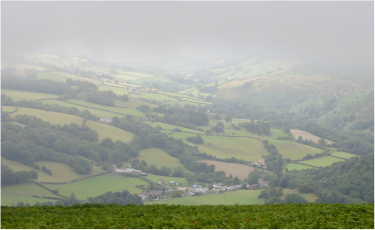
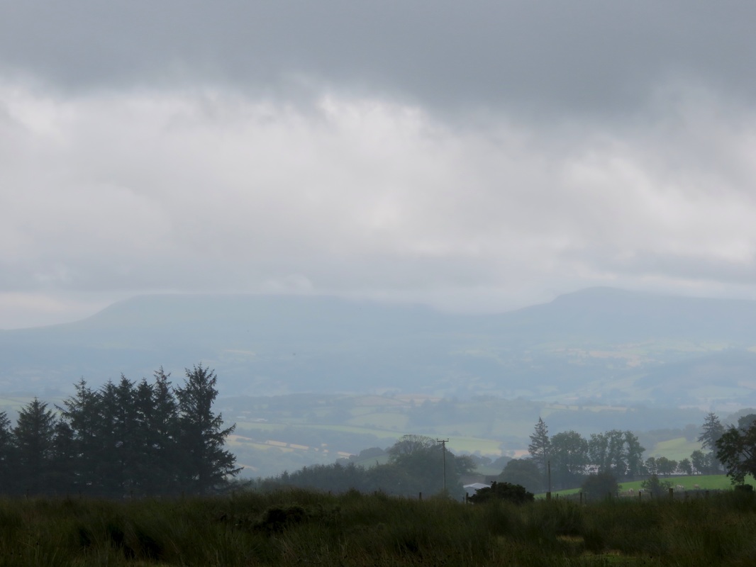
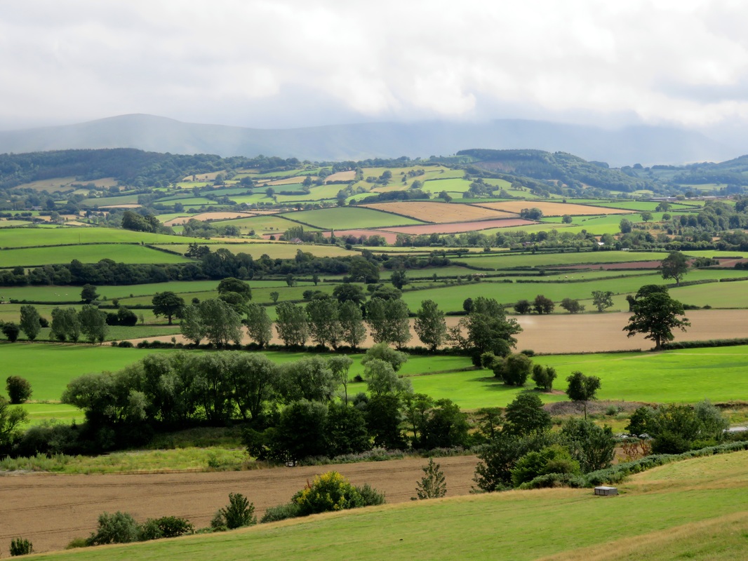
We wandered in and out of the clouds, noticing the very different world this weather created: misty views of valleys that wavered and disappeared, only to reappear from a minutely different angle a few steps later. During the morning, the cloud rose higher and a few shafts of sunlight broke through, illuminating patches of pasture, clusters of farm buildings and stands of trees down below. This is a scene I associate very strongly with Wales - the header of my blog is a photo taken from the slopes of Pen y Fan in the Brecon Beacons.
Sparked by Bill Bryson’s book, we fell into a lively discussion about long distance walks around the world, the people who write about them and the people who read those books. It’s interesting to see how authors make sense of new scenery and evoke it for their audience - by comparing it to another country, or by describing the geology or flora, or by giving a personal account of how their bodies engage with it. We were so deep in conversation that we didn’t realise we’d missed our turnoff until it was a kilometre behind us.
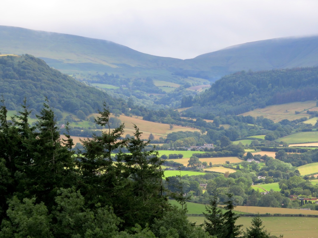
Clouds almost obscuring the tops of Hay Bluff and Lord Hereford's Knob.
Checking the map, we were pretty sure where we were. A postal van in the distance confirmed the existence of . . . yes, it must be that road, and if we keep to the track along here we’ll come to this road and we can follow it all the way into Erwood. It’s nice to be right when it comes to navigation, so we were pleased when our strategy worked exactly as we’d planned. The sky cleared, giving us views over the beautiful rolling countryside to blue hills hidden by clouds in the distance. “It’s starting to look more like the bits of Wales we know,” I said. And we soon realised that’s because it was the Wales we knew: those hills were the Black Mountains, which we’ve visited many times.
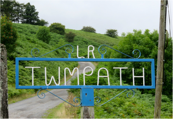
I love finding signs like this, more beautiful and decorative than they have any need to be.
We headed down by Twmpath, rejoined the Wye Valley Walk, then crossed the highway and river to Erwood Station. We found our friend from the campsite rubbing Vaseline on his feet in preparation for his long afternoon walk. The line here was closed in the early 1960s - actually preceding the Beeching cuts - and the station was restored in the 1980s, with a craft centre opening on site. It’s now a gallery and cafe housed in the old buildings and some refurbished carriages. There’s a diesel engine on display and a signal box which was apparently rescued from a farm where it was being used as a chook pen. We looked at the art and craft, including some amazing kaleidoscopes, and had lunch outside. Cyclists scooted down the hill in pairs and threes and a DHL van in the carpark sprung into action providing them lunch. We couldn’t work out if it was a sponsored race, or some kind of workplace bonding thing for DHL (they were all middle aged-ish men in DHL branded clothes), or something else entirely.
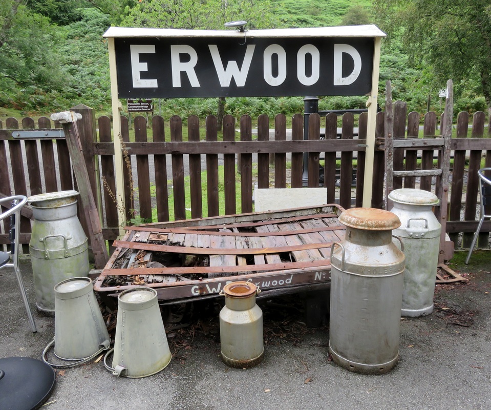
The old station sign at Erwood. Made for Instagram.
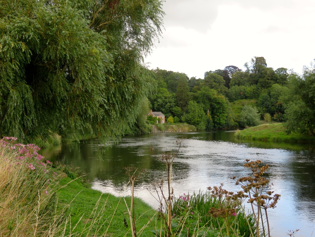
From Erwood, our route took a quiet road through a nature reserve, following the line of the old railway. The Wye Valley Walk used to leave the road for a while to run beside the Wye, but for some reason that permissive path has been closed, so we didn’t see much of the river until we crossed it at Llanstephan Bridge. This is an early 20th century suspension bridge, which looks like a sturdy cycle bridge but which can take a car - though it’s not wide enough for a car and a walker to pass each other.
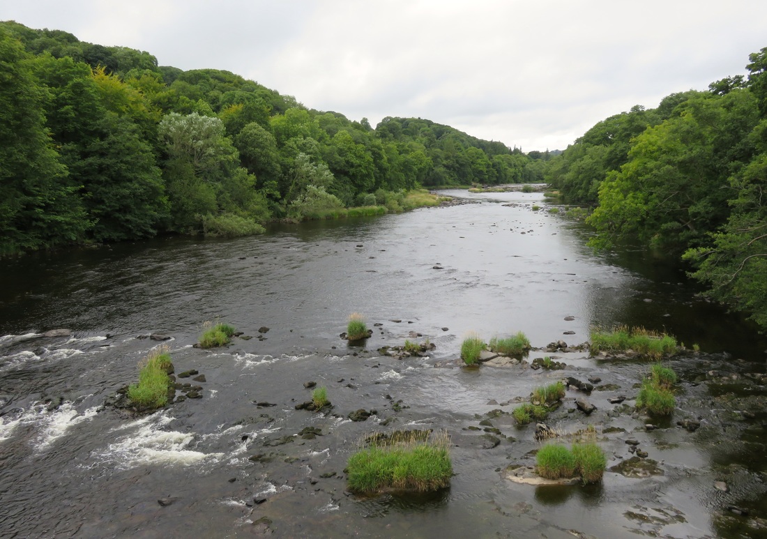
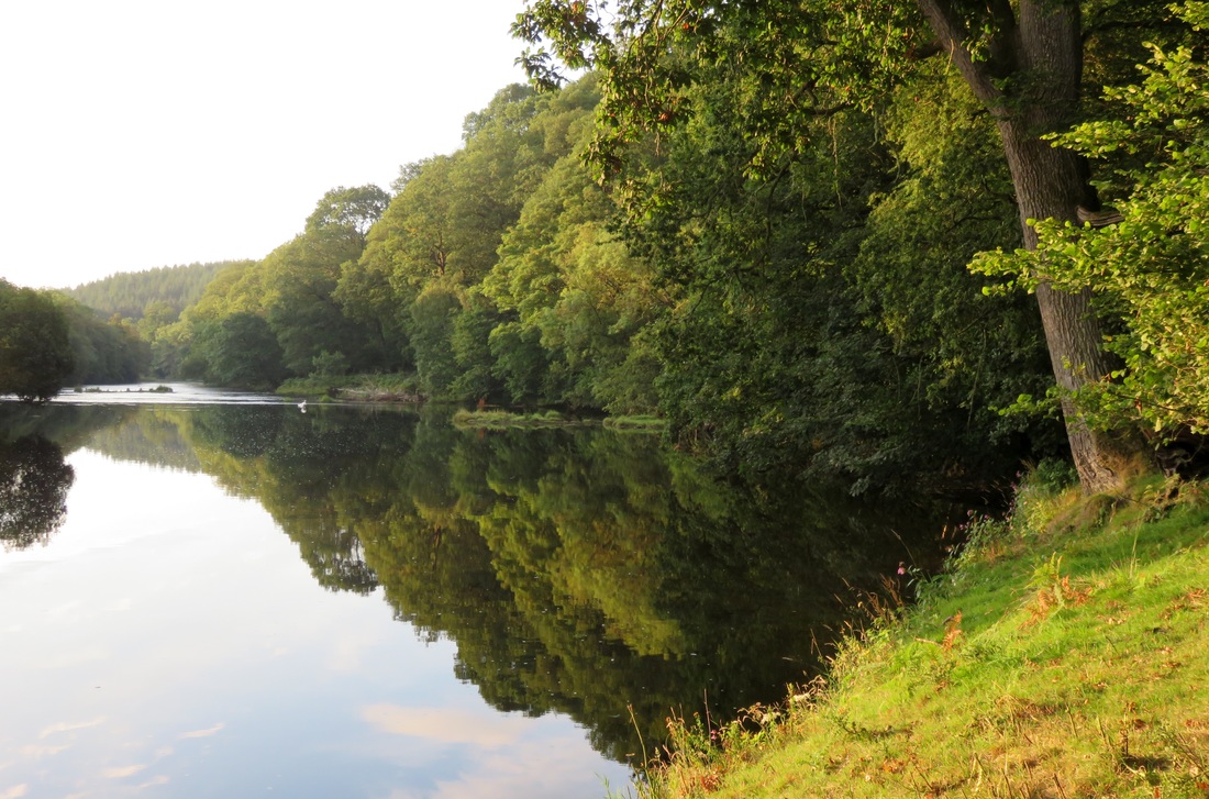
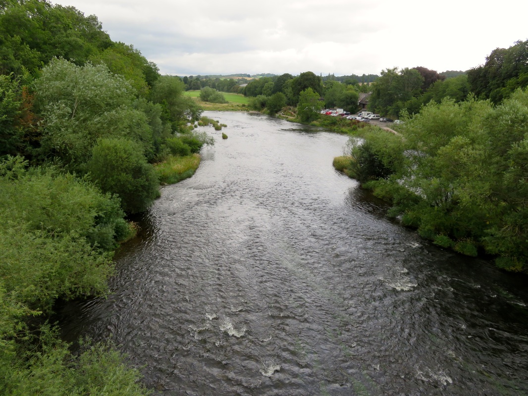
The River Wye viewed from Llanstephan Bridge near Trericket Mill.
Having made good time, we arrived early at Trericket Mill. We set up our tarp in the pretty little orchard, made use of the warm shower and sat under the grass-roofed shelter as the rain began. In addition to camping and a bunkhouse, Trericket Mill is a vegetarian B&B that does dinners for guests. We put on our cleanest clothes and headed over for a scrumptious meal. We could barely finish, because we were so used to eating single packets of instant noodles!
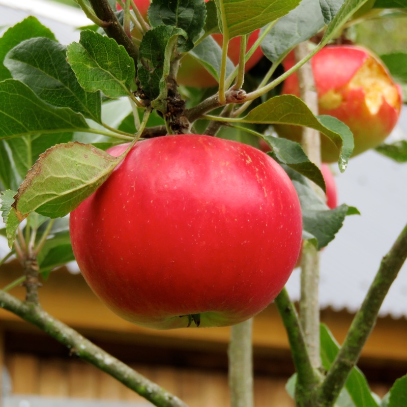 A fairytale red apple at Trericket Mill. | 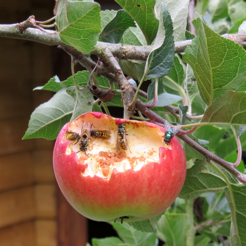 I wasn't the only one tempted by the apples! |
By this stage in our walk, people were usually impressed by how far we’d come. They were also impressed at our apparent hardiness, and slightly concerned about us sleeping out in the pouring rain. One couple we met at Trericket Mill came to stay with us in Battle just last week. “I felt rather guilty, thinking of you out there in the rain while we had a warm, cosy bed inside,” said one of them. But they needn’t have worried: we were dry and surprisingly warm and cosy ourselves under our trusty tarp. Our journal says we “didn’t wash away, not even a little bit.”
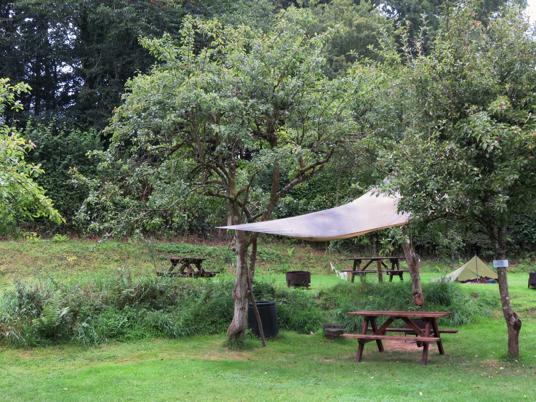
The campsite at Trericket Mill only has a handful of pitches. Can you spot our tarp?
Day 8: Trericket Mill to Hay-on-Wye (19km)
We woke up, stretched out, watched raindrops race down the outside of the tarp, got dressed, packed up our sleeping gear, I sniffed my shoes (bleugh!), we took the tarp down (hanking the cord, cleaning the pegs, shaking rain off) . . . But we had a change to our routine that morning - we hung the tarp up undercover to drip dry while we dashed across the mill stream and into the main building for a cooked breakfast. Yum!
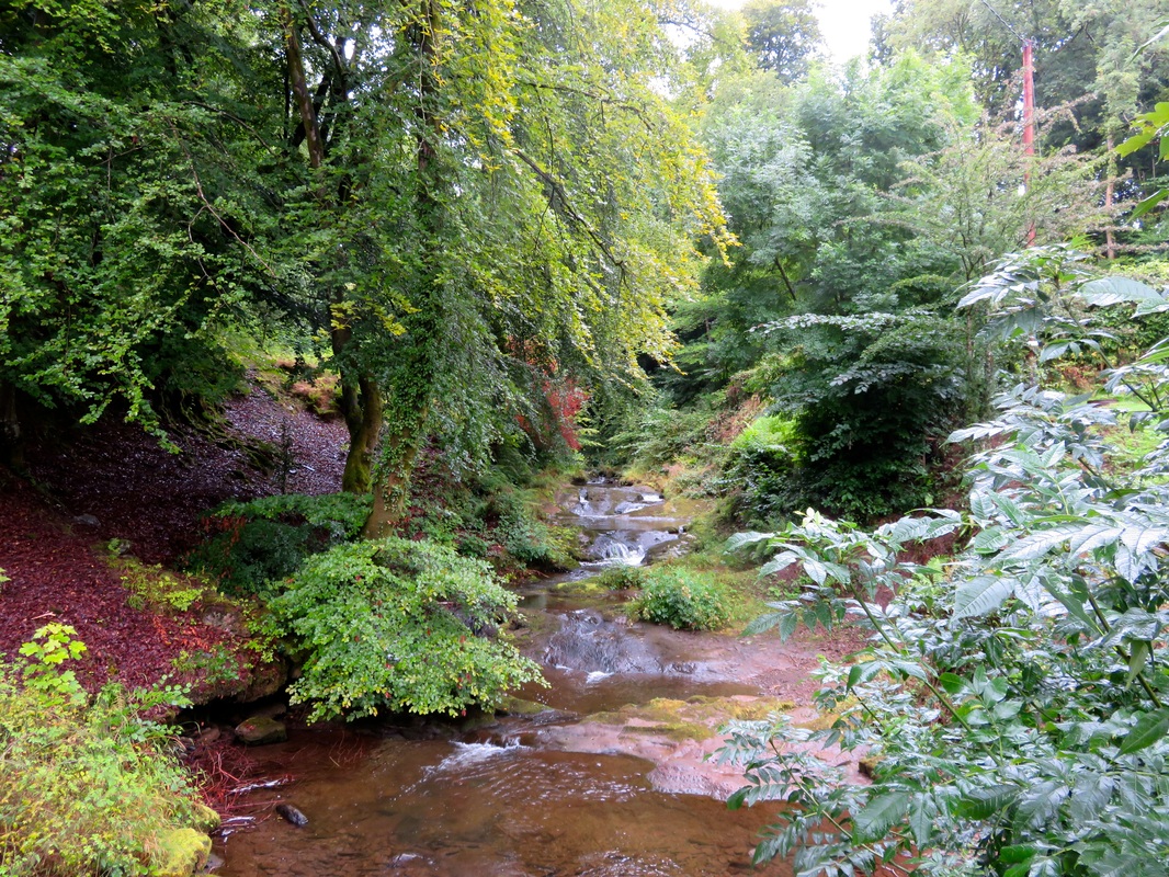
The stream beside the mill. Apparently people have seen otters here. Not us, unfortunately.
It was nice to chat to the other guests again and we ended up making a late, leisurely start at around 10am. We hoisted our packs, which seemed so much lighter now, and set off along the river. There hadn’t been many crops upstream, but many of the fields along the river flats on this last day were corn, wheat, broad beans or potatoes.
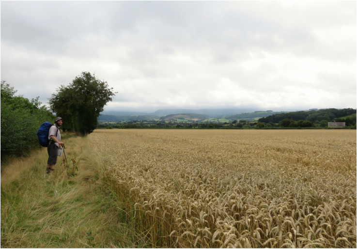
Many of the riverside fields were given over to crops instead of stock.
The weather flirted with the idea of rain, so we sheltered under trees or walked in the lee of hedges for a while. Naturally, once we’d decided the rain was heavy enough to stop and put our coats on, the sky cleared. The signs of autumn we’d first noticed near Rhayader were starting to multiply, but unfortunately the blackberries were still sour. Likewise, when we found a pear tree beside a ruin and a walnut tree by the path, the fruit of both were immature.
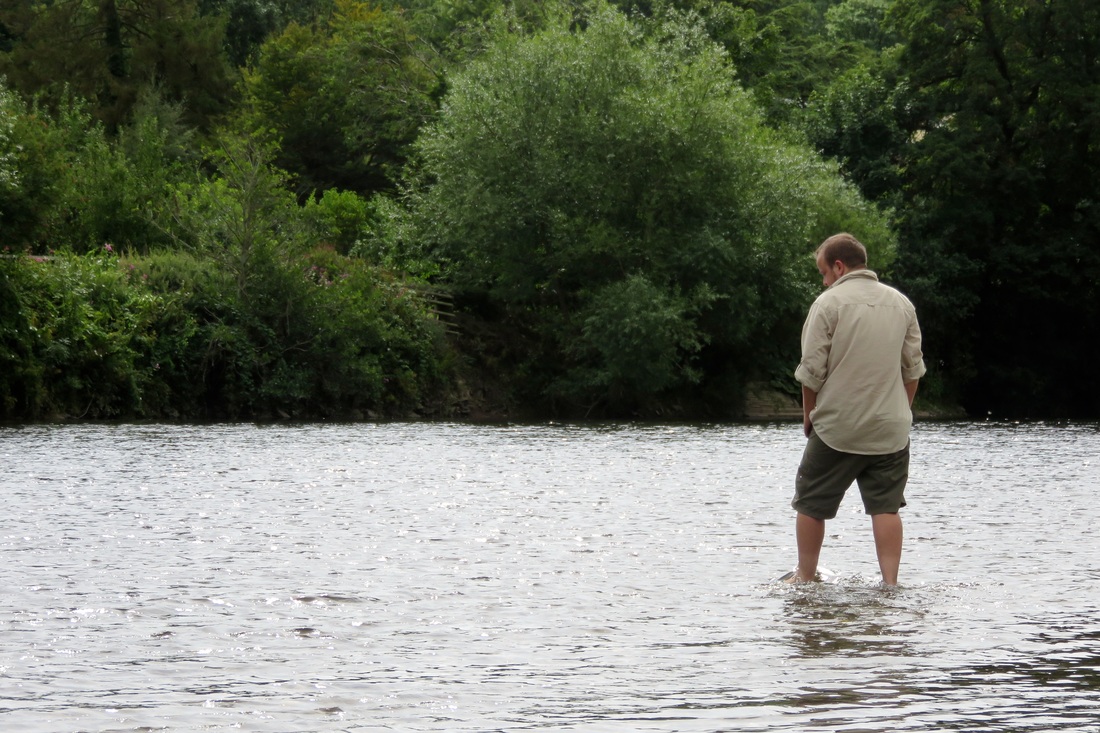
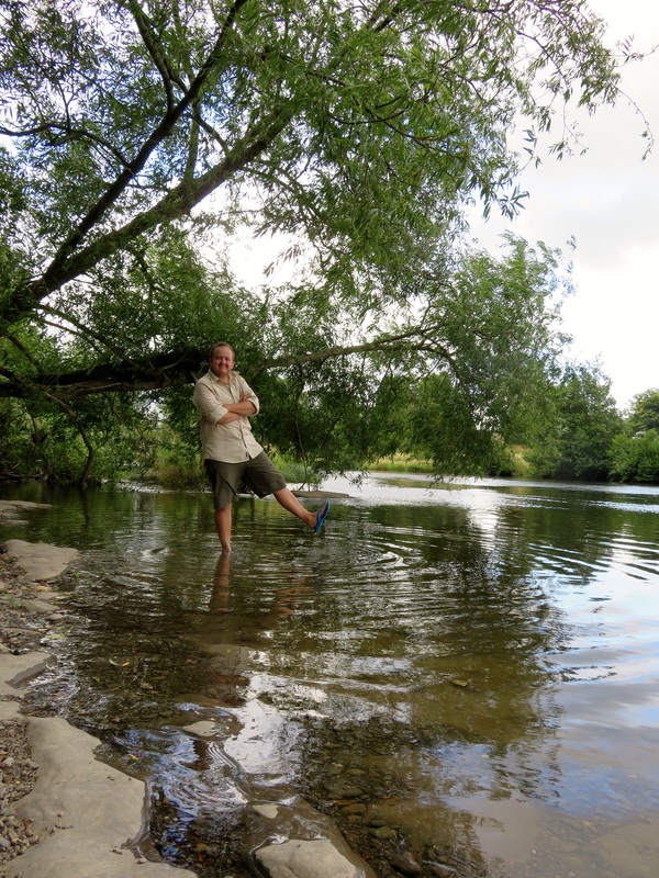
Our last opportunity for a midday paddle. Dan even took his shoes and socks off. I'd converted him!
At Glasbury, I paddled in the chilly river and we shared a Snickers on the stony beach, watching a group of kayakers warm up and set off. Early last summer, we’d done the same thing, kayaking downstream from here to Hay-on-Wye. This was familiar territory.
 Time for lunch. |  Looking back to Llowes from the hill path. |
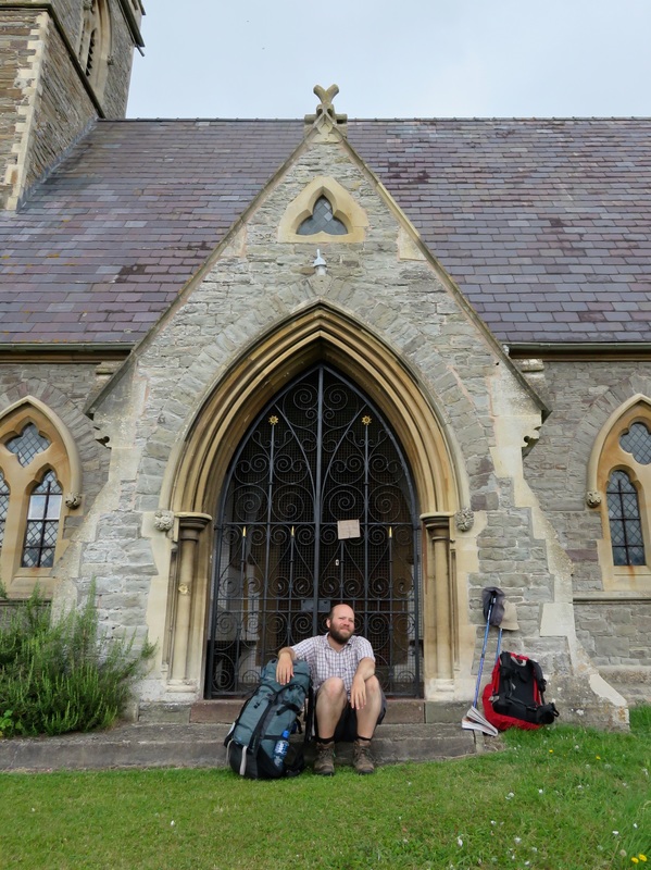
Whereas the day before I’d longed for a flat path beside the river, I was now pleased to follow the footpath into the wooded hillsides above the valley. I felt nostalgic for the mountains and craggy hills we’d climbed when the Wye was a stream just a few paces across. We reflected on our walk as we pushed up an overgrown path and back down towards the small village of Llowes. What would we do differently next time? (Dan: Bring an extra pair of socks!) Had we noticed any physical changes in ourselves? (Jonathan: Calves of steel!) What were our favourite parts of the walk? (Too many to name!) At the church, we admired St Maelog’s Cross and sat on the steps to eat our last odds and ends for lunch.
The beautiful Wye Valley, with the Black Mountains in the background.
The Wye Valley Walk splits at Llowes, and we chose the hilly option. We were rewarded with gorgeous vistas over the valley - Hay Bluff and Lord Hereford’s Knob covered in cloud, rain screening the Beacons, sunlight turning the river into a silver ribbon twisting through the quilted landscape. I think this is one of the most beautiful places in the world. We noticed canoeists on the Wye and tractors at work in the fields - and we held on to the view for as long as we could, until we finally descended to the river for the final stretch.
Looking towards the Gospel Pass between Hay Bluff (to the left) and Lord Hereford's Knob (to the right).
There’s a picturesque bend in the River Wye just before Hay, where a red brick house on the outer bank looks over a band of small rapids to a wide beach. We stopped to watch some canoeists shoot the rapids. Or rather, to watch one pair shoot the rapids and the other pair get stuck. These unfortunates attracted an audience of very British gawkers (i.e. lots of people on the beach who made themselves busy pretending not to look) as they rocked and pushed and eventually managed to float off downstream.
A picturesque bend in the River Wye.
Dulas Brook flows between grey houses on the outskirts of Hay-on-Wye. One side of the stream is Wales, the other England. People nipping to the big supermarket to grab something for dinner are crossing into another country. Dulas Brook joins the River Wye a few hundred metres north of the bridge into town, at which point the river becomes the national border. A ten minute detour along Offa’s Dyke Path took us to a tiny, willow-lined beach on the Wye, where we took our shoes and socks off and wet our feet. From the sea at Aberystwyth to the river at Hay, we’d walked from border to border, all the way across Wales.
 We've walked across a country! | 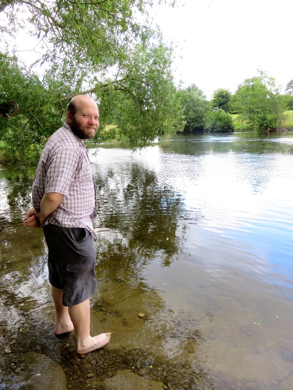 A watery border, far from the beach at Aberystwyth. |
The end of a long walk can often be anticlimactic, because your achievement means more to you than to anyone else. But our lovely Airbnb host was almost as excited us about our walk. She wanted to know how far we’d travelled each day, what gear we’d taken and where we’d camped. She also had a drink with us to celebrate making it across the country. I think she might be planning a similar journey herself - good luck, Joanne!
Saying goodbye to the River Wye from the bridge into Hay. How it's changed from those first trickles in the Cambrian Mountains!
(Side note: If you think you’d like to use Airbnb, please sign up using this link. You’ll get a discount on your first booking and we will get credit, too.)
After
We’d come by bus from Hay-on-Wye to Hereford, winding through hedge-lined lanes, over streams, past churches and farms. It would have felt like a slow journey a week and a half ago, but now things flashed by so quickly I barely had time to register their existence - glimpses and half-formed perceptions, then they were gone. It was a relief to return to walking pace and wander around the cool, lofty space of Hereford Cathedral.
Forever looking out from the walls of Hereford Cathedral.
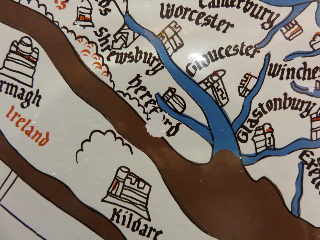
We stood in front of the Hereford Mappa Mundi, a 13th century interpretation of the physical and spiritual world. There’s a story about this Mappa Mundi, which I’d recently read in On the Map, by Simon Garfield. When the map came to public attention in the late 1980s (the cathedral was going to sell it), nobody was really sure where it had been produced. Some early testing of the ink showed that Hereford was written on the vellum at a later date than the rest of the map. Perhaps, researchers thought, it had been made elsewhere and Hereford had been added when it came to the cathedral.
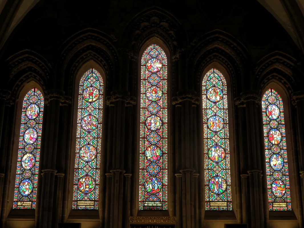
Wonderfully intricate stained glass windows.
But there is another theory. As the map hung on the wall of the cathedral, thousands of people saw it and did what everyone does when they see a map: find where they are and point to it. Years and years of fingertips brushing the map wore the ink away, until somebody had to re-draw Hereford. There’s supporting evidence for this theory in the Mappa Mundi exhibition. A touchable replica, translated to English, stands against a wall. If you look for Hereford, you will find that thousands of fingertips have started to wear the word away. “This is our place in the world,” the worn patch proclaims. In a pleasing paradox, the more it disappears, the more it seems to say, “Here we are.”
"Here we are." How many people have pointed to this spot?
And that's what it's like to walk all the way across a (small) country. I hope you enjoyed hearing bout it! A couple of people have mentioned they'd like to see a kit list, so I'll post that along with our short video of the walk soon.
 RSS Feed
